The Severn Estuary
Fishing regions · Last reviewed 2026-08-14
The second largest tidal range in the world, in a funnel-shaped estuary so turbid that fish hunt by lateral line, with a tidal bore running miles upriver and an elver fishery of real antiquity.
Safety: tides and being cut off — can cause serious injury or death. 2 more points apply here.
Being listed here is not permission to fish. What that meansClose
Access, fishing rights, seasons, licences, local bylaws and permitted methods vary and can change. Check current access, permission, local regulations, closures and restrictions before you travel or fish. FishingHQ describes what the ground is and names who holds the answer; it does not hold the answer itself.
Find the authority for a jurisdiction · What FishingHQ does and does not cover
The Severn is the estuary FishingHQ explains at this depth because everything about it — the fish, the methods, the history and the hazards — follows from one extraordinary physical fact.
THE TIDAL RANGE IS AMONG THE LARGEST ON EARTH. Spring tides in the upper estuary rise and fall by well over ten metres, second only to the Bay of Fundy. The cause is resonance and funnelling: the estuary narrows and shallows towards its head, concentrating the tidal wave, and its dimensions happen to be close to resonant with the tidal period in the Atlantic approaches.
THAT PRODUCES TIDAL STREAMS OF EXTRAORDINARY POWER. Water moving that vertical distance twice a day has to move horizontally at speed, and the currents in the estuary are among the strongest around the British coast.
THE WATER IS PERMANENTLY BROWN AND THAT IS THE ECOLOGY. The energy of those streams keeps enormous quantities of fine sediment in suspension, so the estuary is extremely turbid and light penetration is minimal. Fish here are not sight feeders: the assemblage is dominated by species that hunt by smell, taste and lateral line.
THE BORE IS THE VISIBLE CONSEQUENCE. On the largest spring tides the flood front runs up the narrowing river as a breaking wave travelling many miles inland — one of the largest tidal bores in the world and a genuine hydraulic phenomenon rather than a curiosity.
AND THE HISTORICAL FISHERIES ARE UNLIKE ANYWHERE ELSE. Elver netting on the spring run, lave netting for salmon on the sands, putcher rank fixed traps, and the long-gone but well recorded fishery for migratory fish through the estuary are documented practices with statutory and customary histories attached.
What fishing here is like
A funnel-shaped, extremely turbid, enormously tidal estuary with some of the strongest tidal streams and the second largest tidal range in the world. Light penetration is minimal, so the fish assemblage is dominated by species that hunt by scent and lateral line rather than by sight. It is a migratory corridor for salmon, shad, lamprey and eel, an internationally designated conservation site, and the home of several historically distinctive fisheries. Shore angling from the muddy foreshore and rocky points, and boat fishing in the outer estuary, are the recreational forms.
What you can target here
One entry per fish, grouped by how you would be fishing — because the answer is a different one from the rocks and from a boat. Each entry says how strongly the sources support it and how much evidence sits behind it. These are documented catches, not a forecast, and none of it is a statement that you may fish any particular ground.
From the shore · 20
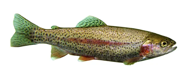 Rainbow troutCharacteristic of this water1 placeLlandegfedd ReservoirOver reservoir
 European sea bassRegular local target10 places · 1 recorded catch · 1 sourceLynmouth, Aberthaw, The Gwent sea wall, Sully Island and 6 moreOver beach, beach section, cove, estuary mark, headland, island, surf beachSources name SurfcastingAround Apr–OctObserved April 2025
 Atlantic codRegular local target8 places · 1 recorded catch · 1 sourceNash Point, Severn Beach, Goldcliff, The Cardiff foreshore and 4 moreOver beach, estuary mark, headland, islandSources name Ledgering with Peeler crabAround Jan–Feb, Nov–DecObserved April 2023
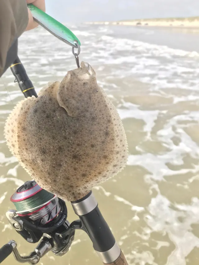 TurbotRegular local target1 place · 1 recorded catch · 1 sourceMonknash and the Nash ledgesOver rock markSources name SurfcastingAround AprObserved April 2023
 Conger eelRegular local target10 placesNash Point, Aberthaw, The Gwent sea wall, Goldcliff and 6 moreOver beach section, cove, estuary mark, headland, islandAround Apr–Oct
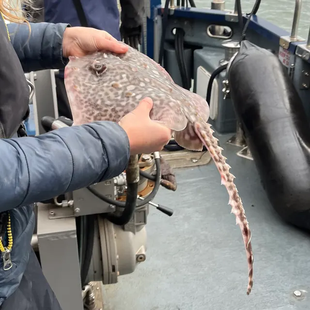 Thornback rayRegular local target9 placesAberthaw, The Gwent sea wall, Sully Island, Sand Point and 5 moreOver beach, beach section, cove, estuary mark, headland, islandAround Jun–Sept
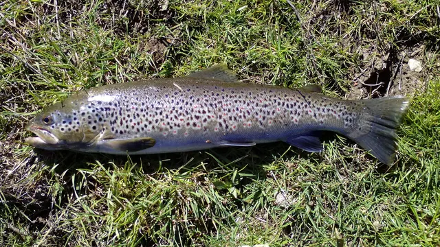
Also documented from the shore: Small-spotted catshark · Whiting · European flounder · Starry smooth-hound · Common sole · Bull huss · Pouting · European plaice · Brown trout · Spotted ray · Blonde ray · Small-eyed ray · Dab · European perch
From a boat · 3
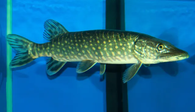
Fly fishing · 2
What these strengths mean
- Characteristic of this water
- This water is strongly identified with this species by the sources that cover it.
- Regular local target
- Fishing sources describe this as a normal local target here, not merely as caught.
- Seasonal
- Well supported, and concentrated in part of the year rather than spread through it.
- Repeatedly reported
- Several independent public accounts. Enough to say it happens more than once; not enough to call it a fishery.
- Recorded here
- At least one credible public account of this species being caught here. That is all it means.
- How breadth is counted
- A fish documented at six marks is shown as six marks: breadth never raises the strength on its own. A fishery account describes the fishing; a recorded catch reports one specific catch. How evidence is weighed.
How people fish here
6 methods are recorded on the places documented here, counted from the records themselves rather than from what is practised in the country. Each opens a full guide to the technique.
Ledgering
Recorded at 28 places here, over estuary mark, headland, beach, beach section.
Fishing a bait on the bottom held by a weight, with no float — the simplest way to fish at distance, in depth, or in wind.
Documented on the same ground: Atlantic cod, Common sole, Conger eel, European flounder, European sea bass, Small-spotted catshark.
Surfcasting
Recorded at 10 places here, over estuary mark, headland, beach, island.
Casting heavy baited tackle from a beach into surf — a method defined by distance, by tide, and by reading water that all looks the same.
Documented on the same ground: Atlantic cod, Common sole, Conger eel, European flounder, European sea bass, Small-spotted catshark.
Spinning
Recorded at 6 places here, over headland, breakwater, island, rock mark.
Casting an artificial lure and retrieving it so that it moves like something alive — the most direct form of lure fishing.
Documented on the same ground: Conger eel, European flounder, European sea bass, Thornback ray, Whiting, Atlantic cod.
Float fishing
Recorded at 3 places here, over breakwater, headland, rock mark.
Suspending a bait at a controlled depth beneath a buoyant indicator — the most visual, most controllable and most widely applicable method in angling.
Crabbing with a line and a drop net
Recorded at 1 place here, over pier.
The commonest introduction to fishing anywhere with a harbour wall: a weighted bait that a crab grips, or a baited net it walks into — and no hook in either.
Stillwater fly fishing
Recorded at 1 place here, over reservoir.
Fly fishing without current, where the angler supplies every movement and the problem becomes finding fish rather than presenting to them.
Documented on the same ground: Rainbow trout, Northern pike, Brown trout, European perch.
These are the methods documented at the places FishingHQ holds here. A species listed beside a method is documented on the same ground, which is not the same as being taken that way — where a source establishes the method a fish was caught on, it is stated on that place’s own page. All fishing methods.
The fishing year here
The months the records under this area actually name, tightest season first. This is “observed in these months” rather than a season: a species whose months nobody recorded is not listed, because a gap in the evidence is not a year-round fishery.
- TurbotApril to April
- Spotted rayMarch to May
- Thornback rayJune to September
- Atlantic codNovember to February
- Small-spotted catsharkJune to September
- WhitingNovember to February
- European flounderNovember to February
- Starry smooth-houndJune to September
- Common soleJune to September
- Bull hussJune to September
- PoutingJune to September
- European plaiceJune to September
What dominates
Shore bait fishing from rock points, piers and the muddy foreshore, with heavy leads to hold in the tidal run. Boat fishing in the outer estuary and Bristol Channel over sandbanks and rough ground. Historic and heritage fisheries with statutory recognition: lave netting for salmon on the sands, putcher and putt rank fixed engines, and elver netting on the spring run. Freshwater and lower-river fishing on the tributary rivers above the tidal limit. Bore surfing, which is not fishing but is the phenomenon most people know the estuary for.
The water available
A funnel-shaped estuary narrowing and shallowing towards its head, producing tidal resonance and an exceptional range; extensive intertidal mudflats and sandbanks exposed over great distances at low water; rock points and ledges where older rock reaches the shore; permanently high suspended sediment concentrations and near-zero underwater visibility; strong tidal streams throughout; saltmarsh along the margins; and, at the head, the tidal reach of the river itself where the bore runs.
How the rules are structured
The estuary spans an England-Wales boundary and several regulatory regimes overlap on it. Sea fishing in the outer estuary falls to the relevant inshore fisheries and conservation authority in England and to the Welsh government's marine and fisheries function on the Welsh side, with national minimum sizes and bass measures applying throughout. Migratory salmonids, shad, lamprey and eel are the responsibility of the environment agency in England and natural resources Wales in Wales, and the migratory fisheries here are subject to specific and long-standing regulation: the historic net fisheries operate as licensed or authorised fixed engines and instruments under legislation of considerable age, and their numbers have been progressively reduced. The eel and elver fishery is separately licensed and sits within national and European eel management measures because of the species' conservation status. The estuary carries European-level habitat and bird designations and is a site of special scientific interest, so conservation law bears on activity as heavily as fisheries law does. Shellfish gathering is subject to sanitary classification and biotoxin monitoring. FishingHQ does not state what any current rule is.
Who to ask
- The environment agency in England and natural resources Wales, for migratory salmonids, eels, elvers and the historic net and fixed-engine fisheries.
- The inshore fisheries and conservation authority for the English side, and the Welsh government's marine and fisheries function on the Welsh side, for sea fishing.
- The statutory nature conservation bodies, for the European habitat and bird designations and the site of special scientific interest covering the estuary.
- The harbour authority for the port and navigation areas, whose rules govern access to piers, walls and navigable channels.
- The local authority and food standards agency, for shellfish ground classification and biotoxin monitoring.
Words you will meet
- The Severn bore
- A tidal bore: the flood front running up the narrowing river as a breaking wave on the largest spring tides, travelling many miles inland. One of the largest in the world, and a direct consequence of the estuary's shape and range.
- Lave net
- A hand-held Y-framed net used by a fisher standing on the sands, who intercepts a salmon seen or sensed moving on the tide. A licensed heritage fishery with a documented history and very few remaining practitioners.
- Putcher rank
- A row of conical basket traps mounted on a frame in the intertidal zone, set to take salmon on the ebb. A fixed engine in the legal sense, with rights of considerable antiquity attached, and now much reduced.
- Elver
- A juvenile European eel arriving from the sea in spring after a transatlantic larval drift. The Severn elver run supported a substantial and distinctive fishery, and the species' collapse has made it one of the most tightly regulated fisheries in the country.
- Tidal resonance
- The amplification of tidal range that occurs when the natural oscillation period of a basin is close to the period of the tide driving it. Combined with funnelling, it is why the Severn's range is what it is.
Conditions and hazards
This estuary is genuinely dangerous and its hazards are unusually severe even by the standards of British coastal water. The tidal range means enormous areas of mud and sand are exposed and then covered, and the flood comes in across level ground faster than a person can walk; people are cut off on the sands regularly. Much of the mud is soft enough to trap a person, and being stuck in mud on a rising tide in this estuary is a recognised and recurring emergency. The tidal streams are among the strongest in Britain and are unsurvivable to swim against. Visibility in the water is effectively nil, so anybody in it cannot see and cannot be seen. The bore itself is a moving hydraulic feature that arrives quickly and can catch people on the banks. Water quality varies and the estuary carries substantial shipping. Cold water shock applies year-round.
Resonance, funnelling and the second largest tide on earth
The Severn's tidal range is the single most important fact about it and the explanation is a good piece of physics.
A TIDE IS A VERY LONG WAVE, and when it enters a shoaling, narrowing basin two things happen to it. Funnelling concentrates the same volume of water into a decreasing cross-section, raising its height. Shoaling slows the wave and further increases its amplitude. Both operate strongly here because the estuary narrows and shallows consistently towards its head.
RESONANCE IS THE MULTIPLIER. Every basin has a natural period at which water sloshes back and forth. When that period is close to the period of the driving tide, the response is amplified — the same effect as pushing a swing at the right moment. The Severn and Bristol Channel system happens to be close to resonant with the semi-diurnal tide, and that is why the range is exceptional rather than merely large.
SPRING TIDES IN THE UPPER ESTUARY EXCEED TEN METRES, second in the world only to the Bay of Fundy, which shares the same combination of causes.
THE HORIZONTAL CONSEQUENCE IS THE ONE THAT MATTERS ON THE WATER. Moving that much water vertically in six hours requires it to move horizontally very fast, and the tidal streams here are among the strongest around Britain. Anything fished on the bottom needs weight to hold, and anything floating goes where the tide goes.
THE BORE IS THE EXTREME CASE. On the largest springs, the flood front entering the narrowing river cannot propagate as a smooth wave and forms a breaking front that travels upstream for many miles. It is a genuine hydraulic jump and one of the largest examples in the world.
AND THE SEDIMENT NEVER SETTLES. The energy in those streams keeps fine sediment permanently in suspension, which is why the water is brown and why the ecology is what it is.
Backed by research — why, and the sources (2)
Supported by peer-reviewed research or fisheries science. The sources are listed and can be checked.
- NOAA Ocean Service tides and water levels educational tutorial — National Oceanic and Atmospheric Administration, United States (Government fisheries body)Relied on for: The mechanism of tides, tidal range, tidal streams and the amplification of tidal range in converging estuaries.States this directlyPassage read and verified
- Met Office shipping forecast, inshore waters forecast and marine warnings — Met Office, United Kingdom (Government fisheries body)Relied on for: Inshore waters forecasting, sea state, swell and the marine warning products issued for British coastal waters.Background and mechanism onlyCitation checked — the work exists and is described correctly
Fish that hunt without seeing, and the migrants passing through
Near-zero visibility selects a particular kind of fish, and the estuary's assemblage is a good illustration of that principle.
THE RESIDENT ASSEMBLAGE IS NON-VISUAL. Where light barely penetrates, sight feeding does not work, and the estuary is dominated by species equipped to hunt by scent, taste and the lateral line: conger and eels, rays and smooth-hounds, whiting, pouting and other gadoids, and flatfish that ambush from the bottom. FishingHQ's lateral line material is the mechanism, and this estuary is one of the clearest environments in which it is the primary sense in use.
SMOOTH-HOUNDS AND THORNBACK RAYS ARE CHARACTERISTIC of the sand and mud ground, and the hounds in particular are strongly associated with crab as prey.
CONGER OCCUPY THE ROCK AND STRUCTURE, and the estuary's harder ground and wrecks hold them.
BASS AND MULLET USE THE ESTUARY as most British estuaries are used, with mullet exploiting the organic-rich margins and bass working the tide.
THE MIGRATORY SPECIES ARE THE INTERNATIONALLY IMPORTANT PART. Atlantic salmon, sea trout, twaite and allis shad, river and sea lamprey and European eel all use this estuary as the corridor to their spawning rivers. Several of these are designated features of the estuary's conservation status, and the shad runs in particular are among the most significant in Britain.
THE ELVER RUN IS A PHENOMENON IN ITS OWN RIGHT. Juvenile eels arriving from the Atlantic after a larval drift of thousands of kilometres enter the estuary in spring and move upriver on the flood, and the run historically occurred in enormous numbers.
AND THE EEL'S COLLAPSE IS THE MODERN FACT. European eel is critically endangered, recruitment has fallen dramatically since the twentieth century, and the fishery that once operated here has been reduced accordingly. Any description of this estuary's fisheries that used the past tense carelessly would mislead.
Backed by research — why, and the sources (2)
Supported by peer-reviewed research or fisheries science. The sources are listed and can be checked.
- Cefas science, advice and data on marine and freshwater environments — Centre for Environment, Fisheries and Aquaculture Science (Government fisheries body)Relied on for: Marine and estuarine environmental science and monitoring in English and Welsh waters, including estuarine fish assemblages and water quality.States this directlyCitation checked — the work exists and is described correctly
- JNCC species and habitat conservation advice — Joint Nature Conservation Committee (Conservation authority)Relied on for: Conservation status, designated features and management advice for protected estuarine and coastal habitats and species.States this directlyCitation checked — the work exists and is described correctly
Heavy leads, hand nets and traps that are legally engines
The fishing practised in this estuary spans a modern shore fishery and several heritage fisheries with statutory recognition, and the second group is the more interesting.
SHORE BAIT FISHING IS THE ORDINARY RECREATIONAL DISCIPLINE. Heavy grip leads to hold in a running tide, strong tackle, scent-based baits, and an acceptance that the water is brown and the fish are found by smell rather than by sight. Rock points and ledges, piers and hard foreshore are the platforms, because the mud is not a place to stand.
BOAT FISHING WORKS THE OUTER ESTUARY over sandbanks, rough ground and wrecks, and it is a substantial fishery for conger, rays, hounds and cod.
LAVE NETTING IS ONE OF THE MOST UNUSUAL FISHING PRACTICES SURVIVING IN BRITAIN. A fisher wades onto the sands with a hand-held Y-framed net and intercepts salmon moving on the tide, working by feel and by knowledge of the channels. It requires reading a sandbank system that changes, and it is conducted in an estuary that kills people who misread it. Very few practitioners remain and the fishery is licensed.
PUTCHER AND PUTT RANKS ARE FIXED ENGINES IN THE LEGAL SENSE. Rows of conical basket traps mounted in the intertidal zone take fish on the ebb, and the rights attached to them are of considerable antiquity — several are recorded in medieval documents. Their numbers have been reduced progressively as salmon stocks declined.
ELVER NETTING IS A SPRING FISHERY with hand-held nets on the flood, historically at very large scale and now tightly licensed because of the eel's status.
AND THE BORE HAS ITS OWN NON-FISHING CULTURE — surfers riding it many miles inland — which is worth recording because it is how most people encounter the estuary's hydraulics at all.
What experienced anglers do — why, and the sources (2)
Widely and independently recommended by experienced anglers and specialist sources. This is real angling knowledge, not proof: controlled evidence for it is limited, and FishingHQ records it as convention rather than as a demonstrated effect.
- Angling Trust guidance for anglers — Angling Trust (Angling or fisheries organisation)Relied on for: Guidance for anglers on practice, participation and the representation of angling interests in England.Background and mechanism onlyCitation checked — the work exists and is described correctly
- Sea Angler — Bauer Media (Specialist angling publication)Relied on for: Established British sea angling practice, tackle conventions and the way particular kinds of ground are fished.States this directlyCitation checked — the work exists and is described correctly
A calendar set by tide height and by the run of migratory fish
The estuary has a seasonal cycle and a fortnightly one, and the second matters as much as the first.
THE SPRING-NEAP CYCLE IS THE FUNDAMENTAL RHYTHM. Range varies enormously between springs and neaps here, and with it the strength of the streams, the area of exposed ground, and whether the bore runs at all. A plan made without reference to the tide table is not a plan in this estuary.
THE ELVER RUN IS THE SPRING EVENT. Juvenile eels arrive in the estuary in the first half of the year and move up on the flood tides, concentrated by temperature and by tide. It is one of the most distinctive seasonal events in British fresh and estuarine water.
SHAD RUN IN LATE SPRING. Twaite and allis shad move up the estuary and into the rivers to spawn in a short and well-defined window, and the estuary's shad populations are of international conservation importance.
SALMON AND SEA TROUT MOVE THROUGH FROM SPRING INTO AUTUMN, with run timing varying between rivers and between years and driven by flow as much as by date.
THE SUMMER SEA FISHING IS SMOOTH-HOUND, RAY AND BASS ORIENTATED, with the hounds particularly associated with the warmer months and with peeler crab as bait.
AUTUMN AND WINTER BRING THE GADOIDS — whiting, pouting and cod — into the outer estuary, and the shore fishing shifts accordingly.
AND THE BORE'S BIGGEST OCCURRENCES CLUSTER around the equinoxes, when the largest spring tides occur. That is astronomy rather than season, and it is predictable years in advance, which is a rare thing in a fishing calendar.
Backed by research — why, and the sources (2)
Supported by peer-reviewed research or fisheries science. The sources are listed and can be checked.
- NOAA Ocean Service tides and water levels educational tutorial — National Oceanic and Atmospheric Administration, United States (Government fisheries body)Relied on for: The mechanism of tides, tidal range, tidal streams and the amplification of tidal range in converging estuaries.States this directlyPassage read and verified
- Met Office shipping forecast, inshore waters forecast and marine warnings — Met Office, United Kingdom (Government fisheries body)Relied on for: Inshore waters forecasting, sea state, swell and the marine warning products issued for British coastal waters.Background and mechanism onlyCitation checked — the work exists and is described correctly
Two countries, medieval rights and a critically endangered eel
The regulatory position here is one of the more complicated in British inshore water, and the complication is instructive.
THE ESTUARY CROSSES A NATIONAL BOUNDARY. England and Wales administer fisheries separately, and the estuary has both banks in different jurisdictions with different agencies, different licensing and, in places, different rules.
MIGRATORY FISH ARE HANDLED SEPARATELY FROM SEA FISH. Salmon, sea trout, shad, lamprey and eel fall to the environment agency in England and natural resources Wales in Wales, and they carry a body of specific regulation that is quite separate from sea fishing byelaws.
THE HERITAGE FISHERIES OPERATE UNDER OLD LAW. Lave nets, putchers and putts are fixed engines and instruments under legislation of considerable age, and some of the rights attached to particular locations are documented back to the medieval period. Their operation is authorised and their numbers have been progressively reduced as salmon stocks declined — a case of ancient rights being constrained by modern stock assessment.
THE EEL IS THE TIGHTEST CONSTRAINT. European eel is critically endangered and recruitment has collapsed since the twentieth century. Eel and elver fishing is licensed, restricted and sits within national and European eel management measures, and the historic elver fishery of this estuary operates at a small fraction of its former scale.
CONSERVATION DESIGNATION COVERS THE WHOLE ESTUARY. European-level habitat and bird designations and site of special scientific interest status apply, with migratory fish among the designated features, so conservation law bears directly on fisheries here rather than sitting alongside them.
HARBOUR AND NAVIGATION AUTHORITIES GOVERN THE PORTS AND CHANNELS, which is what actually decides access to many of the hard structures a shore angler would want to fish from.
AND FISHINGHQ DOES NOT STATE WHAT ANY OF THIS CURRENTLY PERMITS. In an estuary with two national agencies, medieval fixed-engine rights and a critically endangered species, the durable answer is the list of authorities above.
Official guidance — why, and the sources (2)
Stated by a fisheries authority, scientific institute or recognised angling body. Authoritative, but summarising rather than demonstrating.
- Cefas science, advice and data on marine and freshwater environments — Centre for Environment, Fisheries and Aquaculture Science (Government fisheries body)Relied on for: Marine and estuarine environmental science and monitoring in English and Welsh waters, including estuarine fish assemblages and water quality.States this directlyCitation checked — the work exists and is described correctly
- JNCC species and habitat conservation advice — Joint Nature Conservation Committee (Conservation authority)Relied on for: Conservation status, designated features and management advice for protected estuarine and coastal habitats and species.States this directlyCitation checked — the work exists and is described correctly
Bore, lave, putcher: a vocabulary older than the sport
This estuary's vocabulary is unusually old and unusually specific, and several of the words are legal terms as well as fishing ones.
BORE NAMES A HYDRAULIC PHENOMENON. A tidal bore is the flood front propagating upriver as a breaking wave, and it forms only where range, funnelling and river geometry combine. It is a technical term, not a local nickname.
LAVE NET NAMES A SPECIFIC IMPLEMENT AND A SPECIFIC PRACTICE. A Y-framed hand net worked by a person standing on the sands, intercepting fish rather than filtering water. The word and the practice are documented over centuries, and the fishery is now vanishingly small.
PUTCHER AND PUTT NAME CONICAL BASKET TRAPS of different sizes and configurations, set in ranks in the intertidal zone. In law they are fixed engines, a category with its own regulatory history, and some ranks carry rights recorded in medieval documents.
FIXED ENGINE IS THE LEGAL TERM THAT COVERS THEM, and it is worth knowing because it explains why these fisheries are regulated in a completely different way from rod fishing.
ELVER NAMES THE JUVENILE EEL at the stage when it enters fresh water, after the glass eel stage and before the yellow eel one. Getting the life stage right matters because the regulation and the conservation status attach to the species across all of them.
TIDAL RESONANCE IS THE PHYSICAL TERM that explains the range, and a reader who has it can also understand the Bay of Fundy and every other extreme-range estuary in the world.
AND THE MUD HAS ITS OWN VOCABULARY LOCALLY, because a coast where people get stuck in it has needed words for the different kinds. FishingHQ records that the distinction between firm sand and soft mud here is a safety-critical one rather than a textural nicety.
What experienced anglers do — why, and the sources (2)
Widely and independently recommended by experienced anglers and specialist sources. This is real angling knowledge, not proof: controlled evidence for it is limited, and FishingHQ records it as convention rather than as a demonstrated effect.
- Angling Trust guidance for anglers — Angling Trust (Angling or fisheries organisation)Relied on for: Guidance for anglers on practice, participation and the representation of angling interests in England.Background and mechanism onlyCitation checked — the work exists and is described correctly
- Sea Angler — Bauer Media (Specialist angling publication)Relied on for: Established British sea angling practice, tackle conventions and the way particular kinds of ground are fished.States this directlyCitation checked — the work exists and is described correctly
Medieval traps, an elver economy and a fishery regulated into memory
The Severn's fishing history is documented further back than almost any other British fishery, and its recent history is a decline.
THE FIXED-ENGINE FISHERIES ARE MEDIEVAL AND OLDER. Basket traps set in the intertidal zone to take fish on the ebb are recorded in Domesday-era documents and in monastic records, and the rights attached to particular sites persisted for centuries. This is one of the few fisheries in Britain where a modern licensing dispute can turn on a medieval grant.
LAVE NETTING IS OF SIMILAR ANTIQUITY, and the practice — a person on the sands with a hand net, reading the channels — has been documented in essentially its current form for a very long time.
THE ELVER FISHERY WAS AN ECONOMY IN ITSELF. Elvers were taken in enormous quantities in the spring run, eaten locally in dishes now largely forgotten, and later exported live at high value for stocking and for consumption. It supported a seasonal cash economy along the river.
THE SALMON RUN SUPPORTED SUBSTANTIAL COMMERCIAL FISHERIES into the twentieth century, using nets, traps and boats, and the estuary was a significant salmon fishery by national standards.
THE DECLINE IS THE MODERN STORY AND IT HAS SEVERAL CAUSES. Salmon stocks across the region fell for reasons including marine survival, obstructions, water quality and historical exploitation; eel recruitment collapsed for reasons that are still not fully resolved but include barriers, habitat loss and oceanic change. The regulatory response reduced the historic fisheries progressively, and several are now operated by a handful of people or not at all.
THE INDUSTRIAL HISTORY IS PART OF IT TOO. The estuary served heavy industry and shipping for two centuries, with the water quality consequences that implies, and the improvement in water quality over recent decades is a genuine environmental success that fisheries recovery has only partly followed.
AND THE TIDAL ENERGY QUESTION HAS RECURRED FOR A CENTURY. Proposals to barrage or lagoon the estuary for tidal power have been made repeatedly, and every one has raised the same conflict between renewable energy and the intertidal habitat and migratory fish passage the estuary is designated for.
Official guidance — why, and the sources (2)
Stated by a fisheries authority, scientific institute or recognised angling body. Authoritative, but summarising rather than demonstrating.
- ICES Advice on fishing opportunities, catch and effort — International Council for the Exploration of the Sea (Scientific institute)Relied on for: Stock assessment and scientific advice for the sea areas concerned, and the environmental conditions the assessments rest on.States this directlyCitation checked — the work exists and is described correctly
- The IUCN Red List of Threatened Species — International Union for Conservation of Nature (Conservation authority)Relied on for: Assessment and range accounts for the species concerned, including the pressures acting on them.Background and mechanism onlyCitation checked — the work exists and is described correctly
Reading mud, and a fishery that is nearly a museum
The culture of this estuary is built on knowledge of a landscape that is trying to kill you, and on the remains of fisheries that were once ordinary.
READING THE SANDS IS THE CORE SKILL AND IT IS PERISHABLE. The channels, banks and firm routes across the estuary's intertidal zone change with the tides and with the seasons, and the knowledge of where it is safe to walk is held by very few people. The lave net fishers are effectively the last holders of an operational version of it.
THE HERITAGE FISHERIES ARE NOW PARTLY A CONSERVATION SUBJECT. With numbers reduced to a handful, lave netting and putcher fishing are documented, filmed and studied as cultural heritage as much as practised as fisheries, and there is an active argument about whether preserving a practice justifies taking a fish from a depleted stock. Both sides of that are reasonable.
THE ELVER SEASON WAS A COMMUNITY EVENT and is remembered as one along the river, with a food culture attached that has largely disappeared with the fishery.
THE BORE IS THE ESTUARY'S PUBLIC FACE. Crowds gather for the largest bores, surfers ride them for miles, and the phenomenon has a following entirely separate from fishing. It is also the thing that makes the estuary's hydraulics visible to people who would otherwise never think about tidal range.
SHORE ANGLING HERE IS A HARD-GROUND SPECIALITY. Fishing in brown water with heavy leads in a savage tide, from limited platforms, is not a beginner's environment, and the anglers who do it well are working with a good understanding of tide state and of scent-based presentation.
AND THE ESTUARY IS TAKEN SERIOUSLY BY EVERYONE WHO KNOWS IT. Local attitudes to the mud, the tide and the bore are consistently cautious, and a visitor who treats that caution as local colour has misunderstood the place.
What experienced anglers do — why, and the sources (2)
Widely and independently recommended by experienced anglers and specialist sources. This is real angling knowledge, not proof: controlled evidence for it is limited, and FishingHQ records it as convention rather than as a demonstrated effect.
- RNLI water safety guidance: cold water shock and Float to Live — Royal National Lifeboat Institution (Water-safety or diver-training authority)Relied on for: Shore fishing and coastal hazards including being swept in, shore-break, cold water shock and tidal cut-off, and the guidance issued about them.States this directlyPassage read and verified
- RoSPA water safety information and UK accidental drowning statistics — Royal Society for the Prevention of Accidents (Water-safety or diver-training authority)Relied on for: Accidental drowning statistics for the United Kingdom and the circumstances in which recreational water users are most often killed.States this directlyPassage read and verified
A tidal range that turns an ordinary walk into a timetable
The Severn has one of the largest tidal ranges in the world, and almost every hazard here is that single fact expressed in a different way.
THE RANGE IS THE HAZARD. On the biggest spring tides the water moves through a vertical range of something over fourteen metres. Across the estuary's low gradients that produces horizontal movement measured in hundreds of metres to kilometres, uncovering enormous areas of sand, mud and rock ledge twice a day and covering them again on a schedule that does not negotiate.
WHICH MEANS THE GROUND YOU WALKED OUT ONTO HAS AN EXPIRY TIME. It is not that the sea might come in. It is that it will, at a known time, at a speed no one can outwalk over soft ground, filling from behind through gullies and channels as well as advancing from the front.
THE STREAMS ARE COMMENSURATE WITH THE RANGE. Moving that volume of water in and out twice daily produces tidal streams that are strong in the channel and locally very strong around any constriction, headland or bank edge. That is a serious matter for a small craft and it is why an apparently modest crossing here is not a modest crossing.
THE MUD IS NOT INCIDENTAL. Extensive soft mud and silt is the characteristic ground, it varies in bearing capacity from place to place and tide to tide, and somebody who is stuck in it on a flood tide is in the primary hazard rather than a secondary one.
AND THE WATER IS COLD AND OPAQUE. Heavy suspended sediment means very poor visibility in the water, immersion produces cold water shock in most months, and a person in this water cannot see and is difficult to see.
THE BORE IS THE FAMOUS FEATURE AND IS THE LEAST OF IT. It is spectacular, it is predicted, and it arrives at published times on published dates, which makes it the one aspect of this estuary that is straightforwardly avoidable. The unremarkable spring tide on an ordinary afternoon is the one that catches people.
WHAT ACTUALLY HELPS is treating the tide table as the governing document for the session, walking the exit before fishing and noting the low ground behind, setting a leaving time from the tide rather than from the fishing, wearing a buoyancy aid rather than carrying one, not going out onto mud or extensive flats alone, and carrying a means of calling for help on the person.
Official guidance — why, and the sources (2)
Stated by a fisheries authority, scientific institute or recognised angling body. Authoritative, but summarising rather than demonstrating.
- RNLI water safety guidance: cold water shock and Float to Live — Royal National Lifeboat Institution (Water-safety or diver-training authority)Relied on for: Cold water shock and the immersion response, tidal cut-off, and water-safety guidance for shore anglers and small-craft users.States this directlyPassage read and verified
- Cefas science, advice and data on marine and freshwater environments — Centre for Environment, Fisheries and Aquaculture Science (Government fisheries body)Relied on for: Marine environmental science for UK shelf seas, including tidal range, coastal process, sediment characterisation and the monitoring programmes that describe them.States this directlyCitation checked — the work exists and is described correctly
Some of what lives here
Fish recorded here that FishingHQ holds a reviewed photograph of. It is not a complete list of what The Severn Estuary holds, and it is not a prediction that you will catch any of them — it is a way in to the ones we can show you.
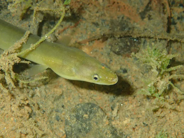 European eelA Critically Endangered fish that breeds in the Sargasso Sea, drifts to Europe as a transparent larva, lives decades in fresh water and returns once to spawn and die.
jujurenoult — CC BY 4.0, via Wikimedia Commons
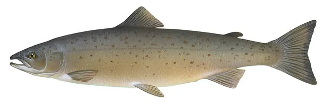 Atlantic salmonAn anadromous salmonid that migrates from its natal river to the North Atlantic and returns to spawn — and a species in serious, well-documented decline.
Knepp, Timothy, Public domain, via Wikimedia Commons
- Thornback rayThe commonest European ray, covered in thorn-like bucklers, laying horny egg cases known as mermaid's purses, and requiring careful handling on release.
Ella McCausland — CC BY, via iNaturalist
- Conger eelA very large scaleless eel of wrecks, rock and harbour walls, reaching three metres, and among the most powerful and most genuinely dangerous fish to handle in European seas.
Holger Krisp — CC BY 3.0, via Wikimedia Commons
 WhitingA small, abundant, silver gadoid of European coasts, a mainstay of winter shore fishing and distinguished by a dark spot at the pectoral fin base.
rmjb — CC BY, via iNaturalist
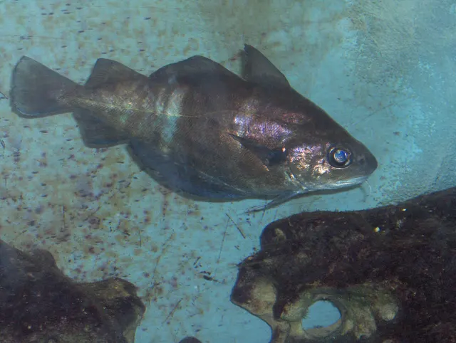 PoutingA deep-bodied coppery gadoid of wrecks and rough ground, barred when fresh, with a prominent chin barbel and a very short shelf life.
Georges Jansoone (JoJan) — CC BY-SA 3.0, via Wikimedia Commons
- European sea bassA fast, predatory inshore fish that hunts in broken water and surf, and one of the most closely managed recreational species in European seas.
Julien Renoult — CC BY 4.0, via Wikimedia Commons
 Thick-lipped grey mulletA shoaling coastal fish that eats algae and detritus rather than prey — which makes it the hardest common sea fish to catch and the most interesting to think about.
Diego Delso — CC BY-SA 4.0, via Wikimedia Commons
Places within this area
Publicly documented fishing geography. FishingHQ describes what the ground is; it does not say whether you may fish it, and every one of these sends that question to the body that holds the answer. Browse every place in this part of the world.
Who to ask before fishing any of these
FishingHQ does not know the current access position here. Shore angling in England is not rod-licensed, but access rights, landowner permission, local authority and harbour byelaws, national and inshore fisheries measures, and site designations all apply and all change. Check the current position with the relevant inshore fisheries and conservation authority, the harbour or local authority, and the landowner before going. This water is tidal and transitional, so the freshwater regime may also apply above the tidal limit: FishingHQ does not know the current access position here. Freshwater rod fishing in England requires a current rod licence AND separate permission from whoever controls the fishing, which is frequently a club, riparian owner or navigation authority rather than a public body. Close seasons, byelaws and local rules apply and change. Check with the Environment Agency and with the controlling club or owner before going.
FishingHQ does not know the current access position here. Shore angling in Wales is not rod-licensed, but access rights, landowner permission, local authority and harbour byelaws, national and inshore fisheries measures, and site designations all apply and all change. Check the current position with Natural Resources Wales, the harbour or local authority, and the landowner before going.
FishingHQ does not know the current access position here. Shore angling in England is not rod-licensed, but access rights, landowner permission, local authority and harbour byelaws, national and inshore fisheries measures, and site designations all apply and all change. Check the current position with the relevant inshore fisheries and conservation authority, the harbour or local authority, and the landowner before going.
FishingHQ does not know the current access position here. Shore angling in Wales is not rod-licensed, but access rights, landowner permission, local authority and harbour byelaws, national and inshore fisheries measures, and site designations all apply and all change. Check the current position with Natural Resources Wales, the harbour or local authority, and the landowner before going. This water is tidal and transitional, so the freshwater regime may also apply above the tidal limit: FishingHQ does not know the current access position here. Freshwater rod fishing in Wales requires a current rod licence AND separate permission from whoever controls the fishing, which is frequently a club, riparian owner or navigation authority rather than a public body. Close seasons, byelaws and local rules apply and change. Check with Natural Resources Wales and with the controlling club or owner before going.
FishingHQ does not know the current access position here. Freshwater rod fishing in Wales requires a current rod licence AND separate permission from whoever controls the fishing, which is frequently a club, riparian owner or navigation authority rather than a public body. Close seasons, byelaws and local rules apply and change. Check with Natural Resources Wales and with the controlling club or owner before going.
Brean Down
Headland · Brackish water
A carboniferous limestone ridge projecting nearly two kilometres west into the Severn Estuary, an outlier of the Mendips surrounded by the estuary's mud and sand. Hard rock on the down itself, deep soft mud on both flanks.
Exposed to the estuary's westerly fetch, with no ocean swell — the Severn has almost no swell, and wind-driven chop over a strong stream is the sea state that matters.
Particular to this ground: tides and being cut off, cold water shock, cliffs and rock platforms.
Severe hazards of The Severn Estuary apply here: moving water and currents.
Particular to this water: This ground carries conservation designations that constrain access, vehicles, bait collection and disturbance independently of any fishing rule.
Nash Point
Headland · Salt water
Layered Lias limestone and shale cliffs stepping down to a wave-cut platform of the same rock, with the Nash Sands — a long shifting sandbank — lying offshore across the tide.
South-facing into the Bristol Channel. There is little ocean swell this far up the channel; wind against a very strong tide is the sea state that matters.
Particular to this ground: tides and being cut off, cliffs and rock platforms, cold water shock.
Severe hazards of The Severn Estuary apply here: moving water and currents.
Particular to this water: This ground carries conservation designations that constrain access, vehicles, bait collection and disturbance independently of any fishing rule.
Lynmouth
Cove · Salt water
A boulder and shingle shore at the mouth of two steep Exmoor rivers, beneath wooded cliffs, where the Bristol Channel's range is already over eight metres.
Severe hazards of The Severn Estuary apply here: tides and being cut off, moving water and currents, cold water shock.
Porlock Weir
Harbour wall · Salt water
A tiny shingle-bar harbour behind a breached storm ridge, with a boulder and shingle foreshore and an extensive drying rock scar in front of it.
Severe hazards of The Severn Estuary apply here: tides and being cut off, moving water and currents, cold water shock.
Minehead
Beach · Salt water
Sand and shingle beneath a wooded headland, with a harbour arm at the western end and an increasingly muddy, increasingly tidal shore running east into the inner channel.
Severe hazards of The Severn Estuary apply here: tides and being cut off, moving water and currents, cold water shock.
Watchet harbour
Harbour wall · Salt water
A small harbour on the alabaster and lias cliffs of west Somerset, drying completely at low water onto a flat rock and mud scar that extends a long way out.
Severe hazards of The Severn Estuary apply here: tides and being cut off, moving water and currents, cold water shock.
Hinkley Point and Stolford
Beach section · Salt water
A flat, ledged lias rock foreshore extending a very long way out into the inner Bristol Channel, with mud between the ledges, beside power station outfalls and their warmed plume.
Particular to this ground: tides and being cut off.
Severe hazards of The Severn Estuary apply here: moving water and currents, cold water shock.
Weston-super-Mare
Beach · Salt water
A vast, near-level bay of sand over deep soft mud, drying more than a kilometre, with two piers and a tidal range among the largest anywhere.
Particular to this ground: drowning and immersion.
Severe hazards of The Severn Estuary apply here: tides and being cut off, moving water and currents, cold water shock.
21 more places in this area
Clevedon Pier
Pier · Salt water
A slender iron pier reaching from a rock shore into the deep central channel of the Severn, standing in the fastest and most heavily silt-laden water on the English side.
Severe hazards of The Severn Estuary apply here: tides and being cut off, moving water and currents, cold water shock.
Portishead
Estuary mark · Brackish water
A rock and mud point at the corner where the Severn narrows towards Avonmouth, with a very strong stream past the point and the deep shipping channel close inshore.
Severe hazards of The Severn Estuary apply here: tides and being cut off, moving water and currents, cold water shock.
Aust and the Severn crossings
Estuary mark · Brackish water
The narrowest point of the upper Severn estuary, where the bridge crossings span mud, rock ledges and a channel carrying the second-largest tidal range on earth at several knots.
Particular to this ground: moving water and currents.
Severe hazards of The Severn Estuary apply here: tides and being cut off, cold water shock.
Port Talbot breakwater
Breakwater · Salt water
A very long rock-armoured breakwater enclosing a deep-water tidal harbour, standing over sand in a heavily industrial stretch of the Bristol Channel.
Severe hazards of The Severn Estuary apply here: tides and being cut off, moving water and currents, cold water shock.
Sker Point and Rest Bay
Rock mark · Salt water
A jagged Carboniferous limestone reef running out from a dune coast, with deep gullies, drying scars and clean sand bays either side of it.
Severe hazards of The Severn Estuary apply here: tides and being cut off, moving water and currents, cold water shock.
Porthcawl breakwater
Breakwater · Salt water
A short stone breakwater with a lighthouse, at the corner of a limestone headland, standing over rock and sand where the Bristol Channel's range is already very large.
Severe hazards of The Severn Estuary apply here: tides and being cut off, moving water and currents, cold water shock.
Aberthaw
Beach section · Salt water
A shingle and boulder shore over flat lias ledges beside a power station outfall, on the Glamorgan heritage coast where the rock steps down to the sea in horizontal beds.
Severe hazards of The Severn Estuary apply here: tides and being cut off, moving water and currents, cold water shock.
Barry Island and Nells Point
Headland · Salt water
A limestone headland between two sand bays at the edge of a large dock complex, with rock ledges, deep gullies and one of the largest tidal ranges in the world running past it.
Severe hazards of The Severn Estuary apply here: tides and being cut off, moving water and currents, cold water shock.
Penarth Pier
Pier · Salt water
An Edwardian pier standing over deep brown water in the inner Bristol Channel beside the Cardiff Bay barrage, with mud and rock beneath and an enormous tidal range.
Severe hazards of The Severn Estuary apply here: tides and being cut off, moving water and currents, cold water shock.
The Usk and Newport
Estuary mark · Brackish water
A deeply incised muddy tidal river in the inner Severn, with the second-largest tidal range on earth producing vertical mud banks, a transporter bridge and a strong bore-like flood.
Severe hazards of The Severn Estuary apply here: tides and being cut off, moving water and currents, cold water shock.
Llandegfedd Reservoir
Reservoir · Fresh water
A fertile lowland reservoir in a shallow Monmouthshire valley, with weedy bays, a soft bed and a long-established stocked trout fishery.
Severe hazards of The Severn Estuary apply here: moving water and currents, cold water shock.
The Gwent sea wall
Estuary mark · Brackish water
The engineered wall along the Gwent levels from Magor down to St Brides, fishing over the soft mud and gravel runs of the upper Severn where the tidal range is among the largest in the world and the water carries permanent colour. Fished off the wall itself rather than off any beach, because at low water there is no beach worth standing on.
Open across the upper estuary to the south-west, with nothing between the wall and the Somerset shore but several miles of moving water.
Severe hazards of The Severn Estuary apply here: tides and being cut off, moving water and currents, cold water shock.
Goldcliff
Estuary mark · Brackish water
The low ledge and the mud below it east of the Usk mouth, where the reef running out from the point gives the only hard ground on a shore that is otherwise silt. Heavy coloured water over a bottom that snags, which is why the fishing here is bait on the bottom and not much else.
Open south-west across the upper estuary, with no shelter from anything.
Particular to this ground: tides and being cut off.
Severe hazards of The Severn Estuary apply here: moving water and currents, cold water shock.
The Cardiff foreshore
Estuary mark · Brackish water
The rock and rubble foreshore east of the barrage, fished off the shelving stone into shallow, permanently coloured water. Mid-range tides rather than springs are what this ground wants, and the depth is never the point: the fish come up on the flood to feed in water that would look unfishable anywhere else.
Open across the estuary to the south, sheltered from the north by the city behind it.
Severe hazards of The Severn Estuary apply here: tides and being cut off, moving water and currents, cold water shock.
Sully Island
Island · Salt water
A tidal island off the Glamorgan shore joined to the mainland by a shingle and rock causeway that covers on every tide. Rough ground and reef off the seaward side, which is what holds the fish and what costs the tackle.
Open south into the Bristol Channel, with the island itself the only shelter there is.
Particular to this ground: tides and being cut off, cold water shock.
Severe hazards of The Severn Estuary apply here: moving water and currents.
Lavernock Point
Headland · Salt water
Low rock ledges dropping to sand and shingle at the point, with the pool the locals call the Ranny below them. The ledges fish and the clean ground beside them fishes differently, which is the whole reason to come here rather than to the beach either side.
Open south and west into the Bristol Channel.
Particular to this ground: cliffs and rock platforms.
Severe hazards of The Severn Estuary apply here: tides and being cut off, moving water and currents, cold water shock.
Monknash and the Nash ledges
Rock mark · Salt water
Limestone ledges running out below the Heritage Coast cliffs west of Nash Point, uncovering on the ebb into a mixture of rock, gravel and sand. The ledges are what is fished; they are flat, they are wide, and they are under water for most of the tide.
Open south-west, and the ledges are exposed by the swell that makes them fishable.
Particular to this ground: cliffs and rock platforms, tides and being cut off.
Severe hazards of The Severn Estuary apply here: moving water and currents, cold water shock.
Aberavon Sands
Surf beach · Salt water
A long, flat, clean sand beach running from the Afan mouth up towards Port Talbot's breakwater, shelving so gently that the tide moves a very long way across it. Featureless ground that fishes on the surf rather than on structure.
Wide open to the south-west across Swansea Bay, which is where its surf comes from.
Severe hazards of The Severn Estuary apply here: tides and being cut off, moving water and currents, cold water shock.
Burnham-on-Sea and Berrow
Beach · Salt water
Miles of flat sand and mud below the Brean dunes at the Parrett mouth, drying an enormous distance, with soft ground and channels in it and the Severn's colour permanently in the water. Among the largest tidal ranges in the world, over ground that is genuinely dangerous underfoot.
Open west across the Severn estuary.
Particular to this ground: tides and being cut off, moving water and currents.
Severe hazards of The Severn Estuary apply here: cold water shock.
Sand Point
Headland · Salt water
A narrow limestone ridge running out west from Sand Bay north of Weston, with rock ledges along both flanks and deep coloured water off the end. The only hard ground for miles on a coast of mud and sand.
Open west and north-west down the estuary.
Particular to this ground: cliffs and rock platforms, tides and being cut off.
Severe hazards of The Severn Estuary apply here: moving water and currents, cold water shock.
Severn Beach
Estuary mark · Brackish water
The sea wall and the mud below it just downstream of the Severn crossings, on the English bank, with rock ledge showing through the mud at low water and the estuary's full colour in the water. As far up the estuary as sea fishing goes.
Open south-west down the estuary.
Severe hazards of The Severn Estuary apply here: tides and being cut off, moving water and currents, cold water shock.
Safety
Tides and being cut off — Can cause serious injury or death
The tidal range exposes enormous areas of sand and mud and then covers them. The flood advances across level ground faster than a person can walk, and channels fill behind before the flat itself covers, so the route back closes first. People are cut off on the sands of this estuary regularly and some are killed.
What reduces it: Never go onto the intertidal zone without knowing the turn time and the route back, treat the filling of channels behind you rather than the water in front as the signal to leave, and do not walk out at all without local knowledge of which ground is firm. Carry a means of calling for help that survives immersion.
Worse when:
- On spring tides, when the exposed area is greatest and the flood fastest.
- In fog or poor light, when there is no reference to walk back on.
- On soft ground, where walking out is far quicker than walking back.
Moving water and currents — Can cause serious injury or death
Tidal streams here are among the strongest around Britain and are unsurvivable to swim against. Underwater visibility is effectively nil, so anybody in the water cannot see and cannot easily be seen. Soft mud can trap a person, and being stuck in mud on a rising tide in this estuary is a recognised recurring emergency.
What reduces it: Stay off soft mud entirely, fish from hard ground, wear a buoyancy aid where there is any chance of going in, and if trapped in mud call for help immediately rather than after struggling. Do not enter the water for any reason.
Cold water shock — Can cause serious injury or death
Water temperature is low enough for most of the year that immersion triggers gasping and hyperventilation, and the ability to swim is lost in the first minute. Combined with a strong tidal stream and zero visibility, an immersion here is a very serious event at any time of year.
What reduces it: Wear a buoyancy aid, keep off slippery hard structures near deep fast water, and if immersed, float and control breathing before attempting anything else.
Further safety reading
- Cold water shock and immersion — Cold water, a tidal stream among the strongest in Britain and effectively zero underwater visibility make an immersion here a very serious event at any time of year.
- Fishing alone — Soft mud can trap a person on a rising tide in an estuary where nobody can see into the water, which is a recognised and recurring emergency here.
- Tides and being cut off — The second largest tidal range in the world exposes enormous areas of sand and mud and then covers them faster than a person can walk, and channels fill behind before the flat itself covers.
Check the rules before you fish
Fishing laws, bylaws, access rules, seasons, bait restrictions and permitted methods vary by location and can change. Check the current rules from the relevant authority and the water you intend to fish before fishing.
Check with:
- Current national or regional law for where you are fishing
- Current local bylaws
- The relevant fisheries authority
- The landowner, club or fishery whose water it is
- Any restrictions specific to the species or the method you intend to use
Where to go next
What swims here
- Atlantic codEnters the outer estuary and the Bristol Channel in the colder months and is a winter target from the harder shore marks.
- Atlantic salmonUses the estuary as the corridor to the spawning rivers of the catchment, and was the basis of the historic lave net and fixed engine fisheries.
- Conger eelHolds the harder ground and structure of the outer estuary, including its wrecks.
- European eelEnters this estuary as elvers in spring after a transatlantic larval drift, in a run that supported a substantial and distinctive fishery and is now critically diminished.
- European sea bassWorks the tide through the estuary as it does in most British estuaries, using the running water to intercept food.
- PoutingOccupies the same ground as whiting and is taken in numbers around structure.
- Sea lampreyPresent in the Severn as one of the migratory species the estuary's conservation designation exists for, alongside salmon, shad and eel.
- Starry smooth-houndA characteristic species of the estuary's sand and mud ground, hunting crab in water with effectively no visibility.
3 more
- Thick-lipped grey mullet Fish
- Thornback ray Fish
- Whiting Fish
How this compares
- AngleseyTwo places where the tide decides what is possible rather than merely making it harder, by different mechanisms: a strait pushed through by a phase difference, and an estuary with the second-largest tidal range on earth.
- Brackish waterA system where the salt wedge moves tens of kilometres with the tide and the flow, so the salinity a fish experiences is a property of the hour rather than the place.
- England and WalesThe second-largest tidal range on earth sits inside this jurisdiction, and it is the environment where its tide-and-cut-off hazard is most acute.
- The Gower and Carmarthen BayThe same tidal funnel produces both, and the Gower gets a large share of the Severn's range without the Severn's mud. Reading the two together is the clearest way to see what tidal range alone does to a coast when the ground type changes under it.
- The Solway FirthTwo funnel estuaries with exceptional tidal ranges, both producing a visible advancing front on the largest tides. Reading them together shows the mechanism rather than the place.
- The Thames EstuaryTwo very large English estuaries that fail in opposite directions. The Severn's danger is an enormous tidal range over hard-edged ground; the Thames's is a soft, shipping-dense, nursery system whose hazards are quiet. Reading one as a guide to the other misleads in both directions.
Rules and access
- Close seasonsMigratory salmonids, shad, lamprey and eel are handled separately from sea fish here and carry their own seasons and their own conservation measures.
- Licences and permissionTwo national agencies, medieval fixed-engine rights and a critically endangered species make this one of the more complicated regulatory positions in British inshore water.
Environment and conservation
- Bycatch and discardsFixed engines set to take fish on the ebb are inherently unselective, and their progressive reduction as salmon stocks declined is an example of ancient rights constrained by modern stock assessment.
- Fish stocks and sustainabilityEuropean eel is critically endangered and recruitment has collapsed since the twentieth century, which is why the historic elver fishery of this estuary now operates at a fraction of its former scale.
History and culture
Sources and evidence
- Cefas science, advice and data on marine and freshwater environments — Centre for Environment, Fisheries and Aquaculture Science (Government fisheries body)Relied on for: Marine and estuarine environmental science and monitoring in English and Welsh waters, including estuarine fish assemblages and water quality.States this directlyCitation checked — the work exists and is described correctly
- JNCC species and habitat conservation advice — Joint Nature Conservation Committee (Conservation authority)Relied on for: Conservation status, designated features and management advice for protected estuarine and coastal habitats and species.States this directlyCitation checked — the work exists and is described correctly
- NOAA Ocean Service tides and water levels educational tutorial — National Oceanic and Atmospheric Administration, United States (Government fisheries body)Relied on for: The mechanism of tides, tidal range, tidal streams and the amplification of tidal range in converging estuaries.States this directlyPassage read and verified
- Met Office shipping forecast, inshore waters forecast and marine warnings — Met Office, United Kingdom (Government fisheries body)Relied on for: Inshore waters forecasting, sea state, swell and the marine warning products issued for British coastal waters.Background and mechanism onlyCitation checked — the work exists and is described correctly
- RNLI water safety guidance: cold water shock and Float to Live — Royal National Lifeboat Institution (Water-safety or diver-training authority)Relied on for: Shore fishing and coastal hazards including being swept in, shore-break, cold water shock and tidal cut-off, and the guidance issued about them.States this directlyPassage read and verified
- RoSPA water safety information and UK accidental drowning statistics — Royal Society for the Prevention of Accidents (Water-safety or diver-training authority)Relied on for: Accidental drowning statistics for the United Kingdom and the circumstances in which recreational water users are most often killed.States this directlyPassage read and verified
Why the 28 connections on this page are here, and the sources
What swims here
Backed by research — 11 connections
Supported by peer-reviewed research or fisheries science. The sources are listed and can be checked.
Atlantic cod
A distribution association between an animal and a kind of water, rather than a claim about any named mark.
- The Fishes of the British Isles and North-West Europe — Macmillan, 1969 (Reference work)Relied on for: Distribution, habitat association, depth and ground preference of fishes in British and north-west European waters.States this directlyCitation checked — the work exists and is described correctly
- FishBase: a global information system on fishes — Froese, R. and D. Pauly, eds. — FishBase Consortium (Scientific institute)Relied on for: Distribution, habitat association and depth range recorded for the species.Background and mechanism onlyPassage read and verified
Atlantic salmon
A distribution association between an animal and a kind of water, rather than a claim about any named mark.
- Freshwater Fishes of the British Isles — HarperCollins (New Naturalist 75), 1992 (Reference work)Relied on for: Distribution, habitat association and ecology of British and Irish freshwater fishes, including occurrence in the water body concerned.States this directlyCitation checked — the work exists and is described correctly
- FishBase: a global information system on fishes — Froese, R. and D. Pauly, eds. — FishBase Consortium (Scientific institute)Relied on for: Distribution, habitat association and life history recorded for the species.Background and mechanism onlyPassage read and verified
Conger eel
A distribution association between an animal and a kind of water, rather than a claim about any named mark.
- The Fishes of the British Isles and North-West Europe — Macmillan, 1969 (Reference work)Relied on for: Distribution, habitat association, depth and ground preference of fishes in British and north-west European waters.States this directlyCitation checked — the work exists and is described correctly
- FishBase: a global information system on fishes — Froese, R. and D. Pauly, eds. — FishBase Consortium (Scientific institute)Relied on for: Distribution, habitat association and depth range recorded for the species.Background and mechanism onlyPassage read and verified
European eel
A distribution association between an animal and a kind of water, rather than a claim about any named mark.
- Freshwater Fishes of the British Isles — HarperCollins (New Naturalist 75), 1992 (Reference work)Relied on for: Distribution, habitat association and ecology of British and Irish freshwater fishes, including occurrence in the water body concerned.States this directlyCitation checked — the work exists and is described correctly
- FishBase: a global information system on fishes — Froese, R. and D. Pauly, eds. — FishBase Consortium (Scientific institute)Relied on for: Distribution, habitat association and life history recorded for the species.Background and mechanism onlyPassage read and verified
European sea bass
A distribution association between an animal and a kind of water, rather than a claim about any named mark.
- The Fishes of the British Isles and North-West Europe — Macmillan, 1969 (Reference work)Relied on for: Distribution, habitat association, depth and ground preference of fishes in British and north-west European waters.States this directlyCitation checked — the work exists and is described correctly
- FishBase: a global information system on fishes — Froese, R. and D. Pauly, eds. — FishBase Consortium (Scientific institute)Relied on for: Distribution, habitat association and depth range recorded for the species.Background and mechanism onlyPassage read and verified
Pouting
A distribution association between an animal and a kind of water, rather than a claim about any named mark.
- The Fishes of the British Isles and North-West Europe — Macmillan, 1969 (Reference work)Relied on for: Distribution, habitat association, depth and ground preference of fishes in British and north-west European waters.States this directlyCitation checked — the work exists and is described correctly
- FishBase: a global information system on fishes — Froese, R. and D. Pauly, eds. — FishBase Consortium (Scientific institute)Relied on for: Distribution, habitat association and depth range recorded for the species.Background and mechanism onlyPassage read and verified
Sea lamprey
That the species occurs in these waters, drawn from distribution science and from the conservation literature on the system.
- FishBase: a global information system on fishes — Froese, R. and D. Pauly, eds. — FishBase Consortium (Scientific institute)Relied on for: Distribution, environment and diadromous parasitic life history of Petromyzon marinus.States this directlyPassage read and verified
- Freshwater Fishes of the British Isles — HarperCollins (New Naturalist 75), 1992 (Reference work)Relied on for: The lampreys of the British Isles and north-west Europe: identification, the ammocoete larval phase, spawning behaviour and population status.States this directlyCitation checked — the work exists and is described correctly
Starry smooth-hound
A distribution association between an animal and a kind of water, rather than a claim about any named mark.
- The Fishes of the British Isles and North-West Europe — Macmillan, 1969 (Reference work)Relied on for: Distribution, habitat association, depth and ground preference of fishes in British and north-west European waters.States this directlyCitation checked — the work exists and is described correctly
- FishBase: a global information system on fishes — Froese, R. and D. Pauly, eds. — FishBase Consortium (Scientific institute)Relied on for: Distribution, habitat association and depth range recorded for the species.Background and mechanism onlyPassage read and verified
Thick-lipped grey mullet
A distribution association between an animal and a kind of water, rather than a claim about any named mark.
- The Fishes of the British Isles and North-West Europe — Macmillan, 1969 (Reference work)Relied on for: Distribution, habitat association, depth and ground preference of fishes in British and north-west European waters.States this directlyCitation checked — the work exists and is described correctly
- FishBase: a global information system on fishes — Froese, R. and D. Pauly, eds. — FishBase Consortium (Scientific institute)Relied on for: Distribution, habitat association and depth range recorded for the species.Background and mechanism onlyPassage read and verified
Thornback ray
A distribution association between an animal and a kind of water, rather than a claim about any named mark.
- The Fishes of the British Isles and North-West Europe — Macmillan, 1969 (Reference work)Relied on for: Distribution, habitat association, depth and ground preference of fishes in British and north-west European waters.States this directlyCitation checked — the work exists and is described correctly
- FishBase: a global information system on fishes — Froese, R. and D. Pauly, eds. — FishBase Consortium (Scientific institute)Relied on for: Distribution, habitat association and depth range recorded for the species.Background and mechanism onlyPassage read and verified
Whiting
A distribution association between an animal and a kind of water, rather than a claim about any named mark.
- The Fishes of the British Isles and North-West Europe — Macmillan, 1969 (Reference work)Relied on for: Distribution, habitat association, depth and ground preference of fishes in British and north-west European waters.States this directlyCitation checked — the work exists and is described correctly
- FishBase: a global information system on fishes — Froese, R. and D. Pauly, eds. — FishBase Consortium (Scientific institute)Relied on for: Distribution, habitat association and depth range recorded for the species.Background and mechanism onlyPassage read and verified
How people fish here
What experienced anglers do — 3 connections
Widely and independently recommended by experienced anglers and specialist sources. This is real angling knowledge, not proof: controlled evidence for it is limited, and FishingHQ records it as convention rather than as a demonstrated effect.
Sea fishing
A discipline that is characteristic of the place rather than merely possible there, joined so a reader can move between the place and the practice.
- General angling website restatements of established technique — Various (Credible secondary source)Relied on for: Widely restated practice associating this discipline with this place, recorded as practitioner consensus rather than as tested fact.Background and mechanism onlyCitation checked — the work exists and is described correctly
- Fishers' Craft and Lettered Art: Tracts on Fishing from the End of the Middle Ages — University of Toronto Press, 1997 (Scientific literature)Relied on for: That fishing traditions develop around the water and fish available to them, and the historical method of reading such traditions.States this directlyCitation checked — the work exists and is described correctly
Traditional net fishing
A discipline that is characteristic of the place rather than merely possible there, joined so a reader can move between the place and the practice.
- General angling website restatements of established technique — Various (Credible secondary source)Relied on for: Widely restated practice associating this discipline with this place, recorded as practitioner consensus rather than as tested fact.Background and mechanism onlyCitation checked — the work exists and is described correctly
- Fishers' Craft and Lettered Art: Tracts on Fishing from the End of the Middle Ages — University of Toronto Press, 1997 (Scientific literature)Relied on for: That fishing traditions develop around the water and fish available to them, and the historical method of reading such traditions.States this directlyCitation checked — the work exists and is described correctly
Traps and pots
A discipline that is characteristic of the place rather than merely possible there, joined so a reader can move between the place and the practice.
- General angling website restatements of established technique — Various (Credible secondary source)Relied on for: Widely restated practice associating this discipline with this place, recorded as practitioner consensus rather than as tested fact.Background and mechanism onlyCitation checked — the work exists and is described correctly
- Fishers' Craft and Lettered Art: Tracts on Fishing from the End of the Middle Ages — University of Toronto Press, 1997 (Scientific literature)Relied on for: That fishing traditions develop around the water and fish available to them, and the historical method of reading such traditions.States this directlyCitation checked — the work exists and is described correctly
How this compares
What experienced anglers do — 5 connections
Widely and independently recommended by experienced anglers and specialist sources. This is real angling knowledge, not proof: controlled evidence for it is limited, and FishingHQ records it as convention rather than as a demonstrated effect.
Anglesey
A navigational claim that two places pose the same problem differently and that a reader on one is likely to want the other.
- Angling Times — Bauer Media (Specialist angling publication)Relied on for: Contemporary British angling practice as reported week by week, across coarse, game and sea fishing, including which waters are fished for what.States this directlyCitation checked — the work exists and is described correctly
- General angling website restatements of established technique — Various (Credible secondary source)Relied on for: Widely restated descriptions of regional angling practice, recorded as consensus rather than as scholarship.Background and mechanism onlyCitation checked — the work exists and is described correctly
England and Wales
Two places a reader would reasonably weigh against one another, joined where the comparison teaches something about both. It is also how the larger geography is linked to what sits inside it.
- General angling website restatements of established technique — Various (Credible secondary source)Relied on for: Widely restated angling practice and belief, recorded as practitioner consensus rather than as tested fact.Background and mechanism onlyCitation checked — the work exists and is described correctly
- Angling Trust guidance for anglers — Angling Trust (Angling or fisheries organisation)Relied on for: Guidance for anglers on participation, licensing structure, access arrangements and getting started.Background and mechanism onlyCitation checked — the work exists and is described correctly
The Gower and Carmarthen Bay
A claim that two places are worth reading against one another, because a reader choosing between them or generalising from one to the other needs to know how the underlying process differs.
- General angling website restatements of established technique — Various (Credible secondary source)Relied on for: Widely restated descriptions of which practices are conventionally used in the waters named, recorded as practitioner consensus rather than as scholarship.Background and mechanism onlyCitation checked — the work exists and is described correctly
- Sea Angler — Bauer Media (Specialist angling publication)Relied on for: Long-running published description of British and Irish sea angling practice by region and by ground type.FishingHQ's interpretation of what it saysCitation checked — the work exists and is described correctly
The Solway Firth
Two records a reader will hold in mind together, joined where reading both is what makes either usable.
- Sea Angler — Bauer Media (Specialist angling publication)Relied on for: Contemporary UK sea angling practice as reported by practitioners, including shore technique, terminal tackle, regional ground and species behaviour.States this directlyCitation checked — the work exists and is described correctly
- Freshwater Fishing — Macdonald & Jane's, 1975 (Specialist angling publication)Relied on for: Comprehensive angling practice including terminal tackle, casting, leaders and the reasoning behind the choices.States this directlyCitation checked — the work exists and is described correctly
The Thames Estuary
A claim that two places are worth reading against one another, because a reader choosing between them or generalising from one to the other needs to know how the underlying process differs.
- General angling website restatements of established technique — Various (Credible secondary source)Relied on for: Widely restated descriptions of which practices are conventionally used in the waters named, recorded as practitioner consensus rather than as scholarship.Background and mechanism onlyCitation checked — the work exists and is described correctly
- Sea Angler — Bauer Media (Specialist angling publication)Relied on for: Long-running published description of British and Irish sea angling practice by region and by ground type.FishingHQ's interpretation of what it saysCitation checked — the work exists and is described correctly
Backed by research — 1 connection
Supported by peer-reviewed research or fisheries science. The sources are listed and can be checked.
Brackish water
A named water joined to the kind of habitat it is an example of, so the habitat page carries real examples and the place page can stop restating the physics.
- NOAA National Ocean Service education on estuaries and the National Estuarine Research Reserve System — National Oceanic and Atmospheric Administration, United States (Government fisheries body)Relied on for: The physical structure and ecology of estuarine, lagoon and coastal systems, including salinity gradients, exchange and nursery function.States this directlyCitation checked — the work exists and is described correctly
- Cefas science, advice and data on marine and freshwater environments — Centre for Environment, Fisheries and Aquaculture Science (Government fisheries body)Relied on for: Coastal and transitional water science, including salinity, water quality and the biology those conditions support.States this directlyCitation checked — the work exists and is described correctly
Safety reading
Official guidance — 3 connections
Stated by a fisheries authority, scientific institute or recognised angling body. Authoritative, but summarising rather than demonstrating.
Cold water shock and immersion
A place is joined to the safety topic that explains a hazard genuinely characteristic of it, so the mechanism is reachable rather than restated as a weak warning.
- RNLI water safety guidance: cold water shock and Float to Live — Royal National Lifeboat Institution (Water-safety or diver-training authority)Relied on for: Cold water shock and the immersion response, shore angling hazards, small-craft guidance and the circumstances in which water users are most often killed.States this directlyPassage read and verified
- RoSPA water safety information and UK accidental drowning statistics — Royal Society for the Prevention of Accidents (Water-safety or diver-training authority)Relied on for: Accidental drowning statistics and the circumstances in which recreational water users are most often killed.Background and mechanism onlyPassage read and verified
Fishing alone
A place is joined to the safety topic that explains a hazard genuinely characteristic of it, so the mechanism is reachable rather than restated as a weak warning.
- RNLI water safety guidance: cold water shock and Float to Live — Royal National Lifeboat Institution (Water-safety or diver-training authority)Relied on for: Cold water shock and the immersion response, shore angling hazards, small-craft guidance and the circumstances in which water users are most often killed.States this directlyPassage read and verified
- RoSPA water safety information and UK accidental drowning statistics — Royal Society for the Prevention of Accidents (Water-safety or diver-training authority)Relied on for: Accidental drowning statistics and the circumstances in which recreational water users are most often killed.Background and mechanism onlyPassage read and verified
Tides and being cut off
A place is joined to the safety topic that explains a hazard genuinely characteristic of it, so the mechanism is reachable rather than restated as a weak warning.
- RNLI water safety guidance: cold water shock and Float to Live — Royal National Lifeboat Institution (Water-safety or diver-training authority)Relied on for: Cold water shock and the immersion response, shore angling hazards, small-craft guidance and the circumstances in which water users are most often killed.States this directlyPassage read and verified
- RoSPA water safety information and UK accidental drowning statistics — Royal Society for the Prevention of Accidents (Water-safety or diver-training authority)Relied on for: Accidental drowning statistics and the circumstances in which recreational water users are most often killed.Background and mechanism onlyPassage read and verified
Rules and access
Official guidance — 2 connections
Stated by a fisheries authority, scientific institute or recognised angling body. Authoritative, but summarising rather than demonstrating.
Close seasons
A place joined to the regulatory concept whose structure it illustrates. The edge asserts that the concept applies here, never what any current rule says.
- Code of Conduct for Responsible Fisheries — Food and Agriculture Organization of the United Nations, Rome, 1995 (Standards body)Relied on for: Principles for the management of fisheries, including licensing, closed seasons, size limits and the treatment of small-scale and shared stocks.States this directlyCitation checked — the work exists and is described correctly
- Good Fish Guide — Marine Conservation Society (Conservation authority)Relied on for: Assessment of fisheries and the management measures applied to them, including the instruments used and their purpose.Background and mechanism onlyCitation checked — the work exists and is described correctly
Licences and permission
A place joined to the regulatory concept whose structure it illustrates. The edge asserts that the concept applies here, never what any current rule says.
- Code of Conduct for Responsible Fisheries — Food and Agriculture Organization of the United Nations, Rome, 1995 (Standards body)Relied on for: Principles for the management of fisheries, including licensing, closed seasons, size limits and the treatment of small-scale and shared stocks.States this directlyCitation checked — the work exists and is described correctly
- Good Fish Guide — Marine Conservation Society (Conservation authority)Relied on for: Assessment of fisheries and the management measures applied to them, including the instruments used and their purpose.Background and mechanism onlyCitation checked — the work exists and is described correctly
Environment and conservation
Backed by research — 2 connections
Supported by peer-reviewed research or fisheries science. The sources are listed and can be checked.
Bycatch and discards
An environmental pressure that is specific to this place rather than general to fishing, joined so the issue is anchored to a real example.
- The IUCN Red List of Threatened Species — International Union for Conservation of Nature (Conservation authority)Relied on for: Assessment of the species and habitats affected, and the pressures acting on them, including habitat change and exploitation.States this directlyCitation checked — the work exists and is described correctly
- Code of Conduct for Responsible Fisheries — Food and Agriculture Organization of the United Nations, Rome, 1995 (Standards body)Relied on for: Principles for responsible fisheries management, precaution, gear selectivity and the treatment of shared and small-scale fisheries.Background and mechanism onlyCitation checked — the work exists and is described correctly
Fish stocks and sustainability
An environmental pressure that is specific to this place rather than general to fishing, joined so the issue is anchored to a real example.
- The IUCN Red List of Threatened Species — International Union for Conservation of Nature (Conservation authority)Relied on for: Assessment of the species and habitats affected, and the pressures acting on them, including habitat change and exploitation.States this directlyCitation checked — the work exists and is described correctly
- Code of Conduct for Responsible Fisheries — Food and Agriculture Organization of the United Nations, Rome, 1995 (Standards body)Relied on for: Principles for responsible fisheries management, precaution, gear selectivity and the treatment of shared and small-scale fisheries.Background and mechanism onlyCitation checked — the work exists and is described correctly
History and culture
Official guidance — 1 connection
Stated by a fisheries authority, scientific institute or recognised angling body. Authoritative, but summarising rather than demonstrating.
Fishing, communities and economies
A place joined to the documented fishing tradition it belongs to, so the history has a real setting and the place has a real past.
- Fishers' Craft and Lettered Art: Tracts on Fishing from the End of the Middle Ages — University of Toronto Press, 1997 (Scientific literature)Relied on for: The historical development of fishing practice and its transmission, and the method of reading a fishing tradition from its documentary record.States this directlyCitation checked — the work exists and is described correctly
- Words of the Lagoon: Fishing and Marine Lore in the Palau District of Micronesia — University of California Press, Berkeley, 1981 (Reference work)Relied on for: Documented traditional marine knowledge and fishing practice, and the social organisation of fishing rights and closures.Background and mechanism onlyCitation checked — the work exists and is described correctly
How FishingHQ labels evidence is explained in the evidence policy.