The Thames Estuary
Fishing regions · Last reviewed 2026-08-16
A vast shallow funnel of mud, sand and moving bank between Essex and Kent, biologically dead within living memory and now one of the most productive nursery systems in north-west Europe. The recovery is the record.
Safety: tides and being cut off — can cause serious injury or death. 4 more points apply here.
Contamination and toxins in the catch — Can cause injury needing treatment
Bivalves filter the water they sit in and concentrate marine biotoxins and microbiological contamination, in an estuary with a long industrial and sewage history. Cooking does not remove a biotoxin.
What reduces it: Check the current shellfish harvesting area classification and any closures with the local authority before taking anything, and treat the classification rather than the look of the water as the operative fact.
Being listed here is not permission to fish. What that meansClose
Access, fishing rights, seasons, licences, local bylaws and permitted methods vary and can change. Check current access, permission, local regulations, closures and restrictions before you travel or fish. FishingHQ describes what the ground is and names who holds the answer; it does not hold the answer itself.
Find the authority for a jurisdiction · What FishingHQ does and does not cover
The Thames Estuary is a system-tier record because it cannot be described as a coast. It is a funnel roughly a hundred kilometres long that narrows from a mouth between Suffolk and Kent to a river at London, and almost everything about the fishing follows from that shape rather than from the shoreline either side of it.
THE GROUND IS SEDIMENT AND IT IS MOVING. There is essentially no rock. What there is instead is a great field of sand and shingle banks lying offshore — long linear ridges separated by deep channels, shifting on a scale of years — backed by enormous intertidal mudflats, saltmarsh and creek systems along both shores. The banks are the structure that a rock coast gets from geology, and unlike geology they move.
THE WATER IS TURBID BY DESIGN. A shallow funnel with a large tidal range and a soft bed keeps its own sediment in suspension, and the estuary is opaque for most of its length most of the time. That is not pollution and it is not a defect: fine suspended sediment carries food, and poor visibility hides small fish from things that would eat them. Turbidity is why this is a nursery.
AND IT IS A NURSERY AT A SCALE THAT MATTERS TO THE WHOLE SOUTHERN NORTH SEA. Bass, sole, plaice, herring, smelt and a long list of others use these creeks and flats as juvenile habitat. That fact organises the regulation of the place as much as the biology: substantial parts of it are designated, several parts are closed to particular gears, and bass nursery restrictions have applied here in various forms for decades.
THE RECOVERY IS THE OTHER HALF OF THE STORY. In the late 1950s the tidal Thames through London was declared biologically dead — no dissolved oxygen through long reaches, and effectively no fish. Sewage treatment, industrial discharge control and time reversed it, and the modern tideway supports well over a hundred fish species along with seals and, in the outer estuary, harbour porpoise. It is the best-documented recovery of a large urban estuary anywhere, and it is the single most useful thing this page has to say to anybody who thinks a damaged water is a finished one.
THE PRACTICAL CONSEQUENCE FOR AN ANGLER is that the estuary is not one fishery but a gradient. At the seaward end it fishes like a shallow sandbank coast — rays, smoothhound, bass, cod in winter. In the middle it is estuarine: bass, flounder, mullet, eel. At London it is a tidal river with freshwater species running down into it, and the fishing is genuinely urban.
What fishing here is like
A very large, shallow, funnel-shaped estuary with an extensive field of mobile offshore sand and shingle banks at its mouth, enormous intertidal mudflats and saltmarsh along both shores, and a network of creeks, secondary estuaries and drowned river valleys behind them. Tidal range is large and increases up the funnel; streams run hard in the channels between the banks. Water is heavily turbid throughout and salinity falls steadily upstream, so the same species occupy different parts of the system at different life stages. Shorelines are a mix of sea wall, marsh, industrial frontage, shingle beach and, at the London end, hard urban embankment.
What you can target here
One entry per fish, grouped by how you would be fishing — because the answer is a different one from the rocks and from a boat. Each entry says how strongly the sources support it and how much evidence sits behind it. These are documented catches, not a forecast, and none of it is a statement that you may fish any particular ground.
From the shore · 10
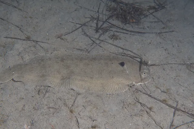 Common soleRegular local target6 placesReculver, Clacton Pier, Southend Pier, Frinton and Holland-on-Sea and 2 moreOver beach, estuary mark, pierAround May–Sept
 European sea bassRegular local target6 placesSouthend Pier, Burnham-on-Crouch, Walton-on-the-Naze pier, Clacton Pier and 2 moreOver beach, estuary mark, pierAround May–Oct
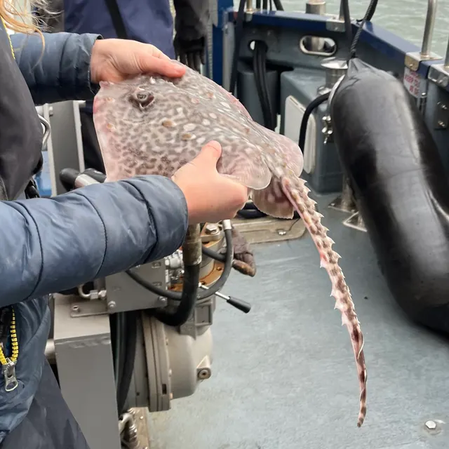 Thornback rayRegular local target5 placesReculver, Burnham-on-Crouch, Walton-on-the-Naze pier, Frinton and Holland-on-Sea and 1 moreOver beach, estuary mark, pierAround May–Oct
 WhitingRegular local target5 placesReculver, Clacton Pier, Frinton and Holland-on-Sea, St Osyth beach and 1 moreOver beach, estuary mark, pierAround Jan–Mar, Oct–Dec
 European flounderRegular local target4 placesSouthend Pier, Reculver, Whitstable and the Street, Burnham-on-CrouchOver beach, beach section, estuary mark, pierAround Jan–Feb, Nov–Dec
 Atlantic codSeasonal4 placesClacton Pier, Frinton and Holland-on-Sea, St Osyth beach, Burnham-on-CrouchOver beach, estuary mark, pierAround Jan–Mar, Oct–Dec
Also documented from the shore: Atlantic mackerel · Dab · Small-spotted catshark · Tope
What these strengths mean
- Regular local target
- Fishing sources describe this as a normal local target here, not merely as caught.
- Seasonal
- Well supported, and concentrated in part of the year rather than spread through it.
- Recorded here
- At least one credible public account of this species being caught here. That is all it means.
- How breadth is counted
- A fish documented at six marks is shown as six marks: breadth never raises the strength on its own. A fishery account describes the fishing; a recorded catch reports one specific catch. How evidence is weighed.
How people fish here
3 methods are recorded on the places documented here, counted from the records themselves rather than from what is practised in the country. Each opens a full guide to the technique.
Ledgering
Recorded at 14 places here, over beach, pier, estuary, estuary mark.
Fishing a bait on the bottom held by a weight, with no float — the simplest way to fish at distance, in depth, or in wind.
Documented on the same ground: Common sole, European flounder, European sea bass, Thornback ray, Whiting, Atlantic cod.
Kayak fishing
Recorded at 3 places here, over estuary, tidal channel.
A platform rather than a technique: quiet, shallow-draught access to water no other craft reaches, bought at the price of exposure, and a discipline where the decision not to launch is part of the skill.
Surfcasting
Recorded at 3 places here, over beach, estuary mark.
Casting heavy baited tackle from a beach into surf — a method defined by distance, by tide, and by reading water that all looks the same.
Documented on the same ground: European sea bass, Thornback ray, Atlantic cod, Whiting, Common sole, Dab.
These are the methods documented at the places FishingHQ holds here. A species listed beside a method is documented on the same ground, which is not the same as being taken that way — where a source establishes the method a fish was caught on, it is stated on that place’s own page. All fishing methods.
The fishing year here
The months the records under this area actually name, tightest season first. This is “observed in these months” rather than a season: a species whose months nobody recorded is not listed, because a gap in the evidence is not a year-round fishery.
- European flounderNovember to February
- Atlantic mackerelJune to September
- DabJune to September
- Small-spotted catsharkJune to September
- Common soleMay to September
- European sea bassMay to October
- Thornback rayMay to October
- WhitingOctober to March
- Atlantic codOctober to March
What dominates
Shore ledgering from the sea walls, beaches and promenades of both shores, which is how most of this estuary is fished. Small-boat and charter fishing to the banks and channels, which is a substantial fishery with a long tradition out of the Essex and Kent ports. Bass and mullet fishing on lure and fly in the creeks and around the marsh drains, which has grown enormously. Flounder and eel fishing in the upper estuary and creeks, which is the estuary's oldest domestic fishery. Urban river fishing in the tideway itself. Bait digging on the flats, which is significant here and is regulated in places. Shore gathering of cockles and other bivalves, where classification permits.
The water available
Mobile offshore linear sand and shingle banks with deep channels between them; extensive intertidal mudflat and sandflat; saltmarsh and creek systems; secondary estuaries and drowned valleys opening off the main funnel; sea wall, groyne and hard urban embankment; shingle and sand beaches on the outer shores; and a long freshwater-to-marine salinity gradient that is the estuary's defining environmental axis.
How the rules are structured
Recreational sea angling in England is not licensed as freshwater angling is, but a considerable framework applies here and more of it than on most English coasts. National minimum sizes and species measures apply, bass measures in particular have changed repeatedly, and this estuary has carried bass nursery area restrictions in various forms for a long time. Inshore byelaws are made by the Inshore Fisheries and Conservation Authority for the district and differ between the Essex and Kent sides. Large parts of the estuary carry conservation designations for their intertidal habitat and birds, which constrain access, vehicles and collection independently of any fishing rule. Bait collection and shellfish gathering are separately regulated in places, and shellfish harvesting areas are classified. The tidal river above the estuary proper falls under the freshwater licensing regime for some species. Port and navigation authority controls apply throughout. FishingHQ does not state what any current rule is.
Who to ask
- The relevant Inshore Fisheries and Conservation Authority for the district, which makes and enforces inshore byelaws including those on bait and shellfish collection.
- The Marine Management Organisation, for national recreational sea fishing measures in English waters.
- The Environment Agency, for rod licensing on the freshwater and upper tidal river and for the migratory species that pass through.
- Natural England and the relevant site management bodies, where a coastal or marine designation affects access, vehicles or collection.
- The Port of London Authority and the other statutory harbour authorities, for navigation, access and safety on the tideway and the estuary.
- The local authority and the Food Standards Agency framework, for shellfish harvesting area classification.
Words you will meet
- Bank
- One of the linear sand or shingle ridges lying offshore in the outer estuary, separated by deeper channels. Banks are the estuary's structure, they carry names, and they move — a chart or a memory more than a few years old is a hypothesis about where one is.
- Fleet
- A creek or drainage channel running through saltmarsh behind a sea wall, filling and emptying with the tide. Fleets are where a great deal of this estuary's bass and mullet fishing happens, and they are also where people are cut off.
- Rag and lug
- Ragworm and lugworm, dug from the intertidal flats and the mainstay bait of the whole estuary. Digging is a fishery in its own right here, with its own conventions and, in several districts, its own rules.
- Wall
- The sea wall or flood embankment that runs behind most of the marsh on both shores. Fishing 'off the wall' means fishing from it at high water when the marsh in front is covered, which is the standard way much of this coast is fished.
Conditions and hazards
The estuary's dangers are quiet ones. There is no cliff to be swept off and almost no rock. What there is instead is enormous areas of soft intertidal mud that fill from behind, creeks that are crossable on the ebb and not on the flood, and mud that carries weight on the way out and will not on the way back — being stuck on a flat with a rising tide is the primary mechanism here rather than a secondary one. The tidal range is large and the flood advances across near-level ground faster than a person walks. Offshore, wind against a strong tidal stream over a shallow bank produces a steep breaking sea disproportionate to the wind strength, and the transition happens over a bank edge rather than gradually, which is a serious small-craft and kayak hazard. The estuary carries very heavy commercial shipping in the deep channels and a small craft cannot be seen easily or avoided by a vessel that is committed. Water is cold enough for most of the year for cold water shock to decide an immersion, and it is turbid enough that a person in it can see nothing. Sea walls and hard embankments give no easy exit from the water. And the catch carries a separate hazard: bivalves filter what they sit in, harvesting areas are classified and closed on monitoring results, and neither cooking nor appearance removes a biotoxin.
A river declared dead, and what actually brought it back
In 1957 a survey of the tidal Thames through London reported no fish at all through long reaches, and the river was described publicly as biologically dead. That is a stronger claim than 'polluted' and it was accurate: dissolved oxygen through the central reaches fell to nothing for months at a time, and nothing that breathes water can live in water with no oxygen in it.
THE MECHANISM OF THE DEATH IS WORTH UNDERSTANDING because it explains the recovery. Untreated and poorly treated sewage entering a river does not primarily poison fish. It feeds bacteria, the bacteria consume oxygen as they break it down, and the fish suffocate. Add industrial effluent, add warm cooling water from power stations which holds less oxygen, and add a tidal river that moves the same water up and down rather than flushing it out to sea, and the oxygen sag becomes a wall that no migratory fish can pass.
WHAT FIXED IT WAS SEWAGE TREATMENT, and this is the part that gets left out of the triumphant version. Not a species reintroduction, not a habitat scheme and not an angling initiative — a programme of treatment works upgrades through the 1960s and after, industrial discharge control, and the closure or cleaning up of the riverside industry that was contributing the rest.
THE RESULT IS ONE OF THE BEST-DOCUMENTED RECOVERIES ANYWHERE. The tideway now supports well over a hundred fish species. Seals breed in the estuary. Harbour porpoise occur. Migratory species pass through reaches that were an impassable oxygen barrier within living memory.
THE HONEST PART OF THE RECORD IS THAT IT IS NOT FINISHED. Combined sewer overflows still discharge into the tideway during heavy rain, which produces short, sharp oxygen crashes and occasional fish kills, and major engineering has been undertaken specifically to address that. The estuary carries a legacy sediment load. And a recovered fish community is not the same community as the historic one.
WHY THIS MATTERS BEYOND LONDON. A great deal of angling conversation treats a damaged water as a permanently damaged one. The Thames is the counter-example at the largest available scale, and the thing that did it was infrastructure rather than sentiment.
Backed by research — why, and the sources (3)
Supported by peer-reviewed research or fisheries science. The sources are listed and can be checked.
- Environment Agency fisheries management, byelaws and rod licensing information — Environment Agency (Government fisheries body)Relied on for: Freshwater and transitional-water fisheries management in England, water quality recovery, licensing structure and the monitoring of rivers and estuaries.States this directlyCitation checked — the work exists and is described correctly
- Cefas science, advice and data on marine and freshwater environments — Centre for Environment, Fisheries and Aquaculture Science (Government fisheries body)Relied on for: Marine environmental science for UK shelf seas, including sediment characterisation, estuarine process, shellfish bed distribution, tidal range and the monitoring programmes that describe them.States this directlyCitation checked — the work exists and is described correctly
- ICES Advice on fishing opportunities, catch and effort — International Council for the Exploration of the Sea (Scientific institute)Relied on for: Ecoregion description, stock distribution and the hydrography of the sea areas assessed.States this directlyCitation checked — the work exists and is described correctly
Banks, creeks and a salinity gradient: reading a soft estuary
A rock coast tells an angler where to fish by being visibly different in different places. A soft estuary hides all of its structure under opaque water, and learning to read it is the whole skill here.
THE OFFSHORE BANKS ARE THE FIRST STRUCTURE. Linear ridges of sand and shingle lie in the outer estuary with deeper channels between them, and the tidal stream is squeezed and accelerated over and around them. That produces scour on the bank edges, food held in suspension, and predictable concentrations of fish where the water does the work. It also produces the estuary's principal small-craft hazard, because wind against a stream over shallow ground stands the sea up abruptly.
THEY MOVE, WHICH IS THE PART TO INTERNALISE. These are mobile sediment features. A bank's position, height and shape change over years, so local knowledge here has a shelf life that local knowledge on a rock coast does not.
THE CREEKS AND FLEETS ARE THE SECOND STRUCTURE AND THEY WORK ON THE TIDE. A saltmarsh creek system is empty at low water, fills on the flood, and drains on the ebb — and everything that lives on the marsh is flushed into and out of it on that cycle. Bass and mullet run up on the flood to feed and drop back as it goes, which makes the productive window a specific part of a specific tide rather than a time of day. Fishing a creek at the wrong state is fishing a ditch.
THE SALINITY GRADIENT IS THE THIRD AND IT ORGANISES THE WHOLE SYSTEM. Salt at the mouth, fresh at the top, and a long brackish middle that moves up and down with the tide and with river flow. Species sort themselves along it and move along it seasonally, so the same estuary holds a marine fishery at one end and a coarse fishery at the other with a transitional zone between that belongs to neither.
AND THE TURBIDITY IS NOT AN OBSTACLE, IT IS THE HABITAT. Fish here hunt by smell, by vibration and by the lateral line rather than by sight, which is why bait fishing works so well, why scent and freshness matter more than presentation, and why lure fishing here rewards vibration and profile over colour.
Backed by research — why, and the sources (4)
Supported by peer-reviewed research or fisheries science. The sources are listed and can be checked.
- Cefas science, advice and data on marine and freshwater environments — Centre for Environment, Fisheries and Aquaculture Science (Government fisheries body)Relied on for: Marine environmental science for UK shelf seas, including sediment characterisation, estuarine process, shellfish bed distribution, tidal range and the monitoring programmes that describe them.States this directlyCitation checked — the work exists and is described correctly
- ICES Advice on fishing opportunities, catch and effort — International Council for the Exploration of the Sea (Scientific institute)Relied on for: Ecoregion description, stock distribution and the hydrography of the sea areas assessed.States this directlyCitation checked — the work exists and is described correctly
- JNCC species and habitat conservation advice — Joint Nature Conservation Committee (Conservation authority)Relied on for: Designation, habitat description and conservation status of the marine and coastal habitats named, and the species characteristically associated with them.States this directlyCitation checked — the work exists and is described correctly
- The Fishes of the British Isles and North-West Europe — Macmillan, 1969 (Reference work)Relied on for: Distribution, habitat association and biology of the fishes of the British Isles and north-west Europe named here.States this directlyCitation checked — the work exists and is described correctly
Three fisheries in one funnel, and the year each of them runs
Because the estuary is a gradient rather than a place, its calendar is really three calendars laid end to end, and an angler who knows which part of the funnel they are on knows most of what the season is doing.
THE OUTER ESTUARY RUNS A SANDBANK COAST'S YEAR. Thornback ray over the cleaner ground from spring into summer, which is one of the fisheries this estuary is genuinely known for. Smoothhound over the same ground in summer, feeding on the crab. Bass along the banks and beaches from late spring through autumn. Cod, whiting and dab through the winter on the open ground, at a fraction of the historic abundance. Sole at night in the warmer months over clean sand, which is a specialist fishery with a real following here.
THE MIDDLE ESTUARY RUNS ON THE TIDE MORE THAN ON THE MONTH. Bass from spring to autumn, hard into the creeks and over the flats on the flood. Thick-lipped grey mullet through the summer in the harbours, creeks and marsh drains, which is a fly and light-tackle fishery with a genuine specialist culture. Flounder from autumn through winter, which is the estuary's traditional cold-weather fish and still the most reliable thing in it. Eel, historically enormous here and now handled under the constraints its conservation status requires.
THE TIDEWAY AT LONDON RUNS A RIVER'S YEAR. Coarse species down from the freshwater river above, bass and mullet up from below, flounder well into the city, and a genuinely urban fishery from hard embankment with the state of the tide governing everything.
TWO THINGS RUN THROUGH ALL THREE. The first is that turbidity and a large tidal range make the state of the tide the dominant variable at every point in the system — bigger than the month, bigger than the weather, and much bigger than the time of day. The second is that this is a nursery, so a very high proportion of what is caught anywhere in the estuary is undersized, and knowing the current minimum sizes and handling small fish properly is more of this fishery's practice than in most places.
What experienced anglers do — why, and the sources (4)
Widely and independently recommended by experienced anglers and specialist sources. This is real angling knowledge, not proof: controlled evidence for it is limited, and FishingHQ records it as convention rather than as a demonstrated effect.
- Sea Angler — Bauer Media (Specialist angling publication)Relied on for: Long-running published description of British sea angling practice by region and by ground type.FishingHQ's interpretation of what it saysCitation checked — the work exists and is described correctly
- General angling website restatements of established technique — Various (Credible secondary source)Relied on for: Widely restated descriptions of which practices are conventionally used in the waters named, recorded as practitioner consensus rather than as scholarship.Background and mechanism onlyCitation checked — the work exists and is described correctly
- JNCC species and habitat conservation advice — Joint Nature Conservation Committee (Conservation authority)Relied on for: Designation, habitat description and conservation status of the marine and coastal habitats named, and the species characteristically associated with them.States this directlyCitation checked — the work exists and is described correctly
- The Fishes of the British Isles and North-West Europe — Macmillan, 1969 (Reference work)Relied on for: Distribution, habitat association and biology of the fishes of the British Isles and north-west Europe named here.States this directlyCitation checked — the work exists and is described correctly
The mud is the hazard, and the shipping is the other one
This estuary has no cliffs and almost no rock, which removes the two dangers most anglers are trained to look for and replaces them with two that are quieter and at least as serious.
THE FIRST IS THE GROUND. Enormous areas of soft intertidal mud and sand are walkable at low water and are not land. The tide does not arrive as a line up a beach here; it fills the creeks and channels first and spreads outward from them, so water appears between a person and the sea wall while the flat they are standing on is still dry. And soft ground that carried weight on the way out will not necessarily carry it on the way back, because it has been worked and because the water table under it has changed. Being stuck on a flat with a rising tide is not an inconvenience — on this ground it is the entire mechanism.
WHICH MAKES THE CREEK THE SPECIFIC TRAP. A fleet that was ankle-deep on the walk out is the thing between a person and the wall an hour later, and it is deeper, faster and softer than the flat either side of it. Do not cross a creek on the ebb that you will need to recross on the flood.
THE SECOND IS THE SHIPPING. This is one of the busiest commercial waterways in northern Europe, the deep channels are the routes, and a large vessel cannot stop, cannot manoeuvre around a small craft and very probably cannot see one. A kayak or dinghy crossing a channel is crossing a road. Cross at right angles, cross quickly, know where the channels are, carry something that makes you visible, and never assume you have been seen.
AND THE BANKS PRODUCE THE THIRD. Wind against a strong stream over shallow ground makes a short steep breaking sea out of all proportion to the wind, and it happens across a bank edge rather than gradually. Treat the inshore forecast and the tidal stream as one decision.
THE WATER ITSELF IS COLD FOR MOST OF THE YEAR and it is opaque, so a person in it cannot see and is hard to see. Sea walls and hard embankments offer no easy exit. Wear a buoyancy aid rather than carry one, carry the means of calling for help on your person, and do not fish the marsh or the flats alone at night.
AND THE CATCH CARRIES ITS OWN SEPARATE HAZARD. Bivalves filter the water they sit in and concentrate biotoxins and microbiological contamination out of it, in an estuary with a very long industrial and sewage history. Neither cooking nor smell nor appearance removes a biotoxin. Harvesting areas are classified and are opened and closed on monitoring a gatherer cannot see, and that classification is the operative fact. Check it with the local authority before taking anything.
Official guidance — why, and the sources (4)
Stated by a fisheries authority, scientific institute or recognised angling body. Authoritative, but summarising rather than demonstrating.
- RNLI water safety guidance: cold water shock and Float to Live — Royal National Lifeboat Institution (Water-safety or diver-training authority)Relied on for: Cold water shock and the immersion response, tidal cut-off, and water-safety guidance for shore anglers and small-craft users.States this directlyPassage read and verified
- Met Office shipping forecast, inshore waters forecast and marine warnings — Met Office, United Kingdom (Government fisheries body)Relied on for: That inshore waters forecasts, sea state and swell are the operative inputs for shore and small-craft decisions in these waters.States this directlyCitation checked — the work exists and is described correctly
- Shellfish classification — Food Standards Agency, 2026 (Government fisheries body)Relied on for: That shellfish harvesting areas are classified, that the classification governs what may be taken and how it must be treated, and that it is set and revised by the authority on monitoring results rather than fixed.States this directlyCitation checked — the work exists and is described correctly
- Biotoxin and phytoplankton monitoring — Food Standards Agency, 2026 (Government fisheries body)Relied on for: Marine biotoxin and phytoplankton monitoring in shellfish harvesting areas and the closures that follow it.States this directlyPassage read and verified
Some of what lives here
Fish recorded here that FishingHQ holds a reviewed photograph of. It is not a complete list of what The Thames Estuary holds, and it is not a prediction that you will catch any of them — it is a way in to the ones we can show you.
- European sea bassA fast, predatory inshore fish that hunts in broken water and surf, and one of the most closely managed recreational species in European seas.
Julien Renoult — CC BY 4.0, via Wikimedia Commons
- European flounderThe flatfish that runs up rivers — a tolerant, estuarine right-eyed flounder with bony tubercles along its fin bases and a habit of turning up in fresh water.
nbasargin — CC BY, via iNaturalist
 Thick-lipped grey mulletA shoaling coastal fish that eats algae and detritus rather than prey — which makes it the hardest common sea fish to catch and the most interesting to think about.
Diego Delso — CC BY-SA 4.0, via Wikimedia Commons
- Thornback rayThe commonest European ray, covered in thorn-like bucklers, laying horny egg cases known as mermaid's purses, and requiring careful handling on release.
Ella McCausland — CC BY, via iNaturalist
- Common soleA nocturnal, sand-dwelling flatfish with a rounded head and a small twisted mouth, and one of the most valuable food fish in European waters.
Julien Renoult — CC BY, via iNaturalist
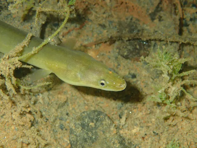 European eelA Critically Endangered fish that breeds in the Sargasso Sea, drifts to Europe as a transparent larva, lives decades in fresh water and returns once to spawn and die.
jujurenoult — CC BY 4.0, via Wikimedia Commons
- WhitingA small, abundant, silver gadoid of European coasts, a mainstay of winter shore fishing and distinguished by a dark spot at the pectoral fin base.
rmjb — CC BY, via iNaturalist
Places within this area
Publicly documented fishing geography. FishingHQ describes what the ground is; it does not say whether you may fish it, and every one of these sends that question to the body that holds the answer. Browse every place in this part of the world.
Who to ask before fishing any of these
FishingHQ does not know the current access position here. Shore angling in England is not rod-licensed, but access rights, landowner permission, local authority and harbour byelaws, national and inshore fisheries measures, and site designations all apply and all change. Check the current position with the relevant inshore fisheries and conservation authority, the harbour or local authority, and the landowner before going. This water is tidal and transitional, so the freshwater regime may also apply above the tidal limit: FishingHQ does not know the current access position here. Freshwater rod fishing in England requires a current rod licence AND separate permission from whoever controls the fishing, which is frequently a club, riparian owner or navigation authority rather than a public body. Close seasons, byelaws and local rules apply and change. Check with the Environment Agency and with the controlling club or owner before going.
FishingHQ does not know the current access position here. Shore angling in England is not rod-licensed, but access rights, landowner permission, local authority and harbour byelaws, national and inshore fisheries measures, and site designations all apply and all change. Check the current position with the relevant inshore fisheries and conservation authority, the harbour or local authority, and the landowner before going.
Southend Pier
Pier · Brackish water
The longest pleasure pier in the world, running 2.15 kilometres out across the Thames estuary mudflats to reach navigable water. Soft mud and sand for its whole length, with the deeper Ray Gut channel off the head.
Sheltered from swell by the shape of the estuary; exposed to wind across a very long fetch of open water in an easterly.
Particular to this ground: cold water shock, boat traffic and being seen.
Severe hazards of The Thames Estuary apply here: tides and being cut off, drowning and immersion.
Particular to this water: This is an owned and operated structure. Whether angling is allowed on it, when, from where and on what terms is the operator's decision, is frequently seasonal, and changes without notice.
Walton-on-the-Naze pier
Pier · Salt water
A long pleasure pier over clean sand and mud beside the Naze, a soft crag headland whose erosion feeds the shoals offshore.
Severe hazards of The Thames Estuary apply here: tides and being cut off, drowning and immersion, boat traffic and being seen.
Clacton Pier
Pier · Salt water
A pleasure pier on a gently shelving sand and mud shore in the outer Thames approaches, with the Gunfleet sands offshore.
Severe hazards of The Thames Estuary apply here: tides and being cut off, drowning and immersion, boat traffic and being seen.
The Blackwater estuary
Estuary · Brackish water
A broad shallow estuary of soft mud, saltmarsh and oyster ground, with an unusually high salinity for an estuary because its freshwater input is small relative to its tidal volume.
Severe hazards of The Thames Estuary apply here: tides and being cut off, drowning and immersion, boat traffic and being seen.
Canvey Island sea wall
Estuary mark · Brackish water
A continuous concrete flood wall around a reclaimed island lying below high-water level, standing over soft mud that dries a long way out into the Thames.
Severe hazards of The Thames Estuary apply here: tides and being cut off, drowning and immersion, boat traffic and being seen.
Holehaven Creek
Tidal channel · Brackish water
A tidal creek separating Canvey from the Essex mainland, running between soft mud banks past oil terminals with a strong stream on both tides.
Severe hazards of The Thames Estuary apply here: tides and being cut off, drowning and immersion, boat traffic and being seen.
The Medway estuary
Estuary · Brackish water
A complex of soft mud islands, saltmarsh and winding creeks behind a single narrow entrance shared with the Thames, with a large tidal range and a long naval and industrial history in its sediment.
Severe hazards of The Thames Estuary apply here: tides and being cut off, drowning and immersion, boat traffic and being seen.
The Swale
Tidal channel · Brackish water
The tidal channel separating the Isle of Sheppey from mainland Kent, joining the Thames at one end and the Medway at the other, floored with soft mud and fringed with saltmarsh throughout.
Severe hazards of The Thames Estuary apply here: tides and being cut off, drowning and immersion, boat traffic and being seen.
6 more places in this area
Reculver
Beach · Salt water
A shingle and sand shore beneath a low eroding clay cliff crowned by two Roman-founded church towers, with a chalk and clay platform uncovering at low water.
Severe hazards of The Thames Estuary apply here: tides and being cut off, drowning and immersion, boat traffic and being seen.
Herne Bay
Beach · Salt water
Shingle over a firm chalk and clay platform in the outer Thames, with the isolated stub of a storm-severed pier head standing a kilometre offshore.
Severe hazards of The Thames Estuary apply here: tides and being cut off, drowning and immersion, boat traffic and being seen.
Whitstable and the Street
Beach section · Salt water
A shingle shore fronting an oyster fishery of Roman standing, with the Street — a natural shingle and clay spit — running more than a kilometre out to sea and uncovering on a low tide.
Particular to this ground: tides and being cut off.
Severe hazards of The Thames Estuary apply here: drowning and immersion, boat traffic and being seen.
Frinton and Holland-on-Sea
Beach · Salt water
Sand and shingle under low London Clay cliffs, held by a long run of timber and concrete groynes with a greensward above. Groyne ground: the fish work the scour holes the timbers cut.
Open east and north-east into the southern North Sea.
Severe hazards of The Thames Estuary apply here: tides and being cut off, drowning and immersion, boat traffic and being seen.
St Osyth beach
Beach · Salt water
Shingle and sand west of Clacton at the Colne mouth, with saltmarsh and creeks behind the beach and the estuary channel running past its western end. Sheltered ground with an estuary's colour in the water.
Open south-east into the Thames approaches.
Severe hazards of The Thames Estuary apply here: tides and being cut off, drowning and immersion, boat traffic and being seen.
Burnham-on-Crouch
Estuary mark · Brackish water
The Crouch waterfront and the sea wall running east from it, over soft estuarine mud with a deep channel close in and oyster and cockle ground on the flats. Sheltered, coloured, and moving hard on the tide.
Sheltered inside the estuary.
Severe hazards of The Thames Estuary apply here: tides and being cut off, drowning and immersion, boat traffic and being seen.
Safety
Contamination and toxins in the catch is set out at the top of this page, where it cannot be missed.
Tides and being cut off — Can cause serious injury or death
Extensive soft intertidal flats fill from the creeks outward rather than from the sea inward, so water appears between a person and the shore while the ground they are standing on is still dry. A creek crossed on the ebb is impassable on the flood.
What reduces it: Know the state of the tide and the exit before going onto any flat, set a leaving time from the tide rather than from the fishing, and do not cross a creek on the ebb that you will need to recross on the flood.
Worse when:
- On spring tides, when the flood advances furthest and fastest across level ground.
- In the dark, when neither the filling creeks behind nor the state of the ground can be seen.
Drowning and immersion — Can cause serious injury or death
Soft mud that carried weight on the way out will not on the way back, and a person stuck on a flat with a rising tide cannot free themselves. The water is opaque, so somebody in it can see nothing and is very hard to see.
What reduces it: Do not go out onto extensive soft flats without local knowledge of that specific ground, do not go alone, wear a buoyancy aid rather than carry one, and carry a means of calling for help on the person.
Boat traffic and being seen — Can cause serious injury or death
The deep channels carry very heavy commercial shipping through a shallow estuary, and a small craft or kayak crossing one is in the path of vessels that cannot stop, cannot manoeuvre and probably cannot see it.
What reduces it: Know where the navigation channels are, cross at right angles and quickly, carry means of being seen, monitor the relevant channel where equipped, and never assume a vessel has seen you.
Boat safety — Can cause injury needing treatment
Wind against a strong tidal stream over a shallow bank produces a steep breaking sea disproportionate to the wind strength, and the change happens across a bank edge rather than gradually.
What reduces it: Treat the inshore waters forecast and the tidal stream as one combined decision, avoid crossing bank edges on a wind-against-tide state, and accept that not launching is a legitimate answer.
Further safety reading
- Tides and being cut off — Extensive soft flats that fill from the creeks outward rather than from the sea inward, on a large tidal range, with mud that will not carry weight on the return. Being stuck on a flat with a rising tide is the primary mechanism here rather than a secondary one.
Check the rules before you fish
Fishing laws, bylaws, access rules, seasons, bait restrictions and permitted methods vary by location and can change. Check the current rules from the relevant authority and the water you intend to fish before fishing.
Check with:
- Current national or regional law for where you are fishing
- Current local bylaws
- The relevant fisheries authority
- The landowner, club or fishery whose water it is
- Any restrictions specific to the species or the method you intend to use
Where to go next
What swims here
- Common soleOver clean sand in the outer estuary, taken at night in the warmer months. The estuary's flats are also a significant nursery for the species well beyond its own waters.
- European eelThroughout the estuary and the tidal river, historically in enormous numbers. Given the species' critically endangered status the association is recorded as a distributional fact and any encounter is handled under the constraints that status requires.
- European flounderThrough the whole brackish middle and upper estuary and well into the tidal river, in the creeks and over the mud. It is the estuary's traditional cold-weather fish and still the most dependable thing in it.
- European sea bassThroughout the system from the outer banks to the tideway at London, and specifically hard into the marsh creeks and over the flats on the flood. This estuary is among the most important bass nursery habitat in England, which is why so much of what is caught here is undersized.
- Starry smooth-houndOver the clean and mixed ground of the outer estuary in summer, where the crab it feeds on is abundant on the bank edges.
- Thick-lipped grey mulletIn the harbours, marsh drains and creeks through the summer, feeding on algae and detritus, which supports a specialist light-tackle and fly fishery.
- Thornback rayOver the cleaner mixed ground of the outer estuary and around the bank edges from spring into summer, which is one of the fisheries this estuary is genuinely known for.
- WhitingOver the open ground of the outer estuary through the colder months, and in practice the fish most winter sessions there actually encounter.
How this compares
- The Severn EstuaryTwo very large English estuaries that fail in opposite directions. The Severn's danger is an enormous tidal range over hard-edged ground; the Thames's is a soft, shipping-dense, nursery system whose hazards are quiet. Reading one as a guide to the other misleads in both directions.
- The Solent and the Hampshire coastTwo south-eastern English systems that both function as major nurseries and are fished almost entirely for the same species, with completely different tidal behaviour — a prolonged double high water against a large simple range — driving completely different session planning.
Environment and conservation
Sources and evidence
- Cefas science, advice and data on marine and freshwater environments — Centre for Environment, Fisheries and Aquaculture Science (Government fisheries body)Relied on for: Marine environmental science for UK shelf seas, including sediment characterisation, estuarine process, shellfish bed distribution, tidal range and the monitoring programmes that describe them.States this directlyCitation checked — the work exists and is described correctly
- ICES Advice on fishing opportunities, catch and effort — International Council for the Exploration of the Sea (Scientific institute)Relied on for: Ecoregion description, stock distribution and the hydrography of the sea areas assessed.States this directlyCitation checked — the work exists and is described correctly
- JNCC species and habitat conservation advice — Joint Nature Conservation Committee (Conservation authority)Relied on for: Designation, habitat description and conservation status of the marine and coastal habitats named, and the species characteristically associated with them.States this directlyCitation checked — the work exists and is described correctly
- The Fishes of the British Isles and North-West Europe — Macmillan, 1969 (Reference work)Relied on for: Distribution, habitat association and biology of the fishes of the British Isles and north-west Europe named here.States this directlyCitation checked — the work exists and is described correctly
- RNLI water safety guidance: cold water shock and Float to Live — Royal National Lifeboat Institution (Water-safety or diver-training authority)Relied on for: Cold water shock and the immersion response, tidal cut-off, and water-safety guidance for shore anglers and small-craft users.States this directlyPassage read and verified
- Met Office shipping forecast, inshore waters forecast and marine warnings — Met Office, United Kingdom (Government fisheries body)Relied on for: That inshore waters forecasts, sea state and swell are the operative inputs for shore and small-craft decisions in these waters.States this directlyCitation checked — the work exists and is described correctly
Why the 14 connections on this page are here, and the sources
What swims here
Backed by research — 8 connections
Supported by peer-reviewed research or fisheries science. The sources are listed and can be checked.
Common sole
A claim that a place contains the ground, water and seasonal conditions the species is associated with. It is a distributional statement about the world, it rests on the regional reference literature, and it deliberately asserts nothing about access, permission or catch.
- The Fishes of the British Isles and North-West Europe — Macmillan, 1969 (Reference work)Relied on for: Distribution and habitat association of the marine, estuarine and freshwater fishes of the British Isles, including which coasts, estuaries and ground types a species occupies.States this directlyCitation checked — the work exists and is described correctly
- FishBase: a global information system on fishes — Froese, R. and D. Pauly, eds. — FishBase Consortium (Scientific institute)Relied on for: Recorded distribution, depth range and habitat association for the species named.States this directlyPassage read and verified
European eel
A claim that a place contains the ground, water and seasonal conditions the species is associated with. It is a distributional statement about the world, it rests on the regional reference literature, and it deliberately asserts nothing about access, permission or catch.
- The Fishes of the British Isles and North-West Europe — Macmillan, 1969 (Reference work)Relied on for: Distribution and habitat association of the marine, estuarine and freshwater fishes of the British Isles, including which coasts, estuaries and ground types a species occupies.States this directlyCitation checked — the work exists and is described correctly
- FishBase: a global information system on fishes — Froese, R. and D. Pauly, eds. — FishBase Consortium (Scientific institute)Relied on for: Recorded distribution, depth range and habitat association for the species named.States this directlyPassage read and verified
European flounder
A claim that a place contains the ground, water and seasonal conditions the species is associated with. It is a distributional statement about the world, it rests on the regional reference literature, and it deliberately asserts nothing about access, permission or catch.
- The Fishes of the British Isles and North-West Europe — Macmillan, 1969 (Reference work)Relied on for: Distribution and habitat association of the marine, estuarine and freshwater fishes of the British Isles, including which coasts, estuaries and ground types a species occupies.States this directlyCitation checked — the work exists and is described correctly
- FishBase: a global information system on fishes — Froese, R. and D. Pauly, eds. — FishBase Consortium (Scientific institute)Relied on for: Recorded distribution, depth range and habitat association for the species named.States this directlyPassage read and verified
European sea bass
A claim that a place contains the ground, water and seasonal conditions the species is associated with. It is a distributional statement about the world, it rests on the regional reference literature, and it deliberately asserts nothing about access, permission or catch.
- The Fishes of the British Isles and North-West Europe — Macmillan, 1969 (Reference work)Relied on for: Distribution and habitat association of the marine, estuarine and freshwater fishes of the British Isles, including which coasts, estuaries and ground types a species occupies.States this directlyCitation checked — the work exists and is described correctly
- FishBase: a global information system on fishes — Froese, R. and D. Pauly, eds. — FishBase Consortium (Scientific institute)Relied on for: Recorded distribution, depth range and habitat association for the species named.States this directlyPassage read and verified
Starry smooth-hound
A claim that a place contains the ground, water and seasonal conditions the species is associated with. It is a distributional statement about the world, it rests on the regional reference literature, and it deliberately asserts nothing about access, permission or catch.
- The Fishes of the British Isles and North-West Europe — Macmillan, 1969 (Reference work)Relied on for: Distribution and habitat association of the marine, estuarine and freshwater fishes of the British Isles, including which coasts, estuaries and ground types a species occupies.States this directlyCitation checked — the work exists and is described correctly
- FishBase: a global information system on fishes — Froese, R. and D. Pauly, eds. — FishBase Consortium (Scientific institute)Relied on for: Recorded distribution, depth range and habitat association for the species named.States this directlyPassage read and verified
Thick-lipped grey mullet
A claim that a place contains the ground, water and seasonal conditions the species is associated with. It is a distributional statement about the world, it rests on the regional reference literature, and it deliberately asserts nothing about access, permission or catch.
- The Fishes of the British Isles and North-West Europe — Macmillan, 1969 (Reference work)Relied on for: Distribution and habitat association of the marine, estuarine and freshwater fishes of the British Isles, including which coasts, estuaries and ground types a species occupies.States this directlyCitation checked — the work exists and is described correctly
- FishBase: a global information system on fishes — Froese, R. and D. Pauly, eds. — FishBase Consortium (Scientific institute)Relied on for: Recorded distribution, depth range and habitat association for the species named.States this directlyPassage read and verified
Thornback ray
A claim that a place contains the ground, water and seasonal conditions the species is associated with. It is a distributional statement about the world, it rests on the regional reference literature, and it deliberately asserts nothing about access, permission or catch.
- The Fishes of the British Isles and North-West Europe — Macmillan, 1969 (Reference work)Relied on for: Distribution and habitat association of the marine, estuarine and freshwater fishes of the British Isles, including which coasts, estuaries and ground types a species occupies.States this directlyCitation checked — the work exists and is described correctly
- FishBase: a global information system on fishes — Froese, R. and D. Pauly, eds. — FishBase Consortium (Scientific institute)Relied on for: Recorded distribution, depth range and habitat association for the species named.States this directlyPassage read and verified
Whiting
A claim that a place contains the ground, water and seasonal conditions the species is associated with. It is a distributional statement about the world, it rests on the regional reference literature, and it deliberately asserts nothing about access, permission or catch.
- The Fishes of the British Isles and North-West Europe — Macmillan, 1969 (Reference work)Relied on for: Distribution and habitat association of the marine, estuarine and freshwater fishes of the British Isles, including which coasts, estuaries and ground types a species occupies.States this directlyCitation checked — the work exists and is described correctly
- FishBase: a global information system on fishes — Froese, R. and D. Pauly, eds. — FishBase Consortium (Scientific institute)Relied on for: Recorded distribution, depth range and habitat association for the species named.States this directlyPassage read and verified
How people fish here
What experienced anglers do — 2 connections
Widely and independently recommended by experienced anglers and specialist sources. This is real angling knowledge, not proof: controlled evidence for it is limited, and FishingHQ records it as convention rather than as a demonstrated effect.
Lure fishing
A claim about angling convention rather than about the world: that this place sits within this branch of fishing, which drives the information architecture as well as the page. It rests on independent practitioner description.
- General angling website restatements of established technique — Various (Credible secondary source)Relied on for: Widely restated descriptions of which practices are conventionally used in the waters named, recorded as practitioner consensus rather than as scholarship.Background and mechanism onlyCitation checked — the work exists and is described correctly
- Sea Angler — Bauer Media (Specialist angling publication)Relied on for: Long-running published description of British and Irish sea angling practice by region and by ground type.FishingHQ's interpretation of what it saysCitation checked — the work exists and is described correctly
Sea fishing
A claim about angling convention rather than about the world: that this place sits within this branch of fishing, which drives the information architecture as well as the page. It rests on independent practitioner description.
- General angling website restatements of established technique — Various (Credible secondary source)Relied on for: Widely restated descriptions of which practices are conventionally used in the waters named, recorded as practitioner consensus rather than as scholarship.Background and mechanism onlyCitation checked — the work exists and is described correctly
- Sea Angler — Bauer Media (Specialist angling publication)Relied on for: Long-running published description of British and Irish sea angling practice by region and by ground type.FishingHQ's interpretation of what it saysCitation checked — the work exists and is described correctly
How this compares
What experienced anglers do — 2 connections
Widely and independently recommended by experienced anglers and specialist sources. This is real angling knowledge, not proof: controlled evidence for it is limited, and FishingHQ records it as convention rather than as a demonstrated effect.
The Severn Estuary
A claim that two places are worth reading against one another, because a reader choosing between them or generalising from one to the other needs to know how the underlying process differs.
- General angling website restatements of established technique — Various (Credible secondary source)Relied on for: Widely restated descriptions of which practices are conventionally used in the waters named, recorded as practitioner consensus rather than as scholarship.Background and mechanism onlyCitation checked — the work exists and is described correctly
- Sea Angler — Bauer Media (Specialist angling publication)Relied on for: Long-running published description of British and Irish sea angling practice by region and by ground type.FishingHQ's interpretation of what it saysCitation checked — the work exists and is described correctly
The Solent and the Hampshire coast
A claim that two places are worth reading against one another, because a reader choosing between them or generalising from one to the other needs to know how the underlying process differs.
- General angling website restatements of established technique — Various (Credible secondary source)Relied on for: Widely restated descriptions of which practices are conventionally used in the waters named, recorded as practitioner consensus rather than as scholarship.Background and mechanism onlyCitation checked — the work exists and is described correctly
- Sea Angler — Bauer Media (Specialist angling publication)Relied on for: Long-running published description of British and Irish sea angling practice by region and by ground type.FishingHQ's interpretation of what it saysCitation checked — the work exists and is described correctly
Safety reading
Official guidance — 1 connection
Stated by a fisheries authority, scientific institute or recognised angling body. Authoritative, but summarising rather than demonstrating.
Tides and being cut off
A claim that a place presents a particular hazard strongly enough that the reader should be sent to the page dealing with it in full, rather than left with the short warning on the place itself.
- RNLI water safety guidance: cold water shock and Float to Live — Royal National Lifeboat Institution (Water-safety or diver-training authority)Relied on for: Cold water shock and the immersion response, tidal cut-off, and water-safety guidance for shore anglers and small-craft users.States this directlyPassage read and verified
Environment and conservation
Backed by research — 1 connection
Supported by peer-reviewed research or fisheries science. The sources are listed and can be checked.
Fish stocks and sustainability
A claim that a place raises a particular environmental question, resting on the scientific and conservation literature for the system rather than on angling practice.
- JNCC species and habitat conservation advice — Joint Nature Conservation Committee (Conservation authority)Relied on for: Habitat classification and description for the intertidal, coastal, estuarine and freshwater habitats named, and the species characteristically associated with them.States this directlyCitation checked — the work exists and is described correctly
- Cefas science, advice and data on marine and freshwater environments — Centre for Environment, Fisheries and Aquaculture Science (Government fisheries body)Relied on for: Characterisation of UK inshore sediment, intertidal habitat, estuarine process and the shellfish beds associated with them.States this directlyCitation checked — the work exists and is described correctly
How FishingHQ labels evidence is explained in the evidence policy.