The Solent and the Hampshire coast
Fishing regions · Last reviewed 2026-08-16
A sheltered strait between an island and the mainland where the tide does something it does nowhere else in Britain — a double high water that holds the sea up for hours, on top of the country's busiest small-craft water.
Safety: boat traffic and being seen — can cause serious injury or death. 3 more points apply here.
Being listed here is not permission to fish. What that meansClose
Access, fishing rights, seasons, licences, local bylaws and permitted methods vary and can change. Check current access, permission, local regulations, closures and restrictions before you travel or fish. FishingHQ describes what the ground is and names who holds the answer; it does not hold the answer itself.
Find the authority for a jurisdiction · What FishingHQ does and does not cover
The Solent is a system-tier record because the thing that defines it is not a shoreline but a tidal anomaly, and that anomaly reaches into every part of how the place is fished.
THE STRAIT ITSELF is a shallow, sheltered channel between the Isle of Wight and the mainland, open at both ends, with harbours, estuaries and drowned river valleys opening off its northern shore and a low, mostly gravel and mud shore along it. The island shelters it from Channel swell almost completely, which is why it is the most intensively used recreational water in Britain and why it has been a naval and commercial anchorage for a very long time.
THE TIDE IS THE ANOMALY. Because water can enter the Solent from both ends, and because the tidal wave arrives at the two entrances at different times and interacts with the shape of the basin, the tidal curve here is not the ordinary twice-daily rise and fall. There is a prolonged stand at or near high water — described locally as a double high water — that holds the level up for several hours, and the ebb that follows is correspondingly short and hard. The practical consequences are large: a very long period of fishable high water, a fierce concentrated ebb stream, and a set of timing rules that do not transfer from anywhere else on the English coast.
THE HARBOURS ARE THE OTHER HALF OF THE SYSTEM. Southampton Water, Portsmouth, Langstone and Chichester Harbours are shallow, muddy, creek-riddled basins with enormous intertidal areas and saltmarsh, and they are among the most important bass and mullet nursery habitat on the south coast. They also carry designation for their habitat and birds, which constrains a great deal of activity independently of any fishing rule.
THE GROUND IS SOFT WITH HARD EXCEPTIONS. Mud, gravel, shell and sand dominate, with scattered rock, hard clay ledges and a great deal of man-made structure — piers, walls, forts, spoil, wreck and dredged channel edges — that functions as reef in a place with very little natural reef.
AND THE TRAFFIC IS EXTRAORDINARY. Deep-draught commercial shipping to a major container and cruise port, naval movements, ferries on fixed routes, and recreational traffic in numbers that have no British equivalent. That is a permanent condition here rather than a summer inconvenience.
What fishing here is like
A shallow, sheltered strait between an island and the mainland, open at both ends, with an unusual tidal curve that produces a prolonged stand at high water and a short hard ebb. Ground is predominantly mud, gravel, shell and sand with scattered hard clay, rock and a great deal of man-made structure. Off the northern shore lie four large shallow harbours and drowned valleys with extensive intertidal mud, saltmarsh and creek systems. Swell is largely excluded by the island, so this is sheltered water in almost all conditions — and it is the most intensively used recreational and commercial water in Britain.
What you can target here
One entry per fish, grouped by how you would be fishing — because the answer is a different one from the rocks and from a boat. Each entry says how strongly the sources support it and how much evidence sits behind it. These are documented catches, not a forecast, and none of it is a statement that you may fish any particular ground.
From the shore · 9
 European sea bassRegular local target4 placesHurst Spit and Hurst Castle, Chichester Harbour, Portsmouth Harbour entrance, Bembridge LedgeOver estuary, ledge, shingle bank, tidal channelAround May–Oct
- Starry smooth-houndRegular local target2 placesHurst Spit and Hurst Castle, Selsey BillOver headland, shingle bankAround May–Sept
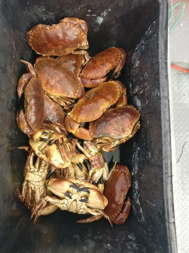 Edible crabRegular local target1 placeBembridge LedgeOver ledge
 European flounderRegular local target1 placePortsmouth Harbour entranceOver tidal channelAround Jan–Mar, Oct–Dec
- European lobsterRegular local target1 placeBembridge LedgeOver ledgeAround Jun–Sept
 Atlantic mackerelRecorded here1 placeHurst Spit and Hurst CastleOver shingle bank
Also documented from the shore: Ballan wrasse · Conger eel · Thornback ray
What these strengths mean
- Regular local target
- Fishing sources describe this as a normal local target here, not merely as caught.
- Recorded here
- At least one credible public account of this species being caught here. That is all it means.
- How breadth is counted
- A fish documented at six marks is shown as six marks: breadth never raises the strength on its own. A fishery account describes the fishing; a recorded catch reports one specific catch. How evidence is weighed.
How people fish here
4 methods are recorded on the places documented here, counted from the records themselves rather than from what is practised in the country. Each opens a full guide to the technique.
Ledgering
Recorded at 14 places here, over headland, estuary, tidal channel, beach.
Fishing a bait on the bottom held by a weight, with no float — the simplest way to fish at distance, in depth, or in wind.
Documented on the same ground: Edible crab, European flounder, European lobster, European sea bass, Starry smooth-hound, Atlantic mackerel.
Spinning
Recorded at 8 places here, over estuary, headland, tidal channel, ledge.
Casting an artificial lure and retrieving it so that it moves like something alive — the most direct form of lure fishing.
Documented on the same ground: Edible crab, European flounder, European lobster, European sea bass, Starry smooth-hound, Atlantic mackerel.
Kayak fishing
Recorded at 6 places here, over estuary, headland, island, shingle bank.
A platform rather than a technique: quiet, shallow-draught access to water no other craft reaches, bought at the price of exposure, and a discipline where the decision not to launch is part of the skill.
Documented on the same ground: European sea bass, Starry smooth-hound, Atlantic mackerel.
Float fishing
Recorded at 4 places here, over headland, ledge, shingle bank.
Suspending a bait at a controlled depth beneath a buoyant indicator — the most visual, most controllable and most widely applicable method in angling.
Documented on the same ground: Edible crab, European lobster, European sea bass, Starry smooth-hound, Atlantic mackerel, Ballan wrasse.
These are the methods documented at the places FishingHQ holds here. A species listed beside a method is documented on the same ground, which is not the same as being taken that way — where a source establishes the method a fish was caught on, it is stated on that place’s own page. All fishing methods.
The fishing year here
The months the records under this area actually name, tightest season first. This is “observed in these months” rather than a season: a species whose months nobody recorded is not listed, because a gap in the evidence is not a year-round fishery.
- European lobsterJune to September
- Starry smooth-houndMay to September
- European sea bassMay to October
- European flounderOctober to March
What dominates
Small-boat and dinghy fishing, which the shelter makes practical for far more of the year than most British waters. Shore fishing from beach, wall, pier and hard, much of it worked around the long high-water stand. Lure and fly fishing for bass, which the harbours and the structure suit particularly well and which has a large following here. Mullet fishing in the harbours and marinas, which is a specialist pursuit with a genuine local tradition. Kayak fishing, for which the sheltered water is unusually good and the shipping is the constraint. Bait digging on the harbour flats, which is significant and is regulated in places. Shore gathering where classification permits.
The water available
A shallow sheltered strait with strong tidal streams and a dredged deep-water channel; extensive intertidal mudflat and saltmarsh in four large harbours; drowned river valleys and creek systems; gravel, shell and mixed ground; scattered hard clay ledge and rock; extensive man-made structure functioning as reef; eelgrass beds in the harbours; and shingle and gravel shores along much of the strait.
How the rules are structured
Recreational sea angling in England is not licensed as freshwater angling is, but this is one of the more densely regulated pieces of English coast. National minimum sizes and species measures apply, and bass measures in particular have changed repeatedly. Inshore byelaws are made by the Inshore Fisheries and Conservation Authority for the district. The harbours carry conservation designations for intertidal habitat, birds and eelgrass, which constrain access, vehicles, anchoring and collection independently of any fishing rule. Bait collection is separately regulated in several of the harbours. Shellfish harvesting areas are classified for food safety. Extensive port, navigation and defence controls apply, including areas from which small craft are excluded and channels in which they must give way. FishingHQ does not state what any current rule is.
Who to ask
- The Southern Inshore Fisheries and Conservation Authority, which makes and enforces inshore byelaws including those on bait and shellfish collection.
- The Marine Management Organisation, for national recreational sea fishing measures in English waters.
- The harbour authorities for the commercial and recreational harbours, for navigation, anchoring, exclusion zones and access.
- The Queen's Harbour Master for the naval port area, where movement and access are controlled independently of ordinary navigation rules.
- Natural England and the site management bodies, where a coastal or marine designation affects access, anchoring or collection.
- The local authority and the Food Standards Agency framework, for shellfish harvesting area classification.
Words you will meet
- The young flood stand
- The Solent's characteristic tidal behaviour: instead of a single high water, the level rises, pauses or dips slightly, and rises again, holding near the top for several hours. It gives an unusually long window of fishable high water and it makes tide tables from elsewhere useless here.
- Hard
- A firm causeway of gravel, stone or hardcore laid across soft intertidal mud to give access to the water at low tide. Hards are how much of this coast is reached, and the mud either side of one is not walkable.
- Rithe
- A small creek or drainage channel through harbour saltmarsh. The rithes fill and empty on the tide and are where a great deal of the harbours' bass and mullet fishing happens — and where people are cut off.
Conditions and hazards
The Solent's shelter is genuine and it produces its own hazards, because it removes the visible signals that normally make people careful. The tidal streams are strong despite the flat water, and the short hard ebb that follows the long stand runs fast enough to take a small craft or a swimmer where it wants — an angler who has judged the tide from the water's flat surface has judged it wrong. The harbours are enormous areas of soft mud that fill from the creeks outward, mud that will not carry weight on the way back, and hards that are the only firm route across it; being cut off in a harbour is the commonest local incident. The commercial traffic is the second hazard and it is exceptional: deep-draught ships confined to a dredged channel cannot leave it, cannot stop and cannot see a small craft close ahead, and the ferries run fixed routes at speed. Naval movements add controlled areas that a small craft must stay out of. Cold water shock applies for most of the year, and the flat sheltered surface is why people do not dress for it. And the recreational traffic density in summer is itself a hazard for anybody in the water.
The double high water, and why no tide table from elsewhere works here
The Solent has the most unusual tidal behaviour of any well-used piece of British coast, and understanding it is the difference between fishing this water and guessing at it.
WHAT HAPPENS. Instead of a single peak, the water level here rises, pauses or falls back slightly, and rises again, holding at or near high water for several hours before dropping. The exact shape differs between the eastern and western ends and between spring and neap tides, but the effect is consistent: an unusually long high-water period followed by a shorter, harder ebb.
WHY IT HAPPENS is a matter of the basin's shape and its two entrances. Water enters the Solent from the west and from the east, the tidal wave reaches the two ends at different times, and the interaction between them — together with the shallowness of the basin and the distortion a shallow basin imposes on a tidal wave — produces a compound curve rather than a simple one. It is not a local curiosity invented to explain good fishing; it is a well-described piece of coastal hydrodynamics.
THE FIRST PRACTICAL CONSEQUENCE IS TIME. On most of the English coast, high water is a moment and the fishing around it is a window of perhaps two hours. Here the high stand can be several hours long, which means a shore session planned around high water is genuinely longer, marks that only fish with water over them are available for much more of the day, and a boat can work shallow ground without the usual race against the ebb.
THE SECOND CONSEQUENCE IS THE EBB. Water that goes up slowly and stays up has to come down in less time, so the ebb stream runs harder than the flood over most of the system. That is where the fishing is on many marks — a hard ebb through a narrows or past a structure concentrates food and disorients it — and it is also the hazard, because a stream that runs faster than a kayak can paddle looks exactly like the flat water it was an hour ago.
THE THIRD IS THAT LOCAL TIMING IS GENUINELY LOCAL. The curve differs along the strait, the harbours have their own timing behind their entrances, and predictions for a standard port elsewhere on the south coast are of no use. Use the local prediction for the specific place, and treat any generalisation from a Channel tide as wrong until checked.
AND THE HABIT IT PRODUCES IS WORTH NAMING. Solent anglers plan sessions around the stand and the ebb rather than around dawn and dusk, which visitors find strange and which is simply the correct response to the water in front of them.
Backed by research — why, and the sources (4)
Supported by peer-reviewed research or fisheries science. The sources are listed and can be checked.
- Cefas science, advice and data on marine and freshwater environments — Centre for Environment, Fisheries and Aquaculture Science (Government fisheries body)Relied on for: Marine environmental science for UK shelf seas, including sediment characterisation, estuarine process, shellfish bed distribution, tidal range and the monitoring programmes that describe them.States this directlyCitation checked — the work exists and is described correctly
- ICES Advice on fishing opportunities, catch and effort — International Council for the Exploration of the Sea (Scientific institute)Relied on for: Ecoregion description, stock distribution and the hydrography of the sea areas assessed.States this directlyCitation checked — the work exists and is described correctly
- Sea Angler — Bauer Media (Specialist angling publication)Relied on for: Long-running published description of British sea angling practice by region and by ground type.FishingHQ's interpretation of what it saysCitation checked — the work exists and is described correctly
- General angling website restatements of established technique — Various (Credible secondary source)Relied on for: Widely restated descriptions of which practices are conventionally used in the waters named, recorded as practitioner consensus rather than as scholarship.Background and mechanism onlyCitation checked — the work exists and is described correctly
Four harbours full of mud, and why the bass are all small
The four large shallow harbours opening off the north side of the Solent are the biological engine of this system, and they explain both what is caught here and why so much of it has to go back.
WHAT A HARBOUR IS HERE. A shallow, drowned river valley with a narrow entrance, filled with soft mud, cut by creeks, fringed with saltmarsh, and largely dry at low water. Warm in summer because it is shallow, food-rich because it is muddy and because the marsh feeds it, turbid, and difficult for large predators to work. That is a nursery specification.
SO THE HARBOURS ARE FULL OF JUVENILES, and bass above all. This is among the most important bass nursery habitat on the English south coast, which is why bass nursery restrictions have applied in these waters in various forms for decades and why so much of the bass fishing here involves fish under the size at which any retention is permitted. An angler who is catching numbers of small bass in a Solent harbour is not doing something wrong; they are fishing a nursery, and the practical expression of that is careful handling, barbless or crushed hooks and quick returns.
EELGRASS IS THE OTHER HABITAT and it is genuinely important. Beds of it in the harbours provide shelter and food for juvenile fish, cuttlefish lay eggs on it, and it is fragile — anchoring and mooring damage is a real and recognised pressure, which is why anchoring restrictions exist in places and why they are worth respecting rather than resenting.
MULLET ARE THE HARBOURS' OTHER SPECIALITY. Thick-lipped grey mullet in numbers through the warmer months in the creeks, marinas and around outfalls, feeding on algae and detritus, and requiring an approach that has almost nothing in common with the rest of British sea angling — fine tackle, bread or weed baits, patience, and a level of stealth that surprises people. It has a serious specialist following here.
FLOUNDER, EEL AND CUTTLEFISH complete the harbour list. Flounder through the colder months across the mud. European eel, whose critically endangered status governs how any encounter should be handled. And cuttlefish in spring, moving inshore to spawn on the eelgrass and hard structure, which supports a genuine seasonal eging fishery.
WHAT TIES ALL OF IT TOGETHER is that these are shallow, soft, designated, heavily used waters where most of what is caught is young. It is a place to fish carefully rather than a place to fill a bag.
Backed by research — why, and the sources (4)
Supported by peer-reviewed research or fisheries science. The sources are listed and can be checked.
- JNCC species and habitat conservation advice — Joint Nature Conservation Committee (Conservation authority)Relied on for: Designation, habitat description and conservation status of the marine and coastal habitats named, and the species characteristically associated with them.States this directlyCitation checked — the work exists and is described correctly
- The Fishes of the British Isles and North-West Europe — Macmillan, 1969 (Reference work)Relied on for: Distribution, habitat association and biology of the fishes of the British Isles and north-west Europe named here.States this directlyCitation checked — the work exists and is described correctly
- Cefas science, advice and data on marine and freshwater environments — Centre for Environment, Fisheries and Aquaculture Science (Government fisheries body)Relied on for: Marine environmental science for UK shelf seas, including sediment characterisation, estuarine process, shellfish bed distribution, tidal range and the monitoring programmes that describe them.States this directlyCitation checked — the work exists and is described correctly
- ICES Advice on fishing opportunities, catch and effort — International Council for the Exploration of the Sea (Scientific institute)Relied on for: Ecoregion description, stock distribution and the hydrography of the sea areas assessed.States this directlyCitation checked — the work exists and is described correctly
The busiest water in Britain, and the shipping that owns the channel
The Solent's dangers are almost entirely the product of its virtues. It is sheltered, so it looks benign. It is convenient, so everybody is on it. And it is deep enough for the largest commercial ships in a channel that is narrow enough to make them dangerous.
THE SHIPPING IS THE FIRST AND IT IS EXCEPTIONAL. Deep-draught container ships, cruise ships, tankers and naval vessels use a dredged channel through shallow water, and the key fact is that they CANNOT LEAVE IT. A ship in that channel has no room to manoeuvre around a small craft, cannot stop in any useful distance, and probably cannot see a kayak or a dinghy close ahead of its bow. Add ferries running fixed routes at speed and the picture is of a road rather than a sea.
WHICH MAKES THE RULES SIMPLE AND NON-NEGOTIABLE. Know where the channel is. Do not fish in it or anchor in it. Cross at right angles and quickly. Keep clear of the ferry tracks. Understand that in a narrow channel the obligation to keep clear sits with the small craft. Stay out of controlled and prohibited areas around the naval port, which are enforced. And carry something that makes you visible.
THE TIDE IS THE SECOND AND THE FLAT SURFACE DISGUISES IT. The streams here run strongly despite the shelter, and the short hard ebb that follows the long stand runs faster than a kayak can paddle or a swimmer can influence. A person who has assessed the water by looking at how calm it is has assessed the wrong variable entirely.
THE HARBOUR MUD IS THE THIRD AND IT IS THE COMMONEST LOCAL INCIDENT. Enormous areas of soft intertidal mud fill from the creeks outward rather than from the entrance inward, so water appears behind somebody working out towards the water. The mud will not carry weight on the way back the way it did on the way out. The hards — firm causeways laid across the mud — are the only reliable route, and stepping off one is stepping into ground that holds people. Know the tide, know the hard you came in on, and set a leaving time from the tide.
COLD WATER IS THE FOURTH AND THE SHELTER IS AGAIN THE PROBLEM. The water is cold enough for most of the year to produce the gasp response and loss of breathing control within seconds of immersion, and the flat sheltered surface is exactly why people do not dress for it, do not wear the buoyancy aid, and go out further than they would on an open coast.
AND IN SUMMER, THE RECREATIONAL TRAFFIC IS ITSELF A HAZARD. This is the most intensively used recreational water in the country, much of it fast, and a person in the water is very hard to see. Wear a buoyancy aid rather than carry one, carry the means of calling for help on the person, and check the current local navigation restrictions with the harbour authority — they are specific, they are enforced, and they change.
Official guidance — why, and the sources (4)
Stated by a fisheries authority, scientific institute or recognised angling body. Authoritative, but summarising rather than demonstrating.
- RNLI water safety guidance: cold water shock and Float to Live — Royal National Lifeboat Institution (Water-safety or diver-training authority)Relied on for: Cold water shock and the immersion response, tidal cut-off, and water-safety guidance for shore anglers and small-craft users.States this directlyPassage read and verified
- Met Office shipping forecast, inshore waters forecast and marine warnings — Met Office, United Kingdom (Government fisheries body)Relied on for: That inshore waters forecasts, sea state and swell are the operative inputs for shore and small-craft decisions in these waters.States this directlyCitation checked — the work exists and is described correctly
- Sea Angler — Bauer Media (Specialist angling publication)Relied on for: Long-running published description of British sea angling practice by region and by ground type.FishingHQ's interpretation of what it saysCitation checked — the work exists and is described correctly
- General angling website restatements of established technique — Various (Credible secondary source)Relied on for: Widely restated descriptions of which practices are conventionally used in the waters named, recorded as practitioner consensus rather than as scholarship.Background and mechanism onlyCitation checked — the work exists and is described correctly
Some of what lives here
Fish recorded here that FishingHQ holds a reviewed photograph of. It is not a complete list of what The Solent and the Hampshire coast holds, and it is not a prediction that you will catch any of them — it is a way in to the ones we can show you.
- European sea bassA fast, predatory inshore fish that hunts in broken water and surf, and one of the most closely managed recreational species in European seas.
Julien Renoult — CC BY 4.0, via Wikimedia Commons
 Thick-lipped grey mulletA shoaling coastal fish that eats algae and detritus rather than prey — which makes it the hardest common sea fish to catch and the most interesting to think about.
Diego Delso — CC BY-SA 4.0, via Wikimedia Commons
- European flounderThe flatfish that runs up rivers — a tolerant, estuarine right-eyed flounder with bony tubercles along its fin bases and a habit of turning up in fresh water.
nbasargin — CC BY, via iNaturalist
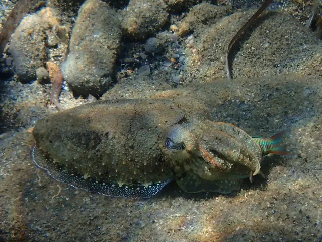 Common cuttlefishA bottom-oriented cephalopod with an internal buoyancy shell, the best-studied invertebrate mind in the sea, and a fishery that works quite differently from squid.
Katerina Kalogerini — CC BY, via iNaturalist
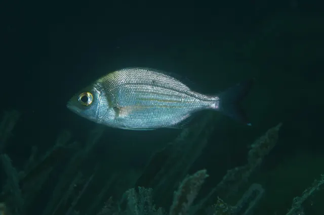 Black seabreamA deep-bodied silver bream that builds and guards nests on gravel — a hard-fighting south-coast summer species whose spawning aggregations are unusually easy to damage.
Julien Renoult — CC BY, via iNaturalist
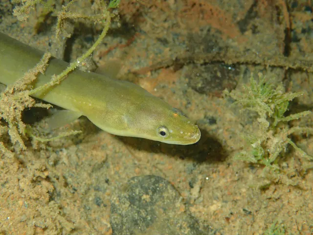 European eelA Critically Endangered fish that breeds in the Sargasso Sea, drifts to Europe as a transparent larva, lives decades in fresh water and returns once to spawn and die.
jujurenoult — CC BY 4.0, via Wikimedia Commons
Places within this area
Publicly documented fishing geography. FishingHQ describes what the ground is; it does not say whether you may fish it, and every one of these sends that question to the body that holds the answer. Browse every place in this part of the world.
Who to ask before fishing any of these
FishingHQ does not know the current access position here. Shore angling in England is not rod-licensed, but access rights, landowner permission, local authority and harbour byelaws, national and inshore fisheries measures, and site designations all apply and all change. Check the current position with the relevant inshore fisheries and conservation authority, the harbour or local authority, and the landowner before going.
FishingHQ does not know the current access position here. Shore angling in England is not rod-licensed, but access rights, landowner permission, local authority and harbour byelaws, national and inshore fisheries measures, and site designations all apply and all change. Check the current position with the relevant inshore fisheries and conservation authority, the harbour or local authority, and the landowner before going. This water is tidal and transitional, so the freshwater regime may also apply above the tidal limit: FishingHQ does not know the current access position here. Freshwater rod fishing in England requires a current rod licence AND separate permission from whoever controls the fishing, which is frequently a club, riparian owner or navigation authority rather than a public body. Close seasons, byelaws and local rules apply and change. Check with the Environment Agency and with the controlling club or owner before going.
Hurst Spit and Hurst Castle
Shingle bank · Salt water
A 1.5-kilometre shingle spit running south-east from the Hampshire mainland to a castle at its tip, constricting the western entrance to the Solent to about a kilometre. Steep shingle on the seaward face, saltmarsh and mud in the lee, and deep water immediately off the castle.
The outer face takes swell up the western Solent approaches; the inner face is sheltered. The spit is overtopped and reshaped in severe south-westerly storms.
Particular to this ground: moving water and currents, slips, trips and falls, cold water shock.
Severe hazards of The Solent and the Hampshire coast apply here: boat traffic and being seen, tides and being cut off.
Particular to this water: This ground carries conservation designations that constrain access, vehicles, bait collection and disturbance independently of any fishing rule.
Bembridge Ledge
Ledge · Salt water
A long limestone and chalk reef running east from the eastern tip of the Isle of Wight, drying extensively at low water and continuing well offshore as a submerged hazard. Hard rock, gullies, weed and heavy snagging ground throughout.
Open to the east and south-east across the Channel approaches, and comparatively sheltered from the prevailing south-westerly by the island itself.
Particular to this ground: tides and being cut off, cliffs and rock platforms, cold water shock.
Severe hazards of The Solent and the Hampshire coast apply here: boat traffic and being seen.
Particular to this water: Shellfish harvesting areas are classified for food safety and are opened and closed on monitoring results a gatherer cannot see. Neither cooking nor appearance removes a biotoxin. Check the current classification with the local authority before taking anything. This ground carries conservation designations that constrain access, vehicles, bait collection and disturbance independently of any fishing rule.
Selsey Bill
Headland · Salt water
A low shingle and clay point where the Sussex coast turns west, with extensive rock and clay ledges — the Mixon and the Streets — running offshore and a strong tide over them.
Severe hazards of The Solent and the Hampshire coast apply here: boat traffic and being seen, tides and being cut off.
Chichester Harbour
Estuary · Brackish water
A large, almost entirely drying natural harbour of mud, saltmarsh and winding channels behind a narrow entrance, with the double high water of the Solent working through it.
Severe hazards of The Solent and the Hampshire coast apply here: boat traffic and being seen, tides and being cut off.
Hayling Island
Island · Salt water
A low sand and shingle island between two drying harbours, with a shingle beach on its seaward side and fast entrance channels at both ends.
Severe hazards of The Solent and the Hampshire coast apply here: boat traffic and being seen, tides and being cut off.
Southsea and Eastney
Beach section · Salt water
Steep shingle on the eastern approach to Portsmouth Harbour, with deep water close in and the strong entrance stream running past the point at Eastney.
Severe hazards of The Solent and the Hampshire coast apply here: boat traffic and being seen, tides and being cut off.
Portsmouth Harbour entrance
Tidal channel · Salt water
A narrow deep entrance to a very large drying harbour, scoured to considerable depth, carrying naval and commercial traffic through a stream that runs hard on both tides.
Particular to this ground: boat traffic and being seen.
Severe hazards of The Solent and the Hampshire coast apply here: tides and being cut off.
Calshot Spit
Headland · Salt water
A shingle spit projecting into Southampton Water at its junction with the Solent, with deep dredged channel immediately off it and the double high water at its most pronounced.
Severe hazards of The Solent and the Hampshire coast apply here: boat traffic and being seen, tides and being cut off.
6 more places in this area
Lymington River
Estuary · Brackish water
A short drowned valley draining the New Forest into the western Solent, with soft mud, extensive saltmarsh and a dredged ferry channel through it.
Severe hazards of The Solent and the Hampshire coast apply here: boat traffic and being seen, tides and being cut off.
Ryde Pier
Pier · Salt water
The oldest seaside pier in England, running most of a kilometre across an enormous drying sand flat to reach navigable water on the island's north shore.
Severe hazards of The Solent and the Hampshire coast apply here: boat traffic and being seen, tides and being cut off.
Yaverland and Sandown Bay
Beach · Salt water
A clean sand bay between Culver Cliff's chalk and the sandstone of Shanklin, with rock ledges at the northern end and gently shelving sand through the middle.
Severe hazards of The Solent and the Hampshire coast apply here: boat traffic and being seen, tides and being cut off.
St Catherine's Point
Headland · Salt water
The southern tip of the Isle of Wight: a landslipped undercliff of chalk and greensand above a boulder shore, with a tidal race running off the point and deep water close in.
Particular to this ground: moving water and currents.
Severe hazards of The Solent and the Hampshire coast apply here: boat traffic and being seen, tides and being cut off.
The Needles
Headland · Salt water
A line of chalk stacks running west from the island's tip, with a strong race through the passage inside them and very deep scoured water close under the rock.
Severe hazards of The Solent and the Hampshire coast apply here: boat traffic and being seen, tides and being cut off.
Christchurch Harbour and Mudeford Run
Tidal channel · Brackish water
A shallow drying harbour fed by the Avon and Stour, draining through a single narrow sand-bar entrance — the Run — where the stream reaches several knots and the channel shifts constantly.
Particular to this ground: moving water and currents.
Severe hazards of The Solent and the Hampshire coast apply here: boat traffic and being seen, tides and being cut off.
Safety
Boat traffic and being seen — Can cause serious injury or death
Deep-draught commercial and naval vessels are confined to a dredged channel through shallow water and cannot leave it, stop or manoeuvre around a small craft, and ferries run fixed routes at speed. A kayak or dinghy in or crossing the channel is in the path of something that cannot avoid it.
What reduces it: Know where the channel and ferry routes are, do not fish or anchor in them, cross at right angles and quickly, stay out of controlled naval areas, carry means of being seen, and never assume you have been seen.
Tides and being cut off — Can cause serious injury or death
The harbours are enormous areas of soft intertidal mud that fill from the creeks outward, so water appears behind a person working towards the water. Mud that carried weight on the way out will not on the way back, and the firm hards are the only reliable route across.
What reduces it: Know the state of the tide and the hard you came in on before starting, set a leaving time from the tide rather than from the fishing, and do not step off a hard onto soft ground you have not crossed before.
Moving water and currents — Can cause injury needing treatment
The prolonged high-water stand is followed by a short hard ebb, so the streams run faster than the flat sheltered surface suggests — faster than a kayak can paddle against or a person can swim across.
What reduces it: Plan movements around the local tidal stream rather than around the look of the water, use the prediction for the specific place rather than a standard port, and treat the ebb as the strong part of the cycle here.
Cold water shock — Can cause injury needing treatment
The water is cold enough for most of the year to produce an involuntary gasp and loss of breathing control within seconds, and the sheltered flat surface is exactly why people do not dress for it or wear flotation.
What reduces it: Wear a buoyancy aid rather than carry one, dress for the water rather than the day, and carry a means of calling for help on the person.
Further safety reading
- Boat safety for anglers — Deep-draught commercial and naval vessels confined to a dredged channel cannot leave it, stop or manoeuvre around a small craft, and ferries run fixed routes at speed. The obligation to keep clear sits with the small craft.
Check the rules before you fish
Fishing laws, bylaws, access rules, seasons, bait restrictions and permitted methods vary by location and can change. Check the current rules from the relevant authority and the water you intend to fish before fishing.
Check with:
- Current national or regional law for where you are fishing
- Current local bylaws
- The relevant fisheries authority
- The landowner, club or fishery whose water it is
- Any restrictions specific to the species or the method you intend to use
Where to go next
What swims here
- Black seabreamOver the gravel, shell and mixed ground of the strait and the approaches through the warmer months, where the species nests on suitable ground.
- Common cuttlefishMoving inshore in spring to spawn on eelgrass and hard structure in the harbours and the strait, which supports a genuine seasonal eging fishery.
- European eelThrough the harbours and their creeks and drains. Given the species' critically endangered status the association is a distributional fact and any encounter is handled under the constraints that status requires.
- European flounderAcross the harbour mud through the colder months, which is the traditional winter fishery of these waters.
- European sea bassThroughout the strait and hard into the four harbours, which are among the most important bass nursery habitat on the English south coast. A high proportion of what is caught here is under any retention size, which is a property of the ground rather than of the angler.
- Thick-lipped grey mulletIn the harbours, creeks, marinas and around outfalls through the warmer months, supporting a specialist light-tackle and fly fishery with a genuine local following.
How this compares
Environment and conservation
Sources and evidence
- Cefas science, advice and data on marine and freshwater environments — Centre for Environment, Fisheries and Aquaculture Science (Government fisheries body)Relied on for: Marine environmental science for UK shelf seas, including sediment characterisation, estuarine process, shellfish bed distribution, tidal range and the monitoring programmes that describe them.States this directlyCitation checked — the work exists and is described correctly
- ICES Advice on fishing opportunities, catch and effort — International Council for the Exploration of the Sea (Scientific institute)Relied on for: Ecoregion description, stock distribution and the hydrography of the sea areas assessed.States this directlyCitation checked — the work exists and is described correctly
- JNCC species and habitat conservation advice — Joint Nature Conservation Committee (Conservation authority)Relied on for: Designation, habitat description and conservation status of the marine and coastal habitats named, and the species characteristically associated with them.States this directlyCitation checked — the work exists and is described correctly
- The Fishes of the British Isles and North-West Europe — Macmillan, 1969 (Reference work)Relied on for: Distribution, habitat association and biology of the fishes of the British Isles and north-west Europe named here.States this directlyCitation checked — the work exists and is described correctly
- RNLI water safety guidance: cold water shock and Float to Live — Royal National Lifeboat Institution (Water-safety or diver-training authority)Relied on for: Cold water shock and the immersion response, tidal cut-off, and water-safety guidance for shore anglers and small-craft users.States this directlyPassage read and verified
- Met Office shipping forecast, inshore waters forecast and marine warnings — Met Office, United Kingdom (Government fisheries body)Relied on for: That inshore waters forecasts, sea state and swell are the operative inputs for shore and small-craft decisions in these waters.States this directlyCitation checked — the work exists and is described correctly
Why the 11 connections on this page are here, and the sources
What swims here
Backed by research — 6 connections
Supported by peer-reviewed research or fisheries science. The sources are listed and can be checked.
Black seabream
A claim that a place contains the ground, water and seasonal conditions the species is associated with. It is a distributional statement about the world, it rests on the regional reference literature, and it deliberately asserts nothing about access, permission or catch.
- The Fishes of the British Isles and North-West Europe — Macmillan, 1969 (Reference work)Relied on for: Distribution and habitat association of the marine, estuarine and freshwater fishes of the British Isles, including which coasts, estuaries and ground types a species occupies.States this directlyCitation checked — the work exists and is described correctly
- FishBase: a global information system on fishes — Froese, R. and D. Pauly, eds. — FishBase Consortium (Scientific institute)Relied on for: Recorded distribution, depth range and habitat association for the species named.States this directlyPassage read and verified
Common cuttlefish
A claim that a place contains the ground, water and seasonal conditions the species is associated with. It is a distributional statement about the world, it rests on the regional reference literature, and it deliberately asserts nothing about access, permission or catch.
- The Fishes of the British Isles and North-West Europe — Macmillan, 1969 (Reference work)Relied on for: Distribution and habitat association of the marine, estuarine and freshwater fishes of the British Isles, including which coasts, estuaries and ground types a species occupies.States this directlyCitation checked — the work exists and is described correctly
- FishBase: a global information system on fishes — Froese, R. and D. Pauly, eds. — FishBase Consortium (Scientific institute)Relied on for: Recorded distribution, depth range and habitat association for the species named.States this directlyPassage read and verified
European eel
A claim that a place contains the ground, water and seasonal conditions the species is associated with. It is a distributional statement about the world, it rests on the regional reference literature, and it deliberately asserts nothing about access, permission or catch.
- The Fishes of the British Isles and North-West Europe — Macmillan, 1969 (Reference work)Relied on for: Distribution and habitat association of the marine, estuarine and freshwater fishes of the British Isles, including which coasts, estuaries and ground types a species occupies.States this directlyCitation checked — the work exists and is described correctly
- FishBase: a global information system on fishes — Froese, R. and D. Pauly, eds. — FishBase Consortium (Scientific institute)Relied on for: Recorded distribution, depth range and habitat association for the species named.States this directlyPassage read and verified
European flounder
A claim that a place contains the ground, water and seasonal conditions the species is associated with. It is a distributional statement about the world, it rests on the regional reference literature, and it deliberately asserts nothing about access, permission or catch.
- The Fishes of the British Isles and North-West Europe — Macmillan, 1969 (Reference work)Relied on for: Distribution and habitat association of the marine, estuarine and freshwater fishes of the British Isles, including which coasts, estuaries and ground types a species occupies.States this directlyCitation checked — the work exists and is described correctly
- FishBase: a global information system on fishes — Froese, R. and D. Pauly, eds. — FishBase Consortium (Scientific institute)Relied on for: Recorded distribution, depth range and habitat association for the species named.States this directlyPassage read and verified
European sea bass
A claim that a place contains the ground, water and seasonal conditions the species is associated with. It is a distributional statement about the world, it rests on the regional reference literature, and it deliberately asserts nothing about access, permission or catch.
- The Fishes of the British Isles and North-West Europe — Macmillan, 1969 (Reference work)Relied on for: Distribution and habitat association of the marine, estuarine and freshwater fishes of the British Isles, including which coasts, estuaries and ground types a species occupies.States this directlyCitation checked — the work exists and is described correctly
- FishBase: a global information system on fishes — Froese, R. and D. Pauly, eds. — FishBase Consortium (Scientific institute)Relied on for: Recorded distribution, depth range and habitat association for the species named.States this directlyPassage read and verified
Thick-lipped grey mullet
A claim that a place contains the ground, water and seasonal conditions the species is associated with. It is a distributional statement about the world, it rests on the regional reference literature, and it deliberately asserts nothing about access, permission or catch.
- The Fishes of the British Isles and North-West Europe — Macmillan, 1969 (Reference work)Relied on for: Distribution and habitat association of the marine, estuarine and freshwater fishes of the British Isles, including which coasts, estuaries and ground types a species occupies.States this directlyCitation checked — the work exists and is described correctly
- FishBase: a global information system on fishes — Froese, R. and D. Pauly, eds. — FishBase Consortium (Scientific institute)Relied on for: Recorded distribution, depth range and habitat association for the species named.States this directlyPassage read and verified
How people fish here
What experienced anglers do — 2 connections
Widely and independently recommended by experienced anglers and specialist sources. This is real angling knowledge, not proof: controlled evidence for it is limited, and FishingHQ records it as convention rather than as a demonstrated effect.
Lure fishing
A claim about angling convention rather than about the world: that this place sits within this branch of fishing, which drives the information architecture as well as the page. It rests on independent practitioner description.
- General angling website restatements of established technique — Various (Credible secondary source)Relied on for: Widely restated descriptions of which practices are conventionally used in the waters named, recorded as practitioner consensus rather than as scholarship.Background and mechanism onlyCitation checked — the work exists and is described correctly
- Sea Angler — Bauer Media (Specialist angling publication)Relied on for: Long-running published description of British and Irish sea angling practice by region and by ground type.FishingHQ's interpretation of what it saysCitation checked — the work exists and is described correctly
Sea fishing
A claim about angling convention rather than about the world: that this place sits within this branch of fishing, which drives the information architecture as well as the page. It rests on independent practitioner description.
- General angling website restatements of established technique — Various (Credible secondary source)Relied on for: Widely restated descriptions of which practices are conventionally used in the waters named, recorded as practitioner consensus rather than as scholarship.Background and mechanism onlyCitation checked — the work exists and is described correctly
- Sea Angler — Bauer Media (Specialist angling publication)Relied on for: Long-running published description of British and Irish sea angling practice by region and by ground type.FishingHQ's interpretation of what it saysCitation checked — the work exists and is described correctly
How this compares
What experienced anglers do — 1 connection
Widely and independently recommended by experienced anglers and specialist sources. This is real angling knowledge, not proof: controlled evidence for it is limited, and FishingHQ records it as convention rather than as a demonstrated effect.
The Thames Estuary
A claim that two places are worth reading against one another, because a reader choosing between them or generalising from one to the other needs to know how the underlying process differs.
- General angling website restatements of established technique — Various (Credible secondary source)Relied on for: Widely restated descriptions of which practices are conventionally used in the waters named, recorded as practitioner consensus rather than as scholarship.Background and mechanism onlyCitation checked — the work exists and is described correctly
- Sea Angler — Bauer Media (Specialist angling publication)Relied on for: Long-running published description of British and Irish sea angling practice by region and by ground type.FishingHQ's interpretation of what it saysCitation checked — the work exists and is described correctly
Safety reading
Official guidance — 1 connection
Stated by a fisheries authority, scientific institute or recognised angling body. Authoritative, but summarising rather than demonstrating.
Boat safety for anglers
A claim that a place presents a particular hazard strongly enough that the reader should be sent to the page dealing with it in full, rather than left with the short warning on the place itself.
- RNLI water safety guidance: cold water shock and Float to Live — Royal National Lifeboat Institution (Water-safety or diver-training authority)Relied on for: Cold water shock and the immersion response, tidal cut-off, and water-safety guidance for shore anglers and small-craft users.States this directlyPassage read and verified
Environment and conservation
Backed by research — 1 connection
Supported by peer-reviewed research or fisheries science. The sources are listed and can be checked.
Habitat damage from bank and shore access
A claim that a place raises a particular environmental question, resting on the scientific and conservation literature for the system rather than on angling practice.
- JNCC species and habitat conservation advice — Joint Nature Conservation Committee (Conservation authority)Relied on for: Habitat classification and description for the intertidal, coastal, estuarine and freshwater habitats named, and the species characteristically associated with them.States this directlyCitation checked — the work exists and is described correctly
- Cefas science, advice and data on marine and freshwater environments — Centre for Environment, Fisheries and Aquaculture Science (Government fisheries body)Relied on for: Characterisation of UK inshore sediment, intertidal habitat, estuarine process and the shellfish beds associated with them.States this directlyCitation checked — the work exists and is described correctly
How FishingHQ labels evidence is explained in the evidence policy.