Avon Beach
Beach · Salt water · in The Solent and the Hampshire coast
A clean sandy beach on Christchurch Bay immediately east of the harbour entrance at Mudeford. The regional guide treats it as its own mark, separately from the harbour behind it and the quay beside it.
Safety: boat traffic and being seen — can cause serious injury or death (general advice, not specific to this place). One more point applies here.
FishingHQ describes what this place is, not whether you may fish it. Access, permits and who to ask.
What you can catch here
Documented at this place, grouped by how you would be fishing, with how strongly the sources support each one. This is what has been written down, not a forecast, and being listed is never permission to fish.
From the shore · 8
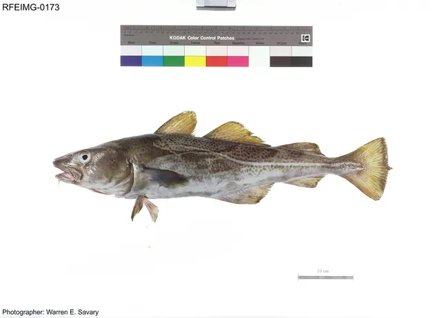 Atlantic codSeasonal1 placeAvon BeachOver beachAround Jan–Feb, Dec
Photo: The U.S. Food and Drug Administration, via Wikimedia Commons, public domain; resized and trimmed to fit
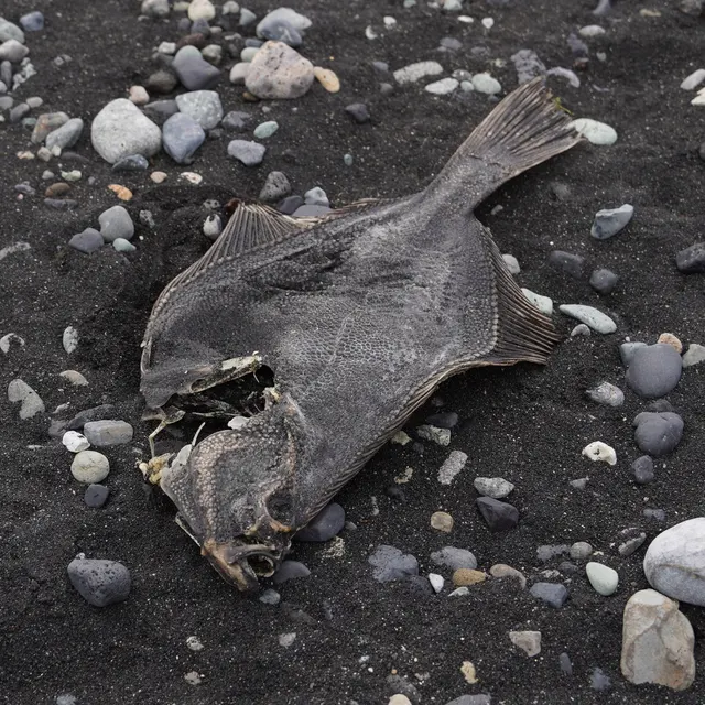 European flounderSeasonal1 placeAvon BeachOver beachAround Jan–Feb, Dec
Photo: nbasargin, via iNaturalist, CC BY; resized and trimmed to fit
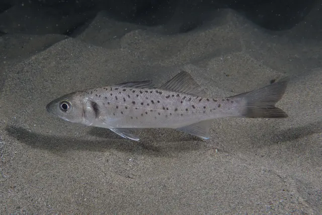 European sea bassSeasonal1 placeAvon BeachOver beachAround Jun–Aug
Photo: Julien Renoult, via Wikimedia Commons, CC BY 4.0; resized and trimmed to fit
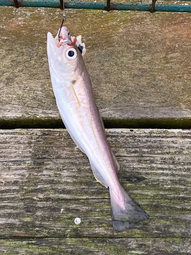 WhitingSeasonal1 placeAvon BeachOver beachAround Jan–Feb, Dec
Photo: rmjb, via iNaturalist, CC BY; resized and trimmed to fit
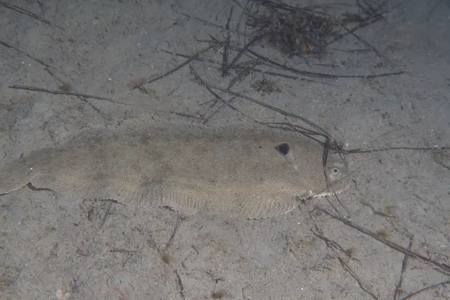 Common soleRecorded here1 placeAvon BeachOver beach
Photo: Julien Renoult, via iNaturalist, CC BY; resized and trimmed to fit
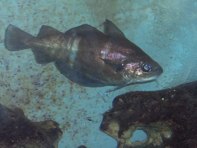 PoutingRecorded here1 placeAvon BeachOver beach
Photo: Georges Jansoone JoJan, via Wikimedia Commons, CC BY-SA 3.0; resized; shared under the same licence
- Small-spotted catsharkRecorded here1 placeAvon BeachOver beach
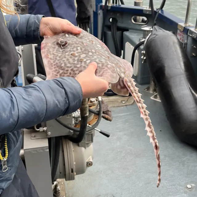 Thornback rayOccasional1 placeAvon BeachOver beach
Photo: Ella McCausland, via iNaturalist, CC BY; resized and trimmed to fit


What these strengths mean
- Seasonal
- Well supported, and concentrated in part of the year rather than spread through it.
- Recorded here
- At least one credible public account of this species being caught here. That is all it means.
- Occasional
- Caught here, and described as unusual rather than normal. Do not plan a session around it.
- How breadth is counted
- A fish documented at six marks is shown as six marks: breadth never raises the strength on its own. A fishery account describes the fishing; a recorded catch reports one specific catch. How evidence is weighed.
Fish documented nearby, not here
Nothing below has been documented at Avon Beach itself. Each one has been documented at a named place on the same ground, and the places are listed with it. Treat this as what the water around here holds rather than as a catch list for this mark.
Also documented at neighbouring places
One or two accounts each, on the ground around here. Enough to know the fish is caught in these waters; not enough to say anything about this place.
From the shore
- Edible crab — documented at Bembridge Ledge
- European lobster — documented at Bembridge Ledge
- Starry smooth-hound — documented at Hurst Spit and Hurst Castle
- Atlantic mackerel — documented at Hurst Spit and Hurst Castle; Ryde Pier
- Black seabream — documented at Southsea and Eastney; Ryde Pier
- Ballan wrasse — documented at Bembridge Ledge
- Conger eel — documented at Bembridge Ledge
- European plaice — documented at Southsea and Eastney
- Garfish — documented at Ryde Pier
- Pollack — documented at Ryde Pier
How people fish it
Practised here: Sea fishing.
Methods the sources name for this ground. Each one is explained in full on its own page.
- Ledgering
Fishing a bait on the bottom held by a weight, with no float — the simplest way to fish at distance, in depth, or in wind.
- Surfcasting
Casting heavy baited tackle from a beach into surf — a method defined by distance, by tide, and by reading water that all looks the same.
Baits and lures for these fish
The baits and lures each of the fish above is commonly taken on, from that fish’s own page. This is what works for the fish, not a report of what people use on this particular water — local knowledge and the conditions on the day still decide.
Baits
- Lugworm — for Atlantic cod, European flounder, Whiting, Common sole and 1 more
- Ragworm — for European flounder, European sea bass, Common sole, Pouting and 1 more
- Fish strip and cut bait — for Atlantic cod, Whiting, Small-spotted catshark, Thornback ray
- Peeler crab — for Atlantic cod, European flounder, European sea bass, Thornback ray
- Sand eel — for European sea bass, Thornback ray
- Squid and cuttlefish — for Atlantic cod, Small-spotted catshark
- Crab and shellfish — for European sea bass
- Sea deadbaits — for Small-spotted catshark
Lures
- Metal jigs — for Atlantic cod, European sea bass
- Soft plastics — for Atlantic cod, European sea bass
- Jerkbaits — for European sea bass
- Streamers — for European sea bass
- Surface lures — for European sea bass
How to catch them: Cod fishing · Flounder fishing · Bass fishing · Whiting fishing · Sole fishing · Dogfish (small-spotted catshark) fishing · Thornback ray fishing
Rods, reels and rigs for them: Atlantic cod · European flounder · European sea bass · Whiting · Common sole · Thornback ray
The ground and the water
- The ground
- A clean sandy beach on Christchurch Bay immediately east of the harbour entrance at Mudeford. The regional guide treats it as its own mark, separately from the harbour behind it and the quay beside it.
- Exposure
- Open to Christchurch Bay and the south-east, with Hengistbury Head and the Isle of Wight taking the worst of the Channel swell.
Not to be confused with Christchurch Harbour and Mudeford Run or Mudeford Quay, which are separate places on different ground.
Through the year
The guide gives bass as the summer fish and says the beach fishes better then, with some cod, whiting and flounder in winter.
The months the sources attach to each species here. Where a species carries no season it is listed underneath rather than assumed to run through the year.
| Species | J | F | M | A | M | J | J | A | S | O | N | D |
|---|---|---|---|---|---|---|---|---|---|---|---|---|
| Atlantic cod — seasonal, recorded in December, January, February. | ||||||||||||
| European flounder — seasonal, recorded in December, January, February. | ||||||||||||
| European sea bass — seasonal, recorded in June, July, August. | ||||||||||||
| Whiting — seasonal, recorded in December, January, February. |
Recorded here with no season stated: Common sole, Pouting, Small-spotted catshark, Thornback ray.
Safety
Boat traffic and being seen — Can cause serious injury or death
General safety for this kind of ground, not a finding about this place.
Deep-draught commercial and naval vessels are confined to a dredged channel through shallow water and cannot leave it, stop or manoeuvre around a small craft, and ferries run fixed routes at speed. A kayak or dinghy in or crossing the channel is in the path of something that cannot avoid it.
What reduces it: Know where the channel and ferry routes are, do not fish or anchor in them, cross at right angles and quickly, stay out of controlled naval areas, carry means of being seen, and never assume you have been seen.
Tides and being cut off — Can cause serious injury or death
General safety for this kind of ground, not a finding about this place.
The harbours are enormous areas of soft intertidal mud that fill from the creeks outward, so water appears behind a person working towards the water. Mud that carried weight on the way out will not on the way back, and the firm hards are the only reliable route across.
What reduces it: Know the state of the tide and the hard you came in on before starting, set a leaving time from the tide rather than from the fishing, and do not step off a hard onto soft ground you have not crossed before.
Rules and access
FishingHQ does not know the current access position here. Shore angling in England is not rod-licensed, but access rights, landowner permission, local authority and harbour byelaws, national and inshore fisheries measures, and site designations all apply and all change. Check the current position with the relevant inshore fisheries and conservation authority, the harbour or local authority, and the landowner before going.
Who holds the answer:
- The Inshore Fisheries and Conservation Authority for the district, which makes and enforces inshore byelaws.
- The Marine Management Organisation, for national recreational sea fishing measures in English waters.
- The local authority and, where one exists, the harbour authority, for access, byelaws and shellfish classification.
- The Southern Inshore Fisheries and Conservation Authority, which makes and enforces inshore byelaws including those on bait and shellfish collection.
- The harbour authorities for the commercial and recreational harbours, for navigation, anchoring, exclusion zones and access.
- The Queen's Harbour Master for the naval port area, where movement and access are controlled independently of ordinary navigation rules.
- Natural England and the site management bodies, where a coastal or marine designation affects access, anchoring or collection.
- The local authority and the Food Standards Agency framework, for shellfish harvesting area classification.
Nearby fishing
Other publicly documented places within about 40 km, by distance. Positions are approximate public geography and are never exact marks.
- Mudeford Quay — under 2 km · Harbour wall
- Christchurch Harbour and Mudeford Run — under 2 km · Tidal channel
- Bournemouth Pier — 10–25 km · Pier
- The Needles — 10–25 km · Headland
- Hurst Spit and Hurst Castle — 10–25 km · Shingle bank
- The Hampshire Avon at Ringwood — 10–25 km · River reach
- Lymington River — 10–25 km · Estuary
- Poole Harbour entrance and Sandbanks — 10–25 km · Tidal channel
Sources for this place
- Sea Angler — Bauer Media (Specialist angling publication)Relied on for: Long-running published description of British sea angling practice by region, ground type and named mark.FishingHQ's interpretation of what it saysCitation checked — the work exists and is described correctly
- General angling website restatements of established technique — Various (Credible secondary source)Relied on for: Widely restated public descriptions of which places are conventionally fished and how, recorded as practitioner consensus rather than as scholarship, and not relied on for access, permission or any current rule.Background and mechanism onlyCitation checked — the work exists and is described correctly
- British Sea Fishing: south coast and south-west England shore marks — British Sea Fishing (Credible secondary source)Relied on for: The identity of this mark, the character of its ground, the species a shore angler takes there and the baits and methods used.States this directlyPassage read and verified
How FishingHQ labels evidence is explained in the evidence policy. Last reviewed 2026-08-16.
Something wrong or out of date?
If something on this page has changed, email us from your own account using the link that fits, with a link to where you saw the change if you can. Every report is checked by a person before anything is changed, and a report never appears on the site by itself. Please don’t send exact private marks.
Before you go
- Fish documented here
- 8 at this place itself. See them.
- Getting there
- Not recorded. FishingHQ holds no sourced description of the way in.
- Rules particular to this water
- None recorded, which is not the same as none existing.
- Hazards particular to this place
- None recorded for this place; the hazards of the wider coast or water still apply.
Check before you travel
- Whether you may fish here, and whether a licence or permit is needed — start with the Inshore Fisheries and Conservation Authority for the district.
- The tide times and the forecast for the day you go.
- Anything recorded here was true when it was read; it is not watched for change.