Bembridge Ledge
Ledge · Salt water · in The Solent and the Hampshire coast
A long limestone and chalk reef running east from the eastern tip of the Isle of Wight, drying extensively at low water and continuing well offshore as a submerged hazard. Hard rock, gullies, weed and heavy snagging ground throughout.
Safety: tides and being cut off — can cause serious injury or death. 3 more points apply here.
FishingHQ describes what this place is, not whether you may fish it. Access, permits and who to ask.
What you can catch here
Documented at this place, grouped by how you would be fishing, with how strongly the sources support each one. This is what has been written down, not a forecast, and being listed is never permission to fish.
From the shore · 5
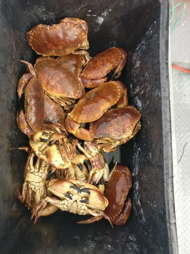 Edible crabRegular local target1 placeBembridge LedgeOver ledge
- European lobsterRegular local target1 placeBembridge LedgeOver ledgeAround Jun–Sept
 Ballan wrasseRecorded here1 placeBembridge LedgeOver ledge
 Conger eelRecorded here1 placeBembridge LedgeOver ledge
 European sea bassRecorded here1 placeBembridge LedgeOver ledge
What these strengths mean
- Regular local target
- Fishing sources describe this as a normal local target here, not merely as caught.
- Recorded here
- At least one credible public account of this species being caught here. That is all it means.
- How breadth is counted
- A fish documented at six marks is shown as six marks: breadth never raises the strength on its own. A fishery account describes the fishing; a recorded catch reports one specific catch. How evidence is weighed.
Also associated with this ground
Recorded as present here without a documented method or strength behind them.
Fish documented nearby, not here
Nothing below has been documented at Bembridge Ledge itself. Each one has been documented at a named place on the same ground, and the places are listed with it. Treat this as what the water around here holds rather than as a catch list for this mark.
Also documented at neighbouring places
One or two accounts each, on the ground around here. Enough to know the fish is caught in these waters; not enough to say anything about this place.
From the shore
- Starry smooth-hound — documented at Hurst Spit and Hurst Castle; Selsey Bill
- European flounder — documented at Portsmouth Harbour entrance
- Thornback ray — documented at Selsey Bill
How people fish it
Practised here: Sea fishing, Spearfishing.
Methods the sources name for this ground. Each one is explained in full on its own page.
- Float fishing
Suspending a bait at a controlled depth beneath a buoyant indicator — the most visual, most controllable and most widely applicable method in angling.
- Spinning
Casting an artificial lure and retrieving it so that it moves like something alive — the most direct form of lure fishing.
- Ledgering
Fishing a bait on the bottom held by a weight, with no float — the simplest way to fish at distance, in depth, or in wind.
The ground and the water
- The ground
- A long limestone and chalk reef running east from the eastern tip of the Isle of Wight, drying extensively at low water and continuing well offshore as a submerged hazard. Hard rock, gullies, weed and heavy snagging ground throughout.
- Exposure
- Open to the east and south-east across the Channel approaches, and comparatively sheltered from the prevailing south-westerly by the island itself.
- Depth
- Very shallow over the reef, dropping into moderate depth off its outer edge.
- Tide and flow
- Streams accelerate across and around the ledge and produce broken water over it on a run tide. The reef covers, and access is entirely tide-dependent.
Through the year
Wrasse and bass over the reef through the warmer months, mackerel in summer, and a long-standing shellfish fishery on the ledge.
Safety
Tides and being cut off — Can cause serious injury or death
The ledge dries a long way out and floods across a wide, level, gullied rock platform rather than up a beach, so the sea fills the gullies behind an angler working the outer edge.
What reduces it: Read the tide table before going rather than after arriving, set a leaving time from the tide rather than from the fishing, and identify the exit and how long it takes while the ground is still uncovered.
Worse when:
- On spring tides, when far more of the reef uncovers and there is much further to walk back.
Cliffs and rock platforms — Can cause serious injury or death
Anglers are swept from rock platforms by individual large sets rather than by the average sea, which means the conditions that kill people frequently look survivable for the twenty minutes before they arrive. Wet rock, weed and a swell running onto a sloping platform remove any chance of recovery.
What reduces it: Watch the water for a full set cycle before committing to a position, know the escape route and how long it takes, wear a flotation aid rather than carry one, never fish a platform alone, and treat a rising swell forecast as a reason not to go rather than a reason to be careful.
Cold water shock — Can cause serious injury or death
UK coastal and inland water is cold enough for most of the year to trigger the involuntary gasp and the loss of swimming ability that decides most immersion deaths, and it does so within the first minute, long before hypothermia is relevant.
What reduces it: Wear a buoyancy aid rather than carry one, carry a means of calling for help on the person rather than in a bag, and plan on the assumption that an unplanned entry into the water is survivable only if somebody knows immediately.
Boat traffic and being seen — Can cause serious injury or death
Deep-draught commercial and naval vessels are confined to a dredged channel through shallow water and cannot leave it, stop or manoeuvre around a small craft, and ferries run fixed routes at speed. A kayak or dinghy in or crossing the channel is in the path of something that cannot avoid it.
What reduces it: Know where the channel and ferry routes are, do not fish or anchor in them, cross at right angles and quickly, stay out of controlled naval areas, carry means of being seen, and never assume you have been seen.
Rules and access
FishingHQ does not know the current access position here. Shore angling in England is not rod-licensed, but access rights, landowner permission, local authority and harbour byelaws, national and inshore fisheries measures, and site designations all apply and all change. Check the current position with the relevant inshore fisheries and conservation authority, the harbour or local authority, and the landowner before going.
Particular to this water: Shellfish harvesting areas are classified for food safety and are opened and closed on monitoring results a gatherer cannot see. Neither cooking nor appearance removes a biotoxin. Check the current classification with the local authority before taking anything. This ground carries conservation designations that constrain access, vehicles, bait collection and disturbance independently of any fishing rule.
Who holds the answer:
- The Inshore Fisheries and Conservation Authority for the district, which makes and enforces inshore byelaws.
- The Marine Management Organisation, for national recreational sea fishing measures in English waters.
- The local authority and, where one exists, the harbour authority, for access, byelaws and shellfish classification.
- The Southern Inshore Fisheries and Conservation Authority, which makes and enforces inshore byelaws including those on bait and shellfish collection.
- The harbour authorities for the commercial and recreational harbours, for navigation, anchoring, exclusion zones and access.
- The Queen's Harbour Master for the naval port area, where movement and access are controlled independently of ordinary navigation rules.
- Natural England and the site management bodies, where a coastal or marine designation affects access, anchoring or collection.
- The local authority and the Food Standards Agency framework, for shellfish harvesting area classification.
Nearby fishing
Other publicly documented places within about 40 km, by distance. Positions are approximate public geography and are never exact marks.
- Yaverland and Sandown Bay — 5–10 km · Beach
- Ryde Pier — 5–10 km · Pier
- Southsea and Eastney — 10–25 km · Beach section
- Portsmouth Harbour entrance — 10–25 km · Tidal channel
- Hayling Island — 10–25 km · Island
- Chichester Harbour — 10–25 km · Estuary
- Selsey Bill — 10–25 km · Headland
- St Catherine's Point — 10–25 km · Headland
Sources for this place
- JNCC species and habitat conservation advice — Joint Nature Conservation Committee (Conservation authority)Relied on for: Description, designation and habitat characterisation of the named coastal and marine features of the United Kingdom, and the species characteristically associated with them.States this directlyCitation checked — the work exists and is described correctly
- Cefas science, advice and data on marine and freshwater environments — Centre for Environment, Fisheries and Aquaculture Science (Government fisheries body)Relied on for: Marine environmental science for UK shelf seas: sediment characterisation, estuarine process, shellfish bed distribution, tidal range and the monitoring that describes them.States this directlyCitation checked — the work exists and is described correctly
- Sea Angler — Bauer Media (Specialist angling publication)Relied on for: Long-running published description of British sea angling practice by region, ground type and named mark.FishingHQ's interpretation of what it saysCitation checked — the work exists and is described correctly
- General angling website restatements of established technique — Various (Credible secondary source)Relied on for: Widely restated public descriptions of which places are conventionally fished and how, recorded as practitioner consensus rather than as scholarship, and not relied on for access, permission or any current rule.Background and mechanism onlyCitation checked — the work exists and is described correctly
- Rock fishing safety and the declared lifejacket areas of New South Wales — NSW Department of Primary Industries and Surf Life Saving NSW (Water-safety or diver-training authority)Relied on for: Rock-platform fishing hazards, the mechanism by which anglers are swept from platforms by sets rather than by average conditions, and the measures that address it.States this directlyCitation checked — the work exists and is described correctly
- RNLI water safety guidance: cold water shock and Float to Live — Royal National Lifeboat Institution (Water-safety or diver-training authority)Relied on for: Cold water shock, immersion response and the advice to carry a means of calling for help on the person.States this directlyPassage read and verified
How FishingHQ labels evidence is explained in the evidence policy. Last reviewed 2026-08-16.