Severn Beach
Estuary mark · Brackish water · in The Severn Estuary
The sea wall and the mud below it just downstream of the Severn crossings, on the English bank, with rock ledge showing through the mud at low water and the estuary's full colour in the water. As far up the estuary as sea fishing goes.
Safety: tides and being cut off — can cause serious injury or death. 2 more points apply here.
FishingHQ describes what this place is, not whether you may fish it. Access, permits and who to ask.
What you can catch here
Documented at this place, grouped by how you would be fishing, with how strongly the sources support each one. This is what has been written down, not a forecast, and being listed is never permission to fish.
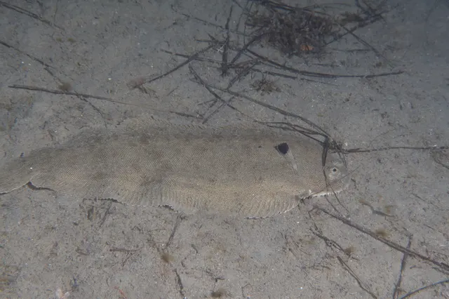
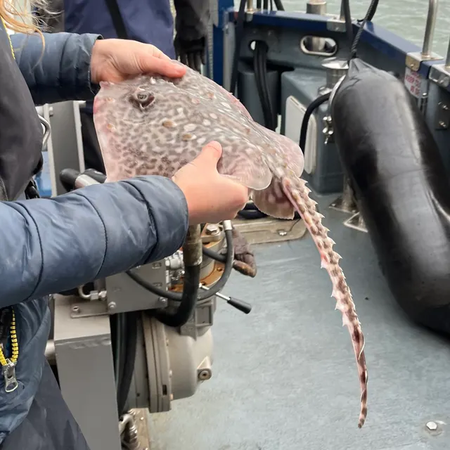
From the shore · 4


What these strengths mean
- Regular local target
- Fishing sources describe this as a normal local target here, not merely as caught.
- How breadth is counted
- A fish documented at six marks is shown as six marks: breadth never raises the strength on its own. A fishery account describes the fishing; a recorded catch reports one specific catch. How evidence is weighed.
Fish documented nearby, not here
Nothing below has been documented at Severn Beach itself. Each one has been documented at a named place on the same ground, and the places are listed with it. Treat this as what the water around here holds rather than as a catch list for this mark.
Widely documented on this ground
Documented at three or more neighbouring places, fished a way this place is also fished. That is a pattern about the ground rather than about any one mark, and it is the closest this site comes to saying you will probably meet a fish somewhere nothing has been written about.
From the shore
- European sea bass — documented at Aberthaw; The Gwent sea wall; Sully Island (+5 more)
- Whiting — documented at Lavernock Point; Aberthaw; The Cardiff foreshore (+3 more)
- Small-spotted catshark — documented at Burnham-on-Sea and Berrow; Sand Point; The Gwent sea wall (+3 more)
- Pouting — documented at Burnham-on-Sea and Berrow; Sand Point; The Cardiff foreshore (+1 more)
- Bull huss — documented at Sand Point; Aberthaw; Sully Island
- European flounder — documented at Burnham-on-Sea and Berrow; Goldcliff; The Cardiff foreshore
Also documented at neighbouring places
One or two accounts each, on the ground around here. Enough to know the fish is caught in these waters; not enough to say anything about this place.
From the shore
- Starry smooth-hound — documented at Aberthaw; The Gwent sea wall
- European plaice — documented at Burnham-on-Sea and Berrow
- Blonde ray — documented at Aberthaw; Sully Island
- Small-eyed ray — documented at Aberthaw; The Gwent sea wall
- Dab — documented at Lavernock Point
- Spotted ray — documented at Aberthaw
How people fish it
Practised here: Sea fishing.
Methods the sources name for this ground. Each one is explained in full on its own page.
- Ledgering
Fishing a bait on the bottom held by a weight, with no float — the simplest way to fish at distance, in depth, or in wind.
- Surfcasting
Casting heavy baited tackle from a beach into surf — a method defined by distance, by tide, and by reading water that all looks the same.
Baits and lures for these fish
The baits and lures each of the fish above is commonly taken on, from that fish’s own page. This is what works for the fish, not a report of what people use on this particular water — local knowledge and the conditions on the day still decide.
Baits
- Fish strip and cut bait — for Atlantic cod, Conger eel, Thornback ray
- Squid and cuttlefish — for Atlantic cod, Conger eel
- Lugworm — for Atlantic cod
- Peeler crab — for Atlantic cod
Lures
- Metal jigs — for Atlantic cod
- Soft plastics — for Atlantic cod
The ground and the water
- The ground
- The sea wall and the mud below it just downstream of the Severn crossings, on the English bank, with rock ledge showing through the mud at low water and the estuary's full colour in the water. As far up the estuary as sea fishing goes.
- Exposure
- Open south-west down the estuary.
- Tide and flow
- The upper estuary's range is enormous and the stream past the wall is fast in both directions.
Not to be confused with Aust and the Severn crossings, which is a separate place on different ground.
Safety
Tides and being cut off — Can cause serious injury or death
The tidal range exposes enormous areas of sand and mud and then covers them. The flood advances across level ground faster than a person can walk, and channels fill behind before the flat itself covers, so the route back closes first. People are cut off on the sands of this estuary regularly and some are killed.
What reduces it: Never go onto the intertidal zone without knowing the turn time and the route back, treat the filling of channels behind you rather than the water in front as the signal to leave, and do not walk out at all without local knowledge of which ground is firm. Carry a means of calling for help that survives immersion.
Worse when:
- On spring tides, when the exposed area is greatest and the flood fastest.
- In fog or poor light, when there is no reference to walk back on.
- On soft ground, where walking out is far quicker than walking back.
Moving water and currents — Can cause serious injury or death
Tidal streams here are among the strongest around Britain and are unsurvivable to swim against. Underwater visibility is effectively nil, so anybody in the water cannot see and cannot easily be seen. Soft mud can trap a person, and being stuck in mud on a rising tide in this estuary is a recognised recurring emergency.
What reduces it: Stay off soft mud entirely, fish from hard ground, wear a buoyancy aid where there is any chance of going in, and if trapped in mud call for help immediately rather than after struggling. Do not enter the water for any reason.
Cold water shock — Can cause serious injury or death
Water temperature is low enough for most of the year that immersion triggers gasping and hyperventilation, and the ability to swim is lost in the first minute. Combined with a strong tidal stream and zero visibility, an immersion here is a very serious event at any time of year.
What reduces it: Wear a buoyancy aid, keep off slippery hard structures near deep fast water, and if immersed, float and control breathing before attempting anything else.
Rules and access
FishingHQ does not know the current access position here. Shore angling in England is not rod-licensed, but access rights, landowner permission, local authority and harbour byelaws, national and inshore fisheries measures, and site designations all apply and all change. Check the current position with the relevant inshore fisheries and conservation authority, the harbour or local authority, and the landowner before going. This water is tidal and transitional, so the freshwater regime may also apply above the tidal limit: FishingHQ does not know the current access position here. Freshwater rod fishing in England requires a current rod licence AND separate permission from whoever controls the fishing, which is frequently a club, riparian owner or navigation authority rather than a public body. Close seasons, byelaws and local rules apply and change. Check with the Environment Agency and with the controlling club or owner before going.
Who holds the answer:
- The Inshore Fisheries and Conservation Authority for the district, which makes and enforces inshore byelaws.
- The Marine Management Organisation, for national recreational sea fishing measures in English waters.
- The local authority and, where one exists, the harbour authority, for access, byelaws and shellfish classification.
- The Environment Agency, for rod licensing, close seasons and fisheries byelaws in England.
- The club, association, riparian owner or navigation authority that controls the fishing.
- The environment agency in England and natural resources Wales, for migratory salmonids, eels, elvers and the historic net and fixed-engine fisheries.
- The inshore fisheries and conservation authority for the English side, and the Welsh government's marine and fisheries function on the Welsh side, for sea fishing.
- The statutory nature conservation bodies, for the European habitat and bird designations and the site of special scientific interest covering the estuary.
- The harbour authority for the port and navigation areas, whose rules govern access to piers, walls and navigable channels.
- The local authority and food standards agency, for shellfish ground classification and biotoxin monitoring.
Nearby fishing
Other publicly documented places within about 40 km, by distance. Positions are approximate public geography and are never exact marks.
- Aust and the Severn crossings — 2–5 km · Estuary mark
- Portishead — 10–25 km · Estuary mark
- The Gwent sea wall — 10–25 km · Estuary mark
- Goldcliff — 10–25 km · Estuary mark
- Clevedon Pier — 10–25 km · Pier
- The Usk and Newport — 10–25 km · Estuary mark
- Llandegfedd Reservoir — 25–40 km · Reservoir
- Chew Valley Lake — 25–40 km · Reservoir
Sources for this place
- Sea Angler — Bauer Media (Specialist angling publication)Relied on for: Long-running published description of British sea angling practice by region, ground type and named mark.FishingHQ's interpretation of what it saysCitation checked — the work exists and is described correctly
- General angling website restatements of established technique — Various (Credible secondary source)Relied on for: Widely restated public descriptions of which places are conventionally fished and how, recorded as practitioner consensus rather than as scholarship, and not relied on for access, permission or any current rule.Background and mechanism onlyCitation checked — the work exists and is described correctly
- British Sea Fishing: south coast and south-west England shore marks — British Sea Fishing (Credible secondary source)Relied on for: Which species are fished for at each named shore mark on the English south and south-west coast, and in which season.States this directlyPassage read and verified
How FishingHQ labels evidence is explained in the evidence policy. Last reviewed 2026-08-16.