The Cornish and Devon coasts
Fishing regions · Last reviewed 2026-08-14
Britain's south-west peninsula has two coasts with different weather, the warmest sea in the country, deep water against rock, and full Atlantic swell — which together produce the widest shore species list in Britain and its most serious rock-fishing hazard.
Safety: cliffs and rock platforms — can cause serious injury or death. One more point applies here.
Being listed here is not permission to fish. What that meansClose
Access, fishing rights, seasons, licences, local bylaws and permitted methods vary and can change. Check current access, permission, local regulations, closures and restrictions before you travel or fish. FishingHQ describes what the ground is and names who holds the answer; it does not hold the answer itself.
Find the authority for a jurisdiction · What FishingHQ does and does not cover
The south-west peninsula is nearly surrounded by sea, and that single fact produces most of what is distinctive about it.
TWO COASTS, DIFFERENT WEATHER. The north coast faces the Atlantic and takes full ocean swell, with long sandy surf beaches between high cliffs. The south coast faces the Channel, is substantially more sheltered, and carries estuaries, shingle, reef and a milder sea state. On any given day one of the two is usually fishable, and moving between them is a short journey. This is the practical fact that organises fishing here.
THE WATER IS THE WARMEST IN BRITAIN, moderated by the Atlantic, and it stays comparatively mild through winter. The species list follows directly: bass, wrasse, pollack, mullet, ray, conger, gilthead bream in the estuaries, and summer visitors from further south that scarcely appear elsewhere in Britain. This is the only part of the country where a shore angler can reasonably expect species that are Mediterranean or Iberian in their main distribution.
THE GROUND IS DEEP AND HARD. Cliff and rock platform drop into deep water at short range over much of both coasts, which is why the rock fishing is so productive and why it is so dangerous. The rock is frequently steep, weathered, weed-covered, and above water that offers no shelf to climb out onto.
AND THE SWELL ARRIVES FROM WEATHER YOU CANNOT SEE. Atlantic groundswell is generated by storms far out in the ocean and travels thousands of miles. It reaches this coast on days that are locally calm and sunny, in sets, with one wave in a set running dramatically higher than the others. That mechanism is the single most important thing a visitor to the north coast needs to understand, and it is the mechanism behind most of the fatalities.
What fishing here is like
Two coasts with different exposure on one peninsula, with the warmest water in Britain, deep water close to hard ground, and full Atlantic swell on the northern side. The species list is the widest in the country and the rock fishing is the most serious.
The culture is a mixed one: a substantial commercial fishing tradition, a large visiting angling population, and a resident shore-angling community whose knowledge is concentrated on rock marks and on which coast to be on for a given weather system.
What you can target here
One entry per fish, grouped by how you would be fishing — because the answer is a different one from the rocks and from a boat. Each entry says how strongly the sources support it and how much evidence sits behind it. These are documented catches, not a forecast, and none of it is a statement that you may fish any particular ground.
From the shore · 28
 Ballan wrasseCharacteristic of this water27 placesMorte Point, Rame Head and Penlee Point, St Agnes Head, The Port Quin to Port Isaac rock coast and 23 moreOver beach, breakwater, cliff coast, cove, estuary, harbour wall, headland, pier, rock markAround Jun–Sept
 Conger eelCharacteristic of this water19 placesThe Plymouth rock marks, Hopes Nose, The Salcombe estuary, Nare Head and 15 moreOver beach, breakwater, cliff coast, estuary, harbour wall, headland, pier, rock mark
 European sea bassRegular local target42 places · 7 fishery accounts · 1 sourceRame Head and Penlee Point, The Polperro rock coast, Prawle Point, Bolt Head and the Salcombe rock and 38 moreOver beach, beach section, breakwater, cliff coast, cove, estuary, estuary mark, harbour wall, headland, pier, rock mark, surf beachAround Jun–Oct
 European flounderRegular local target14 places · 1 fishery account · 1 sourceNewton Ferrers and the Yealm, The Salcombe estuary, Whitsand Bay and Tregantle, St Ives harbour and piers and 10 moreOver beach, estuary, estuary mark, harbour wall, rock mark, surf beachAround Jan–Feb, Nov–Dec
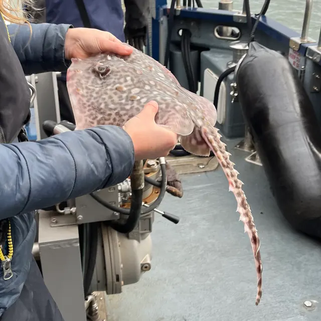 Thornback rayRegular local target6 places · 1 fishery account · 1 sourceWestward Ho!, The Salcombe estuary, The Plymouth rock marks, The Tamar estuary and 2 moreOver estuary, pier, rock mark, surf beachAround Jun–Sept
 PollackRegular local target29 placesRame Head and Penlee Point, The Polperro rock coast, St Agnes Head, The Port Quin to Port Isaac rock coast and 25 moreOver beach, breakwater, cliff coast, cove, estuary, harbour wall, headland, pier, rock markAround Jun–Sept
Also documented from the shore: Thick-lipped grey mullet · Small-spotted catshark · European plaice · Atlantic cod · Pouting · Whiting · Bull huss · Saithe · Small-eyed ray · Starry smooth-hound · Atlantic mackerel · Gilthead bream · Garfish · Black seabream · Common sole · Turbot · Striped red mullet · European lobster · Dab · Atlantic horse mackerel · European squid · Twaite shad
From a boat · 5
- Blue sharkSeasonal1 place · 2 fishery accounts · 2 independent sourcesThe south-west approachesOver sea areaAround Jun–Sept
- Conger eelRepeatedly reported1 place · 1 fishery account · 1 sourceThe south-west approachesOver sea area
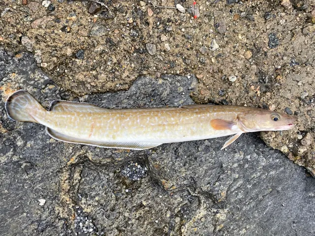 LingRepeatedly reported1 place · 1 fishery account · 1 sourceThe south-west approachesOver sea area
- PollackRepeatedly reported1 place · 1 fishery account · 1 sourceThe south-west approachesOver sea area
 Atlantic codRecorded here1 place · 1 fishery account · 1 sourceThe south-west approachesOver sea area
On a charter · 6
- Blue sharkSeasonal1 place · 2 fishery accounts · 2 independent sourcesThe south-west approachesOver sea areaAround Jun–Sept
- Atlantic bluefin tunaSeasonal1 place · 1 fishery account · 1 sourceThe south-west approachesOver sea areaAround Aug–Dec
- Conger eelRepeatedly reported1 place · 1 fishery account · 1 sourceThe south-west approachesOver sea area
- LingRepeatedly reported1 place · 1 fishery account · 1 sourceThe south-west approachesOver sea area
- PollackRepeatedly reported1 place · 1 fishery account · 1 sourceThe south-west approachesOver sea area
- Atlantic codRecorded here1 place · 1 fishery account · 1 sourceThe south-west approachesOver sea area
From a kayak · 25
 Atlantic mackerelSeasonal11 places · 1 fishery account · 1 sourceLizard Point, Fowey, Falmouth and Castle Beach, Porthleven and 7 moreOver bay, beach section, estuary, estuary mark, harbour wall, headland, surf beachAround Jun–Sept
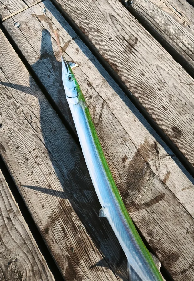 GarfishSeasonal11 placesLizard Point, Fowey, Falmouth and Castle Beach, Porthleven and 7 moreOver bay, beach section, estuary, estuary mark, harbour wall, headland, surf beachAround Jun–Sept
- Atlantic codSeasonal6 placesFowey, Lizard Point, Porthleven, Newquay and Towan Head and 2 moreOver bay, estuary mark, harbour wall, headlandAround Jan–Feb, Nov–Dec
 WhitingSeasonal5 placesFowey, Porthleven, Newquay and Towan Head, Gribbin Head and 1 moreOver estuary mark, harbour wall, headlandAround Jan–Feb, Nov–Dec
- Atlantic horse mackerelSeasonal1 placePorthlevenOver harbour wallAround Jun–Sept
- European sea bassRepeatedly reported9 places · 1 fishery account · 1 sourceLizard Point, Fowey, Falmouth and Castle Beach, Cape Cornwall and 5 moreOver bay, beach section, estuary, estuary mark, headland, surf beach
Also documented from a kayak: Pollack · Ballan wrasse · Conger eel · Bull huss · European plaice · Tub gurnard · Dab · European flounder · Gilthead bream · Small-eyed ray · Turbot · Small-spotted catshark · Thick-lipped grey mullet · Pouting · Thornback ray · Black seabream · Brill · Ling · Starry smooth-hound
What these strengths mean
- Characteristic of this water
- This water is strongly identified with this species by the sources that cover it.
- Regular local target
- Fishing sources describe this as a normal local target here, not merely as caught.
- Seasonal
- Well supported, and concentrated in part of the year rather than spread through it.
- Repeatedly reported
- Several independent public accounts. Enough to say it happens more than once; not enough to call it a fishery.
- Recorded here
- At least one credible public account of this species being caught here. That is all it means.
- Occasional
- Caught here, and described as unusual rather than normal. Do not plan a session around it.
- How breadth is counted
- A fish documented at six marks is shown as six marks: breadth never raises the strength on its own. A fishery account describes the fishing; a recorded catch reports one specific catch. How evidence is weighed.
How people fish here
11 methods are recorded on the places documented here, counted from the records themselves rather than from what is practised in the country. Each opens a full guide to the technique.
Ledgering
Recorded at 61 places here, over headland, estuary, harbour wall, rock mark.
Fishing a bait on the bottom held by a weight, with no float — the simplest way to fish at distance, in depth, or in wind.
Documented on the same ground: Ballan wrasse, Conger eel, Atlantic cod, Bull huss, European flounder, European plaice.
Spinning
Recorded at 50 places here, over headland, estuary, rock mark, surf beach.
Casting an artificial lure and retrieving it so that it moves like something alive — the most direct form of lure fishing.
Documented on the same ground: Ballan wrasse, Conger eel, Atlantic cod, Bull huss, European flounder, European plaice.
Float fishing
Recorded at 45 places here, over headland, rock mark, harbour wall, breakwater.
Suspending a bait at a controlled depth beneath a buoyant indicator — the most visual, most controllable and most widely applicable method in angling.
Documented on the same ground: Ballan wrasse, Conger eel, Atlantic cod, Bull huss, European flounder, European sea bass.
Kayak fishing
Recorded at 28 places here, over estuary, surf beach, breakwater, harbour wall.
A platform rather than a technique: quiet, shallow-draught access to water no other craft reaches, bought at the price of exposure, and a discipline where the decision not to launch is part of the skill.
Documented on the same ground: Ballan wrasse, Conger eel, European flounder, European plaice, European sea bass, Pollack.
Feathering and multi-lure traces
Recorded at 7 places here, over headland, pier, harbour wall, sea area.
A string of small lures on droppers, worked in the water column — how most people in Britain and Ireland catch their first sea fish, and the method most likely to catch far more than anybody intended.
Documented on the same ground: Atlantic cod, Ballan wrasse, Bull huss, Conger eel, European flounder, European sea bass.
Surfcasting
Recorded at 4 places here, over beach, surf beach.
Casting heavy baited tackle from a beach into surf — a method defined by distance, by tide, and by reading water that all looks the same.
Documented on the same ground: Bull huss, European flounder, European plaice, European sea bass, Pouting, Small-eyed ray.
Crabbing with a line and a drop net
Recorded at 2 places here, over harbour wall.
The commonest introduction to fishing anywhere with a harbour wall: a weighted bait that a crab grips, or a baited net it walks into — and no hook in either.
Documented on the same ground: European flounder, European sea bass, Atlantic mackerel, Garfish, Dab, European plaice.
Deadbaiting
Recorded at 1 place here, over sea area.
Presenting a dead fish as bait for predators — a method that works because scavenging is normal predator behaviour, not an exception.
Documented on the same ground: Atlantic bluefin tuna, Blue shark, Conger eel, Ling, Pollack, Atlantic cod.
Jigging
Recorded at 1 place here, over sea area.
Working a weighted lure with a rising-and-falling motion, usually vertically, so it behaves like a wounded or fleeing baitfish.
Documented on the same ground: Atlantic bluefin tuna, Blue shark, Conger eel, Ling, Pollack, Atlantic cod.
2 further methods are recorded at one or two places each: Saltwater fly fishing, Trolling.
These are the methods documented at the places FishingHQ holds here. A species listed beside a method is documented on the same ground, which is not the same as being taken that way — where a source establishes the method a fish was caught on, it is stated on that place’s own page. All fishing methods.
The fishing year here
The months the records under this area actually name, tightest season first. This is “observed in these months” rather than a season: a species whose months nobody recorded is not listed, because a gap in the evidence is not a year-round fishery.
- PollackJune to September
- Ballan wrasseJune to September
- Atlantic mackerelJune to September
- European flounderNovember to February
- GarfishJune to September
- European plaiceJune to September
- Thornback rayJune to September
- Atlantic codNovember to February
- WhitingNovember to February
- Common soleJune to September
- Gilthead breamJune to September
- TurbotJune to September
What dominates
Rock and cliff-mark fishing for bass, wrasse, pollack, conger and ray, which is the coast's signature and its hazard. Surf beach fishing on the north coast for bass and flatfish. Estuary fishing on the south coast for bass, mullet, flounder and gilthead bream. Lure fishing for bass, which has grown into a discipline in its own right here and is arguably the coast's most developed modern speciality. Saltwater fly fishing on the estuaries and surf. Boat and charter fishing from a number of established ports, reaching reef and wreck. Spearfishing, which has a long-established community on both coasts.
The water available
High cliff and rock platform with deep water close in, on both coasts. Long Atlantic surf beaches on the north. Sheltered estuaries and rias on the south, several of them substantial and each with its own salinity and sediment gradient. Reef and kelp on the hard ground. Shingle in places on the south coast. Offshore wreck and reef within reach of small boats. Extensive intertidal rock supporting a rich invertebrate community, which is also the bait supply.
How the rules are structured
Sea angling in England does not require a national rod licence, which differs from the position for freshwater and migratory fish and confuses visitors. What does apply, and changes, includes minimum sizes, bag limits for particular species, protected species, gear restrictions, and a substantial network of marine protected areas along both coasts with their own management measures. Bass in particular has been the subject of specific and repeatedly revised management measures, and treating anything written about it as current is unwise. Estuaries frequently carry additional local byelaws, and several are managed by named authorities. Shellfish and crustacean collection carries both fisheries rules and public health classification. Freshwater and migratory fisheries are separate and require the appropriate national licence and, usually, permission from the fishery. FishingHQ does not state what any of these currently require: establish the position with the relevant authority before fishing, and specifically before retaining anything.
Who to ask
- The national fisheries authority for England, for licensing of freshwater and migratory fishing and for fisheries enforcement
- The relevant inshore fisheries and conservation authority for the district, which sets and enforces local sea fisheries byelaws
- The body managing any marine protected area on the stretch concerned
- The local authority environmental health service, for shellfish classification and public health closures
- The harbour authority for working harbours and quays
- The relevant estuary or river management body, where an estuary carries its own arrangements
Words you will meet
- Groundswell
- Swell generated by distant ocean storms, arriving after travelling thousands of miles. It reaches this coast on locally calm days and is the mechanism behind most rock-fishing fatalities here.
- Ria
- A drowned river valley forming a deep, sheltered, branching estuary. The south Devon and south Cornwall coast has several, and they behave quite differently from the shallow depositional estuaries elsewhere in Britain.
- Cove
- A small sheltered bay between rock headlands, frequently with a beach at its head. A characteristic feature of both coasts and the usual point of access to rock ground.
- Gwithian, porth, pol and similar
- Cornish place-name elements — for a beach, a cove or harbour, and a pool respectively — that recur along the coast and are worth recognising because they frequently describe the landform.
Conditions and hazards
Atlantic groundswell is the defining hazard and it is the one visitors misjudge, because it arrives on calm, sunny days from weather thousands of miles away. It comes in sets, and one wave in a set runs far higher than the others — which means the observation that 'the sea is not reaching this ledge' can be true for fifteen minutes and false in the sixteenth.
Rock and cliff marks put an angler beside deep water with no gradual shelf. Access to many of them involves a descent that is far harder to reverse in a hurry, in the wet, or in the dark.
The north coast carries strong rip currents on its surf beaches, which are a hazard to anybody wading and to anybody who enters the water.
Mobile phone coverage is absent on many stretches of cliff. Tides on parts of the coast cut off coves and rock platforms from the access path.
Water temperature is milder than elsewhere in Britain and is still cold enough for cold water shock to be the first and most immediate risk of any immersion.
Two coasts, and why that is the whole of the local knowledge
The peninsula's north coast and south coast are different fishing environments a short drive apart, and knowing which to be on is the most valuable thing a local knows.
THE NORTH COAST faces the Atlantic. It takes full ocean groundswell, and its long sandy beaches between high cliffs are surf fisheries in the proper sense. When a westerly system is running it is spectacular and largely unfishable; when it settles it produces the best surf bass fishing in the country.
THE SOUTH COAST faces the Channel and is materially more sheltered. It carries deep rias, shingle, reef and estuary, and it remains workable in weather that closes the north.
The practical rule is that a weather system that ruins one usually leaves the other fishable, and the peninsula is narrow enough that both are reachable in a day. That is a piece of geography rather than a tip, and it transfers to any narrow peninsula with two aspects.
What experienced anglers do — why, and the sources (2)
Widely and independently recommended by experienced anglers and specialist sources. This is real angling knowledge, not proof: controlled evidence for it is limited, and FishingHQ records it as convention rather than as a demonstrated effect.
- Sea Angler — Bauer Media (Specialist angling publication)Relied on for: Contemporary UK sea angling practice as reported by practitioners, including regional ground, species and shore technique.States this directlyCitation checked — the work exists and is described correctly
- Met Office shipping forecast, inshore waters forecast and marine warnings — Met Office, United Kingdom (Government fisheries body)Relied on for: Marine forecasting including sea state, swell, wind and the interpretation of inshore waters forecasts.States this directlyCitation checked — the work exists and is described correctly
The widest shore species list in Britain
The warmest water in the country, moderated by the Atlantic and comparatively mild in winter, produces a species list no other British coast matches.
BASS are the headline fish and the focus of a great deal of the modern fishing here, taken from surf, rock and estuary and by lure, fly and bait.
WRASSE — ballan principally — occupy the kelp and rough ground in numbers, and support a substantial specialist and lure fishery.
POLLACK hold on reef and rock, deep and close in.
MULLET work the estuaries and harbours, and are among the most technically demanding fish in British shore angling.
CONGER AND RAY use the deeper rough ground and the mixed bottom.
GILTHEAD BREAM have become established in the southern estuaries within recent decades, which is a real distributional change rather than a curiosity.
And summer brings visitors from further south — trigger fish and other warm-water species — that scarcely appear elsewhere in Britain.
What experienced anglers do — why, and the sources (2)
Widely and independently recommended by experienced anglers and specialist sources. This is real angling knowledge, not proof: controlled evidence for it is limited, and FishingHQ records it as convention rather than as a demonstrated effect.
- The Fishes of the British Isles and North-West Europe — Macmillan, 1969 (Reference work)Relied on for: Distribution, habitat and biology of the fishes of the British Isles and north-west Europe.States this directlyCitation checked — the work exists and is described correctly
- FishBase: a global information system on fishes — Froese, R. and D. Pauly, eds. — FishBase Consortium (Scientific institute)Relied on for: Diet, habitat association, depth range and distribution recorded for the species concerned.States this directlyPassage read and verified
How it is fished, and what has changed
The coast supports an unusually wide range of disciplines because it offers an unusually wide range of ground.
ROCK AND CLIFF-MARK FISHING is the signature: deep water at short range against hard ground, with the tackle and the hazard that follow.
SURF BEACH FISHING on the north coast, for bass and flatfish, in the classic Atlantic surf.
ESTUARY FISHING on the south, for bass, mullet, flounder and gilthead, which is a completely different craft from either of the above.
LURE FISHING FOR BASS has grown from a minority pursuit into arguably the coast's most developed modern speciality, with a body of technique around rock, surf and estuary that did not exist in this form a generation ago.
SALTWATER FLY FISHING has followed the same path on the estuaries and in the surf.
BOAT AND CHARTER WORK from established ports reaches reef and wreck.
AND SPEARFISHING has a long-established community here, on ground and in visibility that suits it.
What experienced anglers do — why, and the sources (2)
Widely and independently recommended by experienced anglers and specialist sources. This is real angling knowledge, not proof: controlled evidence for it is limited, and FishingHQ records it as convention rather than as a demonstrated effect.
- Sea Angler — Bauer Media (Specialist angling publication)Relied on for: Contemporary UK sea angling practice as reported by practitioners, including regional ground, species and shore technique.States this directlyCitation checked — the work exists and is described correctly
- The Fishes of the British Isles and North-West Europe — Macmillan, 1969 (Reference work)Relied on for: Distribution, habitat and biology of the fishes of the British Isles and north-west Europe.States this directlyCitation checked — the work exists and is described correctly
A commercial coast, and what that has meant for angling
The south-west has one of Britain's most substantial commercial fishing traditions, and the relationship between that industry and recreational angling is a live part of the coast's culture rather than background.
The ports here have supported commercial fleets for centuries, the pilchard and later mackerel fisheries shaped whole communities, and the built environment of the harbours exists because of them. That history is visible everywhere and it is the reason many of the accessible fishing platforms exist at all.
It also means the conversation about stocks, gear and access is not abstract here. Bass management in particular has involved commercial and recreational interests directly and has been revised repeatedly. Marine protected areas along both coasts have their own management measures and their own debates.
For a visiting angler the practical consequence is that harbours are working infrastructure rather than amenities, that local views on conservation measures are informed and varied, and that rules on this coast change more often than on most.
What experienced anglers do — why, and the sources (2)
Widely and independently recommended by experienced anglers and specialist sources. This is real angling knowledge, not proof: controlled evidence for it is limited, and FishingHQ records it as convention rather than as a demonstrated effect.
- Angling Trust guidance for anglers — Angling Trust (Angling or fisheries organisation)Relied on for: The structure of angling representation and fisheries governance in England, and the bodies responsible for sea and freshwater angling matters.Background and mechanism onlyCitation checked — the work exists and is described correctly
- Cefas science, advice and data on marine and freshwater environments — Centre for Environment, Fisheries and Aquaculture Science (Government fisheries body)Relied on for: Science on UK marine fisheries, stock distribution, shellfish classification and inshore environmental monitoring.Background and mechanism onlyCitation checked — the work exists and is described correctly
The vocabulary of the peninsula
GROUNDSWELL is the word that matters most. It means swell generated by distant ocean storms, arriving days later on a locally calm coast. Anybody who understands the word understands the hazard.
RIA describes the drowned river valleys of the south coast — deep, branching, sheltered estuaries that behave quite differently from the shallow depositional estuaries of eastern England.
COVE for the small sheltered bays between headlands, which are usually the access point to rock ground rather than the fishing itself.
Cornish place-name elements recur constantly and frequently describe the landform: elements meaning beach, cove or harbour, and pool appear in dozens of names along the coast, and recognising them tells a visitor something about the ground before they arrive.
And the fish carry local names too — pollack and coalfish are distinguished carefully here, and bass has regional names that persist in older usage.
What experienced anglers do — why, and the sources (2)
Widely and independently recommended by experienced anglers and specialist sources. This is real angling knowledge, not proof: controlled evidence for it is limited, and FishingHQ records it as convention rather than as a demonstrated effect.
- Sea Angler — Bauer Media (Specialist angling publication)Relied on for: Contemporary UK sea angling practice as reported by practitioners, including regional ground, species and shore technique.States this directlyCitation checked — the work exists and is described correctly
- The Fishes of the British Isles and North-West Europe — Macmillan, 1969 (Reference work)Relied on for: Distribution, habitat and biology of the fishes of the British Isles and north-west Europe.States this directlyCitation checked — the work exists and is described correctly
Who administers a coast with this many designations
England does not require a national rod licence for sea angling, which is the first thing visitors ask and the least useful thing to know, because a great deal else does apply.
Minimum sizes, bag limits, protected species and gear restrictions are set and enforced partly nationally and partly by the inshore fisheries and conservation authority for the district, whose byelaws are local and differ between districts on the same peninsula. Bass specifically has been the subject of repeatedly revised measures, and anything written about it more than a season ago should be assumed out of date.
Both coasts carry a substantial network of marine protected areas with their own management measures. Several estuaries have additional arrangements. Shellfish and crustacean collection is subject to fisheries rules and, separately, to public health classification and closure. Freshwater and migratory fishing requires the national licence and permission from the fishery, which is a different system entirely.
FishingHQ states none of these. It names the six bodies to ask, which is the durable part.
Official guidance — why, and the sources (2)
Stated by a fisheries authority, scientific institute or recognised angling body. Authoritative, but summarising rather than demonstrating.
- Angling Trust guidance for anglers — Angling Trust (Angling or fisheries organisation)Relied on for: The structure of angling representation and fisheries governance in England, and the bodies responsible for sea and freshwater angling matters.Background and mechanism onlyCitation checked — the work exists and is described correctly
- Cefas science, advice and data on marine and freshwater environments — Centre for Environment, Fisheries and Aquaculture Science (Government fisheries body)Relied on for: Science on UK marine fisheries, stock distribution, shellfish classification and inshore environmental monitoring.Background and mechanism onlyCitation checked — the work exists and is described correctly
Some of what lives here
Fish recorded here that FishingHQ holds a reviewed photograph of. It is not a complete list of what The Cornish and Devon coasts holds, and it is not a prediction that you will catch any of them — it is a way in to the ones we can show you.
- European sea bassA fast, predatory inshore fish that hunts in broken water and surf, and one of the most closely managed recreational species in European seas.
Julien Renoult — CC BY 4.0, via Wikimedia Commons
- Ballan wrasseA long-lived rocky-ground resident that begins life female and may change sex — and the species that turned rock marks into a lure fishery.
Diego Delso — CC BY-SA 4.0, via Wikimedia Commons
Places within this area
Publicly documented fishing geography. FishingHQ describes what the ground is; it does not say whether you may fish it, and every one of these sends that question to the body that holds the answer. Browse every place in this part of the world.
Who to ask before fishing any of these
FishingHQ does not know the current access position here. Shore angling in England is not rod-licensed, but access rights, landowner permission, local authority and harbour byelaws, national and inshore fisheries measures, and site designations all apply and all change. Check the current position with the relevant inshore fisheries and conservation authority, the harbour or local authority, and the landowner before going.
FishingHQ does not know the current access position here. Shore angling in England is not rod-licensed, but access rights, landowner permission, local authority and harbour byelaws, national and inshore fisheries measures, and site designations all apply and all change. Check the current position with the relevant inshore fisheries and conservation authority, the harbour or local authority, and the landowner before going. This water is tidal and transitional, so the freshwater regime may also apply above the tidal limit: FishingHQ does not know the current access position here. Freshwater rod fishing in England requires a current rod licence AND separate permission from whoever controls the fishing, which is frequently a club, riparian owner or navigation authority rather than a public body. Close seasons, byelaws and local rules apply and change. Check with the Environment Agency and with the controlling club or owner before going.
Brixham breakwater
Breakwater · Salt water
A long stone breakwater enclosing the northern side of Brixham harbour in Tor Bay, with rock armour on the outer face and deep water alongside much of its length. Mixed rock, weed and clean ground beneath.
Sheltered from the prevailing south-westerly by the Devon coast, exposed to easterlies which blow straight into Tor Bay. That asymmetry is why it is fished year-round.
Particular to this ground: cold water shock, slips, trips and falls.
Severe hazards of The Cornish and Devon coasts apply here: cliffs and rock platforms, moving water and currents.
Particular to this water: This is an owned and operated structure. Whether angling is allowed on it, when, from where and on what terms is the operator's decision, is frequently seasonal, and changes without notice.
Slapton Sands and Torcross
Beach section · Salt water
A four-kilometre shingle barrier in Start Bay, separating the sea from Slapton Ley, the largest natural freshwater lake in south-west England. Coarse shingle steep-to at the Torcross end, easing north, with clean sand offshore and reef at both ends of the bay.
East-facing and therefore in a lee from the prevailing south-westerly and fully exposed to an easterly, which is the opposite arrangement to most of the south-west and the reason this beach fishes when others cannot.
Particular to this ground: slips, trips and falls, cold water shock.
Severe hazards of The Cornish and Devon coasts apply here: cliffs and rock platforms, moving water and currents.
Particular to this water: This ground carries conservation designations that constrain access, vehicles, bait collection and disturbance independently of any fishing rule.
Plymouth Breakwater
Breakwater · Salt water
A 1.5-kilometre detached stone breakwater lying across the mouth of Plymouth Sound, with deep water on the seaward side, a rubble apron, and the sheltered Sound behind. Not connected to land: it is reached by boat only.
Built to take the full south-westerly swell into the Sound and does so. The landward side is the most sheltered deep water on this coast, which is the entire reason the structure exists.
Particular to this ground: boat safety, cold water shock, boat traffic and being seen.
Severe hazards of The Cornish and Devon coasts apply here: cliffs and rock platforms, moving water and currents.
Particular to this water: This is an owned and operated structure. Whether angling is allowed on it, when, from where and on what terms is the operator's decision, is frequently seasonal, and changes without notice.
Lizard Point
Headland · Salt water
The southernmost point of mainland Britain: a serpentine and schist headland with steep cliffs, offshore reefs and stacks, and deep water close inshore. The rock is unusual — serpentine weathers to a smooth, slick surface quite unlike granite.
Total. The point projects into the Channel approaches and receives Atlantic swell from the west, south and east in turn with no shelter at all.
Particular to this ground: cliffs and rock platforms, moving water and currents, cold water shock.
Particular to this water: This ground carries conservation designations that constrain access, vehicles, bait collection and disturbance independently of any fishing rule.
The Taw and Torridge estuary
Estuary · Brackish water
Two rivers meeting behind a shared bar at the head of Bideford Bay, with extensive sand and mudflats, saltmarsh, and the great dune systems of Braunton Burrows and Northam Burrows either side. Sand throughout; almost no hard ground.
The bar and mouth take the full Atlantic swell from the west and north-west; the inner estuary is sheltered.
Particular to this ground: boat safety, tides and being cut off, cold water shock.
Severe hazards of The Cornish and Devon coasts apply here: cliffs and rock platforms, moving water and currents.
Particular to this water: This ground carries conservation designations that constrain access, vehicles, bait collection and disturbance independently of any fishing rule.
Sidmouth
Beach · Salt water
Steep red shingle beneath New Red Sandstone cliffs, with reef and boulder ground at Chit Rocks to the west and clean ground running east.
Severe hazards of The Cornish and Devon coasts apply here: cliffs and rock platforms, moving water and currents.
Exmouth and the Exe estuary
Estuary · Brackish water
A large drying sand and mud estuary behind a curving sand spit, with a narrow deep entrance, extensive mussel beds and a strong ebb through the bar.
Severe hazards of The Cornish and Devon coasts apply here: cliffs and rock platforms, moving water and currents.
Teignmouth
Estuary mark · Brackish water
A narrow river mouth between a sand spit and the Ness headland, with a notoriously fast and shifting bar, a stone pier, and deep scoured water in the entrance.
Severe hazards of The Cornish and Devon coasts apply here: cliffs and rock platforms, moving water and currents.
57 more places in this area
Torquay harbour
Harbour wall · Salt water
Stone harbour arms on the sheltered northern side of Tor Bay, standing over a mixture of clean sand, weed and limestone rubble.
Severe hazards of The Cornish and Devon coasts apply here: cliffs and rock platforms, moving water and currents.
Berry Head
Headland · Salt water
A Devonian limestone promontory with vertical cliffs dropping into deep water, quarried faces, caves and a reef running out from the point — the deepest easily-reached shore water in Tor Bay.
Severe hazards of The Cornish and Devon coasts apply here: cliffs and rock platforms, moving water and currents.
Start Point
Headland · Salt water
A long narrow ridge of mica schist running out into the Channel with a lighthouse at its tip, deep water on both sides and a strong race off the end.
Particular to this ground: moving water and currents.
Severe hazards of The Cornish and Devon coasts apply here: cliffs and rock platforms.
The Dart estuary
Estuary · Brackish water
A deep drowned valley with steep wooded sides, no bar and no shallow entrance, carrying salt water a long way inland over a mud and gravel bed.
Severe hazards of The Cornish and Devon coasts apply here: cliffs and rock platforms, moving water and currents.
Mount Batten
Breakwater · Salt water
A stone pier and rocky peninsula in the eastern side of Plymouth Sound, over mixed rock, weed and clean ground, sheltered by the detached breakwater outside.
Severe hazards of The Cornish and Devon coasts apply here: cliffs and rock platforms, moving water and currents.
The Tamar estuary
Estuary · Brackish water
A deep drowned valley forming the Devon and Cornwall boundary, with soft mud, extensive intertidal, a naval dockyard on one bank and salt reaching a long way upstream.
Severe hazards of The Cornish and Devon coasts apply here: cliffs and rock platforms, moving water and currents.
Fowey
Estuary mark · Brackish water
A deep, steep-sided drowned valley with no bar, carrying deep water right to the quays, with china-clay jetties downstream and rock ground at the entrance.
Severe hazards of The Cornish and Devon coasts apply here: cliffs and rock platforms, moving water and currents.
Mevagissey harbour
Harbour wall · Salt water
A double stone harbour on a slate coast, with the outer arm standing in moderate depth over broken rock and the inner basin drying to sand and mud.
Severe hazards of The Cornish and Devon coasts apply here: cliffs and rock platforms, moving water and currents.
Falmouth and Castle Beach
Beach section · Salt water
Small shingle and sand beaches on the Pendennis headland at the mouth of the Carrick Roads, over slate reef, eelgrass and clean patches, with unusually sheltered deep water alongside.
Severe hazards of The Cornish and Devon coasts apply here: cliffs and rock platforms, moving water and currents.
The Helford
Estuary · Brackish water
A wooded drowned valley with a wide mouth and no bar, holding one of the largest native oyster beds and eelgrass meadows in Britain over mud and gravel.
Severe hazards of The Cornish and Devon coasts apply here: cliffs and rock platforms, moving water and currents.
Porthleven
Harbour wall · Salt water
A narrow harbour cut into a granite and slate coast facing directly into the prevailing Atlantic swell, with a stone pier that regularly takes green water over it.
Severe hazards of The Cornish and Devon coasts apply here: cliffs and rock platforms, moving water and currents.
Penzance and Mousehole
Harbour wall · Salt water
Granite harbour walls on the sheltered north shore of Mount's Bay, over sand and eelgrass with granite reef at Mousehole and the causeway to St Michael's Mount to the east.
Severe hazards of The Cornish and Devon coasts apply here: cliffs and rock platforms, moving water and currents.
Sennen Cove
Cove · Salt water
A granite-bounded sand cove at the western tip of Cornwall, taking the full Atlantic swell, with heavy surf, granite reef at both horns and clean sand between.
Particular to this ground: moving water and currents.
Severe hazards of The Cornish and Devon coasts apply here: cliffs and rock platforms.
Cape Cornwall
Headland · Salt water
A granite headland with the Brisons reef offshore, deep water immediately below, and a mine-scarred cliff of killas and granite giving broken, snaggy ground throughout.
Severe hazards of The Cornish and Devon coasts apply here: cliffs and rock platforms, moving water and currents.
Hayle estuary
Estuary · Brackish water
A small drying sand estuary behind a dune-backed bar, heavily modified by centuries of mining sediment, with a fast narrow entrance and extensive intertidal sand inside.
Severe hazards of The Cornish and Devon coasts apply here: cliffs and rock platforms, moving water and currents.
Newquay and Towan Head
Headland · Salt water
A slate headland with sand bays either side, taking Atlantic swell on its north-west face, with reef and gully ground round the point and clean surf beaches inside.
Severe hazards of The Cornish and Devon coasts apply here: cliffs and rock platforms, moving water and currents.
Trevose Head
Headland · Salt water
A slate promontory with sheer cliffs and offshore stacks projecting into the Atlantic, with deep water close in on the north face and clean sand bays to the south.
Severe hazards of The Cornish and Devon coasts apply here: cliffs and rock platforms, moving water and currents.
The Camel estuary
Estuary · Brackish water
A drying sand estuary with the Doom Bar across its mouth — a shifting sandbank that breaks in an Atlantic swell — and extensive clean intertidal sand inside.
Particular to this ground: boat safety.
Severe hazards of The Cornish and Devon coasts apply here: cliffs and rock platforms, moving water and currents.
Bude breakwater
Breakwater · Salt water
A short stone breakwater sheltering a canal sea lock, on a shale and sandstone coast whose folded rock beds run out across the beach as sharp parallel reefs.
Severe hazards of The Cornish and Devon coasts apply here: cliffs and rock platforms, moving water and currents.
Hartland Point
Headland · Salt water
A right-angled corner of the coast where folded Carboniferous sandstone runs out as sharp offshore reefs, taking Atlantic swell on one face and Bristol Channel water on the other.
Severe hazards of The Cornish and Devon coasts apply here: cliffs and rock platforms, moving water and currents.
Woolacombe and Baggy Point
Beach · Salt water
Three miles of clean Atlantic surf sand between two slate headlands, with a bar and rip system through the surf zone and reef ground round Baggy Point at the northern end.
Severe hazards of The Cornish and Devon coasts apply here: cliffs and rock platforms, moving water and currents.
Ilfracombe pier
Pier · Salt water
A stone pier in a rock-bound harbour on the Bristol Channel side of north Devon, where the tidal range is already very large and the harbour dries substantially.
Severe hazards of The Cornish and Devon coasts apply here: cliffs and rock platforms, moving water and currents.
Rame Head and Penlee Point
Rock mark · Salt water
The headland closing the western side of Plymouth Sound: a conical rock point with a chapel on it, broken ledge and boulder at the water's edge, and Penlee Point a short distance east where the ground runs down to deeper water off the Sound's entrance.
Open to the west and south-west down the Channel, and to anything the Sound's entrance funnels past it. Sheltered from the east by the head itself.
Particular to this ground: cliffs and rock platforms, cold water shock.
Severe hazards of The Cornish and Devon coasts apply here: moving water and currents.
Particular to this water: This ground carries conservation designations that constrain access, vehicles, bait collection and disturbance independently of any fishing rule.
The Polperro rock coast
Cliff coast · Salt water
The rocky coast either side of Polperro village: broken cliff, boulder foreshore and ledge running east towards Talland and west towards Lansallos, with deep water close in and very little level standing ground anywhere along it.
Open to the south and south-west, and the ground is committing enough that the sea decides whether it is fishable rather than the wind.
Particular to this ground: cliffs and rock platforms, cold water shock.
Severe hazards of The Cornish and Devon coasts apply here: moving water and currents.
Particular to this water: This ground carries conservation designations that constrain access, vehicles, bait collection and disturbance independently of any fishing rule.
The Portscatho and Portloe rock coast
Rock mark · Salt water
The eastern edge of the Roseland peninsula between Portscatho and Portloe: low broken rock and small ledges above deep-ish water, in a series of short stretches separated by coves, on a coast that carries far less angling pressure than the Fal a few miles west of it.
Open to the east and south-east, which is the quarter that makes this side of the Roseland unfishable and the reason it is quiet in a westerly.
Particular to this ground: cliffs and rock platforms, cold water shock.
Severe hazards of The Cornish and Devon coasts apply here: moving water and currents.
Particular to this water: This ground carries conservation designations that constrain access, vehicles, bait collection and disturbance independently of any fishing rule.
Gorran Haven harbour wall
Harbour wall · Salt water
A small stone harbour wall in a sandy cove on the east side of the Dodman peninsula, with clean ground off the beach beside it and broken rock running out towards the point.
Sheltered from the prevailing westerly by the peninsula; open to the east.
Particular to this ground: cold water shock.
Severe hazards of The Cornish and Devon coasts apply here: cliffs and rock platforms, moving water and currents.
Particular to this water: This ground carries conservation designations that constrain access, vehicles, bait collection and disturbance independently of any fishing rule.
St Agnes Head
Cliff coast · Salt water
A high slate and killas headland on the Atlantic coast north of St Agnes, with near-vertical cliff, a boulder and ledge foreshore where it can be reached at all, and deep water close under it.
Full Atlantic exposure with no shelter in any wind with west in it, and ground swell arrives here regardless of the local wind.
Particular to this ground: moving water and currents, cliffs and rock platforms, cold water shock.
Particular to this water: This ground carries conservation designations that constrain access, vehicles, bait collection and disturbance independently of any fishing rule.
The Port Quin to Port Isaac rock coast
Cliff coast · Salt water
Slate cliff and broken rock between the two coves, with ledges dropping into deep water and long stretches where the only standing ground is boulder. The coast runs on north-east from Port Isaac towards Bude with very little between.
North-facing and fully open to the Atlantic. Ground swell from a distant storm is the condition that decides whether any of it is fishable.
Particular to this ground: moving water and currents, cliffs and rock platforms, cold water shock.
Particular to this water: This ground carries conservation designations that constrain access, vehicles, bait collection and disturbance independently of any fishing rule.
Morte Point
Rock mark · Salt water
A long slate spine running out west of Mortehoe into the Bristol Channel, ending in the reefs of Morte Stone. Deep gullies between fins of upended rock, kelp on the seaward side, and no level ground anywhere on the point.
Exposed on both sides: Atlantic swell from the west and the Bristol Channel's own short sea from the north.
Particular to this ground: cliffs and rock platforms, cold water shock.
Severe hazards of The Cornish and Devon coasts apply here: moving water and currents.
Particular to this water: This ground carries conservation designations that constrain access, vehicles, bait collection and disturbance independently of any fishing rule.
Capstone Point, Ilfracombe
Rock mark · Salt water
A rounded slate knoll on the seafront at Ilfracombe with a walled path round it, rough ground and boulder below, and the deep water of the Bristol Channel a short cast out.
Open north into the Bristol Channel, and sheltered by the town and the hill from anything with south in it.
Particular to this ground: cliffs and rock platforms, cold water shock.
Severe hazards of The Cornish and Devon coasts apply here: moving water and currents.
Particular to this water: This ground carries conservation designations that constrain access, vehicles, bait collection and disturbance independently of any fishing rule.
Watermouth Cove
Cove · Salt water
A narrow drying inlet east of Ilfracombe between rock headlands, with a shingle and mud bottom inside and broken rock along both sides of the entrance.
Sheltered inside the inlet; the entrance takes the Bristol Channel's north-westerly.
Particular to this ground: cliffs and rock platforms, cold water shock.
Severe hazards of The Cornish and Devon coasts apply here: moving water and currents.
Particular to this water: This ground carries conservation designations that constrain access, vehicles, bait collection and disturbance independently of any fishing rule.
Prawle Point
Rock mark · Salt water
The most southerly point of Devon: a schist headland of stepped ledges and deep gullies dropping quickly into fast water, with kelp beds below and a raised beach platform behind.
Very exposed. The point stands into the western Channel with the swell reaching it from south-west through south-east as the weather turns.
Particular to this ground: cliffs and rock platforms, cold water shock.
Severe hazards of The Cornish and Devon coasts apply here: moving water and currents.
Particular to this water: This ground carries conservation designations that constrain access, vehicles, bait collection and disturbance independently of any fishing rule.
Bolt Head and the Salcombe rock
Rock mark · Salt water
The schist headland closing the west side of the Salcombe estuary mouth, with ledge and boulder below steep ground, sandier bottom inside the bar towards East Portlemouth, and the run of cliff coast west towards Bolt Tail.
Open south and south-west, and the ground west towards Bolt Tail takes swell and tide together.
Particular to this ground: cliffs and rock platforms, cold water shock.
Severe hazards of The Cornish and Devon coasts apply here: moving water and currents.
Particular to this water: This ground carries conservation designations that constrain access, vehicles, bait collection and disturbance independently of any fishing rule.
The Plymouth rock marks
Rock mark · Salt water
The rock ground on the eastern side of Plymouth Sound and out along the coast beyond it: Stoke Point, the Ledges, and the Mewstone off Wembury — broken reef and boulder with deep water close in and a heavy tidal stream over it.
Open south down the Channel. The Sound gives some shelter inside it and none at all on the marks beyond.
Particular to this ground: cliffs and rock platforms, cold water shock.
Severe hazards of The Cornish and Devon coasts apply here: moving water and currents.
Particular to this water: This ground carries conservation designations that constrain access, vehicles, bait collection and disturbance independently of any fishing rule.
Newton Ferrers and the Yealm
Estuary · Brackish water
A wooded drowned valley east of Plymouth running up from Wembury, with mud and shingle banks inside, moorings the length of it, and a shingle bar at the entrance.
Sheltered throughout; the entrance takes what comes in from the south-west.
Particular to this ground: cold water shock.
Severe hazards of The Cornish and Devon coasts apply here: cliffs and rock platforms, moving water and currents.
Particular to this water: This ground carries conservation designations that constrain access, vehicles, bait collection and disturbance independently of any fishing rule.
Seaton beach and the Axe mouth
Beach · Salt water
A steep flint shingle beach at the mouth of the Axe in east Devon, with a shingle spit closing most of the estuary mouth and soft mud inside it.
Open south into Lyme Bay, with the shingle steep enough to hold a sea against it.
Particular to this ground: cold water shock.
Severe hazards of The Cornish and Devon coasts apply here: cliffs and rock platforms, moving water and currents.
Particular to this water: This ground carries conservation designations that constrain access, vehicles, bait collection and disturbance independently of any fishing rule.
Widemouth Bay
Surf beach · Salt water
A wide west-facing sand bay south of Bude, backed by low cliff, with reef at both ends and sandbars that shift through the year to leave gullies and rips between them.
Fully open to the Atlantic. Surf runs here when the rest of the coast is flat.
Particular to this ground: cliffs and rock platforms.
Severe hazards of The Cornish and Devon coasts apply here: moving water and currents.
Particular to this water: Bass is regulated: a daily bag limit, a minimum size and a catch-and-release-only period early in the year, all set annually. Check the current rules with the fisheries authority before keeping a fish.
Constantine Bay
Surf beach · Salt water
A west-facing sand beach on the Padstow side of Trevose Head, with reef at the northern end and rock running out from the southern, and clean sand and bars between.
Open Atlantic, sheltered a little from the north by Trevose Head.
Particular to this ground: cliffs and rock platforms.
Severe hazards of The Cornish and Devon coasts apply here: moving water and currents.
Particular to this water: Bass is regulated: a daily bag limit, a minimum size and a catch-and-release-only period early in the year, all set annually. Check the current rules with the fisheries authority before keeping a fish.
Watergate Bay
Surf beach · Salt water
Two miles of open north-facing sand between Newquay and Trevelgue, cliff-backed the whole way, with very little structure and a bar that reforms through the winter.
Fully exposed. One of the most consistently surf-swept beaches on the coast.
Severe hazards of The Cornish and Devon coasts apply here: cliffs and rock platforms, moving water and currents.
Particular to this water: Bass is regulated: a daily bag limit, a minimum size and a catch-and-release-only period early in the year, all set annually. Check the current rules with the fisheries authority before keeping a fish.
Perran Sands
Surf beach · Salt water
Three miles of dune-backed west-facing sand running north from Perranporth, almost featureless at low water and cut by rips between the bars when the surf is up.
Fully open to the Atlantic.
Severe hazards of The Cornish and Devon coasts apply here: cliffs and rock platforms, moving water and currents.
Particular to this water: Bass is regulated: a daily bag limit, a minimum size and a catch-and-release-only period early in the year, all set annually. Check the current rules with the fisheries authority before keeping a fish.
The Fal estuary
Estuary · Salt water
A deep drowned river valley running inland from Falmouth, with steep wooded sides, deep water close in along much of it, and mud and eelgrass in the creeks off the main channel.
Sheltered. Fishable when the open coast is not.
Particular to this ground: boat traffic and being seen, drowning and immersion.
Severe hazards of The Cornish and Devon coasts apply here: cliffs and rock platforms, moving water and currents.
Particular to this water: Bass is regulated: a daily bag limit, a minimum size and a catch-and-release-only period early in the year, all set annually. Check the current rules with the fisheries authority before keeping a fish.
Looe
Charter departure port · Salt water
A working south-coast harbour at the mouth of the East and West Looe rivers, and the departure point for the charter fleet that works the grounds and wrecks offshore of it.
Particular to this ground: boat traffic and being seen.
Severe hazards of The Cornish and Devon coasts apply here: cliffs and rock platforms, moving water and currents.
Particular to this water: A departure port, not a fishing mark. What the fleet catches is recorded against the offshore ground, not against this harbour. Charter availability, licensing and permitted species are matters for the individual skipper and the fisheries authority.
Falmouth
Charter departure port · Salt water
A deep natural harbour on the Fal, sheltered in almost any weather, and the departure point for the charter fleet working the western approaches.
Particular to this ground: boat traffic and being seen.
Severe hazards of The Cornish and Devon coasts apply here: cliffs and rock platforms, moving water and currents.
Particular to this water: A departure port, not a fishing mark. Catches are recorded against the offshore ground. Bluefin tuna trips run only under a permitted catch-and-release programme through qualifying skippers.
The south-west approaches
Sea area · Salt water
The open water and wreck ground off the south-west peninsula, where the shelf carries a dense concentration of wrecks and where warm water pushes in from the south-west through the summer and autumn.
Open ocean. Weather decides whether any of it is fishable.
Particular to this ground: boat traffic and being seen.
Severe hazards of The Cornish and Devon coasts apply here: cliffs and rock platforms, moving water and currents.
Particular to this water: Recreational bluefin tuna angling in English waters runs only through a permitted catch-and-release tagging programme fished from qualifying charter boats. There is no open recreational bluefin fishery and no fish may be retained. Blue shark angling in UK waters is catch-and-release in practice and is governed by species protections that change; check current rules before booking.
Budleigh Salterton
Beach · Salt water
A steep bank of large rounded quartzite pebbles at the Otter mouth, dropping quickly into deep water with no shallow margin at all. The pebbles are the famous part: they are the far-travelled cobbles that end up on Chesil.
Open south into Lyme Bay.
Severe hazards of The Cornish and Devon coasts apply here: cliffs and rock platforms, moving water and currents.
Babbacombe and Oddicombe
Pier · Salt water
A small pier and slipway in a red sandstone cove under wooded cliffs, with clean shingle in the bay and reef along both headlands. Sheltered from everything except the east.
Open east into Lyme Bay; well sheltered from the prevailing south-westerly.
Severe hazards of The Cornish and Devon coasts apply here: cliffs and rock platforms, moving water and currents.
Particular to this water: This is an owned and operated structure. Whether angling is allowed on it, when, from where and on what terms is the operator's decision, is frequently seasonal, and changes without notice.
Hopes Nose
Headland · Salt water
A limestone promontory east of Torquay with a raised beach on top and stepped ledges below, deep water immediately off them and the Ore Stone standing offshore. One of the few English marks where red mullet and black bream are both named from the shore.
Open east and south-east into Lyme Bay.
Particular to this ground: cliffs and rock platforms, cold water shock.
Severe hazards of The Cornish and Devon coasts apply here: moving water and currents.
The Salcombe estuary
Estuary · Brackish water
A drowned valley rather than a river mouth: deep clear water with almost no freshwater running into it, a bar across the entrance, sand flats inside and rock along both shores. Warm, clear and southern, which is why the bream are here.
Sheltered inside the ria; the bar at the entrance is where the weather is felt.
Severe hazards of The Cornish and Devon coasts apply here: cliffs and rock platforms, moving water and currents.
Whitsand Bay and Tregantle
Surf beach · Salt water
Four miles of steep sand and shingle beaches below high cliffs on the Rame peninsula, reached by paths down the cliff, with reef at both ends and a firing range above part of it. Big surf and a long climb back.
Fully open south-west into the Channel; this is a surf coast.
Particular to this ground: cold water shock, cliffs and rock platforms.
Severe hazards of The Cornish and Devon coasts apply here: moving water and currents.
Particular to this water: Part of this coast lies below an operating military firing range whose danger area is closed when firing is scheduled. Firing times are published by the range authority and are not reported here.
Talland Bay
Bay · Salt water
A small south-facing bay between Looe and Polperro with shale reef running out from both headlands and shingle and sand between them. Rock at the edges, clean in the middle, and shelter from the west.
Open south into the Channel, with the headlands giving shelter inside the bay.
Particular to this ground: cliffs and rock platforms.
Severe hazards of The Cornish and Devon coasts apply here: moving water and currents.
Gribbin Head
Headland · Salt water
A slate headland south-west of Fowey with the red-and-white daymark tower on top, low broken rock and gullies below it and deep water off the point. The daymark is visible for miles, which is the easiest way to find the ground.
Open south and west into the Channel.
Particular to this ground: cliffs and rock platforms, cold water shock.
Severe hazards of The Cornish and Devon coasts apply here: moving water and currents.
Nare Head
Headland · Salt water
A high slate headland on the Roseland coast with Gull Rock standing off it, steep broken ground below and deep water in the gap between the head and the island. Big ground with a long walk in from the nearest road.
Open south into the Channel from a high, remote headland.
Particular to this ground: cliffs and rock platforms, cold water shock.
Severe hazards of The Cornish and Devon coasts apply here: moving water and currents.
Newlyn North Pier
Pier · Salt water
The stone arm of Cornwall's largest fishing port, with the harbour behind it and deep water off the outer face. A working port: the fishing is around a fleet that is landing and leaving.
Sheltered inside Mount's Bay; the pier takes the south-easterly.
Severe hazards of The Cornish and Devon coasts apply here: cliffs and rock platforms, moving water and currents.
Particular to this water: This is an owned and operated structure. Whether angling is allowed on it, when, from where and on what terms is the operator's decision, is frequently seasonal, and changes without notice.
Porthmeor and Carbis Bay
Beach · Salt water
Two contrasting St Ives beaches: Porthmeor facing north-west into the full Atlantic swell with granite headlands at both ends, and Carbis Bay a mile east facing east into the sheltered water of the bay. The same town, opposite conditions.
Porthmeor is fully open north-west to the Atlantic; Carbis Bay is sheltered and faces east into St Ives Bay. The pair covers both conditions.
Particular to this ground: cold water shock.
Severe hazards of The Cornish and Devon coasts apply here: cliffs and rock platforms, moving water and currents.
St Ives harbour and piers
Harbour wall · Salt water
Smeaton's stone pier and the newer arm enclosing a harbour that dries completely to clean sand, with the granite of the island behind it. The harbour empties, so the fishing is off the arms into the bay.
Open north-east; sheltered from the prevailing south-westerly by the town and the island.
Severe hazards of The Cornish and Devon coasts apply here: cliffs and rock platforms, moving water and currents.
Particular to this water: This is an owned and operated structure. Whether angling is allowed on it, when, from where and on what terms is the operator's decision, is frequently seasonal, and changes without notice.
Padstow Bay and the Rumps
Headland · Salt water
The twin promontories of the Rumps with the Mouls standing off them, and the rock coast round the Camel's mouth, with slate ledges, deep gullies and heavy kelp. Atlantic ground with real depth close in.
Fully open north-west into the Atlantic.
Particular to this ground: cliffs and rock platforms, cold water shock.
Severe hazards of The Cornish and Devon coasts apply here: moving water and currents.
Westward Ho!
Surf beach · Salt water
Two miles of sand backed by the great pebble ridge at the mouth of the Taw and Torridge, with a low rock ledge running out at the eastern end. Big Atlantic surf over clean sand, with the estuary's colour at one end.
Fully open west into the Atlantic across Bideford Bay.
Particular to this ground: cold water shock.
Severe hazards of The Cornish and Devon coasts apply here: cliffs and rock platforms, moving water and currents.
Safety
Cliffs and rock platforms — Can cause serious injury or death
Atlantic groundswell arrives from storms thousands of miles away, on days that are locally calm and sunny, and it comes in sets in which one wave runs far higher than the rest. Anglers are swept from rock platforms that had been dry for twenty minutes, into deep water with no shelf to climb out onto and frequently with a long, hard climb back to the access path.
What reduces it: Check the swell forecast rather than the wind forecast; watch any mark for a long period before committing, and assume the sets you have seen are not the largest; never fish rock alone; wear a buoyancy aid; and plan the exit for the sea state you might have rather than the one you arrived in.
Worse when:
- Any Atlantic swell forecast on the north coast, regardless of local wind
- Rising tide, which brings the sets progressively higher up the platform
- Descents that are hard to reverse, wet rock and weed, and darkness
- Stretches with no mobile coverage, where raising the alarm is not possible
Moving water and currents — Can cause serious injury or death
The north coast's surf beaches carry strong rip currents, which run seaward through gaps in the sandbars and can take a wading angler off their feet and out beyond the surf line faster than they can walk back.
What reduces it: Do not wade deep in surf; learn to identify the calmer, darker, less-breaking channels that mark a rip and stay out of them; and if caught, do not swim against it — swim across the current parallel to the beach until out of it.
Further safety reading
- Rock platform and cliff safety — Atlantic groundswell arrives from storms thousands of miles away on days that are locally calm, in sets where one wave runs far higher than the others. That mechanism is behind most of the fatalities on this coast.
Check the rules before you fish
Fishing laws, bylaws, access rules, seasons, bait restrictions and permitted methods vary by location and can change. Check the current rules from the relevant authority and the water you intend to fish before fishing.
Check with:
- Current national or regional law for where you are fishing
- Current local bylaws
- The relevant fisheries authority
- The landowner, club or fishery whose water it is
- Any restrictions specific to the species or the method you intend to use
Where to go next
What swims here
- Ballan wrasseBallan wrasse occupy the kelp and rough ground in numbers here, which is a consequence of the extent of hard structure rather than of the fishing.
- European sea bassThe south-west holds bass through more of the year than coasts further east, which follows from the water being the warmest in Britain and comparatively mild in winter.
Local knowledge
How this compares
Sources and evidence
- Sea Angler — Bauer Media (Specialist angling publication)Relied on for: Contemporary UK sea angling practice as reported by practitioners, including regional ground, species and shore technique.States this directlyCitation checked — the work exists and is described correctly
- The Fishes of the British Isles and North-West Europe — Macmillan, 1969 (Reference work)Relied on for: Distribution, habitat and biology of the fishes of the British Isles and north-west Europe.States this directlyCitation checked — the work exists and is described correctly
- RNLI water safety guidance: cold water shock and Float to Live — Royal National Lifeboat Institution (Water-safety or diver-training authority)Relied on for: Water safety guidance including tidal cut-off, cold water shock and the circumstances in which coastal users get into difficulty.States this directlyPassage read and verified
Why the 6 connections on this page are here, and the sources
What swims here
Backed by research — 2 connections
Supported by peer-reviewed research or fisheries science. The sources are listed and can be checked.
Ballan wrasse
A distributional claim about where a species occurs, taken from reference works on the fishes of the region rather than from angling report. It states presence and habitat association and asserts nothing about a fishery.
- FishBase: a global information system on fishes — Froese, R. and D. Pauly, eds. — FishBase Consortium (Scientific institute)Relied on for: Distribution, habitat association, depth range and feeding behaviour recorded for the species concerned.States this directlyPassage read and verified
- The Fishes of the British Isles and North-West Europe — Macmillan, 1969 (Reference work)Relied on for: Distribution, habitat and biology of the fishes of the British Isles and north-west Europe.States this directlyCitation checked — the work exists and is described correctly
European sea bass
A distributional claim about where a species occurs, taken from reference works on the fishes of the region rather than from angling report. It states presence and habitat association and asserts nothing about a fishery.
- FishBase: a global information system on fishes — Froese, R. and D. Pauly, eds. — FishBase Consortium (Scientific institute)Relied on for: Distribution, habitat association, depth range and feeding behaviour recorded for the species concerned.States this directlyPassage read and verified
- The Fishes of the British Isles and North-West Europe — Macmillan, 1969 (Reference work)Relied on for: Distribution, habitat and biology of the fishes of the British Isles and north-west Europe.States this directlyCitation checked — the work exists and is described correctly
How people fish here
What experienced anglers do — 1 connection
Widely and independently recommended by experienced anglers and specialist sources. This is real angling knowledge, not proof: controlled evidence for it is limited, and FishingHQ records it as convention rather than as a demonstrated effect.
Sea fishing
Which branch of fishing a coast is fished under is a statement about practice, and is recorded as convention rather than as a property of the place.
- Sea Angler — Bauer Media (Specialist angling publication)Relied on for: Contemporary UK sea angling practice as reported by practitioners, including regional ground, bait and tackle convention.States this directlyCitation checked — the work exists and is described correctly
- Angling Times — Bauer Media (Specialist angling publication)Relied on for: Contemporary UK angling practice as reported by practitioners, including tackle and technique convention.States this directlyCitation checked — the work exists and is described correctly
Local knowledge
What experienced anglers do — 1 connection
Widely and independently recommended by experienced anglers and specialist sources. This is real angling knowledge, not proof: controlled evidence for it is limited, and FishingHQ records it as convention rather than as a demonstrated effect.
Weather windows in sea fishing
Why it works, resting on shore-fishing practice reported consistently across independent practitioner sources rather than on experiment.
- Sea Angler — Bauer Media (Specialist angling publication)Relied on for: Contemporary UK sea angling practice as reported by practitioners, including shore technique, terminal tackle, regional ground and species behaviour.States this directlyCitation checked — the work exists and is described correctly
- Freshwater Fishing — Macdonald & Jane's, 1975 (Specialist angling publication)Relied on for: Comprehensive angling practice including terminal tackle, casting, leaders and the reasoning behind the choices.States this directlyCitation checked — the work exists and is described correctly
How this compares
What experienced anglers do — 1 connection
Widely and independently recommended by experienced anglers and specialist sources. This is real angling knowledge, not proof: controlled evidence for it is limited, and FishingHQ records it as convention rather than as a demonstrated effect.
Portugal
Two records a reader will hold in mind together, joined where reading both is what makes either usable.
- Sea Angler — Bauer Media (Specialist angling publication)Relied on for: Contemporary UK sea angling practice as reported by practitioners, including shore technique, terminal tackle, regional ground and species behaviour.States this directlyCitation checked — the work exists and is described correctly
- Freshwater Fishing — Macdonald & Jane's, 1975 (Specialist angling publication)Relied on for: Comprehensive angling practice including terminal tackle, casting, leaders and the reasoning behind the choices.States this directlyCitation checked — the work exists and is described correctly
Safety reading
Official guidance — 1 connection
Stated by a fisheries authority, scientific institute or recognised angling body. Authoritative, but summarising rather than demonstrating.
Rock platform and cliff safety
A hazard characteristic of the ground or the practice, joined to the topic that treats it in full, on guidance published by water safety bodies.
- RNLI water safety guidance: cold water shock and Float to Live — Royal National Lifeboat Institution (Water-safety or diver-training authority)Relied on for: Water safety guidance including tidal cut-off, cold water shock and the circumstances in which coastal users get into difficulty.States this directlyPassage read and verified
- United States Lifesaving Association public education on rip currents and the surf zone — United States Lifesaving Association (Water-safety or diver-training authority)Relied on for: Public education on rip currents, surf zone hazards and the circumstances in which people are swept from shorelines.States this directlyCitation checked — the work exists and is described correctly
How FishingHQ labels evidence is explained in the evidence policy.