The Plymouth rock marks
Rock mark · Salt water · in The Cornish and Devon coasts
The rock ground on the eastern side of Plymouth Sound and out along the coast beyond it: Stoke Point, the Ledges, and the Mewstone off Wembury — broken reef and boulder with deep water close in and a heavy tidal stream over it.
Safety: cliffs and rock platforms — can cause serious injury or death (general advice, not specific to this place). 2 more points apply here.
FishingHQ describes what this place is, not whether you may fish it. Access, permits and who to ask.
What you can catch here
Documented at this place, grouped by how you would be fishing, with how strongly the sources support each one. This is what has been written down, not a forecast, and being listed is never permission to fish.
From the shore · 4
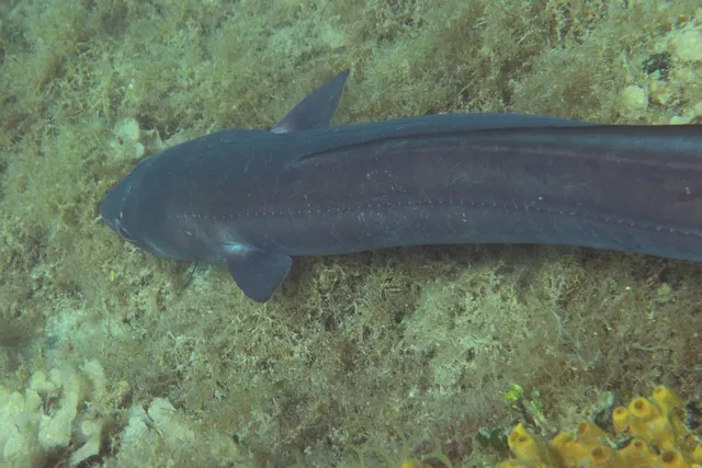 Conger eelCharacteristic of this water1 placeThe Plymouth rock marksOver rock mark
Photo: Holger Krisp, via Wikimedia Commons, CC BY 3.0; resized and trimmed to fit
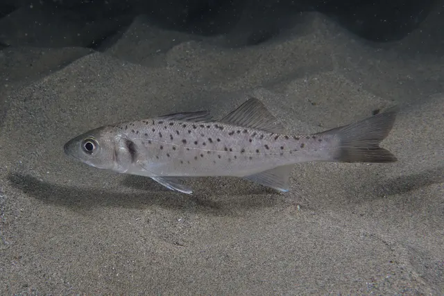 European sea bassRegular local target1 placeThe Plymouth rock marksOver rock mark
Photo: Julien Renoult, via Wikimedia Commons, CC BY 4.0; resized and trimmed to fit
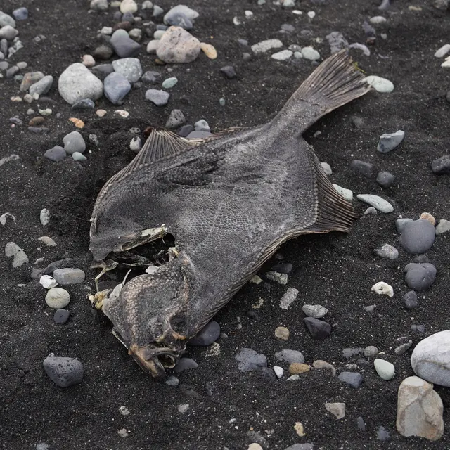 European flounderRepeatedly reported1 placeThe Plymouth rock marksOver rock mark
Photo: nbasargin, via iNaturalist, CC BY; resized and trimmed to fit
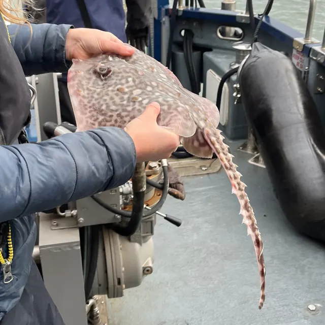 Thornback rayRepeatedly reported1 placeThe Plymouth rock marksOver rock mark
Photo: Ella McCausland, via iNaturalist, CC BY; resized and trimmed to fit


What these strengths mean
- Characteristic of this water
- This water is strongly identified with this species by the sources that cover it.
- Regular local target
- Fishing sources describe this as a normal local target here, not merely as caught.
- Repeatedly reported
- Several independent public accounts. Enough to say it happens more than once; not enough to call it a fishery.
- How breadth is counted
- A fish documented at six marks is shown as six marks: breadth never raises the strength on its own. A fishery account describes the fishing; a recorded catch reports one specific catch. How evidence is weighed.
Fish documented nearby, not here
Nothing below has been documented at The Plymouth rock marks itself. Each one has been documented at a named place on the same ground, and the places are listed with it. Treat this as what the water around here holds rather than as a catch list for this mark.
Widely documented on this ground
Documented at three or more neighbouring places, fished a way this place is also fished. That is a pattern about the ground rather than about any one mark, and it is the closest this site comes to saying you will probably meet a fish somewhere nothing has been written about.
From the shore
- Pollack — documented at Rame Head and Penlee Point; The Polperro rock coast; Prawle Point (+13 more)
- Small-spotted catshark — documented at Babbacombe and Oddicombe; Hopes Nose; Whitsand Bay and Tregantle (+10 more)
- Ballan wrasse — documented at Rame Head and Penlee Point; Prawle Point; Bolt Head and the Salcombe rock (+9 more)
- Thick-lipped grey mullet — documented at Bolt Head and the Salcombe rock; The Salcombe estuary; Torquay harbour (+5 more)
- European plaice — documented at Whitsand Bay and Tregantle; The Salcombe estuary; Slapton Sands and Torcross (+4 more)
- Whiting — documented at Babbacombe and Oddicombe; Hopes Nose; Whitsand Bay and Tregantle (+3 more)
- Pouting — documented at Babbacombe and Oddicombe; Hopes Nose; Whitsand Bay and Tregantle (+2 more)
- Atlantic mackerel — documented at The Polperro rock coast; Gorran Haven harbour wall; Prawle Point (+14 more)
- Garfish — documented at Babbacombe and Oddicombe; Hopes Nose; Brixham breakwater (+8 more)
- Atlantic cod — documented at Hopes Nose; Whitsand Bay and Tregantle; Brixham breakwater (+2 more)
- Black seabream — documented at Hopes Nose; The Salcombe estuary; Brixham breakwater (+1 more)
- Common sole — documented at The Salcombe estuary; Slapton Sands and Torcross; Exmouth and the Exe estuary
Also documented at neighbouring places
One or two accounts each, on the ground around here. Enough to know the fish is caught in these waters; not enough to say anything about this place.
From the shore
- Gilthead bream — documented at The Salcombe estuary; Slapton Sands and Torcross
- Striped red mullet — documented at Hopes Nose
- Bull huss — documented at The Polperro rock coast; Berry Head
- Turbot — documented at Bolt Head and the Salcombe rock; Gorran Haven harbour wall
- Atlantic horse mackerel — documented at Brixham breakwater; Teignmouth
- Starry smooth-hound — documented at Slapton Sands and Torcross
- Twaite shad — documented at Gorran Haven harbour wall
How people fish it
Practised here: Sea fishing.
Methods the sources name for this ground. Each one is explained in full on its own page.
- Float fishing
Suspending a bait at a controlled depth beneath a buoyant indicator — the most visual, most controllable and most widely applicable method in angling.
- Spinning
Casting an artificial lure and retrieving it so that it moves like something alive — the most direct form of lure fishing.
- Ledgering
Fishing a bait on the bottom held by a weight, with no float — the simplest way to fish at distance, in depth, or in wind.
Baits and lures for these fish
The baits and lures each of the fish above is commonly taken on, from that fish’s own page. This is what works for the fish, not a report of what people use on this particular water — local knowledge and the conditions on the day still decide.
Baits
- Peeler crab — for European sea bass, European flounder, Thornback ray
- Fish strip and cut bait — for Conger eel, Thornback ray
- Ragworm — for European sea bass, European flounder
- Sand eel — for European sea bass, Thornback ray
- Crab and shellfish — for European sea bass
- Lugworm — for European flounder
- Sea deadbaits — for Conger eel
- Squid and cuttlefish — for Conger eel
Lures
- Jerkbaits — for European sea bass
- Metal jigs — for European sea bass
- Soft plastics — for European sea bass
- Streamers — for European sea bass
- Surface lures — for European sea bass
How to catch them: Conger fishing · Bass fishing · Flounder fishing · Thornback ray fishing
Rods, reels and rigs for them: Conger eel · European sea bass · European flounder · Thornback ray
The ground and the water
- The ground
- The rock ground on the eastern side of Plymouth Sound and out along the coast beyond it: Stoke Point, the Ledges, and the Mewstone off Wembury — broken reef and boulder with deep water close in and a heavy tidal stream over it.
- Exposure
- Open south down the Channel. The Sound gives some shelter inside it and none at all on the marks beyond.
- Depth
- Deep water is reachable from the rock here, which is the property the source gives as the reason Plymouth's shore angling is as varied as it is.
Safety
Cliffs and rock platforms — Can cause serious injury or death
General safety for this kind of ground, not a finding about this place.
Anglers are swept from rock platforms by individual large sets rather than by the average sea, which means the conditions that kill people frequently look survivable for the twenty minutes before they arrive. Wet rock, weed and a swell running onto a sloping platform remove any chance of recovery.
What reduces it: Watch the water for a full set cycle before committing to a position, know the escape route and how long it takes, wear a flotation aid rather than carry one, never fish a platform alone, and treat a rising swell forecast as a reason not to go rather than a reason to be careful.
Cold water shock — Can cause serious injury or death
General safety for this kind of ground, not a finding about this place.
UK coastal and inland water is cold enough for most of the year to trigger the involuntary gasp and the loss of swimming ability that decides most immersion deaths, and it does so within the first minute, long before hypothermia is relevant.
What reduces it: Wear a buoyancy aid rather than carry one, carry a means of calling for help on the person rather than in a bag, and plan on the assumption that an unplanned entry into the water is survivable only if somebody knows immediately.
Moving water and currents — Can cause serious injury or death
General safety for this kind of ground, not a finding about this place.
The north coast's surf beaches carry strong rip currents, which run seaward through gaps in the sandbars and can take a wading angler off their feet and out beyond the surf line faster than they can walk back.
What reduces it: Do not wade deep in surf; learn to identify the calmer, darker, less-breaking channels that mark a rip and stay out of them; and if caught, do not swim against it — swim across the current parallel to the beach until out of it.
Rules and access
FishingHQ does not know the current access position here. Shore angling in England is not rod-licensed, but access rights, landowner permission, local authority and harbour byelaws, national and inshore fisheries measures, and site designations all apply and all change. Check the current position with the relevant inshore fisheries and conservation authority, the harbour or local authority, and the landowner before going.
Particular to this water: This ground carries conservation designations that constrain access, vehicles, bait collection and disturbance independently of any fishing rule.
Who holds the answer:
- The Inshore Fisheries and Conservation Authority for the district, which makes and enforces inshore byelaws.
- The Marine Management Organisation, for national recreational sea fishing measures in English waters.
- The local authority and, where one exists, the harbour authority, for access, byelaws and shellfish classification.
- The national fisheries authority for England, for licensing of freshwater and migratory fishing and for fisheries enforcement
- The relevant inshore fisheries and conservation authority for the district, which sets and enforces local sea fisheries byelaws
- The body managing any marine protected area on the stretch concerned
- The local authority environmental health service, for shellfish classification and public health closures
- The harbour authority for working harbours and quays
- The relevant estuary or river management body, where an estuary carries its own arrangements
Nearby fishing
Other publicly documented places within about 40 km, by distance. Positions are approximate public geography and are never exact marks.
- Newton Ferrers and the Yealm — 2–5 km · Estuary
- Plymouth Breakwater — 5–10 km · Breakwater
- Mount Batten — 5–10 km · Breakwater
- Plymouth Hoe — 5–10 km · Promenade
- Rame Head and Penlee Point — 5–10 km · Rock mark
- Whitsand Bay and Tregantle — 10–25 km · Surf beach
- The Tamar estuary — 10–25 km · Estuary
- The Salcombe estuary — 10–25 km · Estuary
Sources for this place
- Sea Angler — Bauer Media (Specialist angling publication)Relied on for: Long-running published description of British sea angling practice by region, ground type and named mark.FishingHQ's interpretation of what it saysCitation checked — the work exists and is described correctly
- General angling website restatements of established technique — Various (Credible secondary source)Relied on for: Widely restated public descriptions of which places are conventionally fished and how, recorded as practitioner consensus rather than as scholarship, and not relied on for access, permission or any current rule.Background and mechanism onlyCitation checked — the work exists and is described correctly
- Sea fishing in Devon — an angler's guide, north and south — Fishmag (Specialist angling publication)Relied on for: The identity of these Devon marks, the character of their ground, the species taken at each and the baits used.States this directlyPassage read and verified
How FishingHQ labels evidence is explained in the evidence policy. Last reviewed 2026-08-16.
Something wrong or out of date?
If something on this page has changed, email us from your own account using the link that fits, with a link to where you saw the change if you can. Every report is checked by a person before anything is changed, and a report never appears on the site by itself. Please don’t send exact private marks.
Before you go
- Fish documented here
- 4 at this place itself. See them.
- Getting there
- Not recorded. FishingHQ holds no sourced description of the way in.
- Rules particular to this water
- None recorded, which is not the same as none existing.
- Hazards particular to this place
- 2 recorded. Safety.
Check before you travel
- Whether you may fish here, and whether a licence or permit is needed — start with the Inshore Fisheries and Conservation Authority for the district.
- The tide times and the forecast for the day you go.
- Anything recorded here was true when it was read; it is not watched for change.