New South Wales
Fishing regions · Last reviewed 2026-10-23
A fishing fee for fresh and salt water alike, marine parks and aquatic reserves zoned for what may be done where, a lifejacket law on the rocks, and harbours with rules of their own.
Fishing here at a glance
- Ways to fish
- From the shore · From a boat · From a kayak · Fly fishing
- Set up for
Rod to hook from each fish’s guide, and how to build its rigs.
- Plan a trip
- When is best · Baits and lures to bring · Open the trip planner · What the conditions mean
- Tide and weather
The official pages for this area’s readings. FishingHQ shows no live reading: check them for the day you go.
- Rules and access
- Who sets the rules here — being listed is never permission to fish.
Not documented here yet: tackle shops, charters or guides.
Being listed here is not permission to fish. What that meansClose
Access, fishing rights, seasons, licences, local bylaws and permitted methods vary and can change. Check current access, permission, local regulations, closures and restrictions before you travel or fish. FishingHQ describes what the ground is and names who holds the answer; it does not hold the answer itself.
Find the authority for a jurisdiction · What FishingHQ does and does not cover
New South Wales is a state guide rather than a coast, because the state sets the rules and the questions a visitor arrives with are the state's to answer.
THE FEE IS FOR EVERY WATER. Anyone 18 or over who fishes in NSW — fresh or salt, with a rod, a handline, a spear, a trap or a bait pump, or simply on or near the water with fishing gear — needs the state's recreational fishing licence, which is the receipt for its fishing fee, unless exempt. The state fisheries department collects it and lists the exemptions — among them children under 18, Aboriginal people and holders of particular pensioner and veterans' cards, but not Seniors Cards; proof of either must be carried.
THE GROUND HAS RULES OF ITS OWN. Marine parks and aquatic reserves are zoned, and their sanctuary zones allow no fishing. Sydney Harbour and its tributaries, and Middle Harbour, are intertidal protected areas, where shellfish and other invertebrates may not be taken. Botany Bay is a recreational fishing haven. Sydney Harbour carries government advice against eating fish caught west of the Harbour Bridge. And on rocks exposed to ocean swell in ten declared council areas, a lifejacket is the law.
FRESH WATER IS THE SAME LICENCE AND DIFFERENT RULES. The trout rivers and streams close each winter for spawning while the lakes stay open, some waters are lure and fly only, and most of the Snowy Mountains fishery lies in Kosciuszko National Park, whose rules apply too.
What fishing here is like
A long, populous coast of drowned river valleys, harbours, bays, surf beaches and ocean rock platforms facing the Tasman Sea, from the subtropical north to the temperate south coast, with Sydney's harbours and the Hawkesbury at its centre; and, inland, the high country of the Snowy Mountains with its trout lakes and rivers.
What you can target here
One entry per fish, grouped by how you would be fishing — because the answer is a different one from the rocks and from a boat. Each entry says how strongly the sources support it and how much evidence sits behind it. These are documented catches, not a forecast, and none of it is a statement that you may fish any particular ground.
From the shore · 20
- LuderickRegular local target16 placesSydney Harbour, Middle Harbour, The Spit Bridge, Federation Point and 12 moreOver bay, breakwater, bridge, estuary, headland, island
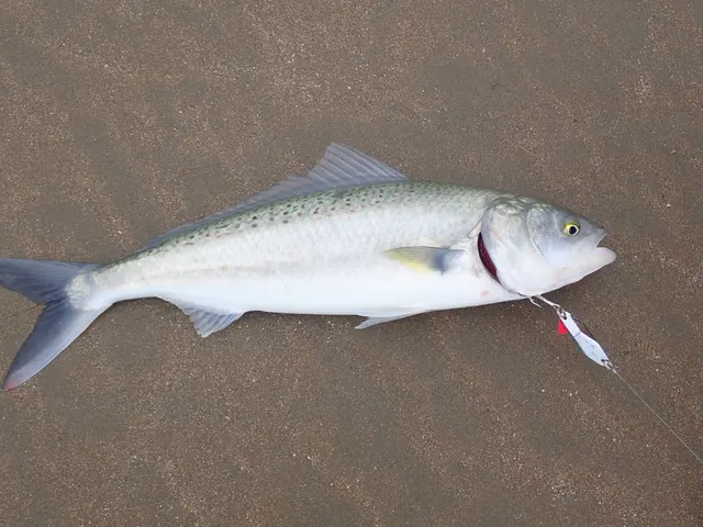 KahawaiRegular local target10 placesBotany Bay, Sydney Harbour, Walsh Bay piers, Clifton Gardens Wharf and 6 moreOver bay, estuary, headland, jetty, pierAround Jan–Dec
Photo: zoology, via Wikimedia Commons, public domain; resized
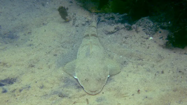 Dusky flatheadRegular local target9 placesSydney Harbour, Botany Bay, Lake Conjola, Burrill Lake and 5 moreOver bay, estuaryAround Jan–Apr, Oct–Dec
Photo: Sylke Rohrlach from Sydney, via Wikimedia Commons, CC BY-SA 2.0; resized and trimmed to fit; shared under the same licence
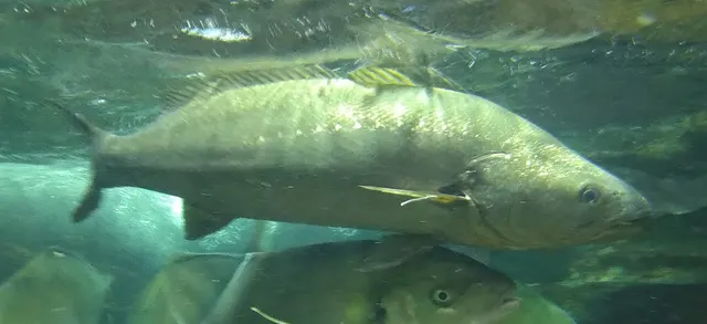 Dusky kobRegular local target9 placesSydney Harbour, Walsh Bay piers, Clarkes Point Reserve, Parramatta River, Gladesville to Ryde and 5 moreOver bay, estuary, headland, pier
Photo: タウナギ, via Wikimedia Commons, CC BY-SA 4.0; resized and trimmed to fit; shared under the same licence
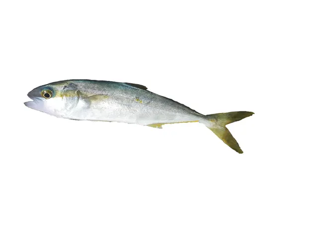 Yellowtail kingfishRegular local target9 placesSydney Harbour, Walsh Bay piers, Clifton Gardens Wharf, McMahons Point and 5 moreOver breakwater, bridge, estuary, headland, jetty, pier
Photo: Hugues Evano (IFREMER, Délégation océan Indien (DOI), Département Ressources Biologiques et Environnement (RBE), F-97420 Le Port, France), via Wikimedia Commons, CC BY 4.0; resized
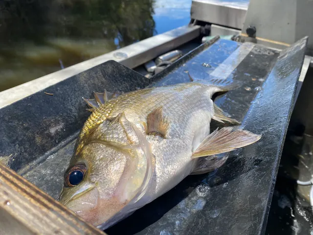 Estuary perchRegular local target8 placesGeorges River, Hawkesbury River and Broken Bay, Lake Conjola, Burrill Lake and 4 moreOver estuary
Photo: Bryce Watts-Parker, via iNaturalist, CC BY; resized


Also documented from the shore: Brown trout · Rainbow trout · Silver trevally · Australian bass · Atlantic salmon · Bluefish · Cobia · Common carp · Eel-tailed catfish · European perch · Golden perch · Longtail tuna · Silver perch · Murray cod
From a boat · 18
- Dusky kobRegular local target9 placesParramatta River, Gladesville to Ryde, Botany Bay, Georges River, Hawkesbury River and Broken Bay and 5 moreOver bay, bridge, estuary, estuary mark
Photo: タウナギ, via Wikimedia Commons, CC BY-SA 4.0; resized and trimmed to fit; shared under the same licence
- Dusky flatheadRegular local target8 placesBotany Bay, Lake Conjola, Burrill Lake, Lake Tabourie and 4 moreOver bay, estuaryAround Jan–Apr, Oct–Dec
Photo: Sylke Rohrlach from Sydney, via Wikimedia Commons, CC BY-SA 2.0; resized and trimmed to fit; shared under the same licence
- LuderickRegular local target8 placesHawkesbury River and Broken Bay, Hawkesbury River bridges at Brooklyn, Dangar Island, Wallis Lake and 4 moreOver bridge, estuary, island
- Estuary perchRegular local target6 placesGeorges River, Hawkesbury River and Broken Bay, Lake Conjola, Burrill Lake and 2 moreOver estuary
Photo: Bryce Watts-Parker, via iNaturalist, CC BY; resized
- KahawaiRegular local target6 placesBotany Bay, Hawkesbury River and Broken Bay, Cowan Creek, Barrenjoey Head and 2 moreOver bay, estuary, headlandAround Jan–Dec
Photo: zoology, via Wikimedia Commons, public domain; resized
- Yellowtail kingfishRegular local target5 placesHawkesbury River and Broken Bay, Cowan Creek, Jervis Bay, Point Perpendicular and 1 moreOver bay, estuary, headland
Photo: Hugues Evano (IFREMER, Délégation océan Indien (DOI), Département Ressources Biologiques et Environnement (RBE), F-97420 Le Port, France), via Wikimedia Commons, CC BY 4.0; resized
Also documented from a boat: Australasian snapper · Bluefish · Brown trout · Rainbow trout · Australian bass · Atlantic salmon · Eel-tailed catfish · European perch · Golden perch · Sand flathead · Silver trevally · Murray cod
From a kayak · 6
- Estuary perchRegular local target6 placesLake Conjola, Burrill Lake, Lake Tabourie, Narrawallee Inlet and 2 moreOver estuary
Photo: Bryce Watts-Parker, via iNaturalist, CC BY; resized
- Dusky flatheadRegular local target5 placesBotany Bay, Lake Conjola, Burrill Lake, Lake Tabourie and 1 moreOver bay, estuary
Photo: Sylke Rohrlach from Sydney, via Wikimedia Commons, CC BY-SA 2.0; resized and trimmed to fit; shared under the same licence
- LuderickRegular local target4 placesLake Conjola, Burrill Lake, Lake Tabourie, Narrawallee InletOver estuary
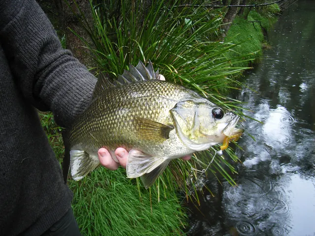 Australian bassRegular local target2 placesParramatta River, Lane Cove RiverOver estuary
Photo: Codman at en.wikipedia, via Wikimedia Commons, CC BY-SA 3.0; resized; shared under the same licence
- Dusky kobRegular local target1 placeBotany BayOver bay
Photo: タウナギ, via Wikimedia Commons, CC BY-SA 4.0; resized and trimmed to fit; shared under the same licence
- Silver trevallyRegular local target1 placeBotany BayOver bay

Fly fishing · 5
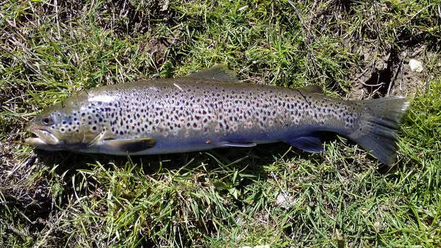 Brown troutRegular local target5 placesLake Jindabyne, Lake Eucumbene, Thredbo River, Eucumbene River and 1 moreOver reservoir, river reach
Photo: Robermix, via Wikimedia Commons, CC0; resized and trimmed to fit
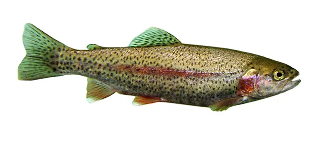 Rainbow troutRegular local target5 placesLake Jindabyne, Lake Eucumbene, Thredbo River, Eucumbene River and 1 moreOver reservoir, river reach
Photo: Jonathunder, via Wikimedia Commons, CC BY-SA 3.0; resized and trimmed to fit; shared under the same licence
- LuderickRegular local target3 placesMiddle Harbour, The Spit Bridge, Federation PointOver bridge, estuary, headland
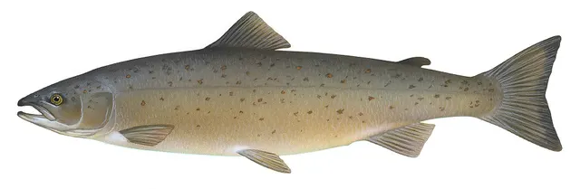 Atlantic salmonRegular local target1 placeLake JindabyneOver reservoir
Illustration: Knepp, Timothy, via Wikimedia Commons, public domain; resized and trimmed to fit
- KahawaiSeasonal2 placesHawkesbury River and Broken Bay, Barrenjoey HeadOver estuary, headlandAround Jan–Apr, Oct–Dec
Photo: zoology, via Wikimedia Commons, public domain; resized


What these strengths mean
- Regular local target
- Fishing sources describe this as a normal local target here, not merely as caught.
- Seasonal
- Well supported, and concentrated in part of the year rather than spread through it.
- How breadth is counted
- A fish documented at six marks is shown as six marks: breadth never raises the strength on its own. A fishery account describes the fishing; a recorded catch reports one specific catch. How evidence is weighed.
How people fish here
13 methods are recorded on the places documented here, counted from those places themselves rather than from what is practised in the country. Each opens a full guide to the technique.
Spinning
Recorded at 33 places here, over estuary, headland, reservoir, bay.
Casting an artificial lure and retrieving it so that it moves like something alive — the most direct form of lure fishing.
Documented on the same ground: Atlantic salmon, Australasian snapper, Australian bass, Bluefish, Brown trout, Cobia.
Ledgering
Recorded at 23 places here, over estuary, reservoir, bay, estuary mark.
Fishing a bait on the bottom held by a weight, with no float — the simplest way to fish at distance, in depth, or in wind.
Documented on the same ground: Atlantic salmon, Australian bass, Bluefish, Brown trout, Common carp, Dusky flathead.
Float fishing
Recorded at 11 places here, over estuary, reservoir, bay, breakwater.
Suspending a bait at a controlled depth beneath a buoyant indicator — the most visual, most controllable and most widely applicable method in angling.
Documented on the same ground: Atlantic salmon, Australian bass, Bluefish, Brown trout, Cobia, Dusky flathead.
Livebaiting at sea
Recorded at 11 places here, over headland, estuary, jetty, bay.
Presenting a living fish where a predator will find it — the most effective method for many species and the one with the clearest welfare questions attached.
Documented on the same ground: Australasian snapper, Dusky flathead, Dusky kob, Luderick, Sand flathead, Silver trevally.
Trolling
Recorded at 10 places here, over reservoir, headland, estuary, bay.
Towing lures or baits behind a moving boat to cover large volumes of water and locate scattered fish.
Documented on the same ground: Atlantic salmon, Australasian snapper, Australian bass, Bluefish, Brown trout, Common carp.
Kayak fishing
Recorded at 5 places here, over estuary, bay.
A platform rather than a technique: quiet, shallow-draught access to water no other craft reaches, bought at the price of exposure, and a discipline where the decision not to launch is part of the skill.
Documented on the same ground: Australian bass, Bluefish, Dusky flathead, Dusky kob, Estuary perch, Kahawai.
Drift fishing
Recorded at 4 places here, over bay, headland.
Letting the boat move with tide and wind while fishing, so the tackle searches ground instead of waiting on it — and the decision that determines whether a boat session works at all.
Documented on the same ground: Australasian snapper, Bluefish, Dusky flathead, Dusky kob, Kahawai, Luderick.
Eging
Recorded at 4 places here, over estuary, bay, headland.
Jigging for squid and cuttlefish with a barbed, weighted lure worked in lifts and pauses — a Japanese discipline with its own tackle, vocabulary and competitive scene.
Documented on the same ground: Australasian snapper, Dusky flathead, Dusky kob, Luderick, Sand flathead, Silver trevally.
Saltwater fly fishing
Recorded at 4 places here, over estuary, headland.
Fly fishing adapted to the sea: heavier lines, corrosion-proof tackle, fish that run rather than fight, and wind as the permanent constraint.
Documented on the same ground: Australian bass, Bluefish, Dusky kob, Estuary perch, Luderick, Yellowtail kingfish.
4 further methods are recorded at one or two places each: Stillwater fly fishing, Dry fly fishing, Jigging, Nymphing.
These are the methods documented at the places FishingHQ holds here. A species listed beside a method is documented on the same ground, which is not the same as being taken that way — where a source establishes the method a fish was caught on, it is stated on that place’s own page. All fishing methods.
Baits and lures for these fish
The methods, baits and lures each of the fish above is commonly taken on, from that fish’s own page. This is what works for the fish, not a report of what people use on this particular water — local knowledge and the conditions on the day still decide.
Methods
- Popping and stickbaiting — for Estuary perch, Bluefish, Cobia, Longtail tuna
- Surfcasting — for Kahawai, Dusky kob, Bluefish
- Float-tube fishing — for Brown trout, Rainbow trout
- Salmon fly fishing — for Brown trout, Atlantic salmon
- Drop shotting — for European perch
- Feeder fishing — for Common carp
- Pole fishing — for Common carp
- Surface fishing for coarse fish — for Common carp
Also: Tenkara
Baits
- Maggots — for Brown trout, European perch
- Boilies — for Common carp
- Lobworms and worms — for European perch
- Particle baits — for Common carp
- Pellets — for Common carp
- Sweetcorn — for Common carp
Lures
- Soft plastics — for Dusky flathead, Silver trevally, Australian bass, Australasian snapper and 1 more
- Surface lures — for Kahawai, Yellowtail kingfish, Australian bass, Bluefish and 1 more
- Metal jigs — for Kahawai, Yellowtail kingfish, Australasian snapper, Bluefish
- Streamers — for Brown trout, Rainbow trout, Atlantic salmon
- Dry flies — for Brown trout, Rainbow trout
- Nymphs — for Brown trout, Rainbow trout
- Saltwater lures — for Cobia, Longtail tuna
- Spinnerbaits and bladed jigs — for Golden perch, Murray cod
Also: Spinners · Wet flies · Crankbaits · Jigs and jig heads · Spoons · Swimbaits · Terrestrial fly patterns
The fishing year here
The months the places and accounts under this area actually name, tightest season first. This is “observed in these months” rather than a season: a species whose months nobody recorded is not listed, because a gap in the evidence is not a year-round fishery.
- Dusky flatheadOctober to April
- Murray codDecember to August
- Kahawaiall year
What dominates
Land-based fishing from harbour wharves, parks and rock; estuary fishing for bream, flathead, luderick and mulloway; boat and kayak fishing on the bays and the Hawkesbury; rock and land-based game fishing on the open coast; and trout fishing with fly, lure and bait in the Snowy Mountains.
The water available
Sydney Harbour, Middle and North Harbour, Botany Bay and the Hawkesbury River and Broken Bay — drowned river valleys with rock foreshores, wharves and seagrass; Jervis Bay, a clear-water bay inside a marine park; ocean rock platforms and surf beaches; and the Snowy Mountains impoundments and trout streams.
How the rules are structured
New South Wales requires its recreational fishing licence — the receipt for the state's fishing fee — for anyone aged 18 or over fishing in its fresh or salt water, including spearfishing, hand gathering, trapping, bait collecting and prawn netting, and being on or near the water with fishing gear, unless exempt. The exemptions are set by the NSW Department of Primary Industries and Regional Development; when read on 23 October 2026 they covered people under 18, an adult helping a child with a single rod or dip net, fishing in a private dam of two hectares or less, Aboriginal people, and holders of named pensioner and veterans' cards, and not Seniors, Health Care or Veteran White Cards. Clients of a charter boat, hire boat or guide holding an exemption certificate are covered by it, and a reduced fee applies in a defined area of the tidal Tweed River. Proof of an exemption, or the receipt, must be carried and shown to an authorised officer on request. Bag and size limits, closures and seasons are set by the department, separately for salt and fresh water, and change; FishingHQ does not restate them. Lakes Hume and Mulwala have rules of their own, and line fishing for eastern blue groper is prohibited for three years from 1 March 2025. Marine parks and aquatic reserves are zoned, and sanctuary zones allow no fishing. Intertidal protected areas, Sydney Harbour and its tributaries among them, allow no shellfish, molluscs or crustaceans to be taken. Under the Rock Fishing Safety Act 2016 a lifejacket must be worn when rock fishing on rocks exposed to ocean swell in the declared council areas. In fresh water, trout rivers and streams have an annual closed season and some are lure and fly only, and national park rules apply in Kosciuszko. FishingHQ does not state what any current rule is: what is said here is what the state's pages said when read, and the state's page is the authority. Check the current position with the department before going.
Who to ask
- The NSW Department of Primary Industries and Regional Development, which sets the recreational fishing fee and its exemptions and publishes the rules, closures, marine park zoning and freshwater seasons.
- Service NSW, the state's service through which the licence is bought.
- The council, port or land manager, for wharves, parks, reserves and other land it owns or leases, which carry rules of their own.
- The NSW Food Authority, for advice on eating fish from waters with a contamination advisory, including Sydney Harbour.
- The National Parks and Wildlife Service, where the water or shore is inside a national park such as Kosciuszko.
- The managers of Booderee National Park, on Jervis Bay's southern shore, which is Commonwealth land with its own fishing rules.
Words you will meet
- Recreational fishing fee
- What NSW charges for fishing in its fresh and salt water; the licence is the receipt for it. Unless exempt, carry it.
- Intertidal protected area
- Shore where shellfish, molluscs and other invertebrates may not be taken, though fishing for finfish may be allowed. Much of Sydney's foreshore is one.
- Aquatic reserve
- A protected area with its own limits on what may be taken and how; some allow only line fishing for finfish.
- Recreational fishing haven
- Water from which commercial fishing has been removed for recreational fishers. Botany Bay is one.
Conditions and hazards
Rock fishing on the open coast is the state's best-known danger: on rocks exposed to ocean swell in ten declared council areas a lifejacket is the law, for children and helpers too. The harbours and estuaries are sheltered water but carry boat and ferry traffic, and on ferry wharves vessels and passengers have priority. In Sydney Harbour the government advises against eating fish or crustaceans caught west of the Harbour Bridge and limits what is eaten from east of it. Sun and dehydration are a routine hazard across the state.
Do you need a fishing licence in New South Wales?
If you are 18 or over, almost certainly, unless you are exempt.
ONE FEE, FRESH AND SALT. The NSW recreational fishing licence is the receipt for the state's fishing fee, and the same one covers the sea, the estuaries, the rivers and the lakes. A licence from another state is not the NSW one.
IT COVERS MORE THAN A ROD. The state's service page lists spearfishing, hand lining and hand gathering, trapping, bait collecting and prawn netting, and simply being on or near NSW waters with fishing gear. Someone carrying a rod along a breakwater is fishing for the purpose of the fee.
CARRY THE PROOF. The receipt has to be shown if an authorised officer asks.
WHO THE DEPARTMENT SAYS IS EXEMPT. When read on 23 October 2026: anyone under 18; an adult helping someone under 18 fish with a single rod, or take prawns with a single dip or scoop net; anyone fishing a private dam of two hectares or less; Aboriginal people; and holders of a current Centrelink or Veterans' Affairs Pensioner Concession Card, a Veterans' Affairs Gold Card printed TPI or EDA, or a Veterans' Affairs letter of a qualifying disability payment. Seniors Cards, Health Care Cards and Veteran White Cards do not exempt. Only the person who signs the card is exempt, and the card is carried instead of a receipt. Check the list on the day: it is the department's to change.
CHARTERS, HIRE BOATS AND GUIDES. An operator may hold an exemption certificate that covers its clients. If it does not, each client pays.
THE TWEED. A reduced fee applies in a defined area of the tidal Tweed River and the beaches beside its breakwaters, which the department maps.
WHERE TO BUY IT. Service NSW sells it; the department sets it. The fee is not restated here.
Official guidance — why, and the sources (3)
Stated by a fisheries authority, scientific institute or recognised angling body. Authoritative, but summarising rather than demonstrating.
- Apply for a recreational fishing licence (3-day or 1-month) — Service NSW (NSW Government) (Local authority, harbour or protected-area body)Relied on for: That people aged 18 or over need the NSW recreational fishing licence for activities in fresh or salt water, including having fishing gear on or near the water; that exemptions exist and their proof must be carried; and that the receipt must be shown to an authorised officer.States this directlyPassage read and verified
- Recreational fishing fee — NSW Department of Primary Industries and Regional Development (Government fisheries body)Relied on for: That the fee is required in NSW fresh and salt water, that a receipt is carried, and that the exemptions are listed by the department.States this directlyPassage read and verified
- Recreational fishing fee exemptions — NSW Department of Primary Industries and Regional Development (Government fisheries body)Relied on for: The categories of people exempt from the NSW fee on the read date, the cards that do not exempt, charter and guide exemption certificates, and the Tweed concession area.States this directlyPassage read and verified
Where the rules are kept, and what closes ground to fishing
BAG AND SIZE LIMITS, CLOSURES AND SEASONS. The NSW Department of Primary Industries and Regional Development sets them and publishes them, separately for salt and fresh water, with the methods each allows. FishingHQ does not copy them; look them up for the fish and the water.
SPECIES WITH THEIR OWN RULES. Line fishing for eastern blue groper is prohibited, a measure the department extended for three years from 1 March 2025. Lakes Hume and Mulwala, on the Murray, have separate rules.
MARINE PARKS AND AQUATIC RESERVES. They are zoned. Sanctuary zones allow no fishing at all; other zones allow some methods and not others. In Jervis Bay Marine Park most of the bay is open to recreational fishing and the sanctuary zones are not; in the North Harbour Aquatic Reserve only line fishing for finfish is allowed and spearfishing is banned across North Harbour; Towra Point in Botany Bay has sanctuary zones and refuge zones.
INTERTIDAL PROTECTED AREAS. All of Sydney Harbour and its tributaries is one, and so is Middle Harbour: the rule there is that shellfish, molluscs and crustaceans may not be taken. The department maps the others.
SYDNEY HARBOUR'S DIOXIN ADVICE. The government advises that no fish or crustacean caught west of the Harbour Bridge be eaten, and limits how much from east of it. The advice covers all of Port Jackson and its tributaries; its health fact sheet dates from 2018 and the department's 2024 harbour guide repeats it.
LAND AND WHARVES. Council, leased and private land has its own rules, and on ferry wharves vessels and passengers come first.
Official guidance — why, and the sources (6)
Stated by a fisheries authority, scientific institute or recognised angling body. Authoritative, but summarising rather than demonstrating.
- Fishing rules and regulations — NSW Department of Primary Industries and Regional Development (Government fisheries body)Relied on for: Where the NSW limits and method rules are published, the separate rules for Lakes Hume and Mulwala, and the eastern blue groper line-fishing prohibition from 1 March 2025.States this directlyPassage read and verified
- Go Fishing — Sydney Harbour's wharves, piers and parks — NSW Department of Primary Industries and Regional Development, 2024 (Government fisheries body)Relied on for: That Sydney Harbour and its tributaries are an intertidal protected area, that council and private land has its own rules, that vessels have priority on ferry wharves, and the dioxin advice by side of the Harbour Bridge.States this directlyPassage read and verified
- Go Fishing — Sydney's Middle and North Harbour parks and reserves — NSW Department of Primary Industries and Regional Development, 2024 (Government fisheries body)Relied on for: The North Harbour Aquatic Reserve's limits on method and invertebrates, the ban on spearfishing in North Harbour, and the little penguin critical habitat hours.States this directlyPassage read and verified
- Go Fishing — Botany Bay Recreational Fishing Haven — NSW Department of Primary Industries and Regional Development, 2024 (Government fisheries body)Relied on for: That Botany Bay is a recreational fishing haven, and that Towra Point Aquatic Reserve has sanctuary zones closed to fishing and refuge zones where invertebrates may not be taken.States this directlyPassage read and verified
- Go Fishing — Jervis Bay — NSW Department of Primary Industries and Regional Development, 2024 (Government fisheries body)Relied on for: That Jervis Bay Marine Park's sanctuary zones allow no fishing, that Booderee National Park on the southern shore is Commonwealth land with its own rules, and that a rock ledge there lies in a Defence range.States this directlyPassage read and verified
- Dioxins in Sydney Harbour and Parramatta River: health advice for recreational fishers — NSW Food Authority (NSW Health), 2018 (Local authority, harbour or protected-area body)Relied on for: That the dioxin advice divides at the Sydney Harbour Bridge and covers Port Jackson and its tributaries; dated 2018.States this directlyPassage read and verified
Rock fishing, and the lifejacket law
Under the Rock Fishing Safety Act 2016, anyone rock fishing on rocks exposed to ocean swell in a declared area must wear an appropriate lifejacket, and that includes children and anyone helping. The state sets the standard the lifejacket must meet, with a higher level for children under twelve, and fines people who fish without one.
THE DECLARED AREAS. When the state's page was read in October 2026 it listed ten councils: Ballina, Central Coast, Kiama, Lake Macquarie, Northern Beaches, Port Stephens, Randwick, Richmond Valley, Sutherland Shire and Wollongong, each with a map of where the law applies. Outside them a lifejacket is not required by this law, and the swell is no smaller.
WHY. The law is written for rocks exposed to ocean swell, where a wave larger than the rest can arrive without warning onto rock that has been dry for some time.
Official guidance — why, and the sources (1)
Stated by a fisheries authority, scientific institute or recognised angling body. Authoritative, but summarising rather than demonstrating.
- Rock fishing lifejacket law and declared areas — NSW Government (Local authority, harbour or protected-area body)Relied on for: That a lifejacket to a stated standard must be worn when rock fishing on rocks exposed to ocean swell in the declared council areas, by children and helpers too, and which councils were listed.States this directlyPassage read and verified
Fresh water: the same licence, different rules
The fishing fee applies in fresh water as in salt. The rules beyond it are different.
TROUT STREAMS CLOSE IN WINTER. The department's 2024 Snowy Mountains guide gives the trout rivers and streams an annual closed season for spawning while the lakes stay open all year, and makes the Thredbo and Eucumbene rivers lure and fly only, with special rules from 1 May. Check the current season dates with the department: they move with the calendar.
NATIONAL PARK RULES APPLY TOO. Most of the Snowy Mountains fishery is inside Kosciuszko National Park.
WHAT IS THERE. The department calls the Snowies arguably the best trout fishing in mainland Australia: rainbow, brown and brook trout and Atlantic salmon in Lakes Jindabyne and Eucumbene, Tantangara Reservoir, and the Thredbo and Eucumbene rivers. Other freshwater waters in the state are not yet described here.
Official guidance — why, and the sources (2)
Stated by a fisheries authority, scientific institute or recognised angling body. Authoritative, but summarising rather than demonstrating.
- Go Freshwater Fishing — Snowies trout waters — NSW Department of Primary Industries and Regional Development, 2024 (Government fisheries body)Relied on for: That most of the Snowy Mountains trout fishery is in Kosciuszko National Park, that the trout rivers and streams have an annual closed season while the lakes stay open, and that two rivers are lure and fly only.States this directlyPassage read and verified
- Recreational fishing fee — NSW Department of Primary Industries and Regional Development (Government fisheries body)Relied on for: That the fee is required in NSW fresh and salt water, that a receipt is carried, and that the exemptions are listed by the department.States this directlyPassage read and verified
Places within this area
Publicly documented fishing geography. FishingHQ describes what the ground is; it does not say whether you may fish it, and every one of these sends that question to the body that holds the answer. Browse every place in this part of the world.
Who to ask before fishing any of these
FishingHQ does not know the current access position here. New South Wales requires its recreational fishing fee to be paid in all its waters, with exemptions the state lists. Marine parks and aquatic reserves have zones where fishing is not allowed or only some methods are, much of the shore is an intertidal protected area where shellfish and other invertebrates may not be taken, the state publishes advice against eating fish from some waters, and wearing a lifejacket is the law when rock fishing in declared council areas. Bag and size limits change. Check the current position with the NSW Department of Primary Industries and Regional Development before going.
FishingHQ does not know the current access position here. New South Wales requires its recreational fishing fee to be paid in all its waters, with exemptions the state lists. Marine parks and aquatic reserves have zones where fishing is not allowed or only some methods are, much of the shore is an intertidal protected area where shellfish and other invertebrates may not be taken, the state publishes advice against eating fish from some waters, and wearing a lifejacket is the law when rock fishing in declared council areas. Bag and size limits change. Check the current position with the NSW Department of Primary Industries and Regional Development before going. This water is tidal and transitional, so the freshwater regime may also apply above the tidal limit: FishingHQ does not know the current access position here. The New South Wales fishing fee applies in fresh water too, trout rivers and streams have a closed season and some are lure and fly only, and much of the high country is national park. All of it changes. Check the current position with the NSW Department of Primary Industries and Regional Development before going.
FishingHQ does not know the current access position here. The New South Wales fishing fee applies in fresh water too, trout rivers and streams have a closed season and some are lure and fly only, and much of the high country is national park. All of it changes. Check the current position with the NSW Department of Primary Industries and Regional Development before going.
Sydney Harbour
Estuary · Salt water
Port Jackson, from its heads past the city to the Parramatta and Lane Cove rivers, with Middle and North Harbour branching north. The state department counts more than 120 known land-based fishing places — rock platforms, wharves, piers, parks and reserves — and numbers seventy of them on its maps. It gives dusky flathead, mulloway, bream, luderick, mullet, tarwhine, silver trevally, squid and leatherjacket as the common fish, with Australian salmon, bonito, frigate mackerel and kingfish arriving in the warmer months.
Particular to this water: Sydney Harbour and all its tributaries are an intertidal protected area: shellfish, molluscs and crustaceans may not be taken. The department says council, leased and private land has its own rules and that anglers should check fishing is allowed at each place; on ferry wharves, vessels and passengers have priority. The department says a number of fishing closures are in place in the harbour, most of them signposted.
Botany Bay
Bay · Salt water
The large bay thirteen kilometres south of Sydney's city centre, between Kamay National Park at Cape Solander and the Port Botany breakwall at Molineaux Point, with the airport runways on its western side. A recreational fishing haven since 2002, with commercial fishing removed, it is fished from boats, kayaks and the shore. The department gives dusky flathead, bream, mulloway, silver trevally, whiting and luderick as its common estuary fish.
Severe hazards of New South Wales apply here: cliffs and rock platforms.
Particular to this water: In the Towra Point Aquatic Reserve on the southern shore, fishing is prohibited in the sanctuary zones; in the refuge zones hook and line is allowed but no invertebrates or marine plants may be taken. The department says restrictions also apply around the airport runways and at Port Botany, and points to the state's dietary advice for fish caught in the bay and the Georges River.
Georges River
Estuary · Brackish water
One of the three rivers, with the Cooks and the Woronora, that the department says run into Botany Bay. The department says the Georges and Woronora give the chance of estuary perch and Australian bass, especially in the upper Georges, as well as bream, flathead, whiting and mulloway. Mulloway are stocked into the river each year; in the department's sampling about a fifth of the mulloway caught in the Georges were stocked fish.
Particular to this water: The department points to the state's dietary advice for fish caught in the Georges River and Botany Bay; read it before eating the catch. Where the river is tidal, the saltwater rules apply, and above the tidal limit the freshwater ones.
Hawkesbury River and Broken Bay
Estuary · Brackish water
The tidal lower Hawkesbury, which meets the sea at Broken Bay north of Sydney, with Pittwater, Cowan Creek and Berowra Creek among its arms. The department says it is best known for some of the state's largest mulloway, found from Broken Bay up to Wisemans Ferry, and for big bream, winter hairtail in Cowan Creek, surface-feeding Australian salmon, bonito, tailor and kingfish in Broken Bay, and Australian bass and estuary perch in its upper reaches.
Particular to this water: The Barrenjoey Head Aquatic Reserve lies at the southern end of Broken Bay; elsewhere the department tells anglers to check closures, limits and protected species before going.
Jervis Bay
Bay · Salt water
A large, clear-water bay on the NSW south coast, with seagrass beds, cliffs, headlands and reefs, inside a marine park that runs about a hundred kilometres from Kinghorn Point to Bherwerre Beach. The department gives estuary, beach, rock, sport and game fishing: snapper on the reefs inside the bay, kingfish on the reefs and cliffs, sand flathead drifted over sand, bream on the calm beaches and in Currambene Creek, Australian salmon off the surf beaches, and squid over the seagrass. Boats reach the offshore banks and canyons for tuna, dolphinfish and marlin.
Severe hazards of New South Wales apply here: cliffs and rock platforms.
Particular to this water: The bay is a marine park: most of it is zoned to allow recreational fishing, but its sanctuary zones, including those at Bowen Island and the Drum and Drumsticks, allow none, and penalties apply. The southern shore is Commonwealth land in Booderee National Park, which has its own fishing rules and allows no spearfishing. Zoning maps come from the marine park office in Huskisson and the department.
Lake Jindabyne
Reservoir · Fresh water
One of the two largest of the Snowy Hydro lakes, at the town of Jindabyne, fed by the Snowy and Thredbo rivers. The department says it suits soaking a bait, land-based sight fly fishing, lure casting and trolling, and maps shore areas for lure, fly and bait and productive trolling water. Atlantic salmon are stocked into it from the hatchery at Jindabyne.
Particular to this water: The department's 2024 guide gives two rods per person on the region's lakes and a daily bag and minimum size for trout and salmon together; check the current rules before going. The lake has marked speed-limit areas for boats.
Lake Eucumbene
Reservoir · Fresh water
The largest of the Snowy Hydro lakes, near Adaminaby, which the department names with Lake Jindabyne as the region's biggest and best suited to bait, land-based sight fly fishing, lure casting and trolling. Its map marks shore areas for lure, fly and bait, productive trolling water, and water it labels for spring and early summer.
Particular to this water: The department's 2024 guide gives two rods per person on the region's lakes and a daily bag and minimum size for trout; check the current rules before going.
Tantangara Reservoir
Reservoir · Fresh water
A smaller Snowy Hydro reservoir on the upper Murrumbidgee, which the department says offers fishing similar to the big lakes but is a little more off the grid, and maps for shore lure, fly and bait fishing and trolling.
Particular to this water: The department says most of the region's fishery is inside Kosciuszko National Park, whose own rules apply alongside the fishing rules. Check the current rules with the department before going.
8 more places in this area
Thredbo River
River reach · Fresh water
A freestone river flowing from Thredbo down to Lake Jindabyne, which the department names with the Eucumbene as the region's premier fly and lure rivers, offering trophy brown and rainbow trout. Late in the season it recommends weighted glo-bugs and small black nymphs drifted over the gravel beds where browns run up from the lake to spawn.
Particular to this water: The department's 2024 guide makes the Thredbo artificial lure and fly only, closes rivers and streams from the June to the October long weekend, and applies special rules from 1 May. The department says most of the region's fishery is inside Kosciuszko National Park. Check the current rules before going.
Eucumbene River
River reach · Fresh water
A freestone river running into Lake Eucumbene, named by the department with the Thredbo as the region's premier fly and lure rivers, offering trophy brown and rainbow trout.
Particular to this water: The department's 2024 guide makes the Eucumbene artificial lure and fly only, closes rivers and streams from the June to the October long weekend, and applies special rules from 1 May. Check the current rules before going.
Wallis Lake
Estuary · Brackish water
The largest of the Great Lakes' five fishable lakes, opening to the sea between Forster and Tuncurry. The department describes channels and sandflats with ribbon weed and oyster racks fed by creeks and basins — ideal whiting ground — and gives luderick, dusky flathead and whiting as key lake fish.
Particular to this ground: boat safety.
Particular to this water: The department places the region beside the Port Stephens–Great Lakes Marine Park, which runs from Cape Hawke near Forster south to Birubi Beach, with sanctuary zones closed to all fishing and habitat protection zones with their own limits; its FishSmart app shows the zones. Whiting here are sand or yellowfin whiting, the department says, so no single species is attached.
Lake Conjola
Estuary · Brackish water
A coastal lake north of Ulladulla and the larger of the area's four recreational fishing havens, with shallow sand flats, weed edges, drop-offs and feeder creeks; the department says it has made its name as a trophy dusky flathead water.
Particular to this water: A recreational fishing haven, as the department lists it. The department lists ramps at the Holiday Haven caravan park on Lake Conjola Entrance Road and at Yooralla Bay (small craft and ski boats only). A listed ramp is not a statement that launching is allowed today. The department asks that big flathead be landed in a large knotless net, kept in the water until the camera and mat are ready, held by the lower jaw with a wet glove and supported, never lifted by lip grips, and released.
Burrill Lake
Estuary · Brackish water
A coastal lake just south of Ulladulla, one of the area's four recreational fishing havens, with sand flats, weed edges and drop-offs; the department names it with Lake Conjola as a trophy dusky flathead water.
Particular to this water: A recreational fishing haven, as the department lists it. The department lists ramps on Kendall Crescent and Maria Avenue (all boats) and a natural ramp on Moore Street (catamarans and skiffs only). A listed ramp is not a statement that launching is allowed today. The department asks that big flathead be landed in a large knotless net, kept in the water until the camera and mat are ready, held by the lower jaw with a wet glove and supported, never lifted by lip grips, and released.
Lake Tabourie
Estuary · Brackish water
A coastal lake south of Ulladulla, one of the area's four recreational fishing havens, which the department lists for dusky flathead, bream, whiting, estuary perch, luderick and mullet.
Particular to this water: A recreational fishing haven, as the department lists it. The department lists no ramp for this lake. A listed ramp is not a statement that launching is allowed today. The department asks that big flathead be landed in a large knotless net, kept in the water until the camera and mat are ready, held by the lower jaw with a wet glove and supported, never lifted by lip grips, and released.
Narrawallee Inlet
Estuary · Brackish water
A small inlet just north of Ulladulla, one of the area's four recreational fishing havens, which the department lists for dusky flathead, bream, whiting, estuary perch, luderick and mullet.
Particular to this water: A recreational fishing haven, as the department lists it. The department lists a ramp on Normandy Street, Narrawallee (small craft only). A listed ramp is not a statement that launching is allowed today. The department asks that big flathead be landed in a large knotless net, kept in the water until the camera and mat are ready, held by the lower jaw with a wet glove and supported, never lifted by lip grips, and released.
Burrendong Dam
Reservoir · Fresh water
A large impoundment 20 km east of Wellington at the junction of the Cudgegong and Macquarie rivers, its old riverbeds lined with drowned trees that the department calls its main fish structure. Access is through Lake Burrendong State Park in the main basin, Mookerawa Waters Park on the Macquarie arm and the Cudgegong River Holiday Park; the department's inside tip is the Meroo Creek arm.
Particular to this ground: boat safety.
Particular to this water: Murray cod have a closed season in spring; check the dates with the department. The department asks that big cod be netted, kept in the water until ready, held by the lower jaw and supported horizontally, without lip grips. Opera house yabby traps are not permitted in any NSW water; open-top pyramid nets and hoop nets are the permitted alternatives. Bowfishing for carp is allowed here only under the department's conditions, among them a current fishing fee receipt, an upright bow with a reeled line, daylight hours and distances from people, camps and dwellings.
Safety
Further safety reading
- Rock platform and cliff safety — A lifejacket must be worn when rock fishing on rocks exposed to ocean swell in ten declared council areas.
Check the rules before you fish
Fishing laws, bylaws, access rules, seasons, bait restrictions and permitted methods vary by location and can change. Check the current rules from the relevant authority and the water you intend to fish before fishing.
Check with:
- Current national or regional law for where you are fishing
- Current local bylaws
- The relevant fisheries authority
- The landowner, club or fishery whose water it is
- Any restrictions specific to the species or the method you intend to use
Where to go next
Rules and access
- Licences and permissionThe NSW fishing fee applies in fresh and salt water to anyone 18 or over unless exempt, and covers having fishing gear on or near the water.
More fishing regions
Not related to this page — just the rest of the section. There is little else joined to this subject yet, and a short page should still lead somewhere.
Sources and evidence
7 sources cited on this page
- Apply for a recreational fishing licence (3-day or 1-month) — Service NSW (NSW Government) (Local authority, harbour or protected-area body)Relied on for: That people aged 18 or over need the NSW recreational fishing licence for activities in fresh or salt water, including having fishing gear on or near the water; that exemptions exist and their proof must be carried; and that the receipt must be shown to an authorised officer.States this directlyPassage read and verified
- Recreational fishing fee exemptions — NSW Department of Primary Industries and Regional Development (Government fisheries body)Relied on for: The categories of people exempt from the NSW fee on the read date, the cards that do not exempt, charter and guide exemption certificates, and the Tweed concession area.States this directlyPassage read and verified
- Fishing rules and regulations — NSW Department of Primary Industries and Regional Development (Government fisheries body)Relied on for: Where the NSW limits and method rules are published, the separate rules for Lakes Hume and Mulwala, and the eastern blue groper line-fishing prohibition from 1 March 2025.States this directlyPassage read and verified
- Rock fishing lifejacket law and declared areas — NSW Government (Local authority, harbour or protected-area body)Relied on for: That a lifejacket to a stated standard must be worn when rock fishing on rocks exposed to ocean swell in the declared council areas, by children and helpers too, and which councils were listed.States this directlyPassage read and verified
- Go Fishing — Sydney Harbour's wharves, piers and parks — NSW Department of Primary Industries and Regional Development, 2024 (Government fisheries body)Relied on for: That Sydney Harbour and its tributaries are an intertidal protected area, that council and private land has its own rules, that vessels have priority on ferry wharves, and the dioxin advice by side of the Harbour Bridge.States this directlyPassage read and verified
- Go Fishing — Jervis Bay — NSW Department of Primary Industries and Regional Development, 2024 (Government fisheries body)Relied on for: That Jervis Bay Marine Park's sanctuary zones allow no fishing, that Booderee National Park on the southern shore is Commonwealth land with its own rules, and that a rock ledge there lies in a Defence range.States this directlyPassage read and verified
- Go Freshwater Fishing — Snowies trout waters — NSW Department of Primary Industries and Regional Development, 2024 (Government fisheries body)Relied on for: That most of the Snowy Mountains trout fishery is in Kosciuszko National Park, that the trout rivers and streams have an annual closed season while the lakes stay open, and that two rivers are lure and fly only.States this directlyPassage read and verified
Why the 2 connections on this page are here, and the sources
Safety reading
Official guidance — 1 connection
Stated by a fisheries authority, scientific institute or recognised angling body. Authoritative, but summarising rather than demonstrating.
Rock platform and cliff safety
The state's own page on the Rock Fishing Safety Act 2016.
- Rock fishing lifejacket law and declared areas — NSW Government (Local authority, harbour or protected-area body)Relied on for: That a lifejacket must be worn when rock fishing on rocks exposed to ocean swell in the declared council areas.States this directlyPassage read and verified
Rules and access
Official guidance — 1 connection
Stated by a fisheries authority, scientific institute or recognised angling body. Authoritative, but summarising rather than demonstrating.
Licences and permission
The state's own licence service page.
- Apply for a recreational fishing licence (3-day or 1-month) — Service NSW (NSW Government) (Local authority, harbour or protected-area body)Relied on for: That people aged 18 or over need the NSW recreational fishing licence for activities in fresh or salt water, unless exempt.States this directlyPassage read and verified
How FishingHQ labels evidence is explained in the evidence policy.