Morecambe Bay and the north-west England coast
Fishing regions · Last reviewed 2026-08-16
The largest continuous intertidal sand and mud flats in Britain. A place defined by what is uncovered rather than by what is underwater — and by how fast it comes back.
Safety: tides and being cut off — can cause serious injury or death. 2 more points apply here.
Contamination and toxins in the catch — Can cause injury needing treatment
Shellfish filter and concentrate what is in the water, including marine biotoxins and microbiological contamination. Neither cooking nor the appearance, smell or taste of the shellfish removes a biotoxin, and beds close on monitoring results sometimes within days.
What reduces it: Check the current harvesting area classification and closure position with the Food Standards Agency and the local authority before gathering, every time, and treat a previous visit as no evidence at all about the present position.
Being listed here is not permission to fish. What that meansClose
Access, fishing rights, seasons, licences, local bylaws and permitted methods vary and can change. Check current access, permission, local regulations, closures and restrictions before you travel or fish. FishingHQ describes what the ground is and names who holds the answer; it does not hold the answer itself.
Find the authority for a jurisdiction · What FishingHQ does and does not cover
Morecambe Bay and the coast either side of it earn a record because they are the clearest British example of an environment FishingHQ had not described at all: a great intertidal embayment where the fishery is a gathering fishery, the ground is exposed for hours at a time, and the tide is not a variable but the whole subject.
THE SCALE IS THE FIRST FACT. At low water the bay uncovers well over three hundred square kilometres of sand and mud — the largest continuous intertidal flats in the United Kingdom. Several rivers enter it, their channels wander across the sands and shift position from year to year, and the water returns across a nearly flat surface.
THAT GEOMETRY PRODUCES THE HAZARD AND THE RESOURCE TOGETHER. A very large tidal range spread over a nearly flat plain means the flood advances horizontally at a speed people cannot outwalk, and it arrives around and behind as much as in front, because it runs up the channels first. The same enormous productive intertidal area is why the bay supports internationally important bird populations and the shellfish beds that have made it a gathering ground for centuries.
THE CATCH HERE IS LARGELY NOT FINFISH. Cockles, in beds that have supported commercial and hand gathering for as long as there are records. Brown shrimp, taken by push net and traditionally by horse-drawn cart, and potted for a dish that is a genuine regional specialism. Mussels on the scars and skears. Razor clams on the low-water sands. Flukes — flounder — taken by a traditional method of treading them out of the sand. That set of practices is not a curiosity; it is the mainstream of what people have done here.
THE FINFISH FISHERY IS AN ESTUARY FISHERY. Bass into the channels and creeks on the flood in summer, flounder throughout, thornback ray over the cleaner ground, and codling and whiting from the more open shores and the promenade and pier marks in winter. It is not a rock fishery and it never has been.
AND THE SAFETY HISTORY HERE IS NOT ABSTRACT. In 2004 at least twenty-one cockle pickers working the bay at night were caught by the flood and drowned. The bay has an official guide to its crossings, a role that has existed for centuries, and the reason the office exists is that the sands kill people who read them wrong. No record about this place is honest without that at the front of it.
What fishing here is like
A vast, shallow, nearly flat intertidal embayment of sand and mud, fed by several rivers whose channels migrate across the flats between years. Over three hundred square kilometres uncover at low water. Tidal range is very large and the flood advances horizontally at a speed a person cannot outwalk, arriving up the channels before it arrives across the open sand. Ground is overwhelmingly soft — sand, muddy sand, and areas of genuinely dangerous quicksand — interrupted by limestone scars and skears carrying mussel and barnacle. The coast either side runs from the Solway in the north to the Mersey in the south, adding saltmarsh, dune, promenade and dock frontage. Water is turbid throughout and warms substantially over the flats in summer.
What you can target here
One entry per fish, grouped by how you would be fishing — because the answer is a different one from the rocks and from a boat. Each entry says how strongly the sources support it and how much evidence sits behind it. These are documented catches, not a forecast, and none of it is a statement that you may fish any particular ground.
From the shore · 17
 Atlantic codRegular local target13 placesNew Brighton and Perch Rock, Walney Island, St Bees Head, Seaforth Rocks and 9 moreOver beach, headland, island, jetty, pier, promenade, rock markAround Jan–Feb, Nov–Dec
 European flounderRegular local target13 placesNew Brighton and Perch Rock, Walney Island, Seaforth Rocks, Otterspool Promenade and 9 moreOver beach, headland, island, jetty, pier, promenade, rock markAround Jan–Mar, May–Dec
 European sea bassRegular local target12 placesSeaforth Rocks, Otterspool Promenade, Priory Wharf, Birkenhead, Blackpool piers and the north wall and 8 moreOver headland, jetty, pier, promenade, rock markAround Jun–Sept
- DabRegular local target11 placesSeaforth Rocks, Otterspool Promenade, Priory Wharf, Birkenhead, Southport Pier and 7 moreOver beach, headland, jetty, pier, promenade, rock markAround Jan–Mar, Jun–Dec
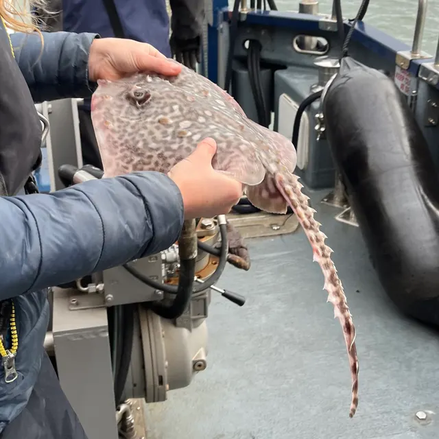 Thornback rayRegular local target4 placesNew Brighton and Perch Rock, Seaforth Rocks, Blackpool piers and the north wall, Rossall PointOver headland, pier, promenade, rock markAround May–Oct
- Starry smooth-houndRegular local target3 placesNew Brighton and Perch Rock, Blackpool piers and the north wall, Cleveleys and the Gynn wallOver beach, pier, promenadeAround May–Oct
Also documented from the shore: Conger eel · Pollack · Whiting · European plaice · Atlantic mackerel · Garfish · Turbot · Small-spotted catshark · Ballan wrasse · Common sole · Tub gurnard
What these strengths mean
- Regular local target
- Fishing sources describe this as a normal local target here, not merely as caught.
- Seasonal
- Well supported, and concentrated in part of the year rather than spread through it.
- Recorded here
- At least one credible public account of this species being caught here. That is all it means.
- How breadth is counted
- A fish documented at six marks is shown as six marks: breadth never raises the strength on its own. A fishery account describes the fishing; a recorded catch reports one specific catch. How evidence is weighed.
How people fish here
5 methods are recorded on the places documented here, counted from the records themselves rather than from what is practised in the country. Each opens a full guide to the technique.
Ledgering
Recorded at 14 places here, over pier, rock mark, headland, jetty.
Fishing a bait on the bottom held by a weight, with no float — the simplest way to fish at distance, in depth, or in wind.
Documented on the same ground: Atlantic cod, Conger eel, Dab, European flounder, European sea bass, Pollack.
Surfcasting
Recorded at 7 places here, over rock mark, beach, headland, pier.
Casting heavy baited tackle from a beach into surf — a method defined by distance, by tide, and by reading water that all looks the same.
Documented on the same ground: Dab, European flounder, European sea bass, Thornback ray, Atlantic cod, European plaice.
Float fishing
Recorded at 5 places here, over jetty, pier, headland.
Suspending a bait at a controlled depth beneath a buoyant indicator — the most visual, most controllable and most widely applicable method in angling.
Documented on the same ground: Atlantic cod, Conger eel, Dab, European flounder, European sea bass, Pollack.
Spinning
Recorded at 2 places here, over headland, pier.
Casting an artificial lure and retrieving it so that it moves like something alive — the most direct form of lure fishing.
Documented on the same ground: Conger eel, Pollack, Atlantic cod, Atlantic mackerel, Dab, European flounder.
Feathering and multi-lure traces
Recorded at 1 place here, over pier.
A string of small lures on droppers, worked in the water column — how most people in Britain and Ireland catch their first sea fish, and the method most likely to catch far more than anybody intended.
Documented on the same ground: Conger eel, Pollack, Atlantic cod, Atlantic mackerel, Dab, European flounder.
These are the methods documented at the places FishingHQ holds here. A species listed beside a method is documented on the same ground, which is not the same as being taken that way — where a source establishes the method a fish was caught on, it is stated on that place’s own page. All fishing methods.
The fishing year here
The months the records under this area actually name, tightest season first. This is “observed in these months” rather than a season: a species whose months nobody recorded is not listed, because a gap in the evidence is not a year-round fishery.
- Atlantic codNovember to February
- European sea bassJune to September
- Atlantic mackerelJune to September
- GarfishJune to September
- TurbotJune to September
- European plaiceMay to September
- WhitingOctober to March
- Thornback rayMay to October
- Starry smooth-houndMay to October
- DabJune to March
- European flounderMay to March
What dominates
Shore gathering, which is the defining practice here: cockling, mussel picking off the scars, razor clam gathering on the low-water sands and shrimping with a push net. Estuary and creek bass, flounder and mullet fishing on the flood. Beach and promenade fishing for flounder, codling, whiting and dab, weighted to autumn and winter. Small-boat fishing in the deeper channels and offshore, constrained by the drying ground. Traditional flounder treading, a local method of finding fish underfoot in shallow water on the flats. Kayak fishing is possible in the channels and off the more open shores but is complicated by the drying ground, the migrating channels and the speed of the flood.
The water available
Vast intertidal sand and mud flats; migrating river channels crossing them; areas of soft ground and quicksand; limestone scars and skears carrying mussel beds; extensive saltmarsh; dune systems; estuarine creeks; promenade, pier and dock frontage; and shallow turbid inshore water over an eastern Irish Sea that is soft-bottomed and productive.
How the rules are structured
Two regimes apply here and they are frequently confused. Sea fisheries measures — minimum sizes, national bass measures, and the byelaws of the Inshore Fisheries and Conservation Authority for the district — govern the finfish and much of the shellfish take. Separately, shellfish beds in this bay are managed intensively: cockle and mussel beds are opened and closed by the authority, permits are required for gathering in several places, quantity limits apply, and beds have been closed for years at a time on stock grounds. On top of both, food safety law classifies shellfish harvesting areas and imposes closures on biotoxin results, which are monitored through the year and can change within days. The bay also carries major conservation designations for its birds and habitats, which constrain vehicles, access and disturbance independently of any fishing rule. FishingHQ does not state what any current rule is, and that goes for classifications and bed status too; here, more than almost anywhere in Britain, they change.
Who to ask
- The relevant Inshore Fisheries and Conservation Authority for the district, which opens, closes and permits the cockle and mussel beds and makes the inshore byelaws.
- The Food Standards Agency and the local authority, for shellfish harvesting area classification and for biotoxin closures.
- The Marine Management Organisation, for national recreational sea fishing measures in English waters.
- Natural England and the site management bodies, where designation constrains vehicles, access or disturbance.
- The Queen's Guide to the Sands and the relevant local authority, for guided crossings of the bay.
- The Maritime and Coastguard Agency and the RNLI, whose hovercraft cover exists here specifically because of this ground.
Words you will meet
- Skear or scar
- A low limestone reef exposed at low water among the sand flats, generally carrying mussel, barnacle and weed. Skears are the hard ground in a soft bay: they hold the mussel beds, they concentrate fish on the flood, and they are the only real structure out there.
- Fluke
- The local name for flounder, and the root of 'fluke treading' — a traditional method of walking shallow water on the flats and locating fish underfoot before taking them by hand or spear. It is a practice of this coast specifically and it is subject to current rules like anything else.
- Jumbo
- A flat board rocked on the wet sand to liquefy it and bring cockles to the surface. It is the traditional cockling implement of this bay and its use has been restricted at times because of the damage it does to the bed.
- Quicksand
- Not folklore here. Saturated sand at particular places on these flats loses its bearing strength and a person sinks and is held. It is worst near channels and where fresh water rises through the sand, its position changes, and it is the reason local guidance is about a route rather than a direction.
Conditions and hazards
Morecambe Bay is the most lethal shore-gathering ground in Britain and the reasons are physical rather than a matter of bad luck. The flats are nearly flat, so a large tidal range translates into a flood that advances horizontally faster than a person walks, and it does not advance as a line: it runs up the channels first and then spreads, so the sea arrives behind and around before it arrives in front. The channels themselves migrate between years and even within a season, so a route that was safe last year may cross deep water now, and they carry a strong stream. There is genuine quicksand at places on these sands, worst near channels and where fresh water rises through, and its position moves. Fog forms over the flats and removes every landmark at once on ground with no features to begin with. Mud on the upper flats and in the creeks will hold a person's weight on the way out and not on the way back. In 2004 at least twenty-one people gathering cockles at night were caught by the flood and drowned, and the Coastguard's hovercraft capability on this coast exists because ordinary lifeboats cannot reach people on drying sand. The measures that address this are unusually specific: do not go out onto the sands without local knowledge of the current route, use the official guide for a crossing, never go at night, never go in fog or when fog is forecast, set a leaving time from the tide and keep it, carry a means of calling for help on the person, and tell somebody the route and the return time. This is one of the few places where the honest advice is that the correct default is not to go alone at all.
A flat plain and a big tide: why the water arrives behind you
The bay's danger is a matter of geometry and it is worth understanding rather than being warned about, because the understanding is what makes the warnings usable.
A LARGE RANGE ON A FLAT SURFACE MOVES HORIZONTALLY. Vertical tidal range here is among the larger ones in Britain. Spread that rise over a surface that falls only a few centimetres per hundred metres and the waterline travels a very long way for each centimetre it rises. The result is a flood that advances across the sand at a walking pace or faster — and a person cannot walk that fast over wet sand for the distance involved.
IT DOES NOT ARRIVE AS A LINE. The channels are lower than the flats. The flood runs up the channels first, filling them, and then spills sideways out of them onto the sand. So water appears in a channel a kilometre inland of where a person is standing before it appears between them and the shore, and the shortest route back is cut before the sea is visible in front.
THE CHANNELS MOVE. Several rivers cross these sands and their channels migrate between years and sometimes within a season. A route that was safe and shallow last summer may cross a deep, fast channel this one, and there is nothing on the surface to tell you until you are in it. This is why local guidance here is always about a specific route on a specific day rather than about a direction.
QUICKSAND IS REAL AND IT IS LOCATED. Saturated sand loses bearing strength where water is rising through it, which happens near channels and at freshwater seepages. A person who goes in is held, and being held on a flooding tide on this ground is the mechanism the bay is notorious for. Its position changes with the channels.
FOG REMOVES EVERYTHING AT ONCE. There are no landmarks out there in the best conditions. In fog there is no way to know which way the shore is, and the tide does not wait for it to clear.
AND THE 2004 DISASTER FOLLOWED ALL OF THIS EXACTLY. At least twenty-one cockle pickers, working at night, without local knowledge of the route, were caught by the flood. Every element of the mechanism above was involved. The bay has had an official guide to its crossings for centuries because that is what this ground requires.
Official guidance — why, and the sources (4)
Stated by a fisheries authority, scientific institute or recognised angling body. Authoritative, but summarising rather than demonstrating.
- RNLI water safety guidance: cold water shock and Float to Live — Royal National Lifeboat Institution (Water-safety or diver-training authority)Relied on for: Cold water shock and the immersion response, tidal cut-off, and water-safety guidance for shore anglers and small-craft users.States this directlyPassage read and verified
- Met Office shipping forecast, inshore waters forecast and marine warnings — Met Office, United Kingdom (Government fisheries body)Relied on for: That inshore waters forecasts, sea state and swell are the operative inputs for shore and small-craft decisions in these waters.States this directlyCitation checked — the work exists and is described correctly
- Cefas science, advice and data on marine and freshwater environments — Centre for Environment, Fisheries and Aquaculture Science (Government fisheries body)Relied on for: Marine environmental science for UK shelf seas, including the physical characterisation of sediment, coastal process and the monitoring programmes that describe them.States this directlyCitation checked — the work exists and is described correctly
- ICES Advice on fishing opportunities, catch and effort — International Council for the Exploration of the Sea (Scientific institute)Relied on for: Ecoregion description, stock distribution and the hydrography of the sea areas assessed.States this directlyCitation checked — the work exists and is described correctly
A gathering coast: cockles, mussels, shrimp, razors and flukes
Most of what is taken here is not caught on a rod, and the practices are old, regulated and genuinely regional.
COCKLES ARE THE BAY'S DEFINING RESOURCE. The beds are extensive, they are enormously productive in some years and effectively absent in others, and they have supported commercial and hand gathering for as long as there are records. They are also intensively managed: beds are opened and closed by the fisheries authority on stock grounds, permits are required in many places, quantity limits apply, and closures have run for years at a time. Nothing about the presence of cockles on a bed tells a gatherer whether that bed is open.
MUSSELS GROW ON THE SKEARS. The limestone reefs among the sand carry mussel beds, and these are managed in the same way and subject to the same classification system.
BROWN SHRIMP ARE A LOCAL SPECIALISM. Taken traditionally by push net worked on foot in shallow water over the sand, and historically by horse-drawn cart, they are the basis of potted shrimp — a regional dish with a genuine history rather than a marketing one. Shrimping on foot is exactly the activity that puts a person a long way out on a rising tide, which is why it needs the same discipline as cockling.
RAZOR CLAMS on the low-water sands, taken by the various methods used for them, are gathered here as elsewhere and are subject to the same classification and to specific restrictions on some methods.
FLUKE TREADING is the local finfish equivalent: walking shallow water on the flats, locating flounder underfoot in the sand and taking them by hand or spear. It is a genuine traditional practice of this coast, and like everything else here it is governed by current rules that a page cannot state.
THE SHELLFISH SAFETY LAYER IS SEPARATE FROM ALL OF IT. Shellfish filter what is in the water and concentrate it. Harvesting areas are classified and biotoxin monitoring runs through the year; when a result requires it, a bed closes, sometimes within days. Neither cooking nor the appearance, smell or taste of the shellfish removes a marine biotoxin. A gatherer's only real protection is the current classification and closure position, which comes from the Food Standards Agency and the local authority and never from a photograph, a memory or a page.
Official guidance — why, and the sources (4)
Stated by a fisheries authority, scientific institute or recognised angling body. Authoritative, but summarising rather than demonstrating.
- Shellfish classification — Food Standards Agency, 2026 (Government fisheries body)Relied on for: That shellfish harvesting areas are classified, that the classification governs what may be taken and how it must be treated, and that the classification is set and revised by the authority rather than fixed.States this directlyCitation checked — the work exists and is described correctly
- Biotoxin and phytoplankton monitoring — Food Standards Agency, 2026 (Government fisheries body)Relied on for: Marine biotoxin monitoring in shellfish harvesting areas and the closures that follow it.States this directlyPassage read and verified
- Fishers' Craft and Lettered Art: Tracts on Fishing from the End of the Middle Ages — University of Toronto Press, 1997 (Scientific literature)Relied on for: That fishing traditions develop around the water and fish available to them, and the historical method of reading such traditions.States this directlyCitation checked — the work exists and is described correctly
- General angling website restatements of established technique — Various (Credible secondary source)Relied on for: Widely restated descriptions of regional angling practice, recorded as practitioner consensus rather than as scholarship.Background and mechanism onlyCitation checked — the work exists and is described correctly
The rod fishery: an estuary rather than a coast
The finfish fishing here is genuinely good and it is estuary fishing, which means it runs on tide state rather than on ground.
BASS COME IN ON THE FLOOD AND THEY COME A LONG WAY. Warm shallow water over a huge productive intertidal area is exactly what a bass wants in summer, and they push up the channels and out over the flats with the tide, feeding on shrimp, crab and small fish as the water covers ground that was dry an hour before. The fishing is about being on a channel edge or a creek mouth as the water arrives, and it ends when the tide does.
FLOUNDER ARE THE CONSTANT. They are here in numbers, all year, over the whole bay, and they are the fish this coast is honestly best at. They follow the flood over the flats to feed and drop back with it.
THORNBACK RAY over the cleaner ground and in the deeper channels, mostly through the warmer months.
CODLING, WHITING AND DAB from the more open shores, the promenades and the pier marks through autumn and winter, on the same pattern as the rest of the Irish Sea: a fishery that follows rough weather and cooling water.
MULLET in the creeks and around freshwater outfalls in summer, in the numbers that estuaries of this kind always hold and with the difficulty they always present.
THE STRUCTURE IS THE SKEARS AND THE CHANNEL EDGES. On a bay with almost no hard ground, the limestone skears and the margins of the migrating channels are the only real features, and they are where fish concentrate on the flood. That also puts an angler on exactly the ground the safety section is about.
AND THE TURBIDITY IS AN ASSET. This is coloured water almost all the time, which suits bass and flounder and makes lure fishing a matter of vibration and profile rather than of clarity. It also means nobody in the water can see anything, which is worth remembering before wading.
What experienced anglers do — why, and the sources (4)
Widely and independently recommended by experienced anglers and specialist sources. This is real angling knowledge, not proof: controlled evidence for it is limited, and FishingHQ records it as convention rather than as a demonstrated effect.
- Fishers' Craft and Lettered Art: Tracts on Fishing from the End of the Middle Ages — University of Toronto Press, 1997 (Scientific literature)Relied on for: That fishing traditions develop around the water and fish available to them, and the historical method of reading such traditions.States this directlyCitation checked — the work exists and is described correctly
- General angling website restatements of established technique — Various (Credible secondary source)Relied on for: Widely restated descriptions of regional angling practice, recorded as practitioner consensus rather than as scholarship.Background and mechanism onlyCitation checked — the work exists and is described correctly
- JNCC species and habitat conservation advice — Joint Nature Conservation Committee (Conservation authority)Relied on for: Designation, habitat description and conservation status of the marine, coastal and freshwater habitats named.States this directlyCitation checked — the work exists and is described correctly
- The Fishes of the British Isles and North-West Europe — Macmillan, 1969 (Reference work)Relied on for: Distribution, habitat association and biology of the fishes of the British Isles named here.States this directlyCitation checked — the work exists and is described correctly
The ground is the hazard here, not the water
On most coasts the danger is the sea and the land is where you are safe. On a great intertidal sand flat that distinction does not hold, and misunderstanding it is what kills people here.
THE TIDE DOES NOT ARRIVE FROM IN FRONT OF YOU. Across a flat embayment of this scale the flood does not advance as a line up a beach; it fills the channels first and spreads outwards from them, so water appears between a person and the shore while the sand they are standing on is still dry. Somebody watching the sea for the tide to reach them is watching the wrong direction.
IT ARRIVES FASTER THAN IT LOOKS AND FASTER THAN A PERSON WALKS. A very small vertical rise translates across a near-level flat into a very large horizontal advance. The water is shallow, unremarkable and moving at a speed that cannot be outpaced across soft ground.
THE GROUND ITSELF CHANGES STATE. Saturated sand and mud that carried weight on the way out will not necessarily carry it on the way back, and channels migrate between tides, so the firm route used yesterday may not exist today. Being stuck is not an inconvenience on a flat with a rising tide; it is the whole mechanism.
AND THE CHANNELS ARE NOT WHERE THEY WERE. The main drainage channels shift, they are deeper and faster than the surrounding flat, and one that was ankle-deep on the way out can be an impassable moving river on the way back.
THIS IS WHY GUIDED CROSSINGS EXIST ON SANDS OF THIS KIND, and why local knowledge of a particular bay is not interchangeable with general competence on a beach. It is also why the standing advice is not to go out onto extensive flats without somebody who knows that ground and that tide.
THE CATCH CARRIES ITS OWN SEPARATE HAZARD. Bivalves filter the water they sit in and concentrate marine biotoxins and microbiological contamination out of it. Neither cooking nor appearance, smell or taste removes a biotoxin. Harvesting areas are classified and are opened and closed on monitoring results that a gatherer cannot see from the sand, and that classification is the operative fact rather than how clean the water looks. This is a food-safety hazard and it is entirely independent of whether the walk out was safe.
WHAT ACTUALLY HELPS is not going out onto flats without local knowledge of that specific ground, setting a leaving time from the tide rather than from the fishing or the gathering, telling somebody ashore the plan and the return time, carrying a means of calling for help on the person, and checking the current shellfish classification and any closures with the local authority before taking anything. The classification changes; FishingHQ does not state it.
Official guidance — why, and the sources (3)
Stated by a fisheries authority, scientific institute or recognised angling body. Authoritative, but summarising rather than demonstrating.
- RNLI water safety guidance: cold water shock and Float to Live — Royal National Lifeboat Institution (Water-safety or diver-training authority)Relied on for: Cold water shock and the immersion response, tidal cut-off, and water-safety guidance for shore anglers and small-craft users.States this directlyPassage read and verified
- Shellfish classification — Food Standards Agency, 2026 (Government fisheries body)Relied on for: That shellfish harvesting areas are classified, that the classification governs what may be taken and how it must be treated, and that it is set and revised by the authority on monitoring results rather than fixed.States this directlyCitation checked — the work exists and is described correctly
- Cefas science, advice and data on marine and freshwater environments — Centre for Environment, Fisheries and Aquaculture Science (Government fisheries body)Relied on for: Marine environmental science for UK shelf seas, including tidal range, coastal process, sediment characterisation and the monitoring programmes that describe them.States this directlyCitation checked — the work exists and is described correctly
Some of what lives here
Fish recorded here that FishingHQ holds a reviewed photograph of. It is not a complete list of what Morecambe Bay and the north-west England coast holds, and it is not a prediction that you will catch any of them — it is a way in to the ones we can show you.
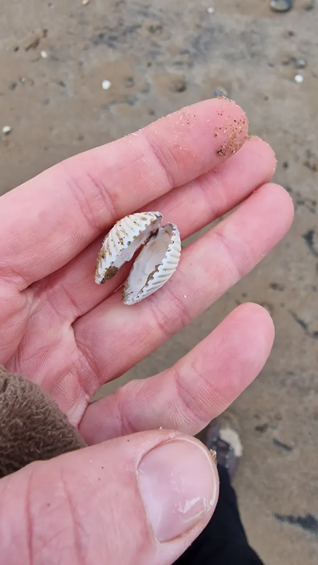 Common cockleA ribbed bivalve living just under the surface of intertidal sand and mud, gathered by rake and by foot, and the animal behind one of the most dangerous gathering fisheries there is.
bitsandbugs — CC0, via iNaturalist
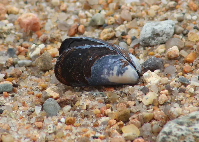 Blue musselThe commonest gathered shellfish on Atlantic European shores, attached to rock by threads it spins itself, and an animal whose safety is decided entirely by the water it grew in.
Steven Lamonde — CC BY, via iNaturalist
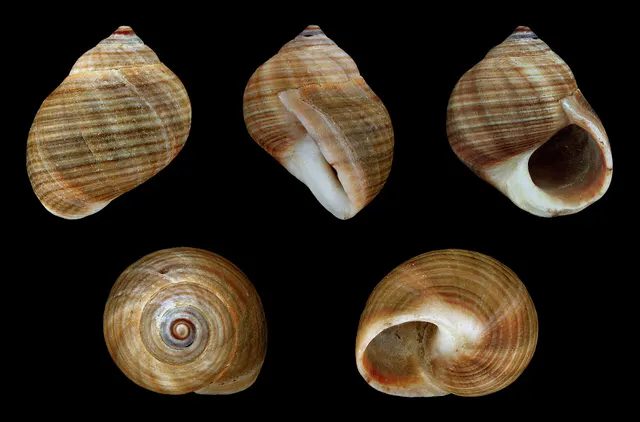 Common periwinkleThe small dark sea snail of rocky shores across the north Atlantic, gathered by hand for centuries, and a grazer rather than a filter feeder — which changes its safety profile substantially.
H. Zell — CC BY-SA 3.0, via Wikimedia Commons
- European flounderThe flatfish that runs up rivers — a tolerant, estuarine right-eyed flounder with bony tubercles along its fin bases and a habit of turning up in fresh water.
nbasargin — CC BY, via iNaturalist
- European sea bassA fast, predatory inshore fish that hunts in broken water and surf, and one of the most closely managed recreational species in European seas.
Julien Renoult — CC BY 4.0, via Wikimedia Commons
- Thornback rayThe commonest European ray, covered in thorn-like bucklers, laying horny egg cases known as mermaid's purses, and requiring careful handling on release.
Ella McCausland — CC BY, via iNaturalist
 WhitingA small, abundant, silver gadoid of European coasts, a mainstay of winter shore fishing and distinguished by a dark spot at the pectoral fin base.
rmjb — CC BY, via iNaturalist
- Atlantic codA large, heavily-built demersal predator of the North Atlantic, and the species whose commercial history is the standard example of stock collapse.
The U.S. Food and Drug Administration, Public domain, via Wikimedia Commons
Places within this area
Publicly documented fishing geography. FishingHQ describes what the ground is; it does not say whether you may fish it, and every one of these sends that question to the body that holds the answer. Browse every place in this part of the world.
Who to ask before fishing any of these
FishingHQ does not know the current access position here. Shore angling in England is not rod-licensed, but access rights, landowner permission, local authority and harbour byelaws, national and inshore fisheries measures, and site designations all apply and all change. Check the current position with the relevant inshore fisheries and conservation authority, the harbour or local authority, and the landowner before going. This water is tidal and transitional, so the freshwater regime may also apply above the tidal limit: FishingHQ does not know the current access position here. Freshwater rod fishing in England requires a current rod licence AND separate permission from whoever controls the fishing, which is frequently a club, riparian owner or navigation authority rather than a public body. Close seasons, byelaws and local rules apply and change. Check with the Environment Agency and with the controlling club or owner before going.
FishingHQ does not know the current access position here. Shore angling in England is not rod-licensed, but access rights, landowner permission, local authority and harbour byelaws, national and inshore fisheries measures, and site designations all apply and all change. Check the current position with the relevant inshore fisheries and conservation authority, the harbour or local authority, and the landowner before going.
New Brighton and Perch Rock
Promenade · Brackish water
A sandstone outcrop and fort at the north-east tip of the Wirral, where the Mersey meets Liverpool Bay, with a long engineered promenade and sea wall running west from it over clean sand and mud.
Open to Liverpool Bay from north through west. Wind over a strong Mersey stream is the sea state that matters; ocean swell is limited.
Particular to this ground: tides and being cut off, cold water shock, boat traffic and being seen.
Severe hazards of Morecambe Bay and the north-west England coast apply here: drowning and immersion.
Walney Island
Island · Salt water
A long, low barrier island of glacial drift, sand and shingle lying off Barrow-in-Furness, with open sand and shingle beaches on the Irish Sea side and the sheltered Walney Channel and its mudflats behind.
The western beaches take the full Irish Sea fetch from south-west through north-west; the channel behind is entirely sheltered.
Particular to this ground: tides and being cut off, cold water shock.
Severe hazards of Morecambe Bay and the north-west England coast apply here: drowning and immersion.
Particular to this water: This ground carries conservation designations that constrain access, vehicles, bait collection and disturbance independently of any fishing rule.
St Bees Head
Headland · Salt water
The only substantial sea cliff on the Cumbrian coast: red St Bees sandstone rising to a hundred metres, with boulder and rock scars beneath, a shingle cove at Fleswick between the two heads, and clean sand to the south.
Open west across the Irish Sea to the Isle of Man and beyond, taking the full fetch from south-west through north-west.
Particular to this ground: cliffs and rock platforms, tides and being cut off, cold water shock.
Severe hazards of Morecambe Bay and the north-west England coast apply here: drowning and immersion.
Particular to this water: This ground carries conservation designations that constrain access, vehicles, bait collection and disturbance independently of any fishing rule.
Seaforth Rocks
Rock mark · Brackish water
The rock revetment armouring the river wall north of Seaforth dock, standing over the deep dredged channel that container ships use. Big loose blocks to stand on and a hard bottom close in, which is the only structure on a river shore that is otherwise silt and sand.
Sheltered inside the estuary, open to whatever the wind does down the channel.
Particular to this ground: cold water shock.
Severe hazards of Morecambe Bay and the north-west England coast apply here: tides and being cut off, drowning and immersion.
Otterspool Promenade
Promenade · Brackish water
A built stone promenade on the Liverpool bank above a shore of mud and rubble, with the river's deep water a long way out and shallow ground under the wall. Reclaimed ground: the promenade is what makes it fishable at all.
Sheltered; the river's width is what the weather crosses.
Particular to this ground: cold water shock.
Severe hazards of Morecambe Bay and the north-west England coast apply here: tides and being cut off, drowning and immersion.
Priory Wharf, Birkenhead
Jetty · Brackish water
A wharf on the Wirral bank opposite the Liverpool waterfront, with a hard edge straight into deep water and the river running past it. Depth without a cast, which on the Mersey is rarer than it sounds.
Sheltered inside the river.
Particular to this ground: cold water shock.
Severe hazards of Morecambe Bay and the north-west England coast apply here: tides and being cut off, drowning and immersion.
Particular to this water: This is an owned and operated structure. Whether angling is allowed on it, when, from where and on what terms is the operator's decision, is frequently seasonal, and changes without notice.
Southport Pier
Pier · Salt water
The second-longest pier in England, running out over sand that dries for more than a mile at low water. The length is the whole point: it is the only way to reach water on a shore where the sea is usually not in sight.
Open west across the Ribble approaches; the sand takes the sea's energy long before the pier does.
Severe hazards of Morecambe Bay and the north-west England coast apply here: tides and being cut off, drowning and immersion.
Particular to this water: This is an owned and operated structure. Whether angling is allowed on it, when, from where and on what terms is the operator's decision, is frequently seasonal, and changes without notice. This pier has been closed to the public since December 2022, shut by the local authority on structural engineers' advice, and the authority states it will remain closed throughout the restoration works. Any reopening date is the authority's to announce and is not reported here.
Blackpool piers and the north wall
Pier · Salt water
Three piers along a flat sand foreshore, with the stepped concrete sea wall running north from the town towards Bispham. Uniform clean sand under all of it, and the wall itself giving hard standing where the beach gives none.
Fully open west into the Irish Sea, which is why the wall exists.
Particular to this ground: overhead power lines.
Severe hazards of Morecambe Bay and the north-west England coast apply here: tides and being cut off, drowning and immersion.
Particular to this water: The piers here are privately operated and angling on them is the operators' decision. Separately, the local authority operates a parking permit specifically for anglers covering a named stretch of the Promenade Lower Walk, under which fishing is allowed no sooner than three hours before high water and three hours after. Its terms, the stretch it covers and whether it is available at all are the authority's to state, not this record's.
6 more places in this area
Cleveleys and the Gynn wall
Beach · Salt water
The stepped sea defence and the sand below it between the Gynn and Cleveleys, with scattered stone and old defence rubble in the sand. The rubble is what makes this different from Blackpool a mile south: it holds crab, and the crab holds the fish that eat it.
Open west into the Irish Sea with no shelter.
Severe hazards of Morecambe Bay and the north-west England coast apply here: tides and being cut off, drowning and immersion.
Rossall Point
Headland · Salt water
The low point where the Fylde coast turns east into the Wyre, armoured with rock and concrete and with a scar of hard ground running off it. The corner puts the point into the tidal stream running into and out of Morecambe Bay, which is the reason it fishes.
Open west and north; the point takes weather from both.
Particular to this ground: tides and being cut off.
Severe hazards of Morecambe Bay and the north-west England coast apply here: drowning and immersion.
Morecambe Stone Jetty
Jetty · Salt water
The stub of the old harbour jetty projecting from Morecambe promenade into the bay, with stone sides and sand around it that dries for miles. The only hard structure reaching water on the east side of the bay.
Open west across Morecambe Bay.
Particular to this ground: tides and being cut off.
Severe hazards of Morecambe Bay and the north-west England coast apply here: drowning and immersion.
Throbshaw Rocks, Heysham
Rock mark · Salt water
A low limestone scar running off the Heysham headland below the harbour, uncovering into gullies and pools on the ebb. Hard ground on a bay whose floor is otherwise sand for twenty miles.
Open west and south-west across the bay.
Particular to this ground: cliffs and rock platforms, tides and being cut off.
Severe hazards of Morecambe Bay and the north-west England coast apply here: drowning and immersion.
Whitehaven north and west piers
Pier · Salt water
Two stone piers enclosing the old coal harbour under the sandstone cliffs, with deep water off the outer arms and the harbour basin behind. Structure standing in real depth, which is uncommon on this shore.
Open west into the Irish Sea; the piers exist to take it.
Severe hazards of Morecambe Bay and the north-west England coast apply here: tides and being cut off, drowning and immersion.
Particular to this water: This is an owned and operated structure. Whether angling is allowed on it, when, from where and on what terms is the operator's decision, is frequently seasonal, and changes without notice.
Workington Rocks
Rock mark · Salt water
Broken rock and scattered boulder north of the Derwent mouth, with patches of clean sand between the outcrops. The mixture is what gives it both the flatfish and the ground that eats leads.
Open west into the Solway approaches.
Particular to this ground: cliffs and rock platforms.
Severe hazards of Morecambe Bay and the north-west England coast apply here: tides and being cut off, drowning and immersion.
Safety
Contamination and toxins in the catch is set out at the top of this page, where it cannot be missed.
Tides and being cut off — Can cause serious injury or death
A very large tidal range spread over a nearly flat plain produces a flood that advances horizontally faster than a person can walk. It fills the channels first and spills sideways from them, so water appears behind and around a person before it appears in front, and the route back closes while the sea is still out of sight.
What reduces it: Do not go out onto the sands without current local knowledge of the route, and use the official guide for a crossing. Set a leaving time from the tide and keep it regardless of the fishing or the gathering. Tell somebody the route and the return time and carry a means of calling for help on the person. The correct default here is not to go alone.
Worse when:
- At night, when the channels filling behind cannot be seen — the mechanism of the 2004 disaster.
- In fog, which removes every reference on ground that has almost none to begin with.
- On spring tides, when the flood is faster and reaches further.
Drowning and immersion — Can cause serious injury or death
Saturated sand near channels and at freshwater seepages loses its bearing strength, and a person sinks into it and is held. Being held on this ground on a flooding tide is the mechanism the bay is notorious for. The locations change as the channels migrate.
What reduces it: Stay on known routes, keep away from channel edges and from places where water is visibly rising through the sand, do not go alone, and carry a means of calling for help on the person. If held, spread weight, do not struggle vertically, and call for help immediately rather than after trying to free yourself.
Worse when:
- Near migrating river channels, where the ground is most saturated.
- After heavy rain, when freshwater flow through the sand increases.
Check the rules before you fish
Fishing laws, bylaws, access rules, seasons, bait restrictions and permitted methods vary by location and can change. Check the current rules from the relevant authority and the water you intend to fish before fishing.
Check with:
- Current national or regional law for where you are fishing
- Current local bylaws
- The relevant fisheries authority
- The landowner, club or fishery whose water it is
- Any restrictions specific to the species or the method you intend to use
Where to go next
What swims here
- Atlantic codThe winter codling fishery from the open shores and structures of this coast, on the eastern Irish Sea pattern: following rough weather and cooling water rather than a date.
- Blue musselOn the limestone skears among the sand flats, which are the only hard ground in the bay and carry the mussel beds because of it. Bed status, permits and harvesting classification are set by the authority and change.
- Common cockleThe bay's cockle beds are among the largest in Britain and have supported gathering for as long as there are records. They are enormously variable between years, and whether any bed is open, permitted or closed is a matter for the fisheries authority and the current shellfish classification, never for a page.
- Common periwinkleOn the skears and the rockier margins of the bay and the coast either side, on hard surfaces among weed.
- European flounderThroughout the bay all year, following the flood out over the flats to feed and dropping back with it. Flounder are the fish this coast is honestly best at, and the local name for them — fluke — carries a traditional method of its own.
- European sea bassUp the channels and out over the warm shallow flats on the flood through the summer, working the shrimp and crab uncovered ground provides. The association is with the arriving tide rather than with a mark.
- Razor clamIn the clean low-water sands of the bay, where the very large tidal range exposes ground that would be subtidal almost anywhere else in England.
- Shore crabThroughout the intertidal, in the creeks, on the skears and across the flats. It is the principal food of most of what a rod catches here, which is why crab is the bait this coast runs on.
3 more
- Thick-lipped grey mullet Fish
- Thornback ray Fish
- Whiting Fish
How this compares
- The Solway FirthTwo great intertidal embayments of the north-west with very large ranges and fast floods. The Solway record leads on the range itself; Morecambe Bay leads on what is gathered off the flats and on the routes across them.
- The Wash and the Lincolnshire coastThe two great intertidal embayments of England, on opposite coasts, with near-identical hazards and quite different fisheries. Reading them against each other is the clearest way to understand what a drying sand flat does and does not offer.
Environment and conservation
Sources and evidence
- RNLI water safety guidance: cold water shock and Float to Live — Royal National Lifeboat Institution (Water-safety or diver-training authority)Relied on for: Cold water shock and the immersion response, tidal cut-off, and water-safety guidance for shore anglers and small-craft users.States this directlyPassage read and verified
- Met Office shipping forecast, inshore waters forecast and marine warnings — Met Office, United Kingdom (Government fisheries body)Relied on for: That inshore waters forecasts, sea state and swell are the operative inputs for shore and small-craft decisions in these waters.States this directlyCitation checked — the work exists and is described correctly
- Cefas science, advice and data on marine and freshwater environments — Centre for Environment, Fisheries and Aquaculture Science (Government fisheries body)Relied on for: Marine environmental science for UK shelf seas, including the physical characterisation of sediment, coastal process and the monitoring programmes that describe them.States this directlyCitation checked — the work exists and is described correctly
- ICES Advice on fishing opportunities, catch and effort — International Council for the Exploration of the Sea (Scientific institute)Relied on for: Ecoregion description, stock distribution and the hydrography of the sea areas assessed.States this directlyCitation checked — the work exists and is described correctly
- Shellfish classification — Food Standards Agency, 2026 (Government fisheries body)Relied on for: That shellfish harvesting areas are classified, that the classification governs what may be taken and how it must be treated, and that the classification is set and revised by the authority rather than fixed.States this directlyCitation checked — the work exists and is described correctly
- Biotoxin and phytoplankton monitoring — Food Standards Agency, 2026 (Government fisheries body)Relied on for: Marine biotoxin monitoring in shellfish harvesting areas and the closures that follow it.States this directlyPassage read and verified
Why the 15 connections on this page are here, and the sources
What swims here
Backed by research — 11 connections
Supported by peer-reviewed research or fisheries science. The sources are listed and can be checked.
Atlantic cod
A claim that a place contains the ground, water and seasonal conditions the species is associated with. It is a distributional statement about the world, it rests on the regional reference literature, and it deliberately asserts nothing about access, permission or catch.
- The Fishes of the British Isles and North-West Europe — Macmillan, 1969 (Reference work)Relied on for: Distribution and habitat association of the marine, estuarine and freshwater fishes of the British Isles, including which coasts and ground types a species occupies.States this directlyCitation checked — the work exists and is described correctly
- FishBase: a global information system on fishes — Froese, R. and D. Pauly, eds. — FishBase Consortium (Scientific institute)Relied on for: Recorded distribution, depth range and habitat association for the species named.States this directlyPassage read and verified
Blue mussel
A claim that a place contains the ground, water and seasonal conditions the species is associated with. It is a distributional statement about the world, it rests on the regional reference literature, and it deliberately asserts nothing about access, permission or catch.
- JNCC species and habitat conservation advice — Joint Nature Conservation Committee (Conservation authority)Relied on for: Habitat classification and description for the intertidal, coastal and freshwater habitats named, and the species characteristically associated with them.States this directlyCitation checked — the work exists and is described correctly
- Cefas science, advice and data on marine and freshwater environments — Centre for Environment, Fisheries and Aquaculture Science (Government fisheries body)Relied on for: Characterisation of UK inshore sediment, intertidal habitat and the shellfish beds associated with them.States this directlyCitation checked — the work exists and is described correctly
Common cockle
A claim that a place contains the ground, water and seasonal conditions the species is associated with. It is a distributional statement about the world, it rests on the regional reference literature, and it deliberately asserts nothing about access, permission or catch.
- JNCC species and habitat conservation advice — Joint Nature Conservation Committee (Conservation authority)Relied on for: Habitat classification and description for the intertidal, coastal and freshwater habitats named, and the species characteristically associated with them.States this directlyCitation checked — the work exists and is described correctly
- Cefas science, advice and data on marine and freshwater environments — Centre for Environment, Fisheries and Aquaculture Science (Government fisheries body)Relied on for: Characterisation of UK inshore sediment, intertidal habitat and the shellfish beds associated with them.States this directlyCitation checked — the work exists and is described correctly
Common periwinkle
A claim that a place contains the ground, water and seasonal conditions the species is associated with. It is a distributional statement about the world, it rests on the regional reference literature, and it deliberately asserts nothing about access, permission or catch.
- JNCC species and habitat conservation advice — Joint Nature Conservation Committee (Conservation authority)Relied on for: Habitat classification and description for the intertidal, coastal and freshwater habitats named, and the species characteristically associated with them.States this directlyCitation checked — the work exists and is described correctly
- Cefas science, advice and data on marine and freshwater environments — Centre for Environment, Fisheries and Aquaculture Science (Government fisheries body)Relied on for: Characterisation of UK inshore sediment, intertidal habitat and the shellfish beds associated with them.States this directlyCitation checked — the work exists and is described correctly
European flounder
A claim that a place contains the ground, water and seasonal conditions the species is associated with. It is a distributional statement about the world, it rests on the regional reference literature, and it deliberately asserts nothing about access, permission or catch.
- The Fishes of the British Isles and North-West Europe — Macmillan, 1969 (Reference work)Relied on for: Distribution and habitat association of the marine, estuarine and freshwater fishes of the British Isles, including which coasts and ground types a species occupies.States this directlyCitation checked — the work exists and is described correctly
- FishBase: a global information system on fishes — Froese, R. and D. Pauly, eds. — FishBase Consortium (Scientific institute)Relied on for: Recorded distribution, depth range and habitat association for the species named.States this directlyPassage read and verified
European sea bass
A claim that a place contains the ground, water and seasonal conditions the species is associated with. It is a distributional statement about the world, it rests on the regional reference literature, and it deliberately asserts nothing about access, permission or catch.
- The Fishes of the British Isles and North-West Europe — Macmillan, 1969 (Reference work)Relied on for: Distribution and habitat association of the marine, estuarine and freshwater fishes of the British Isles, including which coasts and ground types a species occupies.States this directlyCitation checked — the work exists and is described correctly
- FishBase: a global information system on fishes — Froese, R. and D. Pauly, eds. — FishBase Consortium (Scientific institute)Relied on for: Recorded distribution, depth range and habitat association for the species named.States this directlyPassage read and verified
Razor clam
A claim that a place contains the ground, water and seasonal conditions the species is associated with. It is a distributional statement about the world, it rests on the regional reference literature, and it deliberately asserts nothing about access, permission or catch.
- JNCC species and habitat conservation advice — Joint Nature Conservation Committee (Conservation authority)Relied on for: Habitat classification and description for the intertidal, coastal and freshwater habitats named, and the species characteristically associated with them.States this directlyCitation checked — the work exists and is described correctly
- Cefas science, advice and data on marine and freshwater environments — Centre for Environment, Fisheries and Aquaculture Science (Government fisheries body)Relied on for: Characterisation of UK inshore sediment, intertidal habitat and the shellfish beds associated with them.States this directlyCitation checked — the work exists and is described correctly
Shore crab
A claim that a place contains the ground, water and seasonal conditions the species is associated with. It is a distributional statement about the world, it rests on the regional reference literature, and it deliberately asserts nothing about access, permission or catch.
- JNCC species and habitat conservation advice — Joint Nature Conservation Committee (Conservation authority)Relied on for: Habitat classification and description for the intertidal, coastal and freshwater habitats named, and the species characteristically associated with them.States this directlyCitation checked — the work exists and is described correctly
- Cefas science, advice and data on marine and freshwater environments — Centre for Environment, Fisheries and Aquaculture Science (Government fisheries body)Relied on for: Characterisation of UK inshore sediment, intertidal habitat and the shellfish beds associated with them.States this directlyCitation checked — the work exists and is described correctly
Thick-lipped grey mullet
A claim that a place contains the ground, water and seasonal conditions the species is associated with. It is a distributional statement about the world, it rests on the regional reference literature, and it deliberately asserts nothing about access, permission or catch.
- The Fishes of the British Isles and North-West Europe — Macmillan, 1969 (Reference work)Relied on for: Distribution and habitat association of the marine, estuarine and freshwater fishes of the British Isles, including which coasts and ground types a species occupies.States this directlyCitation checked — the work exists and is described correctly
- FishBase: a global information system on fishes — Froese, R. and D. Pauly, eds. — FishBase Consortium (Scientific institute)Relied on for: Recorded distribution, depth range and habitat association for the species named.States this directlyPassage read and verified
Thornback ray
A claim that a place contains the ground, water and seasonal conditions the species is associated with. It is a distributional statement about the world, it rests on the regional reference literature, and it deliberately asserts nothing about access, permission or catch.
- The Fishes of the British Isles and North-West Europe — Macmillan, 1969 (Reference work)Relied on for: Distribution and habitat association of the marine, estuarine and freshwater fishes of the British Isles, including which coasts and ground types a species occupies.States this directlyCitation checked — the work exists and is described correctly
- FishBase: a global information system on fishes — Froese, R. and D. Pauly, eds. — FishBase Consortium (Scientific institute)Relied on for: Recorded distribution, depth range and habitat association for the species named.States this directlyPassage read and verified
Whiting
A claim that a place contains the ground, water and seasonal conditions the species is associated with. It is a distributional statement about the world, it rests on the regional reference literature, and it deliberately asserts nothing about access, permission or catch.
- The Fishes of the British Isles and North-West Europe — Macmillan, 1969 (Reference work)Relied on for: Distribution and habitat association of the marine, estuarine and freshwater fishes of the British Isles, including which coasts and ground types a species occupies.States this directlyCitation checked — the work exists and is described correctly
- FishBase: a global information system on fishes — Froese, R. and D. Pauly, eds. — FishBase Consortium (Scientific institute)Relied on for: Recorded distribution, depth range and habitat association for the species named.States this directlyPassage read and verified
How people fish here
What experienced anglers do — 1 connection
Widely and independently recommended by experienced anglers and specialist sources. This is real angling knowledge, not proof: controlled evidence for it is limited, and FishingHQ records it as convention rather than as a demonstrated effect.
Sea fishing
A claim about angling convention rather than about the world: that this place sits within this branch of fishing, which drives the information architecture as well as the page. It rests on independent practitioner description.
- General angling website restatements of established technique — Various (Credible secondary source)Relied on for: Widely restated descriptions of which practices are conventionally used in the waters named, recorded as practitioner consensus rather than as scholarship.Background and mechanism onlyCitation checked — the work exists and is described correctly
- Sea Angler — Bauer Media (Specialist angling publication)Relied on for: Long-running published description of British sea angling practice by region and by ground type.FishingHQ's interpretation of what it saysCitation checked — the work exists and is described correctly
How this compares
What experienced anglers do — 2 connections
Widely and independently recommended by experienced anglers and specialist sources. This is real angling knowledge, not proof: controlled evidence for it is limited, and FishingHQ records it as convention rather than as a demonstrated effect.
The Solway Firth
A claim that two places are worth reading against one another, because a reader choosing between them or generalising from one to the other needs to know how the underlying process differs.
- General angling website restatements of established technique — Various (Credible secondary source)Relied on for: Widely restated descriptions of which practices are conventionally used in the waters named, recorded as practitioner consensus rather than as scholarship.Background and mechanism onlyCitation checked — the work exists and is described correctly
- Sea Angler — Bauer Media (Specialist angling publication)Relied on for: Long-running published description of British sea angling practice by region and by ground type.FishingHQ's interpretation of what it saysCitation checked — the work exists and is described correctly
The Wash and the Lincolnshire coast
A claim that two places are worth reading against one another, because a reader choosing between them or generalising from one to the other needs to know how the underlying process differs.
- General angling website restatements of established technique — Various (Credible secondary source)Relied on for: Widely restated descriptions of which practices are conventionally used in the waters named, recorded as practitioner consensus rather than as scholarship.Background and mechanism onlyCitation checked — the work exists and is described correctly
- Sea Angler — Bauer Media (Specialist angling publication)Relied on for: Long-running published description of British and Irish sea angling practice by region and by ground type.FishingHQ's interpretation of what it saysCitation checked — the work exists and is described correctly
Environment and conservation
Backed by research — 1 connection
Supported by peer-reviewed research or fisheries science. The sources are listed and can be checked.
Fish stocks and sustainability
A claim that a place raises a particular environmental question, resting on the scientific and conservation literature for the system rather than on angling practice.
- JNCC species and habitat conservation advice — Joint Nature Conservation Committee (Conservation authority)Relied on for: Habitat classification and description for the intertidal, coastal and freshwater habitats named, and the species characteristically associated with them.States this directlyCitation checked — the work exists and is described correctly
- Cefas science, advice and data on marine and freshwater environments — Centre for Environment, Fisheries and Aquaculture Science (Government fisheries body)Relied on for: Characterisation of UK inshore sediment, intertidal habitat and the shellfish beds associated with them.States this directlyCitation checked — the work exists and is described correctly
How FishingHQ labels evidence is explained in the evidence policy.