Southport Pier
Pier · Salt water · in Morecambe Bay and the north-west England coast
The second-longest pier in England, running out over sand that dries for more than a mile at low water. The length is the whole point: it is the only way to reach water on a shore where the sea is usually not in sight.
Safety: tides and being cut off — can cause serious injury or death. One more point applies here.
FishingHQ describes what this place is, not whether you may fish it. Access, permits and who to ask.
What you can catch here
Documented at this place, grouped by how you would be fishing, with how strongly the sources support each one. This is what has been written down, not a forecast, and being listed is never permission to fish.
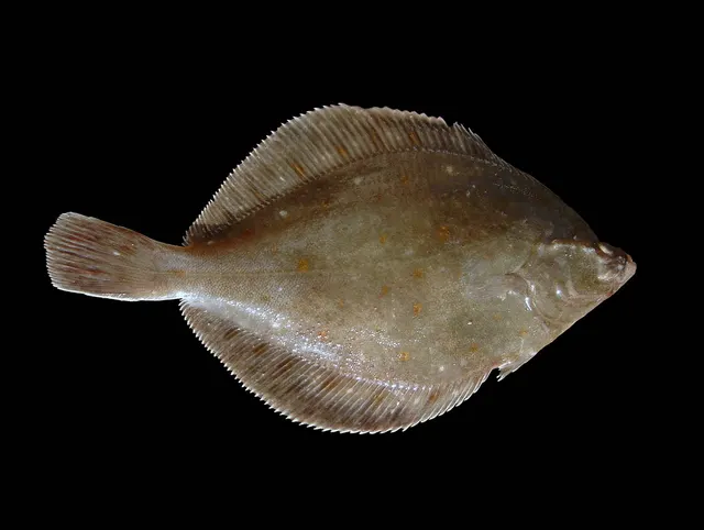
From the shore · 4


What these strengths mean
- Regular local target
- Fishing sources describe this as a normal local target here, not merely as caught.
- Seasonal
- Well supported, and concentrated in part of the year rather than spread through it.
- How breadth is counted
- A fish documented at six marks is shown as six marks: breadth never raises the strength on its own. A fishery account describes the fishing; a recorded catch reports one specific catch. How evidence is weighed.
Fish documented nearby, not here
Nothing below has been documented at Southport Pier itself. Each one has been documented at a named place on the same ground, and the places are listed with it. Treat this as what the water around here holds rather than as a catch list for this mark.
Widely documented on this ground
Documented at three or more neighbouring places, fished a way this place is also fished. That is a pattern about the ground rather than about any one mark, and it is the closest this site comes to saying you will probably meet a fish somewhere nothing has been written about.
From the shore
- Atlantic cod — documented at New Brighton and Perch Rock; Walney Island; Seaforth Rocks (+7 more)
- Thornback ray — documented at New Brighton and Perch Rock; Seaforth Rocks; Blackpool piers and the north wall (+1 more)
- Starry smooth-hound — documented at New Brighton and Perch Rock; Blackpool piers and the north wall; Cleveleys and the Gynn wall
- Whiting — documented at Seaforth Rocks; Otterspool Promenade; Priory Wharf, Birkenhead (+5 more)
- Small-spotted catshark — documented at Blackpool piers and the north wall; Cleveleys and the Gynn wall; Morecambe Stone Jetty
Also documented at neighbouring places
One or two accounts each, on the ground around here. Enough to know the fish is caught in these waters; not enough to say anything about this place.
From the shore
- Conger eel — documented at Morecambe Stone Jetty
- Common sole — documented at Blackpool piers and the north wall
- Tub gurnard — documented at Blackpool piers and the north wall
How people fish it
Practised here: Sea fishing.
Methods the sources name for this ground. Each one is explained in full on its own page.
- Ledgering
Fishing a bait on the bottom held by a weight, with no float — the simplest way to fish at distance, in depth, or in wind.
- Float fishing
Suspending a bait at a controlled depth beneath a buoyant indicator — the most visual, most controllable and most widely applicable method in angling.
The ground and the water
- The ground
- The second-longest pier in England, running out over sand that dries for more than a mile at low water. The length is the whole point: it is the only way to reach water on a shore where the sea is usually not in sight.
- Exposure
- Open west across the Ribble approaches; the sand takes the sea's energy long before the pier does.
- Tide and flow
- Fished at high tide, and only at high tide: for most of the cycle there is no water under the structure at all.
Getting there
What public sources describe, last checked 2026-08-24. Car parks fill, services change and a path existing is not a path anybody may use — none of this is a guarantee of availability and none of it is permission to be anywhere.
- Getting to it
- The pier is closed and has been since December 2022, shut by the council on structural engineers' advice after freezing weather accelerated decay in the decking and corrosion in the steelwork. The council has listed building consent and a funding case for major works, and states the pier remains closed while they are carried out.
Where this access information comes from
- Southport Pier — Sefton Council (Local authority, harbour or protected-area body)Relied on for: The council's own statement that the pier is closed, why it was closed, and that it remains closed through the works.States this directlyPassage read and verified
Through the year
Plaice and bass through the summer, flatfish through the year.
The months the sources attach to each species here. Where a species carries no season it is listed underneath rather than assumed to run through the year.
| Species | J | F | M | A | M | J | J | A | S | O | N | D |
|---|---|---|---|---|---|---|---|---|---|---|---|---|
| European plaice — seasonal, recorded in June, July, August, September. | ||||||||||||
| European sea bass — seasonal, recorded in June, July, August, September. |
Recorded here with no season stated: Dab, European flounder.
Safety
Tides and being cut off — Can cause serious injury or death
A very large tidal range spread over a nearly flat plain produces a flood that advances horizontally faster than a person can walk. It fills the channels first and spills sideways from them, so water appears behind and around a person before it appears in front, and the route back closes while the sea is still out of sight.
What reduces it: Do not go out onto the sands without current local knowledge of the route, and use the official guide for a crossing. Set a leaving time from the tide and keep it regardless of the fishing or the gathering. Tell somebody the route and the return time and carry a means of calling for help on the person. The correct default here is not to go alone.
Worse when:
- At night, when the channels filling behind cannot be seen — the mechanism of the 2004 disaster.
- In fog, which removes every reference on ground that has almost none to begin with.
- On spring tides, when the flood is faster and reaches further.
Drowning and immersion — Can cause serious injury or death
Saturated sand near channels and at freshwater seepages loses its bearing strength, and a person sinks into it and is held. Being held on this ground on a flooding tide is the mechanism the bay is notorious for. The locations change as the channels migrate.
What reduces it: Stay on known routes, keep away from channel edges and from places where water is visibly rising through the sand, do not go alone, and carry a means of calling for help on the person. If held, spread weight, do not struggle vertically, and call for help immediately rather than after trying to free yourself.
Worse when:
- Near migrating river channels, where the ground is most saturated.
- After heavy rain, when freshwater flow through the sand increases.
Rules and access
FishingHQ does not know the current access position here. Shore angling in England is not rod-licensed, but access rights, landowner permission, local authority and harbour byelaws, national and inshore fisheries measures, and site designations all apply and all change. Check the current position with the relevant inshore fisheries and conservation authority, the harbour or local authority, and the landowner before going.
Particular to this water: This is an owned and operated structure. Whether angling is allowed on it, when, from where and on what terms is the operator's decision, is frequently seasonal, and changes without notice. This pier has been closed to the public since December 2022, shut by the local authority on structural engineers' advice, and the authority states it will remain closed throughout the restoration works. Any reopening date is the authority's to announce and is not reported here.
Who holds the answer:
- The Inshore Fisheries and Conservation Authority for the district, which makes and enforces inshore byelaws.
- The Marine Management Organisation, for national recreational sea fishing measures in English waters.
- The local authority and, where one exists, the harbour authority, for access, byelaws and shellfish classification.
- The relevant Inshore Fisheries and Conservation Authority for the district, which opens, closes and permits the cockle and mussel beds and makes the inshore byelaws.
- The Food Standards Agency and the local authority, for shellfish harvesting area classification and for biotoxin closures.
- Natural England and the site management bodies, where designation constrains vehicles, access or disturbance.
- The Queen's Guide to the Sands and the relevant local authority, for guided crossings of the bay.
- The Maritime and Coastguard Agency and the RNLI, whose hovercraft cover exists here specifically because of this ground.
Nearby fishing
Other publicly documented places within about 40 km, by distance. Positions are approximate public geography and are never exact marks.
- Blackpool piers and the north wall — 10–25 km · Pier
- Seaforth Rocks — 10–25 km · Rock mark
- New Brighton and Perch Rock — 10–25 km · Promenade
- Cleveleys and the Gynn wall — 25–40 km · Beach
- Priory Wharf, Birkenhead — 25–40 km · Jetty
- Rossall Point — 25–40 km · Headland
- Otterspool Promenade — 25–40 km · Promenade
- Point of Ayr and Talacre — 25–40 km · Headland
Sources for this place
- Sea Angler — Bauer Media (Specialist angling publication)Relied on for: Long-running published description of British sea angling practice by region, ground type and named mark.FishingHQ's interpretation of what it saysCitation checked — the work exists and is described correctly
- General angling website restatements of established technique — Various (Credible secondary source)Relied on for: Widely restated public descriptions of which places are conventionally fished and how, recorded as practitioner consensus rather than as scholarship, and not relied on for access, permission or any current rule.Background and mechanism onlyCitation checked — the work exists and is described correctly
- British Sea Fishing: north-west England shore marks — British Sea Fishing (Credible secondary source)Relied on for: Which species are fished for at each named north-west England shore mark, in which season, and with which baits and methods.States this directlyPassage read and verified
- Southport Pier — Sefton Council (Local authority, harbour or protected-area body)Relied on for: That the pier has been closed to the public since December 2022 on structural engineers' advice, and that the local authority states it will remain closed throughout the restoration works.States this directlyPassage read and verified
How FishingHQ labels evidence is explained in the evidence policy. Last reviewed 2026-08-16.