The Wash and the Lincolnshire coast
Fishing regions · Last reviewed 2026-08-16
England's largest embayment: four rivers, an enormous drying sandflat, the country's biggest shellfishery and a nursery for a substantial share of the southern North Sea's flatfish.
Safety: tides and being cut off — can cause serious injury or death. 3 more points apply here.
Contamination and toxins in the catch — Can cause injury needing treatment
Bivalves filter the water they sit in and concentrate marine biotoxins and microbiological contamination. Neither cooking nor appearance, smell nor taste removes a biotoxin, and the beds here are extensive and easily reached.
What reduces it: Check the current shellfish harvesting area classification and any closures with the local authority before taking anything, and treat the classification rather than the appearance of the water as the operative fact.
Being listed here is not permission to fish. What that meansClose
Access, fishing rights, seasons, licences, local bylaws and permitted methods vary and can change. Check current access, permission, local regulations, closures and restrictions before you travel or fish. FishingHQ describes what the ground is and names who holds the answer; it does not hold the answer itself.
Find the authority for a jurisdiction · What FishingHQ does and does not cover
The Wash is a square bite out of the east coast of England where four rivers meet the North Sea across the flattest land in the country, and the Lincolnshire coast runs north from it as a long, low, defended sand shore. They belong in one record because they are one sediment system.
THE SCALE OF THE INTERTIDAL IS THE FIRST FACT. At low water the Wash uncovers one of the largest continuous areas of sand and mudflat in Britain, cut by deep channels — the Deeps — that carry the tide in and out. The proportion of this bay that is dry twice a day is what makes it what it is: an enormous, shallow, warm-in-summer, food-rich production system.
FOUR RIVERS FEED IT. The Witham, Welland, Nene and Great Ouse drain a very large and very flat catchment, most of it artificially managed, and they deliver both fresh water and a great deal of nutrient. That is why the Wash is productive and it is also why its nutrient status is a live environmental question.
IT IS ENGLAND'S BIGGEST SHELLFISHERY AND THAT IS NOT INCIDENTAL. Cockle and mussel beds here support a commercial fishery of real economic significance, managed with some of the most developed inshore shellfish regulation in the country, and the same beds are what feed the bird populations the bay is designated for. The tension between those two uses is the defining management question of the place, and it has been argued out publicly for decades.
AND IT IS A NURSERY OF NATIONAL IMPORTANCE. Shallow warm water over enormous food-rich flats is exactly what juvenile flatfish need, and the Wash is a significant nursery for plaice, sole and other species that are fished as adults across a much wider area. Common seals breed here in numbers.
THE LINCOLNSHIRE COAST NORTH OF IT is a different proposition: a long, gently shelving sand beach backed by dunes and by a great deal of sea defence, running up to the Humber. It fishes as a clean-ground surf coast — cod, whiting and dab in winter, bass, smoothhound and ray in summer — and it is one of the most accessible open-beach fisheries in England.
WHAT THE WHOLE SYSTEM HAS IN COMMON is softness. There is essentially no hard ground anywhere in it, the water is turbid, and everything about the fishing follows from a bed made of sediment that moves.
What fishing here is like
A very large, shallow, square embayment with one of the biggest continuous intertidal sand and mudflats in Britain, cut by deep tidal channels and fed by four rivers draining an artificially drained lowland catchment. Behind the flats lie saltmarsh, sea bank and reclaimed farmland at or below sea level. North of the bay the coast runs as a long, low, gently shelving sand beach with dunes and extensive sea defences. Tidal range is large, streams in the channels are strong, and water is turbid throughout. There is almost no hard ground anywhere in the system.
What you can target here
One entry per fish, grouped by how you would be fishing — because the answer is a different one from the rocks and from a boat. Each entry says how strongly the sources support it and how much evidence sits behind it. These are documented catches, not a forecast, and none of it is a statement that you may fish any particular ground.
From the shore · 13
 Atlantic codRegular local target5 places · 1 fishery account · 1 sourceCleethorpes, The Humber estuary, Mablethorpe, Chapel St Leonards and 1 moreOver beach, estuaryAround Jan–Mar, Oct–Dec
 European flounderRegular local target7 placesThe Humber estuary, Mablethorpe, Sutton on Sea, Chapel St Leonards and 3 moreOver beach, beach section, estuary, tidal channelAround Jan–Mar, May–Dec
- DabRegular local target2 placesSkegness, CleethorpesOver beachAround Jan–Feb, Nov–Dec
- Small-spotted catsharkRegular local target2 placesSutton on Sea, SkegnessOver beach
- Starry smooth-houndSeasonal4 places · 1 fishery account · 1 sourceChapel St Leonards, The Boston Deeps, Hunstanton, CleethorpesOver beach, beach section, tidal channelAround May–Sept
 WhitingSeasonal6 placesThe Humber estuary, Cleethorpes, Mablethorpe, Sutton on Sea and 2 moreOver beach, estuaryAround Jan–Mar, Oct–Dec
Also documented from the shore: European sea bass · Thick-lipped grey mullet · Brown trout · Pouting · Thornback ray · European eel · Turbot
What these strengths mean
- Regular local target
- Fishing sources describe this as a normal local target here, not merely as caught.
- Seasonal
- Well supported, and concentrated in part of the year rather than spread through it.
- Recorded here
- At least one credible public account of this species being caught here. That is all it means.
- How breadth is counted
- A fish documented at six marks is shown as six marks: breadth never raises the strength on its own. A fishery account describes the fishing; a recorded catch reports one specific catch. How evidence is weighed.
How people fish here
2 methods are recorded on the places documented here, counted from the records themselves rather than from what is practised in the country. Each opens a full guide to the technique.
Ledgering
Recorded at 8 places here, over beach, beach section, estuary, tidal channel.
Fishing a bait on the bottom held by a weight, with no float — the simplest way to fish at distance, in depth, or in wind.
Documented on the same ground: Atlantic cod, Dab, European flounder, Small-spotted catshark, Brown trout, European sea bass.
Kayak fishing
Recorded at 1 place here, over estuary.
A platform rather than a technique: quiet, shallow-draught access to water no other craft reaches, bought at the price of exposure, and a discipline where the decision not to launch is part of the skill.
Documented on the same ground: European flounder, Atlantic cod, Thick-lipped grey mullet, Whiting.
These are the methods documented at the places FishingHQ holds here. A species listed beside a method is documented on the same ground, which is not the same as being taken that way — where a source establishes the method a fish was caught on, it is stated on that place’s own page. All fishing methods.
The fishing year here
The months the records under this area actually name, tightest season first. This is “observed in these months” rather than a season: a species whose months nobody recorded is not listed, because a gap in the evidence is not a year-round fishery.
- Brown troutSeptember to September
- DabNovember to February
- PoutingNovember to February
- Thornback rayJune to September
- Starry smooth-houndMay to September
- WhitingOctober to March
- Atlantic codOctober to March
- European sea bassMay to October
- Thick-lipped grey mulletMay to October
- European flounderMay to March
What dominates
Open-beach shore fishing along the Lincolnshire coast, which is where most rod fishing here is done and which is weighted to autumn and winter. Estuary and channel fishing around the Wash margins for flounder, bass and eel. Small-boat fishing in the Deeps and the channels, constrained heavily by the drying ground. Bait digging on the intertidal flats, which is substantial. Commercial and permitted shellfish gathering for cockle and mussel, which is the bay's principal fishery by weight and value and is closely regulated. Bass and mullet fishing in the river mouths and creeks in the warmer months.
The water available
Enormous intertidal sand and mudflat; deep tidal channels between the flats; extensive cockle and mussel beds; saltmarsh and creek systems; four river mouths and their brackish transitions; long shallow-gradient sand beaches with dune and defence structures; and shallow, turbid, food-rich shelf water offshore with a mobile sand bed.
How the rules are structured
Recreational sea angling in England is not licensed as freshwater angling is, but this bay carries an unusually dense framework. National minimum sizes and species measures apply. Inshore byelaws are made by the Inshore Fisheries and Conservation Authority for the district, and the shellfisheries here are managed under some of the most developed inshore shellfish regulation in England, including permitting, bed opening and closing, and gear restrictions. The whole bay carries conservation designations for its intertidal habitat, its birds and its seals, and those designations constrain access, vehicles and collection independently of any fishing rule. Bait collection is separately regulated in places. Shellfish harvesting areas are classified for food safety, which is a different framework again. The rivers entering the bay fall under freshwater rod licensing above their tidal limits. FishingHQ does not state what any current rule is.
Who to ask
- The Eastern Inshore Fisheries and Conservation Authority, which makes and enforces inshore byelaws and manages the shellfisheries of this bay.
- The Marine Management Organisation, for national recreational sea fishing measures in English waters.
- The Environment Agency, for rod licensing on the rivers above their tidal limits and for migratory species.
- Natural England and the relevant site management bodies, where a coastal or marine designation affects access, vehicles or collection.
- The local authority and the Food Standards Agency framework, for shellfish harvesting area classification and closures.
- The harbour and port authorities on the four rivers, for navigation and access.
Words you will meet
- Deep
- One of the main tidal channels running across the drying flats of the Wash — the Boston Deeps and the others. The Deeps carry the tide, the boats and most of the fish, and they are the only water in large parts of the bay at low tide.
- Sand
- Used here for a named area of drying flat rather than for the material. The bay's sands carry names and are worked for shellfish and bait, and 'going out on the sand' describes a specific and hazardous activity rather than a walk on a beach.
- Bank
- On this coast the sea bank — the built earth flood embankment behind the marsh — rather than a sandbank offshore. Much of the bay is fished and walked from it, and the land behind it is below the level of the sea.
Conditions and hazards
This is a soft coast and its dangers are the soft-coast dangers at unusual scale. The intertidal in the Wash is so extensive and so level that the flood advances horizontally faster than a person walks, and it fills the channels and creeks first, so water appears behind somebody who is watching the sea in front of them. Channels shift between tides, so the firm route used last week may not exist. Soft ground that carried weight on the way out may not on the way back, and being stuck on a flat with a rising tide is the primary drowning mechanism here rather than a secondary one. Fog is frequent on this coast and the flats offer no landmarks at all, which removes the only navigation available. The Lincolnshire beaches shelve gently, which encourages wading further than intended into water that is cold enough for most of the year for cold water shock to decide an immersion, and much of the fishing is winter night fishing. Offshore, wind against tide over shallow ground raises a steep sea quickly. And the shellfish carry a food-safety hazard entirely independent of the walk: bivalves concentrate biotoxins and contamination, classification governs what may be taken, and neither cooking nor appearance removes a biotoxin.
Why a shallow muddy bay matters to fish caught two hundred miles away
The Wash looks like the least interesting piece of coast in England and it is one of the most consequential, and the reason is a life-stage argument rather than a fishing one.
JUVENILE FLATFISH NEED SHALLOW, WARM, FOOD-RICH, PREDATOR-POOR WATER. Very young plaice and sole are small, slow and entirely dependent on the bottom, so they need somewhere with a great deal of small invertebrate food, water shallow enough to warm quickly and grow them fast, and enough turbidity and enough tidal drying that the larger fish which would eat them cannot spend much time there. An enormous shallow intertidal embayment is a machine for producing exactly that.
SO THE FISH ARE NOT CAUGHT WHERE THEY ARE GROWN. A plaice on a boat trip in the southern North Sea, or a sole taken at night off a Lincolnshire beach, may well have spent its first year or two on flats in this bay. That is the sense in which the Wash matters to fisheries a long way from it, and it is why the protective framework over the bay is denser than its own rod fishery would ever justify.
THE SAME LOGIC EXPLAINS THE BIRDS AND THE SEALS. Enormous invertebrate production supports enormous wader and wildfowl populations, and a large common seal breeding population sits on top of the fish. The bay's conservation designations exist for those, and they constrain what happens on the ground regardless of what any fishing rule says.
AND THIS IS WHERE THE MANAGEMENT ARGUMENT LIVES. The cockle and mussel beds are the same resource in three different accounts: a commercial shellfishery of real economic value, the food supply for the designated bird populations, and the physical habitat that stabilises parts of the flats. Opening and closing beds, setting quotas and choosing gear are decisions that trade those three against each other, and they have been argued out publicly here for decades — including in court. It is one of the clearest available examples of fisheries management as an allocation problem rather than a biological one.
WHAT AN ANGLER SHOULD TAKE FROM IT is that a very high proportion of what they catch anywhere in or near this bay is a juvenile of something, that handling it well is the practical expression of everything above, and that the current minimum sizes are worth knowing before the session rather than after it.
Backed by research — why, and the sources (4)
Supported by peer-reviewed research or fisheries science. The sources are listed and can be checked.
- Cefas science, advice and data on marine and freshwater environments — Centre for Environment, Fisheries and Aquaculture Science (Government fisheries body)Relied on for: Marine environmental science for UK shelf seas, including sediment characterisation, estuarine process, shellfish bed distribution, tidal range and the monitoring programmes that describe them.States this directlyCitation checked — the work exists and is described correctly
- ICES Advice on fishing opportunities, catch and effort — International Council for the Exploration of the Sea (Scientific institute)Relied on for: Ecoregion description, stock distribution and the hydrography of the sea areas assessed.States this directlyCitation checked — the work exists and is described correctly
- JNCC species and habitat conservation advice — Joint Nature Conservation Committee (Conservation authority)Relied on for: Designation, habitat description and conservation status of the marine and coastal habitats named, and the species characteristically associated with them.States this directlyCitation checked — the work exists and is described correctly
- The Fishes of the British Isles and North-West Europe — Macmillan, 1969 (Reference work)Relied on for: Distribution, habitat association and biology of the fishes of the British Isles and north-west Europe named here.States this directlyCitation checked — the work exists and is described correctly
A coast with no hard ground, and how you fish one
There is essentially no rock in this entire system, and that single absence decides the tackle, the method, the bait and the timing of everything done here.
WITH NO STRUCTURE, THE FISH FOLLOW THE FOOD AND THE FOOD FOLLOWS THE WATER. On a rock coast a fish holds in a gully because the gully is always there. On a sand coast there is nothing permanent to hold to, so fish move with the tide over ground that is productive at some states and empty at others. That makes tide state the dominant variable and it makes a static rod a bet on a moving animal passing.
WHICH IS WHY THIS IS A BAIT COAST AND A DISTANCE COAST. Scent works in turbid water where sight does not. Local practice holds that fresh worm dug from the flats in front of you is worth more than anything bought, which is why bait digging here is a discipline in its own right rather than an errand. And on a gently shelving beach the productive water is frequently a long way out, so the casting is long and the leads are grip leads that hold in a running tide over sand.
THE FEATURES THAT DO EXIST ARE MADE OF WATER RATHER THAN ROCK. Gutters and runnels between the sandbars on the beach hold water on the ebb and concentrate food; the edges of the Deeps in the bay scour and concentrate; the mouths of the four rivers push fresh water and food out into the salt. Those are the structure, they are invisible at high water, and the way to learn them is to walk the beach at low tide rather than to look at it at high.
THE YEAR IS A COLD-WATER YEAR ON THE OPEN COAST. Cod, whiting and dab from autumn through winter, with the classic east-coast pattern of fishing best on a dropping sea after a blow rather than in flat calm. Spring brings the first of the ray and the bass. Summer is smoothhound over the clean ground on crab, bass along the whole coast and hard into the river mouths, and sole at night for the specialists. Autumn is generally the best of it, with warm water and moving weather at once.
AND THE BAY ITSELF RUNS A DIFFERENT CALENDAR from the beach. Flounder through the colder months in the channels and river mouths, bass and mullet in the creeks and marsh drains through the summer, and eel where its conservation status permits it to be considered at all.
What experienced anglers do — why, and the sources (4)
Widely and independently recommended by experienced anglers and specialist sources. This is real angling knowledge, not proof: controlled evidence for it is limited, and FishingHQ records it as convention rather than as a demonstrated effect.
- Sea Angler — Bauer Media (Specialist angling publication)Relied on for: Long-running published description of British sea angling practice by region and by ground type.FishingHQ's interpretation of what it saysCitation checked — the work exists and is described correctly
- General angling website restatements of established technique — Various (Credible secondary source)Relied on for: Widely restated descriptions of which practices are conventionally used in the waters named, recorded as practitioner consensus rather than as scholarship.Background and mechanism onlyCitation checked — the work exists and is described correctly
- JNCC species and habitat conservation advice — Joint Nature Conservation Committee (Conservation authority)Relied on for: Designation, habitat description and conservation status of the marine and coastal habitats named, and the species characteristically associated with them.States this directlyCitation checked — the work exists and is described correctly
- The Fishes of the British Isles and North-West Europe — Macmillan, 1969 (Reference work)Relied on for: Distribution, habitat association and biology of the fishes of the British Isles and north-west Europe named here.States this directlyCitation checked — the work exists and is described correctly
Flat land, high water and a coast that is held in place
The landscape behind this coast is the clearest expression in England of what happens when people decide the sea should stay where it is, and it changes the fishing in ways that are easy to miss.
MOST OF THE LAND BEHIND THIS BAY IS BELOW THE LEVEL OF THE SEA. The Fens were drained over centuries, they shrank as their peat dried and oxidised, and they now sit lower than the water in front of them. The sea bank is not a scenic feature; it is the thing keeping a large agricultural region from being an estuary, and behind it a pumped drainage network moves water uphill to get rid of it.
WHICH MEANS THE RIVERS ARE MACHINES. The Witham, Welland, Nene and Great Ouse enter the bay through sluices and controlled outfalls rather than through natural estuarine transitions, and the timing of freshwater release is a management decision as much as a hydrological event. That structures the brackish zone, it affects when migratory fish can move, and it is why fish passage at these outfalls is a live fisheries issue.
RECLAMATION IS STILL VISIBLE IN THE MAP. Successive sea banks lie inland of each other across the marsh, each marking where the coast was at a different date, and a considerable area of what is now farmland was intertidal within historical time. The bay is smaller than it was, and every hectare taken was nursery and shellfish ground.
THE MODERN DIRECTION HAS PARTLY REVERSED. Managed realignment — deliberately breaching a sea bank and letting an area return to saltmarsh — is practised on this coast, on the argument that marsh absorbs wave energy more cheaply than concrete and provides nursery habitat as a by-product. It is one of the few places where an angler can watch coastal policy create fishing habitat on purpose.
AND THE SHELLFISHING TRADITION IS OLDER THAN ANY OF IT. Cockle and mussel gathering here long predates the commercial fishery's modern regulation, it was for a long time a common-right activity, and the shift from that to a permitted, quota-managed fishery with opening and closing decisions is the whole modern history of the bay in one thread. It is also why the argument about who gets to take what is conducted here with more heat than almost anywhere else in English inshore fisheries.
What experienced anglers do — why, and the sources (3)
Widely and independently recommended by experienced anglers and specialist sources. This is real angling knowledge, not proof: controlled evidence for it is limited, and FishingHQ records it as convention rather than as a demonstrated effect.
- Fishers' Craft and Lettered Art: Tracts on Fishing from the End of the Middle Ages — University of Toronto Press, 1997 (Scientific literature)Relied on for: That fishing traditions develop around the water and fish available to them, and the historical method of reading such traditions.Background and mechanism onlyCitation checked — the work exists and is described correctly
- General angling website restatements of established technique — Various (Credible secondary source)Relied on for: Widely restated descriptions of regional angling practice, recorded as practitioner consensus rather than as scholarship.Background and mechanism onlyCitation checked — the work exists and is described correctly
- Environment Agency fisheries management, byelaws and rod licensing information — Environment Agency (Government fisheries body)Relied on for: Freshwater and transitional-water fisheries management in England, water quality recovery, licensing structure and the monitoring of rivers and estuaries.States this directlyCitation checked — the work exists and is described correctly
The flattest ground in England, and the tide that crosses it
The Wash is dangerous in a way that has almost nothing to do with waves, and everything to do with geometry.
A SMALL VERTICAL RISE ON A LEVEL SURFACE IS AN ENORMOUS HORIZONTAL ADVANCE. That is the whole of it. Across flats this large and this flat, the flood covers ground at a speed a person cannot match over soft going, and it does so as unremarkable shallow water rather than as anything that looks like a threat. Nobody is knocked over by this tide. They are simply not able to walk as fast as it fills.
AND IT DOES NOT COME FROM IN FRONT. The channels — the Deeps and the creeks that feed them — fill first, and the water spreads outward and backward from them. So the sea appears between a person and the shore while the sand they are standing on is still dry, and somebody watching the horizon for the tide is watching the wrong direction entirely.
THE GROUND CHANGES STATE AND THE CHANNELS MOVE. Saturated sand and mud that bore weight on the way out may not on the way back, and the channels migrate between tides, so a firm route that worked last week may not exist. Being stuck out there is not a delay; on a rising tide it is the mechanism.
FOG REMOVES THE ONLY NAVIGATION AVAILABLE. There are no landmarks on a flat. A person who can see the shore can walk to it; a person in fog on a featureless plain with water rising behind them has lost the ability to choose a direction at all, and fog is frequent on this coast.
WHICH IS WHY THE STANDING ADVICE IS NOT TO GO OUT ONTO EXTENSIVE FLATS WITHOUT SOMEBODY WHO KNOWS THAT SPECIFIC GROUND AND THAT TIDE. General competence on a beach is not the same capability, and this is one of the very few places on FishingHQ where the honest answer is that local knowledge is not optional.
THE OPEN BEACHES NORTH OF THE BAY carry the quieter version. A gentle gradient invites wading, the water is cold enough for most of the year that immersion produces the gasp response within seconds, the sea is turbid enough that a person in it can see nothing, and this fishery is done at night in winter. A gentle beach is not a safer beach; it is a beach that gets people further out before anything goes wrong.
AND THE SHELLFISH ARE A SEPARATE HAZARD ENTIRELY. Bivalves filter the water they sit in and concentrate marine biotoxins and microbiological contamination. Cooking does not remove a biotoxin and neither does smell or appearance. Harvesting areas are classified and are opened and closed on monitoring results a gatherer cannot see from the sand. Check the current classification and closures with the local authority before taking anything.
WEAR A BUOYANCY AID RATHER THAN CARRY ONE, set a leaving time from the tide rather than from the fishing, tell somebody the plan and the return, and carry the means of calling for help on your person.
Official guidance — why, and the sources (4)
Stated by a fisheries authority, scientific institute or recognised angling body. Authoritative, but summarising rather than demonstrating.
- RNLI water safety guidance: cold water shock and Float to Live — Royal National Lifeboat Institution (Water-safety or diver-training authority)Relied on for: Cold water shock and the immersion response, tidal cut-off, and water-safety guidance for shore anglers and small-craft users.States this directlyPassage read and verified
- Met Office shipping forecast, inshore waters forecast and marine warnings — Met Office, United Kingdom (Government fisheries body)Relied on for: That inshore waters forecasts, sea state and swell are the operative inputs for shore and small-craft decisions in these waters.States this directlyCitation checked — the work exists and is described correctly
- Shellfish classification — Food Standards Agency, 2026 (Government fisheries body)Relied on for: That shellfish harvesting areas are classified, that the classification governs what may be taken and how it must be treated, and that it is set and revised by the authority on monitoring results rather than fixed.States this directlyCitation checked — the work exists and is described correctly
- Biotoxin and phytoplankton monitoring — Food Standards Agency, 2026 (Government fisheries body)Relied on for: Marine biotoxin and phytoplankton monitoring in shellfish harvesting areas and the closures that follow it.States this directlyPassage read and verified
Some of what lives here
Fish recorded here that FishingHQ holds a reviewed photograph of. It is not a complete list of what The Wash and the Lincolnshire coast holds, and it is not a prediction that you will catch any of them — it is a way in to the ones we can show you.
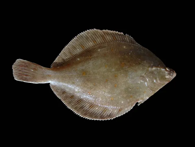 European plaiceA right-eyed flatfish with orange spots and a remarkable lifespan, and the representative flatfish for a body plan nothing else on FishingHQ shares.
Hans Hillewaert — CC BY-SA 4.0, via Wikimedia Commons
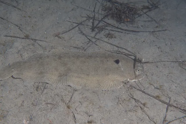 Common soleA nocturnal, sand-dwelling flatfish with a rounded head and a small twisted mouth, and one of the most valuable food fish in European waters.
Julien Renoult — CC BY, via iNaturalist
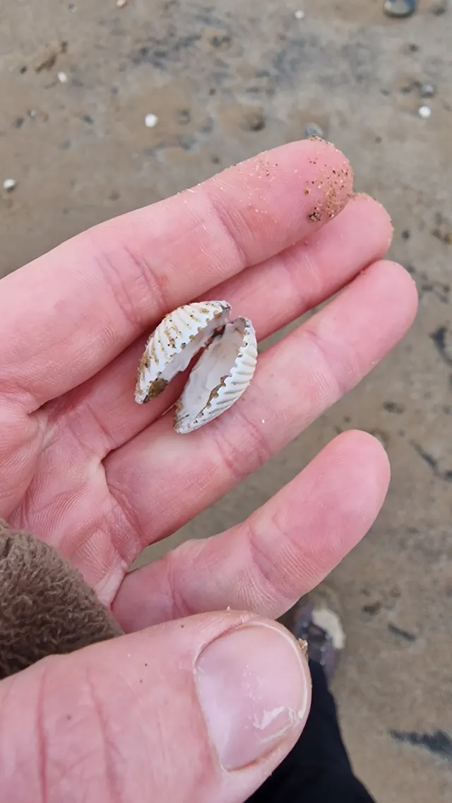 Common cockleA ribbed bivalve living just under the surface of intertidal sand and mud, gathered by rake and by foot, and the animal behind one of the most dangerous gathering fisheries there is.
bitsandbugs — CC0, via iNaturalist
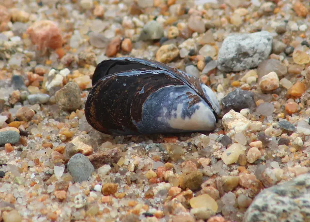 Blue musselThe commonest gathered shellfish on Atlantic European shores, attached to rock by threads it spins itself, and an animal whose safety is decided entirely by the water it grew in.
Steven Lamonde — CC BY, via iNaturalist
- European flounderThe flatfish that runs up rivers — a tolerant, estuarine right-eyed flounder with bony tubercles along its fin bases and a habit of turning up in fresh water.
nbasargin — CC BY, via iNaturalist
 European sea bassA fast, predatory inshore fish that hunts in broken water and surf, and one of the most closely managed recreational species in European seas.
Julien Renoult — CC BY 4.0, via Wikimedia Commons
- Atlantic codA large, heavily-built demersal predator of the North Atlantic, and the species whose commercial history is the standard example of stock collapse.
The U.S. Food and Drug Administration, Public domain, via Wikimedia Commons
Places within this area
Publicly documented fishing geography. FishingHQ describes what the ground is; it does not say whether you may fish it, and every one of these sends that question to the body that holds the answer. Browse every place in this part of the world.
Who to ask before fishing any of these
FishingHQ does not know the current access position here. Shore angling in England is not rod-licensed, but access rights, landowner permission, local authority and harbour byelaws, national and inshore fisheries measures, and site designations all apply and all change. Check the current position with the relevant inshore fisheries and conservation authority, the harbour or local authority, and the landowner before going. This water is tidal and transitional, so the freshwater regime may also apply above the tidal limit: FishingHQ does not know the current access position here. Freshwater rod fishing in England requires a current rod licence AND separate permission from whoever controls the fishing, which is frequently a club, riparian owner or navigation authority rather than a public body. Close seasons, byelaws and local rules apply and change. Check with the Environment Agency and with the controlling club or owner before going.
FishingHQ does not know the current access position here. Shore angling in England is not rod-licensed, but access rights, landowner permission, local authority and harbour byelaws, national and inshore fisheries measures, and site designations all apply and all change. Check the current position with the relevant inshore fisheries and conservation authority, the harbour or local authority, and the landowner before going.
The Humber estuary
Estuary · Brackish water
One of the largest and most turbid estuaries in Britain, draining a fifth of England through a deep central channel between vast mudflats, with a very large tidal range and a heavy commercial shipping load.
Severe hazards of The Wash and the Lincolnshire coast apply here: tides and being cut off, drowning and immersion, cold water shock.
Cleethorpes
Beach · Salt water
An enormous gently shelving sand and mud flat on the south bank of the Humber mouth, drying more than a kilometre at low water, with the deep Haile Sand channel offshore.
Severe hazards of The Wash and the Lincolnshire coast apply here: tides and being cut off, drowning and immersion, cold water shock.
Mablethorpe
Beach · Salt water
A long, low, defended sand coast where a continuous concrete sea wall and groyne field hold a wide flat beach in front of land that lies below high-water level.
Severe hazards of The Wash and the Lincolnshire coast apply here: tides and being cut off, drowning and immersion, cold water shock.
Sutton on Sea
Beach · Salt water
Flat clean sand with a groyne field and, unusually for this coast, exposed peat and forest beds uncovering at low water on the lowest tides.
Severe hazards of The Wash and the Lincolnshire coast apply here: tides and being cut off, drowning and immersion, cold water shock.
Chapel St Leonards
Beach · Salt water
Wide, very gently shelving clean sand backed by dune and defence, with the offshore banks of the Lincolnshire coast lying a few kilometres out and shaping the surf.
Severe hazards of The Wash and the Lincolnshire coast apply here: tides and being cut off, drowning and immersion, cold water shock.
Skegness
Beach · Salt water
A very wide, very shallow sand beach at the corner where the Lincolnshire coast turns into the Wash, with drying banks offshore and a pier standing over sand that dries beneath most of its length.
Severe hazards of The Wash and the Lincolnshire coast apply here: tides and being cut off, drowning and immersion, cold water shock.
The Boston Deeps
Tidal channel · Salt water
One of the deep tidal channels cutting across the drying sands of the Wash, carrying the tide in and out of the bay and holding the only water in this part of the embayment at low tide.
Severe hazards of The Wash and the Lincolnshire coast apply here: tides and being cut off, drowning and immersion, cold water shock.
Hunstanton
Beach section · Salt water
The only place in Britain where a striped cliff of red and white chalk over carstone stands directly above the beach, with a chalk and carstone scar running out beneath it and clean sand either side.
Severe hazards of The Wash and the Lincolnshire coast apply here: tides and being cut off, drowning and immersion, cold water shock.
Safety
Contamination and toxins in the catch is set out at the top of this page, where it cannot be missed.
Tides and being cut off — Can cause serious injury or death
Across an exceptionally large and level intertidal, a small vertical rise becomes an enormous horizontal advance. The flood fills the channels and creeks first and spreads outward from them, so water appears between a person and the shore while the sand they stand on is still dry.
What reduces it: Do not go out onto extensive flats without local knowledge of that specific ground and tide. Set a leaving time from the tide rather than from the fishing, and treat water appearing behind you as the signal to go immediately.
Worse when:
- On spring tides, when the advance is fastest and reaches furthest.
- In fog, which is frequent here and removes the only navigation a flat offers.
Drowning and immersion — Can cause serious injury or death
Saturated sand and mud that carried weight on the way out will not necessarily carry it on the way back, and the channels migrate between tides. Somebody stuck on a flat with a rising tide cannot free themselves.
What reduces it: Do not go alone, tell somebody the plan and the return time, carry a means of calling for help on the person, and wear a buoyancy aid rather than carrying one.
Cold water shock — Can cause serious injury or death
The North Sea here is cold for most of the year and the beach fishery is weighted to winter nights. Immersion produces an involuntary gasp and loss of breathing control within seconds, in turbid water where a person can see nothing and is hard to see.
What reduces it: Wear a buoyancy aid, do not fish alone at night, treat a gently shelving beach as no safer than a steep one for immersion, and carry the means of calling for help on the person.
Further safety reading
- Tides and being cut off — On the flattest intertidal in England, a small vertical rise becomes an enormous horizontal advance, the flood fills the channels first and spreads outward, and fog removes the only navigation a featureless flat offers.
Check the rules before you fish
Fishing laws, bylaws, access rules, seasons, bait restrictions and permitted methods vary by location and can change. Check the current rules from the relevant authority and the water you intend to fish before fishing.
Check with:
- Current national or regional law for where you are fishing
- Current local bylaws
- The relevant fisheries authority
- The landowner, club or fishery whose water it is
- Any restrictions specific to the species or the method you intend to use
Where to go next
What swims here
- Atlantic codThe autumn and winter inshore movement onto the open Lincolnshire beaches is the coast's traditional cold-weather fishery, at a fraction of its historical abundance.
- Blue musselExtensive mussel beds occur on the flats and support both the commercial fishery and the internationally important bird populations the bay is designated for — the same resource counted twice.
- Common cockleThe cockle beds of this bay are among the largest in England and support a commercial fishery of real economic significance, managed under some of the most developed inshore shellfish regulation in the country.
- Common soleAs with plaice, the bay is significant juvenile habitat, and adults are taken at night over clean sand along the Lincolnshire beaches through the warmer months.
- European flounderThroughout the bay's channels, creeks and four river mouths, and out onto the adjacent beaches. The turbid, food-rich estuarine ground is exactly the habitat.
- European plaiceThe bay's enormous shallow warm flats are a nursery of national importance for this species, so juveniles are abundant here and a substantial share of the adults caught across the southern North Sea grew up in it.
- European sea bassAlong the Lincolnshire coast and hard into the river mouths and creeks of the bay in the warmer months, using the shallow warm flats as feeding and nursery ground.
- Starry smooth-houndOver the clean sand and mixed ground off the Lincolnshire beaches in summer, feeding on crab.
How this compares
- Morecambe Bay and the north-west England coastThe two great intertidal embayments of England, on opposite coasts, with near-identical hazards and quite different fisheries. Reading them against each other is the clearest way to understand what a drying sand flat does and does not offer.
- The Wadden SeaThe two great North Sea intertidal nurseries, on opposite sides of the same sea, with identical mechanisms at different scales and quite different governance — one national with a single authority, one continuous across three countries with three.
Environment and conservation
Sources and evidence
- Cefas science, advice and data on marine and freshwater environments — Centre for Environment, Fisheries and Aquaculture Science (Government fisheries body)Relied on for: Marine environmental science for UK shelf seas, including sediment characterisation, estuarine process, shellfish bed distribution, tidal range and the monitoring programmes that describe them.States this directlyCitation checked — the work exists and is described correctly
- ICES Advice on fishing opportunities, catch and effort — International Council for the Exploration of the Sea (Scientific institute)Relied on for: Ecoregion description, stock distribution and the hydrography of the sea areas assessed.States this directlyCitation checked — the work exists and is described correctly
- JNCC species and habitat conservation advice — Joint Nature Conservation Committee (Conservation authority)Relied on for: Designation, habitat description and conservation status of the marine and coastal habitats named, and the species characteristically associated with them.States this directlyCitation checked — the work exists and is described correctly
- The Fishes of the British Isles and North-West Europe — Macmillan, 1969 (Reference work)Relied on for: Distribution, habitat association and biology of the fishes of the British Isles and north-west Europe named here.States this directlyCitation checked — the work exists and is described correctly
- RNLI water safety guidance: cold water shock and Float to Live — Royal National Lifeboat Institution (Water-safety or diver-training authority)Relied on for: Cold water shock and the immersion response, tidal cut-off, and water-safety guidance for shore anglers and small-craft users.States this directlyPassage read and verified
- Met Office shipping forecast, inshore waters forecast and marine warnings — Met Office, United Kingdom (Government fisheries body)Relied on for: That inshore waters forecasts, sea state and swell are the operative inputs for shore and small-craft decisions in these waters.States this directlyCitation checked — the work exists and is described correctly
Why the 14 connections on this page are here, and the sources
What swims here
Backed by research — 8 connections
Supported by peer-reviewed research or fisheries science. The sources are listed and can be checked.
Atlantic cod
A claim that a place contains the ground, water and seasonal conditions the species is associated with. It is a distributional statement about the world, it rests on the regional reference literature, and it deliberately asserts nothing about access, permission or catch.
- The Fishes of the British Isles and North-West Europe — Macmillan, 1969 (Reference work)Relied on for: Distribution and habitat association of the marine, estuarine and freshwater fishes of the British Isles, including which coasts, estuaries and ground types a species occupies.States this directlyCitation checked — the work exists and is described correctly
- FishBase: a global information system on fishes — Froese, R. and D. Pauly, eds. — FishBase Consortium (Scientific institute)Relied on for: Recorded distribution, depth range and habitat association for the species named.States this directlyPassage read and verified
Blue mussel
A claim that a place contains the ground, water and seasonal conditions the species is associated with. It is a distributional statement about the world, it rests on the regional reference literature, and it deliberately asserts nothing about access, permission or catch.
- JNCC species and habitat conservation advice — Joint Nature Conservation Committee (Conservation authority)Relied on for: Habitat classification and description for the intertidal, coastal, estuarine and freshwater habitats named, and the species characteristically associated with them.States this directlyCitation checked — the work exists and is described correctly
- Cefas science, advice and data on marine and freshwater environments — Centre for Environment, Fisheries and Aquaculture Science (Government fisheries body)Relied on for: Characterisation of UK inshore sediment, intertidal habitat, estuarine process and the shellfish beds associated with them.States this directlyCitation checked — the work exists and is described correctly
Common cockle
A claim that a place contains the ground, water and seasonal conditions the species is associated with. It is a distributional statement about the world, it rests on the regional reference literature, and it deliberately asserts nothing about access, permission or catch.
- JNCC species and habitat conservation advice — Joint Nature Conservation Committee (Conservation authority)Relied on for: Habitat classification and description for the intertidal, coastal, estuarine and freshwater habitats named, and the species characteristically associated with them.States this directlyCitation checked — the work exists and is described correctly
- Cefas science, advice and data on marine and freshwater environments — Centre for Environment, Fisheries and Aquaculture Science (Government fisheries body)Relied on for: Characterisation of UK inshore sediment, intertidal habitat, estuarine process and the shellfish beds associated with them.States this directlyCitation checked — the work exists and is described correctly
Common sole
A claim that a place contains the ground, water and seasonal conditions the species is associated with. It is a distributional statement about the world, it rests on the regional reference literature, and it deliberately asserts nothing about access, permission or catch.
- The Fishes of the British Isles and North-West Europe — Macmillan, 1969 (Reference work)Relied on for: Distribution and habitat association of the marine, estuarine and freshwater fishes of the British Isles, including which coasts, estuaries and ground types a species occupies.States this directlyCitation checked — the work exists and is described correctly
- FishBase: a global information system on fishes — Froese, R. and D. Pauly, eds. — FishBase Consortium (Scientific institute)Relied on for: Recorded distribution, depth range and habitat association for the species named.States this directlyPassage read and verified
European flounder
A claim that a place contains the ground, water and seasonal conditions the species is associated with. It is a distributional statement about the world, it rests on the regional reference literature, and it deliberately asserts nothing about access, permission or catch.
- The Fishes of the British Isles and North-West Europe — Macmillan, 1969 (Reference work)Relied on for: Distribution and habitat association of the marine, estuarine and freshwater fishes of the British Isles, including which coasts, estuaries and ground types a species occupies.States this directlyCitation checked — the work exists and is described correctly
- FishBase: a global information system on fishes — Froese, R. and D. Pauly, eds. — FishBase Consortium (Scientific institute)Relied on for: Recorded distribution, depth range and habitat association for the species named.States this directlyPassage read and verified
European plaice
A claim that a place contains the ground, water and seasonal conditions the species is associated with. It is a distributional statement about the world, it rests on the regional reference literature, and it deliberately asserts nothing about access, permission or catch.
- The Fishes of the British Isles and North-West Europe — Macmillan, 1969 (Reference work)Relied on for: Distribution and habitat association of the marine, estuarine and freshwater fishes of the British Isles, including which coasts, estuaries and ground types a species occupies.States this directlyCitation checked — the work exists and is described correctly
- FishBase: a global information system on fishes — Froese, R. and D. Pauly, eds. — FishBase Consortium (Scientific institute)Relied on for: Recorded distribution, depth range and habitat association for the species named.States this directlyPassage read and verified
European sea bass
A claim that a place contains the ground, water and seasonal conditions the species is associated with. It is a distributional statement about the world, it rests on the regional reference literature, and it deliberately asserts nothing about access, permission or catch.
- The Fishes of the British Isles and North-West Europe — Macmillan, 1969 (Reference work)Relied on for: Distribution and habitat association of the marine, estuarine and freshwater fishes of the British Isles, including which coasts, estuaries and ground types a species occupies.States this directlyCitation checked — the work exists and is described correctly
- FishBase: a global information system on fishes — Froese, R. and D. Pauly, eds. — FishBase Consortium (Scientific institute)Relied on for: Recorded distribution, depth range and habitat association for the species named.States this directlyPassage read and verified
Starry smooth-hound
A claim that a place contains the ground, water and seasonal conditions the species is associated with. It is a distributional statement about the world, it rests on the regional reference literature, and it deliberately asserts nothing about access, permission or catch.
- The Fishes of the British Isles and North-West Europe — Macmillan, 1969 (Reference work)Relied on for: Distribution and habitat association of the marine, estuarine and freshwater fishes of the British Isles, including which coasts, estuaries and ground types a species occupies.States this directlyCitation checked — the work exists and is described correctly
- FishBase: a global information system on fishes — Froese, R. and D. Pauly, eds. — FishBase Consortium (Scientific institute)Relied on for: Recorded distribution, depth range and habitat association for the species named.States this directlyPassage read and verified
How people fish here
What experienced anglers do — 2 connections
Widely and independently recommended by experienced anglers and specialist sources. This is real angling knowledge, not proof: controlled evidence for it is limited, and FishingHQ records it as convention rather than as a demonstrated effect.
Sea fishing
A claim about angling convention rather than about the world: that this place sits within this branch of fishing, which drives the information architecture as well as the page. It rests on independent practitioner description.
- General angling website restatements of established technique — Various (Credible secondary source)Relied on for: Widely restated descriptions of which practices are conventionally used in the waters named, recorded as practitioner consensus rather than as scholarship.Background and mechanism onlyCitation checked — the work exists and is described correctly
- Sea Angler — Bauer Media (Specialist angling publication)Relied on for: Long-running published description of British and Irish sea angling practice by region and by ground type.FishingHQ's interpretation of what it saysCitation checked — the work exists and is described correctly
Traps and pots
A claim about angling convention rather than about the world: that this place sits within this branch of fishing, which drives the information architecture as well as the page. It rests on independent practitioner description.
- General angling website restatements of established technique — Various (Credible secondary source)Relied on for: Widely restated descriptions of which practices are conventionally used in the waters named, recorded as practitioner consensus rather than as scholarship.Background and mechanism onlyCitation checked — the work exists and is described correctly
- Sea Angler — Bauer Media (Specialist angling publication)Relied on for: Long-running published description of British and Irish sea angling practice by region and by ground type.FishingHQ's interpretation of what it saysCitation checked — the work exists and is described correctly
How this compares
What experienced anglers do — 2 connections
Widely and independently recommended by experienced anglers and specialist sources. This is real angling knowledge, not proof: controlled evidence for it is limited, and FishingHQ records it as convention rather than as a demonstrated effect.
Morecambe Bay and the north-west England coast
A claim that two places are worth reading against one another, because a reader choosing between them or generalising from one to the other needs to know how the underlying process differs.
- General angling website restatements of established technique — Various (Credible secondary source)Relied on for: Widely restated descriptions of which practices are conventionally used in the waters named, recorded as practitioner consensus rather than as scholarship.Background and mechanism onlyCitation checked — the work exists and is described correctly
- Sea Angler — Bauer Media (Specialist angling publication)Relied on for: Long-running published description of British and Irish sea angling practice by region and by ground type.FishingHQ's interpretation of what it saysCitation checked — the work exists and is described correctly
The Wadden Sea
A claim that two places are worth reading against one another, because a reader choosing between them or generalising from one to the other needs to know how the underlying process differs.
- General angling website restatements of established technique — Various (Credible secondary source)Relied on for: Widely restated descriptions of which practices are conventionally used in the waters named, recorded as practitioner consensus rather than as scholarship.Background and mechanism onlyCitation checked — the work exists and is described correctly
- Sea Angler — Bauer Media (Specialist angling publication)Relied on for: Long-running published description of European sea angling practice by region and by ground type.FishingHQ's interpretation of what it saysCitation checked — the work exists and is described correctly
Safety reading
Official guidance — 1 connection
Stated by a fisheries authority, scientific institute or recognised angling body. Authoritative, but summarising rather than demonstrating.
Tides and being cut off
A claim that a place presents a particular hazard strongly enough that the reader should be sent to the page dealing with it in full, rather than left with the short warning on the place itself.
- RNLI water safety guidance: cold water shock and Float to Live — Royal National Lifeboat Institution (Water-safety or diver-training authority)Relied on for: Cold water shock and the immersion response, tidal cut-off, and water-safety guidance for shore anglers and small-craft users.States this directlyPassage read and verified
Environment and conservation
Backed by research — 1 connection
Supported by peer-reviewed research or fisheries science. The sources are listed and can be checked.
Fish stocks and sustainability
A claim that a place raises a particular environmental question, resting on the scientific and conservation literature for the system rather than on angling practice.
- JNCC species and habitat conservation advice — Joint Nature Conservation Committee (Conservation authority)Relied on for: Habitat classification and description for the intertidal, coastal, estuarine and freshwater habitats named, and the species characteristically associated with them.States this directlyCitation checked — the work exists and is described correctly
- Cefas science, advice and data on marine and freshwater environments — Centre for Environment, Fisheries and Aquaculture Science (Government fisheries body)Relied on for: Characterisation of UK inshore sediment, intertidal habitat, estuarine process and the shellfish beds associated with them.States this directlyCitation checked — the work exists and is described correctly
How FishingHQ labels evidence is explained in the evidence policy.