The Azores
Fishing regions · Last reviewed 2026-08-24
Nine islands strung across five hundred kilometres of the Mid-Atlantic Ridge, where the fishing geography that matters is not the coast but the seamounts rising between them from abyssal depth.
Safety: boat safety — can cause serious injury or death. 5 more points apply here.
Fishing here at a glance
- Ways to fish
- From the shore · From a boat · On a charter · Spearfishing
- Plan a trip
- When is best · Baits and lures to bring · Open the trip planner
- Rules and access
- Who sets the rules here — being listed is never permission to fish.
Being listed here is not permission to fish. What that meansClose
Access, fishing rights, seasons, licences, local bylaws and permitted methods vary and can change. Check current access, permission, local regulations, closures and restrictions before you travel or fish. FishingHQ describes what the ground is and names who holds the answer; it does not hold the answer itself.
Find the authority for a jurisdiction · What FishingHQ does and does not cover
The Azores are nine inhabited volcanic islands sitting on and around the Mid-Atlantic Ridge, fifteen hundred kilometres from Portugal and spread across five hundred kilometres of open ocean in three widely separated groups. They are the most isolated fishing geography FishingHQ holds in the North Atlantic, and the thing that defines them is under the water rather than on it.
THE SEAMOUNTS ARE THE FISHERY. Condor, the Formigas, Princesa Alice, D. João de Castro and a long list of others rise from thousands of metres of abyssal depth to within a few tens of metres of the surface. A seamount in open ocean does something no island coast does: it forces deep, nutrient-rich water upwards, and the resulting concentration of life is dense, localised and predictable enough to fish. Amberjack, grouper, snapper, wahoo, tuna and billfish all associate with them, and the demersal fishery of the archipelago is largely a seamount fishery.
THE PASSAGES CONCENTRATE PELAGICS. Between Faial, Pico and São Jorge — the triangle — deep water runs through relatively narrow channels between steep island flanks, and the bonito and tuna fishing there is a function of that geometry rather than of the islands themselves.
THE COAST IS STEEP, YOUNG AND ROCK. There is almost no shelf and almost no sand. Shore fishing is from lava platform and harbour wall, and it is a real if minor part of the archipelago's angling: the sea's own scale, the swell exposure and the distances between islands push the fishery towards boats.
FRESH WATER IS CRATER LAKES. Several of the islands hold volcanic caldera lakes, some stocked, several inside protected landscapes, and they are administered regionally and separately from anything to do with the sea.
The archipelago also carries an unusually dense network of marine protected areas and seamount closures. Their boundaries are lines on a chart and are not visible from a boat, which makes knowing where you are a regulatory matter here in a way it is not on a coast.
What fishing here is like
An oceanic archipelago whose fishing is organised around underwater topography rather than coastline. Boat fishing dominates — jigging and bottom fishing over seamounts and coastal reefs, popping and trolling for pelagics in the passages and over the banks, and a substantial big-game sector on blue marlin and tuna. Shore fishing from lava rock and harbour walls exists and is a minor share of it.
The culture is Portuguese and deep-ocean, shaped by centuries of whaling and long-line fishing rather than by recreational angling, and the boats and the skippers reflect that.
What you can target here
One entry per fish, grouped by how you would be fishing — because the answer is a different one from the rocks and from a boat. Each entry says how strongly the sources support it and how much evidence sits behind it. These are documented catches, not a forecast, and none of it is a statement that you may fish any particular ground.
From the shore · 24
- White seabreamRepeatedly reported3 placesThe São Miguel coast, Vila Franca do Campo, São Miguel, The Santa Maria coastOver cliff coast, harbour wallAround Mar
- Ornate wrasseRecorded here3 placesPonta Delgada harbour, São Miguel, Vila Franca do Campo, São Miguel, Ponta da Costa, São MiguelOver harbour wall, rock markAround Mar
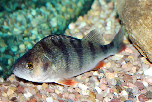 European perchRecorded here2 placesLagoa das Sete Cidades, São Miguel, Lagoa de São Brás, São MiguelOver lakeAround Mar
- Rainbow wrasseRecorded here2 placesVila Franca do Campo, São Miguel, Ponta da Costa, São MiguelOver harbour wall, rock markAround Mar
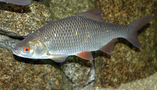 RoachRecorded here2 placesLagoa das Sete Cidades, São Miguel, Lagoa de São Brás, São MiguelOver lakeAround Mar
 Ballan wrasseRecorded here1 placeVila Franca do Campo, São MiguelOver harbour wallAround Mar
Also documented from the shore: Black-faced blenny · Blacktail comber · Blue jack mackerel · Bogue · Canary damselfish · Derbio · Greater forkbeard · Guinean puffer · Largemouth bass · Lesser weever · Mediterranean parrotfish · Montagu's blenny · Northern pike · Rockpool blenny · Salema porgy · Striped red mullet · Thick-lipped grey mullet · Two-banded seabream
From a boat · 9
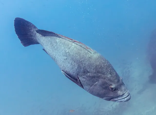 Dusky grouperRegular local target5 placesThe São Miguel coast, The Terceira coastal reefs, The Condor bank, The Formigas and the Dollabarat bank and 1 moreOver cliff coast, offshore bank, reefAround Jun–Sept
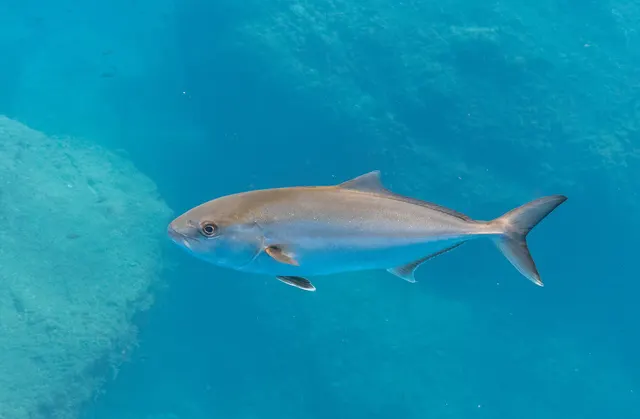 Greater amberjackRegular local target3 placesThe São Miguel coast, The Terceira coastal reefs, The Condor bankOver cliff coast, offshore bank, reefAround Jun–Sept
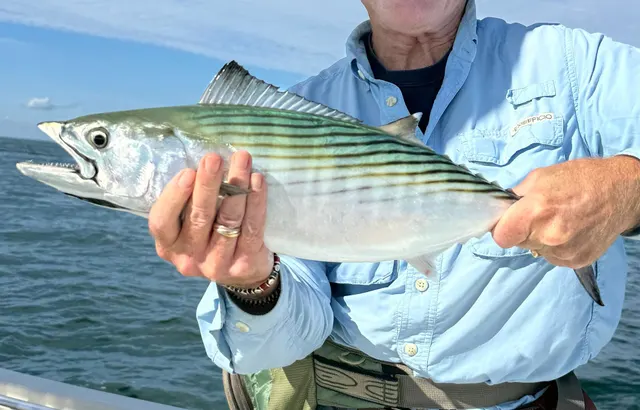 Atlantic bonitoRegular local target1 placeThe Faial–Pico channelOver sound or straitAround Jun–Sept
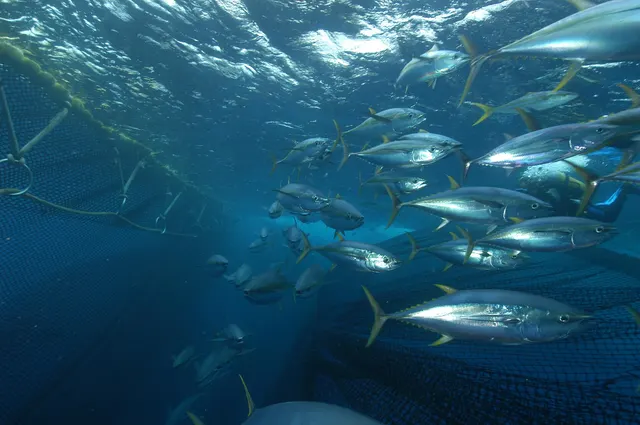 Yellowfin tunaRepeatedly reported3 placesThe Faial–Pico channel, The Santa Maria coast, The Condor bankOver cliff coast, offshore bank, sound or straitAround Jun–Sept
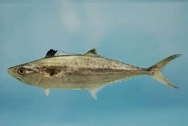 King mackerelRepeatedly reported1 placeThe Formigas and the Dollabarat bankOver offshore bankAround Jun–Sept
- White seabreamRepeatedly reported1 placeThe São Miguel coastOver cliff coast
Also documented from a boat: Bluefish · Great barracuda · Mahi-mahi
What these strengths mean
- Regular local target
- Fishing sources describe this as a normal local target here, not merely as caught.
- Repeatedly reported
- Several independent public accounts. Enough to say it happens more than once; not enough to call it a fishery.
- Recorded here
- At least one credible public account of this species being caught here. That is all it means.
- How breadth is counted
- A fish documented at six marks is shown as six marks: breadth never raises the strength on its own. A fishery account describes the fishing; a recorded catch reports one specific catch. How evidence is weighed.
Also caught across this area
Fish documented across this area but not at any of the named places above — from area-wide fishing sources and dated catch accounts that do not name a single spot.
Caught in this area
Documented being caught in this area, without being described as something people set out for.
- Atlantic blue marlin — from a boat and on a charter · June to October · Out of Horta, Faial (1 July to 31 October) and Ponta Delgada, São Miguel (1 June to 31 July)
- Wahoo — from a boat and on a charter · June to October · Out of Horta and Ponta Delgada
Where this comes from
- Atlantic blue marlin — caught in this area. One source describes it as a target here; a second independent account is needed to call it a regular one.
- Operator-published information for the Macaronesian services, read on 29 August 2026 — The named operators themselves — charter businesses in Madeira, the Azores, Tenerife and Gran Canaria, and a Tenerife tackle shop, each read on its own website
- Wahoo — caught in this area. One source describes it as a target here; a second independent account is needed to call it a regular one.
- Operator-published information for the Macaronesian services, read on 29 August 2026 — The named operators themselves — charter businesses in Madeira, the Azores, Tenerife and Gran Canaria, and a Tenerife tackle shop, each read on its own website
None of this says you may fish anywhere or take anything: licences, protected species, minimum sizes and closed areas are set by the local authority. How evidence is weighed.
How people fish here
9 methods are recorded on the places documented here, counted from those places themselves rather than from what is practised in the country. Each opens a full guide to the technique.
Float fishing
Recorded at 9 places here, over harbour wall, lake, rock mark, rock platform.
Suspending a bait at a controlled depth beneath a buoyant indicator — the most visual, most controllable and most widely applicable method in angling.
Documented on the same ground: Ballan wrasse, Black-faced blenny, Blacktail comber, Blue jack mackerel, Canary damselfish, Derbio.
Light rock fishing
Recorded at 9 places here, over harbour wall, rock mark, beach, rock platform.
Ultralight lure fishing from the shore with tackle rated in single grams — a discipline that catches the fish everybody else steps over, and one FishingHQ held every component of and had never named.
Documented on the same ground: Ballan wrasse, Black-faced blenny, Blacktail comber, Blue jack mackerel, Bogue, Canary damselfish.
Jigging
Recorded at 6 places here, over cliff coast, offshore bank, reef.
Working a weighted lure with a rising-and-falling motion, usually vertically, so it behaves like a wounded or fleeing baitfish.
Documented on the same ground: Dusky grouper, Greater amberjack, King mackerel, White seabream, Yellowfin tuna, Bluefish.
Trolling
Recorded at 5 places here, over offshore bank, cliff coast, reef, sound or strait.
Towing lures or baits behind a moving boat to cover large volumes of water and locate scattered fish.
Documented on the same ground: Atlantic bonito, Greater amberjack, Dusky grouper, King mackerel, Yellowfin tuna, Mahi-mahi.
Deep-drop fishing
Recorded at 4 places here, over offshore bank, cliff coast, reef.
Fishing baits several hundred metres down with heavy weights and, usually, an electric reel — a method defined entirely by what depth does to everything else.
Documented on the same ground: Greater amberjack, Dusky grouper, King mackerel, Yellowfin tuna.
Spinning
Recorded at 4 places here, over cliff coast, lake, sound or strait.
Casting an artificial lure and retrieving it so that it moves like something alive — the most direct form of lure fishing.
Documented on the same ground: Atlantic bonito, Dusky grouper, Greater amberjack, White seabream, Yellowfin tuna, Bluefish.
Drop shotting
Recorded at 3 places here, over harbour wall, rock mark.
A finesse rig with the weight below the hook, letting a small soft plastic be worked in place, off the bottom, without moving anywhere.
Documented on the same ground: Ballan wrasse, Black-faced blenny, Blacktail comber, Blue jack mackerel, Bogue, Canary damselfish.
Feathering and multi-lure traces
Recorded at 1 place here, over harbour wall.
A string of small lures on droppers, worked in the water column — how most people in Britain and Ireland catch their first sea fish, and the method most likely to catch far more than anybody intended.
Surfcasting
Recorded at 1 place here, over beach.
Casting heavy baited tackle from a beach into surf — a method defined by distance, by tide, and by reading water that all looks the same.
Documented on the same ground: Lesser weever.
These are the methods documented at the places FishingHQ holds here. A species listed beside a method is documented on the same ground, which is not the same as being taken that way — where a source establishes the method a fish was caught on, it is stated on that place’s own page. All fishing methods.
Baits and lures for these fish
The methods, baits and lures each of the fish above is commonly taken on, from that fish’s own page. This is what works for the fish, not a report of what people use on this particular water — local knowledge and the conditions on the day still decide.
Methods
- Ledgering — for White seabream, Ballan wrasse, Blacktail comber, Greater forkbeard and 3 more
- Reef spearfishing — for Dusky grouper, Greater amberjack, Atlantic bonito, White seabream and 1 more
- Saltwater fly fishing — for Bluefish, Mahi-mahi, Thick-lipped grey mullet
- Big-game fishing — for Atlantic blue marlin, Wahoo
- Float-tube fishing — for Largemouth bass, Northern pike
- Kayak fishing — for Largemouth bass, Northern pike
- Shore diving — for Mediterranean parrotfish, Striped red mullet
- Deadbaiting — for Northern pike
Also: Kite fishing · Livebaiting at sea · Pole fishing · Popping and stickbaiting · Trotting
Baits
- Bread — for Roach, Thick-lipped grey mullet
- Ragworm — for Ballan wrasse, Striped red mullet
- Casters — for Roach
- Crab and shellfish — for Ballan wrasse
- Fish strip and cut bait — for Thick-lipped grey mullet
- Lobworms and worms — for European perch
- Maggots — for Roach
- Prawns and shrimp — for Ballan wrasse
Also: Sea deadbaits
Lures
- Metal jigs — for Greater amberjack, Atlantic bonito, Yellowfin tuna, King mackerel and 1 more
- Saltwater lures — for Atlantic bonito, Yellowfin tuna, Great barracuda, Mahi-mahi and 1 more
- Soft plastics — for European perch, Ballan wrasse, Largemouth bass, Northern pike
- Crankbaits — for European perch, Largemouth bass, Northern pike
- Spinnerbaits and bladed jigs — for Largemouth bass, Northern pike
- Surface lures — for Bluefish, Largemouth bass
- Jerkbaits — for Northern pike
- Jigs and jig heads — for European perch
The fishing year here
The months the places and accounts under this area actually name, tightest season first. This is “observed in these months” rather than a season: a species whose months nobody recorded is not listed, because a gap in the evidence is not a year-round fishery.
- White seabreamMarch to March
- Ornate wrasseMarch to March
- European perchMarch to March
- Rainbow wrasseMarch to March
- RoachMarch to March
- Ballan wrasseMarch to March
- Black-faced blennyMarch to March
- Blacktail comberMarch to March
- Blue jack mackerelMarch to March
- BogueMarch to March
- Canary damselfishMarch to March
- DerbioMarch to March
Fishing services here
Businesses FishingHQ has researched, each from what it publishes about itself. Listed by name, not ranked and not recommended — and none of it means a trip is running or a shop is open today. Ring before you travel.
Charters and fishing trips (2)
- Brasilia Fishing Charter
Charter and fishing trips · Horta, Faial, and Ponta Delgada, São Miguel · leaves from Horta, Faial
Two boats fishing the Azores on two different islands in two different parts of the summer — São Miguel in June and July, Faial from July to October.
Checked against the operator's own information, last checked 2026-08-29.
- Oceanic Fishing
Charter and fishing trips · Horta, Faial, Azores · leaves from Horta, Faial
A 43-foot boat out of Horta marina on Faial, fishing marlin from July to October and tuna in May and June, booked direct and not through agencies.
Checked against the operator's own information, last checked 2026-08-29.
Every fishing service FishingHQ lists · Tell us about one we have missed
What dominates
Jigging over seamounts and coastal reefs for amberjack, grouper and snapper, which is the discipline the archipelago is best known for internationally. Bottom fishing at anchor over rocky and mixed ground for demersal species. Popping and trolling in the island passages and over the banks for bonito, tuna, wahoo and dorado. Big-game fishing for blue marlin and bluefin tuna in summer. Shore fishing from lava platform and harbour wall for bream, wrasse and bluefish. Spearfishing is practised and regionally regulated.
The water available
Steep young volcanic coast — lava platform, cliff, boulder and harbour wall — with almost no sand and no shelf. Deep water immediately offshore on every island. Seamounts and banks rising from abyssal depth to within tens of metres of the surface, which is the archipelago's defining ground. Narrow deep passages between the central islands. Volcanic crater lakes inland, several stocked and several inside protected landscapes.
How the rules are structured
The Azores are an autonomous region of Portugal administering their own fisheries, and recreational sea and underwater fishing are licensed regionally. Beyond licensing, the archipelago carries an unusually dense network of marine protected areas and seamount closures, several of them well offshore, whose boundaries are lines on a chart and are not visible from a boat. Measures change. Nothing here is a current position: establish licensing, protected-area and closure boundaries with the regional fisheries directorate before fishing, and treat offshore position-keeping as a regulatory matter rather than only a navigational one. FishingHQ does not state what any current rule is.
Who to ask
- The Regional Directorate for Fisheries of the Azores, for recreational licences and the rules on sizes, species and gear
- The managing authorities of the archipelago's marine protected areas and seamount closures, whose boundaries govern what may be done inside them
- The regional environment authority, for the crater lakes and the protected landscapes containing them
- Charter skippers and dive centres, for current practice and for where the closure boundaries actually run
Words you will meet
- Baixa
- A shoal, bank or seamount rising towards the surface. The word an Azorean skipper uses for the ground that produces most of the fishing.
- Encharéu
- The greater amberjack, and the fish most associated with jigging over the banks here.
- O Triângulo
- The triangle: Faial, Pico and São Jorge, close enough together to be treated as one fishing area with deep passages between them.
- Poça
- A natural pool in the lava coast, several of which have been formalised as bathing places. Ground rather than a mark.
Conditions and hazards
Distance is the hazard that has no equivalent in a coastal fishery. A seamount worked from a boat may be tens of kilometres from land in open Atlantic water, and the nearest alternative harbour may be on another island. Weather windows here are decided before leaving and cannot be re-decided halfway.
The islands take Atlantic swell from every direction and there is no shelf to take the energy out of it, so a lava platform that is dry all morning is not necessarily dry all day. Swell rather than wind is the operative forecast.
Lava rock is abrasive, undercut and holed, and deep water immediately offshore means a person who enters it is out of their depth at once and frequently in current.
Places within this area
Publicly documented fishing geography. FishingHQ describes what the ground is; it does not say whether you may fish it, and every one of these sends that question to the body that holds the answer. Browse every place in this part of the world.
Who to ask before fishing any of these
FishingHQ does not know the current access position here. The Azores are an autonomous region of Portugal administering their own fisheries, and recreational sea and underwater fishing are licensed regionally. The archipelago also carries an unusually dense network of marine protected areas and seamount closures whose boundaries are not visible from a boat. Measures change. Check the current position with the regional fisheries directorate before going.
FishingHQ does not know the current access position here. Fresh water in the Azores is a set of volcanic crater lakes under regional administration, several of them stocked and several inside protected landscapes. Permission, seasons and methods are set regionally and change. Check with the regional environment and fisheries authorities before going.
Ponta Delgada harbour, São Miguel
Harbour wall · Salt water
The main port of the Azores, on the south coast of São Miguel: a very large enclosed harbour behind a long breakwater, with the working quays at one end, a public slipway off the seafront promenade, and open rocky coast either side of the arms.
Sheltered by the breakwater and by the bulk of the island from the northerly weather that closes the other coast. When the north of São Miguel is unfishable this is where the fishing moves to, which is most of why it matters.
Particular to this ground: boat traffic and being seen, drowning and immersion, sun, dehydration and fatigue.
Severe hazards of The Azores apply here: boat safety, cliffs and rock platforms.
Particular to this water: This is an owned and operated structure. Whether angling is allowed on it, when, from where and on what terms is the operator's decision, is frequently seasonal, and changes without notice. The Azores carry a dense network of marine protected areas whose boundaries reach inshore as well as offshore. They are lines on a chart: not visible from a boat and not visible from the rocks either, so what is permitted at any given point here is a regulatory question rather than a visible one. Establish the current position with the regional fisheries directorate before fishing.
Vila Franca do Campo, São Miguel
Harbour wall · Salt water
A harbour on São Miguel's south coast in the oldest town on the island, with an armoured arm, quays inside it and rock and boulder along the shore either side. The islet of Vila Franca lies offshore.
On the sheltered southern coast and further sheltered inside the arm, with the offshore islet taking some of what comes in from the south.
Particular to this ground: boat traffic and being seen, drowning and immersion, sun, dehydration and fatigue.
Severe hazards of The Azores apply here: boat safety, cliffs and rock platforms.
Particular to this water: This is an owned and operated structure. Whether angling is allowed on it, when, from where and on what terms is the operator's decision, is frequently seasonal, and changes without notice. The Azores carry a dense network of marine protected areas whose boundaries reach inshore as well as offshore. They are lines on a chart: not visible from a boat and not visible from the rocks either, so what is permitted at any given point here is a regulatory question rather than a visible one. Establish the current position with the regional fisheries directorate before fishing.
Porto de Pescas da Caloura, São Miguel
Harbour wall · Salt water
A small fishing harbour on a low rocky point on São Miguel's south coast, with a short arm, a slipway and broken volcanic ledge along the shore either side of it.
On the sheltered south coast, and open enough at the point that a fair swell runs past outside even when the harbour itself is calm.
Particular to this ground: cliffs and rock platforms, drowning and immersion, sun, dehydration and fatigue.
Severe hazards of The Azores apply here: boat safety.
Particular to this water: This is an owned and operated structure. Whether angling is allowed on it, when, from where and on what terms is the operator's decision, is frequently seasonal, and changes without notice. The Azores carry a dense network of marine protected areas whose boundaries reach inshore as well as offshore. They are lines on a chart: not visible from a boat and not visible from the rocks either, so what is permitted at any given point here is a regulatory question rather than a visible one. Establish the current position with the regional fisheries directorate before fishing.
Praia das Milícias, São Miguel
Beach · Salt water
A dark-sand beach on São Miguel's south coast a short distance east of Ponta Delgada, backed by low ground and with rock at either end.
On the sheltered southern coast, taking what southerly swell reaches the island without the exposure of the north shore.
Particular to this ground: sun, dehydration and fatigue.
Severe hazards of The Azores apply here: boat safety, cliffs and rock platforms.
Particular to this water: The Azores carry a dense network of marine protected areas whose boundaries reach inshore as well as offshore. They are lines on a chart: not visible from a boat and not visible from the rocks either, so what is permitted at any given point here is a regulatory question rather than a visible one. Establish the current position with the regional fisheries directorate before fishing.
Mosteiros, São Miguel
Rock platform · Salt water
A village on the western tip of São Miguel with a small pier, natural bathing pools cut into the lava shelf, black sand between the rock, and offshore islets a short distance out.
Fully open to the west and north-west. This is the corner of the island that takes the Atlantic first, and the natural pools exist because the shelf is scoured rather than because anybody built them.
Particular to this ground: cliffs and rock platforms, drowning and immersion, sun, dehydration and fatigue.
Severe hazards of The Azores apply here: boat safety.
Particular to this water: The Azores carry a dense network of marine protected areas whose boundaries reach inshore as well as offshore. They are lines on a chart: not visible from a boat and not visible from the rocks either, so what is permitted at any given point here is a regulatory question rather than a visible one. Establish the current position with the regional fisheries directorate before fishing.
Ponta da Costa, São Miguel
Rock mark · Salt water
A tiny slipway at the foot of high cliffs on São Miguel's north coast, with fairly shallow rocky ground running out from it and the cliff wall immediately behind.
The north coast, which takes the weather the south is sheltered from. A slight swell here is enough to make the fishing difficult, which is a statement about the ground rather than about the day.
Particular to this ground: cliffs and rock platforms, drowning and immersion, sun, dehydration and fatigue.
Severe hazards of The Azores apply here: boat safety.
Particular to this water: The Azores carry a dense network of marine protected areas whose boundaries reach inshore as well as offshore. They are lines on a chart: not visible from a boat and not visible from the rocks either, so what is permitted at any given point here is a regulatory question rather than a visible one. Establish the current position with the regional fisheries directorate before fishing.
Porto Formoso, São Miguel
Harbour wall · Salt water
A small harbour on São Miguel's north coast below steep green slopes, with a short arm, a slipway and rock along the shore either side.
North-facing and exposed to the swell that runs onto that coast. The report that names it records a flat sea and an offshore wind on the day it was fished, which is the condition this coast needs rather than the condition it usually has.
Particular to this ground: cliffs and rock platforms, drowning and immersion, sun, dehydration and fatigue.
Severe hazards of The Azores apply here: boat safety.
Particular to this water: This is an owned and operated structure. Whether angling is allowed on it, when, from where and on what terms is the operator's decision, is frequently seasonal, and changes without notice. The Azores carry a dense network of marine protected areas whose boundaries reach inshore as well as offshore. They are lines on a chart: not visible from a boat and not visible from the rocks either, so what is permitted at any given point here is a regulatory question rather than a visible one. Establish the current position with the regional fisheries directorate before fishing.
Rabo de Peixe, São Miguel
Harbour wall · Salt water
The principal fishing port of São Miguel's north coast, in a working fishing town, with an armoured arm, quays and a slipway, and rock along the shore beyond.
North-facing and reliant on its arm. The commercial fleet works from here, which is the clearest statement available about how much shelter the structure actually provides.
Particular to this ground: boat traffic and being seen, drowning and immersion, sun, dehydration and fatigue.
Severe hazards of The Azores apply here: boat safety, cliffs and rock platforms.
Particular to this water: This is an owned and operated structure. Whether angling is allowed on it, when, from where and on what terms is the operator's decision, is frequently seasonal, and changes without notice. The Azores carry a dense network of marine protected areas whose boundaries reach inshore as well as offshore. They are lines on a chart: not visible from a boat and not visible from the rocks either, so what is permitted at any given point here is a regulatory question rather than a visible one. Establish the current position with the regional fisheries directorate before fishing.
15 more places in this area
Maia, São Miguel
Rock mark · Salt water
A stretch of rocky shore on São Miguel's north-east coast below a clifftop settlement, with fenced paths and steps built down to the water and lava ledge and boulder at the bottom of them.
North-facing and open, with the same reliance on offshore wind as the rest of this coast.
Particular to this ground: cliffs and rock platforms, drowning and immersion, sun, dehydration and fatigue.
Severe hazards of The Azores apply here: boat safety.
Particular to this water: The Azores carry a dense network of marine protected areas whose boundaries reach inshore as well as offshore. They are lines on a chart: not visible from a boat and not visible from the rocks either, so what is permitted at any given point here is a regulatory question rather than a visible one. Establish the current position with the regional fisheries directorate before fishing.
Lagoa das Sete Cidades, São Miguel
Lake · Fresh water
Two joined freshwater lakes filling a volcanic caldera at the western end of São Miguel, separated by a low isthmus carrying a road and a bridge, with wooded and steep caldera walls all around them.
Enclosed by the caldera and sheltered from the sea entirely, though the wind funnels along the water when it blows down the crater.
Particular to this ground: sun, dehydration and fatigue.
Severe hazards of The Azores apply here: boat safety, cliffs and rock platforms.
Lagoa de São Brás, São Miguel
Lake · Fresh water
A small freshwater lake in the volcanic interior of São Miguel, with vegetated margins and pasture around it.
Inland and enclosed, sheltered from the sea on every side.
Particular to this ground: sun, dehydration and fatigue.
Severe hazards of The Azores apply here: boat safety, cliffs and rock platforms.
The São Miguel coast
Cliff coast · Salt water
The volcanic shore of the largest Azorean island, running sixty kilometres east to west in cliff, lava platform and boulder, with caves and collapsed rock along it and deep water immediately offshore.
Open Atlantic on every side with no shelf, so swell reaches the rock with little energy lost and the sheltered side of the island depends entirely on the day's direction.
Severe hazards of The Azores apply here: boat safety, cliffs and rock platforms.
Particular to this water: This is open-ocean ground inside an archipelago carrying a dense network of marine protected areas and seamount closures. Their boundaries are lines on a chart and are not visible from a boat, so knowing where you are here is a regulatory question as well as a navigational one. Establish the current boundaries with the regional fisheries directorate before fishing.
The Terceira coastal reefs
Reef · Salt water
The broken rock ground around Terceira, where a shelf of submerged reef and pinnacle stands off the island's coast in water deep enough to jig and shallow enough to hold structure.
Open Atlantic ground with no shelf, worked in the weather window rather than in the lee of anything.
Severe hazards of The Azores apply here: boat safety, cliffs and rock platforms.
Particular to this water: This is open-ocean ground inside an archipelago carrying a dense network of marine protected areas and seamount closures. Their boundaries are lines on a chart and are not visible from a boat, so knowing where you are here is a regulatory question as well as a navigational one. Establish the current boundaries with the regional fisheries directorate before fishing.
The Faial–Pico channel
Sound or strait · Salt water
The eight-kilometre passage between Faial and Pico, deep the whole way across with steep island flanks on both sides and the water of the open Atlantic running through it.
A deep channel between two steep islands in open ocean, and the wind funnels along it rather than across.
Severe hazards of The Azores apply here: boat safety, cliffs and rock platforms.
Particular to this water: This is open-ocean ground inside an archipelago carrying a dense network of marine protected areas and seamount closures. Their boundaries are lines on a chart and are not visible from a boat, so knowing where you are here is a regulatory question as well as a navigational one. Establish the current boundaries with the regional fisheries directorate before fishing.
The Condor bank
Offshore bank · Salt water
A submerged volcanic mountain south-west of Faial rising from abyssal depth to within a couple of hundred metres of the surface, one of the best-studied seamounts in the North Atlantic and long fished from the triangle islands.
Open-ocean ground well offshore, with no shelter of any kind and the nearest harbour on an island behind you.
Particular to this ground: boat safety.
Severe hazards of The Azores apply here: cliffs and rock platforms.
Particular to this water: This is open-ocean ground inside an archipelago carrying a dense network of marine protected areas and seamount closures. Their boundaries are lines on a chart and are not visible from a boat, so knowing where you are here is a regulatory question as well as a navigational one. Establish the current boundaries with the regional fisheries directorate before fishing.
The Formigas and the Dollabarat bank
Offshore bank · Salt water
A cluster of low rocks and a submerged bank standing alone in deep ocean between São Miguel and Santa Maria, forty kilometres from either, rising abruptly from abyssal depth to a shallow plateau.
Isolated ground in open ocean with nothing to windward in any direction and no shelter within forty kilometres.
Particular to this ground: boat safety.
Severe hazards of The Azores apply here: cliffs and rock platforms.
Particular to this water: This is open-ocean ground inside an archipelago carrying a dense network of marine protected areas and seamount closures. Their boundaries are lines on a chart and are not visible from a boat, so knowing where you are here is a regulatory question as well as a navigational one. Establish the current boundaries with the regional fisheries directorate before fishing. The Formigas and Dollabarat carry a long-standing nature reserve designation of their own, which is one of the closures a boat cannot see.
The Graciosa north-west coast
Cliff coast · Salt water
The steep north-western shore of the smallest of the central Azorean islands, with deep reef ground falling away from a low cliff coast.
Exposed north-west into open Atlantic with no shelf and no shelter.
Severe hazards of The Azores apply here: boat safety, cliffs and rock platforms.
Particular to this water: This is open-ocean ground inside an archipelago carrying a dense network of marine protected areas and seamount closures. Their boundaries are lines on a chart and are not visible from a boat, so knowing where you are here is a regulatory question as well as a navigational one. Establish the current boundaries with the regional fisheries directorate before fishing.
The Santa Maria coast
Cliff coast · Salt water
The shore of the south-easternmost and oldest Azorean island, drier and more weathered than the rest, with limestone as well as lava and the archipelago's warmest inshore water.
Open Atlantic on all sides, and the first island the southerly swell reaches.
Severe hazards of The Azores apply here: boat safety, cliffs and rock platforms.
Particular to this water: This is open-ocean ground inside an archipelago carrying a dense network of marine protected areas and seamount closures. Their boundaries are lines on a chart and are not visible from a boat, so knowing where you are here is a regulatory question as well as a navigational one. Establish the current boundaries with the regional fisheries directorate before fishing.
Horta, Faial
Charter departure port · Salt water
The marina and commercial port of Horta, on the south-east coast of Faial facing the channel towards Pico, enclosed by a breakwater carrying a beacon. The port authority calls it the most important marina in the Azores and the fourth most visited in Portugal; it opened in 1986 with a hundred and twenty berths and was enlarged in 2002 to three hundred.
Sheltered by its own breakwater and by the bulk of Pico across the channel, which is why the fleet is here rather than on the exposed northern side of the island. The water outside the channel is open North Atlantic and is a different proposition entirely.
Particular to this ground: boat traffic and being seen.
Severe hazards of The Azores apply here: boat safety, cliffs and rock platforms.
Particular to this water: A departure port, not a fishing mark. What the fleet catches is recorded against the offshore ground rather than against this harbour, and what any individual boat may fish for is a matter for its skipper and the fisheries authority. And the water it leaves for sits inside an archipelago carrying a dense network of marine protected areas and seamount closures whose boundaries are lines on a chart and are not visible from a boat. Establish the current boundaries with the regional fisheries directorate before fishing.
Velas, São Jorge
Marina · Salt water
A recently built marina on the south-western coast of São Jorge, below the cliff face that the town of Velas sits under, on the channel side of the island facing Pico and Faial.
On the sheltered southern side of a long, narrow, high island, which is the aspect that makes a marina possible here at all. The northern coast of São Jorge takes the open Atlantic and carries no harbour of this kind.
Particular to this ground: boat traffic and being seen.
Severe hazards of The Azores apply here: boat safety, cliffs and rock platforms.
Particular to this water: A harbour record. Nothing here establishes that fishing is permitted from any part of it, and what may be done on a working quay is the port authority's decision. The water beyond it sits inside an archipelago carrying a dense network of marine protected areas and seamount closures whose boundaries are lines on a chart and are not visible from a boat; establish the current boundaries with the regional fisheries directorate before fishing.
Lajes das Flores
Harbour wall · Salt water
The principal harbour of Flores, on the island's south-eastern coast, holding a commercial quay, a fishing nucleus and a recreational boating nucleus behind one protective mole. The navigation channel into the inner basins runs alongside that mole at about fifteen metres wide, and the port authority warns of a large underwater obstruction beside it that is completely submerged at high water and is marked by its own green light.
On the south-eastern, sheltered side of the westernmost inhabited island in Europe. The scale of what the open Atlantic can do here is on the record: the port is under reconstruction because of damage done by Hurricane Lorenzo in 2019.
Particular to this ground: boat traffic and being seen.
Severe hazards of The Azores apply here: boat safety, cliffs and rock platforms.
Particular to this water: A harbour record. Nothing here establishes that fishing is permitted from any part of it, and what may be done on a working quay is the port authority's decision. The water beyond it sits inside an archipelago carrying a dense network of marine protected areas and seamount closures whose boundaries are lines on a chart and are not visible from a boat; establish the current boundaries with the regional fisheries directorate before fishing.
Santa Cruz das Flores
Harbour wall · Salt water
The second of the two ports the regional authority operates on Flores, on the island's eastern coast at the main town. It is the island's other harbour rather than its principal one, and the authority publishes no quay dimensions for it — which is recorded here as an absence rather than filled in.
On the eastern side of the island, away from the prevailing Atlantic swell that the west coast takes without any shelter at all.
Particular to this ground: boat traffic and being seen.
Severe hazards of The Azores apply here: boat safety, cliffs and rock platforms.
Particular to this water: A harbour record. Nothing here establishes that fishing is permitted from any part of it, and what may be done on a working quay is the port authority's decision. The water beyond it sits inside an archipelago carrying a dense network of marine protected areas and seamount closures whose boundaries are lines on a chart and are not visible from a boat; establish the current boundaries with the regional fisheries directorate before fishing.
Porto da Casa, Corvo
Harbour wall · Salt water
The only harbour on Corvo, on the island's southern coast below the village: eighty metres of quay in two sections, the outer at three and a half metres of depth and the inner at one and a half. There is an anchorage for small and medium vessels, which the authority qualifies as usable only in good weather.
The smallest inhabited island in the Azores, seventeen kilometres square, with one harbour on its sheltered southern side and nothing anywhere else. The authority's own qualification of the anchorage — good conditions only — is the measure of it.
Particular to this ground: boat traffic and being seen.
Severe hazards of The Azores apply here: boat safety, cliffs and rock platforms.
Particular to this water: A harbour record. Nothing here establishes that fishing is permitted from any part of it, and what may be done on a working quay is the port authority's decision. The water beyond it sits inside an archipelago carrying a dense network of marine protected areas and seamount closures whose boundaries are lines on a chart and are not visible from a boat; establish the current boundaries with the regional fisheries directorate before fishing.
Why a seamount holds fish: a mountain under open ocean, and the water going up it
Why a seamount holds fish: a mountain under open ocean, and the water going up it
Reading the ground · Draft — not yet checked against an external reference
This drawing has not been checked against any reference outside FishingHQ. It is a schematic of what the surrounding text describes, and the text is what carries the detail.
Describe this diagram in words
A vertical section through open ocean, far from any land. The sea surface runs flat and featureless across the whole width, because that is exactly what a boat sees over a seamount — there is no visible clue at all. Below it the sea floor runs nearly level on both sides, thousands of metres down, and between them a mountain rises steeply from that floor to a summit that stops well short of the surface. An arrow on the left shows an ocean current arriving through deep water: cold, dark and full of nutrient. Where it meets the flank of the mountain it is deflected upward and follows the slope towards the summit, because it has nowhere else to go. A second arrow carries it over the top and down again on the far side, so the water is not shown simply stopping. A short arrow from the surface shows light reaching down, and the two meet above the summit: nutrient arrives where there is light, and the food chain starts there rather than in the water beside it. That is why a boat forty kilometres from land stops over one patch of open sea. The figure carries no depth, no distance and no current speed — it is a mechanism, not a chart of any particular bank.
How this drawing was produced
Drawn from FishingHQ's own account of the Azores and of upwelling, as a vertical section because the mechanism is entirely a matter of what is above what. The flanks are drawn steep and the summit well below the surface, both of which the region page states; the abyssal plain is drawn nearly flat so the relief reads as the exception it is. Nothing here has been checked against a physical-oceanography reference. The element most likely to be wrong in detail is the flow structure over the summit — real seamount circulation includes trapped eddies and Taylor columns that this figure does not attempt, because drawing them from an unread source would be inventing the part a reader would most want to rely on.
Safety
Boat safety — Can cause serious injury or death
The banks and seamounts that produce the fishing are open-ocean ground far from shelter, sometimes with the nearest alternative harbour on a different island, and Atlantic conditions can deteriorate faster than a small craft can cross that distance.
What reduces it: Treat a seamount trip as offshore passage-making rather than as a fishing outing. Go in a boat and with people equipped for it, set a turn-round decision on the forecast before leaving, and carry the means to call for help from beyond VHF range of land.
Cliffs and rock platforms — Can cause serious injury or death
Swell reaches the islands from any direction with no shelf to dissipate it, so waves at exposed lava platforms are larger and less regular than the wind suggests and arrive in sets rather than steadily.
What reduces it: Check swell rather than wind and check its direction. Watch a platform for a sustained period before committing to it, and never fish a position you could not leave immediately.
Slips, trips and falls — Can cause injury needing treatment
Lava is sharp, undercut and full of voids, and it is wet for much of the year here. Falls cause worse lacerations than falls onto smoother rock.
What reduces it: Substantial footwear with a stiff sole and real grip, deliberate movement, and not crossing broken ground with both hands full.
Precautions that always apply here
- Check the tide before you go and know your exit route. Being cut off is the commonest way a shore session becomes a rescue.
- Tell somebody where you are going and when you expect to be back.
- Carry a charged phone in a waterproof case, or another means of calling for help.
Further safety reading
- Rock platform and cliff safety — Swell reaches the islands from any direction with no shelf to dissipate it, and arrives in sets rather than steadily, so a lava platform dry all morning is not necessarily dry all day.
Check the rules before you fish
Fishing laws, bylaws, access rules, seasons, bait restrictions and permitted methods vary by location and can change. Check the current rules from the relevant authority and the water you intend to fish before fishing.
Check with:
- Current national or regional law for where you are fishing
- Current local bylaws
- The relevant fisheries authority
- The landowner, club or fishery whose water it is
- Any restrictions specific to the species or the method you intend to use
Where to go next
Local knowledge
- Upwelling, and the coasts it makesA seamount is a machine for lifting deep water. Condor, the Formigas and the rest rise thousands of metres from the abyssal plain and force nutrient-rich water upwards, which is why open-ocean ground concentrates life at all and why the archipelago's fishing happens over banks rather than along shores.
More fishing regions
Not related to this page — just the rest of the section. There is little else joined to this subject yet, and a short page should still lead somewhere.
Sources and evidence
- FishBase: a global information system on fishes — Froese, R. and D. Pauly, eds. — FishBase Consortium (Scientific institute)Relied on for: Distribution and habitat association of the species named as characteristic of these waters.Background and mechanism onlyPassage read and verified
- General angling website restatements of established technique — Various (Credible secondary source)Relied on for: Widely restated practice and local fishing character for these waters, recorded as practitioner consensus rather than as tested fact.Background and mechanism onlyCitation checked — the work exists and is described correctly
Why the 3 connections on this page are here, and the sources
How people fish here
What experienced anglers do — 1 connection
Widely and independently recommended by experienced anglers and specialist sources. This is real angling knowledge, not proof: controlled evidence for it is limited, and FishingHQ records it as convention rather than as a demonstrated effect.
Sea fishing
Placing the archipelago in the discipline its fishing belongs to.
- Fishing Madeira, and jigging and popping the Azores islands — GT Fishing (Practitioner report)Relied on for: That the Azorean seamounts, passages and coastal reefs are fished by jigging, popping and trolling for the species named.FishingHQ's interpretation of what it saysPassage read and verified
- Coastal fishing in the Azores — Sao Miguel — Trilhos da Natureza (Practitioner report)Relied on for: The coastal fishing techniques practised off São Miguel and the depths at which each is worked.FishingHQ's interpretation of what it saysPassage read and verified
Local knowledge
Backed by research — 1 connection
Supported by peer-reviewed research or fisheries science. The sources are listed and can be checked.
Upwelling, and the coasts it makes
The single physical fact that explains why an archipelago's fishery lives on its seamounts rather than on its coast.
- FishBase: a global information system on fishes — Froese, R. and D. Pauly, eds. — FishBase Consortium (Scientific institute)Relied on for: Distribution and habitat association of the species whose presence these physical descriptions explain.Background and mechanism onlyPassage read and verified
Safety reading
Official guidance — 1 connection
Stated by a fisheries authority, scientific institute or recognised angling body. Authoritative, but summarising rather than demonstrating.
Rock platform and cliff safety
The shore hazard on a shelfless mid-ocean coast.
- RNLI water safety guidance: cold water shock and Float to Live — Royal National Lifeboat Institution (Water-safety or diver-training authority)Relied on for: That exposed rock platforms are reached by swell generated by distant weather without local warning, and that observation before committing to a position is the primary control.States this directlyPassage read and verified
How FishingHQ labels evidence is explained in the evidence policy.