The Condor bank
Offshore bank · Salt water · in The Azores
A submerged volcanic mountain south-west of Faial rising from abyssal depth to within a couple of hundred metres of the surface, one of the best-studied seamounts in the North Atlantic and long fished from the triangle islands.
Safety: boat safety — can cause serious injury or death. One more point applies here.
FishingHQ describes what this place is, not whether you may fish it. Access, permits and who to ask.
Protected areas are scattered along this coast, with boundaries that are not visible from the shore or a boat. Whether this spot is inside one is the authority's to say. Rules and access.
What you can catch here
Documented at this place, grouped by how you would be fishing, with how strongly the sources support each one. This is what has been written down, not a forecast, and being listed is never permission to fish.
From a boat · 3
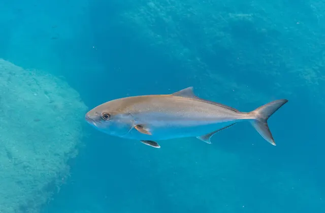
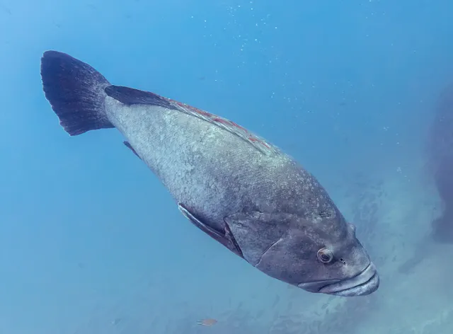
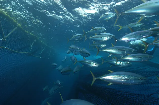
What these strengths mean
- Regular local target
- Fishing sources describe this as a normal local target here, not merely as caught.
- Repeatedly reported
- Several independent public accounts. Enough to say it happens more than once; not enough to call it a fishery.
- Recorded here
- At least one credible public account of this species being caught here. That is all it means.
- How breadth is counted
- A fish documented at six marks is shown as six marks: breadth never raises the strength on its own. A fishery account describes the fishing; a recorded catch reports one specific catch. How evidence is weighed.
How people fish it
Practised here: Sea fishing.
Methods the sources name for this ground. Each one is explained in full on its own page.
- Jigging
Working a weighted lure with a rising-and-falling motion, usually vertically, so it behaves like a wounded or fleeing baitfish.
- Deep-drop fishing
Fishing baits several hundred metres down with heavy weights and, usually, an electric reel — a method defined entirely by what depth does to everything else.
- Trolling
Towing lures or baits behind a moving boat to cover large volumes of water and locate scattered fish.
Baits and lures for these fish
The baits and lures each of the fish above is commonly taken on, from that fish’s own page. This is what works for the fish, not a report of what people use on this particular water — local knowledge and the conditions on the day still decide.
Lures
- Metal jigs — for Greater amberjack, Yellowfin tuna
- Saltwater lures — for Yellowfin tuna
The ground and the water
- The ground
- A submerged volcanic mountain south-west of Faial rising from abyssal depth to within a couple of hundred metres of the surface, one of the best-studied seamounts in the North Atlantic and long fished from the triangle islands.
- Exposure
- Open-ocean ground well offshore, with no shelter of any kind and the nearest harbour on an island behind you.
- Depth
- Worked at roughly a hundred to two hundred metres over a summit that stands thousands of metres above the surrounding sea floor. The relief is what concentrates the fish, and it is why a bank fishes when the open water beside it does not.
Through the year
June to September, on the archipelago's stable summer weather. The season here is set by what a boat can safely reach rather than by the fish.
The months the sources attach to each species here. Where a species carries no season it is listed underneath rather than assumed to run through the year.
| Species | J | F | M | A | M | J | J | A | S | O | N | D |
|---|---|---|---|---|---|---|---|---|---|---|---|---|
| Greater amberjack — regular local target, recorded in June, July, August, September. | ||||||||||||
| Dusky grouper — repeatedly reported, recorded in June, July, August, September. | ||||||||||||
| Yellowfin tuna — recorded here, recorded in June, July, August, September. |
Safety
Boat safety — Can cause serious injury or death
Open Atlantic ground a long way from land, where conditions can deteriorate faster than a small craft can run back and the nearest alternative harbour may be on another island.
What reduces it: Treat it as offshore passage-making rather than as a fishing trip, set a turn-round decision on the forecast before leaving, and carry the means to call for help from beyond VHF range of land.
Cliffs and rock platforms — Can cause serious injury or death
Swell reaches the islands from any direction with no shelf to dissipate it, so waves at exposed lava platforms are larger and less regular than the wind suggests and arrive in sets rather than steadily.
What reduces it: Check swell rather than wind and check its direction. Watch a platform for a sustained period before committing to it, and never fish a position you could not leave immediately.
Rules and access
FishingHQ does not know the current access position here. The Azores are an autonomous region of Portugal administering their own fisheries, and recreational sea and underwater fishing are licensed regionally. The archipelago also carries an unusually dense network of marine protected areas and seamount closures whose boundaries are not visible from a boat. Measures change. Check the current position with the regional fisheries directorate before going.
Particular to this water: This is open-ocean ground inside an archipelago carrying a dense network of marine protected areas and seamount closures. Their boundaries are lines on a chart and are not visible from a boat, so knowing where you are here is a regulatory question as well as a navigational one. Establish the current boundaries with the regional fisheries directorate before fishing.
Who holds the answer:
- The Regional Directorate for Fisheries of the Azores, which licenses recreational sea and underwater fishing across the archipelago.
- The regional maritime authority, for protected areas and local measures.
- The Regional Directorate for Fisheries of the Azores, for recreational licences and the rules on sizes, species and gear
- The managing authorities of the archipelago's marine protected areas and seamount closures, whose boundaries govern what may be done inside them
- The regional environment authority, for the crater lakes and the protected landscapes containing them
- Charter skippers and dive centres, for current practice and for where the closure boundaries actually run
Nearby fishing
Other publicly documented places within about 40 km, by distance. Positions are approximate public geography and are never exact marks.
- Horta, Faial — 25–40 km · Charter departure port
Sources for this place
- Sea Angler — Bauer Media (Specialist angling publication)Relied on for: Long-running published description of British sea angling practice by region, ground type and named mark.FishingHQ's interpretation of what it saysCitation checked — the work exists and is described correctly
- General angling website restatements of established technique — Various (Credible secondary source)Relied on for: Widely restated public descriptions of which places are conventionally fished and how, recorded as practitioner consensus rather than as scholarship, and not relied on for access, permission or any current rule.Background and mechanism onlyCitation checked — the work exists and is described correctly
- Fishing Madeira, and jigging and popping the Azores islands — GT Fishing (Practitioner report)Relied on for: That the named Azorean islands, banks and seamounts are fished for the species given, by the technique and at the depths recorded, and the summer season the operator attaches to them.FishingHQ's interpretation of what it saysPassage read and verified
How FishingHQ labels evidence is explained in the evidence policy. Last reviewed 2026-08-16.