The Moray Firth
Fishing regions · Last reviewed 2026-08-16
A great triangular bight in the north-east shoulder of Scotland: deep cold water, a coast of red sandstone cliff and shingle, the mouths of half the country's best salmon rivers, and a resident population of bottlenose dolphins at the northern edge of the species' range.
Safety: cliffs and rock platforms — can cause serious injury or death. 3 more points apply here.
Being listed here is not permission to fish. What that meansClose
Access, fishing rights, seasons, licences, local bylaws and permitted methods vary and can change. Check current access, permission, local regulations, closures and restrictions before you travel or fish. FishingHQ describes what the ground is and names who holds the answer; it does not hold the answer itself.
Find the authority for a jurisdiction · What FishingHQ does and does not cover
The Moray Firth is the largest embayment on the east coast of Scotland and the whole of it had no record on FishingHQ, which is a substantial hole: it is a distinct hydrographic system, it carries the outfalls of several of the most important salmon rivers in Europe, and it fishes quite unlike either the Forth to the south or the Pentland Firth to the north.
THE SHAPE MATTERS. A broad triangular bight opening east into the North Sea, narrowing westward into a series of inner firths — the Inverness, Beauly, Cromarty and Dornoch — that are shallow, sheltered, muddy and estuarine. So a single system contains fully exposed outer coast, moderately sheltered middle firth, and enclosed nursery estuary, and the fishing changes completely across that gradient.
THE COAST IS RED. Old Red Sandstone dominates the southern and western shore, giving cliff, stack, ledge and boulder ground with a distinctive colour, interrupted by shingle and sand bays and by a long series of small working and former harbours. The northern shore into Caithness is harder, more exposed and increasingly flagstone. It is a rock-and-shingle coast rather than a soft one, which distinguishes it immediately from everything south of the Tay.
THE WATER IS DEEP CLOSE IN over much of it, and it is cold. The firth holds relatively deep basins, water clarity is good by North Sea standards, and temperature stays low year-round.
THE SALMON RIVERS ARE THE FEATURE NOTHING ELSE IN BRITAIN MATCHES. The Spey, the Findhorn, the Ness, the Beauly, the Conon, the Oykel, the Shin and the Alness all reach the sea inside this firth. That concentration means the firth itself is a migratory corridor of international importance, that its estuaries are smolt and returning-adult habitat, and that a considerable part of its regulatory framework exists for fish that are only passing through.
AND THE DOLPHINS ARE NOT DECORATION. The resident bottlenose dolphin population here is among the most northerly in the world and one of the best studied, and the fact that it persists on a diet that includes migratory salmonids is part of the ecological story of the firth rather than a tourist attraction attached to it.
WHAT AN ANGLER FINDS is a cold, clean, rocky, deep-water coast with a strong tradition of shore and small-boat fishing out of small harbours, a serious commercial inheritance, and an inner-firth estuarine fishery that behaves like nothing else on the Scottish east coast.
What fishing here is like
A large triangular embayment opening east into the North Sea and narrowing westward into a series of shallow, sheltered inner firths. The southern and western shore is Old Red Sandstone — cliff, stack, ledge, boulder and shingle — punctuated by many small harbours; the northern shore into Caithness is harder, flatter-bedded and more exposed. Deep water lies close inshore over much of the outer firth, clarity is good by North Sea standards, and water is cold year-round. The inner firths are shallow, muddy, estuarine and comparatively sheltered. The whole system carries the outfalls of several major Atlantic salmon rivers.
What you can target here
One entry per fish, grouped by how you would be fishing — because the answer is a different one from the rocks and from a boat. Each entry says how strongly the sources support it and how much evidence sits behind it. These are documented catches, not a forecast, and none of it is a statement that you may fish any particular ground.
From the shore · 11
 Atlantic codRegular local target4 placesGirdle Ness and Cove Bay, Montrose and the South Esk, Longberry Rock, Chanonry PointOver estuary, headland, rock markAround Jan–Mar, Oct–Dec
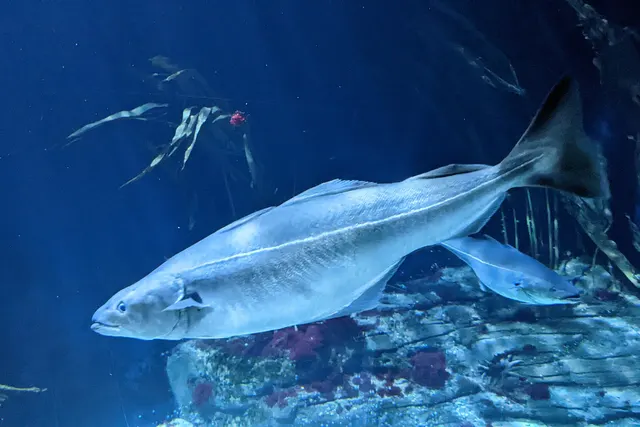 SaitheRegular local target4 placesGirdle Ness and Cove Bay, Stonehaven, Wick, Longberry RockOver harbour wall, rock markAround Jun–Sept
 European flounderRegular local target3 placesMontrose and the South Esk, Brora beach, Embo beachOver beach, estuary
- DabRegular local target2 placesBrora beach, Embo beachOver beach
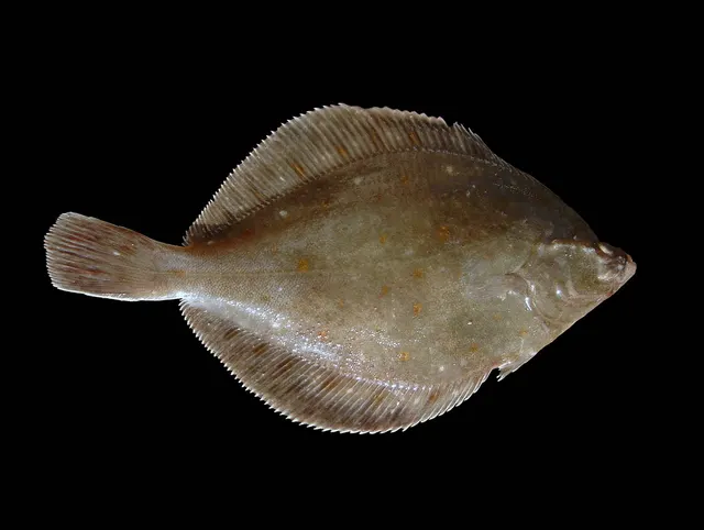 European plaiceRegular local target2 placesMontrose and the South Esk, Embo beachOver beach, estuary
 Ballan wrasseRegular local target1 placeLongberry RockOver rock mark
Also documented from the shore: European sea bass · Atlantic mackerel · Pollack · Turbot · Brown trout
From a boat · 6
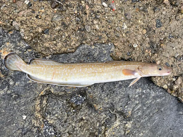 LingRegular local target2 placesStonehaven, Peterhead breakwaterOver breakwater, harbour wall
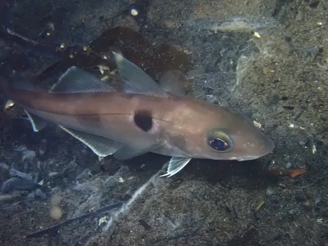 HaddockRegular local target1 placeStonehavenOver harbour wall
 WhitingRegular local target1 placeStonehavenOver harbour wall
- DabRecorded here2 placesPeterhead breakwater, StonehavenOver breakwater, harbour wall
- Atlantic codRecorded here1 placePeterhead breakwaterOver breakwater
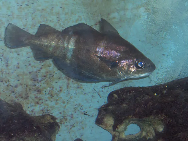 PoutingRecorded here1 placeStonehavenOver harbour wall
What these strengths mean
- Regular local target
- Fishing sources describe this as a normal local target here, not merely as caught.
- Seasonal
- Well supported, and concentrated in part of the year rather than spread through it.
- Repeatedly reported
- Several independent public accounts. Enough to say it happens more than once; not enough to call it a fishery.
- Recorded here
- At least one credible public account of this species being caught here. That is all it means.
- How breadth is counted
- A fish documented at six marks is shown as six marks: breadth never raises the strength on its own. A fishery account describes the fishing; a recorded catch reports one specific catch. How evidence is weighed.
How people fish here
5 methods are recorded on the places documented here, counted from the records themselves rather than from what is practised in the country. Each opens a full guide to the technique.
Ledgering
Recorded at 20 places here, over estuary, harbour wall, beach, rock mark.
Fishing a bait on the bottom held by a weight, with no float — the simplest way to fish at distance, in depth, or in wind.
Documented on the same ground: Atlantic cod, Ballan wrasse, Dab, European flounder, European plaice, Haddock.
Float fishing
Recorded at 9 places here, over harbour wall, rock mark, breakwater, tidal race.
Suspending a bait at a controlled depth beneath a buoyant indicator — the most visual, most controllable and most widely applicable method in angling.
Documented on the same ground: Atlantic cod, Ballan wrasse, Haddock, Ling, Saithe, Whiting.
Kayak fishing
Recorded at 8 places here, over estuary, bay, beach, harbour wall.
A platform rather than a technique: quiet, shallow-draught access to water no other craft reaches, bought at the price of exposure, and a discipline where the decision not to launch is part of the skill.
Documented on the same ground: European flounder, European plaice, Haddock, Ling, Saithe, Whiting.
Spinning
Recorded at 4 places here, over breakwater, harbour wall, headland, rock mark.
Casting an artificial lure and retrieving it so that it moves like something alive — the most direct form of lure fishing.
Documented on the same ground: Ballan wrasse, Haddock, Ling, Saithe, Whiting, Atlantic cod.
Surfcasting
Recorded at 2 places here, over beach.
Casting heavy baited tackle from a beach into surf — a method defined by distance, by tide, and by reading water that all looks the same.
Documented on the same ground: Dab, European flounder, European plaice, European sea bass, Turbot.
These are the methods documented at the places FishingHQ holds here. A species listed beside a method is documented on the same ground, which is not the same as being taken that way — where a source establishes the method a fish was caught on, it is stated on that place’s own page. All fishing methods.
The fishing year here
The months the records under this area actually name, tightest season first. This is “observed in these months” rather than a season: a species whose months nobody recorded is not listed, because a gap in the evidence is not a year-round fishery.
- SaitheJune to September
- European sea bassJune to September
- Atlantic mackerelJune to September
- PollackJune to September
- Atlantic codOctober to March
What dominates
Shore fishing from rock ledge, boulder ground, shingle beach and harbour wall, which is the dominant practice and has a long club tradition here. Small-boat and charter fishing over the deeper ground and the offshore reefs and wrecks. Lure and float fishing for pollack, coalfish, mackerel and wrasse over the rock. Estuary fishing in the inner firths for flounder, bass at the southern edge of its range, and sea trout. Sea trout fishing along the shore and around burn mouths, which is a north-east Scottish tradition in its own right. Creeling for crab and lobster along the rock coast, which is commercially significant. Bait gathering on the shore and the inner-firth flats.
The water available
Old Red Sandstone cliff, stack, ledge and boulder ground with kelp; harder flagstone coast and exposed platform to the north; shingle and sand bays; many small harbours with walls and piers; shallow muddy inner firths with intertidal flat, saltmarsh and eelgrass; several major salmon river estuaries; deep cold basins in the outer firth; and offshore reef, mixed ground and wreck.
How the rules are structured
Scotland's framework differs from England's in ways that matter here. There is no rod licence for sea angling and none for freshwater either, but freshwater and migratory fishing rights are private and permission is required from the owner or the fishery — which is the operative constraint on the salmon rivers entering this firth. Salmon and sea trout are separately and strictly regulated, with district salmon fishery boards administering their own rivers, mandatory catch-and-release provisions in places, and specific rules about methods and seasons. Sea angling for other species is governed by national conservation measures, size limits and species-specific rules rather than by licence. The firth carries substantial conservation designation, including for its bottlenose dolphins and its inner-firth habitats, which constrains activity independently of any fishing rule. Creeling and shellfish gathering are regulated, and shellfish harvesting areas are classified. FishingHQ does not state what any current rule is.
Who to ask
- Marine Directorate of the Scottish Government, for sea fisheries measures, conservation designations and marine licensing in Scottish waters.
- The district salmon fishery board for the river concerned, which administers salmon and sea trout fishing on each of the rivers entering this firth.
- The proprietor, estate or angling association that holds the fishing rights, since freshwater and migratory fishing rights in Scotland are private and permission is required.
- NatureScot and the relevant site management bodies, where a marine or coastal designation affects access or activity.
- The harbour authority or trust at each port, for access to and fishing from harbour structures.
- The local authority and the Food Standards Scotland framework, for shellfish harvesting area classification.
Words you will meet
- Firth
- A Scots word for a large sea inlet or estuary, from the same root as fjord. The Moray Firth contains several smaller firths within it, so the word describes both the whole bight and its inner arms, and which one is meant is decided by context.
- Bothy and the yawl tradition
- The small open working boat of this coast and the fishing settlements built around it. The Moray coast's villages were built on a small-boat fishery, and a great deal of local shore knowledge descends from it rather than from sport angling.
- Finnock
- A young sea trout returning to fresh water after its first short period at sea. On this coast the finnock run is a distinct summer fishery in the estuaries and around burn mouths, quite separate from the larger sea trout that follow.
Conditions and hazards
This is a cold, exposed, rock-dominated coast and the hazards are the northern rock-coast set. The water is cold year-round and cold water shock rather than swimming ability decides an immersion in any month. Rock ledges and boulder ground are the productive shore fishing here, and North Sea swell arrives on them in sets — being swept off rather than falling in is the mechanism. The coast is directly exposed to easterly weather with a long fetch and no shelter, and a rising easterly turns fishable ground into unfishable ground quickly. Sea fret can arrive on easterly airflow in otherwise fine weather and removes the ability to see either the sea or the exit. Cliff access to many marks is down steep or unstable ground. The inner firths present the opposite problem — extensive soft intertidal mud that fills from behind, with mud that will not carry weight on the return. Tidal streams around the headlands and in the narrows between the inner firths are strong. Winter days at this latitude are short. A buoyancy aid worn rather than carried, not fishing rock alone, watching a mark through several set cycles, fixing the exit and the leaving time in advance, and carrying the means of calling for help on the person are the measures that address it.
One bight, half of Scotland's salmon, and what that does to the sea
No other piece of British coast concentrates migratory salmonids the way this one does, and it changes both the ecology of the firth and the way it is administered.
COUNT THE RIVERS. The Spey, the Findhorn, the Ness, the Beauly, the Conon, the Oykel, the Shin, the Alness and the Nairn all reach the sea inside this single embayment, and several of them are salmon rivers of international standing. That means the firth is not merely a place with salmon rivers on it; it is the marine gateway that every fish from all of those systems has to pass through twice.
WHAT THAT MEANS BIOLOGICALLY. Smolts leaving those rivers in spring concentrate in the firth before dispersing to sea, which is a period of extreme vulnerability — small fish, unfamiliar salinity, and every predator in the system aware of the event. Returning adults concentrate again on the way back, holding in the estuaries and the coastal margin waiting for water. Sea trout, which unlike salmon stay close to home, spend their whole marine life in this firth and its coastal margin, which is why the shore sea trout fishery here is a real one rather than an accident.
WHAT IT MEANS ADMINISTRATIVELY, and this is the part that catches visitors. Scotland has no rod licence, which people hear as an absence of regulation and which is the opposite of the truth. Freshwater and migratory fishing rights here are PRIVATE PROPERTY: they belong to somebody, and fishing for salmon or sea trout without that person's permission is not a licensing oversight. Each river is administered by its own district salmon fishery board, with its own rules on seasons, methods and release, and those differ river by river.
AND THE COASTAL NETTING QUESTION IS THE HISTORICAL THREAD. This coast supported substantial commercial salmon netting for a very long time, and the progressive closure and buy-out of those netting stations over recent decades is one of the largest deliberate interventions in a British fishery. Whether it was decisive for the rivers is argued about; that it happened, and that this coast is where it happened most, is not.
THE DOLPHINS SIT ON TOP OF ALL OF IT. A resident bottlenose dolphin population near the northern limit of the species, feeding in part on migratory salmonids at the pinch points where they concentrate, and among the most closely studied cetacean populations anywhere. They are a designated feature of this firth, and the disturbance rules that follow apply to small craft including anglers.
Backed by research — why, and the sources (4)
Supported by peer-reviewed research or fisheries science. The sources are listed and can be checked.
- JNCC species and habitat conservation advice — Joint Nature Conservation Committee (Conservation authority)Relied on for: Designation, habitat description and conservation status of the marine and coastal habitats named, and the species characteristically associated with them.States this directlyCitation checked — the work exists and is described correctly
- The Fishes of the British Isles and North-West Europe — Macmillan, 1969 (Reference work)Relied on for: Distribution, habitat association and biology of the fishes of the British Isles and north-west Europe named here.States this directlyCitation checked — the work exists and is described correctly
- Cefas science, advice and data on marine and freshwater environments — Centre for Environment, Fisheries and Aquaculture Science (Government fisheries body)Relied on for: Marine environmental science for UK shelf seas, including sediment characterisation, estuarine process, shellfish bed distribution, tidal range and the monitoring programmes that describe them.States this directlyCitation checked — the work exists and is described correctly
- ICES Advice on fishing opportunities, catch and effort — International Council for the Exploration of the Sea (Scientific institute)Relied on for: Ecoregion description, stock distribution and the hydrography of the sea areas assessed.States this directlyCitation checked — the work exists and is described correctly
Red rock, small harbours and a shore fishery built on a working coast
The Moray coast fishes like nowhere else in eastern Britain, and the reason is that it is hard rock in a part of the country where everybody expects sand.
OLD RED SANDSTONE IS THE FIRST FACT. It gives cliff, stack, ledge and enormous quantities of broken boulder ground, all of it with kelp on it and deep water not far off. That is the habitat of wrasse, pollack, coalfish and conger, and it means this coast has a genuine summer rough-ground shore fishery of a kind the sandy east coast further south does not.
THE HARBOURS ARE THE SECOND. This coast is studded with small harbours built for a working fishery — some still commercial, many not — and their walls, piers and entrances are among the most productive and most accessible shore fishing anywhere in the north-east. A harbour wall puts an angler over deep water with structure beneath, and the tide through an entrance concentrates everything.
WHICH MAKES THE PRACTICE A MIXED ONE. Heavy ledgering over rough ground with rotten-bottom links, because tackle loss is a given. Float and light lure fishing over kelp for wrasse and pollack. Long-range clean-ground casting off the shingle and sand bays for flatfish and, in season, cod. And a great deal of pier and wall fishing that is done casually, locally and well.
THE COALFISH AND SAITHE FISHERY IS THE NORTHERN SIGNATURE. Further south these are an incidental catch; here they are abundant, they are taken from the shore in numbers, and small saithe around harbours and rock are the fish most young anglers on this coast start on. That is a cultural fact as much as a biological one.
THE INNER FIRTHS ARE A DIFFERENT DISCIPLINE ENTIRELY. Shallow, muddy, estuarine water fished for flounder, for sea trout around the burn mouths, and increasingly for bass at what has been the northern edge of the species' consistent range and is moving. Fine tackle, tidal timing and soft ground rather than rock and rotten-bottoms.
AND THE SEASON IS A COLD-WATER SEASON. Summer for the rough ground — wrasse, pollack, mackerel, coalfish. Autumn as the best of the year, with warm water and moving weather. Winter for cod, whiting and dab on the cleaner ground, at a fraction of the abundance the older literature describes. Spring is the leanest, and it is when the smolts and the returning fish are moving through and everything else in the firth is waiting for them.
What experienced anglers do — why, and the sources (4)
Widely and independently recommended by experienced anglers and specialist sources. This is real angling knowledge, not proof: controlled evidence for it is limited, and FishingHQ records it as convention rather than as a demonstrated effect.
- Sea Angler — Bauer Media (Specialist angling publication)Relied on for: Long-running published description of British sea angling practice by region and by ground type.FishingHQ's interpretation of what it saysCitation checked — the work exists and is described correctly
- General angling website restatements of established technique — Various (Credible secondary source)Relied on for: Widely restated descriptions of which practices are conventionally used in the waters named, recorded as practitioner consensus rather than as scholarship.Background and mechanism onlyCitation checked — the work exists and is described correctly
- Fishers' Craft and Lettered Art: Tracts on Fishing from the End of the Middle Ages — University of Toronto Press, 1997 (Scientific literature)Relied on for: That fishing traditions develop around the water and fish available to them, and the historical method of reading such traditions.Background and mechanism onlyCitation checked — the work exists and is described correctly
- General angling website restatements of established technique — Various (Credible secondary source)Relied on for: Widely restated descriptions of regional angling practice, recorded as practitioner consensus rather than as scholarship.Background and mechanism onlyCitation checked — the work exists and is described correctly
A cold rock coast facing east, and the fog that arrives in fine weather
The Moray Firth's hazards are the northern rock-coast set, with two local specifics that visitors from softer coasts do not expect.
THE FIRST IS THE EXPOSURE DIRECTION. This coast faces broadly north and east, into the North Sea, with a long fetch and nothing between it and Scandinavia. A rising easterly does not build slowly here — it arrives across open water and puts a sea onto ledges and boulder ground that were comfortable an hour before. The forecast to watch is the wind direction as much as the strength, because a strong westerly is an offshore wind on most of this coast and a moderate easterly is not.
AND SWELL ARRIVES IN SETS, as it does everywhere. A ledge that has been dry for twenty minutes is not evidence about the next wave, and being swept from rock rather than falling in is how people are lost on coasts like this one. Watch a mark through several full set cycles before committing to it, choose a position with a way UP behind it rather than only a place to stand, and wear a buoyancy aid on the rocks.
THE SECOND SPECIFIC IS THE HAAR. Cold sea fog forms over the North Sea and comes in on an easterly airflow, quickly, in otherwise fine settled weather — nothing in the general forecast necessarily announces it. On a rock coast where getting off a ledge depends on seeing the route across broken ground, that is not a visibility inconvenience; it removes the answer to the platform hazard at the same time as the tide keeps rising. Treat arriving fog as a reason to leave immediately rather than to wait it out, and know the exit bearing before the visibility goes.
COLD IS THE CONSTANT. The water here is cold in every month, air temperature is a poor guide to it, and immersion produces the involuntary gasp and loss of breathing control within seconds — which is what decides the outcome rather than any swimming afterwards. Winter days at this latitude are short, and a great deal of the best fishing is done in the dark at either end of them.
THE INNER FIRTHS INVERT THE PROBLEM. Extensive soft intertidal mud that fills from the creeks outward rather than from the sea inward, ground that carried weight on the way out and will not on the way back, and a rising tide behind somebody who is watching the water in front. Know the exit and set a leaving time from the tide.
AND THE STREAMS ARE STRONGER THAN THEY LOOK around the headlands and in the narrows between the inner firths, particularly on springs, which matters to anybody afloat in a small craft or a kayak.
WHAT ACTUALLY HELPS. A buoyancy aid worn rather than carried. Not fishing rock alone. The exit and the leaving time fixed before starting. A means of calling for help on the person rather than in a bag at the top of the beach. And the current inshore waters forecast checked on the day, with attention to direction.
Official guidance — why, and the sources (4)
Stated by a fisheries authority, scientific institute or recognised angling body. Authoritative, but summarising rather than demonstrating.
- Rock fishing safety and the declared lifejacket areas of New South Wales — NSW Department of Primary Industries and Surf Life Saving NSW (Water-safety or diver-training authority)Relied on for: Rock-platform fishing hazards, the mechanism by which anglers are swept from platforms by sets rather than by average conditions, and the measures that address it.States this directlyCitation checked — the work exists and is described correctly
- RNLI water safety guidance: cold water shock and Float to Live — Royal National Lifeboat Institution (Water-safety or diver-training authority)Relied on for: Cold water shock, immersion response and the advice to carry a means of calling for help on the person.States this directlyPassage read and verified
- RNLI water safety guidance: cold water shock and Float to Live — Royal National Lifeboat Institution (Water-safety or diver-training authority)Relied on for: Cold water shock and the immersion response, tidal cut-off, and water-safety guidance for shore anglers and small-craft users.States this directlyPassage read and verified
- Met Office shipping forecast, inshore waters forecast and marine warnings — Met Office, United Kingdom (Government fisheries body)Relied on for: That inshore waters forecasts, sea state and swell are the operative inputs for shore and small-craft decisions in these waters.States this directlyCitation checked — the work exists and is described correctly
Some of what lives here
Fish recorded here that FishingHQ holds a reviewed photograph of. It is not a complete list of what The Moray Firth holds, and it is not a prediction that you will catch any of them — it is a way in to the ones we can show you.
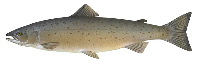 Atlantic salmonAn anadromous salmonid that migrates from its natal river to the North Atlantic and returns to spawn — and a species in serious, well-documented decline.
Knepp, Timothy, Public domain, via Wikimedia Commons
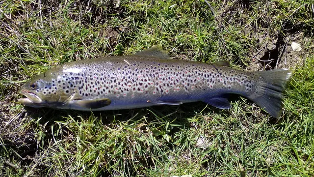 Brown troutA single, extraordinarily plastic species that appears as a tiny hill-stream fish, a deep-bodied loch trout and a silver sea-run migrant — all the same animal.
Robermix, CC0, via Wikimedia Commons
- SaitheA fast, hard-fighting shoaling gadoid of northern rock and wreck — routinely confused with pollack, and a completely different fish once you know the lateral line.
Wilhelm Thomas Fiege — CC BY-SA 4.0, via Wikimedia Commons
 PollackA fast gadoid that hunts up off reefs and wrecks and takes a lure on the drop — and the sea fish most likely to convert a bait angler to lure fishing.
Wilhelm Thomas Fiege — CC BY-SA 4.0, via Wikimedia Commons
- Ballan wrasseA long-lived rocky-ground resident that begins life female and may change sex — and the species that turned rock marks into a lure fishery.
Diego Delso — CC BY-SA 4.0, via Wikimedia Commons
- Atlantic codA large, heavily-built demersal predator of the North Atlantic, and the species whose commercial history is the standard example of stock collapse.
The U.S. Food and Drug Administration, Public domain, via Wikimedia Commons
- European flounderThe flatfish that runs up rivers — a tolerant, estuarine right-eyed flounder with bony tubercles along its fin bases and a habit of turning up in fresh water.
nbasargin — CC BY, via iNaturalist
Places within this area
Publicly documented fishing geography. FishingHQ describes what the ground is; it does not say whether you may fish it, and every one of these sends that question to the body that holds the answer. Browse every place in this part of the world.
Who to ask before fishing any of these
FishingHQ does not know the current access position here. Sea angling in Scotland is not rod-licensed, but access rights under the Scottish Outdoor Access Code carry responsibilities, and harbour, local authority, marine conservation and fisheries measures all apply and all change. Check the current position with the Marine Directorate, the harbour or local authority and the land manager before going.
FishingHQ does not know the current access position here. Sea angling in Scotland is not rod-licensed, but access rights under the Scottish Outdoor Access Code carry responsibilities, and harbour, local authority, marine conservation and fisheries measures all apply and all change. Check the current position with the Marine Directorate, the harbour or local authority and the land manager before going. This water is tidal and transitional, so the freshwater regime may also apply above the tidal limit: FishingHQ does not know the current access position here. Scotland has no general rod licence, and the fishing rights on almost every river and loch belong to somebody: a proprietor, an estate, an angling association or a district salmon fishery board. Permission is a separate question from access, and both change. Check with the relevant fishery board or association before going.
Girdle Ness and Cove Bay
Rock mark · Salt water
Hard granite and schist headland and cliff south of the Dee mouth, with boulder aprons, deep gullies and clean sand between. The rock is Aberdeen granite: hard, grippy dry and slick wet.
Fully open to the North Sea from north through south-east. This is a straight, hard coast with no natural shelter.
Particular to this ground: cliffs and rock platforms, cold water shock.
Peterhead breakwater
Breakwater · Salt water
The massive granite breakwaters enclosing Peterhead Bay, one of the largest artificial harbours in Britain, with deep water inside and out and rock armour on the seaward faces.
Built to take the North Sea on a coast with no natural harbour, and it does. The outer faces are unusable in an easterly blow.
Particular to this ground: cold water shock, slips, trips and falls.
Severe hazards of The Moray Firth apply here: cliffs and rock platforms.
Particular to this water: This is an owned and operated structure. Whether angling is allowed on it, when, from where and on what terms is the operator's decision, is frequently seasonal, and changes without notice.
Chanonry Point
Headland · Salt water
A shingle and sand spit projecting from the Black Isle into the inner Moray Firth, constricting the firth to under a kilometre against the matching spit at Fort George. Shingle at the point, sand and mud either side.
Inner firth: no ocean swell, and the water state is governed by wind over the tidal stream rather than by fetch.
Particular to this ground: moving water and currents, cold water shock, encounters with marine life.
Severe hazards of The Moray Firth apply here: cliffs and rock platforms.
Particular to this water: This ground carries conservation designations that constrain access, vehicles, bait collection and disturbance independently of any fishing rule.
Duncansby Head and the Pentland Firth
Tidal race · Salt water
The north-eastern corner of mainland Britain: Old Red Sandstone cliffs and stacks above a strait roughly ten kilometres wide separating the mainland from Orkney, with an irregular rock bed and sills that force the flow.
Open to the Atlantic from the west and the North Sea from the east, and the two seas meet here. There is no shelter anywhere in the strait.
Particular to this ground: moving water and currents, cliffs and rock platforms, cold water shock.
Montrose and the South Esk
Estuary · Brackish water
A tidal basin of nearly eight square kilometres emptying and filling through a single narrow entrance, producing one of the strongest estuary streams on the east coast.
Severe hazards of The Moray Firth apply here: cliffs and rock platforms, cold water shock.
Stonehaven
Harbour wall · Salt water
A stone harbour in a shingle bay between two hard conglomerate headlands, with deep water off the points and heavy reef ground beneath the cliffs south towards Dunnottar.
Severe hazards of The Moray Firth apply here: cliffs and rock platforms, cold water shock.
The Ythan estuary
Estuary · Brackish water
A narrow drying sand estuary behind the Forvie dune system, with fast channel streams, extensive mussel beds and one of the largest eider colonies in Britain on its banks.
Severe hazards of The Moray Firth apply here: cliffs and rock platforms, cold water shock.
Fraserburgh
Harbour wall · Salt water
A large working fishing harbour at the north-eastern corner of the Scottish mainland, with concrete arms over sand and rock and the exposed Kinnaird Head immediately west.
Severe hazards of The Moray Firth apply here: cliffs and rock platforms, cold water shock.
12 more places in this area
Banff and the Deveron mouth
Estuary · Brackish water
A small river mouth over gravel and sand at the head of a bay on the Moray Firth's southern shore, with rock scars either side and a migratory run through the estuary.
Severe hazards of The Moray Firth apply here: cliffs and rock platforms, cold water shock.
Buckie
Harbour wall · Salt water
A large stone and concrete harbour on the Moray Firth's southern shore, over sand and rock, with a low rocky coast of quartzite and schist running east and west.
Severe hazards of The Moray Firth apply here: cliffs and rock platforms, cold water shock.
Lossiemouth
Beach · Salt water
Extensive clean sand beaches either side of the Lossie's piered mouth, backed by dunes and forest, with the shallow inner Moray Firth offshore.
Severe hazards of The Moray Firth apply here: cliffs and rock platforms, cold water shock.
Findhorn Bay
Bay · Brackish water
A large, almost entirely drying tidal basin behind a shingle spit, filling and emptying through a single narrow entrance with a very strong stream through it.
Severe hazards of The Moray Firth apply here: cliffs and rock platforms, cold water shock.
Nairn
Beach · Salt water
A long clean sand beach with a small piered harbour at the river mouth, on the sheltered inner Moray Firth where the water is shallow and the range modest.
Severe hazards of The Moray Firth apply here: cliffs and rock platforms, cold water shock.
The Cromarty Firth
Estuary · Brackish water
A deep sheltered firth entered between two steep sandstone headlands — the Sutors — with soft mud and sand inside, oil-platform moorings, and resident bottlenose dolphins at the mouth.
Severe hazards of The Moray Firth apply here: cliffs and rock platforms, cold water shock.
The Dornoch Firth
Estuary · Brackish water
A shallow drying firth of sand and mud flats with a bar across its mouth, extensive saltmarsh, and one of the most important migratory salmon systems on the east coast running through it.
Severe hazards of The Moray Firth apply here: cliffs and rock platforms, cold water shock.
Helmsdale
Harbour wall · Salt water
A small stone harbour at a river mouth on the Sutherland coast, over sand and rock, with a steep shingle shore and the open Moray Firth outside.
Severe hazards of The Moray Firth apply here: cliffs and rock platforms, cold water shock.
Wick
Harbour wall · Salt water
A large stone harbour built for the herring fishery, on a hard flagstone coast of horizontally bedded Caithness sandstone with vertical cliffs and geos either side.
Severe hazards of The Moray Firth apply here: cliffs and rock platforms, cold water shock.
Longberry Rock
Rock mark · Salt water
A flagstone ledge on the Caithness coast south of Wick, with the horizontally bedded sandstone forming flat shelves stepping down into deep water. Easy footing and no beach beneath it.
Open east into the North Sea.
Particular to this ground: cliffs and rock platforms, cold water shock.
Brora beach
Beach · Salt water
Sand and shingle either side of the Brora river mouth, with reef and low rock running out south of the town and the river cutting a channel through the beach. Mixed ground with a freshwater influence at its middle.
Open east and south-east into the Moray Firth.
Severe hazards of The Moray Firth apply here: cliffs and rock platforms, cold water shock.
Embo beach
Beach · Salt water
A long sand beach running north from the old fishing village towards Loch Fleet, with a shingle bank at the top and clean, gently shelving sand below it. Featureless in the way that suits flatfish.
Open east into the Moray Firth.
Severe hazards of The Moray Firth apply here: cliffs and rock platforms, cold water shock.
Safety
Cliffs and rock platforms — Can cause serious injury or death
Rock ledges and boulder ground with deep water close in are the productive shore fishing here, and North Sea swell arrives on them in sets. A ledge dry for twenty minutes gives no information about the next wave, and being swept off rather than falling in is the mechanism.
What reduces it: Watch a mark through several full set cycles before committing, choose a position with a way up behind it, wear a buoyancy aid on the rocks, and do not fish exposed rock alone.
Worse when:
- In an easterly airflow, which has a long open fetch onto this coast and no shelter.
- In the dark, when a set cannot be seen coming, which is when much of this fishing is done.
Cold water shock — Can cause serious injury or death
The water here is cold in every month and air temperature is a poor guide to it. Immersion produces an involuntary gasp and loss of breathing control within seconds, removing the ability to swim or to climb out onto weeded rock.
What reduces it: Dress for the water rather than the day, wear a buoyancy aid rather than carrying one, carry a means of calling for help on the person, and tell somebody the mark and the return time.
Weather and lightning — Can cause injury needing treatment
Haar — dense cold sea fog on an easterly airflow — arrives quickly in otherwise fine settled weather and removes the ability to see either an approaching set or the route off a ledge across broken ground.
What reduces it: Treat arriving fog as a reason to leave a rock position immediately rather than to wait it out, know the exit bearing before visibility goes, and carry a light and a means of navigating that does not depend on seeing landmarks.
Tides and being cut off — Can cause injury needing treatment
The inner firths carry extensive soft intertidal mud that fills from the creeks outward, so water appears behind a person working towards the water, and ground that carried weight on the way out will not on the way back.
What reduces it: Know the state of the tide and the exit before going onto any flat, set a leaving time from the tide rather than from the fishing, and do not go out onto soft ground alone.
Further safety reading
- Rock platform and cliff safety — Rock ledges with deep water close in are the productive shore ground, North Sea swell arrives on them in sets, and haar can remove the ability to see either the set or the route off the ledge in otherwise fine weather.
Check the rules before you fish
Fishing laws, bylaws, access rules, seasons, bait restrictions and permitted methods vary by location and can change. Check the current rules from the relevant authority and the water you intend to fish before fishing.
Check with:
- Current national or regional law for where you are fishing
- Current local bylaws
- The relevant fisheries authority
- The landowner, club or fishery whose water it is
- Any restrictions specific to the species or the method you intend to use
Where to go next
What swims here
- Atlantic codOver the rough and mixed ground through the colder months, at a fraction of the abundance the older literature for this coast describes.
- Atlantic salmonThis single bight receives the outfalls of the Spey, Findhorn, Ness, Beauly, Conon, Oykel, Shin and Alness, so it is the marine gateway that fish from all of those systems pass through twice. Smolts concentrate here leaving and adults concentrate here returning.
- Ballan wrasseOn the broken sandstone and boulder ground through the warmer months, which the fractured rock of this coast supplies in quantity.
- Brown troutAs sea trout, along the whole coastal margin and around the burn mouths. Sea trout stay close to home at sea, so this firth is their marine habitat rather than a corridor, which is why shore sea trout fishing here is a real tradition.
- European flounderThroughout the shallow muddy inner firths and their estuaries, where the soft ground and brackish water suit it and where it is present through the year.
- PollackOver the kelp edges, gully ground and boulder of the Old Red Sandstone coast, and around the harbour entrances where the tide concentrates food.
- SaitheAbundant over the rock, harbour walls and kelp of the whole coast, and the fish most young anglers on this coast start on — a northern signature that anglers further south encounter only incidentally.
How this compares
Environment and conservation
Sources and evidence
- Cefas science, advice and data on marine and freshwater environments — Centre for Environment, Fisheries and Aquaculture Science (Government fisheries body)Relied on for: Marine environmental science for UK shelf seas, including sediment characterisation, estuarine process, shellfish bed distribution, tidal range and the monitoring programmes that describe them.States this directlyCitation checked — the work exists and is described correctly
- ICES Advice on fishing opportunities, catch and effort — International Council for the Exploration of the Sea (Scientific institute)Relied on for: Ecoregion description, stock distribution and the hydrography of the sea areas assessed.States this directlyCitation checked — the work exists and is described correctly
- JNCC species and habitat conservation advice — Joint Nature Conservation Committee (Conservation authority)Relied on for: Designation, habitat description and conservation status of the marine and coastal habitats named, and the species characteristically associated with them.States this directlyCitation checked — the work exists and is described correctly
- The Fishes of the British Isles and North-West Europe — Macmillan, 1969 (Reference work)Relied on for: Distribution, habitat association and biology of the fishes of the British Isles and north-west Europe named here.States this directlyCitation checked — the work exists and is described correctly
- RNLI water safety guidance: cold water shock and Float to Live — Royal National Lifeboat Institution (Water-safety or diver-training authority)Relied on for: Cold water shock and the immersion response, tidal cut-off, and water-safety guidance for shore anglers and small-craft users.States this directlyPassage read and verified
- Met Office shipping forecast, inshore waters forecast and marine warnings — Met Office, United Kingdom (Government fisheries body)Relied on for: That inshore waters forecasts, sea state and swell are the operative inputs for shore and small-craft decisions in these waters.States this directlyCitation checked — the work exists and is described correctly
Why the 12 connections on this page are here, and the sources
What swims here
Backed by research — 7 connections
Supported by peer-reviewed research or fisheries science. The sources are listed and can be checked.
Atlantic cod
A claim that a place contains the ground, water and seasonal conditions the species is associated with. It is a distributional statement about the world, it rests on the regional reference literature, and it deliberately asserts nothing about access, permission or catch.
- The Fishes of the British Isles and North-West Europe — Macmillan, 1969 (Reference work)Relied on for: Distribution and habitat association of the marine, estuarine and freshwater fishes of the British Isles, including which coasts, estuaries and ground types a species occupies.States this directlyCitation checked — the work exists and is described correctly
- FishBase: a global information system on fishes — Froese, R. and D. Pauly, eds. — FishBase Consortium (Scientific institute)Relied on for: Recorded distribution, depth range and habitat association for the species named.States this directlyPassage read and verified
Atlantic salmon
A claim that a place contains the ground, water and seasonal conditions the species is associated with. It is a distributional statement about the world, it rests on the regional reference literature, and it deliberately asserts nothing about access, permission or catch.
- The Fishes of the British Isles and North-West Europe — Macmillan, 1969 (Reference work)Relied on for: Distribution and habitat association of the marine, estuarine and freshwater fishes of the British Isles, including which coasts, estuaries and ground types a species occupies.States this directlyCitation checked — the work exists and is described correctly
- FishBase: a global information system on fishes — Froese, R. and D. Pauly, eds. — FishBase Consortium (Scientific institute)Relied on for: Recorded distribution, depth range and habitat association for the species named.States this directlyPassage read and verified
Ballan wrasse
A claim that a place contains the ground, water and seasonal conditions the species is associated with. It is a distributional statement about the world, it rests on the regional reference literature, and it deliberately asserts nothing about access, permission or catch.
- The Fishes of the British Isles and North-West Europe — Macmillan, 1969 (Reference work)Relied on for: Distribution and habitat association of the marine, estuarine and freshwater fishes of the British Isles, including which coasts, estuaries and ground types a species occupies.States this directlyCitation checked — the work exists and is described correctly
- FishBase: a global information system on fishes — Froese, R. and D. Pauly, eds. — FishBase Consortium (Scientific institute)Relied on for: Recorded distribution, depth range and habitat association for the species named.States this directlyPassage read and verified
Brown trout
A claim that a place contains the ground, water and seasonal conditions the species is associated with. It is a distributional statement about the world, it rests on the regional reference literature, and it deliberately asserts nothing about access, permission or catch.
- The Fishes of the British Isles and North-West Europe — Macmillan, 1969 (Reference work)Relied on for: Distribution and habitat association of the marine, estuarine and freshwater fishes of the British Isles, including which coasts, estuaries and ground types a species occupies.States this directlyCitation checked — the work exists and is described correctly
- FishBase: a global information system on fishes — Froese, R. and D. Pauly, eds. — FishBase Consortium (Scientific institute)Relied on for: Recorded distribution, depth range and habitat association for the species named.States this directlyPassage read and verified
European flounder
A claim that a place contains the ground, water and seasonal conditions the species is associated with. It is a distributional statement about the world, it rests on the regional reference literature, and it deliberately asserts nothing about access, permission or catch.
- The Fishes of the British Isles and North-West Europe — Macmillan, 1969 (Reference work)Relied on for: Distribution and habitat association of the marine, estuarine and freshwater fishes of the British Isles, including which coasts, estuaries and ground types a species occupies.States this directlyCitation checked — the work exists and is described correctly
- FishBase: a global information system on fishes — Froese, R. and D. Pauly, eds. — FishBase Consortium (Scientific institute)Relied on for: Recorded distribution, depth range and habitat association for the species named.States this directlyPassage read and verified
Pollack
A claim that a place contains the ground, water and seasonal conditions the species is associated with. It is a distributional statement about the world, it rests on the regional reference literature, and it deliberately asserts nothing about access, permission or catch.
- The Fishes of the British Isles and North-West Europe — Macmillan, 1969 (Reference work)Relied on for: Distribution and habitat association of the marine, estuarine and freshwater fishes of the British Isles, including which coasts, estuaries and ground types a species occupies.States this directlyCitation checked — the work exists and is described correctly
- FishBase: a global information system on fishes — Froese, R. and D. Pauly, eds. — FishBase Consortium (Scientific institute)Relied on for: Recorded distribution, depth range and habitat association for the species named.States this directlyPassage read and verified
Saithe
A claim that a place contains the ground, water and seasonal conditions the species is associated with. It is a distributional statement about the world, it rests on the regional reference literature, and it deliberately asserts nothing about access, permission or catch.
- The Fishes of the British Isles and North-West Europe — Macmillan, 1969 (Reference work)Relied on for: Distribution and habitat association of the marine, estuarine and freshwater fishes of the British Isles, including which coasts, estuaries and ground types a species occupies.States this directlyCitation checked — the work exists and is described correctly
- FishBase: a global information system on fishes — Froese, R. and D. Pauly, eds. — FishBase Consortium (Scientific institute)Relied on for: Recorded distribution, depth range and habitat association for the species named.States this directlyPassage read and verified
How people fish here
What experienced anglers do — 2 connections
Widely and independently recommended by experienced anglers and specialist sources. This is real angling knowledge, not proof: controlled evidence for it is limited, and FishingHQ records it as convention rather than as a demonstrated effect.
Fly fishing
A claim about angling convention rather than about the world: that this place sits within this branch of fishing, which drives the information architecture as well as the page. It rests on independent practitioner description.
- General angling website restatements of established technique — Various (Credible secondary source)Relied on for: Widely restated descriptions of which practices are conventionally used in the waters named, recorded as practitioner consensus rather than as scholarship.Background and mechanism onlyCitation checked — the work exists and is described correctly
- Sea Angler — Bauer Media (Specialist angling publication)Relied on for: Long-running published description of British and Irish sea angling practice by region and by ground type.FishingHQ's interpretation of what it saysCitation checked — the work exists and is described correctly
Sea fishing
A claim about angling convention rather than about the world: that this place sits within this branch of fishing, which drives the information architecture as well as the page. It rests on independent practitioner description.
- General angling website restatements of established technique — Various (Credible secondary source)Relied on for: Widely restated descriptions of which practices are conventionally used in the waters named, recorded as practitioner consensus rather than as scholarship.Background and mechanism onlyCitation checked — the work exists and is described correctly
- Sea Angler — Bauer Media (Specialist angling publication)Relied on for: Long-running published description of British and Irish sea angling practice by region and by ground type.FishingHQ's interpretation of what it saysCitation checked — the work exists and is described correctly
How this compares
What experienced anglers do — 1 connection
Widely and independently recommended by experienced anglers and specialist sources. This is real angling knowledge, not proof: controlled evidence for it is limited, and FishingHQ records it as convention rather than as a demonstrated effect.
The north-east England coast
A claim that two places are worth reading against one another, because a reader choosing between them or generalising from one to the other needs to know how the underlying process differs.
- General angling website restatements of established technique — Various (Credible secondary source)Relied on for: Widely restated descriptions of which practices are conventionally used in the waters named, recorded as practitioner consensus rather than as scholarship.Background and mechanism onlyCitation checked — the work exists and is described correctly
- Sea Angler — Bauer Media (Specialist angling publication)Relied on for: Long-running published description of British and Irish sea angling practice by region and by ground type.FishingHQ's interpretation of what it saysCitation checked — the work exists and is described correctly
Safety reading
Official guidance — 1 connection
Stated by a fisheries authority, scientific institute or recognised angling body. Authoritative, but summarising rather than demonstrating.
Rock platform and cliff safety
A claim that a place presents a particular hazard strongly enough that the reader should be sent to the page dealing with it in full, rather than left with the short warning on the place itself.
- RNLI water safety guidance: cold water shock and Float to Live — Royal National Lifeboat Institution (Water-safety or diver-training authority)Relied on for: Cold water shock and the immersion response, tidal cut-off, and water-safety guidance for shore anglers and small-craft users.States this directlyPassage read and verified
Environment and conservation
Backed by research — 1 connection
Supported by peer-reviewed research or fisheries science. The sources are listed and can be checked.
Fish stocks and sustainability
A claim that a place raises a particular environmental question, resting on the scientific and conservation literature for the system rather than on angling practice.
- JNCC species and habitat conservation advice — Joint Nature Conservation Committee (Conservation authority)Relied on for: Habitat classification and description for the intertidal, coastal, estuarine and freshwater habitats named, and the species characteristically associated with them.States this directlyCitation checked — the work exists and is described correctly
- Cefas science, advice and data on marine and freshwater environments — Centre for Environment, Fisheries and Aquaculture Science (Government fisheries body)Relied on for: Characterisation of UK inshore sediment, intertidal habitat, estuarine process and the shellfish beds associated with them.States this directlyCitation checked — the work exists and is described correctly
How FishingHQ labels evidence is explained in the evidence policy.