Chesil Beach
Fishing regions · Last reviewed 2026-08-14
Eighteen miles of shingle whose stones are graded from pea gravel at one end to fist-sized cobble at the other, with a tideless lagoon behind it and deep water immediately in front.
Safety: drowning and immersion — can cause serious injury or death. 2 more points apply here.
Being listed here is not permission to fish. What that meansClose
Access, fishing rights, seasons, licences, local bylaws and permitted methods vary and can change. Check current access, permission, local regulations, closures and restrictions before you travel or fish. FishingHQ describes what the ground is and names who holds the answer; it does not hold the answer itself.
Find the authority for a jurisdiction · What FishingHQ does and does not cover
Chesil Beach is the clearest single example in Britain of a beach whose physical structure explains its fishing, which is why it is the first place FishingHQ covers this way.
IT IS A BARRIER BEACH, NOT A BAY BEACH. A continuous shingle ridge runs for roughly eighteen miles along the Dorset coast, separated from the land behind it for much of its length by the Fleet, a shallow brackish lagoon. It is one of the largest shingle structures of its kind in Europe.
THE GRADING IS THE FAMOUS PROPERTY AND IT IS REAL. Stone size increases progressively from west to east along the beach — from pea-sized gravel at the western end to cobbles at the eastern end. It is consistent enough that it was historically said local fishermen could tell where they had landed in fog by the size of the stones underfoot. The mechanism is longshore movement of shingle under waves, sorting the material by size along the drift.
STONE SIZE DECIDES THE FISHING, WHICH IS THE POINT. Coarse shingle drains fast and steeply, so the beach shelves abruptly and deep water sits close to the shore at the eastern end. Fine shingle produces a gentler profile. The species that feed in the wash, the distance a bait needs to be cast, and the way a lead holds all follow from what the stones are doing.
THE FLEET BEHIND IT IS A SEPARATE SYSTEM ENTIRELY: a long, shallow, sheltered brackish lagoon with restricted exchange to the sea, internationally important for wildlife and quite unlike the exposed shingle in front of it.
AND THE WHOLE THING IS PROTECTED. The beach, the Fleet and the surrounding coast carry multiple conservation designations, and the coastline as a whole holds World Heritage status for its geology.
What fishing here is like
A very long, steep, exposed shingle barrier beach with deep water close inshore at its eastern end, backed for much of its length by a shallow brackish lagoon. The stone size grades along its length and takes the beach profile with it, which is why the fishing changes from one end to the other. It is one of the best-known shore fishing beaches in Britain and it is also a heavily protected landscape whose designations govern a great deal of what happens on and around it.
What you can target here
One entry per fish, grouped by how you would be fishing — because the answer is a different one from the rocks and from a boat. Each entry says how strongly the sources support it and how much evidence sits behind it. These are documented catches, not a forecast, and none of it is a statement that you may fish any particular ground.
From the shore · 15
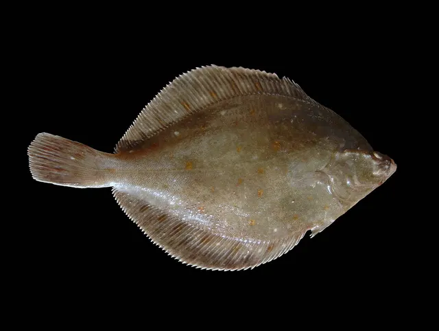 European plaiceCharacteristic of this water4 placesWest Bexington, Cogden Beach, Ferrybridge and the Chesil Beach centre, Hive Beach, Burton BradstockOver beach sectionAround Mar–May
 Atlantic codCharacteristic of this water3 placesAbbotsbury beach, West Bexington, Chesil CoveOver beach sectionAround Jan–Mar, Oct–Dec
 European sea bassRegular local target5 placesChesil Cove, Ferrybridge and the Chesil Beach centre, Abbotsbury beach, Hive Beach, Burton Bradstock and 1 moreOver beach sectionAround May–Oct
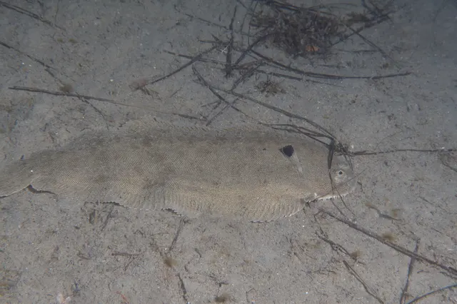 Common soleRegular local target2 placesWest Bexington, Cogden BeachOver beach sectionAround May–Oct
 Conger eelRegular local target2 placesChesil Cove, Abbotsbury beachOver beach sectionAround May–Oct
 European flounderRegular local target1 placeFerrybridge and the Chesil Beach centreOver beach section
Also documented from the shore: Small-eyed ray · Atlantic mackerel · Whiting · Garfish · Ballan wrasse · Black seabream · Dab · Thornback ray · Thick-lipped grey mullet
What these strengths mean
- Characteristic of this water
- This water is strongly identified with this species by the sources that cover it.
- Regular local target
- Fishing sources describe this as a normal local target here, not merely as caught.
- Seasonal
- Well supported, and concentrated in part of the year rather than spread through it.
- Recorded here
- At least one credible public account of this species being caught here. That is all it means.
- How breadth is counted
- A fish documented at six marks is shown as six marks: breadth never raises the strength on its own. A fishery account describes the fishing; a recorded catch reports one specific catch. How evidence is weighed.
How people fish here
4 methods are recorded on the places documented here, counted from the records themselves rather than from what is practised in the country. Each opens a full guide to the technique.
Ledgering
Recorded at 6 places here, over beach section.
Fishing a bait on the bottom held by a weight, with no float — the simplest way to fish at distance, in depth, or in wind.
Documented on the same ground: Atlantic cod, European plaice, Common sole, Conger eel, European flounder, European sea bass.
Spinning
Recorded at 5 places here, over beach section.
Casting an artificial lure and retrieving it so that it moves like something alive — the most direct form of lure fishing.
Documented on the same ground: Atlantic cod, European plaice, Common sole, Conger eel, European flounder, European sea bass.
Surfcasting
Recorded at 5 places here, over beach section.
Casting heavy baited tackle from a beach into surf — a method defined by distance, by tide, and by reading water that all looks the same.
Documented on the same ground: Atlantic cod, European plaice, Common sole, Conger eel, European flounder, European sea bass.
Float fishing
Recorded at 3 places here, over beach section.
Suspending a bait at a controlled depth beneath a buoyant indicator — the most visual, most controllable and most widely applicable method in angling.
Documented on the same ground: Conger eel, European flounder, European sea bass, Atlantic cod, Atlantic mackerel, Ballan wrasse.
These are the methods documented at the places FishingHQ holds here. A species listed beside a method is documented on the same ground, which is not the same as being taken that way — where a source establishes the method a fish was caught on, it is stated on that place’s own page. All fishing methods.
The fishing year here
The months the records under this area actually name, tightest season first. This is “observed in these months” rather than a season: a species whose months nobody recorded is not listed, because a gap in the evidence is not a year-round fishery.
- European plaiceMarch to May
- Atlantic mackerelJune to September
- GarfishJune to September
- European sea bassMay to October
- Atlantic codOctober to March
- WhitingOctober to March
- Common soleMay to October
- Conger eelMay to October
- Small-eyed rayMay to October
- Ballan wrasseMay to October
- Black seabreamMay to October
- DabOctober to March
What dominates
Shore fishing from the shingle, which is what the beach is known for: long-range bait fishing over clean ground, and closer work in the wash for species that feed in it. Lure fishing from the shingle for bass and mackerel. Float fishing from the steeper eastern sections where deep water is close. Boat fishing over the ground offshore of the beach. The Fleet behind is a wildlife and shellfish environment rather than a general angling one, with its own designations and its own management.
The water available
A continuous shingle barrier of great length and considerable height, exposed to the full run of English Channel swell; a steeply shelving profile with deep water close inshore towards the eastern end and a gentler profile westward; clean shingle and sand ground offshore with limited rough; the Fleet, a shallow, sheltered, brackish lagoon behind the barrier with restricted tidal exchange and an internationally important habitat; and a coastline of Jurassic and Cretaceous rock at either end that behaves entirely differently.
How the rules are structured
Sea fishing along this coast falls under the inshore fisheries and conservation authority for the district, which sets byelaws on gear, minimum sizes above national ones where it judges necessary, and any local restrictions; national minimum conservation reference sizes and bass measures apply on top of that. The beach and the Fleet carry a stack of conservation designations — a site of special scientific interest, European-level habitat and bird designations, a national nature reserve over parts of the Fleet, and a World Heritage designation over the coastline for its geology — and those designations, rather than fisheries law, govern much of what may happen on and behind the beach. The Fleet is additionally subject to private ownership and to management arrangements of its own. Shellfish gathering anywhere on this coast is subject to sanitary classification and biotoxin monitoring by the local authority and food agency, which is a separate regime from the fisheries one. Beach access, parking and any local restriction are matters for the landowners and managing bodies. FishingHQ does not state what any current rule is.
Who to ask
- The inshore fisheries and conservation authority for the district, for sea fishing byelaws, gear rules and local restrictions.
- The national fisheries authority, for minimum conservation reference sizes and national measures including those applying to bass.
- The statutory nature conservation body, for the site of special scientific interest and European habitat and bird designations covering the beach and the Fleet.
- The landowner and the managing bodies of the Fleet and the nature reserve, for access and for what may be done behind the barrier.
- The local authority and food standards agency, for shellfish ground classification and biotoxin monitoring.
Words you will meet
- The Fleet
- The long, shallow, brackish lagoon lying behind the shingle barrier for much of its length, with very restricted exchange to the sea. A separate environment from the beach in front of it, internationally designated, and not a general angling water.
- Grading
- The progressive change in shingle size along the beach, from fine gravel at the western end to cobble at the eastern. Produced by longshore sorting of material under wave action, and the reason the beach profile and the fishing change along its length.
- The undertow
- The strong seaward backwash off a steep shingle beach after a wave breaks. On coarse steep shingle it is powerful enough to take a person off their feet in the wash, and it is the mechanism behind this beach's drowning record.
- Cod cove and the deep end
- Informal names anglers use for the steeper eastern sections where deep water lies close in. FishingHQ records the vocabulary because a reader will meet it, and describes the physical reason for it rather than directing anybody to a mark.
- Barrier beach
- A shingle or sand ridge separated from the mainland by a lagoon or marsh. A specific coastal landform, and the reason the beach and the water behind it are two different systems rather than a beach with a pond.
Conditions and hazards
This is one of the more dangerous beaches in Britain and the reason is the profile rather than the weather. A steep coarse shingle beach shelves abruptly, so a person standing in the wash is a step away from water over their head; the backwash off that slope is powerful, and it pulls seaward through the shingle rather than running back over it. People are taken off their feet in ankle-deep water. The beach faces the open Channel and receives swell that arrives independently of local wind, and the shingle collapses under the feet of anybody trying to climb back out. There are long stretches with no easy exit, no shelter and no quick access for rescue. Shingle is also physically exhausting to walk on and a fall while carrying tackle is common. In rough weather the beach is genuinely not a fishing venue, and it is at its most deceptive on a calm day with a swell running.
Why the stones get bigger along the beach, and what that does to the fishing
The grading of Chesil's shingle is the most-repeated fact about the beach and it is worth explaining properly, because it is a mechanism rather than a curiosity.
THE SORTING IS DONE BY WAVES AND DRIFT. Waves approaching a beach at an angle move material along it, and the process sorts by size: a wave has enough energy to carry a small stone further than a large one, so over a long enough beach and a long enough time the material grades along the direction of net movement. Chesil is long enough, and old enough, for that sorting to be strikingly consistent.
THE RESULT IS A BEACH WITH A GRADIENT IN PROFILE, NOT JUST IN STONE SIZE. Coarse shingle drains quickly, so the water sinks in rather than running back over the surface, and the beach can hold a much steeper face. Fine shingle drains slowly and the profile is gentler. The eastern end is therefore steep with deep water close in, and the western end is shallower.
THAT PROFILE DECIDES WHAT LIVES CLOSE AND WHAT DOES NOT. Where the beach shelves abruptly into deep water, species that would normally require a boat are within casting range, and the whole character of the fishing is long-range or deep-water rather than surf-orientated. Where it shelves gently, the wash is broader, the surf table is wider, and the fish that hunt in it are different.
THE WASH ITSELF IS A FEEDING ZONE and it works the same way everywhere it occurs. Breaking waves turn over the top of the shingle and mobilise small crustaceans, worms and molluscs; fish move in to take them; and the coarser and steeper the beach, the more violent and concentrated that turnover is.
AND THE GROUND OFFSHORE IS MOSTLY CLEAN. Shingle and sand with limited rough means gear can be fished on the bottom without constant losses, which is part of why the beach became a mainstream shore fishing venue rather than a specialist one.
Backed by research — why, and the sources (2)
Supported by peer-reviewed research or fisheries science. The sources are listed and can be checked.
- NOAA Ocean Service tides and water levels educational tutorial — National Oceanic and Atmospheric Administration, United States (Government fisheries body)Relied on for: The mechanism of tides, tidal range, tidal streams and the amplification of tidal range in converging estuaries.States this directlyPassage read and verified
- Met Office shipping forecast, inshore waters forecast and marine warnings — Met Office, United Kingdom (Government fisheries body)Relied on for: Inshore waters forecasting, sea state, swell and the marine warning products issued for British coastal waters.Background and mechanism onlyCitation checked — the work exists and is described correctly
What a Channel shingle beach actually holds
The species associated with this beach are the ones a steep clean shingle shore on the English Channel would be expected to hold, and the mix changes with season and with where along the beach you are.
COD ARE THE FISH THE BEACH IS HISTORICALLY KNOWN FOR, taken in the colder months from the deeper eastern sections, and the beach's reputation was built substantially on that winter fishery. Cod abundance in the western Channel has changed considerably over recent decades and the historical reputation should be read with that in mind.
BASS WORK THE WASH AND THE SURF TABLE. European sea bass feed in broken water along shingle, taking the invertebrates the surf turns over and the small fish that gather in it, and they are the principal summer and autumn catch.
WHITING, POUTING AND SMALL GADOIDS are the numerous cold-season fish over clean ground and are what a night session on the beach most often produces.
PLAICE, SOLE, TURBOT AND BRILL OCCUPY THE CLEAN GROUND. Flatfish on the sand and shingle offshore of the beach are a genuine part of its fishery, and turbot and brill in particular are associated with clean ground of this kind.
MACKEREL AND GARFISH ARRIVE IN THE WARMER MONTHS as the pelagic shoals come inshore, and they are taken close in from the steeper sections.
CONGER, THORNBACK RAY AND SMOOTH-HOUND occur over and around the ground, with the rays and hounds on the cleaner sand and the conger where there is structure.
AND THE FLEET IS A DIFFERENT FAUNA ENTIRELY: a brackish lagoon holding mullet, eels and an internationally important invertebrate and bird community, and it is designated rather than fished as a general venue.
Backed by research — why, and the sources (2)
Supported by peer-reviewed research or fisheries science. The sources are listed and can be checked.
- The Fishes of the British Isles and North-West Europe — Macmillan, 1969 (Reference work)Relied on for: Distribution, habitat association, depth and ground preference of fishes in British and north-west European waters.States this directlyCitation checked — the work exists and is described correctly
- FishBase: a global information system on fishes — Froese, R. and D. Pauly, eds. — FishBase Consortium (Scientific institute)Relied on for: Distribution, habitat association and depth range recorded for the species.Background and mechanism onlyPassage read and verified
The disciplines a steep shingle beach demands
Chesil is a shore fishing beach and the way it is fished follows directly from the profile and the ground.
LONG-RANGE BAIT FISHING IS THE CLASSIC APPROACH. Clean ground offshore and a beach that gives no obstruction behind means distance casting is both possible and useful, and this beach has been one of the venues on which British beach-casting technique and tackle developed. Long powerful rods, fixed-spool or multiplier reels, shock leaders and streamlined rigs are the standard arrangement.
THE SHOCK LEADER IS NOT OPTIONAL HERE and it is worth stating as a safety matter rather than a tackle preference: casting a heavy lead on light main line without one risks a crack-off that sends the lead a long way at speed along a beach that frequently has other people on it.
CLOSE-IN FISHING IN THE WASH IS THE OTHER HALF OF IT, and it is under-used by visitors. Bass and other species feed in the broken water at the top of the shingle, sometimes within a rod length, and casting past them is a common mistake.
LURE FISHING FROM THE SHINGLE for bass and mackerel is straightforward where the beach shelves quickly, because deep water is reachable without distance.
FLOAT FISHING WORKS ON THE STEEPER SECTIONS in the same way it would from a pier, because the depth is there.
THE PHYSICAL DEMAND IS REAL. Shingle is exhausting to walk on with tackle, the beach is long, and the exits are widely spaced. Planning a session here is partly a logistics exercise.
AND BOAT FISHING WORKS THE SAME GROUND FROM THE OTHER SIDE, over the clean bottom offshore of the barrier, which is a different fishery on the same seabed.
What experienced anglers do — why, and the sources (2)
Widely and independently recommended by experienced anglers and specialist sources. This is real angling knowledge, not proof: controlled evidence for it is limited, and FishingHQ records it as convention rather than as a demonstrated effect.
- Angling Trust guidance for anglers — Angling Trust (Angling or fisheries organisation)Relied on for: Guidance for anglers on practice, participation and the representation of angling interests in England.Background and mechanism onlyCitation checked — the work exists and is described correctly
- Sea Angler — Bauer Media (Specialist angling publication)Relied on for: Established British sea angling practice, tackle conventions and the way particular kinds of ground are fished.States this directlyCitation checked — the work exists and is described correctly
A beach whose season is set by water temperature and by swell
The fishing year here follows the general pattern of the English Channel, with the beach's own profile deciding what is reachable when.
SPRING IS THE TRANSITION. As water warms, flatfish move onto the clean ground, and the first of the summer species appear. Water clarity is variable and the after-effects of winter storms are still reshaping the beach profile.
SUMMER IS PELAGIC AND SHALLOW. Mackerel and garfish shoals arrive inshore, bass feed in the wash, and the fishing shifts towards daylight lure work and close-range bait fishing. Warm calm conditions and a settled sea are good for the angler and often modest for the fishing, which is the usual summer trade-off on a British shore.
AUTUMN IS THE BROADEST AND MOST PRODUCTIVE PERIOD. Water is still warm, the first autumn swells stir the ground, bass feed hard, and the winter species begin to appear. Most experienced shore anglers on this coast would take autumn over any other season.
WINTER IS THE HISTORIC PEAK AND THE MOST DANGEROUS PERIOD. Cold water brings whiting, pouting and — historically in numbers, less so now — cod within range, and the beach is fished at night in conditions that are genuinely hazardous. The stock changes in the western Channel mean the winter cod fishing this beach was famous for is not what it was, and an honest page says so rather than repeating the reputation.
SWELL IS THE OVERRIDING VARIABLE AT ANY SEASON. A big swell rearranges the shingle, colours the water and makes the beach unfishable and unsafe; a moderate one stirs food and improves the fishing. Reading swell height, period and direction rather than wind is the skill this beach demands.
AND THE BEACH ITSELF CHANGES. Storms move very large volumes of shingle, and the profile at a given point is not a fixed thing between years.
Backed by research — why, and the sources (2)
Supported by peer-reviewed research or fisheries science. The sources are listed and can be checked.
- ICES Advice on fishing opportunities, catch and effort — International Council for the Exploration of the Sea (Scientific institute)Relied on for: Stock assessment and scientific advice for the sea areas concerned, and the environmental conditions the assessments rest on.States this directlyCitation checked — the work exists and is described correctly
- The IUCN Red List of Threatened Species — International Union for Conservation of Nature (Conservation authority)Relied on for: Assessment and range accounts for the species concerned, including the pressures acting on them.Background and mechanism onlyCitation checked — the work exists and is described correctly
A beach with more designations than most nature reserves
The regulatory position here is unusual because conservation designation does more work than fisheries law.
SEA FISHING FALLS TO THE DISTRICT INSHORE FISHERIES AUTHORITY. Byelaws on gear, local minimum sizes and any place-specific restrictions are set at that level, with national minimum conservation reference sizes and the national measures applying to bass on top.
THE CONSERVATION DESIGNATIONS ARE THE HEAVIER LAYER. The beach and the lagoon behind it carry site of special scientific interest status, European-level habitat and bird designations, and national nature reserve status over parts of the Fleet, and the coastline as a whole holds World Heritage status for its geology. Those designations govern access, disturbance, works and activity in ways that have nothing to do with fisheries law and frequently matter more.
THE FLEET IS NOT A GENERAL ANGLING WATER. It is privately owned in part, managed under its own arrangements, and designated at several levels. Treating it as an extension of the beach in front of it is a misreading of what it is.
SHELLFISH ARE A SEPARATE REGIME AGAIN. Gathering anything filter-feeding on this coast falls under sanitary classification of the ground and biotoxin monitoring, administered by the local authority and the food agency. That regime applies regardless of anything a fisheries byelaw says, and it exists because the risk is a public health one.
ACCESS AND PARKING ARE LANDOWNER AND MANAGER MATTERS, and the practical arrangements at any given point on an eighteen-mile beach are not something a guide can maintain.
SO WHAT THIS PAGE DOES IS NAME THE BODIES. Which authority governs which question is the durable answer here, and it stays true when the byelaws, the designations and the access arrangements change — which they do.
Official guidance — why, and the sources (2)
Stated by a fisheries authority, scientific institute or recognised angling body. Authoritative, but summarising rather than demonstrating.
- Cefas science, advice and data on marine and freshwater environments — Centre for Environment, Fisheries and Aquaculture Science (Government fisheries body)Relied on for: Marine and estuarine environmental science and monitoring in English and Welsh waters, including estuarine fish assemblages and water quality.States this directlyCitation checked — the work exists and is described correctly
- JNCC species and habitat conservation advice — Joint Nature Conservation Committee (Conservation authority)Relied on for: Conservation status, designated features and management advice for protected estuarine and coastal habitats and species.States this directlyCitation checked — the work exists and is described correctly
Shingle words: grading, undertow and the shock leader
A small vocabulary carries most of what is specific about fishing a beach like this one.
GRADING NAMES THE SORTING OF STONE SIZE ALONG THE BEACH, and it is a coastal geomorphology term rather than an angling one. Understanding that it is caused by longshore drift explains why the beach profile changes with it.
UNDERTOW IS USED LOOSELY EVERYWHERE AND PRECISELY HERE. On a steep coarse shingle beach the backwash after a wave breaks runs seaward hard and low, through and over the stones. It is what takes people off their feet in shallow water, and on this beach it is the specific mechanism behind a bad drowning record.
SHOCK LEADER NAMES A PIECE OF SAFETY EQUIPMENT that beach anglers describe as tackle. A heavier length of line between the main line and the lead absorbs the shock of the cast, and without one a crack-off sends a heavy lead down a populated beach. It is standard practice on this kind of ground for exactly that reason.
THE SURF TABLE NAMES THE ZONE OF BROKEN WATER where waves have already broken and are running up the beach. It is where food is mobilised and where bass hunt, and knowing that it is a feeding zone rather than a nuisance changes how a beach is fished.
BARRIER BEACH NAMES THE LANDFORM: a shingle or sand ridge separated from the mainland by a lagoon or marsh, rather than a beach fronting land directly. The distinction matters because it means there are two water bodies here, not one.
AND THE INFORMAL MARK NAMES EXIST AND ARE MET CONSTANTLY. FishingHQ records that anglers use them and describes the physical reason a stretch of beach differs from its neighbours, which is the durable part; it does not direct anybody to a piece of ground.
What experienced anglers do — why, and the sources (2)
Widely and independently recommended by experienced anglers and specialist sources. This is real angling knowledge, not proof: controlled evidence for it is limited, and FishingHQ records it as convention rather than as a demonstrated effect.
- Angling Trust guidance for anglers — Angling Trust (Angling or fisheries organisation)Relied on for: Guidance for anglers on practice, participation and the representation of angling interests in England.Background and mechanism onlyCitation checked — the work exists and is described correctly
- Sea Angler — Bauer Media (Specialist angling publication)Relied on for: Established British sea angling practice, tackle conventions and the way particular kinds of ground are fished.States this directlyCitation checked — the work exists and is described correctly
A storm beach, a fleet of wrecks and a fishery of some antiquity
Chesil's history is a history of the sea acting on a shingle bank, and of people fishing and being wrecked on it.
THE BEACH IS A POST-GLACIAL LANDFORM. The shingle was reworked and driven landward as sea level rose after the last glaciation, and the barrier is the result. It is still moving, slowly, and storm events remain the mechanism.
IT HAS A LONG RECORD AS A SHIPWRECK COAST. A steep shingle bank on a lee shore with no shelter is a trap for a vessel embayed in a south-westerly, and the historical record of wrecks along this beach is substantial. That history is part of why the coast is so well documented hydrographically.
THE LOCAL FISHERY IS OLD AND WAS ONCE A SEINE FISHERY. Mackerel and other shoaling fish were historically taken from the beach with seine nets shot from small boats launched off the shingle and hauled back onto it, a communal practice of the kind FishingHQ describes for several other surf coasts. Elements of it persisted into the modern era.
THE SWANNERY AND THE FLEET HAVE THEIR OWN LONG HISTORY, including a managed swan colony of medieval origin and long-standing oyster and shellfish interests in the lagoon.
THE MODERN ANGLING REPUTATION IS TWENTIETH-CENTURY. Chesil became one of the best-known shore fishing venues in Britain as beach casting developed as a discipline, and it features heavily in the angling press and in competition history. Some of the technique now standard on British shingle was worked out on ground like this.
AND THE STORM RECORD IS PART OF THE PLACE. Major storms have breached and reshaped the barrier, flooded the land behind, and changed the beach profile substantially within living memory. It is not a stable landform and the fishing changes with it.
Official guidance — why, and the sources (2)
Stated by a fisheries authority, scientific institute or recognised angling body. Authoritative, but summarising rather than demonstrating.
- NOAA Ocean Service tides and water levels educational tutorial — National Oceanic and Atmospheric Administration, United States (Government fisheries body)Relied on for: The mechanism of tides, tidal range, tidal streams and the amplification of tidal range in converging estuaries.States this directlyPassage read and verified
- Met Office shipping forecast, inshore waters forecast and marine warnings — Met Office, United Kingdom (Government fisheries body)Relied on for: Inshore waters forecasting, sea state, swell and the marine warning products issued for British coastal waters.Background and mechanism onlyCitation checked — the work exists and is described correctly
The culture of a beach that takes effort to fish
Chesil has a distinctive angling culture and it is shaped by the physical demand of the place.
IT IS A NIGHT FISHERY AS MUCH AS A DAY ONE. Much of the beach's serious fishing happens after dark in the colder months, which produces a particular social pattern: anglers spread along the shingle, rod tips lit, sessions measured in hours rather than minutes.
THE EFFORT IS PART OF THE IDENTITY. Walking a mile on shingle with a rod holdall, a seat box and bait, in the dark, in winter, filters the participants. The people who fish this beach regularly are committed to it, and there is a corresponding culture of knowledge, kit and shared conditions reporting.
CASTING IS TAKEN SERIOUSLY. Beaches like this are where British distance casting developed, and there is a real technical culture around rods, leads, leaders and technique, with competition casting as an adjacent sport.
THE ETIQUETTE IS SPACING AND LEADS. On a beach where everybody is casting heavy weights a long way, the conventions about spacing, about not crossing lines and about warning before casting are safety practice rather than politeness.
THE CONSERVATION CONTEXT IS PART OF THE CULTURE TOO. Anglers fishing a site with this density of designation operate alongside wardens, birdwatchers and managers, and the relationship is generally cooperative and occasionally not. Behaving well on a designated site is part of retaining access to it.
AND THE REPUTATION HAS OUTLIVED SOME OF THE FISHING. The winter cod fishery that made this beach famous is diminished, and there is a live and honest conversation among anglers about what the beach is now versus what it was. Recording that is more useful than repeating a reputation.
What experienced anglers do — why, and the sources (2)
Widely and independently recommended by experienced anglers and specialist sources. This is real angling knowledge, not proof: controlled evidence for it is limited, and FishingHQ records it as convention rather than as a demonstrated effect.
- Angling Trust guidance for anglers — Angling Trust (Angling or fisheries organisation)Relied on for: Guidance for anglers on practice, participation and the representation of angling interests in England.Background and mechanism onlyCitation checked — the work exists and is described correctly
- Sea Angler — Bauer Media (Specialist angling publication)Relied on for: Established British sea angling practice, tackle conventions and the way particular kinds of ground are fished.States this directlyCitation checked — the work exists and is described correctly
One step, and the whole record of this beach is in it
Most drowning stories are about people who went too far. This beach's story is about people who went one step, and the reason is geometry rather than weather.
WHAT A STEEP COARSE SHINGLE BEACH ACTUALLY IS. Sand beaches shelve slowly because sand is moved easily and settles at a shallow angle. Coarse shingle does not: waves throw stones up the face and the water drains back THROUGH the bank rather than over it, so the beach builds and holds a steep profile. The consequence is that the water goes from ankle-deep to over a person's head within a stride or two, particularly on the eastern sections where the stone is largest and the profile steepest.
THE BACKWASH IS THE SECOND HALF. On a shallow beach the returning water spreads out and slows. On a steep one it runs down the face fast and concentrated, and it takes what is standing in it with it. People are taken off their feet in shallow water here — that is the characteristic event, and it does not require a large wave or a rough day.
AND THEN THE BEACH REFUSES TO LET ANYBODY BACK ON. This is the part that turns an immersion into a fatality. A shingle bank collapses under the hands and feet of somebody trying to climb out of the water; the harder they scrabble, the more of it comes away, and the next wave and its backwash arrive while they are doing it. There is no shallow margin to stand up in and no firm ground to get a purchase on.
THE DANGEROUS DAY IS THE CALM ONE. The beach faces the open Channel and receives swell that arrives independently of local wind, so a still bright day with a swell running produces heavy surging water on the face and nothing in the sky to warn about it. In genuinely rough weather this is not a fishing venue and most people can see that. It is the pleasant afternoon with a groundswell that catches people, and it catches them because everything looks fine.
THE LENGTH IS ITS OWN HAZARD. Long stretches have no easy exit, no shelter and no quick access. Shingle is exhausting to walk on, anglers carry heavy tackle a long way in the dark, and a fall out there is a long way from anywhere.
WHAT ACTUALLY HELPS. Stay well up the beach and out of the wash, and never turn your back on the sea while moving on the face. Treat swell rather than wind as the condition that decides whether to fish, and do not fish the beach at all in rough conditions. Fish with somebody. Wear a buoyancy aid on the steeper sections. Know where the nearest access point is before dark and carry a light. Carry the means of calling for help on your person.
AND THE THIRD-PARTY HAZARD IS REAL HERE TOO. Heavy leads cast at distance on a populated beach are dangerous if the line fails — a crack-off sends several ounces a long way at speed, and other people are frequently within range. A shock leader matched to the lead, a leader knot and line checked before the session, and a look behind and to both sides before every cast are what address it.
Official guidance — why, and the sources (3)
Stated by a fisheries authority, scientific institute or recognised angling body. Authoritative, but summarising rather than demonstrating.
- RNLI water safety guidance: cold water shock and Float to Live — Royal National Lifeboat Institution (Water-safety or diver-training authority)Relied on for: Cold water shock and the immersion response, tidal cut-off, and water-safety guidance for shore anglers and small-craft users.States this directlyPassage read and verified
- RoSPA water safety information and UK accidental drowning statistics — Royal Society for the Prevention of Accidents (Water-safety or diver-training authority)Relied on for: UK accidental drowning statistics and water-safety guidance, including the proportion of drownings that begin with no intention of entering the water.States this directlyPassage read and verified
- United States Lifesaving Association public education on rip currents and the surf zone — United States Lifesaving Association (Water-safety or diver-training authority)Relied on for: Surf-zone hazards including rip currents, shore dump on steep beaches, and the public guidance on recognising and escaping them.States this directlyCitation checked — the work exists and is described correctly
Some of what lives here
Fish recorded here that FishingHQ holds a reviewed photograph of. It is not a complete list of what Chesil Beach holds, and it is not a prediction that you will catch any of them — it is a way in to the ones we can show you.
- European sea bassA fast, predatory inshore fish that hunts in broken water and surf, and one of the most closely managed recreational species in European seas.
Julien Renoult — CC BY 4.0, via Wikimedia Commons
- Atlantic codA large, heavily-built demersal predator of the North Atlantic, and the species whose commercial history is the standard example of stock collapse.
The U.S. Food and Drug Administration, Public domain, via Wikimedia Commons
 WhitingA small, abundant, silver gadoid of European coasts, a mainstay of winter shore fishing and distinguished by a dark spot at the pectoral fin base.
rmjb — CC BY, via iNaturalist
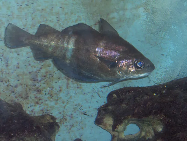 PoutingA deep-bodied coppery gadoid of wrecks and rough ground, barred when fresh, with a prominent chin barbel and a very short shelf life.
Georges Jansoone (JoJan) — CC BY-SA 3.0, via Wikimedia Commons
- European plaiceA right-eyed flatfish with orange spots and a remarkable lifespan, and the representative flatfish for a body plan nothing else on FishingHQ shares.
Hans Hillewaert — CC BY-SA 4.0, via Wikimedia Commons
- Common soleA nocturnal, sand-dwelling flatfish with a rounded head and a small twisted mouth, and one of the most valuable food fish in European waters.
Julien Renoult — CC BY, via iNaturalist
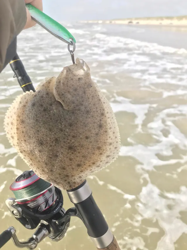 TurbotA large, almost circular left-eyed flatfish with bony tubercles instead of scales, the most valuable flatfish in European waters.
Jonas Holm Hald Therkildsen — CC0, via iNaturalist
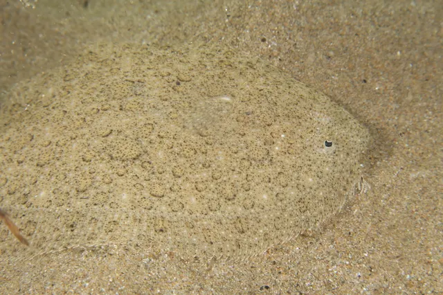 BrillA smooth-skinned left-eyed flatfish of sandy ground, separated from turbot by scales rather than tubercles and by fringed rays at the front of the dorsal fin.
Julien Renoult — CC BY, via iNaturalist
Places within this area
Publicly documented fishing geography. FishingHQ describes what the ground is; it does not say whether you may fish it, and every one of these sends that question to the body that holds the answer. Browse every place in this part of the world.
Who to ask before fishing any of these
FishingHQ does not know the current access position here. Shore angling in England is not rod-licensed, but access rights, landowner permission, local authority and harbour byelaws, national and inshore fisheries measures, and site designations all apply and all change. Check the current position with the relevant inshore fisheries and conservation authority, the harbour or local authority, and the landowner before going.
Chesil Cove
Beach section · Salt water
The Portland end of Chesil Beach, where the shingle bank meets the Isle of Portland and is at its steepest, coarsest and deepest. Large flint and chert cobbles here, against the rock of Portland, with reef either side of the cove.
The most exposed corner of the whole bank. South-westerly swell funnels straight into the cove, and it is one of the few English mainland beaches where the surf is a recognised big-wave feature rather than a nuisance.
Particular to this ground: slips, trips and falls, cold water shock.
Severe hazards of Chesil Beach apply here: drowning and immersion.
Particular to this water: This ground carries conservation designations that constrain access, vehicles, bait collection and disturbance independently of any fishing rule.
Ferrybridge and the Chesil Beach centre
Beach section · Salt water
The eastern tail of the bank where it runs out to meet the Portland causeway, with the Fleet's outflow on the landward side and Portland Harbour beyond it. The shingle here is at its coarsest along the mainland stretch but the bank is at its lowest and shortest, and there is sand as well as stone within reach.
The most sheltered part of the bank, tucked behind Portland, and the one that stays fishable when the rest of Chesil is unfishable in a south-westerly.
Particular to this ground: drowning and immersion, cold water shock.
Particular to this water: The Fleet is a Site of Special Scientific Interest and the bank carries conservation designations. This ground carries conservation designations that constrain access, vehicles, bait collection and disturbance independently of any fishing rule.
Abbotsbury beach
Beach section · Salt water
The middle of the bank, opposite Abbotsbury and the widest part of the Fleet behind it. Classic Chesil: a high steep storm ridge of medium flint and chert shingle with deep water at the foot of it, and the mark most associated with the beach's cod fishing.
Open to the south-west with nothing between it and the Atlantic swell, and no shelter of any kind along the bank.
Particular to this ground: drowning and immersion, cold water shock, moving water and currents.
Particular to this water: The Fleet behind this stretch is a Site of Special Scientific Interest and the swannery holds nesting birds through the spring. This ground carries conservation designations that constrain access, vehicles, bait collection and disturbance independently of any fishing rule.
West Bexington
Beach section · Salt water
The western half of the bank, where the shingle has graded down towards fine and sand, clay and mussel beds lie within reach of the shore. The flattest ground of the Chesil marks in what it holds, and the one anglers travel to for flatfish rather than for cod.
Open to the south-west, and steep enough that a building surf makes it unfishable quickly. It takes the swell as hard as the rest of the bank.
Particular to this ground: drowning and immersion, cold water shock, moving water and currents.
Particular to this water: This ground carries conservation designations that constrain access, vehicles, bait collection and disturbance independently of any fishing rule.
Cogden Beach
Beach section · Salt water
A quiet stretch of the bank between Burton Bradstock and West Bexington, on the fine-shingle half of the beach, with sand appearing at low water. Clean ground, no snags, and the least walked-on of the marks along this part of Chesil.
Open to the south-west, with no shelter and a steeply shelving face.
Particular to this ground: drowning and immersion, cold water shock.
Particular to this water: This ground carries conservation designations that constrain access, vehicles, bait collection and disturbance independently of any fishing rule.
Hive Beach, Burton Bradstock
Beach section · Salt water
The western end of the Chesil system, under the golden sandstone cliffs at Burton Bradstock, where the shingle is fine and gives way to sand at low water. The most straightforward access on this half of the beach and the one with facilities behind it.
Open to the south-west. Sheltered by nothing, though the cliffs behind take the edge off a northerly.
Particular to this ground: drowning and immersion, cold water shock, cliffs and rock platforms.
Particular to this water: This ground carries conservation designations that constrain access, vehicles, bait collection and disturbance independently of any fishing rule.
Safety
Drowning and immersion — Can cause serious injury or death
A steep coarse shingle beach shelves abruptly, so water is over a person's head within a step or two of the wash, and the backwash off the slope runs seaward hard. People are taken off their feet in shallow water and pulled into deep water immediately, and the collapsing shingle makes climbing back out very difficult. The beach has a serious drowning record.
What reduces it: Stay well up the beach and out of the wash, do not turn your back on the sea, and treat a swell running on a calm day as the dangerous condition rather than the safe one. Fish with somebody else, wear a buoyancy aid on the steeper sections, and do not fish the beach at all in rough conditions.
Worse when:
- On the steeper eastern sections, where the profile is most abrupt and the water deepest close in.
- With any swell running, regardless of local wind, because swell arrives independently of it.
- At night and in winter, which is when much of the beach's fishing is done.
Slips, trips and falls — Can cause injury needing treatment
Shingle is unstable and exhausting underfoot, the beach is high and steep in places, and anglers carry heavy tackle long distances in the dark. Falls while walking on or climbing the bank are common and can cause injury a long way from any access point.
What reduces it: Carry less, use a barrow or a proper harness, wear supportive footwear, and use a head torch. Plan the walk in and out as part of the session rather than as an afterthought, and know where the nearest access point is.
Line under tension — Can cause injury needing treatment
Heavy leads cast at distance on a populated beach are dangerous if the line fails. A crack-off sends several ounces of lead a long way at speed, and other anglers are frequently within range.
What reduces it: Use a shock leader appropriate to the lead weight, check the leader knot and the line for damage before each session, look behind and to the sides before casting, and observe the spacing conventions the beach's regulars use.
Further safety reading
- Cold water shock and immersion — Channel water is cold enough year-round that immersion incapacitates within the first minute, which on a steep beach with a strong backwash is the minute that decides the outcome.
- Night fishing safety — Much of the beach's serious fishing happens after dark in winter, a long walk from any access point, on unstable ground with widely spaced exits.
- Shore entry and exit for divers — A steep coarse shingle beach shelves abruptly and the backwash runs seaward hard, so people are taken off their feet in ankle-deep water and the collapsing shingle makes climbing out very difficult.
Check the rules before you fish
Fishing laws, bylaws, access rules, seasons, bait restrictions and permitted methods vary by location and can change. Check the current rules from the relevant authority and the water you intend to fish before fishing.
Check with:
- Current national or regional law for where you are fishing
- Current local bylaws
- The relevant fisheries authority
- The landowner, club or fishery whose water it is
- Any restrictions specific to the species or the method you intend to use
Where to go next
What swims here
- Atlantic codHistorically the beach's winter fish, taken from the deeper eastern sections, though western Channel abundance has changed considerably over recent decades.
 Atlantic mackerelComes within range from the steeper eastern sections in the warmer months as the pelagic shoals move inshore.
- BrillOccupies the same clean ground as turbot offshore of the barrier.
- Common soleOccupies the softer clean ground offshore of the beach, feeding at night over sand.
- Conger eelOccupies what structure exists on and around the ground, holding in holes rather than over open shingle.
- European plaiceA flatfish of the clean shingle and sand offshore of the barrier, moving inshore as water warms.
- European sea bassFeeds in the broken water at the top of the shingle, taking the invertebrates the surf turns over, and is the principal summer and autumn catch.
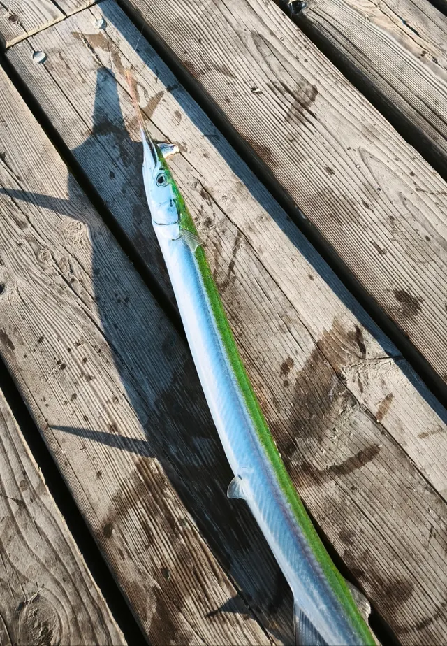 GarfishArrives inshore with the mackerel in the warmer months and works the surface layers close to the steep beach.
6 more
- Lesser sandeel Fish
- Pouting Fish
- Starry smooth-hound Fish
- Thornback ray Fish
- Turbot Fish
- Whiting Fish
How this compares
Rules and access
Environment and conservation
- Discarded line and lost tackleA heavily fished beach beside internationally designated bird and habitat sites is exactly where discarded line and lead do most harm.
- Lead in anglingBeach casting uses heavy leads in quantity and loses them regularly on ground where a lagoon of international wildlife importance sits directly behind the barrier.
Sources and evidence
- The Fishes of the British Isles and North-West Europe — Macmillan, 1969 (Reference work)Relied on for: Distribution, habitat association, depth and ground preference of fishes in British and north-west European waters.States this directlyCitation checked — the work exists and is described correctly
- FishBase: a global information system on fishes — Froese, R. and D. Pauly, eds. — FishBase Consortium (Scientific institute)Relied on for: Distribution, habitat association and depth range recorded for the species.Background and mechanism onlyPassage read and verified
- NOAA Ocean Service tides and water levels educational tutorial — National Oceanic and Atmospheric Administration, United States (Government fisheries body)Relied on for: The mechanism of tides, tidal range, tidal streams and the amplification of tidal range in converging estuaries.States this directlyPassage read and verified
- Met Office shipping forecast, inshore waters forecast and marine warnings — Met Office, United Kingdom (Government fisheries body)Relied on for: Inshore waters forecasting, sea state, swell and the marine warning products issued for British coastal waters.Background and mechanism onlyCitation checked — the work exists and is described correctly
- RNLI water safety guidance: cold water shock and Float to Live — Royal National Lifeboat Institution (Water-safety or diver-training authority)Relied on for: Shore fishing and coastal hazards including being swept in, shore-break, cold water shock and tidal cut-off, and the guidance issued about them.States this directlyPassage read and verified
- RoSPA water safety information and UK accidental drowning statistics — Royal Society for the Prevention of Accidents (Water-safety or diver-training authority)Relied on for: Accidental drowning statistics for the United Kingdom and the circumstances in which recreational water users are most often killed.States this directlyPassage read and verified
Why the 23 connections on this page are here, and the sources
What swims here
Backed by research — 14 connections
Supported by peer-reviewed research or fisheries science. The sources are listed and can be checked.
Atlantic cod
A distribution association between an animal and a kind of water, rather than a claim about any named mark.
- The Fishes of the British Isles and North-West Europe — Macmillan, 1969 (Reference work)Relied on for: Distribution, habitat association, depth and ground preference of fishes in British and north-west European waters.States this directlyCitation checked — the work exists and is described correctly
- FishBase: a global information system on fishes — Froese, R. and D. Pauly, eds. — FishBase Consortium (Scientific institute)Relied on for: Distribution, habitat association and depth range recorded for the species.Background and mechanism onlyPassage read and verified
Atlantic mackerel
A distribution association between an animal and a kind of water, rather than a claim about any named mark.
- The Fishes of the British Isles and North-West Europe — Macmillan, 1969 (Reference work)Relied on for: Distribution, habitat association, depth and ground preference of fishes in British and north-west European waters.States this directlyCitation checked — the work exists and is described correctly
- FishBase: a global information system on fishes — Froese, R. and D. Pauly, eds. — FishBase Consortium (Scientific institute)Relied on for: Distribution, habitat association and depth range recorded for the species.Background and mechanism onlyPassage read and verified
Brill
A distribution association between an animal and a kind of water, rather than a claim about any named mark.
- The Fishes of the British Isles and North-West Europe — Macmillan, 1969 (Reference work)Relied on for: Distribution, habitat association, depth and ground preference of fishes in British and north-west European waters.States this directlyCitation checked — the work exists and is described correctly
- FishBase: a global information system on fishes — Froese, R. and D. Pauly, eds. — FishBase Consortium (Scientific institute)Relied on for: Distribution, habitat association and depth range recorded for the species.Background and mechanism onlyPassage read and verified
Common sole
A distribution association between an animal and a kind of water, rather than a claim about any named mark.
- The Fishes of the British Isles and North-West Europe — Macmillan, 1969 (Reference work)Relied on for: Distribution, habitat association, depth and ground preference of fishes in British and north-west European waters.States this directlyCitation checked — the work exists and is described correctly
- FishBase: a global information system on fishes — Froese, R. and D. Pauly, eds. — FishBase Consortium (Scientific institute)Relied on for: Distribution, habitat association and depth range recorded for the species.Background and mechanism onlyPassage read and verified
Conger eel
A distribution association between an animal and a kind of water, rather than a claim about any named mark.
- The Fishes of the British Isles and North-West Europe — Macmillan, 1969 (Reference work)Relied on for: Distribution, habitat association, depth and ground preference of fishes in British and north-west European waters.States this directlyCitation checked — the work exists and is described correctly
- FishBase: a global information system on fishes — Froese, R. and D. Pauly, eds. — FishBase Consortium (Scientific institute)Relied on for: Distribution, habitat association and depth range recorded for the species.Background and mechanism onlyPassage read and verified
European plaice
A distribution association between an animal and a kind of water, rather than a claim about any named mark.
- The Fishes of the British Isles and North-West Europe — Macmillan, 1969 (Reference work)Relied on for: Distribution, habitat association, depth and ground preference of fishes in British and north-west European waters.States this directlyCitation checked — the work exists and is described correctly
- FishBase: a global information system on fishes — Froese, R. and D. Pauly, eds. — FishBase Consortium (Scientific institute)Relied on for: Distribution, habitat association and depth range recorded for the species.Background and mechanism onlyPassage read and verified
European sea bass
A distribution association between an animal and a kind of water, rather than a claim about any named mark.
- The Fishes of the British Isles and North-West Europe — Macmillan, 1969 (Reference work)Relied on for: Distribution, habitat association, depth and ground preference of fishes in British and north-west European waters.States this directlyCitation checked — the work exists and is described correctly
- FishBase: a global information system on fishes — Froese, R. and D. Pauly, eds. — FishBase Consortium (Scientific institute)Relied on for: Distribution, habitat association and depth range recorded for the species.Background and mechanism onlyPassage read and verified
Garfish
A distribution association between an animal and a kind of water, rather than a claim about any named mark.
- The Fishes of the British Isles and North-West Europe — Macmillan, 1969 (Reference work)Relied on for: Distribution, habitat association, depth and ground preference of fishes in British and north-west European waters.States this directlyCitation checked — the work exists and is described correctly
- FishBase: a global information system on fishes — Froese, R. and D. Pauly, eds. — FishBase Consortium (Scientific institute)Relied on for: Distribution, habitat association and depth range recorded for the species.Background and mechanism onlyPassage read and verified
Lesser sandeel
A distribution association between an animal and a kind of water, rather than a claim about any named mark.
- The Fishes of the British Isles and North-West Europe — Macmillan, 1969 (Reference work)Relied on for: Distribution, habitat association, depth and ground preference of fishes in British and north-west European waters.States this directlyCitation checked — the work exists and is described correctly
- FishBase: a global information system on fishes — Froese, R. and D. Pauly, eds. — FishBase Consortium (Scientific institute)Relied on for: Distribution, habitat association and depth range recorded for the species.Background and mechanism onlyPassage read and verified
Pouting
A distribution association between an animal and a kind of water, rather than a claim about any named mark.
- The Fishes of the British Isles and North-West Europe — Macmillan, 1969 (Reference work)Relied on for: Distribution, habitat association, depth and ground preference of fishes in British and north-west European waters.States this directlyCitation checked — the work exists and is described correctly
- FishBase: a global information system on fishes — Froese, R. and D. Pauly, eds. — FishBase Consortium (Scientific institute)Relied on for: Distribution, habitat association and depth range recorded for the species.Background and mechanism onlyPassage read and verified
Starry smooth-hound
A distribution association between an animal and a kind of water, rather than a claim about any named mark.
- The Fishes of the British Isles and North-West Europe — Macmillan, 1969 (Reference work)Relied on for: Distribution, habitat association, depth and ground preference of fishes in British and north-west European waters.States this directlyCitation checked — the work exists and is described correctly
- FishBase: a global information system on fishes — Froese, R. and D. Pauly, eds. — FishBase Consortium (Scientific institute)Relied on for: Distribution, habitat association and depth range recorded for the species.Background and mechanism onlyPassage read and verified
Thornback ray
A distribution association between an animal and a kind of water, rather than a claim about any named mark.
- The Fishes of the British Isles and North-West Europe — Macmillan, 1969 (Reference work)Relied on for: Distribution, habitat association, depth and ground preference of fishes in British and north-west European waters.States this directlyCitation checked — the work exists and is described correctly
- FishBase: a global information system on fishes — Froese, R. and D. Pauly, eds. — FishBase Consortium (Scientific institute)Relied on for: Distribution, habitat association and depth range recorded for the species.Background and mechanism onlyPassage read and verified
Turbot
A distribution association between an animal and a kind of water, rather than a claim about any named mark.
- The Fishes of the British Isles and North-West Europe — Macmillan, 1969 (Reference work)Relied on for: Distribution, habitat association, depth and ground preference of fishes in British and north-west European waters.States this directlyCitation checked — the work exists and is described correctly
- FishBase: a global information system on fishes — Froese, R. and D. Pauly, eds. — FishBase Consortium (Scientific institute)Relied on for: Distribution, habitat association and depth range recorded for the species.Background and mechanism onlyPassage read and verified
Whiting
A distribution association between an animal and a kind of water, rather than a claim about any named mark.
- The Fishes of the British Isles and North-West Europe — Macmillan, 1969 (Reference work)Relied on for: Distribution, habitat association, depth and ground preference of fishes in British and north-west European waters.States this directlyCitation checked — the work exists and is described correctly
- FishBase: a global information system on fishes — Froese, R. and D. Pauly, eds. — FishBase Consortium (Scientific institute)Relied on for: Distribution, habitat association and depth range recorded for the species.Background and mechanism onlyPassage read and verified
How people fish here
What experienced anglers do — 2 connections
Widely and independently recommended by experienced anglers and specialist sources. This is real angling knowledge, not proof: controlled evidence for it is limited, and FishingHQ records it as convention rather than as a demonstrated effect.
Lure fishing
A discipline that is characteristic of the place rather than merely possible there, joined so a reader can move between the place and the practice.
- General angling website restatements of established technique — Various (Credible secondary source)Relied on for: Widely restated practice associating this discipline with this place, recorded as practitioner consensus rather than as tested fact.Background and mechanism onlyCitation checked — the work exists and is described correctly
- Fishers' Craft and Lettered Art: Tracts on Fishing from the End of the Middle Ages — University of Toronto Press, 1997 (Scientific literature)Relied on for: That fishing traditions develop around the water and fish available to them, and the historical method of reading such traditions.States this directlyCitation checked — the work exists and is described correctly
Sea fishing
A discipline that is characteristic of the place rather than merely possible there, joined so a reader can move between the place and the practice.
- General angling website restatements of established technique — Various (Credible secondary source)Relied on for: Widely restated practice associating this discipline with this place, recorded as practitioner consensus rather than as tested fact.Background and mechanism onlyCitation checked — the work exists and is described correctly
- Fishers' Craft and Lettered Art: Tracts on Fishing from the End of the Middle Ages — University of Toronto Press, 1997 (Scientific literature)Relied on for: That fishing traditions develop around the water and fish available to them, and the historical method of reading such traditions.States this directlyCitation checked — the work exists and is described correctly
How this compares
What experienced anglers do — 1 connection
Widely and independently recommended by experienced anglers and specialist sources. This is real angling knowledge, not proof: controlled evidence for it is limited, and FishingHQ records it as convention rather than as a demonstrated effect.
The Channel shingle coasts
Two places a reader would reasonably weigh against one another, joined where the comparison teaches something about both. It is also how the larger geography is linked to what sits inside it.
- General angling website restatements of established technique — Various (Credible secondary source)Relied on for: Widely restated practice associating this discipline with this place, recorded as practitioner consensus rather than as tested fact.Background and mechanism onlyCitation checked — the work exists and is described correctly
- Fishers' Craft and Lettered Art: Tracts on Fishing from the End of the Middle Ages — University of Toronto Press, 1997 (Scientific literature)Relied on for: That fishing traditions develop around the water and fish available to them, and the historical method of reading such traditions.States this directlyCitation checked — the work exists and is described correctly
Safety reading
Official guidance — 3 connections
Stated by a fisheries authority, scientific institute or recognised angling body. Authoritative, but summarising rather than demonstrating.
Cold water shock and immersion
A place is joined to the safety topic that explains a hazard genuinely characteristic of it, so the mechanism is reachable rather than restated as a weak warning.
- RNLI water safety guidance: cold water shock and Float to Live — Royal National Lifeboat Institution (Water-safety or diver-training authority)Relied on for: Cold water shock and the immersion response, shore angling hazards, small-craft guidance and the circumstances in which water users are most often killed.States this directlyPassage read and verified
- RoSPA water safety information and UK accidental drowning statistics — Royal Society for the Prevention of Accidents (Water-safety or diver-training authority)Relied on for: Accidental drowning statistics and the circumstances in which recreational water users are most often killed.Background and mechanism onlyPassage read and verified
Night fishing safety
A place is joined to the safety topic that explains a hazard genuinely characteristic of it, so the mechanism is reachable rather than restated as a weak warning.
- RNLI water safety guidance: cold water shock and Float to Live — Royal National Lifeboat Institution (Water-safety or diver-training authority)Relied on for: Cold water shock and the immersion response, shore angling hazards, small-craft guidance and the circumstances in which water users are most often killed.States this directlyPassage read and verified
- RoSPA water safety information and UK accidental drowning statistics — Royal Society for the Prevention of Accidents (Water-safety or diver-training authority)Relied on for: Accidental drowning statistics and the circumstances in which recreational water users are most often killed.Background and mechanism onlyPassage read and verified
Shore entry and exit for divers
A place is joined to the safety topic that explains a hazard genuinely characteristic of it, so the mechanism is reachable rather than restated as a weak warning.
- RNLI water safety guidance: cold water shock and Float to Live — Royal National Lifeboat Institution (Water-safety or diver-training authority)Relied on for: Cold water shock and the immersion response, shore angling hazards, small-craft guidance and the circumstances in which water users are most often killed.States this directlyPassage read and verified
- RoSPA water safety information and UK accidental drowning statistics — Royal Society for the Prevention of Accidents (Water-safety or diver-training authority)Relied on for: Accidental drowning statistics and the circumstances in which recreational water users are most often killed.Background and mechanism onlyPassage read and verified
Rules and access
Official guidance — 1 connection
Stated by a fisheries authority, scientific institute or recognised angling body. Authoritative, but summarising rather than demonstrating.
Size limits and retention
A place joined to the regulatory concept whose structure it illustrates. The edge asserts that the concept applies here, never what any current rule says.
- Code of Conduct for Responsible Fisheries — Food and Agriculture Organization of the United Nations, Rome, 1995 (Standards body)Relied on for: Principles for the management of fisheries, including licensing, closed seasons, size limits and the treatment of small-scale and shared stocks.States this directlyCitation checked — the work exists and is described correctly
- Good Fish Guide — Marine Conservation Society (Conservation authority)Relied on for: Assessment of fisheries and the management measures applied to them, including the instruments used and their purpose.Background and mechanism onlyCitation checked — the work exists and is described correctly
Environment and conservation
Backed by research — 2 connections
Supported by peer-reviewed research or fisheries science. The sources are listed and can be checked.
Discarded line and lost tackle
An environmental pressure that is specific to this place rather than general to fishing, joined so the issue is anchored to a real example.
- The IUCN Red List of Threatened Species — International Union for Conservation of Nature (Conservation authority)Relied on for: Assessment of the species and habitats affected, and the pressures acting on them, including habitat change and exploitation.States this directlyCitation checked — the work exists and is described correctly
- Code of Conduct for Responsible Fisheries — Food and Agriculture Organization of the United Nations, Rome, 1995 (Standards body)Relied on for: Principles for responsible fisheries management, precaution, gear selectivity and the treatment of shared and small-scale fisheries.Background and mechanism onlyCitation checked — the work exists and is described correctly
Lead in angling
An environmental pressure that is specific to this place rather than general to fishing, joined so the issue is anchored to a real example.
- The IUCN Red List of Threatened Species — International Union for Conservation of Nature (Conservation authority)Relied on for: Assessment of the species and habitats affected, and the pressures acting on them, including habitat change and exploitation.States this directlyCitation checked — the work exists and is described correctly
- Code of Conduct for Responsible Fisheries — Food and Agriculture Organization of the United Nations, Rome, 1995 (Standards body)Relied on for: Principles for responsible fisheries management, precaution, gear selectivity and the treatment of shared and small-scale fisheries.Background and mechanism onlyCitation checked — the work exists and is described correctly
How FishingHQ labels evidence is explained in the evidence policy.