The Channel shingle coasts
Fishing regions · Last reviewed 2026-08-13
Steep banks of graded pebbles with deep water a rod's length out. The grading is not decoration — it sorts the seabed by particle size, and the fish distribute themselves along that sorting.
Safety: drowning and immersion — can cause serious injury or death. 2 more points apply here.
Being listed here is not permission to fish. What that meansClose
Access, fishing rights, seasons, licences, local bylaws and permitted methods vary and can change. Check current access, permission, local regulations, closures and restrictions before you travel or fish. FishingHQ describes what the ground is and names who holds the answer; it does not hold the answer itself.
Find the authority for a jurisdiction · What FishingHQ does and does not cover
The shingle coasts of the English Channel are a coast-tier case because one physical process — the wave sorting of pebbles — explains the shape of the beach, where the fish feed, how the fishing is conducted, and why people are killed on it.
SHINGLE BEACHES ARE STEEP BECAUSE SHINGLE DRAINS. A wave running up a sand beach carries water back down the face as sheet flow, which drags sediment seaward and produces a shallow gradient. On a coarse pebble beach the uprush sinks into the porous bed instead, so much less water returns down the face, so much less material is dragged back. Material is therefore pushed up the beach more effectively than it is pulled down, and the profile steepens until it reaches an angle where the two balance. That is why shingle banks are steep-to and why deep water lies close inshore — the defining fact of the fishing.
AND WAVES GRADE THE PEBBLES BY SIZE. Larger clasts are thrown highest by wave uprush and are least easily returned; finer material works down the profile and offshore. The result is a beach that is sorted vertically, with the coarsest material at the crest and progressively finer material down the face and out onto the seabed beyond. Longshore drift adds a second axis of sorting along the coast, which is why some shingle structures grade in particle size over many kilometres of their length.
THE GRADING GOVERNS WHERE FOOD IS. Coarse, mobile, well-drained shingle supports very little infauna — it is a scoured, unstable substrate. Finer sediment further out is stable enough to hold worms, crustaceans and molluscs. So the productive feeding ground is not the beach face but the zone beyond it where the substrate becomes fine enough to live in, and how far out that is depends on the beach's steepness and the size of its material.
WHICH IS THE PRACTICAL INTELLIGENCE THIS PAGE EXISTS TO GIVE. On a steep shingle beach, the assumption that distance equals success is frequently wrong, and the assumption that fish feed close in is frequently right — bass, rays and flatfish work the deeper water immediately off the step, and the food is concentrated where the seabed stops being mobile. Reading a shingle beach means reading the profile and the material rather than the geography.
AND THE SAME STEEPNESS PRODUCES THE HAZARD. Waves do not dissipate gradually across a wide surf zone as they do on a sand beach; they arrive at a steep face and break directly onto it. That produces a violent shore-break, powerful backwash, and unstable footing on loose material at the exact point where a person is standing. Chesil Beach and its analogues along the Channel have a long record of anglers being taken by it, and the mechanism is the beach rather than bad luck.
What fishing here is like
Steep, coarse, mobile pebble beaches with deep water close inshore, occurring along the Channel coast of southern England and in comparable form on parts of the French side and elsewhere in northern Europe. The fishing is predominantly shore angling — the deep water close in means a shore angler reaches ground that would require a boat on a shallow sandy coast. Session fishing at night is normal, and the beaches are heavily used and long-established as venues.
What you can target here
One entry per fish, grouped by how you would be fishing — because the answer is a different one from the rocks and from a boat. Each entry says how strongly the sources support it and how much evidence sits behind it. These are documented catches, not a forecast, and none of it is a statement that you may fish any particular ground.
From the shore · 12
 European sea bassRegular local target7 placesDungeness Point, Ramsgate harbour, Folkestone harbour arm, Eastbourne Pier and 3 moreOver breakwater, harbour wall, marina, pier, shingle bankAround May–Oct
 Atlantic codRegular local target5 placesDungeness Point, Deal Pier, Hastings and the Stade, Newhaven west arm and 1 moreOver beach section, breakwater, marina, pier, shingle bankAround Jan–Feb, Nov–Dec
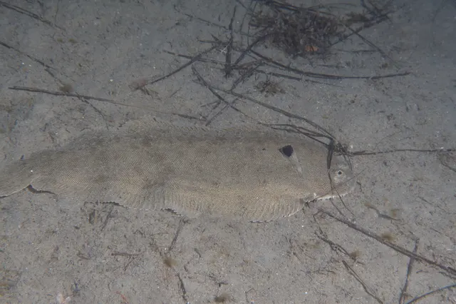 Common soleRegular local target5 placesHastings and the Stade, Sandwich Bay, Dungeness Point, Deal Pier and 1 moreOver beach, beach section, pier, shingle bankAround May–Sept
- Starry smooth-houndRegular local target4 placesDungeness Point, Hastings and the Stade, Sandwich Bay, Worthing PierOver beach, beach section, pier, shingle bankAround May–Sept
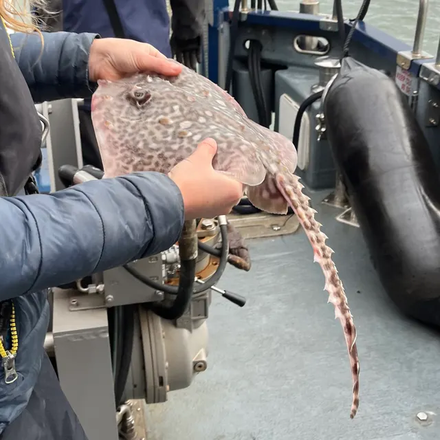 Thornback rayRegular local target4 placesDungeness Point, Hastings and the Stade, Sandwich Bay, Worthing PierOver beach, beach section, pier, shingle bankAround May–Sept
 WhitingRegular local target3 placesSandwich Bay, Ramsgate harbour, Worthing PierOver beach, harbour wall, pierAround Jan–Feb, Nov–Dec
Also documented from the shore: Conger eel · Pollack · Thick-lipped grey mullet · Black seabream · European flounder · European squid
What these strengths mean
- Regular local target
- Fishing sources describe this as a normal local target here, not merely as caught.
- Seasonal
- Well supported, and concentrated in part of the year rather than spread through it.
- How breadth is counted
- A fish documented at six marks is shown as six marks: breadth never raises the strength on its own. A fishery account describes the fishing; a recorded catch reports one specific catch. How evidence is weighed.
How people fish here
4 methods are recorded on the places documented here, counted from the records themselves rather than from what is practised in the country. Each opens a full guide to the technique.
Ledgering
Recorded at 14 places here, over beach, pier, breakwater, beach section.
Fishing a bait on the bottom held by a weight, with no float — the simplest way to fish at distance, in depth, or in wind.
Documented on the same ground: Atlantic cod, Common sole, Conger eel, European sea bass, Pollack, Starry smooth-hound.
Float fishing
Recorded at 8 places here, over breakwater, pier, harbour wall, ledge.
Suspending a bait at a controlled depth beneath a buoyant indicator — the most visual, most controllable and most widely applicable method in angling.
Documented on the same ground: Atlantic cod, Conger eel, European sea bass, Pollack, Starry smooth-hound, Thornback ray.
Spinning
Recorded at 4 places here, over beach section, estuary mark, ledge, shingle bank.
Casting an artificial lure and retrieving it so that it moves like something alive — the most direct form of lure fishing.
Documented on the same ground: Atlantic cod, Common sole, European sea bass, Starry smooth-hound, Thick-lipped grey mullet, Thornback ray.
Kayak fishing
Recorded at 1 place here, over estuary mark.
A platform rather than a technique: quiet, shallow-draught access to water no other craft reaches, bought at the price of exposure, and a discipline where the decision not to launch is part of the skill.
Documented on the same ground: Thick-lipped grey mullet, European flounder.
These are the methods documented at the places FishingHQ holds here. A species listed beside a method is documented on the same ground, which is not the same as being taken that way — where a source establishes the method a fish was caught on, it is stated on that place’s own page. All fishing methods.
The fishing year here
The months the records under this area actually name, tightest season first. This is “observed in these months” rather than a season: a species whose months nobody recorded is not listed, because a gap in the evidence is not a year-round fishery.
- Atlantic codNovember to February
- WhitingNovember to February
- European squidOctober to January
- Common soleMay to September
- Starry smooth-houndMay to September
- Thornback rayMay to September
- European sea bassMay to October
- PollackMay to October
- Thick-lipped grey mulletMay to October
- Black seabreamMay to October
- European flounderOctober to March
What dominates
Surfcasting and ledgering from the beach, which is the overwhelmingly dominant discipline. Float fishing and light lure fishing where the ground and conditions allow, particularly for bass and mackerel over the step. Some small-boat and kayak launching from shingle, which is genuinely difficult and is a specific skill on this ground. Bait collection on adjacent estuarine and sandy ground rather than on the shingle itself, which supports very little.
The water available
Steep-to graded shingle banks, frequently backed by lagoons or low ground and sometimes forming barrier structures across former estuaries; a narrow, steep, mobile beach face; a step or shoulder at the base of the face beyond which the seabed grades to finer sediment; and mixed ground of shingle, sand, clay and occasional rock offshore. Longshore drift is active along the whole system and moves large volumes of material.
How the rules are structured
Recreational sea angling in England is not licensed in the way freshwater angling is, but a substantial framework applies nonetheless: minimum conservation reference sizes, species-specific measures for bass that have changed repeatedly in recent years, byelaws made by the local inshore fisheries and conservation authority, and marine protected area designations covering parts of this coast. Many shingle structures are also protected for their geomorphology and their bird and plant communities, which restricts access and vehicles independently of any fishing rule. Access itself is a separate question of land ownership and local arrangement. FishingHQ does not state what any current rule is.
Who to ask
- The relevant Inshore Fisheries and Conservation Authority, which makes and enforces byelaws for the inshore district concerned.
- The Marine Management Organisation, for national recreational sea fishing measures in English waters.
- Natural England and the relevant protected site management body, where a shingle structure carries a conservation designation affecting access.
- The landowner or managing body for the beach itself, since access and parking are property matters rather than fisheries ones.
- The Maritime and Coastguard Agency and the RNLI, for safety guidance on this coast.
Words you will meet
- Steep-to
- A beach whose face descends steeply so that deep water lies close inshore. The defining property of a shingle beach and the reason a shore angler can reach fish that would require a boat elsewhere.
- The step
- The break of slope at the base of the beach face where the steep shingle gives way to the flatter seabed beyond. The zone immediately beyond it is where substrate becomes stable enough to hold food, and it is closer in than most anglers assume.
- Backwash
- The water returning down the beach face after a wave has broken. On a steep shingle beach it is powerful, concentrated and moves loose material with it, and it is the mechanism by which people are pulled off their feet.
- Longshore drift
- The net movement of beach material along the coast, driven by waves arriving at an angle. It builds and maintains shingle structures, grades them along their length, and means the beach is a moving system rather than a fixed one.
Conditions and hazards
Shingle beaches kill anglers, and the mechanism is specific and repeatable rather than a matter of misfortune. Because the beach is steep, waves break directly onto the face rather than dissipating across a surf zone, so a person standing at the water's edge is standing where the full energy of the wave arrives. The backwash is powerful and runs down a slope of loose, mobile material that gives way underfoot, so a person knocked down is being pulled down a slope they cannot grip while unable to regain their feet. Deep water is immediately there. Sets are irregular and a beach that has been benign for an hour produces a much larger wave without warning, particularly when a long-period swell is running that the local wind does not explain. Night fishing, which is normal here, removes the ability to see a set coming. A buoyancy aid, not fishing alone, keeping back from the water's edge in any swell, and treating a rising sea as a reason to leave rather than to move up the beach are the measures that address the actual mechanism.
Reading a shingle beach: what the material tells you
The most useful skill on this coast is reading the beach itself, and it is genuinely learnable because the beach is the visible output of the process that shaped the seabed in front of it.
PARTICLE SIZE INDICATES ENERGY. Coarse material means high wave energy at that point; finer material means lower. A stretch of beach with markedly larger pebbles is a stretch taking more energy, which usually means a steeper face and deeper water closer in. A stretch that grades finer is flatter and shallower, and the productive ground lies further out.
THE PROFILE INDICATES THE SEASON'S HISTORY. Shingle beaches build a steep, high berm in settled conditions and are cut back and flattened by storms, which move material offshore and along the coast. A beach that has recently been storm-cut has a different profile, a different position of the step, and frequently freshly exposed underlying clay, peat or rock — all of which change where fish feed and where gear will be lost.
THE STEP IS THE FEATURE THAT MATTERS. It is where the mobile beach face ends and the more stable seabed begins, and it is the boundary between substrate that supports almost nothing and substrate that supports the worms, crustaceans and molluscs fish come in to eat. Finding it — by casting, by feeling the lead, by watching the wave break — locates the fishing far more reliably than distance does.
LONGSHORE DRIFT EXPLAINS THE COAST'S LARGE-SCALE STRUCTURE. Waves arriving at an angle move material along the shore, and where that movement is interrupted — by a headland, a river mouth, a groyne, a harbour arm — material accumulates on one side and is starved on the other. That is why the two sides of an obstruction fish differently and why beaches change character over a walk of a kilometre.
AND THE WHOLE SYSTEM MOVES. A shingle bank is not a landform in the sense a cliff is; it is a body of sediment in transit, reshaped by every storm. Features are not permanent, and intelligence about a beach has a shelf life measured in seasons rather than in years — which is precisely why this page describes the process rather than listing places.
Backed by research — why, and the sources (4)
Supported by peer-reviewed research or fisheries science. The sources are listed and can be checked.
- Cefas science, advice and data on marine and freshwater environments — Centre for Environment, Fisheries and Aquaculture Science (Government fisheries body)Relied on for: Marine and freshwater environmental science, including the physical characterisation of shelf seas and the monitoring programmes that describe them.States this directlyCitation checked — the work exists and is described correctly
- ICES Advice on fishing opportunities, catch and effort — International Council for the Exploration of the Sea (Scientific institute)Relied on for: Ecoregion description, stock distribution and the hydrography of the area assessed.States this directlyCitation checked — the work exists and is described correctly
- RNLI water safety guidance: cold water shock and Float to Live — Royal National Lifeboat Institution (Water-safety or diver-training authority)Relied on for: Cold water shock and the immersion response, tidal cut-off, and guidance for shore anglers and small-craft users.States this directlyPassage read and verified
- Met Office shipping forecast, inshore waters forecast and marine warnings — Met Office, United Kingdom (Government fisheries body)Relied on for: That inshore waters forecasts, sea state and swell are the operative inputs for shore and small-craft decisions in these waters.Background and mechanism onlyCitation checked — the work exists and is described correctly
Why this coast is more dangerous than it looks
Shingle beaches present a hazard profile that is genuinely different from a sandy shore, and the difference is not one of degree.
A SAND BEACH DISSIPATES WAVE ENERGY GRADUALLY. The gentle gradient produces a wide surf zone in which waves break progressively and lose energy over a considerable distance, so the water reaching an angler at the edge has already spent most of it.
A STEEP SHINGLE BEACH DOES NOT. Waves travel in deep water almost to the beach face and break on it directly, delivering their full energy at the point where a person is standing. There is no surf zone to absorb anything. That is the same property that makes the fishing good — deep water close in — expressed as a hazard.
THE BACKWASH IS THE KILLING MECHANISM. Water returning down a steep face is fast, concentrated and carries mobile material with it. A person knocked off their feet is on a slope of loose pebbles that shift under any attempt to grip, being pulled downhill by moving water, into deep water immediately. Regaining footing is very difficult and the sequence takes seconds.
SETS AND SWELL MAKE IT UNPREDICTABLE. Waves arrive in groups, and the largest wave in a set may be substantially larger than those before it. Where a long-period ground swell is running — generated by weather far away, arriving with no local wind — the sets are larger still and the calm appearance of the intervening water is actively misleading.
AND THE FISHING CULTURE COMPOUNDS ALL OF IT. Sessions here are conducted at night, often alone, often in winter, in cold water, on a beach where a fall means immersion. Cold water shock produces an involuntary gasp and hyperventilation on entry, which is why immersion in cold water so often kills people who could swim.
WHAT ACTUALLY HELPS is a buoyancy aid worn rather than carried, not fishing alone, standing back from the water's edge whenever a swell is running rather than at it, treating a building sea as a reason to leave rather than to move up the beach, telling somebody the plan and the return time, and carrying a means of calling for help on the person. None of that is specific to shingle except that shingle is where it is most needed.
Official guidance — why, and the sources (2)
Stated by a fisheries authority, scientific institute or recognised angling body. Authoritative, but summarising rather than demonstrating.
- United States Lifesaving Association public education on rip currents and the surf zone — United States Lifesaving Association (Water-safety or diver-training authority)Relied on for: Surf zone hazards, rip current formation and behaviour, and public guidance on shore-break and steep-beach hazards.States this directlyCitation checked — the work exists and is described correctly
- RNLI water safety guidance: cold water shock and Float to Live — Royal National Lifeboat Institution (Water-safety or diver-training authority)Relied on for: Shore angling hazards including shingle shore-break, cold water shock and tidal cut-off, and the advice to carry a means of calling for help.States this directlyPassage read and verified
How shingle sorts itself, and why the beach profile follows
The Channel's shingle coasts are the clearest demonstration in Britain of a physical process producing a fishery, and the process is longshore sorting.
WAVES ARRIVING AT AN ANGLE MOVE MATERIAL ALONG THE BEACH. Each wave carries shingle up the beach obliquely and the backwash returns it straight down the slope, so material migrates along the shore in the direction of the prevailing wave approach. Over a long beach and a long time this produces net transport — longshore drift.
TRANSPORT SORTS BY SIZE. A given wave has enough energy to move a small stone further than a large one, so material grades along the drift direction, with finer shingle at one end and coarser at the other. Chesil is the extreme example; the effect operates on every shingle beach on this coast.
STONE SIZE DECIDES DRAINAGE AND DRAINAGE DECIDES SLOPE. Coarse shingle drains fast, so water sinks in rather than running back over the surface, and the beach can hold a much steeper face. Fine shingle drains slowly and the profile is gentler. That is why coarse shingle beaches shelve abruptly into deep water and fine ones do not.
STEEPNESS DECIDES THE FISHING. A steep beach puts deep water within casting range and produces a narrow violent wash; a gentle one produces a broad surf table and a wider feeding zone. Both hold fish and they hold them differently and at different distances.
GROYNES AND SEA DEFENCES INTERRUPT THE DRIFT DELIBERATELY, trapping shingle updrift and starving the beach downdrift, which is why an engineered stretch of this coast has a different profile every few hundred metres.
AND THE GROUND OFFSHORE IS GENERALLY CLEAN — shingle, sand and mixed ground with limited rough — which is why bait can be fished on the bottom without constant losses and why this coast became a mainstream shore fishing one.
Backed by research — why, and the sources (2)
Supported by peer-reviewed research or fisheries science. The sources are listed and can be checked.
- NOAA Ocean Service tides and water levels educational tutorial — National Oceanic and Atmospheric Administration, United States (Government fisheries body)Relied on for: The mechanism of tides, tidal range and tidal streams, and their amplification by coastal geometry.States this directlyPassage read and verified
- Met Office shipping forecast, inshore waters forecast and marine warnings — Met Office, United Kingdom (Government fisheries body)Relied on for: Inshore waters forecasting, sea state and swell, and the marine warning products issued for north-west European waters.Background and mechanism onlyCitation checked — the work exists and is described correctly
What lives on and off a Channel shingle beach
The species associated with these beaches are those that feed in or over clean mobile ground, and the mix changes sharply with water temperature.
BASS ARE THE PRINCIPAL WARM-SEASON PREDATOR. European sea bass hunt in the broken water at the top of the beach, taking the small crustaceans, worms and molluscs the surf turns over and the small fish that gather there. On a steep shingle beach they are frequently far closer than a visiting angler expects.
COD, WHITING AND POUTING ARE THE COLD-SEASON GADOIDS over the clean ground offshore. Cod on this coast are the historic winter fish, and western Channel abundance has changed markedly over recent decades, which any honest description has to state.
FLATFISH OCCUPY THE CLEAN GROUND ALL YEAR in changing proportion: plaice and dab on the sand and mixed ground, sole feeding at night over softer bottoms, and turbot and brill as ambush predators on the cleaner shingle and sand.
MACKEREL, GARFISH AND SCAD ARRIVE IN THE WARMER MONTHS as pelagic shoals come inshore, and they are the reason a steep beach fishes as a deep-water mark in summer.
RAYS AND SMOOTH-HOUNDS WORK THE CLEANER GROUND, with thornback ray widespread and smooth-hounds strongly associated with crab as prey.
CONGER AND WRASSE OCCUPY ANY STRUCTURE — groynes, breakwaters, rough patches — rather than the open shingle.
AND THE FORAGE IS THE FOUNDATION. Sandeels buried in the clean ground, sprats and small shoaling fish in the water column, and the invertebrates the wash mobilises are what every predator above is there for. FishingHQ's sandeel page explains why a clean sandy bottom is not empty ground.
Backed by research — why, and the sources (2)
Supported by peer-reviewed research or fisheries science. The sources are listed and can be checked.
- The Fishes of the British Isles and North-West Europe — Macmillan, 1969 (Reference work)Relied on for: Distribution, habitat association, depth and ground preference of fishes in British and north-west European waters.States this directlyCitation checked — the work exists and is described correctly
- FishBase: a global information system on fishes — Froese, R. and D. Pauly, eds. — FishBase Consortium (Scientific institute)Relied on for: Distribution, habitat association and depth range recorded for the species.Background and mechanism onlyPassage read and verified
Beach casting, and the fishing that happens at your feet
Shingle beaches are shore fishing venues and the disciplines are shaped by clean ground and an unobstructed back-cast.
LONG-RANGE BAIT FISHING IS THE CLASSIC APPROACH AND IT MADE THE TACKLE. Clean ground offshore and open beach behind means distance casting is both possible and useful, and British beach-casting technique, rod design and lead development came substantially from beaches like these. Long powerful rods, streamlined leads, simplified rigs and shock leaders are the standard arrangement.
THE SHOCK LEADER IS SAFETY EQUIPMENT rather than a refinement. Casting a heavy lead on light main line without one risks a crack-off that sends several ounces of lead a long way along a beach that frequently has other people on it, and it is standard practice on this coast for that reason.
CLOSE-IN FISHING IS THE UNDER-USED HALF. Bass, flatfish and rays feed in the wash and the first gully, sometimes within a rod length, and the commonest visitor error on a steep shingle beach is casting over the fish.
LURE FISHING FROM THE STEEPER SECTIONS works because deep water is reachable without distance, and it is the growth area in shore fishing on this coast.
FLOAT FISHING WORKS FROM STEEP BEACHES AND GROYNES in the same way it would from a pier, for mackerel, garfish and wrasse.
NIGHT FISHING IS THE PRODUCTIVE MODE FOR SEVERAL SPECIES, particularly sole, bass and cod, and much of the serious effort on these beaches happens after dark.
AND THE PHYSICAL LOGISTICS ARE PART OF THE DISCIPLINE. Shingle is exhausting underfoot, access points are widely spaced, and planning what to carry and how far is as much a part of a session as the tackle.
What experienced anglers do — why, and the sources (2)
Widely and independently recommended by experienced anglers and specialist sources. This is real angling knowledge, not proof: controlled evidence for it is limited, and FishingHQ records it as convention rather than as a demonstrated effect.
- General angling website restatements of established technique — Various (Credible secondary source)Relied on for: Widely restated practice associating this discipline or technique with this place, recorded as practitioner consensus rather than as tested fact.Background and mechanism onlyCitation checked — the work exists and is described correctly
- Fishers' Craft and Lettered Art: Tracts on Fishing from the End of the Middle Ages — University of Toronto Press, 1997 (Scientific literature)Relied on for: That fishing traditions develop around the water and fish available to them, and the historical method of reading such traditions from their documentary record.States this directlyCitation checked — the work exists and is described correctly
A cold-season coast with a warm-season overlay
The Channel's shingle beaches have a pronounced seasonal cycle driven by water temperature, and the shape of it is worth stating plainly.
WINTER IS THE HISTORIC PEAK. Cold water brings whiting, pouting and — historically in numbers, less so now — cod within casting range, and the beaches are fished hard at night through the coldest months. The changed cod picture in the western Channel means this season is not what it was, and repeating the old reputation without that caveat would mislead.
SPRING IS THE TRANSITION AND THE FLATFISH PERIOD. Plaice and dab move onto the clean ground, water clarity improves, and the beach profile is still recovering from winter storms.
SUMMER IS PELAGIC AND CLOSE-RANGE. Mackerel, garfish and scad arrive inshore, bass feed in the wash, sole feed at night over softer ground, and smooth-hounds and rays are at their most available. Calm bright conditions are pleasant and frequently unproductive, which is the usual summer trade-off.
AUTUMN IS THE BEST GENERAL PERIOD. Warm water, feeding bass, the first autumn swells stirring the ground and the winter species beginning to appear — most experienced shore anglers on this coast would take autumn over any other season.
SWELL IS THE OVERRIDING SHORT-TERM VARIABLE. A moderate swell stirs food and improves the fishing; a large one rearranges the shingle, colours the water and makes the beach unfishable and dangerous. Reading swell height, period and direction rather than wind is the skill this coast demands.
AND THE BEACH ITSELF IS SEASONAL. Winter storms move very large volumes of shingle, so the profile at a given point is not constant between years, and a gully that fished last winter may not exist this one.
Backed by research — why, and the sources (2)
Supported by peer-reviewed research or fisheries science. The sources are listed and can be checked.
- ICES Advice on fishing opportunities, catch and effort — International Council for the Exploration of the Sea (Scientific institute)Relied on for: Stock assessment, the environmental drivers of stock distribution and abundance, and the scientific basis for advice in the sea areas concerned.States this directlyCitation checked — the work exists and is described correctly
- FishBase: a global information system on fishes — Froese, R. and D. Pauly, eds. — FishBase Consortium (Scientific institute)Relied on for: Distribution, temperature tolerance, migratory behaviour and habitat association of the species concerned.Background and mechanism onlyPassage read and verified
Byelaws, bass measures and a coast that is largely designated
The regulatory position on these coasts is an English inshore one with a substantial conservation overlay.
DISTRICT INSHORE FISHERIES AND CONSERVATION AUTHORITIES SET THE LOCAL RULES. Gear restrictions, local minimum sizes above national ones where judged necessary, and place-specific measures are made at that level, and the districts change along the coast.
NATIONAL MEASURES SIT ON TOP. Minimum conservation reference sizes apply to a long list of species, and the national measures applying to bass — which have been revised repeatedly in response to stock advice — are the ones a shore angler on this coast meets most directly.
CONSERVATION DESIGNATION IS EXTENSIVE. Sites of special scientific interest, European habitat and bird designations, marine conservation zones and, along parts of the coast, World Heritage status for geology all bear on activity, and they are administered by conservation bodies rather than fisheries ones.
SHELLFISH GATHERING FALLS UNDER A SEPARATE PUBLIC HEALTH REGIME of sanitary classification and biotoxin monitoring administered by local authorities and the food agency, which applies regardless of what any fisheries byelaw says.
ACCESS IS A LANDOWNER MATTER. Who owns the beach, where parking is, whether a stretch is closed for defence works or for nesting birds — these are decided outside the fisheries system and change.
BAIT DIGGING IS FREQUENTLY LOCALLY CONTROLLED, particularly on designated estuarine and intertidal sites, and the rules differ between adjacent stretches.
AND FISHINGHQ DOES NOT STATE WHAT ANY OF THIS CURRENTLY PERMITS. Byelaws, bass measures and designations on this coast have all changed within recent years, which is exactly why the durable answer is the list of bodies rather than the list of rules.
Official guidance — why, and the sources (2)
Stated by a fisheries authority, scientific institute or recognised angling body. Authoritative, but summarising rather than demonstrating.
- Code of Conduct for Responsible Fisheries — Food and Agriculture Organization of the United Nations, Rome, 1995 (Standards body)Relied on for: Principles for the management of fisheries, including licensing, closed seasons, size limits and the treatment of small-scale and shared stocks.States this directlyCitation checked — the work exists and is described correctly
- Good Fish Guide — Marine Conservation Society (Conservation authority)Relied on for: Assessment of fisheries and the management measures applied to them, including the instruments used and their purpose.Background and mechanism onlyCitation checked — the work exists and is described correctly
Drift, gully and grip: the vocabulary of a shingle beach
Shingle beach fishing has a working vocabulary that mixes coastal geomorphology with tackle, and the two halves explain each other.
LONGSHORE DRIFT NAMES THE PROCESS that moves shingle along the beach and sorts it by size. It is the term that explains why one end of a beach fishes differently from the other, and why groynes exist.
GRADING NAMES THE RESULT — the progressive change in stone size along the drift direction — and it is a geomorphological term rather than an angling one, which is a good indication of how physical this fishery is.
GULLY NAMES A DEPRESSION RUNNING PARALLEL TO OR THROUGH THE BEACH, holding water at low tide and channelling it on the flood. Gullies concentrate food and fish, they move between seasons, and finding them at low water is how a beach is read.
THE SURF TABLE NAMES THE ZONE OF ALREADY-BROKEN WATER running up the beach. It is a feeding zone rather than an obstacle, and understanding that changes how close a bass angler fishes.
GRIP LEAD NAMES A WEIGHT WITH WIRES that dig into the bottom to hold against tide and swell, as against a plain lead that is meant to move. Choosing between them is a reading of how much the water is doing, and it is one of the more consequential small decisions in shore fishing.
SHOCK LEADER NAMES THE HEAVIER LENGTH OF LINE between main line and lead that absorbs the shock of the cast. It is safety equipment described as tackle.
AND UNDERTOW IS USED LOOSELY ELSEWHERE AND PRECISELY HERE, naming the strong seaward backwash off a steep shingle face that takes people off their feet in shallow water.
What experienced anglers do — why, and the sources (2)
Widely and independently recommended by experienced anglers and specialist sources. This is real angling knowledge, not proof: controlled evidence for it is limited, and FishingHQ records it as convention rather than as a demonstrated effect.
- General angling website restatements of established technique — Various (Credible secondary source)Relied on for: Widely restated practice associating this discipline or technique with this place, recorded as practitioner consensus rather than as tested fact.Background and mechanism onlyCitation checked — the work exists and is described correctly
- Fishers' Craft and Lettered Art: Tracts on Fishing from the End of the Middle Ages — University of Toronto Press, 1997 (Scientific literature)Relied on for: That fishing traditions develop around the water and fish available to them, and the historical method of reading such traditions from their documentary record.States this directlyCitation checked — the work exists and is described correctly
Wrecks, defences and the invention of a sport
The history of these coasts is a history of the sea moving stone and people trying to stop it, with a fishery growing on top.
THE BEACHES ARE POST-GLACIAL. Shingle driven landward as sea level rose after the last glaciation formed the barriers and banks that now front much of this coast, and they are still moving.
THIS IS A WRECK COAST WITH A LONG RECORD. Steep shingle on a lee shore with no shelter is a trap for a vessel embayed in a south-westerly, and the losses along this coast are documented over centuries. That record is part of why the hydrography here is so well surveyed.
BEACH SEINING AND LOCAL INSHORE FISHING ARE OLD PRACTICES. Small boats launched off shingle and seine nets shot from them to take mackerel and other shoaling fish were ordinary along this coast, and elements of the practice persisted into the modern era in places.
COASTAL DEFENCE RESHAPED THE BEACHES INDUSTRIALLY. Groynes, sea walls and shingle recharge schemes built through the nineteenth and twentieth centuries interrupted the drift deliberately, and the resulting profile changes altered the fishing along whole stretches.
MODERN SHORE ANGLING DEVELOPED HERE. Beaches of this kind were where British distance casting, beach rod design and the modern shore rig were worked out, supported by a competition scene and a specialist press, and the technique now standard on shingle worldwide has a great deal of this coast in its ancestry.
THE COD FISHERY'S DECLINE IS THE RECENT HISTORY, and it changed what winter on these beaches means.
AND THE DESIGNATIONS ARRIVED LAST, layering conservation protection over a coast that had been an industrial, military and defensive landscape for two centuries.
Official guidance — why, and the sources (2)
Stated by a fisheries authority, scientific institute or recognised angling body. Authoritative, but summarising rather than demonstrating.
- Fishers' Craft and Lettered Art: Tracts on Fishing from the End of the Middle Ages — University of Toronto Press, 1997 (Scientific literature)Relied on for: The historical development of fishing practice and its transmission, and the method of reading a fishing tradition from its documentary record.States this directlyCitation checked — the work exists and is described correctly
- Code of Conduct for Responsible Fisheries — Food and Agriculture Organization of the United Nations, Rome, 1995 (Standards body)Relied on for: Principles for fisheries management including the treatment of traditional, small-scale and shared fisheries, against which historical arrangements can be read.Background and mechanism onlyCitation checked — the work exists and is described correctly
Some of what lives here
Fish recorded here that FishingHQ holds a reviewed photograph of. It is not a complete list of what The Channel shingle coasts holds, and it is not a prediction that you will catch any of them — it is a way in to the ones we can show you.
- European sea bassA fast, predatory inshore fish that hunts in broken water and surf, and one of the most closely managed recreational species in European seas.
Julien Renoult — CC BY 4.0, via Wikimedia Commons
- Common soleA nocturnal, sand-dwelling flatfish with a rounded head and a small twisted mouth, and one of the most valuable food fish in European waters.
Julien Renoult — CC BY, via iNaturalist
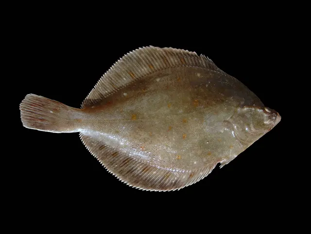 European plaiceA right-eyed flatfish with orange spots and a remarkable lifespan, and the representative flatfish for a body plan nothing else on FishingHQ shares.
Hans Hillewaert — CC BY-SA 4.0, via Wikimedia Commons
- Thornback rayThe commonest European ray, covered in thorn-like bucklers, laying horny egg cases known as mermaid's purses, and requiring careful handling on release.
Ella McCausland — CC BY, via iNaturalist
- WhitingA small, abundant, silver gadoid of European coasts, a mainstay of winter shore fishing and distinguished by a dark spot at the pectoral fin base.
rmjb — CC BY, via iNaturalist
- Atlantic codA large, heavily-built demersal predator of the North Atlantic, and the species whose commercial history is the standard example of stock collapse.
The U.S. Food and Drug Administration, Public domain, via Wikimedia Commons
 Atlantic mackerelA fast, schooling, obligate-swimming pelagic fish that arrives inshore in summer in enormous numbers, and the species most sea anglers catch first.
Hans Hillewaert — CC BY-SA 4.0, via Wikimedia Commons
 Conger eelA very large scaleless eel of wrecks, rock and harbour walls, reaching three metres, and among the most powerful and most genuinely dangerous fish to handle in European seas.
Holger Krisp — CC BY 3.0, via Wikimedia Commons
Places within this area
Publicly documented fishing geography. FishingHQ describes what the ground is; it does not say whether you may fish it, and every one of these sends that question to the body that holds the answer. Browse every place in this part of the world.
Who to ask before fishing any of these
FishingHQ does not know the current access position here. Shore angling in England is not rod-licensed, but access rights, landowner permission, local authority and harbour byelaws, national and inshore fisheries measures, and site designations all apply and all change. Check the current position with the relevant inshore fisheries and conservation authority, the harbour or local authority, and the landowner before going.
FishingHQ does not know the current access position here. Shore angling in England is not rod-licensed, but access rights, landowner permission, local authority and harbour byelaws, national and inshore fisheries measures, and site designations all apply and all change. Check the current position with the relevant inshore fisheries and conservation authority, the harbour or local authority, and the landowner before going. This water is tidal and transitional, so the freshwater regime may also apply above the tidal limit: FishingHQ does not know the current access position here. Freshwater rod fishing in England requires a current rod licence AND separate permission from whoever controls the fishing, which is frequently a club, riparian owner or navigation authority rather than a public body. Close seasons, byelaws and local rules apply and change. Check with the Environment Agency and with the controlling club or owner before going.
Dungeness Point
Shingle bank · Salt water
The largest cuspate shingle foreland in Europe: a vast triangular apron of flint shingle projecting into the Dover Strait, built by longshore drift from both sides. The bank is exceptionally steep-to at the point itself, and shingle continues down below the waterline.
Fully exposed on both faces, which face south-west and east respectively. Because the point protrudes, one face is almost always in a lee — which is the practical reason it is fished in weather that closes the rest of the coast.
Particular to this ground: slips, trips and falls, cold water shock, boat traffic and being seen.
Severe hazards of The Channel shingle coasts apply here: drowning and immersion.
Particular to this water: This ground carries conservation designations that constrain access, vehicles, bait collection and disturbance independently of any fishing rule.
Deal Pier
Pier · Salt water
A concrete-piled pier running out from a steep shingle beach into the Downs — the sheltered anchorage between the Kent coast and the Goodwin Sands. Shingle and clean sand under the structure, with the Goodwins offshore.
Partly sheltered from the open Channel by the Goodwin Sands, which is why this anchorage exists at all. Exposed to easterlies, which blow straight in over the sands.
Particular to this ground: cold water shock.
Severe hazards of The Channel shingle coasts apply here: drowning and immersion.
Particular to this water: This is an owned and operated structure. Whether angling is allowed on it, when, from where and on what terms is the operator's decision, is frequently seasonal, and changes without notice.
Hastings and the Stade
Beach section · Salt water
A steep shingle beach beneath the sandstone cliffs of the East Hill, and the working shore of the largest beach-launched fishing fleet in Europe. Shingle over sand, with rock scars and reef running out at either end of the bay.
Open to the Channel from south-west through south-east. The fleet launches and recovers across the open beach because there is no harbour, which is the fact the whole place is organised around.
Particular to this ground: cold water shock, boat safety.
Severe hazards of The Channel shingle coasts apply here: drowning and immersion.
Ramsgate harbour
Harbour wall · Salt water
A large enclosed royal harbour with long stone and concrete arms over sand and chalk, at the corner where the Thames estuary turns into the Dover Strait.
Severe hazards of The Channel shingle coasts apply here: drowning and immersion, cold water shock.
Sandwich Bay
Beach · Salt water
A wide sand and shingle bay backed by the largest dune system in south-east England, over the buried medieval channel of the Wantsum, with the Goodwin Sands lying a few kilometres offshore.
Severe hazards of The Channel shingle coasts apply here: drowning and immersion, cold water shock.
Folkestone harbour arm
Breakwater · Salt water
A stone arm and pier enclosing a small harbour beneath the chalk of the East Cliff, standing over mixed chalk rubble, shingle and sand.
Severe hazards of The Channel shingle coasts apply here: drowning and immersion, cold water shock.
Camber Sands
Beach · Salt water
The only extensive dune-backed sand beach in East Sussex, lying in the lee of Dungeness where the drift system drops its finer material, drying a very long way at low water.
Severe hazards of The Channel shingle coasts apply here: drowning and immersion, cold water shock.
Bexhill
Beach · Salt water
Shingle over a sandstone and clay platform that uncovers as flat scars at low water, giving mixed rough and clean ground within a short cast.
Severe hazards of The Channel shingle coasts apply here: drowning and immersion, cold water shock.
6 more places in this area
Eastbourne Pier
Pier · Salt water
A Victorian pleasure pier on a shingle shore immediately east of Beachy Head, with chalk ground running out beneath the shingle towards the headland.
Severe hazards of The Channel shingle coasts apply here: drowning and immersion, cold water shock.
Beachy Head and the ledges
Ledge · Salt water
Chalk wave-cut ledges beneath the highest chalk sea cliff in Britain, with flint reefs, gullies and heavy kelp, and deep water not far off the point.
Particular to this ground: cliffs and rock platforms.
Severe hazards of The Channel shingle coasts apply here: drowning and immersion, cold water shock.
Newhaven west arm
Breakwater · Salt water
A long concrete breakwater running south from the Ouse entrance, with deep dredged water in the harbour mouth inside and chalk and shingle ground outside.
Severe hazards of The Channel shingle coasts apply here: drowning and immersion, cold water shock.
Brighton Marina
Marina · Salt water
The largest artificial marina in Britain, built out onto a chalk platform, with deep water alongside its outer walls and chalk reef either side.
Severe hazards of The Channel shingle coasts apply here: drowning and immersion, cold water shock.
Worthing Pier
Pier · Salt water
A pleasure pier standing over very gently shelving sand and shingle, with clay and chalk reef exposed on the lowest tides some way out.
Severe hazards of The Channel shingle coasts apply here: drowning and immersion, cold water shock.
Littlehampton and the Arun
Estuary mark · Brackish water
A narrow river entrance between long training walls with a strong stream on both tides, over sand and shingle, with the Arun running fast and coloured behind it.
Severe hazards of The Channel shingle coasts apply here: drowning and immersion, cold water shock.
Safety
Drowning and immersion — Can cause serious injury or death
Waves break directly onto a steep shingle face without a dissipating surf zone, and the backwash runs fast down a slope of loose mobile pebbles into deep water immediately offshore. A person knocked down cannot get a footing on shifting material while being pulled downslope, and is in deep cold water within seconds.
What reduces it: Stand well back from the water's edge whenever any swell is running rather than at it, wear a buoyancy aid, do not fish alone at night, treat a building sea as a reason to leave rather than to retreat up the beach, tell somebody the plan and the return time, and carry a means of calling for help on the person rather than in a bag.
Worse when:
- Long-period ground swell arriving with no local wind, which produces much larger sets than the conditions suggest.
- Night sessions, when a set cannot be seen coming — which is when most of this fishing is done.
- Cold water, where cold water shock incapacitates a competent swimmer within the first minute.
Cold water shock — Can cause serious injury or death
The fishery here is weighted to autumn, winter and night, and the water is cold for most of it. Immersion produces an involuntary gasp and loss of breathing control within seconds — before cold has had any effect on the muscles — which is why immersion kills competent swimmers on a beach they can stand up on.
What reduces it: Wear a buoyancy aid rather than carry one, stand back from the water's edge whenever a swell is running, do not fish alone at night, and carry a means of calling for help on the person rather than in a bag at the top of the bank.
Worse when:
- Between roughly November and April, when sea temperature is at its lowest and the fishery is at its busiest.
- At night and alone, when nobody sees the entry and the response time is however long it takes somebody to miss you.
Slips, trips and falls — Can cause injury needing treatment
Loose graded pebbles on a steep face give way underfoot, and carrying tackle up and down a steep shingle bank in the dark is a common cause of falls and ankle injuries a long way from a road.
What reduces it: Use the established access points rather than descending the face directly, carry less, use a light, and treat a freshly storm-cut beach as different ground from the one you last fished.
Further safety reading
- Cold water shock and immersion — A person knocked down by backwash is in deep cold water within seconds, and cold water shock incapacitates competent swimmers inside the first minute.
- Fishing alone — The characteristic accident on this ground is being pulled off the feet by backwash on a slope that gives no footing, and it is survivable far more often when somebody else is present.
- Night fishing safety — Sessions here are conducted at night, frequently alone and in winter, on a beach where a fall means immersion in cold water and where a set cannot be seen coming.
- Rock platform and cliff safety — Waves break directly onto a steep shingle face with no dissipating surf zone, and the powerful backwash runs down loose mobile material into deep water immediately offshore.
Check the rules before you fish
Fishing laws, bylaws, access rules, seasons, bait restrictions and permitted methods vary by location and can change. Check the current rules from the relevant authority and the water you intend to fish before fishing.
Check with:
- Current national or regional law for where you are fishing
- Current local bylaws
- The relevant fisheries authority
- The landowner, club or fishery whose water it is
- Any restrictions specific to the species or the method you intend to use
Where to go next
What swims here
- Atlantic codMoves within reach of steep shingle beaches in the colder months, and the deep water immediately inshore is the reason a shore angler can reach it at all.
- Atlantic mackerelShoals within casting range over the step in the warmer months, which on a shallow sandy coast would require a boat.
- Common soleFeeds over the finer sediment beyond the shingle face at night, moving up as the flood covers ground, which is the basis of the shore night fishery here.
- Conger eelOccupies whatever hard structure lies off or along these beaches — groynes, wreckage, rough patches — rather than the shingle itself, which offers no cavity.
- European plaiceUses the cleaner sand and mixed ground beyond the step rather than the mobile shingle itself, which supports very little infauna.
- European sea bassWorks the deep water immediately off the step, where the mobile beach face gives way to seabed stable enough to hold food. The steepness of the beach is what brings them within a shore angler's reach.
- Thornback rayComes onto the mixed ground off shingle beaches to feed on crustaceans and small fish, and the deep water close inshore is what makes it a shore-caught species here.
- WhitingPresent in numbers over the ground beyond the step through the colder months, and a mainstay of winter shore sessions on this coast.
Local knowledge
How this compares
- Chesil BeachThe coast page explains how shingle comes to be graded along a shore; this beach is the clearest single example of it anywhere in Britain, so the general mechanism and the place that best demonstrates it are worth reading together.
- England and WalesThe shingle coasts of the Channel are among the most heavily fished shore marks in the jurisdiction and gave beachcasting much of its technique.
- Portland Bill and the Portland RaceA headland race and a shingle barrier on the same coast, fishing in completely different ways for completely different physical reasons — the clearest local demonstration of why ground matters more than area.
- Reading a coast for the flyShingle beaches with gutters, bars and stream mouths hold fish inside fly range, which is not obvious on a coast famous for distance casting.
Sources and evidence
- Cefas science, advice and data on marine and freshwater environments — Centre for Environment, Fisheries and Aquaculture Science (Government fisheries body)Relied on for: Marine and freshwater environmental science, including the physical characterisation of shelf seas and the monitoring programmes that describe them.States this directlyCitation checked — the work exists and is described correctly
- ICES Advice on fishing opportunities, catch and effort — International Council for the Exploration of the Sea (Scientific institute)Relied on for: Ecoregion description, stock distribution and the hydrography of the area assessed.States this directlyCitation checked — the work exists and is described correctly
- RNLI water safety guidance: cold water shock and Float to Live — Royal National Lifeboat Institution (Water-safety or diver-training authority)Relied on for: Cold water shock and the immersion response, tidal cut-off, and guidance for shore anglers and small-craft users.States this directlyPassage read and verified
- Met Office shipping forecast, inshore waters forecast and marine warnings — Met Office, United Kingdom (Government fisheries body)Relied on for: That inshore waters forecasts, sea state and swell are the operative inputs for shore and small-craft decisions in these waters.Background and mechanism onlyCitation checked — the work exists and is described correctly
Why the 18 connections on this page are here, and the sources
What swims here
Backed by research — 8 connections
Supported by peer-reviewed research or fisheries science. The sources are listed and can be checked.
Atlantic cod
Occurrence of the species in this system or along this coast: a statement about the animal's distribution, not a venue recommendation.
- The Fishes of the British Isles and North-West Europe — Macmillan, 1969 (Reference work)Relied on for: Distribution and habitat association of fishes in British and north-west European waters.States this directlyCitation checked — the work exists and is described correctly
- FishBase: a global information system on fishes — Froese, R. and D. Pauly, eds. — FishBase Consortium (Scientific institute)Relied on for: Distribution, depth range and habitat association recorded for the species.States this directlyPassage read and verified
Atlantic mackerel
Occurrence of the species in this system or along this coast: a statement about the animal's distribution, not a venue recommendation.
- The Fishes of the British Isles and North-West Europe — Macmillan, 1969 (Reference work)Relied on for: Distribution and habitat association of fishes in British and north-west European waters.States this directlyCitation checked — the work exists and is described correctly
- FishBase: a global information system on fishes — Froese, R. and D. Pauly, eds. — FishBase Consortium (Scientific institute)Relied on for: Distribution, depth range and habitat association recorded for the species.States this directlyPassage read and verified
Common sole
Occurrence of the species in this system or along this coast: a statement about the animal's distribution, not a venue recommendation.
- The Fishes of the British Isles and North-West Europe — Macmillan, 1969 (Reference work)Relied on for: Distribution and habitat association of fishes in British and north-west European waters.States this directlyCitation checked — the work exists and is described correctly
- FishBase: a global information system on fishes — Froese, R. and D. Pauly, eds. — FishBase Consortium (Scientific institute)Relied on for: Distribution, depth range and habitat association recorded for the species.States this directlyPassage read and verified
Conger eel
Occurrence of the species in this system or along this coast: a statement about the animal's distribution, not a venue recommendation.
- The Fishes of the British Isles and North-West Europe — Macmillan, 1969 (Reference work)Relied on for: Distribution and habitat association of fishes in British and north-west European waters.States this directlyCitation checked — the work exists and is described correctly
- FishBase: a global information system on fishes — Froese, R. and D. Pauly, eds. — FishBase Consortium (Scientific institute)Relied on for: Distribution, depth range and habitat association recorded for the species.States this directlyPassage read and verified
European plaice
Occurrence of the species in this system or along this coast: a statement about the animal's distribution, not a venue recommendation.
- The Fishes of the British Isles and North-West Europe — Macmillan, 1969 (Reference work)Relied on for: Distribution and habitat association of fishes in British and north-west European waters.States this directlyCitation checked — the work exists and is described correctly
- FishBase: a global information system on fishes — Froese, R. and D. Pauly, eds. — FishBase Consortium (Scientific institute)Relied on for: Distribution, depth range and habitat association recorded for the species.States this directlyPassage read and verified
European sea bass
Occurrence of the species in this system or along this coast: a statement about the animal's distribution, not a venue recommendation.
- The Fishes of the British Isles and North-West Europe — Macmillan, 1969 (Reference work)Relied on for: Distribution and habitat association of fishes in British and north-west European waters.States this directlyCitation checked — the work exists and is described correctly
- FishBase: a global information system on fishes — Froese, R. and D. Pauly, eds. — FishBase Consortium (Scientific institute)Relied on for: Distribution, depth range and habitat association recorded for the species.States this directlyPassage read and verified
Thornback ray
Occurrence of the species in this system or along this coast: a statement about the animal's distribution, not a venue recommendation.
- The Fishes of the British Isles and North-West Europe — Macmillan, 1969 (Reference work)Relied on for: Distribution and habitat association of fishes in British and north-west European waters.States this directlyCitation checked — the work exists and is described correctly
- FishBase: a global information system on fishes — Froese, R. and D. Pauly, eds. — FishBase Consortium (Scientific institute)Relied on for: Distribution, depth range and habitat association recorded for the species.States this directlyPassage read and verified
Whiting
Occurrence of the species in this system or along this coast: a statement about the animal's distribution, not a venue recommendation.
- The Fishes of the British Isles and North-West Europe — Macmillan, 1969 (Reference work)Relied on for: Distribution and habitat association of fishes in British and north-west European waters.States this directlyCitation checked — the work exists and is described correctly
- FishBase: a global information system on fishes — Froese, R. and D. Pauly, eds. — FishBase Consortium (Scientific institute)Relied on for: Distribution, depth range and habitat association recorded for the species.States this directlyPassage read and verified
How people fish here
What experienced anglers do — 1 connection
Widely and independently recommended by experienced anglers and specialist sources. This is real angling knowledge, not proof: controlled evidence for it is limited, and FishingHQ records it as convention rather than as a demonstrated effect.
Sea fishing
The discipline that dominates fishing in this place, recorded as established practice rather than as a ranking.
- General angling website restatements of established technique — Various (Credible secondary source)Relied on for: Widely restated practice associating this discipline with this coast or system, recorded as practitioner consensus rather than as tested fact.Background and mechanism onlyCitation checked — the work exists and is described correctly
- Fishers' Craft and Lettered Art: Tracts on Fishing from the End of the Middle Ages — University of Toronto Press, 1997 (Scientific literature)Relied on for: That fishing traditions develop around the water and fish available to them, and the historical method of reading such traditions.States this directlyCitation checked — the work exists and is described correctly
Local knowledge
What experienced anglers do — 1 connection
Widely and independently recommended by experienced anglers and specialist sources. This is real angling knowledge, not proof: controlled evidence for it is limited, and FishingHQ records it as convention rather than as a demonstrated effect.
Reading a shingle beach
Why it works, resting on shore-fishing practice reported consistently across independent practitioner sources rather than on experiment.
- Sea Angler — Bauer Media (Specialist angling publication)Relied on for: Contemporary UK sea angling practice as reported by practitioners, including shore technique, terminal tackle, regional ground and species behaviour.States this directlyCitation checked — the work exists and is described correctly
- Freshwater Fishing — Macdonald & Jane's, 1975 (Specialist angling publication)Relied on for: Comprehensive angling practice including terminal tackle, casting, leaders and the reasoning behind the choices.States this directlyCitation checked — the work exists and is described correctly
How this compares
What experienced anglers do — 4 connections
Widely and independently recommended by experienced anglers and specialist sources. This is real angling knowledge, not proof: controlled evidence for it is limited, and FishingHQ records it as convention rather than as a demonstrated effect.
Chesil Beach
Two places a reader would reasonably weigh against one another, joined where the comparison teaches something about both. It is also how the larger geography is linked to what sits inside it.
- General angling website restatements of established technique — Various (Credible secondary source)Relied on for: Widely restated practice associating this discipline with this place, recorded as practitioner consensus rather than as tested fact.Background and mechanism onlyCitation checked — the work exists and is described correctly
- Fishers' Craft and Lettered Art: Tracts on Fishing from the End of the Middle Ages — University of Toronto Press, 1997 (Scientific literature)Relied on for: That fishing traditions develop around the water and fish available to them, and the historical method of reading such traditions.States this directlyCitation checked — the work exists and is described correctly
England and Wales
Two places a reader would reasonably weigh against one another, joined where the comparison teaches something about both. It is also how the larger geography is linked to what sits inside it.
- General angling website restatements of established technique — Various (Credible secondary source)Relied on for: Widely restated angling practice and belief, recorded as practitioner consensus rather than as tested fact.Background and mechanism onlyCitation checked — the work exists and is described correctly
- Angling Trust guidance for anglers — Angling Trust (Angling or fisheries organisation)Relied on for: Guidance for anglers on participation, licensing structure, access arrangements and getting started.Background and mechanism onlyCitation checked — the work exists and is described correctly
Portland Bill and the Portland Race
Two places a reader would reasonably weigh against one another, joined where the comparison teaches something about both. It is also how the larger geography is linked to what sits inside it.
- General angling website restatements of established technique — Various (Credible secondary source)Relied on for: Widely restated practice associating this discipline with this place, recorded as practitioner consensus rather than as tested fact.Background and mechanism onlyCitation checked — the work exists and is described correctly
- Fishers' Craft and Lettered Art: Tracts on Fishing from the End of the Middle Ages — University of Toronto Press, 1997 (Scientific literature)Relied on for: That fishing traditions develop around the water and fish available to them, and the historical method of reading such traditions.States this directlyCitation checked — the work exists and is described correctly
Reading a coast for the fly
Two records a reader would reasonably weigh against one another, joined where the comparison teaches something about both.
- Sea Angler — Bauer Media (Specialist angling publication)Relied on for: Contemporary UK sea angling practice as reported and restated by practitioners, including shore technique, species behaviour and tackle convention.Background and mechanism onlyCitation checked — the work exists and is described correctly
- General angling website restatements of established technique — Various (Credible secondary source)Relied on for: Widely restated angling practice and belief, recorded as practitioner consensus rather than as tested fact.Background and mechanism onlyCitation checked — the work exists and is described correctly
Safety reading
Official guidance — 4 connections
Stated by a fisheries authority, scientific institute or recognised angling body. Authoritative, but summarising rather than demonstrating.
Cold water shock and immersion
A hazard characteristic of this place, connected to the safety topic that explains the mechanism.
- RNLI water safety guidance: cold water shock and Float to Live — Royal National Lifeboat Institution (Water-safety or diver-training authority)Relied on for: Cold water shock and the immersion response, tidal cut-off, shore angling hazards and small-craft guidance.States this directlyPassage read and verified
- RoSPA water safety information and UK accidental drowning statistics — Royal Society for the Prevention of Accidents (Water-safety or diver-training authority)Relied on for: Accidental drowning statistics and the circumstances in which recreational water users are most often killed.States this directlyPassage read and verified
Fishing alone
A hazard characteristic of this place, connected to the safety topic that explains the mechanism.
- RNLI water safety guidance: cold water shock and Float to Live — Royal National Lifeboat Institution (Water-safety or diver-training authority)Relied on for: Cold water shock and the immersion response, tidal cut-off, shore angling hazards and small-craft guidance.States this directlyPassage read and verified
- RoSPA water safety information and UK accidental drowning statistics — Royal Society for the Prevention of Accidents (Water-safety or diver-training authority)Relied on for: Accidental drowning statistics and the circumstances in which recreational water users are most often killed.States this directlyPassage read and verified
Night fishing safety
A hazard characteristic of this place, connected to the safety topic that explains the mechanism.
- RNLI water safety guidance: cold water shock and Float to Live — Royal National Lifeboat Institution (Water-safety or diver-training authority)Relied on for: Cold water shock and the immersion response, tidal cut-off, shore angling hazards and small-craft guidance.States this directlyPassage read and verified
- RoSPA water safety information and UK accidental drowning statistics — Royal Society for the Prevention of Accidents (Water-safety or diver-training authority)Relied on for: Accidental drowning statistics and the circumstances in which recreational water users are most often killed.States this directlyPassage read and verified
Rock platform and cliff safety
A hazard characteristic of this place, connected to the safety topic that explains the mechanism.
- United States Lifesaving Association public education on rip currents and the surf zone — United States Lifesaving Association (Water-safety or diver-training authority)Relied on for: Surf zone hazards, rip current formation, shore-break and steep-beach hazards, and public guidance on them.States this directlyCitation checked — the work exists and is described correctly
- RNLI water safety guidance: cold water shock and Float to Live — Royal National Lifeboat Institution (Water-safety or diver-training authority)Relied on for: Shore angling hazards including shore-break, cold water shock and being swept in.States this directlyPassage read and verified
How FishingHQ labels evidence is explained in the evidence policy.