Portland Bill and the Portland Race
Fishing regions · Last reviewed 2026-08-14
A limestone headland projecting into the Channel with a tidal race off its tip that is one of the most dangerous pieces of water in northern Europe, and one of the most productive.
Safety: boat safety — can cause serious injury or death. 2 more points apply here.
Being listed here is not permission to fish. What that meansClose
Access, fishing rights, seasons, licences, local bylaws and permitted methods vary and can change. Check current access, permission, local regulations, closures and restrictions before you travel or fish. FishingHQ describes what the ground is and names who holds the answer; it does not hold the answer itself.
Find the authority for a jurisdiction · What FishingHQ does and does not cover
Portland is the headland and tidal race FishingHQ explains at this depth, and it is here because the mechanism it demonstrates — flow accelerating past an obstruction and over uneven ground — is one of the most transferable pieces of fishing intelligence there is.
THE HEADLAND FORCES THE TIDE. A limestone peninsula projects several miles south into the English Channel. The tidal stream running up and down the Channel cannot go through it, so it accelerates round the tip, and the water that has to squeeze past moves very fast indeed.
THE SEABED DOES THE REST. Off the tip the bottom is uneven, with a steep ledge and rapid depth changes, and fast flow over rough topography produces standing waves, overfalls, boils and eddies. The result is a permanent, predictable, extremely violent piece of water — a tidal race — that runs on every tide and is at its worst on springs against wind.
THE SHAMBLES BANK COMPOUNDS IT. A large sandbank lying off the headland splits and further accelerates the flow, creating a second area of disturbed water and a second race.
THAT WATER IS PRODUCTIVE FOR EXACTLY THE REASON IT IS DANGEROUS. Turbulence disorients and concentrates bait fish, brings food up off the bottom, and creates edges and eddies where predators can hold in slack water and feed on what the flow delivers. The same mechanism operates in every tidal race in the world at a smaller scale.
AND THE HAZARD IS NOT A CAUTION APPENDED TO A FISHING DESCRIPTION. This race has a long record of drownings, capsizes and vessel losses, and it is one of the pieces of water on the British coast that is genuinely capable of overwhelming a competent boat.
What fishing here is like
A limestone headland projecting into the English Channel with a permanent tidal race off its tip and a second area of disturbed water over an offshore sandbank. The fishing is the fishing of fast water: predators holding in eddies and slack behind structure, feeding on what the flow delivers. It is one of the most productive marks in southern England and one of the most dangerous pieces of inshore water in northern Europe, and both facts have the same cause.
What you can target here
One entry per fish, grouped by how you would be fishing — because the answer is a different one from the rocks and from a boat. Each entry says how strongly the sources support it and how much evidence sits behind it. These are documented catches, not a forecast, and none of it is a statement that you may fish any particular ground.
From the shore · 7
 Ballan wrasseRegular local target1 placePortland Bill and Pulpit RockOver headland
 Conger eelRegular local target1 placePortland Bill and Pulpit RockOver headland
 European sea bassRegular local target1 placePortland Bill and Pulpit RockOver headland
 PollackRegular local target1 placePortland Bill and Pulpit RockOver headland
 Atlantic mackerelSeasonal1 placePortland Bill and Pulpit RockOver headlandAround Jun–Sept
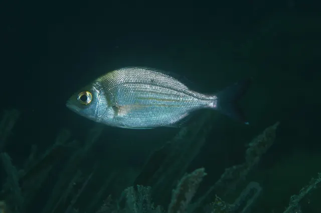 Black seabreamSeasonal1 placePortland Bill and Pulpit RockOver headlandAround Jun–Sept
Also documented from the shore: Garfish
What these strengths mean
- Regular local target
- Fishing sources describe this as a normal local target here, not merely as caught.
- Seasonal
- Well supported, and concentrated in part of the year rather than spread through it.
- How breadth is counted
- A fish documented at six marks is shown as six marks: breadth never raises the strength on its own. A fishery account describes the fishing; a recorded catch reports one specific catch. How evidence is weighed.
How people fish here
4 methods are recorded on the places documented here, counted from the records themselves rather than from what is practised in the country. Each opens a full guide to the technique.
Feathering and multi-lure traces
Recorded at 1 place here, over headland.
A string of small lures on droppers, worked in the water column — how most people in Britain and Ireland catch their first sea fish, and the method most likely to catch far more than anybody intended.
Documented on the same ground: Ballan wrasse, Conger eel, European sea bass, Pollack, Atlantic mackerel, Black seabream.
Float fishing
Recorded at 1 place here, over headland.
Suspending a bait at a controlled depth beneath a buoyant indicator — the most visual, most controllable and most widely applicable method in angling.
Documented on the same ground: Ballan wrasse, Conger eel, European sea bass, Pollack, Atlantic mackerel, Black seabream.
Ledgering
Recorded at 1 place here, over headland.
Fishing a bait on the bottom held by a weight, with no float — the simplest way to fish at distance, in depth, or in wind.
Documented on the same ground: Ballan wrasse, Conger eel, European sea bass, Pollack, Atlantic mackerel, Black seabream.
Spinning
Recorded at 1 place here, over headland.
Casting an artificial lure and retrieving it so that it moves like something alive — the most direct form of lure fishing.
Documented on the same ground: Ballan wrasse, Conger eel, European sea bass, Pollack, Atlantic mackerel, Black seabream.
These are the methods documented at the places FishingHQ holds here. A species listed beside a method is documented on the same ground, which is not the same as being taken that way — where a source establishes the method a fish was caught on, it is stated on that place’s own page. All fishing methods.
The fishing year here
The months the records under this area actually name, tightest season first. This is “observed in these months” rather than a season: a species whose months nobody recorded is not listed, because a gap in the evidence is not a year-round fishery.
- Atlantic mackerelJune to September
- Black seabreamJune to September
- GarfishJune to September
What dominates
Shore fishing from the limestone ledges around the headland, into deep fast water close in. Lure and float fishing for bass, pollack and wrasse from the rock. Boat fishing on the edges of the race and over the offshore bank, principally by drifting with lures or bait through the disturbed water. Bass and pollack lure fishing on the tide edges. Deep-water bottom fishing over the ledges. The race itself is worked by experienced boat anglers who understand it and is not a place to learn.
The water available
A high limestone peninsula with wave-cut ledges and cliffs, dropping into deep water close inshore; a tidal race off the tip with standing waves, overfalls, boils and strong eddies running on every tide; an offshore sandbank splitting and accelerating the flow further; uneven rocky ground and ledges beneath the race; deeper clean ground beyond; and, on the sheltered side, calmer water in the lee of the headland where the tide runs comparatively slack.
How the rules are structured
Sea fishing here falls under the inshore fisheries and conservation authority for the district, which sets byelaws on gear, local minimum sizes and any place-specific measures, with national minimum conservation reference sizes and the national measures applying to bass on top. Parts of the surrounding coast and seabed carry marine conservation designations, and the coastline holds World Heritage status for its geology, which bears on activity on the cliffs and ledges. Access to the headland and its ledges is a matter for landowners and for the bodies managing the site rather than for fisheries law, and some areas are used by other activities including quarrying, climbing and lighthouse operation. Navigation in the race and around the headland is subject to the general obligations on small craft and to any local navigation guidance; the maritime and coastguard agency and the local lifeboat station are the relevant bodies for safety. FishingHQ does not state what any current rule is.
Who to ask
- The inshore fisheries and conservation authority for the district, for sea fishing byelaws, gear rules and local measures.
- The national fisheries authority, for minimum conservation reference sizes and national measures including those applying to bass.
- The statutory nature conservation body and the marine conservation zone management arrangements covering parts of the surrounding seabed.
- The landowner and site managers for access to the headland, ledges and quarry areas.
- The maritime and coastguard agency and the local lifeboat station, for small-craft safety and for the navigational reality of the race.
Words you will meet
- Tidal race
- A stretch of fast, turbulent water produced where a tidal stream is forced to accelerate past an obstruction and over uneven ground. A permanent, predictable feature that runs on every tide rather than a weather event.
- Overfall
- A standing wave or breaking crest formed where fast flow passes over an abrupt change in depth. Overfalls mark the shallowest and most violent parts of a race and are what makes it visible on a chart and from a distance.
- The Shambles
- The large sandbank lying off the headland, which splits and accelerates the tidal flow and creates a second area of disturbed water. Its presence is why the race system here is more complex than a simple headland race.
- Slack water
- The short period around the turn of the tide when the stream is weakest. In a race this is the only workable window for many purposes, and its timing and duration are the most important planning information there is.
- The inside passage
- The narrow band of comparatively calmer water close to the shore inside a race, used by small craft to pass a headland. It exists at some states of tide and not others, and using it requires knowing which.
Conditions and hazards
This is one of the most dangerous pieces of inshore water in northern Europe and the danger is permanent rather than weather-dependent. The race runs on every tide; at springs it produces standing waves, overfalls and breaking water capable of overwhelming a small boat in flat calm conditions. Wind against tide makes it dramatically worse and is the classic fatal combination. The record of losses here is long. Ashore, the limestone ledges around the headland drop into deep fast water, are wet and slippery, and receive swell that arrives independently of local wind; being swept from them is the characteristic shore accident, and self-rescue from water moving at that speed is not realistic. There are stretches with no exit from the water and no easy access for rescue. Cold water shock applies year-round in the Channel. The cliffs above are high and in places unstable.
How a headland makes a race, and why the race makes fish
The Portland Race is the clearest demonstration in southern England of a mechanism that operates wherever tide meets an obstruction, and understanding it transfers to every headland a reader will ever fish.
THE TIDE RUNS ALONG THE CHANNEL AND THE HEADLAND IS IN THE WAY. A peninsula projecting several miles into the stream forces the water to go round it. Because the same volume has to pass in the same time through a constricted path, it accelerates — the same principle as putting a thumb over a hose.
THE SEABED TURNS SPEED INTO VIOLENCE. Flow that is merely fast over smooth deep ground becomes turbulent over uneven ground. Off the tip the bottom shoals and steps, and fast water passing over those steps generates standing waves, overfalls, upwelling boils and downstream eddies. That is the race.
THE SANDBANK OFFSHORE MAKES IT A SYSTEM RATHER THAN A FEATURE. A large bank lying off the headland splits the flow and accelerates it further, producing a second area of disturbance and a more complex pattern than a single headland would.
NOW THE FISHING PART. Turbulence lifts food off the bottom and holds it in suspension. It disorients small fish, which lose the ability to hold formation in unpredictable flow. It creates sharp boundaries — the edge of the race, the lee of a boil, the back of an eddy — where a predator can sit in relatively slack water expending little energy while disoriented prey is delivered past its nose.
SO THE PREDATORS SIT ON THE EDGES, NOT IN THE MIDDLE. That is the transferable insight. The productive water is the boundary between fast and slow, and finding it is the whole skill of fishing a race anywhere.
AND THE SAME EDGES ARE WHERE A BOAT GETS INTO TROUBLE, because the transition between water moving at very different speeds is exactly where a small vessel is least stable.
Backed by research — why, and the sources (2)
Supported by peer-reviewed research or fisheries science. The sources are listed and can be checked.
- NOAA Ocean Service tides and water levels educational tutorial — National Oceanic and Atmospheric Administration, United States (Government fisheries body)Relied on for: The mechanism of tides, tidal range, tidal streams and the amplification of tidal range in converging estuaries.States this directlyPassage read and verified
- Met Office shipping forecast, inshore waters forecast and marine warnings — Met Office, United Kingdom (Government fisheries body)Relied on for: Inshore waters forecasting, sea state, swell and the marine warning products issued for British coastal waters.Background and mechanism onlyCitation checked — the work exists and is described correctly
The predators that hold in fast water
The species associated with a headland and race system are those adapted to hold station in current and to feed on what it delivers.
BASS ARE THE ARCHETYPE. European sea bass are strong swimmers that use structure and eddies to hold in flow while intercepting bait swept past, and a tidal race is the environment where that ability is most useful. Bass on a race are a classic British sea fishing proposition and the tide state is the whole game.
POLLACK HOLD ON THE ROCK AND IN THE EDDIES, rising into the flow to intercept and dropping back. They are strongly associated with deep water close to structure, which the headland's ledges provide.
WRASSE OCCUPY THE ROCKY GROUND close in, and ballan wrasse in particular are a mainstay of shore fishing on limestone ledges of this kind.
MACKEREL AND GARFISH ARRIVE IN THE WARMER MONTHS and are drawn to the same concentrations of small fish that the turbulence produces.
COD, WHITING AND POUTING work the deeper ground on the seasonal pattern common to the Channel.
CONGER OCCUPY THE ROUGH GROUND AND ANY STRUCTURE, as they do wherever there are holes in a rock bottom.
AND THE FORAGE IS THE REASON FOR ALL OF IT. Sandeels, sprats and small pelagic fish are concentrated and disoriented by the race, and FishingHQ's records for those species describe animals whose defence is coordinated shoaling — which is precisely what turbulence destroys. A race is a place where a shoal's principal defence stops working, and every predator in the area knows it.
Backed by research — why, and the sources (2)
Supported by peer-reviewed research or fisheries science. The sources are listed and can be checked.
- The Fishes of the British Isles and North-West Europe — Macmillan, 1969 (Reference work)Relied on for: Distribution, habitat association, depth and ground preference of fishes in British and north-west European waters.States this directlyCitation checked — the work exists and is described correctly
- FishBase: a global information system on fishes — Froese, R. and D. Pauly, eds. — FishBase Consortium (Scientific institute)Relied on for: Distribution, habitat association and depth range recorded for the species.Background and mechanism onlyPassage read and verified
Fishing the edge rather than the middle
The disciplines here are shaped by the fact that the most attractive-looking water is the water no rod can work and no small boat belongs in.
SHORE FISHING FROM THE LEDGES is the accessible form. Limestone platforms around the headland drop into deep water quickly, so float fishing, lure fishing and bottom fishing all work from the rock without needing distance. Pollack, wrasse, bass and mackerel are the fish.
LURE FISHING ON THE TIDE EDGES is the discipline that best matches the mechanism. Working a lure across the boundary between fast and slack water, letting it be carried into the eddy, imitates exactly what a disoriented bait fish does. This is the technique the race rewards.
BOAT FISHING WORKS THE MARGINS BY DRIFTING. Experienced boat anglers drift the edges of the race and the water over and around the bank, presenting lures or bait through the disturbed zone and picking up on the transitions. It requires an accurate understanding of the tide, an engine you trust and a clear plan for where the drift ends.
TIMING IS THE PRIMARY SKILL. The race runs on every tide, so the question is never whether it is running but how hard, and which parts are workable at which state. Slack water and the early stages of a run are the workable windows; peak springs are not, for anybody.
DEEP-WATER BOTTOM FISHING over the ledges is a boat discipline in its own right and depends on holding a position in moving water, which is a boat-handling problem as much as a tackle one.
AND THE SINGLE MOST IMPORTANT DISCIPLINE IS KNOWING WHEN NOT TO. Wind against tide on a spring here produces water that will overwhelm a small boat regardless of the skipper's ability. Recognising that is not caution; it is the competence the place demands.
What experienced anglers do — why, and the sources (2)
Widely and independently recommended by experienced anglers and specialist sources. This is real angling knowledge, not proof: controlled evidence for it is limited, and FishingHQ records it as convention rather than as a demonstrated effect.
- Angling Trust guidance for anglers — Angling Trust (Angling or fisheries organisation)Relied on for: Guidance for anglers on practice, participation and the representation of angling interests in England.Background and mechanism onlyCitation checked — the work exists and is described correctly
- Sea Angler — Bauer Media (Specialist angling publication)Relied on for: Established British sea angling practice, tackle conventions and the way particular kinds of ground are fished.States this directlyCitation checked — the work exists and is described correctly
A tide-cycle season and a calendar one
Two cycles govern the fishing here and the shorter one is more important.
THE TIDAL CYCLE IS THE PRIMARY SEASON. Within each tide, the race builds from slack to peak flow and back, and the fishable windows sit at particular points in that progression. Within each fortnight, springs and neaps change the intensity enormously: a neap tide here is a different piece of water from a spring. Planning a session means picking a tide before picking a day.
WIND AGAINST TIDE IS THE CONDITION THAT MATTERS MOST and it is not seasonal. When the wind blows against the direction of the stream, the waves steepen and shorten dramatically. This is the classic dangerous condition in any race and here it is severe.
THE ANNUAL CYCLE FOLLOWS THE CHANNEL PATTERN. Bass and mackerel arrive as water warms from late spring, peak through summer and autumn, and thin out in winter. Pollack and wrasse are available across a longer season with a summer peak. Cod, whiting and pouting are cold-season fish on the deeper ground.
AUTUMN IS THE BEST GENERAL PERIOD, as it is on most of the southern British coast: warm water, feeding predators, and enough weather to stir the ground without shutting it down.
SWELL IS THE OTHER VARIABLE AND IT IS INDEPENDENT OF WIND. Channel swell arriving on the ledges makes shore fishing dangerous on days that look calm, and it interacts with the race to produce genuinely chaotic water.
AND THE WINTER FISHING IS FOR EXPERIENCED PEOPLE ONLY. Short days, cold water, big tides and Atlantic weather combine on exposed ledges over deep fast water, and the margin for error is small.
Backed by research — why, and the sources (2)
Supported by peer-reviewed research or fisheries science. The sources are listed and can be checked.
- The Fishes of the British Isles and North-West Europe — Macmillan, 1969 (Reference work)Relied on for: Distribution, habitat association, depth and ground preference of fishes in British and north-west European waters.States this directlyCitation checked — the work exists and is described correctly
- FishBase: a global information system on fishes — Froese, R. and D. Pauly, eds. — FishBase Consortium (Scientific institute)Relied on for: Distribution, habitat association and depth range recorded for the species.Background and mechanism onlyPassage read and verified
Byelaws, designations and the bodies that come when it goes wrong
The framework here is a fairly standard English inshore one with a conservation layer and a very significant safety dimension.
SEA FISHING IS ADMINISTERED BY THE DISTRICT INSHORE FISHERIES AND CONSERVATION AUTHORITY, which sets byelaws on gear, may set local minimum sizes above national ones, and may make place-specific measures. National minimum conservation reference sizes and the national measures applying to bass sit on top.
MARINE CONSERVATION DESIGNATIONS COVER PARTS OF THE SURROUNDING SEABED, with their own management arrangements, and the coastline holds World Heritage status for its geology, which bears on what may happen on the cliffs and ledges.
ACCESS TO THE HEADLAND IS A LAND MATTER. Who owns and manages the ground, which paths are open, where quarrying or other activity restricts access — these are decided by landowners and site managers rather than by fisheries law, and they change.
NAVIGATION IS GOVERNED BY THE GENERAL OBLIGATIONS ON SMALL CRAFT, and the practical authority in a race is the coastguard and the lifeboat station rather than a fisheries body. That distinction is worth making because the question people most need answered here is a safety question rather than a fisheries one.
THE SAFETY INFRASTRUCTURE IS PART OF THE FRAMEWORK. A lighthouse, a coastguard presence and a lifeboat station exist here because of what this water does, and the historic record of losses is the reason.
AND FISHINGHQ DOES NOT STATE WHAT ANY OF THIS CURRENTLY PERMITS. Byelaws change, designations change, and access to a working catch coastline changes. Naming the bodies is the durable answer.
Official guidance — why, and the sources (2)
Stated by a fisheries authority, scientific institute or recognised angling body. Authoritative, but summarising rather than demonstrating.
- RNLI water safety guidance: cold water shock and Float to Live — Royal National Lifeboat Institution (Water-safety or diver-training authority)Relied on for: Shore fishing and coastal hazards including being swept in, shore-break, cold water shock and tidal cut-off, and the guidance issued about them.States this directlyPassage read and verified
- RoSPA water safety information and UK accidental drowning statistics — Royal Society for the Prevention of Accidents (Water-safety or diver-training authority)Relied on for: Accidental drowning statistics for the United Kingdom and the circumstances in which recreational water users are most often killed.States this directlyPassage read and verified
Race, overfall, slack: the vocabulary of moving water
The words used here are hydrographic terms, and they are worth learning precisely because they appear on charts and in forecasts.
TIDAL RACE NAMES A PERMANENT FEATURE, not an event. It is the stretch of fast turbulent water produced where a stream accelerates past an obstruction and over uneven ground, and it runs on every tide. Treating it as a weather phenomenon is the most common and most dangerous misunderstanding.
OVERFALL NAMES THE STANDING WAVE OR BREAKING CREST formed where fast flow crosses an abrupt depth change. Overfalls appear on charts as a specific symbol, and they mark the parts of a race that are shallowest and most violent.
SLACK WATER NAMES THE SHORT PERIOD AROUND THE TURN when the stream is weakest. In a race it is the operational window, and knowing its timing and duration for the specific place is the single most valuable piece of information available.
WIND AGAINST TIDE NAMES THE DANGEROUS COMBINATION. When wind and stream oppose each other the wave field steepens and shortens, and in a race that is what turns difficult water into impossible water. The phrase appears in every marine forecast and it means something specific.
EDDY AND BACK-EDDY NAME THE SLACK BEHIND AN OBSTRUCTION, where the flow reverses or stalls. These are where fish hold and where a boat can find refuge, and reading them is the skill.
THE INSIDE PASSAGE NAMES THE NARROW CALMER BAND close inshore that exists at some states of tide, used by small craft to pass a headland. It is a real feature and it is state-dependent, which is exactly why it catches people out.
AND THE SHAMBLES IS A PROPER NAME with a hydrographic meaning: the offshore bank that splits and accelerates the flow, and the reason this race system is more complicated than a simple headland one.
What experienced anglers do — why, and the sources (2)
Widely and independently recommended by experienced anglers and specialist sources. This is real angling knowledge, not proof: controlled evidence for it is limited, and FishingHQ records it as convention rather than as a demonstrated effect.
- NOAA Ocean Service tides and water levels educational tutorial — National Oceanic and Atmospheric Administration, United States (Government fisheries body)Relied on for: The mechanism of tides, tidal range, tidal streams and the amplification of tidal range in converging estuaries.States this directlyPassage read and verified
- Met Office shipping forecast, inshore waters forecast and marine warnings — Met Office, United Kingdom (Government fisheries body)Relied on for: Inshore waters forecasting, sea state, swell and the marine warning products issued for British coastal waters.Background and mechanism onlyCitation checked — the work exists and is described correctly
A stone headland, a shipping hazard and a lighthouse record
Portland's history is quarrying, navigation and loss, and all three have shaped what the place is now.
THE STONE IS THE FIRST HISTORY. Portland limestone has been quarried here for centuries and built a great deal of London, and the quarrying left the ledges, spoil and coastal structures that shore anglers now fish from. The landscape an angler stands on is largely an industrial one.
THE RACE IS AN ANCIENT NAVIGATIONAL HAZARD. Sailing vessels working the Channel had to pass Portland, and the race has taken ships for as long as there have been records. That danger is why lighthouses have stood on the headland since the eighteenth century and why the lighthouse record here is unusually well documented.
THE HARBOUR WAS A NAVAL BASE. A vast artificial harbour was built in the nineteenth century behind breakwaters, which created substantial sheltered water and a great deal of hard structure, and served as a major naval facility into the twentieth century. Its subsequent conversion to civilian use changed access along the coast considerably.
THE LIFEBOAT AND COASTGUARD HISTORY IS SUBSTANTIAL, as it would be at a place with this page.
THE ANGLING HISTORY IS TWENTIETH-CENTURY AND SIGNIFICANT. The headland's ledges and the ground offshore became a well-known southern sea fishing area, with a competition and charter history, and the deep water close to shore made it one of the venues where British lure and float fishing from rock developed.
AND THE CONSERVATION HISTORY IS RECENT. The geological importance of the coastline was recognised with World Heritage status, and marine conservation designations followed on parts of the surrounding seabed, adding a layer of protection to a coast that had been an industrial and naval one for centuries.
Official guidance — why, and the sources (2)
Stated by a fisheries authority, scientific institute or recognised angling body. Authoritative, but summarising rather than demonstrating.
- NOAA Ocean Service tides and water levels educational tutorial — National Oceanic and Atmospheric Administration, United States (Government fisheries body)Relied on for: The mechanism of tides, tidal range, tidal streams and the amplification of tidal range in converging estuaries.States this directlyPassage read and verified
- Met Office shipping forecast, inshore waters forecast and marine warnings — Met Office, United Kingdom (Government fisheries body)Relied on for: Inshore waters forecasting, sea state, swell and the marine warning products issued for British coastal waters.Background and mechanism onlyCitation checked — the work exists and is described correctly
Local knowledge that is genuinely about staying alive
The angling culture here is notably serious, and the reason is that the place punishes casual behaviour.
TIDE KNOWLEDGE IS THE CURRENCY. Anglers who fish this headland regularly talk in terms of tide state, height and timing rather than in terms of days, and a conversation about fishing here is a conversation about the tide table. That is a genuinely different frame from most British shore fishing.
THE LEDGES HAVE A STRONG SAFETY CULTURE among regulars, and it is transmitted rather than published: which ledges are workable at which swell, where the exits are, what a rising sea looks like an hour before it becomes a problem. A visitor without that knowledge is at a real disadvantage.
THE BOAT COMMUNITY IS EXPLICITLY RESPECTFUL OF THE RACE. Skippers who work this water talk about it in terms that visitors sometimes read as exaggeration, and it is not. The record of losses is the evidence.
CHARTER AND CLUB FISHING ARE ESTABLISHED, with a competition history and a body of local practice around the deep-water marks.
THE CATCH LANDSCAPE IS PART OF THE EXPERIENCE. Fishing from ledges cut by two centuries of stone extraction, below a working and post-industrial landscape, gives the place a character quite unlike a natural headland.
AND THE ETIQUETTE IS SPACE AND WARNING. On limited platforms above deep water, where people are casting and moving on wet rock in the dark, the conventions about spacing, about announcing a cast and about not crowding an occupied ledge are safety practice.
WHAT A VISITOR OWES IS SIMPLE: arrive with the tide table read, the swell forecast checked, somebody who knows the ground or somebody who knows where you are, and a willingness to leave without fishing. That is the culture and it is a rational one.
What experienced anglers do — why, and the sources (2)
Widely and independently recommended by experienced anglers and specialist sources. This is real angling knowledge, not proof: controlled evidence for it is limited, and FishingHQ records it as convention rather than as a demonstrated effect.
- RNLI water safety guidance: cold water shock and Float to Live — Royal National Lifeboat Institution (Water-safety or diver-training authority)Relied on for: Shore fishing and coastal hazards including being swept in, shore-break, cold water shock and tidal cut-off, and the guidance issued about them.States this directlyPassage read and verified
- RoSPA water safety information and UK accidental drowning statistics — Royal Society for the Prevention of Accidents (Water-safety or diver-training authority)Relied on for: Accidental drowning statistics for the United Kingdom and the circumstances in which recreational water users are most often killed.States this directlyPassage read and verified
A lethal tidal race a few hundred metres from an ordinary mark
Portland Race is one of the most dangerous pieces of water on the south coast of England, and its particular danger is proximity: it is a short distance from ground that is being fished by people standing safely on rock.
WHAT THE RACE IS. A large tidal stream is forced around and over the shallow ledge running south from the Bill, and the water accelerates, shoals and overfalls. The result is a confined area of steep, broken, unpredictable sea that appears and disappears with the state of the tide, in a place where the surrounding water may be comparatively ordinary. It is a navigational hazard of long standing rather than a local reputation.
THE FIRST PRACTICAL POINT IS THAT IT IS TIMED, NOT PERMANENT. The race builds and slackens with the tidal stream, so the same position is dangerous and unremarkable at different hours of the same day. That is genuinely useful and it is also the trap: a small craft that crossed comfortably is not thereby informed about the return.
THE SECOND IS THAT WIND AGAINST TIDE MAKES IT WORSE THAN EITHER. A strong stream running into opposing wind produces a short, steep, breaking sea far beyond what the wind strength alone suggests, and this is the specific combination that overwhelms small craft here.
THE THIRD IS THAT THE SHORE IS NOT A SAFE VANTAGE POINT. The Bill is rock, with ledges at various heights above the water, deep water close in and swell that arrives in sets. A person standing on a low ledge watching the race is standing exactly where a set will reach, and the water below them is moving fast enough that recovery from an entry is not realistic. Choose a position with a way up rather than only a way to stand.
AND THE WATER IS COLD ENOUGH TO MATTER FOR MOST OF THE YEAR. Immersion produces an involuntary gasp and loss of breathing control in seconds, and doing that in moving water beside rock is not a survivable sequence for most people.
WHAT ACTUALLY HELPS is treating the tidal stream atlas and the inshore waters forecast as the governing documents rather than the look of the sea, planning any small-craft passage around the state of the stream and not around the fishing, staying well clear of the overfalls rather than near them, watching a full set before committing to any rock position, wearing a buoyancy aid rather than carrying one, and carrying a means of calling for help on the person. Conditions here change with the hour; check the current forecast and tide before going.
Official guidance — why, and the sources (3)
Stated by a fisheries authority, scientific institute or recognised angling body. Authoritative, but summarising rather than demonstrating.
- Met Office shipping forecast, inshore waters forecast and marine warnings — Met Office, United Kingdom (Government fisheries body)Relied on for: That inshore waters forecasts, sea state, swell and wind are the operative inputs for shore and small-craft decisions, and the spatial resolution at which those forecasts are issued.States this directlyCitation checked — the work exists and is described correctly
- Rock fishing safety and the declared lifejacket areas of New South Wales — NSW Department of Primary Industries and Surf Life Saving NSW (Water-safety or diver-training authority)Relied on for: Rock-platform fishing hazards, the mechanism by which anglers are swept from platforms by sets rather than by average conditions, and the measures that address it including buoyancy aids and observing the sea before committing to a position.States this directlyCitation checked — the work exists and is described correctly
- RNLI water safety guidance: cold water shock and Float to Live — Royal National Lifeboat Institution (Water-safety or diver-training authority)Relied on for: Cold water shock and the immersion response, tidal cut-off, and water-safety guidance for shore anglers and small-craft users.States this directlyPassage read and verified
Some of what lives here
Fish recorded here that FishingHQ holds a reviewed photograph of. It is not a complete list of what Portland Bill and the Portland Race holds, and it is not a prediction that you will catch any of them — it is a way in to the ones we can show you.
- European sea bassA fast, predatory inshore fish that hunts in broken water and surf, and one of the most closely managed recreational species in European seas.
Julien Renoult — CC BY 4.0, via Wikimedia Commons
- PollackA fast gadoid that hunts up off reefs and wrecks and takes a lure on the drop — and the sea fish most likely to convert a bait angler to lure fishing.
Wilhelm Thomas Fiege — CC BY-SA 4.0, via Wikimedia Commons
- Ballan wrasseA long-lived rocky-ground resident that begins life female and may change sex — and the species that turned rock marks into a lure fishery.
Diego Delso — CC BY-SA 4.0, via Wikimedia Commons
- Atlantic mackerelA fast, schooling, obligate-swimming pelagic fish that arrives inshore in summer in enormous numbers, and the species most sea anglers catch first.
Hans Hillewaert — CC BY-SA 4.0, via Wikimedia Commons
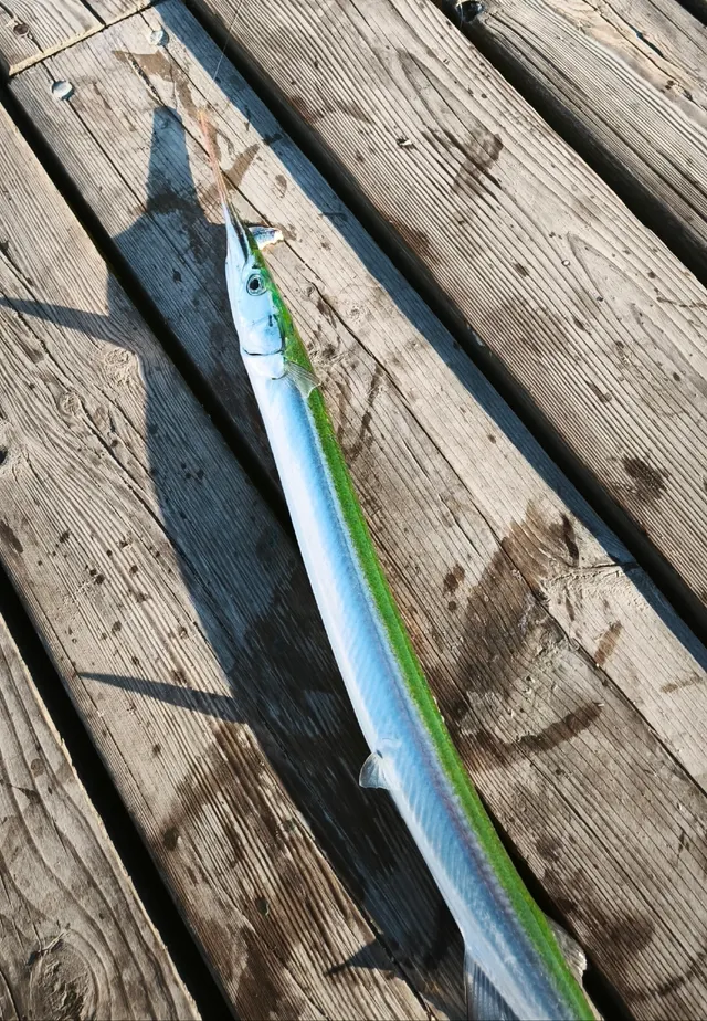 GarfishA slender surface-hunting fish with a long beaked jaw and green bones — a harmless pigment that alarms people unnecessarily.
Dmitry Petrov — CC BY, via iNaturalist
- Conger eelA very large scaleless eel of wrecks, rock and harbour walls, reaching three metres, and among the most powerful and most genuinely dangerous fish to handle in European seas.
Holger Krisp — CC BY 3.0, via Wikimedia Commons
 Atlantic codA large, heavily-built demersal predator of the North Atlantic, and the species whose commercial history is the standard example of stock collapse.
The U.S. Food and Drug Administration, Public domain, via Wikimedia Commons
 WhitingA small, abundant, silver gadoid of European coasts, a mainstay of winter shore fishing and distinguished by a dark spot at the pectoral fin base.
rmjb — CC BY, via iNaturalist
Places within this area
Publicly documented fishing geography. FishingHQ describes what the ground is; it does not say whether you may fish it, and every one of these sends that question to the body that holds the answer. Browse every place in this part of the world.
Who to ask before fishing any of these
FishingHQ does not know the current access position here. Shore angling in England is not rod-licensed, but access rights, landowner permission, local authority and harbour byelaws, national and inshore fisheries measures, and site designations all apply and all change. Check the current position with the relevant inshore fisheries and conservation authority, the harbour or local authority, and the landowner before going.
Portland Bill and Pulpit Rock
Headland · Salt water
The limestone tip of Portland, with the stacked block of Pulpit Rock at the point and stepped quarried ledges either side dropping straight into deep water. The Race runs off the end of it, which is the reason the ground holds what it holds.
Open on three sides, and the Portland Race off the point is among the most dangerous pieces of water on the English coast.
Particular to this ground: cliffs and rock platforms, cold water shock, moving water and currents.
Severe hazards of Portland Bill and the Portland Race apply here: boat safety.
Safety
Boat safety — Can cause serious injury or death
The race runs on every tide and at springs produces standing waves, overfalls and breaking water capable of overwhelming a small boat in flat calm conditions. Wind against tide steepens and shortens the sea dramatically and is the classic fatal combination. The record of capsizes and losses here is long.
What reduces it: Plan around slack water and neap tides, never enter the race with wind against stream, know the state of tide before leaving harbour rather than on arrival, carry the means to summon help, and treat a decision not to go as the normal outcome rather than a failure.
Worse when:
- Spring tides, when the stream runs hardest and the overfalls are largest.
- Wind against tide, which is the condition that has caused most losses here.
- With any Channel swell running, which interacts with the race to produce chaotic water.
Cliffs and rock platforms — Can cause serious injury or death
Limestone ledges around the headland drop into deep, fast-moving water. They are frequently wet and slippery, and swell arrives independently of local wind. Anglers swept from them enter water moving too fast to swim in, with cliffs behind and no landing place.
What reduces it: Check swell height, period and direction rather than wind, watch a full set before committing to a ledge, stand higher than feels necessary, wear a buoyancy aid, never fish the ledges alone, and know where the exits are before you need one.
Cold water shock — Can cause serious injury or death
Channel water is cold enough year-round that immersion triggers gasping and hyperventilation, and swimming ability is lost within the first minute — which in fast water over rock is the minute that decides the outcome.
What reduces it: Wear a buoyancy aid on the ledges and in a boat, and if immersed, float and control breathing before attempting to swim. Do not assume summer water is warm enough to remove this risk.
Further safety reading
- Boat safety for anglers — The race runs on every tide and at springs produces standing waves and overfalls capable of overwhelming a small boat in flat calm; wind against tide is the classic fatal combination.
- Cold water shock and immersion — Channel water is cold enough year-round that swimming ability is lost within the first minute, which in fast water over rock is the minute that decides the outcome.
- Rock platform and cliff safety — Limestone ledges drop into deep fast-moving water, are frequently wet, and receive swell independently of local wind, with cliffs behind and no landing place below.
Check the rules before you fish
Fishing laws, bylaws, access rules, seasons, bait restrictions and permitted methods vary by location and can change. Check the current rules from the relevant authority and the water you intend to fish before fishing.
Check with:
- Current national or regional law for where you are fishing
- Current local bylaws
- The relevant fisheries authority
- The landowner, club or fishery whose water it is
- Any restrictions specific to the species or the method you intend to use
Where to go next
What swims here
- Atlantic codWorks the deeper ground around the headland on the seasonal pattern common to the western Channel.
- Atlantic mackerelDrawn to the concentrations of small fish the turbulence produces, and taken close in from the steeper ledges in the warmer months.
- Ballan wrasseOccupies the rocky ground close in and is a mainstay of shore fishing from limestone ledges of this kind.
- Conger eelOccupies the rough ground and the holes in the rock bottom around the headland.
- European sea bassUses structure and eddies to hold in fast water while intercepting bait swept past, which is the ability a tidal race makes most useful.
- European spratShoals in the water around the headland, and its coordinated shoaling defence is exactly what turbulence in a race breaks down.
- GarfishWorks the surface layers over deep water close to the headland through the warmer months.
- Lesser sandeelBuries in the cleaner ground around the headland and is one of the forage species the turbulence disorients and concentrates.
How this compares
Rules and access
Sources and evidence
- The Fishes of the British Isles and North-West Europe — Macmillan, 1969 (Reference work)Relied on for: Distribution, habitat association, depth and ground preference of fishes in British and north-west European waters.States this directlyCitation checked — the work exists and is described correctly
- FishBase: a global information system on fishes — Froese, R. and D. Pauly, eds. — FishBase Consortium (Scientific institute)Relied on for: Distribution, habitat association and depth range recorded for the species.Background and mechanism onlyPassage read and verified
- NOAA Ocean Service tides and water levels educational tutorial — National Oceanic and Atmospheric Administration, United States (Government fisheries body)Relied on for: The mechanism of tides, tidal range, tidal streams and the amplification of tidal range in converging estuaries.States this directlyPassage read and verified
- Met Office shipping forecast, inshore waters forecast and marine warnings — Met Office, United Kingdom (Government fisheries body)Relied on for: Inshore waters forecasting, sea state, swell and the marine warning products issued for British coastal waters.Background and mechanism onlyCitation checked — the work exists and is described correctly
- RNLI water safety guidance: cold water shock and Float to Live — Royal National Lifeboat Institution (Water-safety or diver-training authority)Relied on for: Shore fishing and coastal hazards including being swept in, shore-break, cold water shock and tidal cut-off, and the guidance issued about them.States this directlyPassage read and verified
- RoSPA water safety information and UK accidental drowning statistics — Royal Society for the Prevention of Accidents (Water-safety or diver-training authority)Relied on for: Accidental drowning statistics for the United Kingdom and the circumstances in which recreational water users are most often killed.States this directlyPassage read and verified
Why the 18 connections on this page are here, and the sources
What swims here
Backed by research — 11 connections
Supported by peer-reviewed research or fisheries science. The sources are listed and can be checked.
Atlantic cod
A distribution association between an animal and a kind of water, rather than a claim about any named mark.
- The Fishes of the British Isles and North-West Europe — Macmillan, 1969 (Reference work)Relied on for: Distribution, habitat association, depth and ground preference of fishes in British and north-west European waters.States this directlyCitation checked — the work exists and is described correctly
- FishBase: a global information system on fishes — Froese, R. and D. Pauly, eds. — FishBase Consortium (Scientific institute)Relied on for: Distribution, habitat association and depth range recorded for the species.Background and mechanism onlyPassage read and verified
Atlantic mackerel
A distribution association between an animal and a kind of water, rather than a claim about any named mark.
- The Fishes of the British Isles and North-West Europe — Macmillan, 1969 (Reference work)Relied on for: Distribution, habitat association, depth and ground preference of fishes in British and north-west European waters.States this directlyCitation checked — the work exists and is described correctly
- FishBase: a global information system on fishes — Froese, R. and D. Pauly, eds. — FishBase Consortium (Scientific institute)Relied on for: Distribution, habitat association and depth range recorded for the species.Background and mechanism onlyPassage read and verified
Ballan wrasse
A distribution association between an animal and a kind of water, rather than a claim about any named mark.
- The Fishes of the British Isles and North-West Europe — Macmillan, 1969 (Reference work)Relied on for: Distribution, habitat association, depth and ground preference of fishes in British and north-west European waters.States this directlyCitation checked — the work exists and is described correctly
- FishBase: a global information system on fishes — Froese, R. and D. Pauly, eds. — FishBase Consortium (Scientific institute)Relied on for: Distribution, habitat association and depth range recorded for the species.Background and mechanism onlyPassage read and verified
Conger eel
A distribution association between an animal and a kind of water, rather than a claim about any named mark.
- The Fishes of the British Isles and North-West Europe — Macmillan, 1969 (Reference work)Relied on for: Distribution, habitat association, depth and ground preference of fishes in British and north-west European waters.States this directlyCitation checked — the work exists and is described correctly
- FishBase: a global information system on fishes — Froese, R. and D. Pauly, eds. — FishBase Consortium (Scientific institute)Relied on for: Distribution, habitat association and depth range recorded for the species.Background and mechanism onlyPassage read and verified
European sea bass
A distribution association between an animal and a kind of water, rather than a claim about any named mark.
- The Fishes of the British Isles and North-West Europe — Macmillan, 1969 (Reference work)Relied on for: Distribution, habitat association, depth and ground preference of fishes in British and north-west European waters.States this directlyCitation checked — the work exists and is described correctly
- FishBase: a global information system on fishes — Froese, R. and D. Pauly, eds. — FishBase Consortium (Scientific institute)Relied on for: Distribution, habitat association and depth range recorded for the species.Background and mechanism onlyPassage read and verified
European sprat
A distribution association between an animal and a kind of water, rather than a claim about any named mark.
- The Fishes of the British Isles and North-West Europe — Macmillan, 1969 (Reference work)Relied on for: Distribution, habitat association, depth and ground preference of fishes in British and north-west European waters.States this directlyCitation checked — the work exists and is described correctly
- FishBase: a global information system on fishes — Froese, R. and D. Pauly, eds. — FishBase Consortium (Scientific institute)Relied on for: Distribution, habitat association and depth range recorded for the species.Background and mechanism onlyPassage read and verified
Garfish
A distribution association between an animal and a kind of water, rather than a claim about any named mark.
- The Fishes of the British Isles and North-West Europe — Macmillan, 1969 (Reference work)Relied on for: Distribution, habitat association, depth and ground preference of fishes in British and north-west European waters.States this directlyCitation checked — the work exists and is described correctly
- FishBase: a global information system on fishes — Froese, R. and D. Pauly, eds. — FishBase Consortium (Scientific institute)Relied on for: Distribution, habitat association and depth range recorded for the species.Background and mechanism onlyPassage read and verified
Lesser sandeel
A distribution association between an animal and a kind of water, rather than a claim about any named mark.
- The Fishes of the British Isles and North-West Europe — Macmillan, 1969 (Reference work)Relied on for: Distribution, habitat association, depth and ground preference of fishes in British and north-west European waters.States this directlyCitation checked — the work exists and is described correctly
- FishBase: a global information system on fishes — Froese, R. and D. Pauly, eds. — FishBase Consortium (Scientific institute)Relied on for: Distribution, habitat association and depth range recorded for the species.Background and mechanism onlyPassage read and verified
Pollack
A distribution association between an animal and a kind of water, rather than a claim about any named mark.
- The Fishes of the British Isles and North-West Europe — Macmillan, 1969 (Reference work)Relied on for: Distribution, habitat association, depth and ground preference of fishes in British and north-west European waters.States this directlyCitation checked — the work exists and is described correctly
- FishBase: a global information system on fishes — Froese, R. and D. Pauly, eds. — FishBase Consortium (Scientific institute)Relied on for: Distribution, habitat association and depth range recorded for the species.Background and mechanism onlyPassage read and verified
Pouting
A distribution association between an animal and a kind of water, rather than a claim about any named mark.
- The Fishes of the British Isles and North-West Europe — Macmillan, 1969 (Reference work)Relied on for: Distribution, habitat association, depth and ground preference of fishes in British and north-west European waters.States this directlyCitation checked — the work exists and is described correctly
- FishBase: a global information system on fishes — Froese, R. and D. Pauly, eds. — FishBase Consortium (Scientific institute)Relied on for: Distribution, habitat association and depth range recorded for the species.Background and mechanism onlyPassage read and verified
Whiting
A distribution association between an animal and a kind of water, rather than a claim about any named mark.
- The Fishes of the British Isles and North-West Europe — Macmillan, 1969 (Reference work)Relied on for: Distribution, habitat association, depth and ground preference of fishes in British and north-west European waters.States this directlyCitation checked — the work exists and is described correctly
- FishBase: a global information system on fishes — Froese, R. and D. Pauly, eds. — FishBase Consortium (Scientific institute)Relied on for: Distribution, habitat association and depth range recorded for the species.Background and mechanism onlyPassage read and verified
How people fish here
What experienced anglers do — 2 connections
Widely and independently recommended by experienced anglers and specialist sources. This is real angling knowledge, not proof: controlled evidence for it is limited, and FishingHQ records it as convention rather than as a demonstrated effect.
Lure fishing
A discipline that is characteristic of the place rather than merely possible there, joined so a reader can move between the place and the practice.
- General angling website restatements of established technique — Various (Credible secondary source)Relied on for: Widely restated practice associating this discipline with this place, recorded as practitioner consensus rather than as tested fact.Background and mechanism onlyCitation checked — the work exists and is described correctly
- Fishers' Craft and Lettered Art: Tracts on Fishing from the End of the Middle Ages — University of Toronto Press, 1997 (Scientific literature)Relied on for: That fishing traditions develop around the water and fish available to them, and the historical method of reading such traditions.States this directlyCitation checked — the work exists and is described correctly
Sea fishing
A discipline that is characteristic of the place rather than merely possible there, joined so a reader can move between the place and the practice.
- General angling website restatements of established technique — Various (Credible secondary source)Relied on for: Widely restated practice associating this discipline with this place, recorded as practitioner consensus rather than as tested fact.Background and mechanism onlyCitation checked — the work exists and is described correctly
- Fishers' Craft and Lettered Art: Tracts on Fishing from the End of the Middle Ages — University of Toronto Press, 1997 (Scientific literature)Relied on for: That fishing traditions develop around the water and fish available to them, and the historical method of reading such traditions.States this directlyCitation checked — the work exists and is described correctly
How this compares
What experienced anglers do — 1 connection
Widely and independently recommended by experienced anglers and specialist sources. This is real angling knowledge, not proof: controlled evidence for it is limited, and FishingHQ records it as convention rather than as a demonstrated effect.
The Channel shingle coasts
Two places a reader would reasonably weigh against one another, joined where the comparison teaches something about both. It is also how the larger geography is linked to what sits inside it.
- General angling website restatements of established technique — Various (Credible secondary source)Relied on for: Widely restated practice associating this discipline with this place, recorded as practitioner consensus rather than as tested fact.Background and mechanism onlyCitation checked — the work exists and is described correctly
- Fishers' Craft and Lettered Art: Tracts on Fishing from the End of the Middle Ages — University of Toronto Press, 1997 (Scientific literature)Relied on for: That fishing traditions develop around the water and fish available to them, and the historical method of reading such traditions.States this directlyCitation checked — the work exists and is described correctly
Safety reading
Official guidance — 3 connections
Stated by a fisheries authority, scientific institute or recognised angling body. Authoritative, but summarising rather than demonstrating.
Boat safety for anglers
A place is joined to the safety topic that explains a hazard genuinely characteristic of it, so the mechanism is reachable rather than restated as a weak warning.
- RNLI water safety guidance: cold water shock and Float to Live — Royal National Lifeboat Institution (Water-safety or diver-training authority)Relied on for: Cold water shock and the immersion response, shore angling hazards, small-craft guidance and the circumstances in which water users are most often killed.States this directlyPassage read and verified
- RoSPA water safety information and UK accidental drowning statistics — Royal Society for the Prevention of Accidents (Water-safety or diver-training authority)Relied on for: Accidental drowning statistics and the circumstances in which recreational water users are most often killed.Background and mechanism onlyPassage read and verified
Cold water shock and immersion
A place is joined to the safety topic that explains a hazard genuinely characteristic of it, so the mechanism is reachable rather than restated as a weak warning.
- RNLI water safety guidance: cold water shock and Float to Live — Royal National Lifeboat Institution (Water-safety or diver-training authority)Relied on for: Cold water shock and the immersion response, shore angling hazards, small-craft guidance and the circumstances in which water users are most often killed.States this directlyPassage read and verified
- RoSPA water safety information and UK accidental drowning statistics — Royal Society for the Prevention of Accidents (Water-safety or diver-training authority)Relied on for: Accidental drowning statistics and the circumstances in which recreational water users are most often killed.Background and mechanism onlyPassage read and verified
Rock platform and cliff safety
A place is joined to the safety topic that explains a hazard genuinely characteristic of it, so the mechanism is reachable rather than restated as a weak warning.
- Rock fishing safety and the declared lifejacket areas of New South Wales — NSW Department of Primary Industries and Surf Life Saving NSW (Water-safety or diver-training authority)Relied on for: Rock and ledge fishing hazards, the mechanism by which anglers are swept from exposed platforms, and the measures that reduce it.States this directlyCitation checked — the work exists and is described correctly
- United States Lifesaving Association public education on rip currents and the surf zone — United States Lifesaving Association (Water-safety or diver-training authority)Relied on for: Surf zone hazards, rip current formation and behaviour, and the circumstances in which people are carried offshore.States this directlyCitation checked — the work exists and is described correctly
Rules and access
Official guidance — 1 connection
Stated by a fisheries authority, scientific institute or recognised angling body. Authoritative, but summarising rather than demonstrating.
Size limits and retention
A place joined to the regulatory concept whose structure it illustrates. The edge asserts that the concept applies here, never what any current rule says.
- Code of Conduct for Responsible Fisheries — Food and Agriculture Organization of the United Nations, Rome, 1995 (Standards body)Relied on for: Principles for the management of fisheries, including licensing, closed seasons, size limits and the treatment of small-scale and shared stocks.States this directlyCitation checked — the work exists and is described correctly
- Good Fish Guide — Marine Conservation Society (Conservation authority)Relied on for: Assessment of fisheries and the management measures applied to them, including the instruments used and their purpose.Background and mechanism onlyCitation checked — the work exists and is described correctly
How FishingHQ labels evidence is explained in the evidence policy.