Eastbourne Pier
Pier · Salt water · in The Channel shingle coasts
A Victorian pleasure pier on a shingle shore immediately east of Beachy Head, with chalk ground running out beneath the shingle towards the headland.
Safety: drowning and immersion — can cause serious injury or death (general advice, not specific to this place). One more point applies here.
FishingHQ describes what this place is, not whether you may fish it. Access, permits and who to ask.
What you can catch here
Documented at this place, grouped by how you would be fishing, with how strongly the sources support each one. This is what has been written down, not a forecast, and being listed is never permission to fish.
From the shore · 10
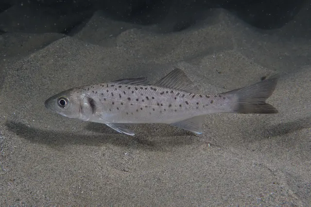 European sea bassRegular local target1 placeEastbourne PierOver pierAround May–Oct
Photo: Julien Renoult, via Wikimedia Commons, CC BY 4.0; resized and trimmed to fit
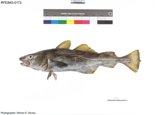 Atlantic codRecorded here1 placeEastbourne PierOver pier
Photo: The U.S. Food and Drug Administration, via Wikimedia Commons, public domain; resized and trimmed to fit
- Atlantic horse mackerelRecorded here1 placeEastbourne PierOver pier
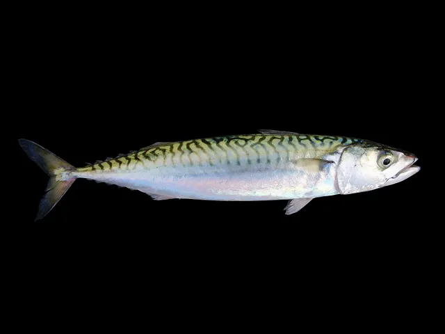 Atlantic mackerelRecorded here1 placeEastbourne PierOver pier
Photo: Hans Hillewaert, via Wikimedia Commons, CC BY-SA 4.0; resized; shared under the same licence
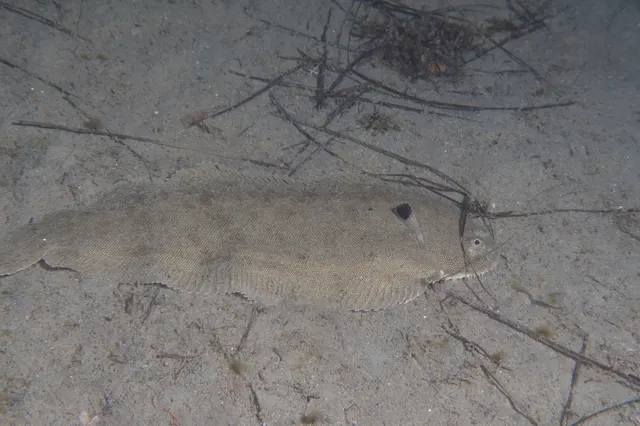 Common soleRecorded here1 placeEastbourne PierOver pier
Photo: Julien Renoult, via iNaturalist, CC BY; resized and trimmed to fit
- DabRecorded here1 placeEastbourne PierOver pier
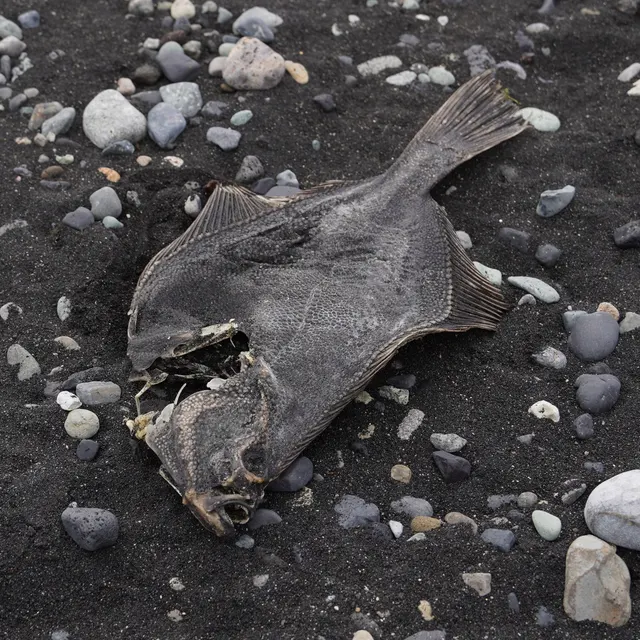 European flounderRecorded here1 placeEastbourne PierOver pier
Photo: nbasargin, via iNaturalist, CC BY; resized and trimmed to fit
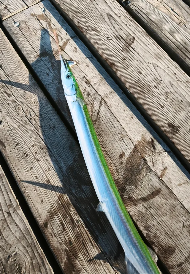 GarfishRecorded here1 placeEastbourne PierOver pier
Photo: Dmitry Pietrow, via iNaturalist, CC BY; resized and trimmed to fit


Also documented from the shore: Small-spotted catshark · Whiting
What these strengths mean
- Regular local target
- Fishing sources describe this as a normal local target here, not merely as caught.
- Recorded here
- At least one credible public account of this species being caught here. That is all it means.
- How breadth is counted
- A fish documented at six marks is shown as six marks: breadth never raises the strength on its own. A fishery account describes the fishing; a recorded catch reports one specific catch. How evidence is weighed.
Also associated with this ground
Recorded as present here without a documented method or strength behind them.
Fish documented nearby, not here
Nothing below has been documented at Eastbourne Pier itself. Each one has been documented at a named place on the same ground, and the places are listed with it. Treat this as what the water around here holds rather than as a catch list for this mark.
Widely documented on this ground
Documented at three or more neighbouring places, fished a way this place is also fished. That is a pattern about the ground rather than about any one mark, and it is the closest this site comes to saying you will probably meet a fish somewhere nothing has been written about.
From the shore
- Starry smooth-hound — documented at Dungeness Point; Hastings and the Stade; Worthing Pier
- Thornback ray — documented at Dungeness Point; Hastings and the Stade; Worthing Pier
Also documented at neighbouring places
One or two accounts each, on the ground around here. Enough to know the fish is caught in these waters; not enough to say anything about this place.
From the shore
- Pollack — documented at Brighton Marina
- Thick-lipped grey mullet — documented at Littlehampton and the Arun
- Black seabream — documented at Brighton Marina
- European squid — documented at Brighton Marina
How people fish it
Practised here: Sea fishing.
Methods the sources name for this ground. Each one is explained in full on its own page.
- Ledgering
Fishing a bait on the bottom held by a weight, with no float — the simplest way to fish at distance, in depth, or in wind.
- Float fishing
Suspending a bait at a controlled depth beneath a buoyant indicator — the most visual, most controllable and most widely applicable method in angling.
Baits and lures for these fish
The baits and lures each of the fish above is commonly taken on, from that fish’s own page. This is what works for the fish, not a report of what people use on this particular water — local knowledge and the conditions on the day still decide.
Baits
- Lugworm — for Atlantic cod, Common sole, Dab, European flounder and 1 more
- Ragworm — for European sea bass, Common sole, Dab, European flounder and 1 more
- Fish strip and cut bait — for Atlantic cod, Garfish, Small-spotted catshark, Whiting
- Peeler crab — for European sea bass, Atlantic cod, European flounder
- Squid and cuttlefish — for Atlantic cod, Dab, Small-spotted catshark
- Sand eel — for European sea bass, Garfish
- Crab and shellfish — for European sea bass
- Sea deadbaits — for Small-spotted catshark
Lures
- Metal jigs — for European sea bass, Atlantic cod, Atlantic mackerel
- Soft plastics — for European sea bass, Atlantic cod
- Spinners — for Atlantic mackerel, Garfish
- Jerkbaits — for European sea bass
- Streamers — for European sea bass
- Surface lures — for European sea bass
How to catch them: Bass fishing · Cod fishing · Mackerel fishing · Sole fishing · Flounder fishing · Garfish fishing · Dogfish (small-spotted catshark) fishing · Whiting fishing
Rods, reels and rigs for them: European sea bass · Atlantic cod · Atlantic mackerel · Common sole · European flounder · Garfish · Whiting
What guides and anglers say
These are statements other people have published about fishing here, summarised and attributed. Where one is a catch, it is that angler’s own report of one day; a recommendation is not a catch, and neither is a forecast.
Getting there, as described
A regional mark guide reports that angling on Eastbourne Pier was stopped in 2016 and allowed again from 2019 for members of an angling club only, and warns that weever fish can turn up in catches there. Whoever runs it holds the current terms; they are not restated here.
A published angling guide: British Sea Fishing.
The ground and the water
- The ground
- A Victorian pleasure pier on a shingle shore immediately east of Beachy Head, with chalk ground running out beneath the shingle towards the headland.
Safety
Drowning and immersion — Can cause serious injury or death
General safety for this kind of ground, not a finding about this place.
Waves break directly onto a steep shingle face without a dissipating surf zone, and the backwash runs fast down a slope of loose mobile pebbles into deep water immediately offshore. A person knocked down cannot get a footing on shifting material while being pulled downslope, and is in deep cold water within seconds.
What reduces it: Stand well back from the water's edge whenever any swell is running rather than at it, wear a buoyancy aid, do not fish alone at night, treat a building sea as a reason to leave rather than to retreat up the beach, tell somebody the plan and the return time, and carry a means of calling for help on the person rather than in a bag.
Worse when:
- Long-period ground swell arriving with no local wind, which produces much larger sets than the conditions suggest.
- Night sessions, when a set cannot be seen coming — which is when most of this fishing is done.
- Cold water, where cold water shock incapacitates a competent swimmer within the first minute.
Cold water shock — Can cause serious injury or death
General safety for this kind of ground, not a finding about this place.
The fishery here is weighted to autumn, winter and night, and the water is cold for most of it. Immersion produces an involuntary gasp and loss of breathing control within seconds — before cold has had any effect on the muscles — which is why immersion kills competent swimmers on a beach they can stand up on.
What reduces it: Wear a buoyancy aid rather than carry one, stand back from the water's edge whenever a swell is running, do not fish alone at night, and carry a means of calling for help on the person rather than in a bag at the top of the bank.
Worse when:
- Between roughly November and April, when sea temperature is at its lowest and the fishery is at its busiest.
- At night and alone, when nobody sees the entry and the response time is however long it takes somebody to miss you.
Rules and access
FishingHQ does not know the current access position here. Shore angling in England is not rod-licensed, but access rights, landowner permission, local authority and harbour byelaws, national and inshore fisheries measures, and site designations all apply and all change. Check the current position with the relevant inshore fisheries and conservation authority, the harbour or local authority, and the landowner before going.
Who holds the answer:
- The Inshore Fisheries and Conservation Authority for the district, which makes and enforces inshore byelaws.
- The Marine Management Organisation, for national recreational sea fishing measures in English waters.
- The local authority and, where one exists, the harbour authority, for access, byelaws and shellfish classification.
- The relevant Inshore Fisheries and Conservation Authority, which makes and enforces byelaws for the inshore district concerned.
- Natural England and the relevant protected site management body, where a shingle structure carries a conservation designation affecting access.
- The landowner or managing body for the beach itself, since access and parking are property matters rather than fisheries ones.
- The Maritime and Coastguard Agency and the RNLI, for safety guidance on this coast.
Nearby fishing
Other publicly documented places within about 40 km, by distance. Positions are approximate public geography and are never exact marks.
- Beachy Head and the ledges — 2–5 km · Ledge
- Bexhill — 10–25 km · Beach
- Newhaven west arm — 10–25 km · Breakwater
- Hastings and the Stade — 10–25 km · Beach section
- Brighton Marina — 25–40 km · Marina
- Bewl Water — 25–40 km · Reservoir
- Camber Sands — 25–40 km · Beach
Sources for this place
- Sea Angler — Bauer Media (Specialist angling publication)Relied on for: Long-running published description of British sea angling practice by region, ground type and named mark.FishingHQ's interpretation of what it saysCitation checked — the work exists and is described correctly
- General angling website restatements of established technique — Various (Credible secondary source)Relied on for: Widely restated public descriptions of which places are conventionally fished and how, recorded as practitioner consensus rather than as scholarship, and not relied on for access, permission or any current rule.Background and mechanism onlyCitation checked — the work exists and is described correctly
- British Sea Fishing: south-east England shore marks — British Sea Fishing (Credible secondary source)Relied on for: The Bexhill and Eastbourne entry: the summer and winter species split for the pier and the beaches, and the pier's angling ban from 2016 and reopening to club members in 2019.States this directlyPassage read and verified
How FishingHQ labels evidence is explained in the evidence policy. Last reviewed 2026-08-16.
Something wrong or out of date?
If something on this page has changed, email us from your own account using the link that fits, with a link to where you saw the change if you can. Every report is checked by a person before anything is changed, and a report never appears on the site by itself. Please don’t send exact private marks.
Before you go
- Fish documented here
- 10 at this place itself. See them.
- Getting there
- Not recorded. FishingHQ holds no sourced description of the way in.
- Rules particular to this water
- None recorded, which is not the same as none existing.
- Hazards particular to this place
- None recorded for this place; the hazards of the wider coast or water still apply.
Check before you travel
- Whether you may fish here, and whether a licence or permit is needed — start with the Inshore Fisheries and Conservation Authority for the district.
- The tide times and the forecast for the day you go.
- Anything recorded here was true when it was read; it is not watched for change.