Brighton Marina
Marina · Salt water · in The Channel shingle coasts
The largest artificial marina in Britain, built out onto a chalk platform, with deep water alongside its outer walls and chalk reef either side.
Safety: drowning and immersion — can cause serious injury or death. One more point applies here.
FishingHQ describes what this place is, not whether you may fish it. Access, permits and who to ask.
What you can catch here
Documented at this place, grouped by how you would be fishing, with how strongly the sources support each one. This is what has been written down, not a forecast, and being listed is never permission to fish.
From the shore · 5
 European sea bassRegular local target1 placeBrighton MarinaOver marinaAround May–Oct
 PollackRegular local target1 placeBrighton MarinaOver marinaAround May–Oct
 Atlantic codSeasonal1 placeBrighton MarinaOver marinaAround Jan–Feb, Nov–Dec
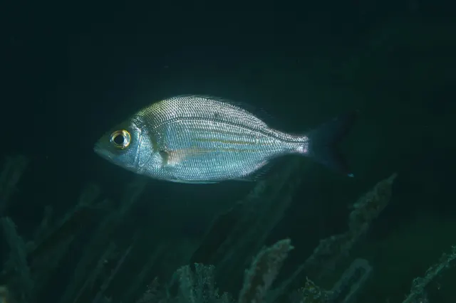 Black seabreamSeasonal1 placeBrighton MarinaOver marinaAround May–Oct
- European squidSeasonal1 placeBrighton MarinaOver marinaAround Jan, Oct–Dec
What these strengths mean
- Regular local target
- Fishing sources describe this as a normal local target here, not merely as caught.
- Seasonal
- Well supported, and concentrated in part of the year rather than spread through it.
- How breadth is counted
- A fish documented at six marks is shown as six marks: breadth never raises the strength on its own. A fishery account describes the fishing; a recorded catch reports one specific catch. How evidence is weighed.
Also associated with this ground
Recorded as present here without a documented method or strength behind them.
Atlantic mackerel · Thick-lipped grey mullet · Conger eel · Whiting · Garfish · Common sole · European plaice · Small-spotted catshark · European flounder
Recorded here, but not a species to target
These are recorded here, but they are not fish to take. Each is either assessed as Critically Endangered or protected by statute in this jurisdiction, and taking one may be prohibited outright — elsewhere every rod-caught fish must be returned. Read the species page and check the current rules with the authority before fishing.
Fish documented nearby, not here
Nothing below has been documented at Brighton Marina itself. Each one has been documented at a named place on the same ground, and the places are listed with it. Treat this as what the water around here holds rather than as a catch list for this mark.
Also documented at neighbouring places
One or two accounts each, on the ground around here. Enough to know the fish is caught in these waters; not enough to say anything about this place.
From the shore
- Starry smooth-hound — documented at Hastings and the Stade; Worthing Pier
- Thornback ray — documented at Hastings and the Stade; Worthing Pier
How people fish it
Practised here: Sea fishing.
Methods the sources name for this ground. Each one is explained in full on its own page.
- Ledgering
Fishing a bait on the bottom held by a weight, with no float — the simplest way to fish at distance, in depth, or in wind.
- Float fishing
Suspending a bait at a controlled depth beneath a buoyant indicator — the most visual, most controllable and most widely applicable method in angling.
The ground and the water
- The ground
- The largest artificial marina in Britain, built out onto a chalk platform, with deep water alongside its outer walls and chalk reef either side.
Through the year
The months the sources attach to each species here. Where a species carries no season it is listed underneath rather than assumed to run through the year.
| Species | J | F | M | A | M | J | J | A | S | O | N | D |
|---|---|---|---|---|---|---|---|---|---|---|---|---|
| European sea bass — regular local target, recorded in May, June, July, August, September, October. | ||||||||||||
| Pollack — regular local target, recorded in May, June, July, August, September, October. | ||||||||||||
| Atlantic cod — seasonal, recorded in November, December, January, February. | ||||||||||||
| Black seabream — seasonal, recorded in May, June, July, August, September, October. | ||||||||||||
| European squid — seasonal, recorded in October, November, December, January. |
Safety
Drowning and immersion — Can cause serious injury or death
Waves break directly onto a steep shingle face without a dissipating surf zone, and the backwash runs fast down a slope of loose mobile pebbles into deep water immediately offshore. A person knocked down cannot get a footing on shifting material while being pulled downslope, and is in deep cold water within seconds.
What reduces it: Stand well back from the water's edge whenever any swell is running rather than at it, wear a buoyancy aid, do not fish alone at night, treat a building sea as a reason to leave rather than to retreat up the beach, tell somebody the plan and the return time, and carry a means of calling for help on the person rather than in a bag.
Worse when:
- Long-period ground swell arriving with no local wind, which produces much larger sets than the conditions suggest.
- Night sessions, when a set cannot be seen coming — which is when most of this fishing is done.
- Cold water, where cold water shock incapacitates a competent swimmer within the first minute.
Cold water shock — Can cause serious injury or death
The fishery here is weighted to autumn, winter and night, and the water is cold for most of it. Immersion produces an involuntary gasp and loss of breathing control within seconds — before cold has had any effect on the muscles — which is why immersion kills competent swimmers on a beach they can stand up on.
What reduces it: Wear a buoyancy aid rather than carry one, stand back from the water's edge whenever a swell is running, do not fish alone at night, and carry a means of calling for help on the person rather than in a bag at the top of the bank.
Worse when:
- Between roughly November and April, when sea temperature is at its lowest and the fishery is at its busiest.
- At night and alone, when nobody sees the entry and the response time is however long it takes somebody to miss you.
Rules and access
FishingHQ does not know the current access position here. Shore angling in England is not rod-licensed, but access rights, landowner permission, local authority and harbour byelaws, national and inshore fisheries measures, and site designations all apply and all change. Check the current position with the relevant inshore fisheries and conservation authority, the harbour or local authority, and the landowner before going.
Who holds the answer:
- The Inshore Fisheries and Conservation Authority for the district, which makes and enforces inshore byelaws.
- The Marine Management Organisation, for national recreational sea fishing measures in English waters.
- The local authority and, where one exists, the harbour authority, for access, byelaws and shellfish classification.
- The relevant Inshore Fisheries and Conservation Authority, which makes and enforces byelaws for the inshore district concerned.
- Natural England and the relevant protected site management body, where a shingle structure carries a conservation designation affecting access.
- The landowner or managing body for the beach itself, since access and parking are property matters rather than fisheries ones.
- The Maritime and Coastguard Agency and the RNLI, for safety guidance on this coast.
Nearby fishing
Other publicly documented places within about 40 km, by distance. Positions are approximate public geography and are never exact marks.
- Newhaven west arm — 10–25 km · Breakwater
- Worthing Pier — 10–25 km · Pier
- Beachy Head and the ledges — 25–40 km · Ledge
- Eastbourne Pier — 25–40 km · Pier
- Littlehampton and the Arun — 25–40 km · Estuary mark
Sources for this place
- Sea Angler — Bauer Media (Specialist angling publication)Relied on for: Long-running published description of British sea angling practice by region, ground type and named mark.FishingHQ's interpretation of what it saysCitation checked — the work exists and is described correctly
- General angling website restatements of established technique — Various (Credible secondary source)Relied on for: Widely restated public descriptions of which places are conventionally fished and how, recorded as practitioner consensus rather than as scholarship, and not relied on for access, permission or any current rule.Background and mechanism onlyCitation checked — the work exists and is described correctly
- British Sea Fishing: south-east England shore marks — British Sea Fishing (Credible secondary source)Relied on for: The mark-by-mark entry for Brighton Marina: its species split into a warmer and a colder half, the baits and rigs for each, and squid taken there on rod and line.States this directlyPassage read and verified
How FishingHQ labels evidence is explained in the evidence policy. Last reviewed 2026-08-16.