Abbotsbury beach
Beach section · Salt water · in Chesil Beach
The middle of the bank, opposite Abbotsbury and the widest part of the Fleet behind it. Classic Chesil: a high steep storm ridge of medium flint and chert shingle with deep water at the foot of it, and the mark most associated with the beach's cod fishing.
Safety: drowning and immersion — can cause serious injury or death. 2 more points apply here.
FishingHQ describes what this place is, not whether you may fish it. Access, permits and who to ask.
What you can catch here
Documented at this place, grouped by how you would be fishing, with how strongly the sources support each one. This is what has been written down, not a forecast, and being listed is never permission to fish.
From the shore · 6
 Atlantic codCharacteristic of this water1 placeAbbotsbury beachOver beach sectionAround Jan–Mar, Oct–Dec
 Conger eelRegular local target1 placeAbbotsbury beachOver beach sectionAround May–Oct
 European sea bassRegular local target1 placeAbbotsbury beachOver beach sectionAround May–Oct
 Atlantic mackerelSeasonal1 placeAbbotsbury beachOver beach sectionAround Jun–Sept
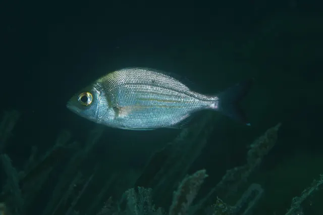 Black seabreamSeasonal1 placeAbbotsbury beachOver beach sectionAround May–Oct
 WhitingSeasonal1 placeAbbotsbury beachOver beach sectionAround Jan–Mar, Oct–Dec
What these strengths mean
- Characteristic of this water
- This water is strongly identified with this species by the sources that cover it.
- Regular local target
- Fishing sources describe this as a normal local target here, not merely as caught.
- Seasonal
- Well supported, and concentrated in part of the year rather than spread through it.
- How breadth is counted
- A fish documented at six marks is shown as six marks: breadth never raises the strength on its own. A fishery account describes the fishing; a recorded catch reports one specific catch. How evidence is weighed.
Also associated with this ground
Recorded as present here without a documented method or strength behind them.
Fish documented nearby, not here
Nothing below has been documented at Abbotsbury beach itself. Each one has been documented at a named place on the same ground, and the places are listed with it. Treat this as what the water around here holds rather than as a catch list for this mark.
Widely documented on this ground
Documented at three or more neighbouring places, fished a way this place is also fished. That is a pattern about the ground rather than about any one mark, and it is the closest this site comes to saying you will probably meet a fish somewhere nothing has been written about.
From the shore
- European plaice — documented at West Bexington; Cogden Beach; Ferrybridge and the Chesil Beach centre (+1 more)
Also documented at neighbouring places
One or two accounts each, on the ground around here. Enough to know the fish is caught in these waters; not enough to say anything about this place.
From the shore
- Common sole — documented at West Bexington; Cogden Beach
- European flounder — documented at Ferrybridge and the Chesil Beach centre
- Small-eyed ray — documented at West Bexington
- Garfish — documented at Ferrybridge and the Chesil Beach centre; Hive Beach, Burton Bradstock
- Ballan wrasse — documented at Chesil Cove
- Dab — documented at West Bexington
- Thick-lipped grey mullet — documented at Ferrybridge and the Chesil Beach centre
How people fish it
Practised here: Sea fishing.
Methods the sources name for this ground. Each one is explained in full on its own page.
- Ledgering
Fishing a bait on the bottom held by a weight, with no float — the simplest way to fish at distance, in depth, or in wind.
- Surfcasting
Casting heavy baited tackle from a beach into surf — a method defined by distance, by tide, and by reading water that all looks the same.
- Spinning
Casting an artificial lure and retrieving it so that it moves like something alive — the most direct form of lure fishing.
The ground and the water
- The ground
- The middle of the bank, opposite Abbotsbury and the widest part of the Fleet behind it. Classic Chesil: a high steep storm ridge of medium flint and chert shingle with deep water at the foot of it, and the mark most associated with the beach's cod fishing.
- Exposure
- Open to the south-west with nothing between it and the Atlantic swell, and no shelter of any kind along the bank.
- Depth
- Deep water at the foot of the bank, which is why big baits fished close are a Chesil tactic rather than a compromise.
- Tide and flow
- A strong lateral drift runs along the bank here and decides where a lead will hold. The Portland double tide applies along the whole beach.
Getting there
What public sources describe, last checked 2026-08-22. Car parks fill, services change and a path existing is not a path anybody may use — none of this is a guarantee of availability and none of it is permission to be anywhere.
- Getting to it
- Reached from the B3157 coast road through Abbotsbury and down the lane behind the bank, which ends at a parking area with an information board and a boardwalk to the shingle.
- The walk in
- A short walk from the parking area over the crest of the bank. It is a climb up loose shingle and then a steep descent to the water, which is the part that makes carrying a full beach outfit here work.
Parking
Abbotsbury beach car park
Public car park · Charged
A charged car park at the end of the beach lane. The charge and the operator are not published here; a directory figure for a seasonal beach car park is the field most likely to be wrong.
Where this access information comes from
- Shore fishing Chesil: the marks, from the Cove to Hive — Weymouth Angling Centre (Practitioner report)Relied on for: That Abbotsbury is a mid-beach mark of medium access difficulty with deep water, what is fished for there and how.Passage read and verified
Through the year
Cod and whiting through the colder months, bass and mackerel from late spring to autumn, bream and conger over the warmer ones.
The months the sources attach to each species here. Where a species carries no season it is listed underneath rather than assumed to run through the year.
| Species | J | F | M | A | M | J | J | A | S | O | N | D |
|---|---|---|---|---|---|---|---|---|---|---|---|---|
| Atlantic cod — characteristic of this water, recorded in October, November, December, January, February, March. | ||||||||||||
| Conger eel — regular local target, recorded in May, June, July, August, September, October. | ||||||||||||
| European sea bass — regular local target, recorded in May, June, July, August, September, October. | ||||||||||||
| Atlantic mackerel — seasonal, recorded in June, July, August, September. | ||||||||||||
| Black seabream — seasonal, recorded in May, June, July, August, September, October. | ||||||||||||
| Whiting — seasonal, recorded in October, November, December, January, February, March. |
Safety
Drowning and immersion — Can cause serious injury or death
The bank shelves steeply into deep water and breaks in a single step at the waterline. A wave running up the face and back down takes a person off their feet into water that is out of their depth immediately, and the backwash drags loose shingle from under them while they try to climb out of it.
What reduces it: Stand well above the step, treat the swell forecast rather than the wind as the deciding input, never turn your back on the sea, and leave the beach when a ground swell starts running rather than when it arrives.
Worse when:
- In any south-westerly ground swell, which reaches the beach before the wind that made it.
Cold water shock — Can cause serious injury or death
UK coastal and inland water is cold enough for most of the year to trigger the involuntary gasp and the loss of swimming ability that decides most immersion deaths, and it does so within the first minute, long before hypothermia is relevant.
What reduces it: Wear a buoyancy aid rather than carry one, carry a means of calling for help on the person rather than in a bag, and plan on the assumption that an unplanned entry into the water is survivable only if somebody knows immediately.
Moving water and currents — Minor injury
Weed carried along the bank by the lateral drift loads a line until a grip lead will not hold, which is a fishing problem rather than a safety one until an angler wades to clear it.
What reduces it: Read the drift before casting, and clear a fouled line from where you are standing rather than by going down the step to it.
Rules and access
FishingHQ does not know the current access position here. Shore angling in England is not rod-licensed, but access rights, landowner permission, local authority and harbour byelaws, national and inshore fisheries measures, and site designations all apply and all change. Check the current position with the relevant inshore fisheries and conservation authority, the harbour or local authority, and the landowner before going.
Particular to this water: The Fleet behind this stretch is a Site of Special Scientific Interest and the swannery holds nesting birds through the spring. This ground carries conservation designations that constrain access, vehicles, bait collection and disturbance independently of any fishing rule.
Who holds the answer:
- The Inshore Fisheries and Conservation Authority for the district, which makes and enforces inshore byelaws.
- The Marine Management Organisation, for national recreational sea fishing measures in English waters.
- The local authority and, where one exists, the harbour authority, for access, byelaws and shellfish classification.
- The inshore fisheries and conservation authority for the district, for sea fishing byelaws, gear rules and local restrictions.
- The national fisheries authority, for minimum conservation reference sizes and national measures including those applying to bass.
- The statutory nature conservation body, for the site of special scientific interest and European habitat and bird designations covering the beach and the Fleet.
- The landowner and the managing bodies of the Fleet and the nature reserve, for access and for what may be done behind the barrier.
- The local authority and food standards agency, for shellfish ground classification and biotoxin monitoring.
Nearby fishing
Other publicly documented places within about 40 km, by distance. Positions are approximate public geography and are never exact marks.
- West Bexington — 5–10 km · Beach section
- Cogden Beach — 5–10 km · Beach section
- Hive Beach, Burton Bradstock — 10–25 km · Beach section
- Ferrybridge and the Chesil Beach centre — 10–25 km · Beach section
- Weymouth Harbour — 10–25 km · Harbour wall
- West Bay and Bridport harbour — 10–25 km · Harbour wall
- Weymouth Pleasure Pier — 10–25 km · Pier
- Weymouth Stone Pier — 10–25 km · Breakwater
Sources for this place
- Sea Angler — Bauer Media (Specialist angling publication)Relied on for: Long-running published description of British sea angling practice by region, ground type and named mark.FishingHQ's interpretation of what it saysCitation checked — the work exists and is described correctly
- General angling website restatements of established technique — Various (Credible secondary source)Relied on for: Widely restated public descriptions of which places are conventionally fished and how, recorded as practitioner consensus rather than as scholarship, and not relied on for access, permission or any current rule.Background and mechanism onlyCitation checked — the work exists and is described correctly
How FishingHQ labels evidence is explained in the evidence policy. Last reviewed 2026-08-16.