East Lothian and the Firth of Forth coast
Fishing regions · Last reviewed 2026-08-14
A short stretch of Scotland's east coast where rock platform, reef, clean sand and estuary alternate within a few miles, on cold, comparatively sheltered water with a long shore-fishing tradition.
Safety: cliffs and rock platforms — can cause serious injury or death. One more point applies here.
Being listed here is not permission to fish. What that meansClose
Access, fishing rights, seasons, licences, local bylaws and permitted methods vary and can change. Check current access, permission, local regulations, closures and restrictions before you travel or fish. FishingHQ describes what the ground is and names who holds the answer; it does not hold the answer itself.
Find the authority for a jurisdiction · What FishingHQ does and does not cover
East Lothian and the outer Firth of Forth present something unusual in British shore fishing: several genuinely different ground types within a distance that can be covered in an afternoon. Volcanic rock platforms and reef alternate with clean sandy bays, with an estuarine gradient running inland and a scatter of islands and skerries offshore.
WHAT THE VARIETY MEANS PRACTICALLY is that the answer to a difficult day is usually a short drive rather than a change of tackle. A wind that makes the rock unfishable frequently leaves a sandy bay a few miles away perfectly workable, and a coast that offers that is rarer than it sounds.
THE WATER IS COLD AND THE COAST FACES EAST, which sets the species list and the weather exposure. Cold water year-round means a northern species assemblage, with cod, coalfish, mackerel, flatfish and wrasse as the shore staples and no realistic prospect of the warm-water species that reach south-west England. An east-facing coast is sheltered from the prevailing westerlies — which is why it is fishable when much of Britain is not — and fully exposed to easterly weather out of the North Sea, which arrives with little warning and builds a short, steep, unpleasant sea.
THE FORTH ITSELF is a substantial estuary with an industrial and maritime history that has shaped its water quality, its structure and its access. It carries commercial shipping, it has extensive built structure along its shores, and it has undergone considerable environmental improvement over recent decades, which is a genuine and documented change in a fishery rather than a nostalgia point.
AND THE TRADITION IS LONG. This is a coast with a documented shore-angling culture, established clubs, and generations of accumulated knowledge about which ground fishes on which wind — the kind of knowledge that is local by nature and that this platform describes the shape of rather than attempts to replace.
What fishing here is like
A varied, cold, east-facing coast with rock, reef, sand and estuary within a few miles of each other, sheltered from prevailing westerly weather and exposed to easterlies. Shore fishing dominates and the fishery is organised around ground type and wind direction rather than around long-range casting.
The culture is a settled club-and-community one with a long documented history, close to a major city, and correspondingly well fished.
What you can target here
One entry per fish, grouped by how you would be fishing — because the answer is a different one from the rocks and from a boat. Each entry says how strongly the sources support it and how much evidence sits behind it. These are documented catches, not a forecast, and none of it is a statement that you may fish any particular ground.
From the shore · 13
 Atlantic codRegular local target9 placesNorth Berwick and the Bass Rock, Granton breakwater, Eyemouth, Portobello and 5 moreOver breakwater, harbour wall, island, pier, promenade, rock markAround Jan–Mar, Oct–Dec
 Ballan wrasseRegular local target8 placesNorth Berwick and the Bass Rock, Fife Ness, Eyemouth, Anstruther and 4 moreOver breakwater, harbour wall, headland, island, pier, rock markAround May–Oct
 PollackRegular local target7 placesSt Abbs Head, North Berwick and the Bass Rock, Fife Ness, Eyemouth and 3 moreOver breakwater, harbour wall, headland, island, pierAround May–Oct
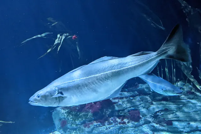 SaitheRegular local target5 placesFife Ness, Eyemouth, Anstruther, Cellardyke piers and 1 moreOver breakwater, harbour wall, headland, pier
 European sea bassRegular local target4 placesCockenzie, Torness and Skateraw, The Kirkcaldy rock marks, Granton breakwaterOver breakwater, rock markAround Jun–Sept
 European flounderRegular local target3 placesPortobello, The Kirkcaldy rock marks, Dysart harbourOver harbour wall, promenade, rock markAround Sept–Nov
Also documented from the shore: Thick-lipped grey mullet · Atlantic mackerel · Whiting · Edible crab · European lobster · Ling · European eel
From a kayak · 3
- Atlantic codRepeatedly reported1 place · 1 fishery account · 1 sourceSt Abbs HeadOver headlandSources name Kayak fishing with Soft plasticsAround JunObserved June 2025
 Atlantic mackerelRepeatedly reported1 place · 1 fishery account · 1 sourceSt Abbs HeadOver headlandSources name Kayak fishing with Metal jigsAround JunObserved June 2025
- Ballan wrasseRepeatedly reported1 place · 1 fishery account · 1 sourceSt Abbs HeadOver headlandSources name Kayak fishing with Soft plasticsAround JunObserved June 2025
What these strengths mean
- Regular local target
- Fishing sources describe this as a normal local target here, not merely as caught.
- Seasonal
- Well supported, and concentrated in part of the year rather than spread through it.
- Repeatedly reported
- Several independent public accounts. Enough to say it happens more than once; not enough to call it a fishery.
- Recorded here
- At least one credible public account of this species being caught here. That is all it means.
- How breadth is counted
- A fish documented at six marks is shown as six marks: breadth never raises the strength on its own. A fishery account describes the fishing; a recorded catch reports one specific catch. How evidence is weighed.
How people fish here
7 methods are recorded on the places documented here, counted from the records themselves rather than from what is practised in the country. Each opens a full guide to the technique.
Ledgering
Recorded at 17 places here, over harbour wall, rock mark, breakwater, headland.
Fishing a bait on the bottom held by a weight, with no float — the simplest way to fish at distance, in depth, or in wind.
Documented on the same ground: Atlantic cod, Ballan wrasse, European flounder, European sea bass, Pollack, Saithe.
Float fishing
Recorded at 14 places here, over harbour wall, rock mark, breakwater, headland.
Suspending a bait at a controlled depth beneath a buoyant indicator — the most visual, most controllable and most widely applicable method in angling.
Documented on the same ground: Atlantic cod, Ballan wrasse, European flounder, European sea bass, Pollack, Saithe.
Spinning
Recorded at 6 places here, over rock mark, headland, island.
Casting an artificial lure and retrieving it so that it moves like something alive — the most direct form of lure fishing.
Documented on the same ground: Atlantic cod, Ballan wrasse, European flounder, European sea bass, Pollack, Thick-lipped grey mullet.
Kayak fishing
Recorded at 4 places here, over estuary mark, harbour wall, headland, island.
A platform rather than a technique: quiet, shallow-draught access to water no other craft reaches, bought at the price of exposure, and a discipline where the decision not to launch is part of the skill.
Documented on the same ground: Atlantic cod, Ballan wrasse, Pollack, Saithe, Atlantic mackerel, Edible crab.
Feathering and multi-lure traces
Recorded at 3 places here, over breakwater, harbour wall.
A string of small lures on droppers, worked in the water column — how most people in Britain and Ireland catch their first sea fish, and the method most likely to catch far more than anybody intended.
Documented on the same ground: Atlantic cod, Ballan wrasse, Saithe, Atlantic mackerel, European flounder, Pollack.
Crabbing with a line and a drop net
Recorded at 1 place here, over harbour wall.
The commonest introduction to fishing anywhere with a harbour wall: a weighted bait that a crab grips, or a baited net it walks into — and no hook in either.
Documented on the same ground: Ballan wrasse, Pollack, Saithe, Atlantic cod, Ling.
Light rock fishing
Recorded at 1 place here, over pier.
Ultralight lure fishing from the shore with tackle rated in single grams — a discipline that catches the fish everybody else steps over, and one FishingHQ held every component of and had never named.
Documented on the same ground: Saithe, Atlantic cod, Ballan wrasse, Pollack.
These are the methods documented at the places FishingHQ holds here. A species listed beside a method is documented on the same ground, which is not the same as being taken that way — where a source establishes the method a fish was caught on, it is stated on that place’s own page. All fishing methods.
The fishing year here
The months the records under this area actually name, tightest season first. This is “observed in these months” rather than a season: a species whose months nobody recorded is not listed, because a gap in the evidence is not a year-round fishery.
- European flounderSeptember to November
- European sea bassJune to September
- Thick-lipped grey mulletJune to September
- WhitingNovember to February
- Atlantic mackerelMay to September
- Ballan wrasseMay to October
- PollackMay to October
- Atlantic codJanuary, February, March, June, October, November and December
What dominates
Shore fishing from rock platform and reef for cod, coalfish, wrasse and pollack. Beach fishing over clean sand for flatfish and, seasonally, cod. Float and light-lure fishing from harbour walls and rock for mackerel and coalfish through the warmer months. Lure fishing over reef. Estuary fishing on the Forth itself, where the ground and the salinity gradient change the species mix. Small-boat and charter work out of the harbours along the coast. Bait collection on the sandy bays and rough ground.
The water available
Volcanic rock platforms and reef with kelp. Clean sandy bays between the rock headlands. Harbour walls and built structure, several of them working harbours. An estuarine gradient running west into the Forth, with mud, sand and reduced salinity. Offshore islands and skerries. Extensive kelp on the hard ground, which shapes both the fishing and the tackle loss.
How the rules are structured
Scotland's arrangements for sea angling differ from those in England and Wales, and the difference surprises visitors moving between them. Sea fisheries matters are administered by the Scottish authorities; minimum sizes, protected areas, gear rules and species restrictions all apply and all change. Freshwater and migratory fisheries are governed under a separate Scottish system with its own permissions, which are proprietor-based to a degree that has no English equivalent. Shellfish and crustacean collection is subject to both fisheries rules and public health classification. Several stretches of this coast carry conservation designations, and working harbours are operational infrastructure with their own access rules rather than public amenity. FishingHQ does not state what any current rule is; establish the position with the relevant Scottish authority and, for harbours, with the harbour authority.
Who to ask
- The Scottish marine and fisheries authorities, for sea fisheries rules, minimum sizes, protected areas and species restrictions
- The relevant district salmon fishery board, for anything concerning migratory salmon and sea trout
- The local authority environmental health service, for shellfish harvesting classification and closures
- The harbour authority for any working harbour, which is operational infrastructure rather than public space
- The body managing any conservation designation on the stretch concerned
Words you will meet
- Saithe and coalfish
- The same fish under two names, and the Scottish east coast uses both. Young fish taken from rock and harbour in numbers have their own local names in parts of Scotland, and the size classes are treated almost as different catch.
- Skerry
- A small rocky island or reef, frequently awash. A feature that concentrates fish and a hazard to small craft, and the word is used freely along this coast.
- Firth
- A large sea inlet or estuary. The Firth of Forth is the defining feature of this coast and the word appears across Scotland for the same landform.
- Haar
- The cold sea fog that rolls in off the North Sea onto this coast, frequently on otherwise fine days. It arrives quickly, reduces visibility to very little, and drops the temperature sharply.
Conditions and hazards
Rock platform is the characteristic hazard here as it is anywhere. Volcanic rock weathers into steep, broken, weed-covered ground with deep water alongside it, and a person who goes in has no gradual shelf to climb out onto in water that is cold in every month.
Easterly weather is the specific local warning. A coast sheltered from the prevailing wind lulls people into treating it as benign, and an easterly out of the North Sea builds a short steep sea quickly and arrives with less warning than an Atlantic swell.
Haar — cold sea fog — can reduce visibility to a few metres on a clear day, which matters on rock and matters much more to small craft.
Working harbours carry vessel movement, and the walls that make good fishing platforms are operational structures with drops, no railings in places, and traffic.
Water temperature is low year-round; immersion is serious in any month and cold shock is the first risk rather than hypothermia.
Four grounds within a few miles
The defining feature of this coast is variety at short range, and it is what makes it forgiving to fish.
VOLCANIC ROCK PLATFORM AND REEF, with heavy kelp, holding wrasse, pollack, coalfish and cod. Structurally complex, productive, and the ground that costs tackle.
CLEAN SANDY BAYS between the rock headlands, holding flatfish and taking cod in the cold months. Straightforward ledgering ground and the answer when the rock is unfishable.
HARBOUR WALLS AND BUILT STRUCTURE, several of them working harbours, offering depth at short range and the standard float and light-lure fishing for mackerel and coalfish.
THE ESTUARINE GRADIENT running west into the Forth, where salinity falls, the sediment softens and the species mix shifts towards flounder, bass in warmer months and the estuarine assemblage.
A wind that ruins one of these usually leaves another workable, which is why local knowledge here is largely a mapping of wind direction onto ground.
What experienced anglers do — why, and the sources (2)
Widely and independently recommended by experienced anglers and specialist sources. This is real angling knowledge, not proof: controlled evidence for it is limited, and FishingHQ records it as convention rather than as a demonstrated effect.
- Sea Angler — Bauer Media (Specialist angling publication)Relied on for: Contemporary UK sea angling practice as reported by practitioners, including regional ground, species and shore technique.States this directlyCitation checked — the work exists and is described correctly
- Cefas science, advice and data on marine and freshwater environments — Centre for Environment, Fisheries and Aquaculture Science (Government fisheries body)Relied on for: Science on UK marine fisheries, stock distribution, shellfish classification and inshore environmental monitoring.Background and mechanism onlyCitation checked — the work exists and is described correctly
A cold-water species list, and how it turns over
Cold water year-round produces a northern assemblage with no realistic warm-water component, and the seasonal turnover is pronounced.
COD are the traditional winter shore species and the fish the coast's angling culture was built around, taken from both rock and clean ground through the cold half of the year.
COALFISH AND POLLACK hold on the reef and around structure, with young coalfish available from rock and harbour in numbers through the warmer months.
MACKEREL arrive inshore in summer and are taken on float and feathers from any ground with depth close in.
WRASSE occupy the kelp and rough ground through the warmer half of the year and effectively disappear from the shore fishery in winter.
FLATFISH — flounder and dab principally — work the sand and the estuary throughout.
And the Forth's rivers carry migratory salmonids, governed entirely separately.
What experienced anglers do — why, and the sources (2)
Widely and independently recommended by experienced anglers and specialist sources. This is real angling knowledge, not proof: controlled evidence for it is limited, and FishingHQ records it as convention rather than as a demonstrated effect.
- The Fishes of the British Isles and North-West Europe — Macmillan, 1969 (Reference work)Relied on for: Distribution, habitat and biology of the fishes of the British Isles and north-west Europe.States this directlyCitation checked — the work exists and is described correctly
- FishBase: a global information system on fishes — Froese, R. and D. Pauly, eds. — FishBase Consortium (Scientific institute)Relied on for: Diet, habitat association, depth range and distribution recorded for the species concerned.States this directlyPassage read and verified
How the coast is fished
Shore fishing dominates, and the technique follows the ground rather than a house style.
ROCK AND REEF FISHING with short, strong terminal tackle and an expectation of tackle loss, frequently at close range because the water is deep near the edge. This is where the coast's cod tradition sits.
BEACH LEDGERING over the sandy bays, at moderate rather than extreme range, for flatfish and winter cod.
FLOAT AND LIGHT LURE FISHING from harbour walls and rock for mackerel, coalfish and pollack — the accessible face of the coast and how most people here start.
LURE FISHING over reef, which has grown considerably and suits the ground.
ESTUARY FISHING on the Forth, where the approach changes with the salinity and the sediment.
SMALL-BOAT AND CHARTER WORK from the harbours, reaching reef and offshore ground that shore fishing cannot.
What experienced anglers do — why, and the sources (2)
Widely and independently recommended by experienced anglers and specialist sources. This is real angling knowledge, not proof: controlled evidence for it is limited, and FishingHQ records it as convention rather than as a demonstrated effect.
- Sea Angler — Bauer Media (Specialist angling publication)Relied on for: Contemporary UK sea angling practice as reported by practitioners, including regional ground, species and shore technique.States this directlyCitation checked — the work exists and is described correctly
- The Fishes of the British Isles and North-West Europe — Macmillan, 1969 (Reference work)Relied on for: Distribution, habitat and biology of the fishes of the British Isles and north-west Europe.States this directlyCitation checked — the work exists and is described correctly
An industrial estuary, and a fishery that changed with it
The Firth of Forth's fishing cannot be separated from its industrial history. This was a working estuary with heavy industry, shipping, mining along its shores and the water quality that followed from all three, and the fishery reflected that for a long period.
What has happened since is a genuine and documented environmental change rather than a nostalgic one: substantial improvement in water quality across recent decades, with corresponding recovery in the estuary's biological community. That is worth stating carefully — improvement is not restoration, and the estuary remains a heavily used industrial waterway with commercial shipping and extensive built structure.
The angling culture here is old, club-based and close to a major population centre, which means the coast is well fished and the accumulated knowledge is deep. It also means pressure: ground within easy reach of a city is ground that gets visited, and the etiquette and conservation conversations here are correspondingly live ones.
What experienced anglers do — why, and the sources (2)
Widely and independently recommended by experienced anglers and specialist sources. This is real angling knowledge, not proof: controlled evidence for it is limited, and FishingHQ records it as convention rather than as a demonstrated effect.
- Cefas science, advice and data on marine and freshwater environments — Centre for Environment, Fisheries and Aquaculture Science (Government fisheries body)Relied on for: Science on UK marine fisheries, stock distribution, shellfish classification and inshore environmental monitoring.Background and mechanism onlyCitation checked — the work exists and is described correctly
- Angling Trust guidance for anglers — Angling Trust (Angling or fisheries organisation)Relied on for: The structure of angling representation and fisheries governance in England, and the bodies responsible for sea and freshwater angling matters.Background and mechanism onlyCitation checked — the work exists and is described correctly
The words a visitor will meet
SAITHE and COALFISH are the same fish, and both are used here. Scotland has additional local names for the young size classes, which are treated almost as a separate catch from the adult fish and are a traditional food fish rather than only a sport one.
FIRTH means a large sea inlet or estuary, and appears all over Scotland for the same landform.
SKERRY is a small rocky island or awash reef — a fish-holding feature and a hazard to small craft.
HAAR is the cold North Sea fog that rolls onto this coast, often on an otherwise clear day. It is worth knowing as a word because a local warning about it is a genuine safety communication.
And the Scottish position on shore sea angling licensing differs from the English and Welsh one in a way that regularly surprises visitors, which is a vocabulary problem as much as a regulatory one — the word 'licence' does not mean the same thing on both sides of the border.
What experienced anglers do — why, and the sources (2)
Widely and independently recommended by experienced anglers and specialist sources. This is real angling knowledge, not proof: controlled evidence for it is limited, and FishingHQ records it as convention rather than as a demonstrated effect.
- Sea Angler — Bauer Media (Specialist angling publication)Relied on for: Contemporary UK sea angling practice as reported by practitioners, including regional ground, species and shore technique.States this directlyCitation checked — the work exists and is described correctly
- Angling Trust guidance for anglers — Angling Trust (Angling or fisheries organisation)Relied on for: The structure of angling representation and fisheries governance in England, and the bodies responsible for sea and freshwater angling matters.Background and mechanism onlyCitation checked — the work exists and is described correctly
Who administers this coast
Scotland operates its own fisheries administration, separate from that of England and Wales, and the arrangements differ in ways that matter to a visitor.
Sea fisheries matters — minimum sizes, protected species, gear rules, marine protected areas — sit with the Scottish authorities. Migratory salmon and sea trout are governed under a distinct Scottish system in which district salmon fishery boards and proprietors play a role with no direct English equivalent. Shellfish and crustacean collection is subject both to fisheries rules and, separately, to public health classification and closure administered by the local authority.
Several stretches of this coast carry conservation designations with their own management. Working harbours are operational infrastructure administered by harbour authorities, and access to a pier or wall is a matter for them.
FishingHQ does not state what any of these currently require. The point of setting out the structure is so that a reader knows which of five different bodies to ask.
Official guidance — why, and the sources (2)
Stated by a fisheries authority, scientific institute or recognised angling body. Authoritative, but summarising rather than demonstrating.
- Angling Trust guidance for anglers — Angling Trust (Angling or fisheries organisation)Relied on for: The structure of angling representation and fisheries governance in England, and the bodies responsible for sea and freshwater angling matters.Background and mechanism onlyCitation checked — the work exists and is described correctly
- Cefas science, advice and data on marine and freshwater environments — Centre for Environment, Fisheries and Aquaculture Science (Government fisheries body)Relied on for: Science on UK marine fisheries, stock distribution, shellfish classification and inshore environmental monitoring.Background and mechanism onlyCitation checked — the work exists and is described correctly
Places within this area
Publicly documented fishing geography. FishingHQ describes what the ground is; it does not say whether you may fish it, and every one of these sends that question to the body that holds the answer. Browse every place in this part of the world.
Who to ask before fishing any of these
FishingHQ does not know the current access position here. Sea angling in Scotland is not rod-licensed, but access rights under the Scottish Outdoor Access Code carry responsibilities, and harbour, local authority, marine conservation and fisheries measures all apply and all change. Check the current position with the Marine Directorate, the harbour or local authority and the land manager before going.
FishingHQ does not know the current access position here. Sea angling in Scotland is not rod-licensed, but access rights under the Scottish Outdoor Access Code carry responsibilities, and harbour, local authority, marine conservation and fisheries measures all apply and all change. Check the current position with the Marine Directorate, the harbour or local authority and the land manager before going. This water is tidal and transitional, so the freshwater regime may also apply above the tidal limit: FishingHQ does not know the current access position here. Scotland has no general rod licence, and the fishing rights on almost every river and loch belong to somebody: a proprietor, an estate, an angling association or a district salmon fishery board. Permission is a separate question from access, and both change. Check with the relevant fishery board or association before going.
St Abbs Head
Headland · Salt water
Hard volcanic rock rising in cliffs of over ninety metres, with clean, exceptionally clear water beneath and a kelp-covered reef system running offshore. The clarity is unusual for the North Sea and is why this is Scotland's best-known shore diving ground as well as an angling one.
Fully open from north through south-east. There is no shelter on this headland and the swell arrives with the full North Sea behind it.
Particular to this ground: cliffs and rock platforms, cold water shock.
Particular to this water: This ground carries conservation designations that constrain access, vehicles, bait collection and disturbance independently of any fishing rule.
North Berwick and the Bass Rock
Island · Salt water
A volcanic plug rising a hundred metres sheer out of the outer Firth of Forth, with deep water all round it and no landing except in calm conditions, and a rocky mainland shore of the same volcanic origin two miles inside it.
Wholly exposed in the outer firth, taking swell from north through east. The mainland shore has partial shelter from westerlies.
Particular to this ground: cold water shock, boat safety, encounters with marine life.
Severe hazards of East Lothian and the Firth of Forth coast apply here: cliffs and rock platforms.
Particular to this water: This ground carries conservation designations that constrain access, vehicles, bait collection and disturbance independently of any fishing rule.
Fife Ness
Headland · Salt water
A low, flat rock platform of Carboniferous sandstone and limestone at the corner where the Firth of Forth turns into the open North Sea, with extensive drying scars, gullies and offshore reef.
The corner position means it is exposed to two different weather systems: firth conditions from the south-west and open North Sea swell from the north-east.
Particular to this ground: cliffs and rock platforms, tides and being cut off, cold water shock.
Eyemouth
Harbour wall · Salt water
A working fishing harbour cut into a hard volcanic and greywacke coast, with a narrow rock-walled entrance, deep water inside and heavy reef ground on both sides outside.
Severe hazards of East Lothian and the Firth of Forth coast apply here: cliffs and rock platforms, cold water shock.
Torness and Skateraw
Rock mark · Salt water
A low rock and boulder shore of Old Red Sandstone and limestone beside a power station cooling outfall, with clean sand bays between the scars and a warmed plume offshore.
Severe hazards of East Lothian and the Firth of Forth coast apply here: cliffs and rock platforms, cold water shock.
Dunbar harbour
Harbour wall · Salt water
A stone harbour blasted through a volcanic headland, with the ruins of a castle over the entrance and hard reef ground running out on both sides.
Severe hazards of East Lothian and the Firth of Forth coast apply here: cliffs and rock platforms, cold water shock.
Port Seton
Harbour wall · Salt water
A small harbour on the shallow southern shore of the Firth of Forth, over sand and mud with low rock scars either side and extensive drying ground at low water.
Severe hazards of East Lothian and the Firth of Forth coast apply here: cliffs and rock platforms, cold water shock.
Portobello
Promenade · Salt water
A long sand beach and promenade on Edinburgh's shore of the inner Forth, over clean sand and mud, with the deep-water channel of the firth some distance offshore.
Severe hazards of East Lothian and the Firth of Forth coast apply here: cliffs and rock platforms, cold water shock.
9 more places in this area
The Forth bridges and Queensferry
Estuary mark · Brackish water
The narrows of the Firth of Forth, where the firth constricts between rock shores to about a kilometre, with deep scoured water, a strong stream and three major bridges over it.
Severe hazards of East Lothian and the Firth of Forth coast apply here: cliffs and rock platforms, cold water shock.
Kinghorn and Pettycur
Rock mark · Salt water
A basalt and sandstone shore on the Fife side of the Forth, with rock scars, a small drying harbour and clean sand bays between the outcrops.
Severe hazards of East Lothian and the Firth of Forth coast apply here: cliffs and rock platforms, cold water shock.
Anstruther
Harbour wall · Salt water
A stone harbour on the East Neuk of Fife, drying to sand and mud inside, with low rock scars and reef ground running out along the coast either side.
Severe hazards of East Lothian and the Firth of Forth coast apply here: cliffs and rock platforms, cold water shock.
Cellardyke piers
Pier · Salt water
The old harbour arms east of Anstruther, built into a rock shore of low volcanic reef that runs out a long way at low water. The reef around the harbour is the ground; the walls are the standing.
Open south-east into the outer Forth.
Particular to this ground: cliffs and rock platforms.
Severe hazards of East Lothian and the Firth of Forth coast apply here: cold water shock.
Particular to this water: This is an owned and operated structure. Whether angling is allowed on it, when, from where and on what terms is the operator's decision, is frequently seasonal, and changes without notice.
Dysart harbour
Harbour wall · Salt water
A small stone harbour cut into the sandstone cliffs east of Kirkcaldy, with the harbour basin drying and rock and weed ground outside the entrance. Sheltered, and the fishing is off the arms into the channel.
Open south across the Forth.
Severe hazards of East Lothian and the Firth of Forth coast apply here: cliffs and rock platforms, cold water shock.
Particular to this water: This is an owned and operated structure. Whether angling is allowed on it, when, from where and on what terms is the operator's decision, is frequently seasonal, and changes without notice.
The Kirkcaldy rock marks
Rock mark · Salt water
Low sandstone and dolerite ledges along the Kirkcaldy shore below the esplanade, uncovering into weed-filled gullies on the ebb with sand patches between them. Rough ground close in on a firth of mostly soft bottom.
Open south across the Forth.
Particular to this ground: cliffs and rock platforms.
Severe hazards of East Lothian and the Firth of Forth coast apply here: cold water shock.
Burntisland breakwater
Breakwater · Salt water
The stone arm enclosing the old dock at Burntisland, with the deep-water channel of the upper Forth running close by and rock and weed under the structure. Depth at the end without a long cast.
Open south across the Forth to Edinburgh.
Severe hazards of East Lothian and the Firth of Forth coast apply here: cliffs and rock platforms, cold water shock.
Particular to this water: This is an owned and operated structure. Whether angling is allowed on it, when, from where and on what terms is the operator's decision, is frequently seasonal, and changes without notice.
Granton breakwater
Breakwater · Salt water
The long middle pier and eastern breakwater of the old Granton harbour on the Edinburgh shore, with mud and rubble ground inside and the channel outside. City fishing with real structure.
Open north across the Forth; sheltered inside the arms.
Severe hazards of East Lothian and the Firth of Forth coast apply here: cliffs and rock platforms, cold water shock.
Particular to this water: This is an owned and operated structure. Whether angling is allowed on it, when, from where and on what terms is the operator's decision, is frequently seasonal, and changes without notice.
Cockenzie
Rock mark · Salt water
The rock and rubble shore beside the old power station outfall at Cockenzie, with the small harbour to the east and low reef running off the point. The outfall ground is what concentrated the fishing here.
Open north across the Forth.
Particular to this ground: cliffs and rock platforms.
Severe hazards of East Lothian and the Firth of Forth coast apply here: cold water shock.
Safety
Cliffs and rock platforms — Can cause serious injury or death
Volcanic rock weathers into steep, broken, weed-covered platforms with deep water immediately alongside. Somebody who slips or is knocked over by a wave is in cold water out of their depth with no gradual shelf to climb out onto, and rock fishing kills more shore anglers than any other ground.
What reduces it: Watch any rock mark for a considerable period before committing to a position, never fish rock alone, wear a buoyancy aid, plan an exit that works in the sea state you may have rather than the one you arrived in, and leave when the sea builds rather than when it becomes difficult.
Worse when:
- Easterly weather off the North Sea, which builds a short steep sea quickly on a coast that is usually sheltered
- Swell arriving in sets, where one wave runs far higher than the rest
- Wet kelp and weed on the platform, and darkness
Cold water shock — Can cause serious injury or death
Water temperature here is low in every month. Sudden immersion triggers an involuntary gasp and hyperventilation that can cause drowning within the first minute, well before hypothermia is a factor, and it defeats swimming ability regardless of fitness.
What reduces it: Wear a buoyancy aid on rock, harbour walls and any elevated mark; assume that going in means being unable to help yourself for the first minute; and fish with somebody who can raise the alarm.
Further safety reading
- Rock platform and cliff safety — Volcanic rock weathers into steep, broken, weed-covered ground beside deep cold water, and a coast sheltered from the prevailing wind lulls visitors into treating easterly weather as though it were not a hazard.
Check the rules before you fish
Fishing laws, bylaws, access rules, seasons, bait restrictions and permitted methods vary by location and can change. Check the current rules from the relevant authority and the water you intend to fish before fishing.
Check with:
- Current national or regional law for where you are fishing
- Current local bylaws
- The relevant fisheries authority
- The landowner, club or fishery whose water it is
- Any restrictions specific to the species or the method you intend to use
Where to go next
What swims here
Local knowledge
How this compares
More fishing regions
Not related to this page — just the rest of the section. There is little else joined to this subject yet, and a short page should still lead somewhere.
Sources and evidence
- Sea Angler — Bauer Media (Specialist angling publication)Relied on for: Contemporary UK sea angling practice as reported by practitioners, including regional ground, species and shore technique.States this directlyCitation checked — the work exists and is described correctly
- The Fishes of the British Isles and North-West Europe — Macmillan, 1969 (Reference work)Relied on for: Distribution, habitat and biology of the fishes of the British Isles and north-west Europe.States this directlyCitation checked — the work exists and is described correctly
- RNLI water safety guidance: cold water shock and Float to Live — Royal National Lifeboat Institution (Water-safety or diver-training authority)Relied on for: Water safety guidance including tidal cut-off, cold water shock and the circumstances in which coastal users get into difficulty.States this directlyPassage read and verified
Why the 5 connections on this page are here, and the sources
What swims here
Backed by research — 1 connection
Supported by peer-reviewed research or fisheries science. The sources are listed and can be checked.
Saithe
A distributional claim about where a species occurs, taken from reference works on the fishes of the region rather than from angling report. It states presence and habitat association and asserts nothing about a fishery.
- FishBase: a global information system on fishes — Froese, R. and D. Pauly, eds. — FishBase Consortium (Scientific institute)Relied on for: Distribution, habitat association, depth range and feeding behaviour recorded for the species concerned.States this directlyPassage read and verified
- The Fishes of the British Isles and North-West Europe — Macmillan, 1969 (Reference work)Relied on for: Distribution, habitat and biology of the fishes of the British Isles and north-west Europe.States this directlyCitation checked — the work exists and is described correctly
How people fish here
What experienced anglers do — 1 connection
Widely and independently recommended by experienced anglers and specialist sources. This is real angling knowledge, not proof: controlled evidence for it is limited, and FishingHQ records it as convention rather than as a demonstrated effect.
Sea fishing
Which branch of fishing a coast is fished under is a statement about practice, and is recorded as convention rather than as a property of the place.
- Sea Angler — Bauer Media (Specialist angling publication)Relied on for: Contemporary UK sea angling practice as reported by practitioners, including regional ground, bait and tackle convention.States this directlyCitation checked — the work exists and is described correctly
- Angling Times — Bauer Media (Specialist angling publication)Relied on for: Contemporary UK angling practice as reported by practitioners, including tackle and technique convention.States this directlyCitation checked — the work exists and is described correctly
Local knowledge
What experienced anglers do — 1 connection
Widely and independently recommended by experienced anglers and specialist sources. This is real angling knowledge, not proof: controlled evidence for it is limited, and FishingHQ records it as convention rather than as a demonstrated effect.
Bottom type, and what lives on it
Why it works, resting on shore-fishing practice reported consistently across independent practitioner sources rather than on experiment.
- Sea Angler — Bauer Media (Specialist angling publication)Relied on for: Contemporary UK sea angling practice as reported by practitioners, including shore technique, terminal tackle, regional ground and species behaviour.States this directlyCitation checked — the work exists and is described correctly
- Freshwater Fishing — Macdonald & Jane's, 1975 (Specialist angling publication)Relied on for: Comprehensive angling practice including terminal tackle, casting, leaders and the reasoning behind the choices.States this directlyCitation checked — the work exists and is described correctly
How this compares
What experienced anglers do — 1 connection
Widely and independently recommended by experienced anglers and specialist sources. This is real angling knowledge, not proof: controlled evidence for it is limited, and FishingHQ records it as convention rather than as a demonstrated effect.
Scotland
Two records a reader will hold in mind together, joined where reading both is what makes either usable.
- Sea Angler — Bauer Media (Specialist angling publication)Relied on for: Contemporary UK sea angling practice as reported by practitioners, including shore technique, terminal tackle, regional ground and species behaviour.States this directlyCitation checked — the work exists and is described correctly
- Freshwater Fishing — Macdonald & Jane's, 1975 (Specialist angling publication)Relied on for: Comprehensive angling practice including terminal tackle, casting, leaders and the reasoning behind the choices.States this directlyCitation checked — the work exists and is described correctly
Safety reading
Official guidance — 1 connection
Stated by a fisheries authority, scientific institute or recognised angling body. Authoritative, but summarising rather than demonstrating.
Rock platform and cliff safety
A hazard characteristic of the ground or the practice, joined to the topic that treats it in full, on guidance published by water safety bodies.
- RNLI water safety guidance: cold water shock and Float to Live — Royal National Lifeboat Institution (Water-safety or diver-training authority)Relied on for: Water safety guidance including tidal cut-off, cold water shock and the circumstances in which coastal users get into difficulty.States this directlyPassage read and verified
- United States Lifesaving Association public education on rip currents and the surf zone — United States Lifesaving Association (Water-safety or diver-training authority)Relied on for: Public education on rip currents, surf zone hazards and the circumstances in which people are swept from shorelines.States this directlyCitation checked — the work exists and is described correctly
How FishingHQ labels evidence is explained in the evidence policy.