Lough Erne
Fishing regions · Last reviewed 2026-08-16
Two very different lakes with one name: a maze of drumlin islands and channels above, a deep open lough below, and between them the water that carried Ireland's coarse fishing reputation for half a century.
Safety: boat safety — can cause serious injury or death. 3 more points apply here.
Being listed here is not permission to fish. What that meansClose
Access, fishing rights, seasons, licences, local bylaws and permitted methods vary and can change. Check current access, permission, local regulations, closures and restrictions before you travel or fish. FishingHQ describes what the ground is and names who holds the answer; it does not hold the answer itself.
Find the authority for a jurisdiction · What FishingHQ does and does not cover
Lough Erne is a feature-tier record that contains two waters so different that treating them as one is the commonest mistake made about it.
UPPER LOUGH ERNE IS NOT REALLY A LAKE. It is a labyrinth: a drowned drumlin landscape where the river has spread out among hundreds of small islands and headlands, producing a maze of shallow bays, narrow channels, weedy margins and sheltered arms. There is very little open water and almost no fetch, so it rarely raises a sea. It is warm, weedy, sheltered and enormously productive, and it is the classic Irish coarse fishery — bream, roach, hybrids, tench, rudd and pike in quantity.
LOWER LOUGH ERNE IS THE OPPOSITE. A large, deep, open lough with long fetches, rocky shores, big islands and genuinely open water. It fishes for trout — including a distinctive local strain — and for very large pike, and it behaves like a proper lake with a proper wind problem.
THE RIVER ERNE JOINS THEM and runs on to a substantial estuary at Ballyshannon, and the system was extensively engineered for hydro-electric power in the mid twentieth century, which lowered levels and changed the river below the lower lough considerably.
WHAT MADE THIS SYSTEM FAMOUS was the coarse fishing, and specifically the visiting-angler economy that grew up around it from the 1960s. For a long period Fermanagh was one of the premier coarse-fishing destinations in Europe, with bream shoals of a size English anglers had not seen at home for a century, and a tourist infrastructure built entirely on it.
AND THAT FISHERY HAS CHANGED SUBSTANTIALLY, which the record states rather than avoids. Roach spread through the system, hybridised extensively with bream, and altered the shoal composition. Water quality and nutrient status have been live issues. The visiting-angler economy is smaller than it was for a mixture of reasons that include all of the above and none of them alone. What remains is still very good fishing and it is not the fishery the 1970s brochures describe.
THE SHANNON-ERNE WATERWAY, restored in the 1990s, connects this system to the Shannon and makes the two the largest connected inland navigation in these islands. That is a recreational fact and a biosecurity one at once.
AND IT IS THE WHOLE OF NORTHERN IRELAND'S COARSE FISHING in any meaningful sense, which is why its absence from FishingHQ was a gap rather than an omission.
What fishing here is like
Two connected but physically opposite lakes. The upper lough is a drowned drumlin maze of hundreds of small islands, narrow channels, shallow weedy bays and sheltered arms with almost no open fetch — warm, productive and rarely rough. The lower lough is a large, deep, open water with long fetches, rocky shores, substantial islands and genuine open-water conditions. The whole system sits on limestone-influenced ground, water is moderately alkaline and productive, and the system is extensively engineered for hydro power and navigation. A canal connects it to the Shannon.
What you can target here
One entry per fish, grouped by how you would be fishing — because the answer is a different one from the rocks and from a boat. Each entry says how strongly the sources support it and how much evidence sits behind it. These are documented catches, not a forecast, and none of it is a statement that you may fish any particular ground.
From the shore · 6
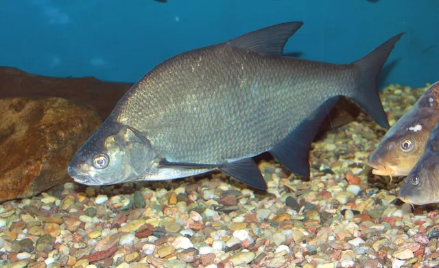 Common breamCharacteristic of this water2 placesThe Erne at Enniskillen, Lough MacneanOver lough, river reachAround Mar–Oct
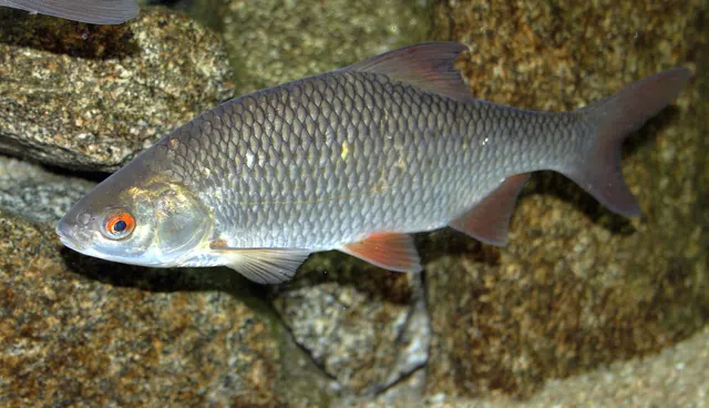 RoachCharacteristic of this water2 placesThe Erne at Enniskillen, Lough MacneanOver lough, river reach
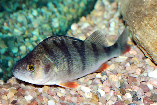 European perchRegular local target2 placesThe Erne at Enniskillen, Lough MacneanOver lough, river reach
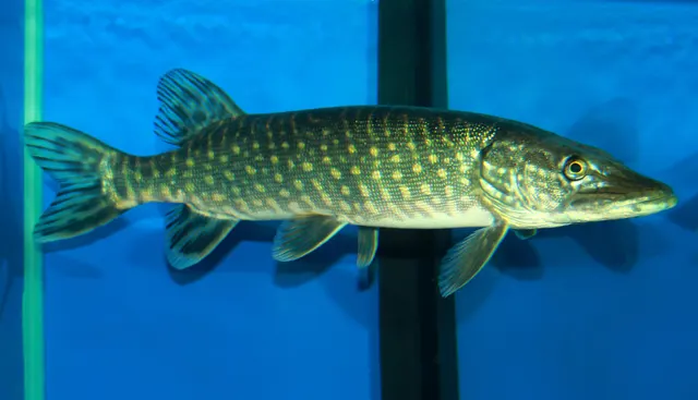 Northern pikeRegular local target2 placesLough Macnean, The Erne at EnniskillenOver lough, river reach
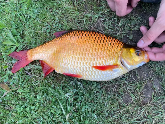 RuddRepeatedly reported1 placeThe Erne at EnniskillenOver river reach
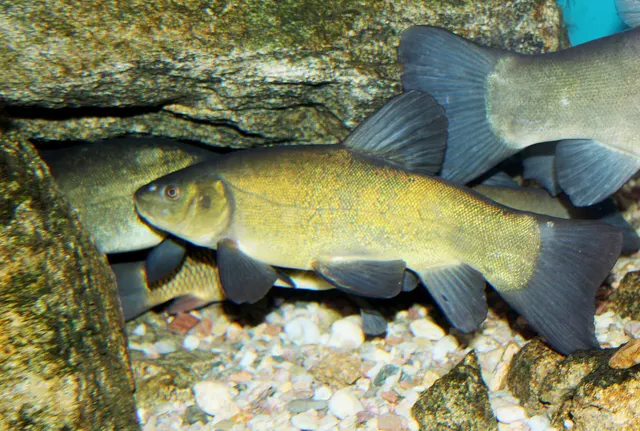 TenchRecorded here1 placeThe Erne at EnniskillenOver river reach
From a boat · 7
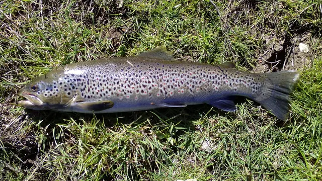 Brown troutCharacteristic of this water1 placeLough MelvinOver loughAround Mar–Sept
- Common breamCharacteristic of this water1 placeThe Erne at EnniskillenOver river reachAround Mar–Oct
- RoachCharacteristic of this water1 placeThe Erne at EnniskillenOver river reach
- Northern pikeRegular local target2 placesLough Macnean, The Erne at EnniskillenOver lough, river reach
- European perchRegular local target1 placeThe Erne at EnniskillenOver river reach
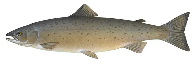 Atlantic salmonSeasonal1 placeLough MelvinOver loughAround Apr–Jul
Also documented from a boat: Arctic char
Fly fishing · 2
What these strengths mean
- Characteristic of this water
- This water is strongly identified with this species by the sources that cover it.
- Regular local target
- Fishing sources describe this as a normal local target here, not merely as caught.
- Seasonal
- Well supported, and concentrated in part of the year rather than spread through it.
- Repeatedly reported
- Several independent public accounts. Enough to say it happens more than once; not enough to call it a fishery.
- Recorded here
- At least one credible public account of this species being caught here. That is all it means.
- How breadth is counted
- A fish documented at six marks is shown as six marks: breadth never raises the strength on its own. A fishery account describes the fishing; a recorded catch reports one specific catch. How evidence is weighed.
How people fish here
7 methods are recorded on the places documented here, counted from the records themselves rather than from what is practised in the country. Each opens a full guide to the technique.
Float fishing
Recorded at 2 places here, over lough, river reach.
Suspending a bait at a controlled depth beneath a buoyant indicator — the most visual, most controllable and most widely applicable method in angling.
Documented on the same ground: Common bream, Roach, European perch, Northern pike, Rudd, Brown trout.
Deadbaiting
Recorded at 1 place here, over lough.
Presenting a dead fish as bait for predators — a method that works because scavenging is normal predator behaviour, not an exception.
Documented on the same ground: Common bream, Northern pike, Roach, Brown trout, European perch.
Dry fly fishing
Recorded at 1 place here, over lough.
Presenting a floating artificial to a fish feeding at the surface, so that it drifts exactly as a natural insect would.
Documented on the same ground: Brown trout, Atlantic salmon, Arctic char.
Feeder fishing
Recorded at 1 place here, over river reach.
Legering with a weight that also carries bait, so that free offerings arrive in exactly the same place as the hookbait, cast after cast.
Documented on the same ground: Common bream, Roach, European perch, Northern pike, Rudd, Tench.
Ledgering
Recorded at 1 place here, over river reach.
Fishing a bait on the bottom held by a weight, with no float — the simplest way to fish at distance, in depth, or in wind.
Documented on the same ground: Common bream, Roach, European perch, Northern pike, Rudd, Tench.
Spinning
Recorded at 1 place here, over lough.
Casting an artificial lure and retrieving it so that it moves like something alive — the most direct form of lure fishing.
Documented on the same ground: Common bream, Northern pike, Roach, Brown trout, European perch.
Stillwater fly fishing
Recorded at 1 place here, over lough.
Fly fishing without current, where the angler supplies every movement and the problem becomes finding fish rather than presenting to them.
Documented on the same ground: Brown trout, Atlantic salmon, Arctic char.
These are the methods documented at the places FishingHQ holds here. A species listed beside a method is documented on the same ground, which is not the same as being taken that way — where a source establishes the method a fish was caught on, it is stated on that place’s own page. All fishing methods.
The fishing year here
The months the records under this area actually name, tightest season first. This is “observed in these months” rather than a season: a species whose months nobody recorded is not listed, because a gap in the evidence is not a year-round fishery.
- Atlantic salmonApril to July
- Brown troutMarch to September
- Common breamMarch to October
What dominates
Coarse fishing on the upper lough for bream, roach, hybrids, tench and rudd, using feeder, float and pole methods, which is what this system's reputation was built on. Pike fishing across both loughs, by lure, deadbait and increasingly fly, with the lower lough producing the larger fish. Trout fly fishing on the lower lough, from boat and bank, including for a locally distinctive strain. Boat fishing throughout, which is how most productive water is reached on both loughs. Match fishing on the upper lough and the connected river reaches, which had a substantial competition calendar. Perch fishing, which is genuine and undervalued. Trolling on the lower lough.
The water available
A drowned drumlin maze of shallow weedy bays, narrow channels and hundreds of small islands; a large deep open lough with rocky shores and long fetch; extensive reedbed and marginal weed; connecting river reaches with slow flow; a canal navigation linking the system to the Shannon; hydro-regulated river below the lower lough; and a substantial estuary at the foot of the system.
How the rules are structured
Northern Ireland's freshwater framework is its own and is more complicated than most visitors expect, because two different licensing regimes operate in different parts of the country. Freshwater angling here requires BOTH a rod licence AND a separate fishery permit, which is a two-document requirement that catches visitors constantly, and the licensing body differs by area — the Erne system falls under a different arrangement from parts of the country administered by the cross-border Loughs Agency. Coarse fishing, game fishing and pike are all subject to their own rules, seasons and size or bag provisions which have changed over time. Parts of the system carry conservation designation. Biosecurity requirements apply and matter here because of the connection to the Shannon. FishingHQ does not state what any current rule is, and licence and permit arrangements here are exactly the kind of thing that differs by area and changes.
Who to ask
- The Northern Ireland department responsible for agriculture, environment and rural affairs, which administers freshwater fisheries and rod licensing for this system.
- The Loughs Agency, the cross-border body whose licensing arrangements cover other parts of Northern Ireland and differ from those here — which is why the area matters.
- Waterways Ireland, the cross-border body responsible for navigation on the Erne system and the Shannon-Erne Waterway.
- The fishery owner, club or angling association, for the permit that is required in addition to the rod licence.
- The Northern Ireland Environment Agency, where a conservation designation affects the water or its species.
Words you will meet
- Upper and Lower
- On the Erne, upper means upstream and is the sheltered drumlin maze; lower means downstream and is the big open lough. Visitors reverse this constantly because the lower lough is further north on the map, and getting it wrong means arriving at entirely the wrong kind of water.
- Hybrid
- A bream-roach cross, which occurs here in numbers rather than as a curiosity. Hybrids fight harder than bream, grow larger than roach, and complicate both identification and match weights — and their abundance is a direct consequence of roach spreading through a bream water.
- Drumlin
- A rounded hill of glacial till. The upper lough's hundreds of islands are drowned drumlins, which is why they share a shape and an alignment and why the water between them is a maze of channels rather than an open lake.
Conditions and hazards
The two loughs fail in completely different ways and a visitor who prepares for one is unprepared for the other. The upper lough is sheltered and rarely rough, and its hazard is navigation: hundreds of similar-looking islands, narrow channels, shallow shoals and a marked navigation that exists because the rest is not safe to travel fast. People get genuinely lost there, and in fog or failing light it is very difficult ground. The lower lough is the opposite: large, deep and open, with long fetches that let wind build a substantial sea quickly, rocky shores, and conditions in the open water that can be far worse than they look from a sheltered bay. Both are cold enough for most of the year for cold water shock to decide an immersion, and distances to a landing place on the lower lough are considerable. Bank fishing on the upper lough is frequently from soft, low, undercut margins with dense weed concealing the edge. The river below the lower lough is hydro-regulated, so levels can change from a release rather than from weather. And the connection to the Shannon makes biosecurity a real obligation rather than a formality.
Two lakes, one name, and the mistake everybody makes
The single most useful thing to know about Lough Erne is that upper and lower are not two ends of the same water; they are two different kinds of lake, and almost every practical decision follows from which one is being fished.
UPPER LOUGH ERNE IS A DROWNED LANDSCAPE. County Fermanagh sits in a classic drumlin field — hundreds of rounded glacial hills, all aligned the same way — and when the water rose it flooded the low ground between them. The result is not a lake with islands in it. It is a maze: a network of channels, bays, arms and narrows threading between hundreds of small islands and headlands, with almost nowhere that a wind can get a run at the water.
WHAT THAT GIVES IS SHELTER AND PRODUCTIVITY. Shallow, warm, weedy, sheltered water with an enormous margin-to-area ratio — every one of those islands has a shoreline, and shorelines are where the food is. It is a bream and roach factory, and it is fishable on days when nothing else is. It is also, precisely because of the shelter, easy to get lost in.
LOWER LOUGH ERNE IS A PROPER LAKE. Large, deep, open, with rocky shores and big islands and long stretches of unobstructed water. Wind has room to work, so it raises a sea, and the fishing is a lake fishery — trout on the fly from a drifting boat, big pike over the deeper ground, and a set of decisions about where to be that are made by the weather rather than by the fish.
SO THE FISHERIES ARE DIFFERENT IN KIND. The upper is a coarse angler's water: pole, feeder and float from bank or anchored boat, groundbait, shoals worked and held. The lower is a fly and predator water: drifting, trolling, covering ground, reading wind lanes. Pike occur throughout and the biggest tend to come from the lower.
AND THE LOCAL DIRECTION CONFUSES VISITORS PERSISTENTLY. Upper means upstream, which here is the southern maze; lower means downstream, which is the big northern lough. On the map the lower lough is above the upper one, which is exactly backwards from how the names read, and people arrive at the wrong lake.
WHAT CONNECTS THEM is the river between, and what connects the whole system to the rest of Ireland is the restored canal to the Shannon — which makes this the largest connected inland navigation in these islands, a genuine recreational asset and a genuine biosecurity liability at the same time.
What experienced anglers do — why, and the sources (4)
Widely and independently recommended by experienced anglers and specialist sources. This is real angling knowledge, not proof: controlled evidence for it is limited, and FishingHQ records it as convention rather than as a demonstrated effect.
- Coarse Fishing — A. & C. Black, 1912 (Specialist angling publication)Relied on for: Established description of English coarse fishing practice on rivers, canals and still waters.FishingHQ's interpretation of what it saysCitation checked — the work exists and is described correctly
- General angling website restatements of established technique — Various (Credible secondary source)Relied on for: Widely restated descriptions of which practices are conventionally used on the waters named, recorded as practitioner consensus rather than as scholarship.Background and mechanism onlyCitation checked — the work exists and is described correctly
- JNCC species and habitat conservation advice — Joint Nature Conservation Committee (Conservation authority)Relied on for: Designation, habitat description and conservation status of the freshwater and wetland habitats named, and the species characteristically associated with them.States this directlyCitation checked — the work exists and is described correctly
- The Fishes of the British Isles and North-West Europe — Macmillan, 1969 (Reference work)Relied on for: Distribution, habitat association and biology of the freshwater and migratory fishes of the British Isles named here.States this directlyCitation checked — the work exists and is described correctly
The bream years, the roach that arrived, and an honest present tense
For a long period this system was one of the best-known coarse fisheries in Europe, and understanding both why and what changed is more useful than repeating the reputation.
WHAT THE FISHERY WAS. From the 1960s, English coarse anglers travelled to Fermanagh in numbers for bream fishing of a quality that had disappeared at home — very large shoals, in productive water, on a system with a great deal of it, and largely unpressured. A tourist economy grew around that: guesthouses, boat hire, match calendars and a reputation that carried the county for decades.
WHY IT WAS SO GOOD. Productive limestone-influenced water, an enormous shoreline-to-area ratio in the upper lough, extensive weed and reedbed, warm shallow bays, and comparatively low angling pressure across a very large area. Bream are a shoal fish that concentrate where the food is, and this water produced food.
AND THEN THE ROACH ARRIVED. Roach are not native to most of Ireland and spread through Irish waters in the twentieth century, reaching this system and establishing strongly. Two consequences followed. The first is competition: roach and bream overlap in diet and habitat, and a water that filled with roach did not carry the same bream population. The second is hybridisation — bream-roach hybrids occur here in numbers rather than as oddities, and a shoal that used to be bream is now a mixed one.
OTHER PRESSURES ACTED AT THE SAME TIME. Nutrient enrichment from the catchment has been a live issue affecting weed growth, oxygen and water clarity. Travel patterns changed and the visiting-angler market went elsewhere. The fishery is quieter than it was, and disentangling those causes is genuinely difficult.
WHAT IS HONEST TO SAY NOW. This is still very good coarse fishing by any European standard, with bream, roach, hybrids, tench, rudd and perch in quantity across a very large and lightly pressured water. It is not the fishery described in material written when the bream shoals were at their peak, and an angler arriving with those expectations will be measuring the present against something that no longer exists.
THE PIKE FISHERY HAS ARGUABLY GONE THE OTHER WAY. A very large productive system with a great deal of prey biomass and a modern catch-and-release culture supports big pike, and the lower lough in particular has a serious reputation. Handling requirements for large pike are strict here as everywhere, and a fish of that size represents decades of growth.
AND THE TROUT ON THE LOWER LOUGH are a genuine and distinct fishery, including a locally distinctive strain, fished from a drifting boat in the Irish loch tradition.
What experienced anglers do — why, and the sources (4)
Widely and independently recommended by experienced anglers and specialist sources. This is real angling knowledge, not proof: controlled evidence for it is limited, and FishingHQ records it as convention rather than as a demonstrated effect.
- Coarse Fishing — A. & C. Black, 1912 (Specialist angling publication)Relied on for: Established description of English coarse fishing practice on rivers, canals and still waters.FishingHQ's interpretation of what it saysCitation checked — the work exists and is described correctly
- General angling website restatements of established technique — Various (Credible secondary source)Relied on for: Widely restated descriptions of which practices are conventionally used on the waters named, recorded as practitioner consensus rather than as scholarship.Background and mechanism onlyCitation checked — the work exists and is described correctly
- Freshwater Fishes of the British Isles — HarperCollins (New Naturalist 75), 1992 (Reference work)Relied on for: Distribution, ecology, life history and conservation status of the freshwater fishes of the British Isles named here.States this directlyCitation checked — the work exists and is described correctly
- Environment Agency fisheries management, byelaws and rod licensing information — Environment Agency (Government fisheries body)Relied on for: Freshwater fisheries management, water quality, river and still-water monitoring, and the structure of the licensing framework.States this directlyCitation checked — the work exists and is described correctly
A maze you can get lost in, and an open lough that builds a sea
This system's two halves present opposite hazards, and preparing for one is no preparation at all for the other.
THE UPPER LOUGH'S HAZARD IS NAVIGATION RATHER THAN WEATHER. Hundreds of similar-looking drumlin islands, narrow channels between them, shallow shoals, and almost no distant landmark to steer by. It is genuinely easy to become disoriented, and it becomes very difficult ground in fog or failing light — a boat that knows roughly where it is can still be unable to find the channel out of a bay.
WHICH IS WHAT THE MARKED NAVIGATION IS FOR. The Erne carries a marked navigation channel, and it exists precisely because the rest of the water is not safe to travel fast. Stay in it when moving, learn the routes to fishing ground before using them at speed, go slowly on unfamiliar water, and carry a means of navigating that does not rely on recognising an island.
THE LOWER LOUGH'S HAZARD IS THE WIND AND IT IS THE ORDINARY BIG-LAKE ONE. Long fetches over open water let a wind build a substantial sea, the shore may be a long way off, and the decision to go out is made from a sheltered bay that tells you nothing about the middle. Watch the forecast rather than the current conditions, fix a turnaround time and a named landing shore before setting off, and come in early rather than late.
BOTH LOUGHS ARE COLD ENOUGH FOR MOST OF THE YEAR for cold water shock to decide an immersion — the gasp response and loss of breathing control in the first minute, a long way from anywhere to swim to on the lower lough. Wear a lifejacket rather than carry one, stay with the boat if it stays afloat, and if immersed float and control the breathing before attempting anything else.
BANK FISHING ON THE UPPER LOUGH has its own quieter set. Margins are frequently soft, low and undercut, dense weed conceals the edge and the depth beyond it, and a great deal of the bank is a long way from a road. Test soft ground before committing weight, and do not fish an unseen edge in the dark alone.
THE RIVER BELOW THE LOWER LOUGH IS HYDRO-REGULATED, which means levels can change from a release rather than from weather — a rise with no rain and no natural warning. That is worth knowing before standing in it.
AND THE BIOSECURITY OBLIGATION IS REAL HERE RATHER THAN NOMINAL. This system is connected by canal to the Shannon, making the two the largest connected inland navigation in these islands, and gear, boats, nets and waders move organisms between waters. The Erne's own recent history — the arrival and spread of species that changed the fishery — is the argument. Check, clean and dry everything between waters, and drain wells and bilges. On a connected system this large, that practice is the only barrier that exists.
Official guidance — why, and the sources (3)
Stated by a fisheries authority, scientific institute or recognised angling body. Authoritative, but summarising rather than demonstrating.
- RNLI water safety guidance: cold water shock and Float to Live — Royal National Lifeboat Institution (Water-safety or diver-training authority)Relied on for: Cold water shock and the immersion response, and water-safety guidance for anglers and small-craft users on inland water.States this directlyPassage read and verified
- RoSPA water safety information and UK accidental drowning statistics — Royal Society for the Prevention of Accidents (Water-safety or diver-training authority)Relied on for: UK accidental drowning statistics and inland water-safety guidance, including the proportion of drownings that begin with no intention of entering the water.States this directlyPassage read and verified
- Check Clean Dry — biosecurity guidance for water users — GB Non-native Species Secretariat (Conservation authority)Relied on for: Check Clean Dry biosecurity guidance for water users and the mechanisms by which invasive non-native species are spread between waters on gear and craft.States this directlyPassage read and verified
Some of what lives here
Fish recorded here that FishingHQ holds a reviewed photograph of. It is not a complete list of what Lough Erne holds, and it is not a prediction that you will catch any of them — it is a way in to the ones we can show you.
- Common breamA deep-bodied, slow-moving shoal fish that feeds in large groups over soft bottoms and can transform a swim when it arrives.
Karelj, Public domain, via Wikimedia Commons
- RoachThe most numerous and most frequently caught coarse fish across much of Europe, and the prey species that underpins the whole freshwater predator food web.
Karelj, Public domain, via Wikimedia Commons
- Northern pikeThe dominant freshwater ambush predator of the northern hemisphere: long, cryptic, and built for one violent acceleration rather than pursuit.
Karelj, Public domain, via Wikimedia Commons
- European perchA small, shoaling, spiny-finned predator that is both the most accessible predator to catch and the one most anglers first learn on.
Karelj, Public domain, via Wikimedia Commons
- Brown troutA single, extraordinarily plastic species that appears as a tiny hill-stream fish, a deep-bodied loch trout and a silver sea-run migrant — all the same animal.
Robermix, CC0, via Wikimedia Commons
Places within this area
Publicly documented fishing geography. FishingHQ describes what the ground is; it does not say whether you may fish it, and every one of these sends that question to the body that holds the answer. Browse every place in this part of the world.
Who to ask before fishing any of these
FishingHQ does not know the current access position here. Angling in Northern Ireland generally requires both a rod licence from the relevant fisheries body and a separate permit for the water, and the two are issued by different bodies. Rules, seasons and permit arrangements change. Check with the Department of Agriculture, Environment and Rural Affairs, the Loughs Agency where relevant, and the permit issuer before going.
Lough Melvin
Lough · Fresh water
A cross-border lough on the Fermanagh and Leitrim boundary: a shallow-to-moderate glacial lake with rocky shores, islands, gravel spawning tributaries and a short river to the Atlantic.
Open western lough, exposed to Atlantic weather with a substantial fetch along its axis.
Particular to this ground: cold water shock, boat safety, biosecurity and disease transfer.
Particular to this water: This ground carries conservation designations that constrain access, vehicles, bait collection and disturbance independently of any fishing rule.
Lough Macnean
Lough · Fresh water
Two connected limestone loughs on the Fermanagh and Cavan border, with clear alkaline water, marl shallows and a mixed coarse and trout population.
Severe hazards of Lough Erne apply here: boat safety, cold water shock.
The Erne at Enniskillen
River reach · Fresh water
The short river reach joining Upper and Lower Lough Erne through the town, with a controlled level, deep slow water and one of the richest coarse fisheries in these islands.
Severe hazards of Lough Erne apply here: boat safety, cold water shock.
Safety
Boat safety — Can cause serious injury or death
The lower lough is large, deep and open with long fetches, so wind builds a substantial sea while the decision to go out was made in a sheltered bay. The upper lough is a maze of hundreds of similar islands, narrow channels and shoals in which boats become genuinely lost, particularly in fog or failing light.
What reduces it: Wear a lifejacket rather than carry one, stay in the marked navigation when travelling, fix a turnaround time and a named landing shore before setting off on the lower lough, and carry a means of navigating that does not rely on recognising an island.
Worse when:
- In fog or failing light on the upper lough, where there is no distant landmark to steer by.
- On the open water of the lower lough in a rising wind, where the shore may be a long way off.
Cold water shock — Can cause serious injury or death
Water temperatures are low for most of the year on both loughs. Immersion produces gasping and loss of breathing control within the first minute, a long way from a landing place on the lower lough.
What reduces it: Wear a lifejacket rather than carry one, stay with the boat if it remains afloat, and if immersed float and control the breathing before attempting anything else.
Slips, trips and falls — Can cause injury needing treatment
Bank margins on the upper lough are frequently soft, low and undercut, and dense weed conceals the edge and the depth beyond it. Much of the bank is a long way from a road.
What reduces it: Test soft ground before committing weight, do not fish an unseen edge in the dark alone, carry a light, and tell somebody where you are fishing and when you will return.
Biosecurity and disease transfer — Can cause injury needing treatment
This system is connected by canal to the Shannon, making the two the largest connected inland navigation in these islands, and gear, boats, nets and waders move organisms between waters. The harm falls on the fishery rather than on the angler.
What reduces it: Check, clean and dry all gear, boats and clothing between waters, and drain wells and bilges. On a connected system this size the practice is the only barrier that exists.
Further safety reading
- Boat safety for anglers — The upper lough is a maze of hundreds of similar drumlin islands in which boats become genuinely lost, and the lower is a large open water with fetch enough to build a substantial sea while the decision to go out was made in a sheltered bay.
Check the rules before you fish
Fishing laws, bylaws, access rules, seasons, bait restrictions and permitted methods vary by location and can change. Check the current rules from the relevant authority and the water you intend to fish before fishing.
Check with:
- Current national or regional law for where you are fishing
- Current local bylaws
- The relevant fisheries authority
- The landowner, club or fishery whose water it is
- Any restrictions specific to the species or the method you intend to use
Where to go next
What swims here
- Brown troutOn the deep open lower lough as a real fly fishery from a drifting boat, including a locally distinctive strain, which is a completely different proposition from the coarse fishing above.
- Common breamIn the sheltered weedy bays and channels of the upper lough, in the shoals that built this system's international reputation from the 1960s and that are a different composition now than they were.
- European perchThroughout both loughs, genuine and undervalued, in a system whose small-fish production is exceptionally high.
- Northern pikeAcross both loughs with the larger fish tending to come from the deep open lower lough, supported by a very large biomass of coarse fish and a modern catch-and-release culture.
- RoachWidespread through the system after spreading into it, competing with bream for diet and habitat and hybridising with them extensively — the two effects together are why the shoals changed.
How this compares
Environment and conservation
Sources and evidence
- Freshwater Fishes of the British Isles — HarperCollins (New Naturalist 75), 1992 (Reference work)Relied on for: Distribution, ecology, life history and conservation status of the freshwater fishes of the British Isles named here.States this directlyCitation checked — the work exists and is described correctly
- Environment Agency fisheries management, byelaws and rod licensing information — Environment Agency (Government fisheries body)Relied on for: Freshwater fisheries management, water quality, river and still-water monitoring, and the structure of the licensing framework.States this directlyCitation checked — the work exists and is described correctly
- JNCC species and habitat conservation advice — Joint Nature Conservation Committee (Conservation authority)Relied on for: Designation, habitat description and conservation status of the freshwater and wetland habitats named, and the species characteristically associated with them.States this directlyCitation checked — the work exists and is described correctly
- The Fishes of the British Isles and North-West Europe — Macmillan, 1969 (Reference work)Relied on for: Distribution, habitat association and biology of the freshwater and migratory fishes of the British Isles named here.States this directlyCitation checked — the work exists and is described correctly
- RNLI water safety guidance: cold water shock and Float to Live — Royal National Lifeboat Institution (Water-safety or diver-training authority)Relied on for: Cold water shock and the immersion response, and water-safety guidance for anglers and small-craft users on inland water.States this directlyPassage read and verified
- RoSPA water safety information and UK accidental drowning statistics — Royal Society for the Prevention of Accidents (Water-safety or diver-training authority)Relied on for: UK accidental drowning statistics and inland water-safety guidance, including the proportion of drownings that begin with no intention of entering the water.States this directlyPassage read and verified
Why the 10 connections on this page are here, and the sources
What swims here
Backed by research — 5 connections
Supported by peer-reviewed research or fisheries science. The sources are listed and can be checked.
Brown trout
A claim that a place contains the ground, water and seasonal conditions the species is associated with. It is a distributional statement about the world, it rests on the regional reference literature, and it deliberately asserts nothing about access, permission or catch.
- Freshwater Fishes of the British Isles — HarperCollins (New Naturalist 75), 1992 (Reference work)Relied on for: Distribution, ecology and conservation status of the freshwater fishes of the British Isles, including in artificial and modified waters.States this directlyCitation checked — the work exists and is described correctly
- Environment Agency fisheries management, byelaws and rod licensing information — Environment Agency (Government fisheries body)Relied on for: Fisheries monitoring, water quality and species distribution in English rivers, canals and still waters.States this directlyCitation checked — the work exists and is described correctly
Common bream
A claim that a place contains the ground, water and seasonal conditions the species is associated with. It is a distributional statement about the world, it rests on the regional reference literature, and it deliberately asserts nothing about access, permission or catch.
- Freshwater Fishes of the British Isles — HarperCollins (New Naturalist 75), 1992 (Reference work)Relied on for: Distribution, ecology and conservation status of the freshwater fishes of the British Isles, including in artificial and modified waters.States this directlyCitation checked — the work exists and is described correctly
- Environment Agency fisheries management, byelaws and rod licensing information — Environment Agency (Government fisheries body)Relied on for: Fisheries monitoring, water quality and species distribution in English rivers, canals and still waters.States this directlyCitation checked — the work exists and is described correctly
European perch
A claim that a place contains the ground, water and seasonal conditions the species is associated with. It is a distributional statement about the world, it rests on the regional reference literature, and it deliberately asserts nothing about access, permission or catch.
- Freshwater Fishes of the British Isles — HarperCollins (New Naturalist 75), 1992 (Reference work)Relied on for: Distribution, ecology and conservation status of the freshwater fishes of the British Isles, including in artificial and modified waters.States this directlyCitation checked — the work exists and is described correctly
- Environment Agency fisheries management, byelaws and rod licensing information — Environment Agency (Government fisheries body)Relied on for: Fisheries monitoring, water quality and species distribution in English rivers, canals and still waters.States this directlyCitation checked — the work exists and is described correctly
Northern pike
A claim that a place contains the ground, water and seasonal conditions the species is associated with. It is a distributional statement about the world, it rests on the regional reference literature, and it deliberately asserts nothing about access, permission or catch.
- Freshwater Fishes of the British Isles — HarperCollins (New Naturalist 75), 1992 (Reference work)Relied on for: Distribution, ecology and conservation status of the freshwater fishes of the British Isles, including in artificial and modified waters.States this directlyCitation checked — the work exists and is described correctly
- Environment Agency fisheries management, byelaws and rod licensing information — Environment Agency (Government fisheries body)Relied on for: Fisheries monitoring, water quality and species distribution in English rivers, canals and still waters.States this directlyCitation checked — the work exists and is described correctly
Roach
A claim that a place contains the ground, water and seasonal conditions the species is associated with. It is a distributional statement about the world, it rests on the regional reference literature, and it deliberately asserts nothing about access, permission or catch.
- Freshwater Fishes of the British Isles — HarperCollins (New Naturalist 75), 1992 (Reference work)Relied on for: Distribution, ecology and conservation status of the freshwater fishes of the British Isles, including in artificial and modified waters.States this directlyCitation checked — the work exists and is described correctly
- Environment Agency fisheries management, byelaws and rod licensing information — Environment Agency (Government fisheries body)Relied on for: Fisheries monitoring, water quality and species distribution in English rivers, canals and still waters.States this directlyCitation checked — the work exists and is described correctly
How people fish here
What experienced anglers do — 2 connections
Widely and independently recommended by experienced anglers and specialist sources. This is real angling knowledge, not proof: controlled evidence for it is limited, and FishingHQ records it as convention rather than as a demonstrated effect.
Coarse fishing
A claim about angling convention rather than about the world: that this place sits within this branch of fishing, which drives the information architecture as well as the page. It rests on independent practitioner description.
- General angling website restatements of established technique — Various (Credible secondary source)Relied on for: Widely restated descriptions of which practices are conventionally used on the waters named, recorded as practitioner consensus rather than as scholarship.Background and mechanism onlyCitation checked — the work exists and is described correctly
- Coarse Fishing — A. & C. Black, 1912 (Specialist angling publication)Relied on for: Established description of English coarse and game fishing practice on rivers, canals and still waters.FishingHQ's interpretation of what it saysCitation checked — the work exists and is described correctly
Predator fishing
A claim about angling convention rather than about the world: that this place sits within this branch of fishing, which drives the information architecture as well as the page. It rests on independent practitioner description.
- General angling website restatements of established technique — Various (Credible secondary source)Relied on for: Widely restated descriptions of which practices are conventionally used on the waters named, recorded as practitioner consensus rather than as scholarship.Background and mechanism onlyCitation checked — the work exists and is described correctly
- Coarse Fishing — A. & C. Black, 1912 (Specialist angling publication)Relied on for: Established description of English coarse and game fishing practice on rivers, canals and still waters.FishingHQ's interpretation of what it saysCitation checked — the work exists and is described correctly
How this compares
What experienced anglers do — 1 connection
Widely and independently recommended by experienced anglers and specialist sources. This is real angling knowledge, not proof: controlled evidence for it is limited, and FishingHQ records it as convention rather than as a demonstrated effect.
Lough Neagh
A claim that two places are worth reading against one another, because a reader choosing between them or generalising from one to the other needs to know how the underlying process differs.
- General angling website restatements of established technique — Various (Credible secondary source)Relied on for: Widely restated descriptions of which practices are conventionally used in the waters named, recorded as practitioner consensus rather than as scholarship.Background and mechanism onlyCitation checked — the work exists and is described correctly
- Sea Angler — Bauer Media (Specialist angling publication)Relied on for: Long-running published description of British and Irish sea angling practice by region and by ground type.FishingHQ's interpretation of what it saysCitation checked — the work exists and is described correctly
Safety reading
Official guidance — 1 connection
Stated by a fisheries authority, scientific institute or recognised angling body. Authoritative, but summarising rather than demonstrating.
Boat safety for anglers
A claim that a place presents a particular hazard strongly enough that the reader should be sent to the page dealing with it in full, rather than left with the short warning on the place itself.
- RNLI water safety guidance: cold water shock and Float to Live — Royal National Lifeboat Institution (Water-safety or diver-training authority)Relied on for: Cold water shock and the immersion response, tidal cut-off, and water-safety guidance for shore anglers and small-craft users.States this directlyPassage read and verified
Environment and conservation
Backed by research — 1 connection
Supported by peer-reviewed research or fisheries science. The sources are listed and can be checked.
Invasive species and biosecurity
A claim that a place raises a particular environmental question, resting on the scientific and conservation literature for the system rather than on angling practice.
- JNCC species and habitat conservation advice — Joint Nature Conservation Committee (Conservation authority)Relied on for: Habitat classification and description for the intertidal, coastal, estuarine and freshwater habitats named, and the species characteristically associated with them.States this directlyCitation checked — the work exists and is described correctly
- Cefas science, advice and data on marine and freshwater environments — Centre for Environment, Fisheries and Aquaculture Science (Government fisheries body)Relied on for: Characterisation of UK inshore sediment, intertidal habitat, estuarine process and the shellfish beds associated with them.States this directlyCitation checked — the work exists and is described correctly
How FishingHQ labels evidence is explained in the evidence policy.