Rocky shores and reefs
Habitat · Last reviewed 2026-08-10
Hard, structurally complex ground with kelp, gullies and broken rock — the richest inshore habitat, and the most dangerous to fish from.
Safety: cliffs and rock platforms — can cause serious injury or death. 5 more points apply here.
- Water
- Saltwater
Rocky shore is the most biologically productive inshore ground there is. Hard substrate supports attached life — kelp, weed, barnacles, mussels — which supports invertebrates, which supports fish. The structural complexity gives shelter at every scale from a crevice to a gully, so the density and diversity of fish is far higher than on open sand.
It is also where spearfishing happens, where wrasse and bass live, and where most rough-ground sea angling is done.
And it is the most dangerous shore environment on FishingHQ. Swell arrives in sets, and the largest wave of a set can be several times the height of the ones before it; wet weed-covered rock is as slippery as ice; and a rising tide cuts off rock platforms from behind. People are killed on rock marks every year, and almost always by one of those three things rather than by anything exotic.
What characterises it
Hard substrate ranging from boulder fields and broken rock to solid platforms and submerged reef. Structurally complex at every scale, with gullies, ledges, overhangs, crevices and kelp forest. Water depth close in is frequently much greater than on sand, and wave energy is high. Kelp is the dominant structural element in the shallow subtidal on many coasts and functions as a habitat in its own right.
What lives there
Attached algae and filter feeders form the base, supporting a dense invertebrate community and, through it, a fish community far richer than open sand. Wrasse are the characteristic resident species; bass, pollack and mackerel hunt over and around it; conger and other species use crevices and reef. Kelp forest provides nursery habitat for a range of species and is itself a significant carbon and biodiversity feature. Because so much of the life is attached and slow-growing, physical damage to rocky ground recovers far more slowly than damage to mobile sediment.
Through the year
Winter storms strip weed and rework the shallow zone; kelp regrows through spring and summer. Warm-water species move inshore over reef in summer and offshore in winter, while resident species like wrasse remain and become less active in cold water. Access is strongly seasonal too: many rock marks that are reasonable in a settled summer are simply not fishable safely from autumn onwards.
Reefs and pinnacles, and how fish arrange themselves on them
A reef is not a place where fish are; it is a structure that current interacts with, and the fish are arranged by what the current does to it.
THE MECHANISM. Water flowing over and around a raised structure accelerates over the top, separates at the edges and produces a slack or reversed area behind it. Food carried in the flow is concentrated at the edges and dropped in the slack. Predators sit where the energy cost is low and the food delivery is high — which is beside the fast water, not in it, and on the downtide side rather than the uptide one.
SO THE FISH MOVE WHEN THE TIDE TURNS. The productive side of a pinnacle on the flood is the unproductive side on the ebb, and it swaps within an hour of slack. An angler anchored or standing in one position through a whole tide is fishing two different marks and usually notices only that it went off.
THE VERTICAL ARRANGEMENT IS AS IMPORTANT AS THE HORIZONTAL ONE. Pollack and bass hold above the structure and take upward; wrasse hold in and against it; conger and ling are in the holes within it; and the ground at its base holds a different set again. A single reef fished at three depths produces three different species lists, and that is a description of the reef rather than of the tackle.
PINNACLES CONCENTRATE MORE THAN REEFS DO because they are smaller. An isolated pinnacle in deeper water gathers fish from a wide area onto a very small footprint, which makes it productive and makes it fishable-out. Rotating marks matters more on isolated structure than on continuous reef.
AND THE HAZARD IS THE GROUND YOU STAND ON. Shore reef fishing means rock platforms, and rock platforms take swell that arrives without warning from weather that is nowhere in sight. Check the swell forecast rather than the wind forecast, watch the sea for fifteen minutes before committing to a position, never fish a platform you cannot leave quickly, and go home if the sea is doing anything you did not expect. Leaving is always a valid answer.
RELATED INTELLIGENCE. Rough-ground rigs; pollack and wrasse; and the rock-fishing safety material, which is the part of this section that matters most.
What experienced anglers do — why, and the sources (2)
Widely and independently recommended by experienced anglers and specialist sources. This is real angling knowledge, not proof: controlled evidence for it is limited, and FishingHQ records it as convention rather than as a demonstrated effect.
- Sea Angler — Bauer Media (Specialist angling publication)Relied on for: Shore and boat practice in north-west European sea angling for the ground, method or species described, presented across multiple independent contributors.States this directlyCitation checked — the work exists and is described correctly
- The Fishes of the British Isles and North-West Europe — Macmillan, 1969 (Reference work)Relied on for: Habitat association, distribution and life history of the north-west European inshore fish community that uses this ground.States this directlyCitation checked — the work exists and is described correctly
Some of what lives here
Fish recorded here that FishingHQ holds a reviewed photograph of. It is not a complete list of what Rocky shores and reefs holds, and it is not a prediction that you will catch any of them — it is a way in to the ones we can show you.
 European sea bassA fast, predatory inshore fish that hunts in broken water and surf, and one of the most closely managed recreational species in European seas.
Julien Renoult — CC BY 4.0, via Wikimedia Commons
 Atlantic codA large, heavily-built demersal predator of the North Atlantic, and the species whose commercial history is the standard example of stock collapse.
The U.S. Food and Drug Administration, Public domain, via Wikimedia Commons
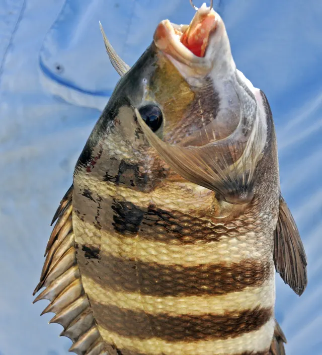 SheepsheadA boldly barred inshore sea bream with flattened human-like incisors and heavy molars, built to crush barnacles and shellfish off pilings and structure.
James St. John — CC BY 2.0, via Wikimedia Commons
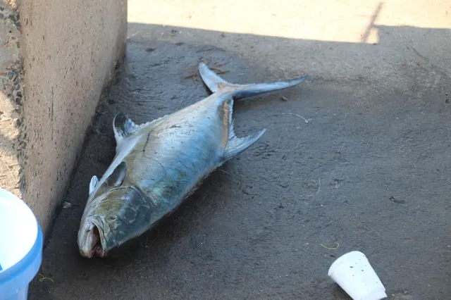 LeerfishA large, fast, laterally compressed jack of Mediterranean and African coasts, known as garrick in South Africa, and a prime surf and lure target.
Erwin Sieben — CC0, via iNaturalist
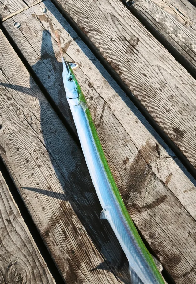 GarfishA slender surface-hunting fish with a long beaked jaw and green bones — a harmless pigment that alarms people unnecessarily.
Dmitry Petrov — CC BY, via iNaturalist
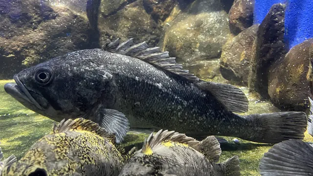 Korean rockfishThe principal recreational and farmed rockfish of Korea, China and Japan, bearing live young and carrying venomous fin spines.
Totti — CC BY-SA 4.0, via Wikimedia Commons
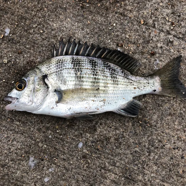 Blackhead seabreamA wary East Asian sparid of harbours and rocky shores, sex-changing as it grows, and the subject of an entire specialised Japanese angling discipline.
Rakurakuda — CC BY-SA 4.0, via Wikimedia Commons
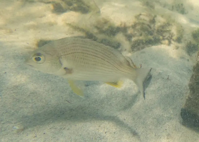 Yellowfin breamThe archetypal Australian estuary sparid, wary, structure-oriented, and the species around which a whole competitive lure discipline has been built.
Rolf Lawrenz — CC BY, via iNaturalist
The same rock, three hours apart: why a bass mark is a state of tide rather than a place
The same rock, three hours apart: why a bass mark is a state of tide rather than a place
Reading the ground · Draft — not yet checked against an external reference
This drawing has not been checked against any reference outside FishingHQ. It is a schematic of what the surrounding text describes, and the text is what carries the detail.
Describe this diagram in words
One piece of shore seen from above, drawn twice, one panel above the other, so it can be compared with itself. Two notes at the top state that nothing changes between the panels except whether water is moving. The UPPER panel is headed 1 · TIDE RUNNING. Across its open water runs a long arrow with a head at the right, labelled WATER MOVING, AND FOOD MOVING WITH IT. Below it two broken lines enclose a long irregular shape labelled REEF — ROCK, WITH SAND EITHER SIDE, and a short channel runs out from its far end labelled GULLY. A second arrow, also with a head, runs along the shoreward side of the reef and is deflected around it. Three positions are labelled BASS, each pointing at the line beside it: where the deflected flow first meets the rock, at a step in the shoreward boundary, and at the mouth of the gully. A note reads THE FISH ARE ON THE EDGES — NOT SPREAD OVER THE GROUND. Two lines at the foot mark the SHORE. The LOWER panel is headed 2 · SLACK WATER, SAME ROCK and repeats every drawn feature at the same shape and spacing. It has no arrows and nothing labelled BASS, and two notes say so. Three notes close the figure: SAME GROUND, SAME CAST, DIFFERENT PLACE; that no depths, distances or hours of tide are shown and nor is which side of the rock; and that casting further is not the answer because bass feed in very shallow water over ground like this.
How this drawing was produced
Drawn by hand from the bass record's own section 'Where bass actually are, and why it is a tidal question rather than a map one'. Two things that section does not settle are absent: which SIDE of a feature a fish holds on, and what 'tide running' means in hours. The lower rock outline is the upper one offset by a constant rather than redrawn, so the panels cannot drift apart. Rendered and inspected three times. The first put the panels side by side with centred notes and pushed half the text off the right edge. The second drew the fish near the rock rather than on it, and the geometry audit was right to reject it. In the third the fish became LABELS rather than markers: a component marker must sit on a tackle line and a bed is scenery, so marking a fish with a shape would have meant weakening a guard that has caught a real defect elsewhere — and three unlabelled circles were worse.
The platform that has been dry all morning: why watching for a few minutes is not enough
The platform that has been dry all morning: why watching for a few minutes is not enough
Reading the ground · Draft — not yet checked against an external reference
This drawing has not been checked against any reference outside FishingHQ. It is a schematic of what the surrounding text describes, and the text is what carries the detail.
Describe this diagram in words
The same rock platform drawn twice, side by side, separated by an interval of time that is deliberately not quantified. In the left panel a cliff drops to a broad flat shelf that runs out to a seaward edge, and the water sits well below the platform, reaching nowhere near it — this is what an angler watching the mark for twenty minutes sees, and a marker shows the position they then choose to stand in. The right panel is the identical cliff, the identical platform and the identical position, with one difference: a large wave is running up over the whole shelf from the seaward edge to the foot of the cliff, and an arrow shows the direction of the run-up, with the cliff behind leaving no retreat. Nothing about the angler's judgement changed between the two pictures; the sea did. The figure carries the conclusion from FishingHQ's rock platform safety record at its foot — the fatality pattern in rock fishing is not usually somebody taking an obvious risk, it is somebody standing where the water had not reached yet — together with the measures that change outcomes: a buoyancy aid, footwear with real grip on wet rock, and never fishing alone on an exposed platform.
How this drawing was produced
Drawn in-repository from the standing visual vocabulary. Reviewed for internal consistency: the cliff, platform and seaward edge are drawn with identical geometry in both panels and offset by a fixed horizontal distance, so the only difference between them is the water; the wave in the right panel runs continuously from the seaward edge to the foot of the cliff, covering the marked position. No interval, wave height or safe distance is drawn, because the record states none and a number would invite timing rather than caution. RENDERED AND LOOKED AT. The first draft carried the phrase 'dry for twenty minutes', which contradicted this figure's own refusal to publish an interval and was rewritten; the low water in the left panel was drawn as a closed shape, rendered as a floating box, and is now a waterline well below the platform.
Safety
Cliffs and rock platforms — Can cause serious injury or death
Swell arrives in sets, and the largest wave in a set can be several times the height of the preceding ones. A platform dry for twenty minutes is not a safe platform. Wet weed-covered rock is extremely slippery, and a fall into water at the base of a rock face is very difficult to get out of.
What reduces it: Watch a mark for a full set cycle — at least twenty minutes — before committing. Wear a buoyancy aid and studded or felt-soled boots. Know your exit and the tide before you start. Never fish a rock mark alone, and treat a forecast ground swell as a decision already made.
Worse when:
- Any ground swell, regardless of what the local wind is doing
- A rising tide, which closes the retreat before it reaches your feet
- Darkness, when an incoming set is invisible
Slips, trips and falls — Can cause injury needing treatment
Weed-covered rock offers effectively no grip, and barnacle-covered rock cuts badly on impact. Most rock-mark injuries are falls rather than immersions.
What reduces it: Studded or felt soles, both hands free for moving, and a deliberate pace. Move tackle in stages rather than carrying everything in one crossing.
Precautions that always apply here
- Check the tide before you go and know your exit route. Being cut off is the commonest way a shore session becomes a rescue.
- Wear a buoyancy aid or lifejacket. Cold water incapacitates strong swimmers within a minute, long before swimming ability matters.
- Tell somebody where you are going and when you expect to be back.
- Carry a charged phone in a waterproof case, or another means of calling for help.
Further safety reading
- Buoyancy aids for anglers — A fall from rock means immediate deep-water immersion.
- Rock platform and cliff safety — Rock and ledge marks concentrate swell, poor footing and deep water at the edge.
- Shore entry and exit for divers — Rock entries concentrate swell energy where a diver is least mobile.
- Tides and being cut off
Where to go next
Fish found here
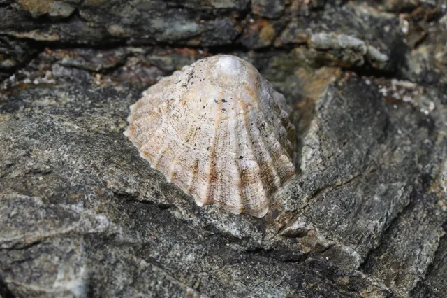 Common limpetFixed to bare exposed rock across the intertidal, each animal returning to its own scar on the stone. It occupies the most wave-exposed rock on the shore, which is exactly the ground that is most dangerous to work.
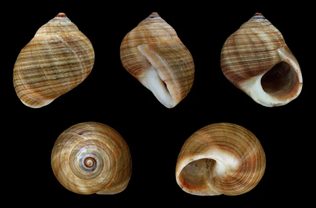 Common periwinkleGrazes the algal film on rock and weed through the intertidal zone, most abundantly on the middle and lower shore, and it is the commonest gathered gastropod of the north-east Atlantic shore.
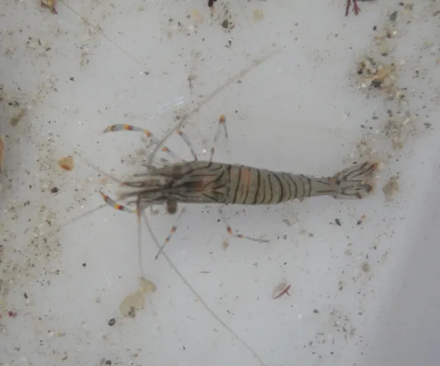 Common prawnWeed-filled rock pools and overhangs on the low shore are the classic hand-net ground, and the prawns are in the cover rather than in the open water of the pool.
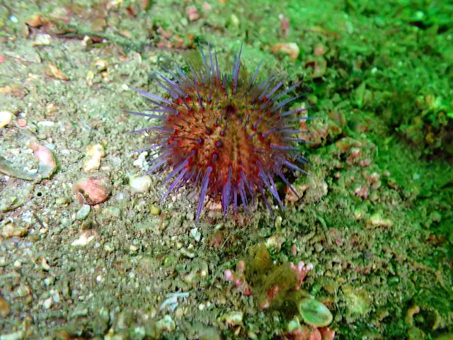 European sea urchinOccupies rock and boulder ground from the low intertidal downwards, grazing algae, and in some places forms the barren grounds that follow when its predators are removed.
- Atlantic codCod are strongly associated with rough ground, reefs and wrecks where prey concentrates.
- Atlantic rock crabThe splash zone — wetted by spray rather than by tide.
- Azores chromisThe same rock as the other fula, in slightly deeper water above it.
- Bermuda sea chubThe top ten metres of it, where the weed it eats grows.
62 more
- Black moray Fish
- Black seabream Fish
- Black-faced blenny Fish
- Blackhead seabream Fish
- Blacktail comber Fish
- Blue cod Fish
- Blue mussel Fish
- Blue wrasse Fish
- Bogue Fish
- Brown moray Fish
- Bull huss Fish
- Butterfly-winged comber Fish
- Canary damselfish Fish
- Canary mussel Fish
- Comber Fish
- Common octopus Fish
- Corkwing wrasse Fish
- Cuckoo wrasse Fish
- Curled octopus Fish
- Derbio Fish
- Diamond lizardfish Fish
- Edible crab Fish
- Emerald wrasse Fish
- European lobster Fish
- Five-bearded rockling Fish
- Garfish Fish
- Grey triggerfish Fish
- Island grouper Fish
- Japanese rockfish Fish
- Korean rockfish Fish
- Leerfish Fish
- Long-spined sea scorpion Fish
- Longtail tuna Fish
- Macaronesian sharpnose puffer Fish
- Madeira goby Fish
- Madeira rockfish Fish
- Mediterranean moray Fish
- Mediterranean parrotfish Fish
- Ornate wrasse Fish
- Planehead filefish Fish
- Rainbow wrasse Fish
- Red porgy Fish
- Red scorpionfish Fish
- Ringneck blenny Fish
- Rock goby Fish
- Rockpool blenny Fish
- Saddled seabream Fish
- Salema porgy Fish
- Shanny Fish
- Sheepshead Fish
- Shore crab Fish
- Short-spined sea scorpion Fish
- Silver trevally Fish
- Spiny spider crab Fish
- Three-bearded rockling Fish
- Two-banded seabream Fish
- Velvet swimming crab Fish
- White seabream Fish
- Yellowfin bream Fish
- Yellowmouth barracuda Fish
- Zebra seabream Fish
- European sea bass Fish
Reading this water
- Currents, eddies and where fish holdRock deflects water, and the deflection is the feature: the acceleration off a point, the eddy behind it and the seam between them are where the fish are and where the danger is.
- Fishing rock marksThe habitat page explains why rocky ground is productive; this one explains how the assessment of whether to fish it is made, which comes first in time as well as in importance.
- Fishing rough ground, and what it costsThe habitat page explains why rough ground holds the most fish. This one explains what fishing it costs, and why the whole technique is organised around losing gear cheaply and on purpose.
- Saltwater fly fishing: what changesThe ground that changes the mechanics most. Standing on rock with swell running, wind at your back or in your face, line to be managed on a surface that catches it, and a retrieve made with the hand rather than the reel — none of which a river bank prepares an angler for.
- Weak links and rotten bottomsThe habitat that makes the technique necessary: reef, boulder and kelp hold fish and take tackle, and the second fact is a property of the ground rather than of anybody's casting.
- Why rigs snag, and how to reduce itThe ground holds fish because it is rough, and the tackle cost is the price rather than a mistake.
How this compares
- Fly fishing for pollack over rough ground and kelpKelp edges, gully mouths and reef margins beside deep water are where pollack hold, and they are also the most dangerous ground a shore angler stands on.
- Harbours, piers and breakwatersA breakwater is an artificial reef somebody built for another reason, and it works the same way — hard vertical surface, colonised, holding food and the fish that eat it.
- Malta and GozoLimestone ledge and platform is the ground almost all Maltese shore fishing is done from, and the hazard model that goes with it.
- Mudflats and intertidal sandflatsThe two intertidal habitats a gatherer works, holding entirely different catch and killing people in entirely different ways.
- Saltwater fly fishingThe ground pollack fly fishing happens on, and the most dangerous shore environment on FishingHQ for somebody standing still watching a fly line.
Sources and evidence
- RNLI water safety guidance: cold water shock and Float to Live — Royal National Lifeboat Institution (Water-safety or diver-training authority)Relied on for: The nature of the risk from swell, from being cut off and from falls on coastal rock.FishingHQ's interpretation of what it saysPassage read and verified
Why the 85 connections on this page are here, and the sources
Fish found here
Backed by research — 68 connections
Supported by peer-reviewed research or fisheries science. The sources are listed and can be checked.
Common limpet
A distribution association between an animal and a kind of water, rather than a claim about any named mark.
- FishBase: a global information system on fishes — Froese, R. and D. Pauly, eds. — FishBase Consortium (Scientific institute)Relied on for: Distribution, habitat association and depth range recorded for the species, including its occurrence in the water body concerned.States this directlyPassage read and verified
- The IUCN Red List of Threatened Species — International Union for Conservation of Nature (Conservation authority)Relied on for: Assessment and range account for the species, including the systems and coasts it occupies.Background and mechanism onlyCitation checked — the work exists and is described correctly
A claim that a place contains the ground and conditions the animal is associated with. It is a distributional statement about the world and rests on reference works, and it deliberately asserts nothing about access or permission.
- The Fishes of the British Isles and North-West Europe — Macmillan, 1969 (Reference work)Relied on for: Distribution and habitat association of the inshore fauna of the British Isles and the north-east Atlantic.States this directlyCitation checked — the work exists and is described correctly
- FishBase: a global information system on fishes — Froese, R. and D. Pauly, eds. — FishBase Consortium (Scientific institute)Relied on for: Recorded distribution and habitat association for the species where held.Background and mechanism onlyPassage read and verified
- The IUCN Red List of Threatened Species — International Union for Conservation of Nature (Conservation authority)Relied on for: Range and recorded threats for the species where assessed.Background and mechanism onlyCitation checked — the work exists and is described correctly
Common periwinkle
Habitat association recorded for the species rather than inferred from the fishery.
- FishBase: a global information system on fishes — Froese, R. and D. Pauly, eds. — FishBase Consortium (Scientific institute)Relied on for: Habitat association, depth range and distribution for the species, with SeaLifeBase as its sister database for non-finfish taxa.States this directlyPassage read and verified
A claim that a place contains the ground and conditions the animal is associated with. It is a distributional statement about the world and rests on reference works, and it deliberately asserts nothing about access or permission.
- The Fishes of the British Isles and North-West Europe — Macmillan, 1969 (Reference work)Relied on for: Distribution and habitat association of the inshore fauna of the British Isles and the north-east Atlantic.States this directlyCitation checked — the work exists and is described correctly
- FishBase: a global information system on fishes — Froese, R. and D. Pauly, eds. — FishBase Consortium (Scientific institute)Relied on for: Recorded distribution and habitat association for the species where held.Background and mechanism onlyPassage read and verified
- The IUCN Red List of Threatened Species — International Union for Conservation of Nature (Conservation authority)Relied on for: Range and recorded threats for the species where assessed.Background and mechanism onlyCitation checked — the work exists and is described correctly
Common prawn
Habitat association recorded for the species rather than inferred from the fishery.
- FishBase: a global information system on fishes — Froese, R. and D. Pauly, eds. — FishBase Consortium (Scientific institute)Relied on for: Habitat association, depth range, diet and distribution for the species, with SeaLifeBase as its sister database for non-finfish taxa.States this directlyPassage read and verified
A claim that a place contains the ground and conditions the animal is associated with. It is a distributional statement about the world and rests on reference works, and it deliberately asserts nothing about access or permission.
- The Fishes of the British Isles and North-West Europe — Macmillan, 1969 (Reference work)Relied on for: Distribution and habitat association of the inshore fauna of the British Isles and the north-east Atlantic.States this directlyCitation checked — the work exists and is described correctly
- FishBase: a global information system on fishes — Froese, R. and D. Pauly, eds. — FishBase Consortium (Scientific institute)Relied on for: Recorded distribution and habitat association for the species where held.Background and mechanism onlyPassage read and verified
- The IUCN Red List of Threatened Species — International Union for Conservation of Nature (Conservation authority)Relied on for: Range and recorded threats for the species where assessed.Background and mechanism onlyCitation checked — the work exists and is described correctly
European sea urchin
Habitat association recorded for the species rather than inferred from the fishery.
- FishBase: a global information system on fishes — Froese, R. and D. Pauly, eds. — FishBase Consortium (Scientific institute)Relied on for: Habitat association, depth range and distribution for the species, with SeaLifeBase as its sister database for non-finfish taxa.States this directlyPassage read and verified
A claim that a place contains the ground and conditions the animal is associated with. It is a distributional statement about the world and rests on reference works, and it deliberately asserts nothing about access or permission.
- The Fishes of the British Isles and North-West Europe — Macmillan, 1969 (Reference work)Relied on for: Distribution and habitat association of the inshore fauna of the British Isles and the north-east Atlantic.States this directlyCitation checked — the work exists and is described correctly
- FishBase: a global information system on fishes — Froese, R. and D. Pauly, eds. — FishBase Consortium (Scientific institute)Relied on for: Recorded distribution and habitat association for the species where held.Background and mechanism onlyPassage read and verified
- The IUCN Red List of Threatened Species — International Union for Conservation of Nature (Conservation authority)Relied on for: Range and recorded threats for the species where assessed.Background and mechanism onlyCitation checked — the work exists and is described correctly
Atlantic cod
Habitat association documented in the fisheries science literature.
- FishBase: a global information system on fishes — Froese, R. and D. Pauly, eds. — FishBase Consortium (Scientific institute)Relied on for: Habitat and depth records for Gadus morhua.States this directlyPassage read and verified
- Cefas science, advice and data on marine and freshwater environments — Centre for Environment, Fisheries and Aquaculture Science (Government fisheries body)Relied on for: Cod habitat use and distribution in UK waters.FishingHQ's interpretation of what it saysCitation checked — the work exists and is described correctly
Azores chromis
Recorded as reef-associated and non-migratory from 5 to 45 m — shallow enough at its upper edge for a pier end, and generally deeper than the Canary damselfish's band.
- FishBase: a global information system on fishes — Froese, R. and D. Pauly, eds. — FishBase Consortium (Scientific institute)Relied on for: Environment, depth range, habitat association and distribution for Chromis limbata.States this directlyPassage read and verified
Bermuda sea chub
Recorded as reef-associated from 1 to 30 m and usually within 10 m, circumglobal in subtropical seas. A grazing fish is tied to the depth its food photosynthesises at, which is why its usual band is so much shallower than its maximum.
- FishBase: a global information system on fishes — Froese, R. and D. Pauly, eds. — FishBase Consortium (Scientific institute)Relied on for: Environment, depth range, habitat association and distribution for Kyphosus sectator.States this directlyPassage read and verified
Black moray
Recorded as demersal and non-migratory from 0 to 250 m and usually shallower than 50 m, restricted to the Macaronesian archipelagos.
- FishBase: a global information system on fishes — Froese, R. and D. Pauly, eds. — FishBase Consortium (Scientific institute)Relied on for: Environment, depth range, habitat association and distribution for Muraena augusti.States this directlyPassage read and verified
Black seabream
A distributional claim about where a species is found, which is a claim about the world and rests on the standard regional reference works rather than on angling report.
- The Fishes of the British Isles and North-West Europe — Macmillan, 1969 (Reference work)Relied on for: Distribution, habitat association, identification and biology of the fishes of the British Isles and north-west Europe.States this directlyCitation checked — the work exists and is described correctly
- FAO Species Identification Guides for Fishery Purposes and the FAO Species Catalogues — Food and Agriculture Organization of the United Nations (Scientific institute)Relied on for: Diagnostic characters, habitat and depth range as set out in the FAO species identification sheets for the eastern Atlantic and Mediterranean.States this directlyCitation checked — the work exists and is described correctly
Black-faced blenny
Recorded as demersal over a depth range of 0 to 40 m and usually 6 to 12 m along the eastern Atlantic and Mediterranean. It holds to vertical and overhanging rock rather than to horizontal ground, which is unusual enough to be the habitat fact worth recording.
- FishBase: a global information system on fishes — Froese, R. and D. Pauly, eds. — FishBase Consortium (Scientific institute)Relied on for: Environment, depth range, habitat association and distribution for Tripterygion delaisi.States this directlyPassage read and verified
Blackhead seabream
A habitat association for Acanthopagrus schlegelii taken from the environment and distribution data on its FishBase summary.
- FishBase: a global information system on fishes — Froese, R. and D. Pauly, eds. — FishBase Consortium (Scientific institute)Relied on for: The environment, depth range and habitat description recorded for Acanthopagrus schlegelii.States this directlyPassage read and verified
Blacktail comber
Recorded as demersal over a depth range of 3 to 150 m from Biscay and the Azores south to the Canaries and Guinea-Bissau, on hard bottom.
- FishBase: a global information system on fishes — Froese, R. and D. Pauly, eds. — FishBase Consortium (Scientific institute)Relied on for: Environment, depth range, habitat association and distribution for Serranus atricauda.States this directlyPassage read and verified
Blue cod
A habitat association for Parapercis colias taken from the environment and distribution data on its FishBase summary.
- FishBase: a global information system on fishes — Froese, R. and D. Pauly, eds. — FishBase Consortium (Scientific institute)Relied on for: The environment, depth range and habitat description recorded for Parapercis colias.States this directlyPassage read and verified
Blue mussel
Habitat association recorded for the species rather than inferred from the fishery.
- FishBase: a global information system on fishes — Froese, R. and D. Pauly, eds. — FishBase Consortium (Scientific institute)Relied on for: Habitat association, depth range and distribution for the species, with SeaLifeBase as its sister database for non-finfish taxa.States this directlyPassage read and verified
Blue wrasse
Recorded as demersal and non-migratory over a depth range of 1 to 30 m and usually 5 to 15 m, from Madeira, the Canary Islands and the Azores.
- FishBase: a global information system on fishes — Froese, R. and D. Pauly, eds. — FishBase Consortium (Scientific institute)Relied on for: Environment, depth range, habitat association and distribution for Symphodus caeruleus.States this directlyPassage read and verified
Bogue
Boops boops is recorded as demersal over a depth range from the surface to 350 m, usually within the top 100, and the fish an angler meets are shoaling in the upper water over hard ground.
- FishBase: a global information system on fishes — Froese, R. and D. Pauly, eds. — FishBase Consortium (Scientific institute)Relied on for: Environment, depth range, habitat association and distribution for Boops boops.States this directlyPassage read and verified
Brown moray
Recorded as demersal over a depth range of 0 to 20 m from southern Portugal to Cape Verde and throughout the Mediterranean. That depth band is the whole reason this is the moray a shore angler meets.
- FishBase: a global information system on fishes — Froese, R. and D. Pauly, eds. — FishBase Consortium (Scientific institute)Relied on for: Environment, depth range, habitat association and distribution for Gymnothorax unicolor.States this directlyPassage read and verified
Bull huss
A distributional claim about where a species is found, which rests on the standard regional reference works rather than on angling report.
- The Fishes of the British Isles and North-West Europe — Macmillan, 1969 (Reference work)Relied on for: Distribution, habitat association, identification and biology of the sharks, skates and rays of the British Isles and north-west Europe.States this directlyCitation checked — the work exists and is described correctly
- FAO Species Identification Guides for Fishery Purposes and the FAO Species Catalogues — Food and Agriculture Organization of the United Nations (Scientific institute)Relied on for: Diagnostic characters, habitat and depth range as set out in the FAO species identification sheets for the eastern Atlantic and Mediterranean.States this directlyCitation checked — the work exists and is described correctly
Butterfly-winged comber
Recorded as demersal over a depth range of 3 to 80 m from the Canaries down the north-west African coast, on the hard ground the small serranids hunt from.
- FishBase: a global information system on fishes — Froese, R. and D. Pauly, eds. — FishBase Consortium (Scientific institute)Relied on for: Environment, depth range, habitat association and distribution for Serranus papilionaceus.States this directlyPassage read and verified
Canary damselfish
Recorded as reef-associated and non-migratory over a depth range of 0 to 25 m across Macaronesia and West Africa.
- FishBase: a global information system on fishes — Froese, R. and D. Pauly, eds. — FishBase Consortium (Scientific institute)Relied on for: Environment, depth range, habitat association and distribution for Similiparma lurida.States this directlyPassage read and verified
Comber
Serranus cabrilla is recorded as demersal over a very wide depth range, from about 5 m to 500 m, holding to rock, rubble and reef throughout — an unusually broad vertical range for a fish this size.
- FishBase: a global information system on fishes — Froese, R. and D. Pauly, eds. — FishBase Consortium (Scientific institute)Relied on for: Environment, depth range, habitat association and distribution for Serranus cabrilla.States this directlyPassage read and verified
Common octopus
A distributional claim about where a species is found, resting on the standard identification and compilation sources rather than on fishing report.
- FAO Species Identification Guides for Fishery Purposes and the FAO Species Catalogues — Food and Agriculture Organization of the United Nations (Scientific institute)Relied on for: Diagnostic characters, habitat association, depth range and distribution as set out in the FAO species identification guides for fishery purposes.States this directlyCitation checked — the work exists and is described correctly
- FishBase: a global information system on fishes — Froese, R. and D. Pauly, eds. — FishBase Consortium (Scientific institute)Relied on for: Distribution, maximum size, depth range, habitat association and biology as compiled for the species.States this directlyPassage read and verified
Corkwing wrasse
A distributional claim about where a species is found, resting on the standard regional reference works rather than on angling report.
- The Fishes of the British Isles and North-West Europe — Macmillan, 1969 (Reference work)Relied on for: Distribution, habitat association, identification and biology of the fishes and inshore fauna of the British Isles and north-west Europe.States this directlyCitation checked — the work exists and is described correctly
- FAO Species Identification Guides for Fishery Purposes and the FAO Species Catalogues — Food and Agriculture Organization of the United Nations (Scientific institute)Relied on for: Diagnostic characters, family placement, habitat and depth range as set out in the FAO species identification sheets for the eastern Atlantic and Mediterranean.States this directlyCitation checked — the work exists and is described correctly
Cuckoo wrasse
A distributional claim about where a species is found, resting on the standard regional reference works rather than on angling report.
- The Fishes of the British Isles and North-West Europe — Macmillan, 1969 (Reference work)Relied on for: Distribution, habitat association, identification and biology of the fishes and inshore fauna of the British Isles and north-west Europe.States this directlyCitation checked — the work exists and is described correctly
- FAO Species Identification Guides for Fishery Purposes and the FAO Species Catalogues — Food and Agriculture Organization of the United Nations (Scientific institute)Relied on for: Diagnostic characters, family placement, habitat and depth range as set out in the FAO species identification sheets for the eastern Atlantic and Mediterranean.States this directlyCitation checked — the work exists and is described correctly
Curled octopus
A habitat association resting on the standard regional reference works rather than on angling report.
- The Fishes of the British Isles and North-West Europe — Macmillan, 1969 (Reference work)Relied on for: Distribution, habitat association, identification and biology of the fishes and inshore fauna of the British Isles and north-west Europe.States this directlyCitation checked — the work exists and is described correctly
- FAO Species Identification Guides for Fishery Purposes and the FAO Species Catalogues — Food and Agriculture Organization of the United Nations (Scientific institute)Relied on for: Diagnostic characters, family placement, habitat and depth range as set out in the FAO species identification sheets for the region concerned.States this directlyCitation checked — the work exists and is described correctly
Derbio
FishBase records adults as moderately common in shallow water in areas of surge and small specimens as regularly caught at night from steep rocky shores, which is a habitat statement the depth-range field alone would hide.
- FishBase: a global information system on fishes — Froese, R. and D. Pauly, eds. — FishBase Consortium (Scientific institute)Relied on for: Environment, depth range, habitat association and distribution for Trachinotus ovatus.States this directlyPassage read and verified
Diamond lizardfish
FishBase records this species as reef-associated where it records Synodus saurus as demersal. That difference is small and it is the source's own, and it is why one carries this and the other does not.
- FishBase: a global information system on fishes — Froese, R. and D. Pauly, eds. — FishBase Consortium (Scientific institute)Relied on for: Environment, depth range, habitat association and distribution for Synodus synodus.States this directlyPassage read and verified
Edible crab
Habitat association recorded for the species rather than inferred from the fishery.
- FishBase: a global information system on fishes — Froese, R. and D. Pauly, eds. — FishBase Consortium (Scientific institute)Relied on for: Habitat association, depth range, diet and distribution for the species, with SeaLifeBase as its sister database for non-finfish taxa.States this directlyPassage read and verified
Emerald wrasse
Recorded as reef-associated over a depth range of 5 to 15 m and known only from the Azores, Madeira and the Canary Islands together with the Mediterranean.
- FishBase: a global information system on fishes — Froese, R. and D. Pauly, eds. — FishBase Consortium (Scientific institute)Relied on for: Environment, depth range, habitat association and distribution for Symphodus trutta.States this directlyPassage read and verified
European lobster
Habitat association recorded for the species rather than inferred from the fishery.
- FishBase: a global information system on fishes — Froese, R. and D. Pauly, eds. — FishBase Consortium (Scientific institute)Relied on for: Habitat association, depth range, diet and distribution for the species, with SeaLifeBase as its sister database for non-finfish taxa.States this directlyPassage read and verified
Five-bearded rockling
A habitat association resting on the standard regional reference works rather than on angling report.
- The Fishes of the British Isles and North-West Europe — Macmillan, 1969 (Reference work)Relied on for: Distribution, habitat association, identification and biology of the fishes of the British Isles and north-west Europe.States this directlyCitation checked — the work exists and is described correctly
- FAO Species Identification Guides for Fishery Purposes and the FAO Species Catalogues — Food and Agriculture Organization of the United Nations (Scientific institute)Relied on for: Diagnostic characters, family placement, habitat and depth range as set out in the FAO species identification sheets for the north-east Atlantic.States this directlyCitation checked — the work exists and is described correctly
Garfish
A habitat association for Belone belone taken from the environment and distribution data on its FishBase summary.
- FishBase: a global information system on fishes — Froese, R. and D. Pauly, eds. — FishBase Consortium (Scientific institute)Relied on for: The environment, depth range and habitat description recorded for Belone belone.States this directlyPassage read and verified
Grey triggerfish
Recorded as reef-associated from the surface to 100 m and usually within 55 m across the tropical and warm-temperate Atlantic on both sides. Its crushing dentition is for hard-shelled prey attached to rock, so the ground and the animal are the same fact.
- FishBase: a global information system on fishes — Froese, R. and D. Pauly, eds. — FishBase Consortium (Scientific institute)Relied on for: Environment, depth range, habitat association and distribution for Balistes capriscus.States this directlyPassage read and verified
Island grouper
Recorded as demersal from 1 to 200 m and usually 20 to 30 m, restricted to four eastern Atlantic archipelagos. Its site fidelity to particular caves is the trait behind both its catchability and its Vulnerable assessment.
- FishBase: a global information system on fishes — Froese, R. and D. Pauly, eds. — FishBase Consortium (Scientific institute)Relied on for: Environment, depth range, habitat association and distribution for Mycteroperca fusca.States this directlyPassage read and verified
Japanese rockfish
Demersal and oceanodromous on rock, weed and structure in the north-west Pacific. The enlarged eye the Japanese name refers to is the adaptation of a fish that feeds when there is very little light to feed by.
- FishBase: a global information system on fishes — Froese, R. and D. Pauly, eds. — FishBase Consortium (Scientific institute)Relied on for: Environment, depth range, habitat association and distribution for Sebastes inermis.States this directlyPassage read and verified
Korean rockfish
A habitat association for Sebastes schlegelii taken from the environment and distribution data on its FishBase summary.
- FishBase: a global information system on fishes — Froese, R. and D. Pauly, eds. — FishBase Consortium (Scientific institute)Relied on for: The environment, depth range and habitat description recorded for Sebastes schlegelii.States this directlyPassage read and verified
Leerfish
A habitat association for Lichia amia taken from the environment and distribution data on its FishBase summary.
- FishBase: a global information system on fishes — Froese, R. and D. Pauly, eds. — FishBase Consortium (Scientific institute)Relied on for: The environment, depth range and habitat description recorded for Lichia amia.States this directlyPassage read and verified
Long-spined sea scorpion
A habitat association resting on the standard regional reference works rather than on angling report.
- The Fishes of the British Isles and North-West Europe — Macmillan, 1969 (Reference work)Relied on for: Distribution, habitat association, identification and biology of the fishes and inshore fauna of the British Isles and north-west Europe.States this directlyCitation checked — the work exists and is described correctly
- FAO Species Identification Guides for Fishery Purposes and the FAO Species Catalogues — Food and Agriculture Organization of the United Nations (Scientific institute)Relied on for: Diagnostic characters, family placement, habitat and depth range as set out in the FAO species identification sheets for the region concerned.States this directlyCitation checked — the work exists and is described correctly
Longtail tuna
A habitat association for Thunnus tonggol taken from the environment and distribution data on its FishBase summary.
- FishBase: a global information system on fishes — Froese, R. and D. Pauly, eds. — FishBase Consortium (Scientific institute)Relied on for: The environment, depth range and habitat description recorded for Thunnus tonggol.States this directlyPassage read and verified
Macaronesian sharpnose puffer
Recorded as reef-associated over a depth range of 0 to 20 m and known from oceanic islands, which is as narrow a habitat statement as FishBase gives.
- FishBase: a global information system on fishes — Froese, R. and D. Pauly, eds. — FishBase Consortium (Scientific institute)Relied on for: Environment, depth range, habitat association and distribution for Canthigaster capistrata.States this directlyPassage read and verified
Madeira goby
A demersal rock fish of the Macaronesian islands. FishBase gives no depth range for it, so nothing is claimed here beyond the hard-bottom association the record does establish.
- FishBase: a global information system on fishes — Froese, R. and D. Pauly, eds. — FishBase Consortium (Scientific institute)Relied on for: Environment, depth range, habitat association and distribution for Mauligobius maderensis.States this directlyPassage read and verified
Madeira rockfish
Recorded as demersal over a depth range of 20 to 40 m across Macaronesia, Morocco and the Mediterranean, and it is an ambush predator whose entire strategy depends on being invisible against hard bottom.
- FishBase: a global information system on fishes — Froese, R. and D. Pauly, eds. — FishBase Consortium (Scientific institute)Relied on for: Environment, depth range, habitat association and distribution for Scorpaena maderensis.States this directlyPassage read and verified
Mediterranean moray
A distributional claim resting on the regional identification and fisheries literature rather than on angling report.
- Cefas science, advice and data on marine and freshwater environments — Centre for Environment, Fisheries and Aquaculture Science (Government fisheries body)Relied on for: UK marine science: distribution, habitat association, shellfish and crustacean monitoring, and the biological basis of management advice.States this directlyCitation checked — the work exists and is described correctly
- FAO Species Identification Guides for Fishery Purposes and the FAO Species Catalogues — Food and Agriculture Organization of the United Nations (Scientific institute)Relied on for: Habitat, depth range and distribution as set out in the FAO species identification sheets for the region concerned.States this directlyCitation checked — the work exists and is described correctly
Mediterranean parrotfish
Sparisoma cretense is recorded by FishBase as reef-associated, and its fused beak is an apparatus for scraping algae off hard substrate. Unlike an ambush predator that merely shelters in rock, this fish cannot feed away from it.
- FishBase: a global information system on fishes — Froese, R. and D. Pauly, eds. — FishBase Consortium (Scientific institute)Relied on for: Environment, depth range, habitat association and distribution for Sparisoma cretense.States this directlyPassage read and verified
Ornate wrasse
Recorded as reef-associated from 1 to 150 m and usually 1 to 50 m, inhabiting coastal waters near rocks and eel-grass beds.
- FishBase: a global information system on fishes — Froese, R. and D. Pauly, eds. — FishBase Consortium (Scientific institute)Relied on for: Environment, depth range, habitat association and distribution for Thalassoma pavo.States this directlyPassage read and verified
Planehead filefish
Recorded as reef-associated over a depth range of 0 to 293 m on both sides of the Atlantic. Its tiny mouth is an apparatus for picking growth off hard surfaces, so the structure is the food rather than the shelter.
- FishBase: a global information system on fishes — Froese, R. and D. Pauly, eds. — FishBase Consortium (Scientific institute)Relied on for: Environment, depth range, habitat association and distribution for Stephanolepis hispidus.States this directlyPassage read and verified
Rainbow wrasse
Recorded as reef-associated over a depth range of 0 to 120 m and usually 1 to 60 m from Sweden to Gabon and through the Mediterranean. Its habit of burying in sand at night and when threatened is why a mark full of them by day can look empty at dusk.
- FishBase: a global information system on fishes — Froese, R. and D. Pauly, eds. — FishBase Consortium (Scientific institute)Relied on for: Environment, depth range, habitat association and distribution for Coris julis.States this directlyPassage read and verified
Red porgy
Pagrus pagrus is recorded as benthopelagic from the surface to 250 m, usually 10 to 80 m, over hard and mixed ground — which is what puts it within reach of a shore mark where rock falls quickly into depth.
- FishBase: a global information system on fishes — Froese, R. and D. Pauly, eds. — FishBase Consortium (Scientific institute)Relied on for: Environment, depth range, habitat association and distribution for Pagrus pagrus.States this directlyPassage read and verified
Red scorpionfish
A distributional claim resting on the regional identification and fisheries literature rather than on angling report.
- Cefas science, advice and data on marine and freshwater environments — Centre for Environment, Fisheries and Aquaculture Science (Government fisheries body)Relied on for: UK marine science: distribution, habitat association, shellfish and crustacean monitoring, and the biological basis of management advice.States this directlyCitation checked — the work exists and is described correctly
- FAO Species Identification Guides for Fishery Purposes and the FAO Species Catalogues — Food and Agriculture Organization of the United Nations (Scientific institute)Relied on for: Habitat, depth range and distribution as set out in the FAO species identification sheets for the region concerned.States this directlyCitation checked — the work exists and is described correctly
Ringneck blenny
Recorded as demersal over a depth range of 0 to 25 m on rocky ground across an unusually wide latitudinal span, from 44°N to 56°S.
- FishBase: a global information system on fishes — Froese, R. and D. Pauly, eds. — FishBase Consortium (Scientific institute)Relied on for: Environment, depth range, habitat association and distribution for Parablennius pilicornis.States this directlyPassage read and verified
Rock goby
A distribution and habitat statement drawn from systematic description rather than from angling report.
- The Fishes of the British Isles and North-West Europe — Macmillan, 1969 (Reference work)Relied on for: Systematic description, distribution and identification characters for the fishes of the British Isles and north-west Europe.States this directlyCitation checked — the work exists and is described correctly
- FishBase: a global information system on fishes — Froese, R. and D. Pauly, eds. — FishBase Consortium (Scientific institute)Relied on for: Compiled species data: nomenclature, distribution, habitat, depth range and maximum recorded size.States this directlyPassage read and verified
Rockpool blenny
A demersal fish of the top metre over hard substrate. The intertidal band and the rocky shore are the same ground described by height and by material.
- FishBase: a global information system on fishes — Froese, R. and D. Pauly, eds. — FishBase Consortium (Scientific institute)Relied on for: Environment, depth range, habitat association and distribution for Parablennius parvicornis.States this directlyPassage read and verified
Saddled seabream
Recorded as benthopelagic and oceanodromous down to about 30 m. `Benthopelagic` is doing real work here: it feeds in the water column above hard ground, which is what separates it from the bottom-feeding bream on the same mark.
- FishBase: a global information system on fishes — Froese, R. and D. Pauly, eds. — FishBase Consortium (Scientific institute)Relied on for: Environment, depth range, habitat association and distribution for Oblada melanura.States this directlyPassage read and verified
Salema porgy
Recorded over shallow rock as well as seagrass across its eastern Atlantic and Mediterranean range, grazing the algal film on both.
- FishBase: a global information system on fishes — Froese, R. and D. Pauly, eds. — FishBase Consortium (Scientific institute)Relied on for: Environment, depth range, habitat association and distribution for Sarpa salpa.States this directlyPassage read and verified
Shanny
A habitat association resting on the standard regional reference works rather than on angling report.
- The Fishes of the British Isles and North-West Europe — Macmillan, 1969 (Reference work)Relied on for: Distribution, habitat association, identification and biology of the fishes and inshore fauna of the British Isles and north-west Europe.States this directlyCitation checked — the work exists and is described correctly
- FAO Species Identification Guides for Fishery Purposes and the FAO Species Catalogues — Food and Agriculture Organization of the United Nations (Scientific institute)Relied on for: Diagnostic characters, family placement, habitat and depth range as set out in the FAO species identification sheets for the region concerned.States this directlyCitation checked — the work exists and is described correctly
Sheepshead
A habitat association for Archosargus probatocephalus taken from the environment and distribution data on its FishBase summary.
- FishBase: a global information system on fishes — Froese, R. and D. Pauly, eds. — FishBase Consortium (Scientific institute)Relied on for: The environment, depth range and habitat description recorded for Archosargus probatocephalus.States this directlyPassage read and verified
Shore crab
A claim that a place contains the ground and conditions the animal is associated with. It is a distributional statement about the world and rests on reference works, and it deliberately asserts nothing about access or permission.
- The Fishes of the British Isles and North-West Europe — Macmillan, 1969 (Reference work)Relied on for: Distribution and habitat association of the inshore fauna of the British Isles and the north-east Atlantic.States this directlyCitation checked — the work exists and is described correctly
- FishBase: a global information system on fishes — Froese, R. and D. Pauly, eds. — FishBase Consortium (Scientific institute)Relied on for: Recorded distribution and habitat association for the species where held.Background and mechanism onlyPassage read and verified
- The IUCN Red List of Threatened Species — International Union for Conservation of Nature (Conservation authority)Relied on for: Range and recorded threats for the species where assessed.Background and mechanism onlyCitation checked — the work exists and is described correctly
Short-spined sea scorpion
A habitat association resting on the standard regional reference works rather than on angling report.
- The Fishes of the British Isles and North-West Europe — Macmillan, 1969 (Reference work)Relied on for: Distribution, habitat association, identification and biology of the fishes of the British Isles and north-west Europe.States this directlyCitation checked — the work exists and is described correctly
- FAO Species Identification Guides for Fishery Purposes and the FAO Species Catalogues — Food and Agriculture Organization of the United Nations (Scientific institute)Relied on for: Diagnostic characters, family placement, habitat and depth range as set out in the FAO species identification sheets for the north-east Atlantic.States this directlyCitation checked — the work exists and is described correctly
Silver trevally
A habitat association for Pseudocaranx georgianus taken from the environment and distribution data on its FishBase summary.
- FishBase: a global information system on fishes — Froese, R. and D. Pauly, eds. — FishBase Consortium (Scientific institute)Relied on for: The environment, depth range and habitat description recorded for Pseudocaranx georgianus.States this directlyPassage read and verified
Spiny spider crab
A distributional claim about where a species is found, resting on the standard regional reference works rather than on angling report.
- The Fishes of the British Isles and North-West Europe — Macmillan, 1969 (Reference work)Relied on for: Distribution, habitat association, identification and biology of the fishes and inshore fauna of the British Isles and north-west Europe.States this directlyCitation checked — the work exists and is described correctly
- FAO Species Identification Guides for Fishery Purposes and the FAO Species Catalogues — Food and Agriculture Organization of the United Nations (Scientific institute)Relied on for: Diagnostic characters, family placement, habitat and depth range as set out in the FAO species identification sheets for the eastern Atlantic and Mediterranean.States this directlyCitation checked — the work exists and is described correctly
Three-bearded rockling
A habitat association resting on the standard regional reference works rather than on angling report.
- The Fishes of the British Isles and North-West Europe — Macmillan, 1969 (Reference work)Relied on for: Distribution, habitat association, identification and biology of the fishes of the British Isles and north-west Europe.States this directlyCitation checked — the work exists and is described correctly
- FAO Species Identification Guides for Fishery Purposes and the FAO Species Catalogues — Food and Agriculture Organization of the United Nations (Scientific institute)Relied on for: Diagnostic characters, family placement, habitat and depth range as set out in the FAO species identification sheets for the north-east Atlantic.States this directlyCitation checked — the work exists and is described correctly
Two-banded seabream
Recorded as a euryhaline benthopelagic fish inhabiting rocky and sometimes sandy bottoms to 160 m but more commonly inside 50 m, with young sometimes in seagrass.
- FishBase: a global information system on fishes — Froese, R. and D. Pauly, eds. — FishBase Consortium (Scientific institute)Relied on for: Environment, depth range, habitat association and distribution for Diplodus vulgaris.States this directlyPassage read and verified
Velvet swimming crab
A habitat association resting on the standard regional reference works rather than on angling report.
- The Fishes of the British Isles and North-West Europe — Macmillan, 1969 (Reference work)Relied on for: Distribution, habitat association, identification and biology of the fishes and inshore fauna of the British Isles and north-west Europe.States this directlyCitation checked — the work exists and is described correctly
- FAO Species Identification Guides for Fishery Purposes and the FAO Species Catalogues — Food and Agriculture Organization of the United Nations (Scientific institute)Relied on for: Diagnostic characters, family placement, habitat and depth range as set out in the FAO species identification sheets for the region concerned.States this directlyCitation checked — the work exists and is described correctly
White seabream
A habitat association for Diplodus sargus taken from the environment and distribution data on its FishBase summary.
- FishBase: a global information system on fishes — Froese, R. and D. Pauly, eds. — FishBase Consortium (Scientific institute)Relied on for: The environment, depth range and habitat description recorded for Diplodus sargus.States this directlyPassage read and verified
Yellowfin bream
A habitat association for Acanthopagrus australis taken from the environment and distribution data on its FishBase summary.
- FishBase: a global information system on fishes — Froese, R. and D. Pauly, eds. — FishBase Consortium (Scientific institute)Relied on for: The environment, depth range and habitat description recorded for Acanthopagrus australis.States this directlyPassage read and verified
Yellowmouth barracuda
Recorded as pelagic-neritic from the surface to 100 m, which is the shelf water over and beside hard ground rather than the open ocean. The Canary sources that name it place it on rock and reef.
- FishBase: a global information system on fishes — Froese, R. and D. Pauly, eds. — FishBase Consortium (Scientific institute)Relied on for: Environment, depth range, habitat association and distribution for Sphyraena viridensis.States this directlyPassage read and verified
Zebra seabream
Recorded as reef-associated and oceanodromous from 30 to 300 m along the eastern Atlantic including Madeira and the Canaries. That band is normally a boat proposition; a steep volcanic island puts it under a rock platform, which is why the same species is shore-caught here and not elsewhere.
- FishBase: a global information system on fishes — Froese, R. and D. Pauly, eds. — FishBase Consortium (Scientific institute)Relied on for: Environment, depth range, habitat association and distribution for Diplodus cervinus.States this directlyPassage read and verified
European sea bass
Recorded habitat association.
- FishBase: a global information system on fishes — Froese, R. and D. Pauly, eds. — FishBase Consortium (Scientific institute)Relied on for: Habitat records for Dicentrarchus labrax including rocky inshore ground.States this directlyPassage read and verified
- Cefas science, advice and data on marine and freshwater environments — Centre for Environment, Fisheries and Aquaculture Science (Government fisheries body)Relied on for: Inshore habitat use by bass.FishingHQ's interpretation of what it saysCitation checked — the work exists and is described correctly
Official guidance — 2 connections
Stated by a fisheries authority, scientific institute or recognised angling body. Authoritative, but summarising rather than demonstrating.
Atlantic rock crab
A fast grapsid crab of eastern Atlantic island rock, living above the waterline in the band wetted by spray and wave rather than by the tide, and regulated as shore-gathering species across the Canary Islands. It returns to the water to wet its gills and to escape rather than to feed.
- Tallas mínimas de captura — Canarias: minimum landing sizes and closed seasons — Gobierno de Canarias, Consejería de Agricultura, Ganadería y Pesca — Dirección General de Pesca, with the Grupo de Acción Costera de Tenerife and the Cabildo de Tenerife (Government fisheries body)Relied on for: That this animal is regulated recreational shore-gathering species across the Canary Islands, and the Canarian name the directorate gives it.States this directlyPassage read and verified
Canary mussel
A warm-water mytilid anchored by byssal threads to exposed rock, forming dense beds rather than occurring as scattered animals, and regulated as shore-gathering species across the Canary Islands. Its preference for wave exposure is why the beds sit where they are hardest and most dangerous to reach.
- Tallas mínimas de captura — Canarias: minimum landing sizes and closed seasons — Gobierno de Canarias, Consejería de Agricultura, Ganadería y Pesca — Dirección General de Pesca, with the Grupo de Acción Costera de Tenerife and the Cabildo de Tenerife (Government fisheries body)Relied on for: That this animal is regulated recreational shore-gathering species across the Canary Islands, and the Canarian name the directorate gives it.States this directlyPassage read and verified
Reading this water
What experienced anglers do — 5 connections
Widely and independently recommended by experienced anglers and specialist sources. This is real angling knowledge, not proof: controlled evidence for it is limited, and FishingHQ records it as convention rather than as a demonstrated effect.
Currents, eddies and where fish hold
A link from a practice, an environment or a geography to the mechanism it rests on. It asserts that the mechanism is load-bearing here rather than merely relevant, which is the test applied throughout this file.
- Sea Angler — Bauer Media (Specialist angling publication)Relied on for: Long-running published description of how conditions are read in the practice named, by ground type and by region.FishingHQ's interpretation of what it saysCitation checked — the work exists and is described correctly
- General angling website restatements of established technique — Various (Credible secondary source)Relied on for: Widely restated descriptions of how the condition named governs the practice named, recorded as practitioner consensus rather than as scholarship.Background and mechanism onlyCitation checked — the work exists and is described correctly
Fishing rough ground, and what it costs
Why it works, resting on shore-fishing practice reported consistently across independent practitioner sources rather than on experiment.
- Sea Angler — Bauer Media (Specialist angling publication)Relied on for: Contemporary UK sea angling practice as reported by practitioners, including shore technique, terminal tackle, regional ground and species behaviour.States this directlyCitation checked — the work exists and is described correctly
- Freshwater Fishing — Macdonald & Jane's, 1975 (Specialist angling publication)Relied on for: Comprehensive angling practice including terminal tackle, casting, leaders and the reasoning behind the choices.States this directlyCitation checked — the work exists and is described correctly
Saltwater fly fishing: what changes
A fish or a water joined to the fly-fishing mechanism it is a worked example of, written only where the subject's own behaviour or physical character is what this page explains. The direction is the one FishingHQ writes this kind of connection in, and the one it already uses 176 times, and it is also the semantically correct one: the mechanism explains the fish, not the reverse.
- Sea Angler — Bauer Media (Specialist angling publication)Relied on for: British sea angling practice including shore fishing for bass, pollack and mullet, the ground each is found over and the presentation each takes.FishingHQ's interpretation of what it saysCitation checked — the work exists and is described correctly
- FAO Species Identification Guides for Fishery Purposes and the FAO Species Catalogues — Food and Agriculture Organization of the United Nations (Scientific institute)Relied on for: Distribution, habitat and feeding biology of coastal and tropical marine species, from regional identification guides prepared for fishery purposes.States this directlyCitation checked — the work exists and is described correctly
Weak links and rotten bottoms
A link from a practice or a piece of equipment to the mechanism or explanation it rests on.
- Sea Angler — Bauer Media (Specialist angling publication)Relied on for: Long-running published description of British sea angling practice, including reels, casting, rough-ground technique and terminal arrangement.FishingHQ's interpretation of what it saysCitation checked — the work exists and is described correctly
- General angling website restatements of established technique — Various (Credible secondary source)Relied on for: Widely restated descriptions of equipment convention and its use, recorded as practitioner consensus rather than as scholarship.Background and mechanism onlyCitation checked — the work exists and is described correctly
Why rigs snag, and how to reduce it
The habitat and the practical consequence of fishing it.
- Freshwater Fishing — Macdonald & Jane's, 1975 (Specialist angling publication)Relied on for: Terminal tackle behaviour, line drag in flow, bait presentation and rig geometry.States this directlyCitation checked — the work exists and is described correctly
- Pike and the Pike Angler — Stanley Paul, 1981 (Specialist angling publication)Relied on for: Rig and terminal-tackle mechanics described independently of the sea-angling tradition.States this directlyCitation checked — the work exists and is described correctly
Official guidance — 1 connection
Stated by a fisheries authority, scientific institute or recognised angling body. Authoritative, but summarising rather than demonstrating.
Fishing rock marks
Rock fishing safety guidance sets out the assessment before the fishing.
- Rock fishing safety and the declared lifejacket areas of New South Wales — NSW Department of Primary Industries and Surf Life Saving NSW (Water-safety or diver-training authority)Relied on for: Guidance on observing a mark, planning an exit and wearing flotation while rock fishing.States this directlyCitation checked — the work exists and is described correctly
How this compares
What experienced anglers do — 5 connections
Widely and independently recommended by experienced anglers and specialist sources. This is real angling knowledge, not proof: controlled evidence for it is limited, and FishingHQ records it as convention rather than as a demonstrated effect.
Fly fishing for pollack over rough ground and kelp
Two records a reader would reasonably weigh against one another, joined where the comparison teaches something about both.
- Sea Angler — Bauer Media (Specialist angling publication)Relied on for: Contemporary UK sea angling practice as reported and restated by practitioners, including shore technique, species behaviour and tackle convention.Background and mechanism onlyCitation checked — the work exists and is described correctly
- General angling website restatements of established technique — Various (Credible secondary source)Relied on for: Widely restated angling practice and belief, recorded as practitioner consensus rather than as tested fact.Background and mechanism onlyCitation checked — the work exists and is described correctly
Harbours, piers and breakwaters
An ecological comparison stated at practitioner level, because the claim is about how anglers should read the ground rather than about the ecology itself.
- Sea Angler — Bauer Media (Specialist angling publication)Relied on for: Practitioner treatment of harbour and breakwater ground as functionally equivalent to natural rough ground.Citation checked — the work exists and is described correctly
- General angling website restatements of established technique — Various (Credible secondary source)Relied on for: Widely restated practitioner guidance on fishing man-made coastal structure.Citation checked — the work exists and is described correctly
Malta and Gozo
A destination joined to the ground it is made of, so a reader can follow from the place to how the habitat behaves.
- General angling website restatements of established technique — Various (Credible secondary source)Relied on for: Widely restated descriptions of regional practice, ground and species, recorded as consensus rather than as scholarship.Background and mechanism onlyCitation checked — the work exists and is described correctly
- Code of Conduct for Responsible Fisheries — Food and Agriculture Organization of the United Nations, Rome, 1995 (Standards body)Relied on for: International principles for responsible fisheries, including the management of small-scale and artisanal fisheries.Background and mechanism onlyCitation checked — the work exists and is described correctly
Mudflats and intertidal sandflats
A comparison a reader with the animal or the decision in front of them actually needs, joining two records that resolve one another.
- Cefas science, advice and data on marine and freshwater environments — Centre for Environment, Fisheries and Aquaculture Science (Government fisheries body)Relied on for: UK marine science: distribution, habitat association, shellfish and crustacean monitoring, and the biological basis of management advice.States this directlyCitation checked — the work exists and is described correctly
- FAO Species Identification Guides for Fishery Purposes and the FAO Species Catalogues — Food and Agriculture Organization of the United Nations (Scientific institute)Relied on for: Habitat, depth range and distribution as set out in the FAO species identification sheets for the region concerned.States this directlyCitation checked — the work exists and is described correctly
Saltwater fly fishing
A comparison a reader making this decision genuinely needs.
- Still Water Fly-Fishing — Andre Deutsch, 1952 (Specialist angling publication)Relied on for: Fly-fishing practice from a practitioner tradition: line control, depth management, retrieve and the reading of water.States this directlyCitation checked — the work exists and is described correctly
- Sea Angler — Bauer Media (Specialist angling publication)Relied on for: Contemporary UK sea angling practice as reported by practitioners: ground, tackle, presentation and seasonal timing.States this directlyCitation checked — the work exists and is described correctly
Safety reading
Official guidance — 4 connections
Stated by a fisheries authority, scientific institute or recognised angling body. Authoritative, but summarising rather than demonstrating.
Buoyancy aids for anglers
A fall from rock means immediate deep-water immersion.
- RNLI water safety guidance: cold water shock and Float to Live — Royal National Lifeboat Institution (Water-safety or diver-training authority)Relied on for: Water-safety guidance underlying this connection. A fall from rock means immediate deep-water immersion.States this directlyPassage read and verified
Rock platform and cliff safety
Rock and ledge marks concentrate swell, poor footing and deep water at the edge.
- RNLI water safety guidance: cold water shock and Float to Live — Royal National Lifeboat Institution (Water-safety or diver-training authority)Relied on for: Water-safety guidance underlying this connection. Rock and ledge marks concentrate swell, poor footing and deep water at the edge.States this directlyPassage read and verified
Shore entry and exit for divers
Rock entries concentrate swell energy where a diver is least mobile.
- DAN guidance on freediving safety, hypoxia and shallow-water blackout — Divers Alert Network (Water-safety or diver-training authority)Relied on for: Diver safety guidance underlying this connection. Rock entries concentrate swell energy where a diver is least mobile.States this directlyPassage read and verified
Tides and being cut off
Rock platforms are identified as high-risk coastal locations.
- RNLI water safety guidance: cold water shock and Float to Live — Royal National Lifeboat Institution (Water-safety or diver-training authority)Relied on for: Coastal safety guidance for rock and cliff locations.FishingHQ's interpretation of what it saysPassage read and verified
How FishingHQ labels evidence is explained in the evidence policy.