The Firth of Clyde
Fishing regions · Last reviewed 2026-08-16
A drowned glacial basin, deep, sheltered and almost enclosed — and the clearest case anywhere in Britain of a sea angling fishery that was famous, then was not.
Safety: cold water shock — can cause serious injury or death. 2 more points apply here.
Being listed here is not permission to fish. What that meansClose
Access, fishing rights, seasons, licences, local bylaws and permitted methods vary and can change. Check current access, permission, local regulations, closures and restrictions before you travel or fish. FishingHQ describes what the ground is and names who holds the answer; it does not hold the answer itself.
Find the authority for a jurisdiction · What FishingHQ does and does not cover
The Firth of Clyde is a system-tier record because the thing that explains its fishing is a physical arrangement rather than a coastline: a set of deep glacial basins, largely enclosed, with restricted exchange with the open Atlantic.
THE SHAPE IS GLACIAL. Ice carved the Clyde and its sea lochs into deep troughs and then the sea flooded them. The result is water of 100 metres and more within sight of the shore, sheltered from Atlantic swell by Kintyre, Arran and Bute, and reached from the open sea only around the Mull of Kintyre or through the narrow North Channel. Several of the sea lochs off it — Loch Fyne, Loch Long, Loch Goil, the Gareloch — are separate deep basins again, some behind shallow sills.
THAT ARRANGEMENT HAS TWO CONSEQUENCES. Shelter, which is why the Clyde has been the most accessible deep-water sea fishing in Britain for a century and a half: a small boat can reach a hundred metres of water in a firth that is rarely dangerous in the way an Atlantic coast is. And enclosure, which means water exchange is slow, sediment and nutrients accumulate, and the system responds strongly to what is done to it.
WHAT WAS DONE TO IT IS THE POINT. Within living memory the Clyde supported one of the best-known sea angling fisheries in Europe, with a long-running international festival built on cod, haddock, whiting and a great weight of other round fish, and with skate of a size that had a worldwide reputation. Those fisheries are, in the ordinary sense of the word, gone. Cod, haddock and whiting are at a small fraction of former abundance and the demersal fishery that targeted them closed. What remains commercially is overwhelmingly nephrops and scallops.
THE HONEST DESCRIPTION OF THE FISHING NOW is therefore not the one in the older books. There is excellent sport, and it is a different sport: a common skate fishery, catch-and-release and internationally significant, built around the deep basins; spurdog in numbers; thornback ray; mackerel and pollack in season; and a strong shore fishery for smaller species. What there is not, on any scale, is the round-fish fishery the Clyde was famous for.
AND IT IS THE PLACE TO LEARN WHAT A MARINE PROTECTED AREA IS FOR. The Clyde carries designations including one built specifically around common skate, and the argument about what has and has not worked here is one of the liveliest in British fisheries.
What fishing here is like
A large, almost enclosed, deep-water firth carved by ice and flooded by the sea, sheltered from Atlantic swell by the Kintyre peninsula and the islands of Arran and Bute. Depths exceed 100 metres in the main basins and in several of the sea lochs opening off it, within a short distance of the shore. Shores range from rocky and kelp-fringed on the island and loch coasts, through shingle and sand along the Ayrshire coast, to soft mud in the upper firth and the inner lochs. Water is generally clearer than the North Sea and colder than its latitude suggests in the deep basins, which remain cold year round. Tidal range is moderate and streams are strong in the narrows between islands and at loch mouths.
What you can target here
One entry per fish, grouped by how you would be fishing — because the answer is a different one from the rocks and from a boat. Each entry says how strongly the sources support it and how much evidence sits behind it. These are documented catches, not a forecast, and none of it is a statement that you may fish any particular ground.
From the shore · 12
 Ballan wrasseRegular local target5 placesLoch Long, Troon and Ayr, Saltcoats harbour, Ardrossan and 1 moreOver beach, harbour wall, sea loch
 PollackRegular local target4 placesLargs and the Cumbrae channel, Saltcoats harbour, Ardrossan, Millport and Crocodile RockOver harbour wall, sound or straitAround Jun–Sept
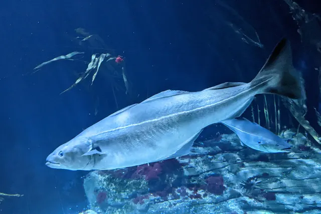 SaitheRegular local target4 placesLoch Long, Troon and Ayr, Saltcoats harbour, Millport and Crocodile RockOver beach, harbour wall, sea loch
- Small-spotted catsharkRegular local target4 placesLoch Long, Saltcoats harbour, Ardrossan, Millport and Crocodile RockOver harbour wall, sea loch
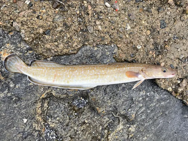
 Conger eelRegular local target3 placesLoch Long, Ardrossan, Millport and Crocodile RockOver harbour wall, sea loch
 Atlantic mackerelSeasonal4 placesLoch Fyne, Largs and the Cumbrae channel, Troon and Ayr, Millport and Crocodile RockOver beach, harbour wall, sea loch, sound or straitAround Jun–Sept
Also documented from the shore: Atlantic cod · Thick-lipped grey mullet · Whiting · European flounder · Dab · European sea bass
From a boat · 2
What these strengths mean
- Regular local target
- Fishing sources describe this as a normal local target here, not merely as caught.
- Seasonal
- Well supported, and concentrated in part of the year rather than spread through it.
- Recorded here
- At least one credible public account of this species being caught here. That is all it means.
- How breadth is counted
- A fish documented at six marks is shown as six marks: breadth never raises the strength on its own. A fishery account describes the fishing; a recorded catch reports one specific catch. How evidence is weighed.
How people fish here
6 methods are recorded on the places documented here, counted from the records themselves rather than from what is practised in the country. Each opens a full guide to the technique.
Float fishing
Recorded at 10 places here, over harbour wall, sea loch, sound or strait, headland.
Suspending a bait at a controlled depth beneath a buoyant indicator — the most visual, most controllable and most widely applicable method in angling.
Documented on the same ground: Ballan wrasse, Conger eel, Pollack, Saithe, Small-spotted catshark, Atlantic cod.
Spinning
Recorded at 9 places here, over harbour wall, sea loch, sound or strait, headland.
Casting an artificial lure and retrieving it so that it moves like something alive — the most direct form of lure fishing.
Documented on the same ground: Ballan wrasse, Conger eel, Pollack, Saithe, Small-spotted catshark, Atlantic cod.
Kayak fishing
Recorded at 8 places here, over sea loch, sound or strait, beach, harbour wall.
A platform rather than a technique: quiet, shallow-draught access to water no other craft reaches, bought at the price of exposure, and a discipline where the decision not to launch is part of the skill.
Documented on the same ground: Ballan wrasse, Conger eel, Pollack, Saithe, Small-spotted catshark, Atlantic mackerel.
Ledgering
Recorded at 8 places here, over harbour wall, sea loch, beach, headland.
Fishing a bait on the bottom held by a weight, with no float — the simplest way to fish at distance, in depth, or in wind.
Documented on the same ground: Ballan wrasse, Conger eel, Pollack, Saithe, Small-spotted catshark, Atlantic cod.
Jigging
Recorded at 5 places here, over sea loch, sound or strait.
Working a weighted lure with a rising-and-falling motion, usually vertically, so it behaves like a wounded or fleeing baitfish.
Documented on the same ground: Ballan wrasse, Conger eel, Pollack, Saithe, Small-spotted catshark, Atlantic mackerel.
Light rock fishing
Recorded at 1 place here, over harbour wall.
Ultralight lure fishing from the shore with tackle rated in single grams — a discipline that catches the fish everybody else steps over, and one FishingHQ held every component of and had never named.
Documented on the same ground: Ballan wrasse, Conger eel, Saithe, Atlantic mackerel, Pollack, European flounder.
These are the methods documented at the places FishingHQ holds here. A species listed beside a method is documented on the same ground, which is not the same as being taken that way — where a source establishes the method a fish was caught on, it is stated on that place’s own page. All fishing methods.
The fishing year here
The months the records under this area actually name, tightest season first. This is “observed in these months” rather than a season: a species whose months nobody recorded is not listed, because a gap in the evidence is not a year-round fishery.
- PollackJune to September
- Atlantic mackerelJune to September
- Atlantic codNovember to February
- Thick-lipped grey mulletJune to September
- WhitingNovember to February
What dominates
Small-boat and charter fishing, which is what the Clyde is for and what its shelter and depth make possible — including a specialist catch-and-release common skate fishery on the deep ground. Shore fishing from rock, shingle and pier along the Ayrshire coast, the island shores and the loch sides. Kayak fishing, for which the sheltered lochs and island shores are unusually well suited by British standards, with the important caveat that the water is deep and cold and the wind funnels down the lochs. Lure and float fishing from the shore for pollack, mackerel and wrasse. Sea trout fishing along the shores and around the burn mouths, which is a Clyde tradition in its own right.
The water available
Deep glacial basins and troughs; sea lochs, several behind shallow sills that separate their deep water from the firth; kelp-fringed rocky island and loch shores; shingle and sand along the mainland coast; soft mud and sediment in the upper firth and inner lochs; strong tidal narrows between the islands; and mud and sand ground offshore that supports the nephrops fishery.
How the rules are structured
Sea angling in Scotland is not licensed, but the framework here is dense and active. Scotland sets its own recreational and commercial sea fisheries measures separately from the rest of the UK. The Firth of Clyde carries marine protected area designations, including one established around common skate, and further spatial measures and closures apply within the firth; several have been the subject of sustained public argument and have changed. Common skate is a critically endangered species and is subject to specific protection, so the fishery is a catch-and-release one and the handling requirements are not optional. Freshwater and migratory fish entering the firth are governed by a different regime again, with district salmon fishery boards and statutory close seasons. Access to the foreshore in Scotland is broadly permitted under Scottish access rights, which does not extend to piers, harbours or private structures. FishingHQ does not state what any current rule is; the Clyde is a place where they change.
Who to ask
- Marine Directorate of the Scottish Government, for sea fisheries measures, marine protected areas and spatial management within Scottish waters.
- NatureScot, for designation and management of the protected sites within the firth.
- The relevant district salmon fishery board, for salmon and sea trout in the rivers entering the firth and in the coastal waters covered by their district.
- The harbour authority or trust at each port and pier, where fishing is from a structure or a small craft is launched.
- The Maritime and Coastguard Agency and the RNLI, for safety guidance in these waters.
Words you will meet
- Sill
- A shallow rock or moraine bar across the mouth of a sea loch, left by the glacier that cut it. Water inside the sill is a partly separate body: it exchanges slowly with the firth, it can stratify, and its deep basin can behave quite differently from water of the same depth outside.
- Common skate
- The great skate of the Clyde, historically the fish that gave these waters an international reputation. It is now understood to be two species rather than one, it is critically endangered, and the fishery is catch-and-release with specific handling expectations. The word 'common' is a survival from a time when it was.
- The narrows
- The constrictions between islands and at loch mouths where the tidal stream accelerates. They concentrate food and fish in the way any tidal restriction does, and they are also where a small craft finds itself in far more water movement than the open firth suggested.
- Nephrops
- The Norway lobster, langoustine or Dublin Bay prawn, which lives in burrows in the soft mud of the deep basins. It is now the commercial mainstay of the Clyde, and the shift from a round-fish fishery to a nephrops and scallop fishery is the single clearest summary of what has changed here.
Conditions and hazards
The Clyde's shelter is real and it produces its own hazard, which is that conditions look manageable in a place where the consequences of immersion are not. The deep basins hold cold water all year, so cold water shock is the operative risk on immersion in July as much as in January, and a kayak or small boat a few hundred metres off a loch shore may be over eighty metres of water. Wind funnels down the sea lochs and accelerates: a loch that was flat when a craft launched can be unworkable an hour later with no change in the general forecast, and the direction is constrained by the topography rather than by the synoptic wind. Tidal streams in the narrows between the islands and at loch mouths are strong enough to hold a paddled craft stationary. The firth carries commercial traffic, ferries on fixed routes and naval movements in some areas. Onshore, rock and kelp-covered shores are slippery, and the west-coast weather changes faster than most visitors expect. A buoyancy aid worn rather than carried, a means of calling for help on the person, and a genuine plan for the wind rather than a hope about it are the measures that address all of this.
A drowned glacier, and why the depth is right against the shore
The Clyde's physical shape is not a coastline that happens to be deep. It is a set of ice-cut troughs that the sea has flooded, and the difference explains everything from where the fish are to why the wind behaves as it does.
ICE CUT DOWNWARDS, NOT OUTWARDS. A glacier occupying a valley erodes vertically far more effectively than water does, and it does so below the level the sea would ever have reached. When the ice went and the sea came in, the result was troughs that are far deeper than the shelf outside them. That is why a hundred metres of water sits a few hundred metres from a beach you can walk onto.
SEVERAL OF THE LOCHS HAVE SILLS. A glacier leaves a moraine, or fails to cut through a hard bar, at the point where it thinned. That leaves a shallow threshold across the mouth of a deep basin. The water inside a sill exchanges slowly with the water outside it, can stratify into layers that do not mix, and can develop quite different temperature and oxygen conditions at depth. In practical terms it means two lochs of the same depth on the same coast are not the same water.
THE SHELTER IS TOPOGRAPHIC AND SO IS THE WIND. Kintyre, Arran and Bute break the Atlantic swell, which is why the Clyde has been small-boat water since small boats existed. But the same steep-sided topography channels wind down the lochs, accelerates it, and makes the local wind direction a function of the hills rather than of the isobars. A forecast for the firth is not a forecast for a loch inside it.
WHAT THE DEPTH DOES BIOLOGICALLY. Cold, deep, slow-exchanging basins with soft mud floors are exactly the habitat of nephrops, which burrow in it, and of the large elasmobranchs that hunt over it. They are not, in themselves, productive habitat for the shoaling round fish the Clyde was once famous for, which used the shallower ground and the whole system together.
AND THE NARROWS ARE THE FISHING. Every constriction — between islands, at a loch mouth, over a sill — accelerates the tidal stream, concentrates food, and produces the reliable arrangement of moving water and slack water beside it that predators exploit. On a firth where much of the ground is featureless deep mud, the narrows are disproportionately important.
Backed by research — why, and the sources (4)
Supported by peer-reviewed research or fisheries science. The sources are listed and can be checked.
- Cefas science, advice and data on marine and freshwater environments — Centre for Environment, Fisheries and Aquaculture Science (Government fisheries body)Relied on for: Marine environmental science for UK shelf seas, including the physical characterisation of sediment, coastal process and the monitoring programmes that describe them.States this directlyCitation checked — the work exists and is described correctly
- ICES Advice on fishing opportunities, catch and effort — International Council for the Exploration of the Sea (Scientific institute)Relied on for: Ecoregion description, stock distribution and the hydrography of the sea areas assessed.States this directlyCitation checked — the work exists and is described correctly
- JNCC species and habitat conservation advice — Joint Nature Conservation Committee (Conservation authority)Relied on for: Designation, habitat description and conservation status of the marine, coastal and freshwater habitats named.States this directlyCitation checked — the work exists and is described correctly
- The Fishes of the British Isles and North-West Europe — Macmillan, 1969 (Reference work)Relied on for: Distribution, habitat association and biology of the fishes of the British Isles named here.States this directlyCitation checked — the work exists and is described correctly
The fishery that was, and the honest account of what happened
The Clyde is the place to learn what a fishery collapse looks like from the inside, because it is unusually well recorded and because anglers watched it happen.
WHAT IT WAS. Through the middle of the twentieth century the Clyde carried a sea angling fishery of a scale that is difficult to credit now: cod, haddock and whiting in quantity, a long-running international sea angling festival built on them, and a common skate fishery whose fish were the largest routinely caught anywhere in Europe. Charter fleets worked out of the firth's towns on the strength of it.
WHAT HAPPENED IS NOT ONE THING. Sustained heavy fishing pressure on the round-fish stocks; a change in the pattern of trawling that followed the removal of long-standing spatial restrictions on the firth; the removal of large predators from the system; and the accumulated effect of a nearly enclosed basin absorbing all of it with little exchange. Different accounts weight those causes differently, and the argument is live rather than settled.
WHAT IS NOT IN DISPUTE is the outcome. The demersal round-fish fishery is commercially finished. Cod, haddock and whiting are at a small fraction of their former abundance. The commercial fishery is now overwhelmingly nephrops and scallops. The angling festival that was built on the old fishery does not run on it.
THE SKATE ARE THE OTHER STORY, and it runs the other way. Common skate — now recognised as two species, and critically endangered — persisted in the deep basins, and the Clyde holds one of the most significant remaining populations in the world. That fishery is now catch-and-release, closely studied, tagged, and supported by anglers who have become a substantial part of the science. A marine protected area was established around it.
WHY THIS BELONGS ON A FISHING SITE rather than in a policy paper. Because a reader arriving at the Clyde with a forty-year-old book, or a reputation absorbed second-hand, will fish for something that is not there and conclude they are doing it wrong. And because the Clyde is the clearest available demonstration that a sea fishery is a thing that can be lost, in a lifetime, in a place people are still fishing.
Backed by research — why, and the sources (4)
Supported by peer-reviewed research or fisheries science. The sources are listed and can be checked.
- Cefas science, advice and data on marine and freshwater environments — Centre for Environment, Fisheries and Aquaculture Science (Government fisheries body)Relied on for: Marine environmental science for UK shelf seas, including the physical characterisation of sediment, coastal process and the monitoring programmes that describe them.States this directlyCitation checked — the work exists and is described correctly
- ICES Advice on fishing opportunities, catch and effort — International Council for the Exploration of the Sea (Scientific institute)Relied on for: Ecoregion description, stock distribution and the hydrography of the sea areas assessed.States this directlyCitation checked — the work exists and is described correctly
- JNCC species and habitat conservation advice — Joint Nature Conservation Committee (Conservation authority)Relied on for: Designation, habitat description and conservation status of the marine, coastal and freshwater habitats named.States this directlyCitation checked — the work exists and is described correctly
- The Fishes of the British Isles and North-West Europe — Macmillan, 1969 (Reference work)Relied on for: Distribution, habitat association and biology of the fishes of the British Isles named here.States this directlyCitation checked — the work exists and is described correctly
What is actually there now, through a year
A description of the present fishery, written to be useful rather than to protect a reputation.
THE SKATE FISHERY IS THE HEADLINE and it is a specialist one. It is deep-water boat fishing over the soft basins, it is catch-and-release without exception, and the handling matters enormously: these are large, slow-growing, critically endangered animals and a badly handled fish is a real loss to the population rather than a bad day. Anglers fishing it are generally working with the tagging and recording programmes, and that is the way into it.
SPURDOG ARE PRESENT IN NUMBERS and have recovered strongly in these waters, to the point where they are frequently the fish that finds the bait first. They are a shoaling deep-water dogfish with a spine in front of each dorsal fin, and they need handling accordingly.
THORNBACK AND OTHER RAYS over the cleaner mixed ground, through the warmer months in particular.
MACKEREL AND POLLACK in season — mackerel inshore in summer, pollack over the kelp edges and around the rocky island shores through much of the year. Coalfish over the same ground and generally deeper.
WRASSE on the rocky shores in summer, which is a straightforward and genuinely good shore fishery here.
SEA TROUT along the shores and around the burn mouths, which is an old Clyde tradition and a demanding one, weighted to spring and early summer.
AND CODLING, WHITING AND HADDOCK exist rather than abound. A reader should expect to encounter them and should not plan a trip around them.
WHAT DRIVES THE SEASON is less the water temperature than in the North Sea and more the wind, because the fishing here is largely boat fishing in a firth where the wind decides whether you go out. The practical calendar is: settled spells from late spring through early autumn for the deep-water fishing, summer for the shore and the wrasse, and a shore fishery through the colder months that is quieter but perfectly workable in shelter the open coast does not have.
What experienced anglers do — why, and the sources (4)
Widely and independently recommended by experienced anglers and specialist sources. This is real angling knowledge, not proof: controlled evidence for it is limited, and FishingHQ records it as convention rather than as a demonstrated effect.
- Fishers' Craft and Lettered Art: Tracts on Fishing from the End of the Middle Ages — University of Toronto Press, 1997 (Scientific literature)Relied on for: That fishing traditions develop around the water and fish available to them, and the historical method of reading such traditions.States this directlyCitation checked — the work exists and is described correctly
- General angling website restatements of established technique — Various (Credible secondary source)Relied on for: Widely restated descriptions of regional angling practice, recorded as practitioner consensus rather than as scholarship.Background and mechanism onlyCitation checked — the work exists and is described correctly
- JNCC species and habitat conservation advice — Joint Nature Conservation Committee (Conservation authority)Relied on for: Designation, habitat description and conservation status of the marine, coastal and freshwater habitats named.States this directlyCitation checked — the work exists and is described correctly
- The Fishes of the British Isles and North-West Europe — Macmillan, 1969 (Reference work)Relied on for: Distribution, habitat association and biology of the fishes of the British Isles named here.States this directlyCitation checked — the work exists and is described correctly
Sheltered water that is still cold, deep and windy
The Clyde's particular safety problem is that it does not look like the sea, and the consequences of getting it wrong are the sea's consequences.
THE WATER IS COLD ALL YEAR IN THE DEEP. Surface temperatures in the sea lochs rise in summer but the basins beneath do not, and a person in the water in a firth in July is in cold water. Cold water shock — the involuntary gasp and the loss of breathing control in the first seconds — decides the outcome of an immersion far more than swimming ability does.
THE DEPTH IS IMMEDIATELY OFFSHORE. A kayak or small boat a couple of hundred metres from a loch shore may be over sixty or eighty metres. There is no shallow margin to stand up in, and a swim back is a swim in cold water rather than a wade.
THE WIND IS A LOCAL PHENOMENON. Steep-sided lochs channel and accelerate wind, and they do it in a direction set by the hills rather than by the general forecast. A loch that was glass at launch can be unworkable an hour later while the shipping forecast for the firth has not changed. Wind against tide in a narrows produces a short steep sea out of proportion to the wind strength.
THE STREAMS IN THE NARROWS ARE STRONG. A paddled craft can be held stationary or set backwards through a constriction, and a drifting boat can find itself carried further and faster than intended.
AND THE FIRTH IS BUSY. Ferries run fixed routes on schedule, commercial traffic uses the deep channels, and there is naval activity in parts of it. A small craft is difficult to see and has no right to be where a ferry is turning.
WHAT ADDRESSES IT is unglamorous and consistent: a buoyancy aid worn rather than stowed, a means of calling for help carried on the person, a genuine wind plan with a stated turnaround time and an escape shore, and telling somebody ashore where the craft is going and when it will be back.
What experienced anglers do — why, and the sources (4)
Widely and independently recommended by experienced anglers and specialist sources. This is real angling knowledge, not proof: controlled evidence for it is limited, and FishingHQ records it as convention rather than as a demonstrated effect.
- RNLI water safety guidance: cold water shock and Float to Live — Royal National Lifeboat Institution (Water-safety or diver-training authority)Relied on for: Cold water shock and the immersion response, tidal cut-off, and water-safety guidance for shore anglers and small-craft users.States this directlyPassage read and verified
- Met Office shipping forecast, inshore waters forecast and marine warnings — Met Office, United Kingdom (Government fisheries body)Relied on for: That inshore waters forecasts, sea state and swell are the operative inputs for shore and small-craft decisions in these waters.States this directlyCitation checked — the work exists and is described correctly
- Fishers' Craft and Lettered Art: Tracts on Fishing from the End of the Middle Ages — University of Toronto Press, 1997 (Scientific literature)Relied on for: That fishing traditions develop around the water and fish available to them, and the historical method of reading such traditions.States this directlyCitation checked — the work exists and is described correctly
- General angling website restatements of established technique — Various (Credible secondary source)Relied on for: Widely restated descriptions of regional angling practice, recorded as practitioner consensus rather than as scholarship.Background and mechanism onlyCitation checked — the work exists and is described correctly
Shelter is the hazard here, because it makes deep cold water look like a pond
The Clyde's great virtue is that it is sheltered. Kintyre and the islands keep Atlantic swell out, the lochs are enclosed, and on a great many days the water is flat when the open coast is not. That shelter is real, and it is also the mechanism, because it makes a place look benign where the consequences of going in are as serious as anywhere in Britain.
WHAT IS ACTUALLY UNDER THE BOAT. This is a drowned glacial trough. The main basins and several of the sea lochs exceed a hundred metres within a short distance of the shore, which means a kayak a few hundred metres off a loch side may be over eighty metres of water. That deep water is cold all year — the surface warms only thinly — so immersion in July is immersion in cold water, the gasp response and loss of breathing control arrive within seconds, and there is nothing to stand on and frequently nobody in sight to see it.
THE FLAT SURFACE IS DOING NOTHING TO CHANGE ANY OF THAT. It is only removing the signal that would otherwise make somebody wear the buoyancy aid rather than sit on it.
THE WIND IS MADE BY THE GROUND, NOT DELIVERED BY THE FORECAST. Sea lochs are steep-sided trenches. Air drains off high ground, accelerates downhill and arrives on the water from a direction the synoptic chart does not predict, at a strength it does not predict either, with no change in the general weather to announce it. A loch that was flat at launch can be unworkable within the hour while the firth's forecast stays accurate and unchanged. Treat the loch's own wind as the forecast, fix a turnaround time and a named escape shore before launching, and read any increase as the beginning of a trend rather than as a gust.
THE NARROWS ARE THE THIRD ELEMENT. Streams between the islands and at loch mouths run strongly enough to hold a paddled craft stationary, and wind against one of them produces a short steep sea in a place that is otherwise sheltered. That is the combination — katabatic wind off the hill, meeting a stream through a narrows, on a small craft, over cold deep water — and it is a sequence rather than a list.
AND THIS IS A WORKING WATERWAY. Scheduled ferries on fixed routes, commercial traffic in the deep channels, and naval movements in some areas. A kayak or small boat is very hard to see from a ship's bridge and cannot get out of the way of a vessel that is already committed to its course. Know where the ferry routes are and stay off them, cross channels at right angles and quickly, carry something that makes you visible, and never assume you have been seen.
WHAT ACTUALLY HELPS. A buoyancy aid worn rather than carried. A means of calling for help on the person. A plan for the wind rather than a hope about it. Not going alone, particularly out of season when there is nobody else afloat to notice. And checking the current inshore waters forecast and the tidal streams before launching — the shelter is genuine and it is not a substitute for either.
Official guidance — why, and the sources (3)
Stated by a fisheries authority, scientific institute or recognised angling body. Authoritative, but summarising rather than demonstrating.
- RNLI water safety guidance: cold water shock and Float to Live — Royal National Lifeboat Institution (Water-safety or diver-training authority)Relied on for: Cold water shock and the immersion response, tidal cut-off, and water-safety guidance for shore anglers and small-craft users.States this directlyPassage read and verified
- Met Office shipping forecast, inshore waters forecast and marine warnings — Met Office, United Kingdom (Government fisheries body)Relied on for: That inshore waters forecasts, sea state, swell and wind are the operative inputs for shore and small-craft decisions, and the spatial resolution at which those forecasts are issued.States this directlyCitation checked — the work exists and is described correctly
- Cefas science, advice and data on marine and freshwater environments — Centre for Environment, Fisheries and Aquaculture Science (Government fisheries body)Relied on for: Marine environmental science for UK shelf seas, including tidal range, tidal streams, coastal process, sediment characterisation and the monitoring programmes that describe them.States this directlyCitation checked — the work exists and is described correctly
Some of what lives here
Fish recorded here that FishingHQ holds a reviewed photograph of. It is not a complete list of what The Firth of Clyde holds, and it is not a prediction that you will catch any of them — it is a way in to the ones we can show you.
- PollackA fast gadoid that hunts up off reefs and wrecks and takes a lure on the drop — and the sea fish most likely to convert a bait angler to lure fishing.
Wilhelm Thomas Fiege — CC BY-SA 4.0, via Wikimedia Commons
- Atlantic mackerelA fast, schooling, obligate-swimming pelagic fish that arrives inshore in summer in enormous numbers, and the species most sea anglers catch first.
Hans Hillewaert — CC BY-SA 4.0, via Wikimedia Commons
- Ballan wrasseA long-lived rocky-ground resident that begins life female and may change sex — and the species that turned rock marks into a lure fishery.
Diego Delso — CC BY-SA 4.0, via Wikimedia Commons
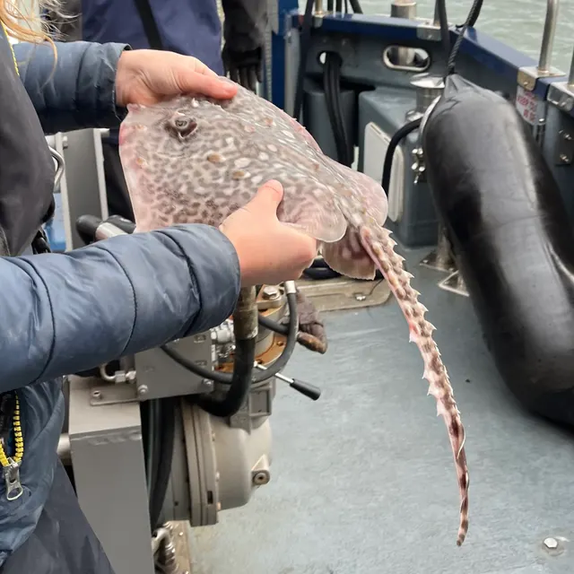 Thornback rayThe commonest European ray, covered in thorn-like bucklers, laying horny egg cases known as mermaid's purses, and requiring careful handling on release.
Ella McCausland — CC BY, via iNaturalist
 Atlantic codA large, heavily-built demersal predator of the North Atlantic, and the species whose commercial history is the standard example of stock collapse.
The U.S. Food and Drug Administration, Public domain, via Wikimedia Commons
 WhitingA small, abundant, silver gadoid of European coasts, a mainstay of winter shore fishing and distinguished by a dark spot at the pectoral fin base.
rmjb — CC BY, via iNaturalist
 European sea bassA fast, predatory inshore fish that hunts in broken water and surf, and one of the most closely managed recreational species in European seas.
Julien Renoult — CC BY 4.0, via Wikimedia Commons
Places within this area
Publicly documented fishing geography. FishingHQ describes what the ground is; it does not say whether you may fish it, and every one of these sends that question to the body that holds the answer. Browse every place in this part of the world.
Who to ask before fishing any of these
FishingHQ does not know the current access position here. Sea angling in Scotland is not rod-licensed, but access rights under the Scottish Outdoor Access Code carry responsibilities, and harbour, local authority, marine conservation and fisheries measures all apply and all change. Check the current position with the Marine Directorate, the harbour or local authority and the land manager before going.
Loch Fyne
Sea loch · Salt water
The longest sea loch in Scotland, running some sixty-five kilometres from the Sound of Bute into Argyll, with a deep central channel, soft mud basins, rock shores and extensive shellfish ground.
Sheltered along most of its length; the mouth opens to the Firth of Clyde. Down-loch wind over a long fetch produces a short steep sea.
Particular to this ground: cold water shock.
Severe hazards of The Firth of Clyde apply here: boat safety.
Particular to this water: Shellfish harvesting areas are classified for food safety and are opened and closed on monitoring results a gatherer cannot see. Neither cooking nor appearance removes a biotoxin. Check the current classification with the local authority before taking anything.
Loch Long
Sea loch · Salt water
A long narrow fjordic loch running north from the Clyde between steep hillsides, deep throughout, with a naval facility partway along it and very little shallow margin anywhere.
Severe hazards of The Firth of Clyde apply here: cold water shock, boat safety.
The Kyles of Bute
Sound or strait · Salt water
A narrow winding channel separating Bute from the Cowal peninsula, with a shallow rock narrows at the Burnt Islands, deep water either side and strong streams through the constriction.
Severe hazards of The Firth of Clyde apply here: cold water shock, boat safety.
Dunoon and the Holy Loch
Sea loch · Salt water
A short shallow sea loch off the upper Clyde with soft mud and sand, a marina at its head, and the deeper firth channel immediately outside its mouth at Dunoon.
Severe hazards of The Firth of Clyde apply here: cold water shock, boat safety.
Largs and the Cumbrae channel
Sound or strait · Salt water
The channel between the Ayrshire coast and Great Cumbrae, with a deep trench, a marina at Largs and one of the longest-running marine biological stations in Britain on the island shore.
Severe hazards of The Firth of Clyde apply here: cold water shock, boat safety.
Campbeltown Loch
Sea loch · Salt water
A sheltered sea loch on the east side of Kintyre with an island across its mouth, soft mud and sand inside and rock ground round the entrance.
Severe hazards of The Firth of Clyde apply here: cold water shock, boat safety.
The Mull of Kintyre
Headland · Salt water
A steep hard headland at the southern tip of Kintyre, twenty kilometres from Ireland across the North Channel, with deep water close in and a powerful race running past it.
Particular to this ground: moving water and currents.
Severe hazards of The Firth of Clyde apply here: cold water shock, boat safety.
Troon and Ayr
Beach · Salt water
Long clean sand beaches on the Ayrshire coast with harbours at both towns, over sand and mud, looking west across the firth to Arran with the deeper channel some way offshore.
Severe hazards of The Firth of Clyde apply here: cold water shock, boat safety.
4 more places in this area
Girvan
Harbour wall · Salt water
A river-mouth harbour on the south Ayrshire coast over sand and shingle, looking out at Ailsa Craig's granite dome ten miles offshore.
Severe hazards of The Firth of Clyde apply here: cold water shock, boat safety.
Saltcoats harbour
Harbour wall · Salt water
A small drying harbour behind a rock shore on the Ayrshire coast, with the old harbour walls, the sea wall along the promenade and reef running out on both sides. The reef is the fishing; the harbour is where you stand.
Open west across the firth to Arran.
Particular to this ground: cliffs and rock platforms.
Severe hazards of The Firth of Clyde apply here: cold water shock, boat safety.
Particular to this water: This is an owned and operated structure. Whether angling is allowed on it, when, from where and on what terms is the operator's decision, is frequently seasonal, and changes without notice.
Ardrossan
Harbour wall · Salt water
The ferry harbour and the rock shore at Ardrossan point, with breakwater stone, the harbour channel and low reef between them. Working port ground, with a dredged channel giving depth close to the wall.
Open west across the firth.
Severe hazards of The Firth of Clyde apply here: cold water shock, boat safety.
Particular to this water: This is an owned and operated structure. Whether angling is allowed on it, when, from where and on what terms is the operator's decision, is frequently seasonal, and changes without notice.
Millport and Crocodile Rock
Harbour wall · Salt water
The bay and old quay at Millport on Great Cumbrae, with the painted boulder the island is known for on the shore beside it and rock, weed and shell ground all round the bay. Sheltered water inside a firth that is itself sheltered.
Sheltered inside the firth, open south across the Tan.
Severe hazards of The Firth of Clyde apply here: cold water shock, boat safety.
Safety
Cold water shock — Can cause serious injury or death
The deep basins hold cold water year round and the surface warms only thinly. Immersion produces an involuntary gasp and loss of breathing control within seconds, in water too deep to stand in and frequently out of sight of anybody.
What reduces it: Wear a buoyancy aid rather than carry one, carry a means of calling for help on the person, do not go out alone, and treat summer water here as cold water because at any depth it is.
Worse when:
- In the sea lochs, where deep cold water lies immediately below a thin warm surface layer.
- Out of season, when there is nobody else afloat to see an incident.
Boat safety — Can cause serious injury or death
Wind funnels down the steep-sided sea lochs, accelerates, and blows in a direction set by the topography rather than by the general forecast. Conditions that were flat at launch become unworkable within an hour with no change in the synoptic picture.
What reduces it: Plan for the loch's own wind rather than the firth's forecast, fix a turnaround time and an escape shore before launching, and treat any increase in wind as the start of a trend rather than a gust.
Worse when:
- In the narrows and at loch mouths, where wind against a strong tidal stream produces a short steep sea.
- On a long crossing with no escape shore under the lee.
Boat traffic and being seen — Can cause injury needing treatment
The firth carries scheduled ferry routes, commercial traffic in the deep channels and naval movements in some areas. A small craft or kayak is very hard to see from a ship's bridge and cannot manoeuvre out of the way of a vessel that is already committed.
What reduces it: Know the ferry routes and stay clear of them, cross channels at right angles and quickly, carry means of being seen, and do not assume a vessel has seen you.
Check the rules before you fish
Fishing laws, bylaws, access rules, seasons, bait restrictions and permitted methods vary by location and can change. Check the current rules from the relevant authority and the water you intend to fish before fishing.
Check with:
- Current national or regional law for where you are fishing
- Current local bylaws
- The relevant fisheries authority
- The landowner, club or fishery whose water it is
- Any restrictions specific to the species or the method you intend to use
Where to go next
What swims here
- Atlantic codPresent rather than abundant. The Clyde's round-fish fishery collapsed within living memory and cod is now encountered rather than targeted; the association is recorded honestly at that level and not at the level the older literature implies.
- Atlantic mackerelInshore through the summer, in the narrows and around the island shores where the tidal stream concentrates food.
- Ballan wrasseOn the rocky, kelp-fringed shores of the islands and the sea lochs through the warmer months.
- European sea bassIn the warmer months in the shallower southern parts of the firth and around the Ayrshire coast, at what has been the northern limit of consistent occurrence and is moving.
- PollackOver the kelp edges and rocky island and loch shores throughout the firth, and one of the more dependable species left in it for a shore angler.
- Thornback rayOver the cleaner mixed ground of the firth, principally through the warmer months.
- WhitingAs with cod, present at a small fraction of the abundance that supported the firth's historic sea angling fishery.
How this compares
- Scottish sea lochsThe Clyde is the largest sea-loch system in Britain read as one water. The sea lochs page explains the sill and the basin; the Clyde page explains what happens when a whole firth of them is fished hard and nearly enclosed.
- Strangford Lough and the Ards coastTwo sheltered Irish Sea systems whose shelter is the hazard, and whose famous angling species — skate here, the whole round-fish fishery there — collapsed within living memory. The pair is the clearest available British and Irish case study in what a sea angling fishery losing its stock looks like.
Environment and conservation
- Fish stocks and sustainabilityThe Clyde is the clearest British case of a sea angling fishery collapsing within living memory. The round-fish fishery is commercially finished and the commercial fishery is now overwhelmingly nephrops and scallops.
- Marine protected areas and spearfishingThe firth carries spatial measures including a designation established around common skate, and the argument about what has and has not worked here is live rather than settled.
Sources and evidence
- Cefas science, advice and data on marine and freshwater environments — Centre for Environment, Fisheries and Aquaculture Science (Government fisheries body)Relied on for: Marine environmental science for UK shelf seas, including the physical characterisation of sediment, coastal process and the monitoring programmes that describe them.States this directlyCitation checked — the work exists and is described correctly
- ICES Advice on fishing opportunities, catch and effort — International Council for the Exploration of the Sea (Scientific institute)Relied on for: Ecoregion description, stock distribution and the hydrography of the sea areas assessed.States this directlyCitation checked — the work exists and is described correctly
- JNCC species and habitat conservation advice — Joint Nature Conservation Committee (Conservation authority)Relied on for: Designation, habitat description and conservation status of the marine, coastal and freshwater habitats named.States this directlyCitation checked — the work exists and is described correctly
- The Fishes of the British Isles and North-West Europe — Macmillan, 1969 (Reference work)Relied on for: Distribution, habitat association and biology of the fishes of the British Isles named here.States this directlyCitation checked — the work exists and is described correctly
- RNLI water safety guidance: cold water shock and Float to Live — Royal National Lifeboat Institution (Water-safety or diver-training authority)Relied on for: Cold water shock and the immersion response, tidal cut-off, and water-safety guidance for shore anglers and small-craft users.States this directlyPassage read and verified
- Met Office shipping forecast, inshore waters forecast and marine warnings — Met Office, United Kingdom (Government fisheries body)Relied on for: That inshore waters forecasts, sea state and swell are the operative inputs for shore and small-craft decisions in these waters.States this directlyCitation checked — the work exists and is described correctly
Why the 12 connections on this page are here, and the sources
What swims here
Backed by research — 7 connections
Supported by peer-reviewed research or fisheries science. The sources are listed and can be checked.
Atlantic cod
A claim that a place contains the ground, water and seasonal conditions the species is associated with. It is a distributional statement about the world, it rests on the regional reference literature, and it deliberately asserts nothing about access, permission or catch.
- The Fishes of the British Isles and North-West Europe — Macmillan, 1969 (Reference work)Relied on for: Distribution and habitat association of the marine, estuarine and freshwater fishes of the British Isles, including which coasts and ground types a species occupies.States this directlyCitation checked — the work exists and is described correctly
- FishBase: a global information system on fishes — Froese, R. and D. Pauly, eds. — FishBase Consortium (Scientific institute)Relied on for: Recorded distribution, depth range and habitat association for the species named.States this directlyPassage read and verified
Atlantic mackerel
A claim that a place contains the ground, water and seasonal conditions the species is associated with. It is a distributional statement about the world, it rests on the regional reference literature, and it deliberately asserts nothing about access, permission or catch.
- The Fishes of the British Isles and North-West Europe — Macmillan, 1969 (Reference work)Relied on for: Distribution and habitat association of the marine, estuarine and freshwater fishes of the British Isles, including which coasts and ground types a species occupies.States this directlyCitation checked — the work exists and is described correctly
- FishBase: a global information system on fishes — Froese, R. and D. Pauly, eds. — FishBase Consortium (Scientific institute)Relied on for: Recorded distribution, depth range and habitat association for the species named.States this directlyPassage read and verified
Ballan wrasse
A claim that a place contains the ground, water and seasonal conditions the species is associated with. It is a distributional statement about the world, it rests on the regional reference literature, and it deliberately asserts nothing about access, permission or catch.
- The Fishes of the British Isles and North-West Europe — Macmillan, 1969 (Reference work)Relied on for: Distribution and habitat association of the marine, estuarine and freshwater fishes of the British Isles, including which coasts and ground types a species occupies.States this directlyCitation checked — the work exists and is described correctly
- FishBase: a global information system on fishes — Froese, R. and D. Pauly, eds. — FishBase Consortium (Scientific institute)Relied on for: Recorded distribution, depth range and habitat association for the species named.States this directlyPassage read and verified
European sea bass
A claim that a place contains the ground, water and seasonal conditions the species is associated with. It is a distributional statement about the world, it rests on the regional reference literature, and it deliberately asserts nothing about access, permission or catch.
- The Fishes of the British Isles and North-West Europe — Macmillan, 1969 (Reference work)Relied on for: Distribution and habitat association of the marine, estuarine and freshwater fishes of the British Isles, including which coasts and ground types a species occupies.States this directlyCitation checked — the work exists and is described correctly
- FishBase: a global information system on fishes — Froese, R. and D. Pauly, eds. — FishBase Consortium (Scientific institute)Relied on for: Recorded distribution, depth range and habitat association for the species named.States this directlyPassage read and verified
Pollack
A claim that a place contains the ground, water and seasonal conditions the species is associated with. It is a distributional statement about the world, it rests on the regional reference literature, and it deliberately asserts nothing about access, permission or catch.
- The Fishes of the British Isles and North-West Europe — Macmillan, 1969 (Reference work)Relied on for: Distribution and habitat association of the marine, estuarine and freshwater fishes of the British Isles, including which coasts and ground types a species occupies.States this directlyCitation checked — the work exists and is described correctly
- FishBase: a global information system on fishes — Froese, R. and D. Pauly, eds. — FishBase Consortium (Scientific institute)Relied on for: Recorded distribution, depth range and habitat association for the species named.States this directlyPassage read and verified
Thornback ray
A claim that a place contains the ground, water and seasonal conditions the species is associated with. It is a distributional statement about the world, it rests on the regional reference literature, and it deliberately asserts nothing about access, permission or catch.
- The Fishes of the British Isles and North-West Europe — Macmillan, 1969 (Reference work)Relied on for: Distribution and habitat association of the marine, estuarine and freshwater fishes of the British Isles, including which coasts and ground types a species occupies.States this directlyCitation checked — the work exists and is described correctly
- FishBase: a global information system on fishes — Froese, R. and D. Pauly, eds. — FishBase Consortium (Scientific institute)Relied on for: Recorded distribution, depth range and habitat association for the species named.States this directlyPassage read and verified
Whiting
A claim that a place contains the ground, water and seasonal conditions the species is associated with. It is a distributional statement about the world, it rests on the regional reference literature, and it deliberately asserts nothing about access, permission or catch.
- The Fishes of the British Isles and North-West Europe — Macmillan, 1969 (Reference work)Relied on for: Distribution and habitat association of the marine, estuarine and freshwater fishes of the British Isles, including which coasts and ground types a species occupies.States this directlyCitation checked — the work exists and is described correctly
- FishBase: a global information system on fishes — Froese, R. and D. Pauly, eds. — FishBase Consortium (Scientific institute)Relied on for: Recorded distribution, depth range and habitat association for the species named.States this directlyPassage read and verified
How people fish here
What experienced anglers do — 1 connection
Widely and independently recommended by experienced anglers and specialist sources. This is real angling knowledge, not proof: controlled evidence for it is limited, and FishingHQ records it as convention rather than as a demonstrated effect.
Sea fishing
A claim about angling convention rather than about the world: that this place sits within this branch of fishing, which drives the information architecture as well as the page. It rests on independent practitioner description.
- General angling website restatements of established technique — Various (Credible secondary source)Relied on for: Widely restated descriptions of which practices are conventionally used in the waters named, recorded as practitioner consensus rather than as scholarship.Background and mechanism onlyCitation checked — the work exists and is described correctly
- Sea Angler — Bauer Media (Specialist angling publication)Relied on for: Long-running published description of British sea angling practice by region and by ground type.FishingHQ's interpretation of what it saysCitation checked — the work exists and is described correctly
How this compares
What experienced anglers do — 2 connections
Widely and independently recommended by experienced anglers and specialist sources. This is real angling knowledge, not proof: controlled evidence for it is limited, and FishingHQ records it as convention rather than as a demonstrated effect.
Scottish sea lochs
A claim that two places are worth reading against one another, because a reader choosing between them or generalising from one to the other needs to know how the underlying process differs.
- General angling website restatements of established technique — Various (Credible secondary source)Relied on for: Widely restated descriptions of which practices are conventionally used in the waters named, recorded as practitioner consensus rather than as scholarship.Background and mechanism onlyCitation checked — the work exists and is described correctly
- Sea Angler — Bauer Media (Specialist angling publication)Relied on for: Long-running published description of British sea angling practice by region and by ground type.FishingHQ's interpretation of what it saysCitation checked — the work exists and is described correctly
Strangford Lough and the Ards coast
A claim that two places are worth reading against one another, because a reader choosing between them or generalising from one to the other needs to know how the underlying process differs.
- General angling website restatements of established technique — Various (Credible secondary source)Relied on for: Widely restated descriptions of which practices are conventionally used in the waters named, recorded as practitioner consensus rather than as scholarship.Background and mechanism onlyCitation checked — the work exists and is described correctly
- Sea Angler — Bauer Media (Specialist angling publication)Relied on for: Long-running published description of British and Irish sea angling practice by region and by ground type.FishingHQ's interpretation of what it saysCitation checked — the work exists and is described correctly
Environment and conservation
Backed by research — 2 connections
Supported by peer-reviewed research or fisheries science. The sources are listed and can be checked.
Fish stocks and sustainability
A claim that a place raises a particular environmental question, resting on the scientific and conservation literature for the system rather than on angling practice.
- JNCC species and habitat conservation advice — Joint Nature Conservation Committee (Conservation authority)Relied on for: Habitat classification and description for the intertidal, coastal and freshwater habitats named, and the species characteristically associated with them.States this directlyCitation checked — the work exists and is described correctly
- Cefas science, advice and data on marine and freshwater environments — Centre for Environment, Fisheries and Aquaculture Science (Government fisheries body)Relied on for: Characterisation of UK inshore sediment, intertidal habitat and the shellfish beds associated with them.States this directlyCitation checked — the work exists and is described correctly
Marine protected areas and spearfishing
A claim that a place raises a particular environmental question, resting on the scientific and conservation literature for the system rather than on angling practice.
- JNCC species and habitat conservation advice — Joint Nature Conservation Committee (Conservation authority)Relied on for: Habitat classification and description for the intertidal, coastal and freshwater habitats named, and the species characteristically associated with them.States this directlyCitation checked — the work exists and is described correctly
- Cefas science, advice and data on marine and freshwater environments — Centre for Environment, Fisheries and Aquaculture Science (Government fisheries body)Relied on for: Characterisation of UK inshore sediment, intertidal habitat and the shellfish beds associated with them.States this directlyCitation checked — the work exists and is described correctly
How FishingHQ labels evidence is explained in the evidence policy.