The Norfolk and Suffolk sandbank coast
Fishing regions · Last reviewed 2026-08-15
A soft, moving coast in front of a field of offshore sandbanks. The banks make the fishing and the softness makes the coast retreat — the same sediment system does both.
Safety: cold water shock — can cause serious injury or death. 7 more points apply here.
Being listed here is not permission to fish. What that meansClose
Access, fishing rights, seasons, licences, local bylaws and permitted methods vary and can change. Check current access, permission, local regulations, closures and restrictions before you travel or fish. FishingHQ describes what the ground is and names who holds the answer; it does not hold the answer itself.
Find the authority for a jurisdiction · What FishingHQ does and does not cover
The coast from the Wash round to the Suffolk estuaries is a coast-tier case because one system — a shallow shelf sea full of mobile sand — explains the ground, the species, the seasons and the reason the land is disappearing.
THE DEFINING FEATURE IS OFFSHORE AND INVISIBLE. A field of sandbanks lies off this coast, some of them many kilometres long, running broadly parallel to the shore and separated by deeper channels. They are built and maintained by strong tidal streams working on an enormous supply of sand, and they are dynamic: they migrate, they change shape, and the channels between them shift.
BANKS CONCENTRATE FISH BECAUSE THEY CONCENTRATE WATER. A tidal stream forced over and around a bank accelerates, scours the channel edges, and produces exactly the arrangement predatory fish exploit — food swept off the bank into a defined lane, and slack water behind the bank in which to wait for it. That is why the edges of the banks matter far more than their tops, and why the state of the tide changes which side of a bank is the working one.
THE SHORE IS SOFT AND IT IS LOSING. Much of this coast is glacial till, sand and shingle rather than rock, and it is among the fastest-eroding coastline in Europe. Longshore drift runs broadly southward, stripping material from the north and delivering it southward to build spits and choke estuaries. Villages have gone into the sea within recorded history and continue to. That is not a historical curiosity: it means the beach an angler fished last winter may not be there, and it is the reason this page describes a process rather than listing marks.
THE FISHING IS A COLD-SEA SHORE FISHERY WITH A WARM-SEA SUMMER. Winter brings cod, whiting and dab inshore onto the beaches — this coast is one of the classic winter cod fisheries of Britain, and the season is defined by water temperature and by rough weather stirring food out of the sand rather than by a date. Summer brings bass, smoothhound, tope and rays over the same ground, along with mackerel when the water is right.
AND THE ESTUARIES ARE A DIFFERENT FISHERY AGAIN. The Suffolk and north Norfolk estuaries and harbours are shallow, muddy, warm in summer and heavily used by bass, mullet and flounder, and they behave nothing like the open beach a mile away.
What fishing here is like
A low, soft, actively eroding coast of sand, shingle and glacial till fronting a shallow North Sea shelf that carries an extensive field of mobile offshore sandbanks. Beaches are generally shallow-gradient sand and shingle with groyne fields and sea defences over much of their length. Behind them lie shallow estuaries, harbours, tidal creeks and grazing marsh. Water is turbid — this is a sediment-rich sea — and visibility is generally poor, which shapes both the fishing and the feeding.
What you can target here
One entry per fish, grouped by how you would be fishing — because the answer is a different one from the rocks and from a boat. Each entry says how strongly the sources support it and how much evidence sits behind it. These are documented catches, not a forecast, and none of it is a statement that you may fish any particular ground.
From the shore · 15
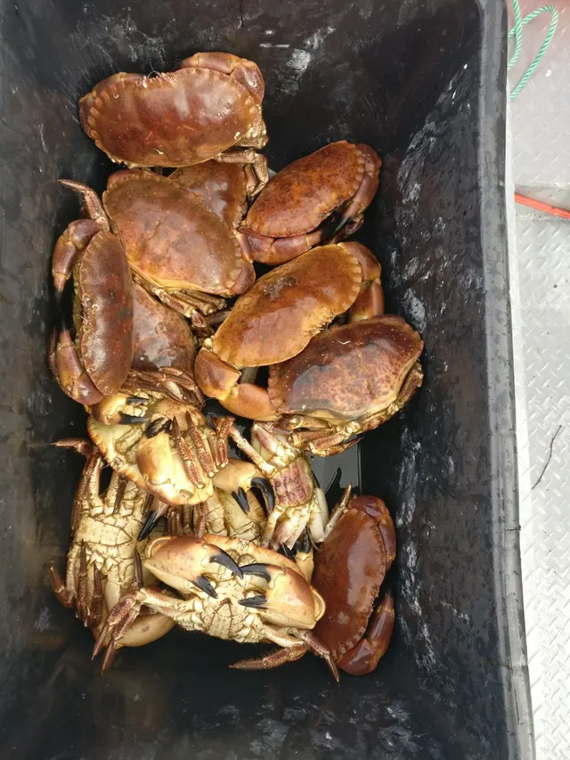 Edible crabCharacteristic of this water1 placeCromer PierOver pierAround Mar–Oct
 European sea bassRegular local target18 placesKessingland, The Orwell and Stour estuaries, Wells and Holkham, Felixstowe and Landguard Point and 14 moreOver beach, beach section, estuary, estuary mark, pier, sandbankAround May–Oct
 Atlantic codRegular local target16 placesCromer Pier, Kessingland, Brancaster and the north Norfolk marshes, Blakeney Point and 12 moreOver beach, beach section, estuary, estuary mark, pier, sandbankAround Jan–Mar, Oct–Dec
 WhitingRegular local target13 placesKessingland, Blakeney Point, Sheringham, Great Yarmouth north beach and 9 moreOver beach, beach section, estuary, pier, sandbankAround Jan–Mar, Oct–Dec
- DabRegular local target10 placesBlakeney Point, Sheringham, Dunwich, The Orwell and Stour estuaries and 6 moreOver beach, beach section, estuary, pier, sandbankAround Jan–Mar, Oct–Dec
 European flounderRegular local target10 placesBrancaster and the north Norfolk marshes, Blakeney Point, Sheringham, Southwold Pier and 6 moreOver beach, beach section, estuary, estuary mark, pier, sandbank
Also documented from the shore: Starry smooth-hound · Pouting · Thornback ray · Small-spotted catshark · Thick-lipped grey mullet · Common sole · Atlantic mackerel · European plaice · Turbot
What these strengths mean
- Characteristic of this water
- This water is strongly identified with this species by the sources that cover it.
- Regular local target
- Fishing sources describe this as a normal local target here, not merely as caught.
- Seasonal
- Well supported, and concentrated in part of the year rather than spread through it.
- Recorded here
- At least one credible public account of this species being caught here. That is all it means.
- How breadth is counted
- A fish documented at six marks is shown as six marks: breadth never raises the strength on its own. A fishery account describes the fishing; a recorded catch reports one specific catch. How evidence is weighed.
How people fish here
5 methods are recorded on the places documented here, counted from the records themselves rather than from what is practised in the country. Each opens a full guide to the technique.
Ledgering
Recorded at 22 places here, over beach, pier, beach section, estuary.
Fishing a bait on the bottom held by a weight, with no float — the simplest way to fish at distance, in depth, or in wind.
Documented on the same ground: Edible crab, Atlantic cod, Dab, European flounder, European sea bass, Pouting.
Spinning
Recorded at 6 places here, over beach, estuary, estuary mark, pier.
Casting an artificial lure and retrieving it so that it moves like something alive — the most direct form of lure fishing.
Documented on the same ground: Dab, European flounder, European sea bass, Thornback ray, Atlantic cod, Thick-lipped grey mullet.
Surfcasting
Recorded at 5 places here, over beach.
Casting heavy baited tackle from a beach into surf — a method defined by distance, by tide, and by reading water that all looks the same.
Documented on the same ground: Dab, European flounder, European sea bass, Thornback ray, Atlantic cod, Starry smooth-hound.
Kayak fishing
Recorded at 4 places here, over estuary, estuary mark, sandbank.
A platform rather than a technique: quiet, shallow-draught access to water no other craft reaches, bought at the price of exposure, and a discipline where the decision not to launch is part of the skill.
Documented on the same ground: Dab, European flounder, European sea bass, Pouting, Atlantic cod, Thick-lipped grey mullet.
Float fishing
Recorded at 1 place here, over pier.
Suspending a bait at a controlled depth beneath a buoyant indicator — the most visual, most controllable and most widely applicable method in angling.
Documented on the same ground: Edible crab, Atlantic cod, Atlantic mackerel, Common sole, European sea bass.
These are the methods documented at the places FishingHQ holds here. A species listed beside a method is documented on the same ground, which is not the same as being taken that way — where a source establishes the method a fish was caught on, it is stated on that place’s own page. All fishing methods.
The fishing year here
The months the records under this area actually name, tightest season first. This is “observed in these months” rather than a season: a species whose months nobody recorded is not listed, because a gap in the evidence is not a year-round fishery.
- Thick-lipped grey mulletJune to September
- Atlantic mackerelJune to September
- Small-spotted catsharkJune to September
- European plaiceJune to September
- Common soleMay to September
- European sea bassMay to October
- Atlantic codOctober to March
- WhitingOctober to March
- DabOctober to March
- Starry smooth-houndMay to October
- Thornback rayMay to October
- Edible crabMarch to October
What dominates
Shore ledgering and surfcasting from the open beaches, overwhelmingly the dominant practice and strongly weighted to autumn and winter. Small-boat and charter fishing to the banks and channels offshore. Bass and mullet fishing in the estuaries and harbours, on lure, fly and bait. Kayak fishing in sheltered water and on settled days, where launching over shallow gradient beaches is straightforward and the offshore banks are a long way out. Bait digging on the estuarine and intertidal flats, which is a significant activity here and is regulated in places.
The water available
Offshore linear sandbanks and the deeper channels between them; shallow shelf sea with strong tidal streams and high suspended sediment; shallow-gradient sand and shingle beaches with groynes and defences; soft eroding cliffs of glacial till; shingle spits growing southward under longshore drift; shallow muddy estuaries, tidal creeks and harbours; and grazing marsh and reedbed behind the sea wall.
How the rules are structured
Recreational sea angling in England is not licensed as freshwater angling is, but a real framework applies: minimum conservation reference sizes, species-specific measures for bass that have changed repeatedly in recent years, and byelaws made by the local inshore fisheries and conservation authority, which differ between districts along this coast. Large parts of this coastline and its offshore banks carry conservation designations for their habitats and bird populations, and those designations restrict access, vehicles and bait digging independently of any fishing rule. Bait collection is separately regulated in several places. Access to beaches crosses land in a variety of ownerships including conservation bodies. FishingHQ does not state what any current rule is.
Who to ask
- The relevant Inshore Fisheries and Conservation Authority for the district, which makes and enforces inshore byelaws including those on bait collection.
- The Marine Management Organisation, for national recreational sea fishing measures in English waters.
- Natural England and the relevant protected site management body, where a designation affects access, vehicles or bait digging.
- The harbour authority or commissioners, where fishing is from harbour structures or where small craft are launched.
- The Maritime and Coastguard Agency and the RNLI, for safety guidance on this coast.
Words you will meet
- Bank
- One of the linear offshore sand ridges lying broadly parallel to the coast. The productive water is the edge and the channel beside it rather than the shallow top, and which edge works depends on the direction the tide is running.
- Longshore drift
- The net southward movement of beach material along this coast under wave action arriving at an angle. It strips material from the north and builds it southward into spits, and it is the reason the coastline is a moving system rather than a fixed one.
- Coloured water
- Water carrying heavy suspended sediment after a blow. On most coasts it is a problem; here it is frequently the condition that produces the fishing, because the sea has stirred food out of the sand and the fish come in to it.
- Sea wall
- The engineered defence running behind much of this coast. It fixes the position of the beach artificially, which changes how material moves and means the beach in front of it behaves differently from an undefended one.
Conditions and hazards
This coast is less obviously dangerous than a rock platform and kills people in quieter ways. The beaches shelve gently and the sea looks benign, which encourages wading; the water is cold enough for most of the year that cold water shock is the operative risk on immersion, and the sediment-laden water gives no visibility to anybody in it. Soft eroding cliffs of glacial till collapse without warning and are actively unstable after rain, so the base of a cliff is not a place to sit. Groynes and defence structures are slippery, and their submerged remains are a hazard to wading and to small craft. The estuaries and creeks carry fast tidal streams over soft mud, and mud that will hold a person's weight on the ebb will not on the way back. Offshore, the banks produce steep breaking seas in wind against tide over shallow water, which is a small-craft hazard out of all proportion to the wind strength — a modest breeze over a bank on a spring ebb produces conditions a kayak or small boat should not be in. Winter night sessions on an exposed beach in cold water are the normal way this fishing is done, which is why a buoyancy aid, not fishing alone, and a means of calling for help carried on the person matter here as much as anywhere with cliffs.
Reading a sandbank coast: where the fish actually are
The practical intelligence of this coast is that the productive ground is defined by moving water rather than by structure you can see, and that is learnable.
THE BANKS ORGANISE EVERYTHING OFFSHORE. A tidal stream meeting a linear bank accelerates around and over it. On the up-tide side the stream is compressed and scours; on the down-tide side it separates and leaves slacker, eddying water. Food — sandeels, crustaceans, worms scoured out of the sediment — is swept off the bank and into the channel. Predatory fish sit in the slack and intercept it, which is why the edges and the channel margins hold fish while the shallow top of a bank frequently does not.
WHICH SIDE WORKS CHANGES WITH THE TIDE, and it reverses. A mark that fishes on the flood is frequently dead on the ebb, and the same feature is approached from the opposite side six hours later. That is not local folklore; it follows directly from where the stream is accelerating.
INSHORE, THE SAME LOGIC APPLIES AT SMALLER SCALE. A shallow-gradient beach is not featureless. Longshore bars, runnels, the scour holes beside groynes and the gutters that drain a beach on the ebb all concentrate water and therefore food. Reading them is done at low water, by walking the beach you intend to fish at the bottom of the tide and remembering what was there.
COLOURED WATER IS AN ASSET HERE AND THIS IS THE COAST WHERE THAT IS MOST TRUE. A sea that has been stirred by a blow has suspended sediment, reduced visibility and, crucially, food dislodged from the sand. Fish that would be well offshore in clear settled water come in to feed. The classic winter cod session on this coast follows a rough sea rather than preceding it, and clear flat calm water in mid-winter is generally poor.
AND THE ESTUARIES INVERT THE SEASON. While the open beach is a winter fishery, the estuaries and creeks are at their best in summer, when shallow water warms quickly, bass and mullet move in on the flood and the whole fishery is about tide state rather than about weather.
Backed by research — why, and the sources (4)
Supported by peer-reviewed research or fisheries science. The sources are listed and can be checked.
- Cefas science, advice and data on marine and freshwater environments — Centre for Environment, Fisheries and Aquaculture Science (Government fisheries body)Relied on for: Marine environmental science for UK shelf seas, including the physical characterisation of sediment, coastal process and the monitoring programmes that describe them.States this directlyCitation checked — the work exists and is described correctly
- ICES Advice on fishing opportunities, catch and effort — International Council for the Exploration of the Sea (Scientific institute)Relied on for: Ecoregion description, stock distribution and the hydrography of the sea areas assessed.States this directlyCitation checked — the work exists and is described correctly
- ICES Advice on fishing opportunities, catch and effort — International Council for the Exploration of the Sea (Scientific institute)Relied on for: Stock distribution, ecoregion boundaries and the physical description of the sea areas assessed, including depth, salinity and hydrography.States this directlyCitation checked — the work exists and is described correctly
- FishBase: a global information system on fishes — Froese, R. and D. Pauly, eds. — FishBase Consortium (Scientific institute)Relied on for: Distribution, temperature tolerance and habitat association of the species named as characteristic of these waters.States this directlyPassage read and verified
A coast that is being taken away, and what that means for fishing it
This is among the fastest-eroding coastline in Europe, and the erosion is not background — it is a live constraint on the fishing.
THE MATERIAL IS SOFT. Much of this coast is glacial till, sand and gravel left by ice rather than rock. It has almost no resistance to wave attack, and cliffs of it fail by slumping and collapse rather than by slow abrasion. Rain saturates them and they give way; there is generally no warning.
LONGSHORE DRIFT MOVES THE SEDIMENT SOUTHWARD. Waves arriving at an angle move material along the shore, and over this coast the net movement is broadly southward. Material eroded from the north is carried down the coast and deposited, building spits that grow across estuary mouths and deflect river outfalls.
DEFENCES CHANGE WHERE THE LOSS HAPPENS RATHER THAN WHETHER IT DOES. Fixing one stretch of coast starves the stretch downdrift of the material that would have fed it, so a defended village is frequently flanked by accelerating loss. Groyne fields interrupt drift locally and produce the characteristic sawtooth beach, wide on the updrift side of each groyne and narrow on the downdrift side.
WHAT THIS MEANS PRACTICALLY. Beach features are not durable. A gutter, a bar or a scour hole may not survive a winter. Local knowledge here has a genuinely short shelf life and intelligence more than a season or two old should be treated as a hypothesis. Access points close permanently when the land behind them goes. Cliff-top parking and paths are withdrawn.
AND IT MEANS THE CLIFFS ARE NOT SHELTER. Sitting at the base of a soft cliff out of the wind is the obvious thing to do on a cold beach and it is the wrong thing to do on this one, particularly after rain and particularly where the cliff face is fresh rather than vegetated.
Backed by research — why, and the sources (4)
Supported by peer-reviewed research or fisheries science. The sources are listed and can be checked.
- Cefas science, advice and data on marine and freshwater environments — Centre for Environment, Fisheries and Aquaculture Science (Government fisheries body)Relied on for: Marine environmental science for UK shelf seas, including the physical characterisation of sediment, coastal process and the monitoring programmes that describe them.States this directlyCitation checked — the work exists and is described correctly
- ICES Advice on fishing opportunities, catch and effort — International Council for the Exploration of the Sea (Scientific institute)Relied on for: Ecoregion description, stock distribution and the hydrography of the sea areas assessed.States this directlyCitation checked — the work exists and is described correctly
- FishBase: a global information system on fishes — Froese, R. and D. Pauly, eds. — FishBase Consortium (Scientific institute)Relied on for: Distribution, habitat association and thermal tolerance of the species named as characteristic of these waters.States this directlyPassage read and verified
- JNCC species and habitat conservation advice — Joint Nature Conservation Committee (Conservation authority)Relied on for: Designation, habitat description and conservation status of the marine and coastal habitats named.States this directlyCitation checked — the work exists and is described correctly
The winter cod coast, and why the season is a temperature rather than a date
East Anglia's reputation rests on a winter shore fishery, and understanding what actually drives it is more useful than any calendar.
COD MOVE INSHORE AS THE SEA COOLS. The North Sea is shallow and cools substantially through autumn, and the inshore movement follows the temperature rather than the month. A warm autumn delays it; a cold one brings it forward. Anglers on this coast have watched the reliable start of that season become later and less certain over recent decades, which is a real change rather than nostalgia.
ROUGH WEATHER IS THE TRIGGER WITHIN THE SEASON. A sea that has been running for a day or two lifts worms, crustaceans and shellfish out of the sand and holds them in suspension. Fish come in to feed on that, and the productive session is generally as the sea drops back rather than at its height. Flat calm clear water in December is usually a poor prospect on the same beach.
WHITING AND DAB ARRIVE ON THE SAME PATTERN and in far greater numbers, and are the realistic expectation of most winter sessions. A record that promised cod would be selling a fishery that has become markedly harder.
SUMMER IS A DIFFERENT COAST. Smoothhound over the same ground on crab, tope offshore and from a few beaches, thornback and other rays on the mixed ground, bass everywhere from the surf to the creeks, and mackerel inshore in settled warm spells.
THE STOCK PICTURE MATTERS AND IT IS NOT COMFORTABLE. North Sea cod has been the subject of sustained management concern and recovery effort for decades, and the shore fishery's decline is not an artefact of anglers fishing worse. What may be retained, and at what size, is a matter for the responsible authority and changes — which is the honest thing for this page to say rather than restating a limit that will be wrong.
What experienced anglers do — why, and the sources (4)
Widely and independently recommended by experienced anglers and specialist sources. This is real angling knowledge, not proof: controlled evidence for it is limited, and FishingHQ records it as convention rather than as a demonstrated effect.
- Fishers' Craft and Lettered Art: Tracts on Fishing from the End of the Middle Ages — University of Toronto Press, 1997 (Scientific literature)Relied on for: That fishing traditions develop around the water and fish available to them, and the historical method of reading such traditions.States this directlyCitation checked — the work exists and is described correctly
- General angling website restatements of established technique — Various (Credible secondary source)Relied on for: Widely restated descriptions of regional angling practice, recorded as practitioner consensus rather than as scholarship.Background and mechanism onlyCitation checked — the work exists and is described correctly
- ICES Advice on fishing opportunities, catch and effort — International Council for the Exploration of the Sea (Scientific institute)Relied on for: Stock distribution, ecoregion boundaries and the physical description of the sea areas assessed, including depth, salinity and hydrography.States this directlyCitation checked — the work exists and is described correctly
- FishBase: a global information system on fishes — Froese, R. and D. Pauly, eds. — FishBase Consortium (Scientific institute)Relied on for: Distribution, temperature tolerance and habitat association of the species named as characteristic of these waters.States this directlyPassage read and verified
A gentle beach in front of a hard sea, and the bank you cannot see
Nothing on this coast looks dangerous, and that is the mechanism rather than a consolation. There is no cliff to be swept off and no rock platform to be cut off on. The sea shelves gently, the beach is sand and shingle, and the danger is somewhere the reader is not looking.
THE BANKS ARE THE SEA'S REAL STRUCTURE HERE. Offshore lies a field of mobile linear sandbanks with deeper channels between them, and the tidal stream running along this coast is squeezed and accelerated over and around them. Where a strong stream runs over shallow ground and a wind blows against it, the water stands up into a short steep breaking sea, and it does so ACROSS A BANK EDGE rather than gradually. A small boat or kayak in workable conditions crosses a line and is in unworkable ones, and the wind that did it may be a breeze that felt like nothing on the beach.
THAT IS THE HAZARD WITH THE WORST RATIO OF APPEARANCE TO CONSEQUENCE on this coast, and it is why the tidal stream matters as much as the wind here. The two are one input rather than two: a light wind on a spring ebb over a bank is a worse proposition than a stronger wind at slack water, and no wind forecast alone will tell anybody that.
ASHORE, THE GENTLE GRADIENT IS THE PROBLEM. A shallow-shelving beach invites wading, and wading further than intended is easy when the depth changes slowly. But the water is cold enough for most of the year that immersion produces the gasp response within seconds regardless of how far out a person walked, it is turbid enough that a person in it can see nothing, and this fishery is done at night in winter. A gentle beach is not a safer beach for immersion. It is a beach that gets people further from dry land before anything goes wrong.
THE CLIFFS BEHIND ARE NOT SHELTER. Glacial till and sand fail without warning, they fail worst after rain, and sitting at the foot of one out of the wind on a cold night is the natural thing to do and the wrong one. Where the face is bare and fresh rather than vegetated, it is failing now.
AND THE CREEKS BEHIND THE BEACH FILL FROM BEHIND. Bait digging and creek fishing on the estuarine flats put people on ground that is continuous with the shore at low water and is not at half tide. Mud that carried weight on the ebb will not on the return, and a creek that was ankle-deep on the way out is the thing between a person and the car.
WHAT ACTUALLY HELPS is treating the inshore waters forecast and the tidal stream as one combined decision before launching anything, not crossing bank edges on a wind-against-tide state, setting a leaving time from the tide rather than from the fishing on any flat or creek, staying off the foot of soft cliffs entirely, wearing a buoyancy aid rather than carrying one, not fishing alone at night, and carrying the means of calling for help on the person rather than in a bag up the beach. Deciding not to launch is a legitimate answer and on this coast it is frequently the correct one.
Official guidance — why, and the sources (3)
Stated by a fisheries authority, scientific institute or recognised angling body. Authoritative, but summarising rather than demonstrating.
- RNLI water safety guidance: cold water shock and Float to Live — Royal National Lifeboat Institution (Water-safety or diver-training authority)Relied on for: Cold water shock and the immersion response, tidal cut-off, and water-safety guidance for shore anglers and small-craft users.States this directlyPassage read and verified
- Cefas science, advice and data on marine and freshwater environments — Centre for Environment, Fisheries and Aquaculture Science (Government fisheries body)Relied on for: Marine environmental science for UK shelf seas, including tidal range, tidal streams, coastal process, sediment characterisation and the monitoring programmes that describe them.States this directlyCitation checked — the work exists and is described correctly
- RoSPA water safety information and UK accidental drowning statistics — Royal Society for the Prevention of Accidents (Water-safety or diver-training authority)Relied on for: UK accidental drowning statistics and water-safety guidance, including the proportion of drownings that begin with no intention of entering the water.States this directlyPassage read and verified
Some of what lives here
Fish recorded here that FishingHQ holds a reviewed photograph of. It is not a complete list of what The Norfolk and Suffolk sandbank coast holds, and it is not a prediction that you will catch any of them — it is a way in to the ones we can show you.
- Atlantic codA large, heavily-built demersal predator of the North Atlantic, and the species whose commercial history is the standard example of stock collapse.
The U.S. Food and Drug Administration, Public domain, via Wikimedia Commons
- WhitingA small, abundant, silver gadoid of European coasts, a mainstay of winter shore fishing and distinguished by a dark spot at the pectoral fin base.
rmjb — CC BY, via iNaturalist
- European sea bassA fast, predatory inshore fish that hunts in broken water and surf, and one of the most closely managed recreational species in European seas.
Julien Renoult — CC BY 4.0, via Wikimedia Commons
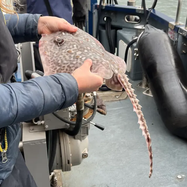 Thornback rayThe commonest European ray, covered in thorn-like bucklers, laying horny egg cases known as mermaid's purses, and requiring careful handling on release.
Ella McCausland — CC BY, via iNaturalist
- European flounderThe flatfish that runs up rivers — a tolerant, estuarine right-eyed flounder with bony tubercles along its fin bases and a habit of turning up in fresh water.
nbasargin — CC BY, via iNaturalist
Places within this area
Publicly documented fishing geography. FishingHQ describes what the ground is; it does not say whether you may fish it, and every one of these sends that question to the body that holds the answer. Browse every place in this part of the world.
Who to ask before fishing any of these
FishingHQ does not know the current access position here. Shore angling in England is not rod-licensed, but access rights, landowner permission, local authority and harbour byelaws, national and inshore fisheries measures, and site designations all apply and all change. Check the current position with the relevant inshore fisheries and conservation authority, the harbour or local authority, and the landowner before going.
FishingHQ does not know the current access position here. Shore angling in England is not rod-licensed, but access rights, landowner permission, local authority and harbour byelaws, national and inshore fisheries measures, and site designations all apply and all change. Check the current position with the relevant inshore fisheries and conservation authority, the harbour or local authority, and the landowner before going. This water is tidal and transitional, so the freshwater regime may also apply above the tidal limit: FishingHQ does not know the current access position here. Freshwater rod fishing in England requires a current rod licence AND separate permission from whoever controls the fishing, which is frequently a club, riparian owner or navigation authority rather than a public body. Close seasons, byelaws and local rules apply and change. Check with the Environment Agency and with the controlling club or owner before going.
Cromer Pier
Pier · Salt water
A Victorian pleasure pier on iron piles standing over clean sand with chalk and flint reef — the Cromer Shoal chalk beds — lying immediately offshore and inshore of it. Sand under the pier, hard broken chalk within casting range.
North-facing and fully open to the North Sea from north-west through north-east. This coast has no shelter from a northerly at all, and the pier is regularly closed in one.
Particular to this ground: cold water shock, hooks and barbs.
Severe hazards of The Norfolk and Suffolk sandbank coast apply here: cliffs and rock platforms, boat safety.
Particular to this water: This is an owned and operated structure. Whether angling is allowed on it, when, from where and on what terms is the operator's decision, is frequently seasonal, and changes without notice. This ground carries conservation designations that constrain access, vehicles, bait collection and disturbance independently of any fishing rule.
Orford Ness and Shingle Street
Shingle bank · Salt water
A sixteen-kilometre shingle spit built by longshore drift, which has deflected the mouth of the Alde and Ore fifteen kilometres south of where the river reaches the coast. Steep-to shingle on the seaward face, a river and marsh system behind, and a narrow, fast, shifting mouth at Shingle Street.
Fully exposed to the southern North Sea from north-east through south-east. The spit exists because this coast moves shingle constantly, which is also why its shape is not fixed.
Particular to this ground: moving water and currents, slips, trips and falls, cold water shock.
Severe hazards of The Norfolk and Suffolk sandbank coast apply here: cliffs and rock platforms, boat safety.
Particular to this water: This ground carries conservation designations that constrain access, vehicles, bait collection and disturbance independently of any fishing rule.
Brancaster and the north Norfolk marshes
Estuary mark · Brackish water
A barrier coast of shingle ridges, dune islands and saltmarsh with a network of tidal creeks behind, draining through narrow harbour channels that run hard on both tides.
Severe hazards of The Norfolk and Suffolk sandbank coast apply here: cold water shock, cliffs and rock platforms, boat safety.
Blakeney Point
Sandbank · Salt water
A six-kilometre shingle spit built westward by longshore drift, deflecting the Glaven's outfall and enclosing a marsh and creek system, with a fast narrow harbour channel at its root.
Severe hazards of The Norfolk and Suffolk sandbank coast apply here: cold water shock, cliffs and rock platforms, boat safety.
Sheringham
Beach section · Salt water
Steep shingle over a chalk platform, with the Cromer Shoal chalk beds — the largest chalk reef in Europe — lying immediately offshore and outcropping on the beach at low water.
Severe hazards of The Norfolk and Suffolk sandbank coast apply here: cold water shock, cliffs and rock platforms, boat safety.
Happisburgh
Beach · Salt water
Sand and shingle beneath a rapidly retreating soft cliff of glacial till, with failed timber revetment along much of it and a shifting bar offshore.
Severe hazards of The Norfolk and Suffolk sandbank coast apply here: cold water shock, cliffs and rock platforms, boat safety.
Sea Palling
Beach · Salt water
Clean sand held in a series of artificial bays behind nine offshore rock reefs, which is unusual ground for this coast: hard structure in a place that has none naturally.
Severe hazards of The Norfolk and Suffolk sandbank coast apply here: cold water shock, cliffs and rock platforms, boat safety.
Great Yarmouth north beach
Beach section · Salt water
Wide flat sand beside the mouth of the Yare, with the North Denes and the deep Yarmouth Roads channel offshore between the shore and the Scroby Sands.
Severe hazards of The Norfolk and Suffolk sandbank coast apply here: cold water shock, cliffs and rock platforms, boat safety.
14 more places in this area
Gorleston pier
Pier · Salt water
The southern training wall of the Yare entrance, running out over sand beside a dredged channel with strong stream on both tides.
Severe hazards of The Norfolk and Suffolk sandbank coast apply here: cold water shock, cliffs and rock platforms, boat safety.
Lowestoft Claremont Pier
Pier · Salt water
A timber pleasure pier standing over clean sand at the most easterly point in Britain, close to the deep water of the Stanford Channel between the shore and the offshore banks.
Severe hazards of The Norfolk and Suffolk sandbank coast apply here: cold water shock, cliffs and rock platforms, boat safety.
Kessingland
Beach · Salt water
A steep shingle bank over sand at the seaward end of a shingle-dominated stretch, with a distinct step at the waterline and deeper water closer in than on the Norfolk sand to the north.
Severe hazards of The Norfolk and Suffolk sandbank coast apply here: cold water shock, cliffs and rock platforms, boat safety.
Southwold Pier
Pier · Salt water
A rebuilt pleasure pier over clean sand and shingle, just north of the Blyth entrance and its training walls.
Severe hazards of The Norfolk and Suffolk sandbank coast apply here: cold water shock, cliffs and rock platforms, boat safety.
Particular to this water: The pier is privately operated and fishing from it requires a permit issued by the operator, obtainable from any of the units along the pier. An annual permit is sold, and the operator states it is available in March only. A member of the Southwold Pier Angling Club is usually on the pier.
Dunwich
Beach · Salt water
Steep shingle over the drowned site of a medieval port, with a soft crag cliff to the north and heavy longshore drift carrying material south.
Severe hazards of The Norfolk and Suffolk sandbank coast apply here: cold water shock, cliffs and rock platforms, boat safety.
Sizewell
Beach · Salt water
Shingle over sand beside two power station outfalls and their offshore intake rigs, which give this stretch a locally warmed plume and a set of hard structures on an otherwise featureless coast.
Severe hazards of The Norfolk and Suffolk sandbank coast apply here: cold water shock, cliffs and rock platforms, boat safety.
Aldeburgh
Beach · Salt water
A steep shingle beach with deep water close in, at the northern end of the Orford Ness drift system and immediately above the point where the Alde turns south behind the spit.
Severe hazards of The Norfolk and Suffolk sandbank coast apply here: cold water shock, cliffs and rock platforms, boat safety.
The Deben estuary
Estuary · Brackish water
A drowned valley entered over a shifting shingle bar, with steep-to shingle at the mouth giving way to mud, saltmarsh and oyster ground upstream.
Particular to this ground: moving water and currents.
Severe hazards of The Norfolk and Suffolk sandbank coast apply here: cold water shock, cliffs and rock platforms, boat safety.
The Orwell and Stour estuaries
Estuary · Brackish water
Two drowned valleys meeting at Harwich behind a common mouth, with soft mud, extensive saltmarsh, a deep dredged container-port channel and very heavy commercial traffic.
Particular to this ground: boat traffic and being seen.
Severe hazards of The Norfolk and Suffolk sandbank coast apply here: cold water shock, cliffs and rock platforms, boat safety.
Snettisham
Beach · Brackish water
Shingle banks and old gravel workings on the east side of the Wash, with mud and sand flats running out for a very long way in front of them. Soft ground, coloured water and one of Britain's biggest tidal ranges.
Open west across the Wash, which is unusual for an east-coast mark.
Particular to this ground: tides and being cut off.
Severe hazards of The Norfolk and Suffolk sandbank coast apply here: cold water shock, cliffs and rock platforms, boat safety.
Wells and Holkham
Beach · Salt water
Miles of firm sand behind pine-backed dunes on the north Norfolk coast, with the Wells channel cutting out through it and creeks and saltmarsh behind. Clean ground with an estuary channel through the middle of it.
Open north into the North Sea across shallow sand.
Particular to this ground: tides and being cut off.
Severe hazards of The Norfolk and Suffolk sandbank coast apply here: cold water shock, cliffs and rock platforms, boat safety.
Mundesley and Walcott
Beach · Salt water
Sand and shingle below crumbling cliffs of glacial till, broken up by timber and rock groynes and a long sea wall at Walcott. Soft cliffs feeding the beach, and hard defences holding the sand in front of them.
Open north-east into the North Sea.
Severe hazards of The Norfolk and Suffolk sandbank coast apply here: cold water shock, cliffs and rock platforms, boat safety.
Caister-on-Sea
Beach · Salt water
Flat sand and low dune north of Great Yarmouth, with the Caister and Scroby sandbanks lying offshore and a deep channel between them and the beach. The banks are why the ground shelves the way it does.
Open east into the North Sea, with the offshore banks taking some of the swell.
Severe hazards of The Norfolk and Suffolk sandbank coast apply here: cold water shock, cliffs and rock platforms, boat safety.
Felixstowe and Landguard Point
Beach · Brackish water
Shingle running down to the Landguard spit at the Orwell and Stour mouth, with the deep dredged container channel passing within a stone's throw of the point. Depth at the rod tip, which almost nothing else on this coast offers.
Open east and south-east, sheltered from the west by the land behind.
Severe hazards of The Norfolk and Suffolk sandbank coast apply here: cold water shock, cliffs and rock platforms, boat safety.
Safety
Cold water shock — Can cause serious injury or death
The North Sea on this coast is cold for most of the year and the fishery is weighted to winter nights. A person entering the water experiences an involuntary gasp and loss of breathing control within seconds, in turbid water with no visibility, frequently alone and in the dark.
What reduces it: Wear a buoyancy aid rather than carry one, do not fish alone at night, carry a means of calling for help on the person rather than in a bag, and tell somebody the beach and the return time. Treat a gently shelving beach as no safer than a steep one for immersion.
Worse when:
- Winter night sessions, which is when most of this fishing is done.
- Wading on a shallow-gradient beach where the apparent safety encourages going further out than intended.
Cliffs and rock platforms — Can cause serious injury or death
Cliffs of glacial till and sand collapse without warning, especially after rain and where the face is fresh rather than vegetated. Sitting at the base of a cliff for shelter on a cold beach places a person directly beneath the failure.
What reduces it: Do not shelter, sit or set up beneath a soft cliff at any time, and keep clear of the cliff edge above, which is undercut and may overhang. Use the open beach and dress for it instead.
Worse when:
- After heavy or prolonged rain, when saturated till slumps.
- Where the cliff face is bare and freshly exposed rather than vegetated and stable.
Boat safety — Can cause serious injury or death
Wind against tide over a shallow bank produces a steep breaking sea disproportionate to the wind strength. A modest breeze against a spring ebb over a bank creates conditions a kayak or small boat should not be in, and the transition from workable to dangerous happens over a bank edge rather than gradually.
What reduces it: Plan around the tide as well as the wind, avoid crossing bank edges on a wind-against-tide state, and treat the inshore waters forecast plus the tidal stream as one combined input rather than two. Deciding not to launch is a legitimate answer.
Worse when:
- Spring tides, when the streams over the banks are strongest.
- Any wind opposing the tidal stream, regardless of how light it feels on the beach.
Tides and being cut off — Can cause injury needing treatment
Estuary creeks and intertidal flats fill from the seaward side and from behind, and soft mud that carries weight on the ebb will not on the return. Bait diggers and creek anglers are cut off on ground that looked continuous with the shore.
What reduces it: Know the state of the tide and the exit before going out onto flats or into creeks, set a time to leave rather than leaving when the fishing slows, and do not cross a creek on the ebb that you would need to recross on the flood.
Precautions that always apply here
- Wear a buoyancy aid or lifejacket. Cold water incapacitates strong swimmers within a minute, long before swimming ability matters.
- Check the tide before you go and know your exit route. Being cut off is the commonest way a shore session becomes a rescue.
- Tell somebody where you are going and when you expect to be back.
- Carry a charged phone in a waterproof case, or another means of calling for help.
Further safety reading
- Cold water shock and immersion — A gently shelving beach and turbid water encourage wading, and the sea is cold enough for most of the year that immersion produces an involuntary gasp and loss of breathing control. Most of this fishing is done on winter nights.
- Tides and being cut off — Estuary creeks and intertidal flats fill from seaward and from behind, and soft mud that carries weight on the ebb will not on the return. Bait diggers and creek anglers are cut off on ground that looked continuous with the shore.
Check the rules before you fish
Fishing laws, bylaws, access rules, seasons, bait restrictions and permitted methods vary by location and can change. Check the current rules from the relevant authority and the water you intend to fish before fishing.
Check with:
- Current national or regional law for where you are fishing
- Current local bylaws
- The relevant fisheries authority
- The landowner, club or fishery whose water it is
- Any restrictions specific to the species or the method you intend to use
Where to go next
What swims here
- Atlantic codThe winter shore fishery this coast is known for. Cod move inshore as the shallow North Sea cools, and the productive sessions follow a blow that has stirred food out of the sand rather than settled clear water. The fishery is much reduced from its historical level and the season now tracks temperature rather than a date.
- DabAbundant on the clean sand of this coast through the colder months, and one of the species that makes a winter session productive when the larger fish are absent.
- European flounderA characteristic fish of the shallow muddy estuaries and tidal creeks behind this coast, tolerating water that is barely brackish and running well up into it.
- European sea bassPresent through the warmer months, and the association is strongest with the shallow muddy estuaries, creeks and harbours behind the open beach rather than with the beach itself — a distinction that matters, because the two are an hour apart and fish quite differently.
- Lesser sandeelBuries in the clean mobile sand of the offshore banks, which is the habitat the species requires. The banks are a sandeel ground, and that is a large part of why they concentrate predators and seabirds.
- Starry smooth-houndA summer species over the mixed and clean ground of this coast, associated with crab as prey and therefore with the periods when crabs are moulting.
- Thornback rayAssociated with the mixed and sandy ground off this coast and with the channels between the offshore banks, where tidal streams concentrate food.
- WhitingThe realistic expectation of most winter beach sessions here, arriving inshore on the same cooling pattern as cod and in far greater numbers.
Local knowledge
How this compares
- Cardigan Bay and the sarnauTwo soft bays whose fishing is created by a linear offshore structure that is also the principal hazard — glacial moraine here, mobile sandbank there. The mechanism is the same and the permanence is not, which is exactly the useful comparison.
- The Yorkshire coastTwo soft, fast-eroding English coasts of glacial till fed by southward drift, with quite different offshore arrangements: East Anglia's fishing is organised by a field of sandbanks, Yorkshire's southern half has none.
Sources and evidence
- Cefas science, advice and data on marine and freshwater environments — Centre for Environment, Fisheries and Aquaculture Science (Government fisheries body)Relied on for: Marine environmental science for UK shelf seas, including the physical characterisation of sediment, coastal process and the monitoring programmes that describe them.States this directlyCitation checked — the work exists and is described correctly
- ICES Advice on fishing opportunities, catch and effort — International Council for the Exploration of the Sea (Scientific institute)Relied on for: Ecoregion description, stock distribution and the hydrography of the sea areas assessed.States this directlyCitation checked — the work exists and is described correctly
- ICES Advice on fishing opportunities, catch and effort — International Council for the Exploration of the Sea (Scientific institute)Relied on for: Stock distribution, ecoregion boundaries and the physical description of the sea areas assessed, including depth, salinity and hydrography.States this directlyCitation checked — the work exists and is described correctly
- FishBase: a global information system on fishes — Froese, R. and D. Pauly, eds. — FishBase Consortium (Scientific institute)Relied on for: Distribution, temperature tolerance and habitat association of the species named as characteristic of these waters.States this directlyPassage read and verified
- FishBase: a global information system on fishes — Froese, R. and D. Pauly, eds. — FishBase Consortium (Scientific institute)Relied on for: Distribution, habitat association and thermal tolerance of the species named as characteristic of these waters.States this directlyPassage read and verified
- JNCC species and habitat conservation advice — Joint Nature Conservation Committee (Conservation authority)Relied on for: Designation, habitat description and conservation status of the marine and coastal habitats named.States this directlyCitation checked — the work exists and is described correctly
Why the 14 connections on this page are here, and the sources
What swims here
Backed by research — 8 connections
Supported by peer-reviewed research or fisheries science. The sources are listed and can be checked.
Atlantic cod
A claim that a place contains the ground and conditions the species is associated with. It is a distributional statement about the world, it rests on the regional reference literature, and it deliberately asserts nothing about access, permission or catch.
- The Fishes of the British Isles and North-West Europe — Macmillan, 1969 (Reference work)Relied on for: Distribution and habitat association of the marine and estuarine fishes of the British Isles, including which coasts and ground types a species occupies.States this directlyCitation checked — the work exists and is described correctly
- FishBase: a global information system on fishes — Froese, R. and D. Pauly, eds. — FishBase Consortium (Scientific institute)Relied on for: Recorded distribution, depth range and habitat association for the species named.States this directlyPassage read and verified
Dab
A claim that a place contains the ground and conditions the species is associated with. It is a distributional statement about the world, it rests on the regional reference literature, and it deliberately asserts nothing about access, permission or catch.
- The Fishes of the British Isles and North-West Europe — Macmillan, 1969 (Reference work)Relied on for: Distribution and habitat association of the marine and estuarine fishes of the British Isles, including which coasts and ground types a species occupies.States this directlyCitation checked — the work exists and is described correctly
- FishBase: a global information system on fishes — Froese, R. and D. Pauly, eds. — FishBase Consortium (Scientific institute)Relied on for: Recorded distribution, depth range and habitat association for the species named.States this directlyPassage read and verified
European flounder
A claim that a place contains the ground and conditions the species is associated with. It is a distributional statement about the world, it rests on the regional reference literature, and it deliberately asserts nothing about access, permission or catch.
- The Fishes of the British Isles and North-West Europe — Macmillan, 1969 (Reference work)Relied on for: Distribution and habitat association of the marine and estuarine fishes of the British Isles, including which coasts and ground types a species occupies.States this directlyCitation checked — the work exists and is described correctly
- FishBase: a global information system on fishes — Froese, R. and D. Pauly, eds. — FishBase Consortium (Scientific institute)Relied on for: Recorded distribution, depth range and habitat association for the species named.States this directlyPassage read and verified
European sea bass
A claim that a place contains the ground and conditions the species is associated with. It is a distributional statement about the world, it rests on the regional reference literature, and it deliberately asserts nothing about access, permission or catch.
- The Fishes of the British Isles and North-West Europe — Macmillan, 1969 (Reference work)Relied on for: Distribution and habitat association of the marine and estuarine fishes of the British Isles, including which coasts and ground types a species occupies.States this directlyCitation checked — the work exists and is described correctly
- FishBase: a global information system on fishes — Froese, R. and D. Pauly, eds. — FishBase Consortium (Scientific institute)Relied on for: Recorded distribution, depth range and habitat association for the species named.States this directlyPassage read and verified
Lesser sandeel
A claim that a place contains the ground and conditions the species is associated with. It is a distributional statement about the world, it rests on the regional reference literature, and it deliberately asserts nothing about access, permission or catch.
- The Fishes of the British Isles and North-West Europe — Macmillan, 1969 (Reference work)Relied on for: Distribution and habitat association of the marine and estuarine fishes of the British Isles, including which coasts and ground types a species occupies.States this directlyCitation checked — the work exists and is described correctly
- FishBase: a global information system on fishes — Froese, R. and D. Pauly, eds. — FishBase Consortium (Scientific institute)Relied on for: Recorded distribution, depth range and habitat association for the species named.States this directlyPassage read and verified
Starry smooth-hound
A claim that a place contains the ground and conditions the species is associated with. It is a distributional statement about the world, it rests on the regional reference literature, and it deliberately asserts nothing about access, permission or catch.
- The Fishes of the British Isles and North-West Europe — Macmillan, 1969 (Reference work)Relied on for: Distribution and habitat association of the marine and estuarine fishes of the British Isles, including which coasts and ground types a species occupies.States this directlyCitation checked — the work exists and is described correctly
- FishBase: a global information system on fishes — Froese, R. and D. Pauly, eds. — FishBase Consortium (Scientific institute)Relied on for: Recorded distribution, depth range and habitat association for the species named.States this directlyPassage read and verified
Thornback ray
A claim that a place contains the ground and conditions the species is associated with. It is a distributional statement about the world, it rests on the regional reference literature, and it deliberately asserts nothing about access, permission or catch.
- The Fishes of the British Isles and North-West Europe — Macmillan, 1969 (Reference work)Relied on for: Distribution and habitat association of the marine and estuarine fishes of the British Isles, including which coasts and ground types a species occupies.States this directlyCitation checked — the work exists and is described correctly
- FishBase: a global information system on fishes — Froese, R. and D. Pauly, eds. — FishBase Consortium (Scientific institute)Relied on for: Recorded distribution, depth range and habitat association for the species named.States this directlyPassage read and verified
Whiting
A claim that a place contains the ground and conditions the species is associated with. It is a distributional statement about the world, it rests on the regional reference literature, and it deliberately asserts nothing about access, permission or catch.
- The Fishes of the British Isles and North-West Europe — Macmillan, 1969 (Reference work)Relied on for: Distribution and habitat association of the marine and estuarine fishes of the British Isles, including which coasts and ground types a species occupies.States this directlyCitation checked — the work exists and is described correctly
- FishBase: a global information system on fishes — Froese, R. and D. Pauly, eds. — FishBase Consortium (Scientific institute)Relied on for: Recorded distribution, depth range and habitat association for the species named.States this directlyPassage read and verified
How people fish here
What experienced anglers do — 1 connection
Widely and independently recommended by experienced anglers and specialist sources. This is real angling knowledge, not proof: controlled evidence for it is limited, and FishingHQ records it as convention rather than as a demonstrated effect.
Sea fishing
A statement about which body of practice dominates in a place, established across a periodical tradition and a historical one rather than measured.
- Sea Angler — Bauer Media (Specialist angling publication)Relied on for: Long-running periodical coverage of British and Irish shore and boat angling, including which disciplines dominate on which coasts.States this directlyCitation checked — the work exists and is described correctly
- Fishers' Craft and Lettered Art: Tracts on Fishing from the End of the Middle Ages — University of Toronto Press, 1997 (Scientific literature)Relied on for: That fishing traditions develop around the water and fish available to them, and the method of reading such traditions.States this directlyCitation checked — the work exists and is described correctly
Local knowledge
Backed by research — 1 connection
Supported by peer-reviewed research or fisheries science. The sources are listed and can be checked.
Reading the tide
A link from a place to the physical mechanism that governs its fishing, which is a claim about coastal process or hydrography rather than about angling.
- ICES Advice on fishing opportunities, catch and effort — International Council for the Exploration of the Sea (Scientific institute)Relied on for: Ecoregion description, stock distribution and the hydrography of the sea areas named, including seasonal inshore movement.States this directlyCitation checked — the work exists and is described correctly
- Cefas science, advice and data on marine and freshwater environments — Centre for Environment, Fisheries and Aquaculture Science (Government fisheries body)Relied on for: Marine environmental science for UK shelf seas, including sediment character, coastal process and inshore monitoring.States this directlyCitation checked — the work exists and is described correctly
How this compares
What experienced anglers do — 2 connections
Widely and independently recommended by experienced anglers and specialist sources. This is real angling knowledge, not proof: controlled evidence for it is limited, and FishingHQ records it as convention rather than as a demonstrated effect.
Cardigan Bay and the sarnau
A claim that two places are worth reading against one another, because a reader choosing between them or generalising from one to the other needs to know how the underlying process differs.
- General angling website restatements of established technique — Various (Credible secondary source)Relied on for: Widely restated descriptions of which practices are conventionally used in the waters named, recorded as practitioner consensus rather than as scholarship.Background and mechanism onlyCitation checked — the work exists and is described correctly
- Sea Angler — Bauer Media (Specialist angling publication)Relied on for: Long-running published description of British and Irish sea angling practice by region and by ground type.FishingHQ's interpretation of what it saysCitation checked — the work exists and is described correctly
The Yorkshire coast
A claim that two places are worth reading against one another, because a reader choosing between them or generalising from one to the other needs to know how the underlying process differs.
- General angling website restatements of established technique — Various (Credible secondary source)Relied on for: Widely restated descriptions of which practices are conventionally used in the waters named, recorded as practitioner consensus rather than as scholarship.Background and mechanism onlyCitation checked — the work exists and is described correctly
- Sea Angler — Bauer Media (Specialist angling publication)Relied on for: Long-running published description of British sea angling practice by region and by ground type.FishingHQ's interpretation of what it saysCitation checked — the work exists and is described correctly
Safety reading
Official guidance — 2 connections
Stated by a fisheries authority, scientific institute or recognised angling body. Authoritative, but summarising rather than demonstrating.
Cold water shock and immersion
A statement that a place presents a particular hazard, resting on water-safety guidance issued by bodies with responsibility for it rather than on angling practice.
- RNLI water safety guidance: cold water shock and Float to Live — Royal National Lifeboat Institution (Water-safety or diver-training authority)Relied on for: Cold water shock, immersion response, tidal cut-off and water-safety guidance for shore anglers and small-craft users.States this directlyPassage read and verified
- Rock fishing safety and the declared lifejacket areas of New South Wales — NSW Department of Primary Industries and Surf Life Saving NSW (Water-safety or diver-training authority)Relied on for: Rock-platform hazards, the mechanism by which anglers are swept, and the measures that address it.States this directlyCitation checked — the work exists and is described correctly
Tides and being cut off
A statement that a place presents a particular hazard, resting on water-safety guidance issued by bodies with responsibility for it rather than on angling practice.
- RNLI water safety guidance: cold water shock and Float to Live — Royal National Lifeboat Institution (Water-safety or diver-training authority)Relied on for: Cold water shock, immersion response, tidal cut-off and water-safety guidance for shore anglers and small-craft users.States this directlyPassage read and verified
- Rock fishing safety and the declared lifejacket areas of New South Wales — NSW Department of Primary Industries and Surf Life Saving NSW (Water-safety or diver-training authority)Relied on for: Rock-platform hazards, the mechanism by which anglers are swept, and the measures that address it.States this directlyCitation checked — the work exists and is described correctly
How FishingHQ labels evidence is explained in the evidence policy.