Shetland
Fishing regions · Last reviewed 2026-08-14
Further north and more exposed than Orkney, with deep water against the shore, a Norse fishing vocabulary and an island group that has always been a fisherman with a croft rather than a farmer with a boat.
Safety: cliffs and rock platforms — can cause serious injury or death. 2 more points apply here.
Being listed here is not permission to fish. What that meansClose
Access, fishing rights, seasons, licences, local bylaws and permitted methods vary and can change. Check current access, permission, local regulations, closures and restrictions before you travel or fish. FishingHQ describes what the ground is and names who holds the answer; it does not hold the answer itself.
Find the authority for a jurisdiction · What FishingHQ does and does not cover
Shetland qualifies as an archipelago record distinct from Orkney because the physical setting and the fishing culture genuinely differ, and the old saying about the two island groups captures it precisely: an Orkney man is a farmer with a boat and a Shetland man a fisherman with a croft.
IT IS FURTHER NORTH AND MORE EXPOSED. Shetland lies at around sixty degrees north, further from the mainland than Orkney, with less fertile land, and open to the Atlantic and the North Sea with no shelter in either direction.
THE GEOLOGY PUTS DEEP WATER AGAINST THE SHORE. Steep cliffs and voes cut into hard rock mean depth close in over much of the coast, which is why shore fishing here reaches water that would need a boat almost anywhere else in Britain.
THE VOES ARE THE DEFINING FEATURE. Long narrow sea inlets cut far into the land, giving sheltered deep water, concentrated tidal flow at their mouths, and a set of environments quite unlike the open coast a few hundred metres away.
TIDAL RACES ARE SEVERE. Strong streams run between and around the islands, and the roosts here are among the most powerful in Britain.
THE FISHING ECONOMY IS CENTRAL RATHER THAN INCIDENTAL. Shetland has one of the most significant fishing industries in Scotland relative to its population, with pelagic, whitefish, shellfish and salmon aquaculture sectors all substantial.
AND THE TROUT FISHING IS A GENUINE AND UNDERRATED FRESHWATER FISHERY, on hundreds of lochs across the islands, largely free of the estate structure that governs mainland game fishing.
What fishing here is like
A far northern archipelago of steep cliff, deep voe and severe tidal race, exposed to both the Atlantic and the North Sea with almost no shelter. Deep water lies close to the shore over much of the coast, which makes shore fishing unusually productive. The commercial fishery — pelagic, whitefish, shellfish and salmon farming — is central to the islands' economy, and there is a substantial and lightly-structured wild brown trout fishery on hundreds of lochs. Sea angling has a serious local following and a competition history.
What you can target here
One entry per fish, grouped by how you would be fishing — because the answer is a different one from the rocks and from a boat. Each entry says how strongly the sources support it and how much evidence sits behind it. These are documented catches, not a forecast, and none of it is a statement that you may fish any particular ground.
From a boat · 3
What these strengths mean
- Regular local target
- Fishing sources describe this as a normal local target here, not merely as caught.
- Repeatedly reported
- Several independent public accounts. Enough to say it happens more than once; not enough to call it a fishery.
- Recorded here
- At least one credible public account of this species being caught here. That is all it means.
- How breadth is counted
- A fish documented at six marks is shown as six marks: breadth never raises the strength on its own. A fishery account describes the fishing; a recorded catch reports one specific catch. How evidence is weighed.
How people fish here
8 methods are recorded on the places documented here, counted from the records themselves rather than from what is practised in the country. Each opens a full guide to the technique.
Spinning
Recorded at 36 places here, over loch, sea loch, beach, harbour wall.
Casting an artificial lure and retrieving it so that it moves like something alive — the most direct form of lure fishing.
Documented on the same ground: Brown trout.
Dry fly fishing
Recorded at 16 places here, over loch.
Presenting a floating artificial to a fish feeding at the surface, so that it drifts exactly as a natural insect would.
Documented on the same ground: Brown trout.
Saltwater fly fishing
Recorded at 16 places here, over sea loch, beach, tidal channel, bay.
Fly fishing adapted to the sea: heavier lines, corrosion-proof tackle, fish that run rather than fight, and wind as the permanent constraint.
Documented on the same ground: Brown trout.
Stillwater fly fishing
Recorded at 16 places here, over loch.
Fly fishing without current, where the angler supplies every movement and the problem becomes finding fish rather than presenting to them.
Documented on the same ground: Brown trout.
Float fishing
Recorded at 4 places here, over harbour wall, headland.
Suspending a bait at a controlled depth beneath a buoyant indicator — the most visual, most controllable and most widely applicable method in angling.
Ledgering
Recorded at 4 places here, over harbour wall, headland.
Fishing a bait on the bottom held by a weight, with no float — the simplest way to fish at distance, in depth, or in wind.
Deep-drop fishing
Recorded at 1 place here, over sea area.
Fishing baits several hundred metres down with heavy weights and, usually, an electric reel — a method defined entirely by what depth does to everything else.
Documented on the same ground: Atlantic cod, Saithe, Ling.
Jigging
Recorded at 1 place here, over sea area.
Working a weighted lure with a rising-and-falling motion, usually vertically, so it behaves like a wounded or fleeing baitfish.
Documented on the same ground: Atlantic cod, Saithe, Ling.
These are the methods documented at the places FishingHQ holds here. A species listed beside a method is documented on the same ground, which is not the same as being taken that way — where a source establishes the method a fish was caught on, it is stated on that place’s own page. All fishing methods.
What dominates
Shore fishing from cliff, rock and voe, reaching deep water directly, which is the archipelago's distinctive angling proposition. Small-boat sea fishing in the voes and sounds for cod, ling, pollack, haddock and coalfish. Loch fly fishing for wild brown trout, from bank and boat, largely administered through a local angling association rather than through estates. Sea trout fishing around the coast and in the voes, a specialised local pursuit. Creeling for lobster, brown crab and velvet crab, the mainstay of the inshore commercial fleet. Pelagic and whitefish commercial fishing from the main ports, at a scale unusual for the population.
The water available
Steep cliffs and stacks with deep water immediately below over much of the coast; long narrow voes cutting far inland, giving sheltered deep water and concentrated tidal flow at their mouths; powerful tidal races between and around the islands; sandy beaches and ayres — shingle bars linking islands — in a limited number of places; hundreds of freshwater lochs, mostly peaty and acidic with some more fertile; and a small number of burns supporting sea trout. The archipelago sits where Atlantic and North Sea water meet, which contributes to its productivity.
How the rules are structured
Shetland sits within the Scottish framework, in which sea angling requires no rod licence and freshwater fishing rights attach to the fishery rather than to a national licence — which in practice means the local angling association administers most of the trout fishing. Sea fisheries are administered nationally through the Scottish marine directorate, with national and international measures on minimum sizes, prohibited species and gear applying. The islands have an unusual local arrangement in the form of a regulating order covering the inshore shellfish fishery, giving a local body statutory responsibility for managing shellfish stocks within a defined area — a genuinely distinctive piece of devolved fisheries management. Salmon and sea trout are separately regulated under the national conservation framework. Salmon aquaculture is regulated through planning, environmental and fish health regimes rather than through fisheries law. Marine protected areas and European habitat designations cover parts of the coast and seabed. FishingHQ does not state what any current rule is.
Who to ask
- The Scottish marine directorate, for sea fisheries, minimum sizes, prohibited species and gear.
- The local body holding the inshore shellfish regulating order, which manages the shellfish fishery within the defined area.
- The local angling association, which administers most of the islands' trout loch fishing.
- The national conservation and fisheries bodies for salmon and sea trout, and for marine protected area management.
- The harbour authority and maritime bodies for port operations and small-craft safety.
Words you will meet
- Voe
- A long narrow sea inlet cutting inland, from the Old Norse. Voes give sheltered deep water, concentrate tidal flow at their mouths and hold different species inside from outside — the defining coastal feature of the archipelago.
- Roost
- A tidal race. Shetland's roosts are among the most powerful in Britain, running between and around the islands, and they are simultaneously the most productive water and the most dangerous.
- Ayre
- A shingle or sand bar joining an island to land or enclosing a lagoon. Ayres create sheltered water behind them and are among the few soft-shore features on a coast that is mostly rock.
- Piltock and sillock
- Young coalfish at different ages. That the same fish has separate names at separate life stages indicates how much it mattered as food, and both were taken in quantity from rock and pier.
- Haaf fishing
- The historic deep-sea fishery worked far offshore from open six-oared boats for ling and cod, dried and exported. A defining and dangerous part of Shetland's history, and the source of much of its maritime vocabulary.
Conditions and hazards
Shetland's shore fishing happens on cliff and rock above deep water on a coast that receives Atlantic swell with no shelter, and being swept from ledges is the characteristic serious accident. Long-period ground swell arrives independently of local wind, so a calm day can be a dangerous one. The roosts are genuinely severe: tidal streams here are among the strongest in Britain and can overwhelm a small boat in flat conditions, and wind against tide makes them far worse. Water temperature is cold year-round and cold water shock is the immediate risk after any immersion. Weather changes fast and the archipelago is windy by any standard, with gale frequency among the highest in Britain. Cliffs are high and in places friable, and the paths to fishing ledges are frequently unofficial. Winter days are very short at this latitude.
Voes, roosts and deep water against the rock
Shetland's coastal environments are shaped by hard rock, glaciation and a position exposed to two seas.
THE VOES ARE DROWNED VALLEYS. Long narrow inlets cut far inland, giving deep sheltered water with restricted mouths. The restriction is the interesting part: tidal flow concentrates at the mouth, creating a feature that holds fish, while the inner voe is calm, deep and quite different in species composition.
DEEP WATER LIES CLOSE TO THE SHORE over much of the coast, because the rock is hard and the shelf narrow. That is what makes Shetland shore fishing unusual in Britain: a rod on a ledge is fishing depths that elsewhere require a boat.
THE ROOSTS ARE THE POWER. Tidal streams between and around the islands accelerate over uneven ground and produce races among the strongest in Britain, with overfalls and standing waves. They concentrate bait and predators and they are hazardous in proportion.
THE AYRES ARE THE SOFT SHORE. Shingle and sand bars linking islands or enclosing lagoons are among the few non-rock features, and they create sheltered water behind them.
THE LOCHS ARE MOSTLY PEATY AND ACIDIC, holding wild brown trout at modest sizes in numbers, with a smaller number of more fertile waters producing better fish.
AND THE ARCHIPELAGO SITS WHERE ATLANTIC AND NORTH SEA WATER MEET, which contributes to the productivity of the surrounding sea and is part of why a small island group supports a fishing industry of this scale.
Backed by research — why, and the sources (2)
Supported by peer-reviewed research or fisheries science. The sources are listed and can be checked.
- The Fishes of the British Isles and North-West Europe — Macmillan, 1969 (Reference work)Relied on for: Distribution, habitat association, depth and ground preference of fishes in British and north-west European waters.States this directlyCitation checked — the work exists and is described correctly
- FishBase: a global information system on fishes — Froese, R. and D. Pauly, eds. — FishBase Consortium (Scientific institute)Relied on for: Distribution, habitat association and depth range recorded for the species.Background and mechanism onlyPassage read and verified
Cod, ling, coalfish and a trout in every loch
Shetland's species picture is northern, cold-water and gadoid-dominated in salt, and salmonid in fresh.
COD AND LING ARE THE HISTORIC FISHERY. Ling in particular was the basis of the haaf fishery, dried and exported, and both remain important commercially and to anglers over hard ground.
SAITHE AND POLLACK OCCUPY THE ROCK AND THE VOES, with saithe abundant and taken from shore and boat at all sizes — and young coalfish, under their local names, were a genuine food fish taken from rock and pier in quantity.
HADDOCK AND WHITING work the cleaner ground offshore.
ATLANTIC HALIBUT OCCUR ON THE DEEPER GROUND, at the southern edge of a stronghold, and the species' depleted status applies here as everywhere.
MACKEREL ARRIVE INSHORE IN THE WARMER MONTHS and are the forage base and bait supply.
WILD BROWN TROUT ARE THE FRESHWATER FISHERY, in hundreds of lochs, mostly peaty and holding numbers of modest fish with a smaller number of richer waters producing better ones.
SEA TROUT RUN THE VOES AND BURNS, and the coastal sea trout fishing is an underrated local speciality worked in the shallow tidal margins.
ATLANTIC SALMON RUN A SMALL NUMBER OF SYSTEMS, in modest numbers.
AND SHELLFISH ARE THE INSHORE COMMERCIAL CATCH — brown crab, velvet crab, lobster and scallops — worked from small boats and managed under a local regulating order, which is the archipelago's most distinctive fisheries arrangement.
Backed by research — why, and the sources (2)
Supported by peer-reviewed research or fisheries science. The sources are listed and can be checked.
- The Fishes of the British Isles and North-West Europe — Macmillan, 1969 (Reference work)Relied on for: Distribution, habitat association, depth and ground preference of fishes in British and north-west European waters.States this directlyCitation checked — the work exists and is described correctly
- FishBase: a global information system on fishes — Froese, R. and D. Pauly, eds. — FishBase Consortium (Scientific institute)Relied on for: Distribution, habitat association and depth range recorded for the species.Background and mechanism onlyPassage read and verified
Fishing off a cliff, and everything else the islands do
Shetland's disciplines follow from deep water close in, severe tides and a lot of fresh water.
SHORE FISHING FROM CLIFF AND ROCK is the distinctive discipline. Deep water directly below a ledge means float fishing, bottom fishing and lure fishing all reach depths and species that a British shore angler would normally need a boat for, and the archipelago has a reputation for large shore-caught fish.
VOE AND SOUND BOAT FISHING works sheltered deep water for cod, ling, pollack, haddock and coalfish, with the tidal flow at voe mouths and between islands as the feature being fished.
LOCH TROUT FISHING IS THE FRESHWATER DISCIPLINE and it is unusually accessible: hundreds of waters, administered largely through a local angling association rather than through estates, fished with traditional loch style from bank and boat.
SEA TROUT FISHING IN THE VOES AND SHALLOW MARGINS is a specialised local pursuit for fish feeding in salt water.
CREELING IS THE INSHORE COMMERCIAL DISCIPLINE, for lobster, brown crab and velvet crab, and it is managed under the local regulating order.
COMMERCIAL PELAGIC AND WHITEFISH FISHING operates at a scale unusual for the population, from the main ports, and it is central to the islands' economy.
AND SALMON AQUACULTURE IS A MAJOR INDUSTRY in the voes, employing substantial numbers and generating the same environmental debate it does elsewhere on the Scottish west coast.
What experienced anglers do — why, and the sources (2)
Widely and independently recommended by experienced anglers and specialist sources. This is real angling knowledge, not proof: controlled evidence for it is limited, and FishingHQ records it as convention rather than as a demonstrated effect.
- General angling website restatements of established technique — Various (Credible secondary source)Relied on for: Widely restated practice associating this discipline or technique with this place, recorded as practitioner consensus rather than as tested fact.Background and mechanism onlyCitation checked — the work exists and is described correctly
- Fishers' Craft and Lettered Art: Tracts on Fishing from the End of the Middle Ages — University of Toronto Press, 1997 (Scientific literature)Relied on for: That fishing traditions develop around the water and fish available to them, and the historical method of reading such traditions from their documentary record.States this directlyCitation checked — the work exists and is described correctly
A year of very long days and very short ones
At sixty degrees north the fishing calendar is governed by light and wind far more than by temperature.
MIDSUMMER HAS ALMOST NO DARKNESS. The simmer dim — the long twilight that never becomes night — extends the fishing day enormously and allows loch and shore fishing around the clock. It is one of the genuine attractions of a Shetland summer and it has no equivalent further south in Britain.
MIDWINTER HAS VERY LITTLE DAYLIGHT, and the practical fishing year contracts sharply.
THE SEA WARMS AND COOLS SLOWLY AND LATE. Surrounded by deep cold water, sea temperature lags the air by months, so the best sea fishing comes later in the year than a southern angler expects and autumn outperforms early summer.
THE TROUT SEASON RUNS THROUGH THE SUMMER under Scottish arrangements. Peaty lochs warm slowly, so early season can be slow, and the best fishing is frequently in the long light of midsummer and into autumn.
WIND IS THE CONSTRAINT AT EVERY SEASON. Shetland is among the windiest places in Britain, and which loch or which coast is fishable on a given day is a wind-direction question. Local knowledge here is largely knowledge of where to go in a given wind.
SWELL GOVERNS THE CLIFF FISHING, and Atlantic ground swell arriving independently of local wind is the condition that closes the ledges.
AND THE SHELLFISH SEASONS FOLLOW THE ANIMALS, with crab and lobster most active and most catchable in the warmer months, which is when the creel fishery concentrates.
Backed by research — why, and the sources (2)
Supported by peer-reviewed research or fisheries science. The sources are listed and can be checked.
- The Fishes of the British Isles and North-West Europe — Macmillan, 1969 (Reference work)Relied on for: Distribution, habitat association, depth and ground preference of fishes in British and north-west European waters.States this directlyCitation checked — the work exists and is described correctly
- FishBase: a global information system on fishes — Froese, R. and D. Pauly, eds. — FishBase Consortium (Scientific institute)Relied on for: Distribution, habitat association and depth range recorded for the species.Background and mechanism onlyPassage read and verified
No rod licence, and a shellfish fishery the islands manage themselves
Shetland sits inside the Scottish framework and adds one arrangement that is genuinely unusual in Britain.
SEA ANGLING REQUIRES NO ROD LICENCE IN SCOTLAND, and nor does brown trout fishing. What exists instead is that the right to fish fresh water attaches to the fishery, so the practical question is permission — and on Shetland that means the local angling association, which administers most of the trout lochs on terms that are notably accessible.
THE INSHORE SHELLFISH REGULATING ORDER IS THE DISTINCTIVE INSTRUMENT. A local body holds statutory responsibility for managing shellfish stocks within a defined area around the islands, setting measures and administering the fishery. That is a genuine devolution of fisheries management to a local organisation and it has few parallels in Britain.
SEA FISHERIES OTHERWISE FALL TO THE SCOTTISH MARINE DIRECTORATE, with national and international measures on minimum sizes, prohibited species and gear.
SALMON AND SEA TROUT ARE SEPARATELY REGULATED under the national conservation framework, with statutory seasons and stock-based measures.
AQUACULTURE IS REGULATED THROUGH PLANNING, ENVIRONMENTAL AND FISH HEALTH REGIMES rather than through fisheries law, which is the same structural point the Inner Hebrides record makes and it matters as much here.
MARINE PROTECTED AREAS AND EUROPEAN HABITAT DESIGNATIONS cover parts of the coast and seabed, with their own management.
AND FISHINGHQ DOES NOT STATE WHAT ANY OF THIS CURRENTLY PERMITS. The angling association, the regulating order body and the marine directorate are the durable answers.
Official guidance — why, and the sources (2)
Stated by a fisheries authority, scientific institute or recognised angling body. Authoritative, but summarising rather than demonstrating.
- Code of Conduct for Responsible Fisheries — Food and Agriculture Organization of the United Nations, Rome, 1995 (Standards body)Relied on for: Principles for the management of fisheries, including licensing, closed seasons, size limits and the treatment of small-scale and shared stocks.States this directlyCitation checked — the work exists and is described correctly
- Good Fish Guide — Marine Conservation Society (Conservation authority)Relied on for: Assessment of fisheries and the management measures applied to them, including the instruments used and their purpose.Background and mechanism onlyCitation checked — the work exists and is described correctly
Norse words for a Norse coast
Shetland's fishing vocabulary is more thoroughly Norse than Orkney's, and several words name features English has no single term for.
VOE NAMES A LONG NARROW SEA INLET, and it is the defining coastal feature. A voe is sheltered deep water with a constricted mouth, so it holds different species inside from outside and concentrates tidal flow where the two meet.
ROOST NAMES A TIDAL RACE, and Shetland's are among the strongest in Britain. The word is used routinely rather than technically, and a roost is a fishing feature and a navigational hazard in the same breath.
AYRE NAMES A SHINGLE OR SAND BAR joining an island to land or enclosing a lagoon — one of the few soft-shore features on a rock coast, and the shelter behind it is why they matter.
HAAF NAMES THE DEEP SEA and, by extension, the historic offshore fishery worked from open boats far from land. Haaf fishing is the defining episode of Shetland's maritime history and much of the islands' vocabulary comes from it.
PILTOCK AND SILLOCK NAME YOUNG COALFISH at different ages, and the existence of stage-specific names indicates how central the fish was as food.
NOOST NAMES THE BOAT-SHAPED HOLLOW cut into the shore above the tide where a small boat is hauled up. They are visible all round the coast and are a physical record of how universal small-boat ownership was.
AND THE SIMMER DIM NAMES THE MIDSUMMER TWILIGHT that never becomes darkness — not a fishing term exactly, but the condition under which a great deal of Shetland's summer fishing happens.
What experienced anglers do — why, and the sources (2)
Widely and independently recommended by experienced anglers and specialist sources. This is real angling knowledge, not proof: controlled evidence for it is limited, and FishingHQ records it as convention rather than as a demonstrated effect.
- General angling website restatements of established technique — Various (Credible secondary source)Relied on for: Widely restated practice associating this discipline or technique with this place, recorded as practitioner consensus rather than as tested fact.Background and mechanism onlyCitation checked — the work exists and is described correctly
- Fishers' Craft and Lettered Art: Tracts on Fishing from the End of the Middle Ages — University of Toronto Press, 1997 (Scientific literature)Relied on for: That fishing traditions develop around the water and fish available to them, and the historical method of reading such traditions from their documentary record.States this directlyCitation checked — the work exists and is described correctly
The haaf, the herring and an oil economy on top
Shetland's history is a fishing history more completely than almost anywhere in Britain, and its modern economy is unusual.
THE HAAF FISHERY IS THE DEFINING EPISODE. From the seventeenth century into the nineteenth, men fished far offshore from open six-oared boats for ling and cod, splitting and drying the catch for export. It was conducted at genuine distance from land in an open boat, and the losses were severe — a storm in 1832 killed over a hundred men in a single night, an event that remains part of the islands' memory.
THE LANDLORD SYSTEM MADE IT COMPULSORY IN EFFECT. Tenants held land on condition of fishing for the landlord, who controlled the sale of the catch — an arrangement documented and resented, and one of the drivers of later land reform.
THE HERRING BOOM TRANSFORMED THE ISLANDS in the late nineteenth and early twentieth centuries, with curing stations, seasonal migrant labour and an economy reorganised around a fishery that then collapsed.
THE MODERN FISHING INDUSTRY IS SUBSTANTIAL, with pelagic, whitefish and shellfish sectors and a fleet of real significance relative to the population.
SALMON AQUACULTURE ARRIVED IN THE VOES from the later twentieth century and became a major employer.
OIL CHANGED THE ECONOMY FROM THE 1970s, with the terminal and associated revenue giving the islands a financial position unusual among remote communities and funding infrastructure that supports the fishing industry among much else.
AND THE SHELLFISH REGULATING ORDER IS A RECENT AND DELIBERATE PIECE OF LOCAL CONTROL, reflecting an islands' preference for managing their own inshore resource that runs right back through this history.
Official guidance — why, and the sources (2)
Stated by a fisheries authority, scientific institute or recognised angling body. Authoritative, but summarising rather than demonstrating.
- Fishers' Craft and Lettered Art: Tracts on Fishing from the End of the Middle Ages — University of Toronto Press, 1997 (Scientific literature)Relied on for: The historical development of fishing practice and its transmission, and the method of reading a fishing tradition from its documentary record.States this directlyCitation checked — the work exists and is described correctly
- Code of Conduct for Responsible Fisheries — Food and Agriculture Organization of the United Nations, Rome, 1995 (Standards body)Relied on for: Principles for fisheries management including the treatment of traditional, small-scale and shared fisheries, against which historical arrangements can be read.Background and mechanism onlyCitation checked — the work exists and is described correctly
A fisherman with a croft
Shetland's fishing culture is distinct from Orkney's in a way the islanders themselves articulate, and it is worth taking seriously.
THE OLD SAYING IS THE STARTING POINT. An Orkney man is a farmer with a boat and a Shetland man a fisherman with a croft. Shetland's land is poorer, its position more exposed, and the sea has been the primary living rather than a supplement.
THE COMMERCIAL FISHERY IS CENTRAL TO IDENTITY as well as to economy, at a scale that makes fishing a mainstream career rather than a marginal one, and the islands' engagement with fisheries politics reflects that.
THE TROUT FISHING IS DEMOCRATIC. Hundreds of lochs administered through a local association on accessible terms is a very different arrangement from the estate-based game fishing of much of Scotland, and it makes the freshwater fishing genuinely a local amenity.
SEA ANGLING HAS A SERIOUS LOCAL FOLLOWING with a competition history and a reputation for large shore-caught fish, and shore fishing from cliffs is an ordinary activity rather than an extreme one.
THE NORSE INHERITANCE IS PRESENT IN LANGUAGE AND IN BOATS. Shetland dialect carries a great deal of Norse vocabulary, particularly for the sea, and the traditional boat forms descend from Norwegian designs imported in kit form for centuries.
THE WEATHER IS A SHARED CONDITION rather than a complaint. Plans change, and the local expectation is that people read the forecast and adjust — which a visitor should adopt rather than resist.
AND THE AQUACULTURE ARGUMENT IS LIVE HERE AS ELSEWHERE, with a major employer and a set of environmental concerns occupying the same voes, and the community holding both.
What experienced anglers do — why, and the sources (2)
Widely and independently recommended by experienced anglers and specialist sources. This is real angling knowledge, not proof: controlled evidence for it is limited, and FishingHQ records it as convention rather than as a demonstrated effect.
- General angling website restatements of established technique — Various (Credible secondary source)Relied on for: Widely restated practice associating this discipline or technique with this place, recorded as practitioner consensus rather than as tested fact.Background and mechanism onlyCitation checked — the work exists and is described correctly
- Fishers' Craft and Lettered Art: Tracts on Fishing from the End of the Middle Ages — University of Toronto Press, 1997 (Scientific literature)Relied on for: That fishing traditions develop around the water and fish available to them, and the historical method of reading such traditions from their documentary record.States this directlyCitation checked — the work exists and is described correctly
A roost in flat calm, and a winter day four hours long
Two things here are outside the range of experience most visiting anglers bring, and both of them break a rule that works everywhere else.
THE FIRST RULE THAT BREAKS: CALM WATER IS SAFE WATER. A roost is a tidal race, the roosts around these islands are among the strongest in Britain, and they produce overfalls and standing waves capable of overwhelming a small boat with no wind at all. The energy is not coming from the air; it is coming from a very large volume of water being forced through and over ground at speed, and a flat, bright, windless day does nothing to reduce it. A skipper who has read the sky and concluded the day is fine has read the wrong instrument.
WIND AGAINST TIDE THEN MAKES IT DRAMATICALLY WORSE, and this is among the windiest places in Britain, with a gale frequency to match. The combination to plan against is not strong wind — it is any wind opposing a running stream, which stands the roost into breaking water out of all proportion to the forecast.
WHICH GIVES THE PLANNING ORDER. Passages around slack water and neap tides. Know where the streams turn at the specific place rather than at a standard port. Never enter a roost with wind against stream. And treat a decision not to go as the ordinary outcome rather than a failure — in an archipelago with this much wind, most days are days somebody decided not to.
THE SECOND RULE THAT BREAKS: THERE IS ENOUGH DAYLIGHT TO GET BACK. At sixty degrees north the winter day is short in a way that is genuinely hard to plan for from further south — a few usable hours between a late dawn and an early dusk, and much less than that under cloud. Everything takes longer than the plan: the walk to the ledge, the walk back off it, the passage home. A margin that would be generous in the Channel is not a margin here, and the darkness arrives while the tide is still running.
THAT MATTERS BECAUSE THE SHORE FISHING IS ON CLIFFS. Deep water directly below rock is why the fishing is good and why being swept from a ledge is the characteristic serious accident. Long-period ground swell arrives independently of local wind, in sets, onto ledges with vertical rock behind them. Watch a full set before committing, stand higher than feels necessary, know the exit, wear a buoyancy aid, and do not fish exposed cliff alone. In the dark, on unfamiliar ground, none of those are possible — which is the argument for being off the rock before the light goes rather than for a better torch.
AND THE WATER IS COLD IN EVERY MONTH. Immersion here triggers the gasp response and hyperventilation, and swimming ability is lost inside the first minute — which below a cliff, in moving water, is the minute that decides it. Float and control breathing before attempting to swim. Do not assume summer removes this. Check the current tidal streams and inshore waters forecast before going afloat or onto the rock, and build the day around the light rather than around the fishing.
Official guidance — why, and the sources (3)
Stated by a fisheries authority, scientific institute or recognised angling body. Authoritative, but summarising rather than demonstrating.
- Met Office shipping forecast, inshore waters forecast and marine warnings — Met Office, United Kingdom (Government fisheries body)Relied on for: That inshore waters forecasts, sea state, swell and wind are the operative inputs for shore and small-craft decisions, and the spatial resolution at which those forecasts are issued.States this directlyCitation checked — the work exists and is described correctly
- Rock fishing safety and the declared lifejacket areas of New South Wales — NSW Department of Primary Industries and Surf Life Saving NSW (Water-safety or diver-training authority)Relied on for: Rock-platform fishing hazards, the mechanism by which anglers are swept from platforms by sets rather than by average conditions, and the measures that address it including buoyancy aids and observing the sea before committing to a position.States this directlyCitation checked — the work exists and is described correctly
- RNLI water safety guidance: cold water shock and Float to Live — Royal National Lifeboat Institution (Water-safety or diver-training authority)Relied on for: Cold water shock and the immersion response, tidal cut-off, and water-safety guidance for shore anglers and small-craft users.States this directlyPassage read and verified
Some of what lives here
Fish recorded here that FishingHQ holds a reviewed photograph of. It is not a complete list of what Shetland holds, and it is not a prediction that you will catch any of them — it is a way in to the ones we can show you.
 Atlantic codA large, heavily-built demersal predator of the North Atlantic, and the species whose commercial history is the standard example of stock collapse.
The U.S. Food and Drug Administration, Public domain, via Wikimedia Commons
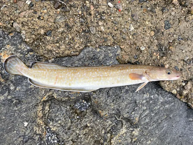 LingA long, eel-shaped gadoid of deep northern wrecks and rough ground, reaching over two metres and forty kilograms, and the classic wreck-fishing prize.
Vsevolod — CC BY 4.0, via Wikimedia Commons
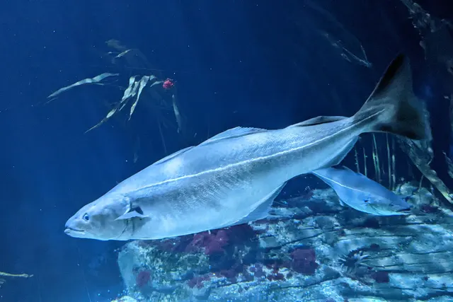 SaitheA fast, hard-fighting shoaling gadoid of northern rock and wreck — routinely confused with pollack, and a completely different fish once you know the lateral line.
Wilhelm Thomas Fiege — CC BY-SA 4.0, via Wikimedia Commons
 PollackA fast gadoid that hunts up off reefs and wrecks and takes a lure on the drop — and the sea fish most likely to convert a bait angler to lure fishing.
Wilhelm Thomas Fiege — CC BY-SA 4.0, via Wikimedia Commons
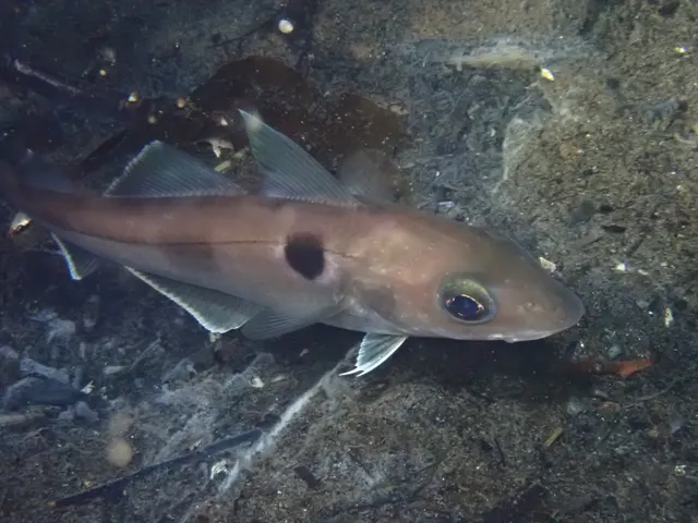 HaddockThe cod's smaller relative, marked with a black lateral line and a dark thumbprint, and one of the most important food fish in the North Atlantic.
Vsevolod Rudyi — CC BY 4.0, via Wikimedia Commons
 Atlantic mackerelA fast, schooling, obligate-swimming pelagic fish that arrives inshore in summer in enormous numbers, and the species most sea anglers catch first.
Hans Hillewaert — CC BY-SA 4.0, via Wikimedia Commons
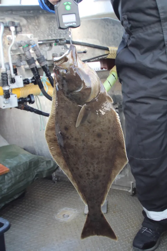 Atlantic halibutThe largest flatfish in the world, reaching over four metres, and a species whose commercial collapse made it one of the clearest cautionary tales in North Atlantic fisheries.
portulaca — CC BY, via iNaturalist
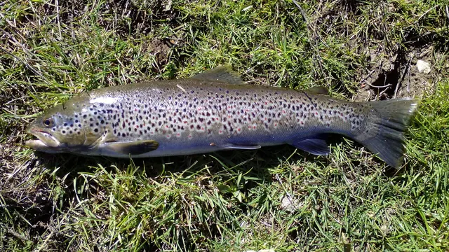 Brown troutA single, extraordinarily plastic species that appears as a tiny hill-stream fish, a deep-bodied loch trout and a silver sea-run migrant — all the same animal.
Robermix, CC0, via Wikimedia Commons
Places within this area
Publicly documented fishing geography. FishingHQ describes what the ground is; it does not say whether you may fish it, and every one of these sends that question to the body that holds the answer. Browse every place in this part of the world.
Who to ask before fishing any of these
FishingHQ does not know the current access position here. Sea angling in Scotland is not rod-licensed, but access rights under the Scottish Outdoor Access Code carry responsibilities, and harbour, local authority, marine conservation and fisheries measures all apply and all change. Check the current position with the Marine Directorate, the harbour or local authority and the land manager before going.
FishingHQ does not know the current access position here. Scotland has no general rod licence, and the fishing rights on almost every river and loch belong to somebody: a proprietor, an estate, an angling association or a district salmon fishery board. Permission is a separate question from access, and both change. Check with the relevant fishery board or association before going.
FishingHQ does not know the current access position here. Sea angling in Scotland is not rod-licensed, but access rights under the Scottish Outdoor Access Code carry responsibilities, and harbour, local authority, marine conservation and fisheries measures all apply and all change. Check the current position with the Marine Directorate, the harbour or local authority and the land manager before going. This water is tidal and transitional, so the freshwater regime may also apply above the tidal limit: FishingHQ does not know the current access position here. Scotland has no general rod licence, and the fishing rights on almost every river and loch belong to somebody: a proprietor, an estate, an angling association or a district salmon fishery board. Permission is a separate question from access, and both change. Check with the relevant fishery board or association before going.
Sumburgh Head
Headland · Salt water
A sandstone headland at Shetland's southern tip with a lighthouse on the cliff, deep water immediately off it and the Sumburgh Roost — a violent tidal race — running past.
Particular to this ground: moving water and currents.
Severe hazards of Shetland apply here: cliffs and rock platforms, boat safety, cold water shock.
Loch of Spiggie
Loch · Fresh water
The largest loch in the South Mainland, a shallow sheet lying behind the dunes at the head of the Bay of Scousburgh with a broad area of sandy shallows at its north end and reed beds along part of its margin.
Low-lying and open to the south-westerly wind that crosses the narrow South Mainland from the Atlantic side, with almost no shelter anywhere on it.
Severe hazards of Shetland apply here: cliffs and rock platforms, boat safety, cold water shock.
Particular to this water: The loch is an RSPB reserve rented by the Shetland Anglers Association, and its fishing is subject to the association's permit and to no-fishing zones covering the southern bay and a north-west corner. Nesting reed beds are closed ground. Both the reserve manager and the association hold conditions that change.
Loch of Tingwall
Loch · Fresh water
A limestone-floored loch in the fertile Tingwall valley, running north to south in a shallow trough of Dalradian marble that makes it markedly richer than Shetland's peat waters.
Sheltered by the valley sides compared with the hill lochs, which is part of why it fishes when the open moorland waters are unfishable.
Severe hazards of Shetland apply here: cliffs and rock platforms, boat safety, cold water shock.
Loch of Asta
Loch · Fresh water
The smaller southern water of the Tingwall pair, almost joined to Tingwall itself across a narrow neck of ground, on the same band of limestone and carrying sea trout as well as brown.
Severe hazards of Shetland apply here: cliffs and rock platforms, boat safety, cold water shock.
Loch of Girlsta
Loch · Fresh water
A large peat-stained loch of roughly ninety-seven hectares on the Mainland's east side, close to sea level and of low alkalinity, with a mean depth around ten metres and deeper holes along a broken eastern shore.
Low ground close to sea level with the A970 along its west shore and open moor behind, so it is exposed along its length but reachable in weather that closes the hill lochs.
Severe hazards of Shetland apply here: cliffs and rock platforms, boat safety, cold water shock.
Particular to this water: The loch holds Arctic charr, a cold-water relict population that the association requires to be released. Whether that is a byelaw, a permit condition or a conservation measure on the day is the association's and the fisheries authority's answer, not this record's.
Loch of Benston
Loch · Fresh water
A low-lying loch in Nesting sitting close to the Shetland coast behind a narrow strip of land, one of the three east-side waters the visitor guide groups as capable of trout over three pounds.
Severe hazards of Shetland apply here: cliffs and rock platforms, boat safety, cold water shock.
Loch of Clousta
Loch · Fresh water
A large, deeply indented Westside loch of many small bays, promontories and islands, lying in low hummocky ground a short distance behind the head of Clousta Voe and carrying sea trout as well as brown.
Open Westside moorland with no high ground close by, so the wind lanes that form between its islands are what make it fishable in a blow.
Severe hazards of Shetland apply here: cliffs and rock platforms, boat safety, cold water shock.
Loch of Vaara
Loch · Fresh water
A large, deep Westside loch on the Clousta road, sitting in open moorland with steep-sided margins and none of the shallow weedy shelf that most Shetland hill waters carry.
Severe hazards of Shetland apply here: cliffs and rock platforms, boat safety, cold water shock.
42 more places in this area
The Upper Loch of Brouster
Loch · Fresh water
A Westside loch behind Bridge of Walls holding fish farm cages, whose rich artificial feeding has produced trout far beyond anything the surrounding peat waters grow.
Severe hazards of Shetland apply here: cliffs and rock platforms, boat safety, cold water shock.
Particular to this water: The loch carries commercial aquaculture. Where a rod may fish in relation to working cages and moorings is the operator's and the association's answer and is not a matter of public right.
Eela Water
Loch · Fresh water
A broad open sheet of roughly sixty-four hectares on the Northmavine moorland, shallow across most of its area and exposed on every side, reached from the road that crosses the neck of the peninsula.
High open moor with no shelter at all, so it is a loch decided by the wind rather than by the fish.
Severe hazards of Shetland apply here: cliffs and rock platforms, boat safety, cold water shock.
Punds Water
Loch · Fresh water
A Northmavine hill loch on the peat ground above Mangaster, named by the visitor guide among the roadside-accessible northern waters and carrying sea trout as well as brown.
Severe hazards of Shetland apply here: cliffs and rock platforms, boat safety, cold water shock.
The Loch of Houlland, Eshaness
Loch · Fresh water
A loch on the Eshaness headland immediately behind the basalt cliffs, holding a broch on an islet at its north end and lying on volcanic rather than peat ground, which is unusual among Shetland's specimen waters.
Directly behind the most exposed cliff line in Shetland, taking the full Atlantic wind with the spray from the Eshaness cliffs carrying over it in a gale.
Severe hazards of Shetland apply here: cliffs and rock platforms, boat safety, cold water shock.
The Loch of Cliff
Loch · Fresh water
The longest loch in Unst, a narrow ribbon of water running north-east from Burrafirth between the serpentine hills of the island's north end, carrying sea trout up from the voe as well as brown.
Aligned with the valley it lies in, so the wind funnels along its length rather than across it and there is little lee on either bank.
Severe hazards of Shetland apply here: cliffs and rock platforms, boat safety, cold water shock.
Particular to this water: Unst runs a separate local permit from the association's general Shetland ticket. Which permit covers this water on the day is the association's answer.
The Loch of Huxter
Loch · Fresh water
A large loch in the low interior of Whalsay with an Iron Age blockhouse on an islet, lying on open ground close to the road and among the most straightforward waters in the islands to reach.
Severe hazards of Shetland apply here: cliffs and rock platforms, boat safety, cold water shock.
Particular to this water: Whalsay runs a separate local permit from the association's general Shetland ticket. Which permit covers this water on the day is the association's answer.
Papil Water
Loch · Fresh water
A small, shallow loch on Fetlar lying immediately behind the sand of Tresta beach, separated from the sea by little more than the beach itself.
Severe hazards of Shetland apply here: cliffs and rock platforms, boat safety, cold water shock.
The Lochs of Lumbister
Loch · Fresh water
A scatter of moorland waters on the RSPB ground above the Daal of Lumbister on Yell, reached across open blanket peat above a steep-sided gorge.
Severe hazards of Shetland apply here: cliffs and rock platforms, boat safety, cold water shock.
Particular to this water: The lochs lie on an RSPB reserve. Access, disturbance and ground-nesting bird constraints are the reserve manager's, and are separate from the association's fishing permit.
The Loch of Strom
Loch · Brackish water
A long, narrow tidal loch behind Strom Ness, joined to the head of Stromness Voe through a single narrow gut that the sea runs in and out of, so it is fresh at the head and salt at the outfall.
Severe hazards of Shetland apply here: cliffs and rock platforms, boat safety, cold water shock.
Weisdale Voe
Sea loch · Salt water
A long north-south voe running six kilometres inland from Stromness Voe to a burn mouth at Kergord, shallow and soft at the head where the Weisdale burn enters and deepening steadily towards the mouth.
Enclosed on both sides by the valley's hills, so it is fishable in weather that shuts the open west coast, and the wind runs along it rather than across.
Severe hazards of Shetland apply here: cliffs and rock platforms, boat safety, cold water shock.
Bixter Voe
Sea loch · Salt water
A short Westside voe running north from the head of Sandsound Voe to the settlement at Bixter, narrow, shallow and largely drying over mud and weed at its inner end.
Severe hazards of Shetland apply here: cliffs and rock platforms, boat safety, cold water shock.
The Vadills
Tidal channel · Salt water
A complex of shallow tidal lagoons and interconnected basins behind Sandsound Voe, filling and emptying through narrow sills so that large areas of sheltered sand and weed drain on each tide.
Severe hazards of Shetland apply here: cliffs and rock platforms, boat safety, cold water shock.
Particular to this water: The Vadills carry conservation designations covering the lagoon habitat itself. Constraints on access, disturbance and bait digging there are the designating body's and are independent of any fishing permit.
Bridge of Walls
Tidal channel · Salt water
The narrow crossing at the head of the Voe of Browland on the far Westside, where the tide runs through a constriction under the road between the sea and the brackish water behind it.
Severe hazards of Shetland apply here: cliffs and rock platforms, boat safety, cold water shock.
Ronas Voe
Sea loch · Salt water
A steep-sided fjordic voe cut into the red granite of Northmavine beneath Ronas Hill, deep for most of its length with cliffs falling straight to the water on the north side and a shallow burn mouth at its head.
Enclosed and deep, but the air draining off Ronas Hill produces squalls along it that the area forecast does not describe.
Severe hazards of Shetland apply here: cliffs and rock platforms, boat safety, cold water shock.
The Brig of Collafirth
Tidal channel · Salt water
The narrows at the head of Collafirth in Northmavine, where the voe pinches to a channel under the road and the tide runs through between the outer firth and the shallow basin above it.
Severe hazards of Shetland apply here: cliffs and rock platforms, boat safety, cold water shock.
Dales Voe, Delting
Sea loch · Salt water
A narrow voe running south-west off the mouth of Sullom Voe in Delting, steep on its northern side and shoaling to soft ground at the head where the Burn of Dale enters.
Severe hazards of Shetland apply here: cliffs and rock platforms, boat safety, cold water shock.
Dury Voe
Sea loch · Salt water
A wide east-facing voe between Lunna Ness and the Nesting shore, open to the North Sea at its mouth and branching at its head into the shallow inlets at Laxo and Dury.
Open eastwards, so it takes wind and sea straight off the North Sea and is a different proposition from the sheltered Westside voes.
Severe hazards of Shetland apply here: cliffs and rock platforms, boat safety, cold water shock.
Catfirth Voe
Sea loch · Salt water
A small sheltered inlet off the south side of the Voe of Catfirth in Nesting, shallow and soft-bottomed, with the remains of a First World War seaplane station on its shore.
Severe hazards of Shetland apply here: cliffs and rock platforms, boat safety, cold water shock.
Gloup Voe
Sea loch · Salt water
A narrow, steep-sided cleft at the northern tip of Yell running inland from an exposed north-facing entrance, with high ground on both flanks and a small burn at its head.
The entrance faces north into open Atlantic water with nothing between it and the edge of the shelf, so swell runs straight into the voe in a northerly.
Severe hazards of Shetland apply here: cliffs and rock platforms, boat safety, cold water shock.
Hamnavoe, Yell
Sea loch · Salt water
A small west-facing inlet on the Yell shore of Yell Sound, sheltered behind its own entrance and lying on the quiet side of the island away from the sound's main tidal stream.
Severe hazards of Shetland apply here: cliffs and rock platforms, boat safety, cold water shock.
West Sandwick
Beach · Salt water
A west-facing sand beach on Yell backed by low dunes and machair, one of the few substantial stretches of clean sand on an island otherwise of peat and rock, looking across Yell Sound to Northmavine.
Open across Yell Sound to the west, so a westerly puts a working surf onto it while the east side of the island stays flat.
Severe hazards of Shetland apply here: cliffs and rock platforms, boat safety, cold water shock.
Baltasound
Bay · Salt water
A wide, sheltered east-facing bay on Unst behind the long spit of Balta Isle, the largest natural harbour in the north isles and once the base of an enormous herring fleet.
Sheltered from all but easterly weather by Balta Isle lying across its mouth, which is what made it a herring station and what makes it fishable in most conditions.
Severe hazards of Shetland apply here: cliffs and rock platforms, boat safety, cold water shock.
Uyeasound
Sound or strait · Salt water
The sheltered water between the south end of Unst and the island of Uyea, with a pier and a small settlement on the Unst shore and the tide running through the sound between them.
Severe hazards of Shetland apply here: cliffs and rock platforms, boat safety, cold water shock.
Burrafirth Beach
Beach · Salt water
A sand and shingle beach at the head of Burra Firth on Unst, enclosed between the serpentine ridge of Saxa Vord and the cliffs of Hermaness, with the outflow of the Loch of Cliff entering behind it.
The firth opens due north into the most exposed water in the British Isles, so a northerly sends swell the full length of it onto the beach.
Severe hazards of Shetland apply here: cliffs and rock platforms, boat safety, cold water shock.
The Spiggie beaches
Beach · Salt water
The sand of Scousburgh and Spiggie on the Atlantic side of the South Mainland, a broad west-facing bay of clean graded sand with the Loch of Spiggie lying immediately behind the dunes.
Faces west into open Atlantic with no shelter, so it carries genuine surf and is unfishable from the shore in any weight of onshore weather.
Severe hazards of Shetland apply here: cliffs and rock platforms, boat safety, cold water shock.
Yell Sound
Sound or strait · Salt water
The tidal channel between the Mainland and Yell, scattered with small holms and skerries and carrying a strong stream through the narrows between them, with the Sullom Voe terminal on its southern shore.
Open at both ends, with a north-going stream meeting north-westerly weather at the Atlantic end.
Particular to this ground: boat traffic and being seen.
Severe hazards of Shetland apply here: cliffs and rock platforms, boat safety, cold water shock.
Bluemull Sound
Tidal race · Salt water
The narrow channel between Yell and Unst, carrying one of the strongest tidal streams in Shetland through a constriction that has been used as a test site for tidal turbines.
Particular to this ground: moving water and currents.
Severe hazards of Shetland apply here: cliffs and rock platforms, boat safety, cold water shock.
Bressay Sound
Sound or strait · Salt water
The deep sheltered channel between Lerwick and the island of Bressay, open at both ends, which has served as Shetland's principal anchorage for as long as there has been shipping in the islands.
Sheltered by Bressay from the east and by the Mainland from the west, which is the whole reason the town is where it is.
Particular to this ground: boat traffic and being seen.
Severe hazards of Shetland apply here: cliffs and rock platforms, boat safety, cold water shock.
Mousa Sound
Sound or strait · Salt water
The shallow channel between the Mainland at Sandwick and the uninhabited island of Mousa, with a strong stream through its narrow middle and clean sand and weed ground on both sides.
Severe hazards of Shetland apply here: cliffs and rock platforms, boat safety, cold water shock.
Particular to this water: Mousa is a bird reserve reached by a seasonal passenger boat. Landing, disturbance and the presence of nesting and roosting seabirds are the reserve manager's and the operator's constraints and are separate from anything about fishing.
Esha Ness
Cliff coast · Salt water
A wall of andesite and tuff on the Atlantic edge of Northmavine, one of the most violently exposed cliff lines in Britain, with blowholes, stacks and blocks of rock thrown onto the clifftop by storm waves.
Full open Atlantic with the whole fetch of the Norwegian Sea behind it, and a coast where storm waves reach the top of a sixty-metre cliff.
Particular to this ground: cliffs and rock platforms.
Severe hazards of Shetland apply here: boat safety, cold water shock.
St Ninian's Isle and the tombolo
Island · Salt water
A tied island off the west side of the South Mainland joined to it by the largest active sand tombolo in Britain, a double-sided bar of clean shell sand that the sea works from both flanks at once.
The tombolo takes weather on both faces, so one side is always the lee and neither is sheltered in a westerly of any weight.
Particular to this ground: tides and being cut off.
Severe hazards of Shetland apply here: cliffs and rock platforms, boat safety, cold water shock.
Mavis Grind
Tidal channel · Salt water
The isthmus where Northmavine joins the Mainland, a strip of rock barely thirty metres wide with the Atlantic on one side and the North Sea on the other, and shallow water on both.
Two entirely different seas within a stone's throw, so one side is always in the lee and the two behave independently in the same weather.
Severe hazards of Shetland apply here: cliffs and rock platforms, boat safety, cold water shock.
Lunna Ness
Headland · Salt water
A long, low peninsula reaching north-east between Dury Voe and Yell Sound, ending in broken rock and skerries with deep water close in on its outer side.
Exposed on the north-east face to anything coming down from the Norwegian Sea, and sheltered on the Dury Voe side in the same weather.
Severe hazards of Shetland apply here: cliffs and rock platforms, boat safety, cold water shock.
Whiteness and the mouth of Stromness Voe
Headland · Salt water
The low tip of the Whiteness peninsula where Stromness Voe opens into Whiteness Voe, with the tide running hard round the point and mixed rock and sand ground on both faces.
Severe hazards of Shetland apply here: cliffs and rock platforms, boat safety, cold water shock.
Sullom Voe
Sea loch · Salt water
A long, deep, sheltered voe running south from Yell Sound, deep enough for the largest tankers and carrying Europe's principal North Sea oil terminal along its eastern shore.
Particular to this ground: boat traffic and being seen.
Severe hazards of Shetland apply here: cliffs and rock platforms, boat safety, cold water shock.
Particular to this water: The voe is a working oil port with a statutory harbour authority, controlled areas and security constraints along much of its shore. Where a person may be, on the water or on the land, is the port authority's answer and is not a matter of public right.
Lerwick harbour
Harbour wall · Salt water
Shetland's principal port, a long working waterfront of stone and concrete quays on the Mainland shore of Bressay Sound, with deep water alongside and clean sand between the berths.
Sheltered by Bressay across the sound, so the harbour is workable in weather that closes every open coast in the islands.
Particular to this ground: boat traffic and being seen.
Severe hazards of Shetland apply here: cliffs and rock platforms, boat safety, cold water shock.
Particular to this water: The quays are the harbour authority's operational estate. Which berths, if any, a person may fish from, and when, is the authority's decision, is frequently seasonal and changes with vessel movements.
Scalloway harbour
Harbour wall · Salt water
Shetland's old capital and its main west-side port, set behind the shelter of the Scalloway islands with a fish market, quays and a boatyard on a shore of mixed rock and sand.
Sheltered from the west by Trondra, Burra and the smaller Scalloway islands lying across the approach, which is what makes a west-coast port possible here at all.
Severe hazards of Shetland apply here: cliffs and rock platforms, boat safety, cold water shock.
Particular to this water: The quays are the harbour authority's operational estate. Whether angling is permitted, where and when is the authority's decision and changes with vessel movements.
Collafirth pier
Pier · Salt water
A deep-water pier and small marina at Saltoo in Collafirth, Northmavine, built in 1988 on the site of a Norwegian whaling station and standing in about nine metres at low water.
Severe hazards of Shetland apply here: cliffs and rock platforms, boat safety, cold water shock.
Particular to this water: The pier is an operational council facility with a marina manager. Whether angling is permitted from it, and from where, is the operator's decision rather than anything this page can state.
Cullivoe
Charter departure port · Salt water
A working pier at the north end of Yell on the Bluemull Sound shore, the departure point for the boats that fish the deep ground off the north isles.
Severe hazards of Shetland apply here: cliffs and rock platforms, boat safety, cold water shock.
Particular to this water: A working pier with commercial users. Access to it and any angling from it are the operator's decision and are separate from anything about the grounds it serves.
The grounds off Muckle Flugga
Sea area · Salt water
The deep water off the stacks at the north end of Unst, where the ground falls to around fifty metres within reach of the lighthouse and the Atlantic and Norwegian Sea streams meet over it.
The most exposed water in the British Isles, with nothing between it and the edge of the shelf, and a sea that gets up faster than a small boat can leave it.
Particular to this ground: boat safety.
Severe hazards of Shetland apply here: cliffs and rock platforms, cold water shock.
The Out Skerries
Island · Salt water
Shetland's most easterly inhabited ground, a cluster of low rocky islands and skerries thirteen kilometres off Whalsay with a sheltered natural harbour between the two main isles and deep water all round.
Isolated low ground in open North Sea water with no larger island to windward in any direction.
Severe hazards of Shetland apply here: cliffs and rock platforms, boat safety, cold water shock.
Symbister
Harbour wall · Salt water
Whalsay's harbour and ferry terminal, a deep, sheltered inlet on the island's south-west shore serving one of Scotland's most concentrated pelagic fishing fleets.
Sheltered by the island itself and by the holms across its approach, so it works when the sound outside does not.
Particular to this ground: boat traffic and being seen.
Severe hazards of Shetland apply here: cliffs and rock platforms, boat safety, cold water shock.
Particular to this water: A working fishing port and ferry terminal. Access to the quays and any angling from them are the harbour authority's decision and change with vessel movements.
Safety
Cliffs and rock platforms — Can cause serious injury or death
Shore fishing here happens on cliff and rock ledges above deep water on a coast exposed to Atlantic swell with no shelter. Long-period ground swell arrives independently of local wind, and being swept from a ledge into cold deep water below a cliff is the characteristic serious accident.
What reduces it: Read swell height, period and direction rather than wind, watch a full set before committing to a ledge, stand higher than feels necessary, wear a buoyancy aid, never fish exposed cliff alone, and know the exit before you need it.
Worse when:
- With any Atlantic ground swell running, including on a calm day.
- In winter, when daylight is very short and conditions change fast.
- On unfamiliar ground, where which ledges are workable is entirely local knowledge.
Boat safety — Can cause serious injury or death
The roosts around Shetland are among the strongest tidal races in Britain, producing overfalls and standing waves capable of overwhelming a small boat in otherwise calm conditions. Wind against tide makes them dramatically worse, and the archipelago is among the windiest places in Britain.
What reduces it: Plan passages around slack water and neap tides, never enter a roost with wind against stream, know the tidal streams before leaving, and treat a decision not to go as the normal outcome rather than a failure.
Cold water shock — Can cause serious injury or death
Sea temperature at this latitude is cold year-round. Immersion triggers the involuntary gasp and hyperventilation response and swimming ability is lost within the first minute — which below a cliff with deep moving water is the minute that decides the outcome.
What reduces it: Wear a buoyancy aid on cliff and in a boat, and if immersed, float and control breathing before attempting to swim. Do not assume summer water is warm enough to remove this risk.
Further safety reading
- Boat safety for anglers — The roosts around the islands are among the strongest tidal races in Britain and can overwhelm a small boat in otherwise calm conditions.
- Cold water shock and immersion — Sea temperature at sixty degrees north is cold year-round, and immersion below a cliff removes the ability to swim within the first minute.
- Rock platform and cliff safety — Cliff and rock ledges above deep water on a coast exposed to Atlantic swell with no shelter, where ground swell arrives independently of local wind.
- Weather, lightning and open water — Shetland is among the windiest places in Britain with gale frequency to match, and weather changes fast at this latitude with very short winter days.
Check the rules before you fish
Fishing laws, bylaws, access rules, seasons, bait restrictions and permitted methods vary by location and can change. Check the current rules from the relevant authority and the water you intend to fish before fishing.
Check with:
- Current national or regional law for where you are fishing
- Current local bylaws
- The relevant fisheries authority
- The landowner, club or fishery whose water it is
- Any restrictions specific to the species or the method you intend to use
Where to go next
What swims here
- Atlantic codOccupies the hard ground and deeper water around the islands, and was one of the two species the historic haaf fishery was built on.
- Atlantic halibutOccurs on the deeper ground around the islands, at a northern latitude that suits the species, and carries its depleted status here as everywhere.
- Atlantic mackerelArrives inshore in the warmer months and is the forage base and bait supply for everything else.
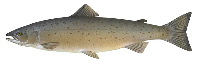 Atlantic salmonRuns a small number of systems in modest numbers, and sea trout use the voes and the shallow tidal margins around the coast.
- Brown troutOccupies hundreds of lochs across the islands, mostly peaty and holding numbers of modest wild fish, with a smaller number of richer waters producing better ones.
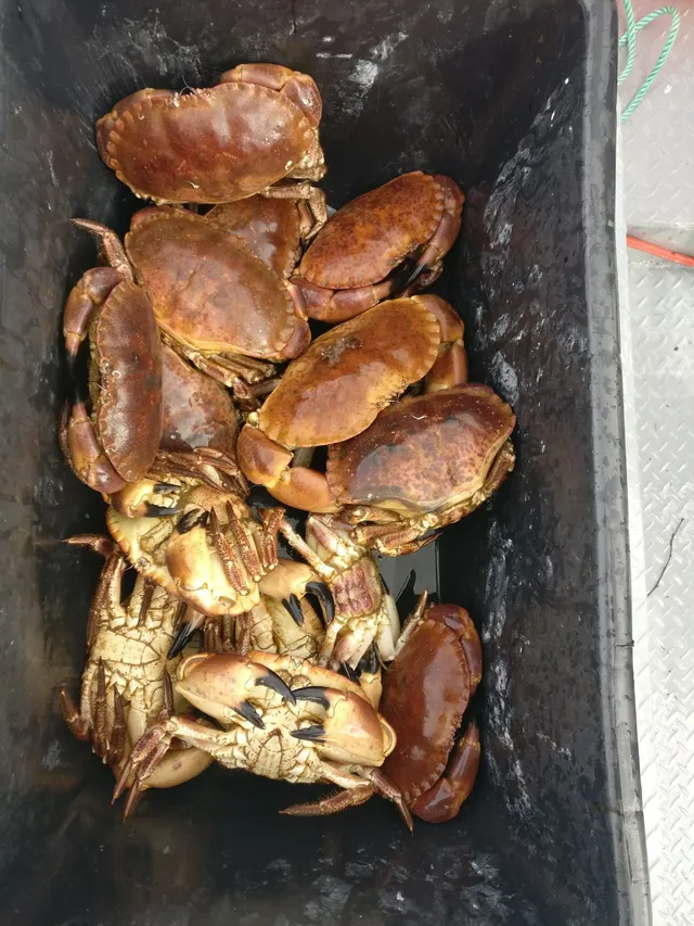 Edible crabWorked in creels around the islands alongside velvet crab and lobster, in the inshore fishery the local regulating order governs.
- European lobsterOccupies the rocky inshore ground and is one of the mainstays of the creel fishery managed under the islands' shellfish regulating order.
- HaddockWorks the cleaner ground offshore and is a mainstay of both the commercial fishery and small-boat angling.
How this compares
Rules and access
Environment and conservation
History and culture
Sources and evidence
- The Fishes of the British Isles and North-West Europe — Macmillan, 1969 (Reference work)Relied on for: Distribution, habitat association, depth and ground preference of fishes in British and north-west European waters.States this directlyCitation checked — the work exists and is described correctly
- FishBase: a global information system on fishes — Froese, R. and D. Pauly, eds. — FishBase Consortium (Scientific institute)Relied on for: Distribution, habitat association and depth range recorded for the species.Background and mechanism onlyPassage read and verified
- Rock fishing safety and the declared lifejacket areas of New South Wales — NSW Department of Primary Industries and Surf Life Saving NSW (Water-safety or diver-training authority)Relied on for: Rock and ledge fishing hazards, the mechanism by which anglers are swept from exposed platforms, and the measures that reduce it.States this directlyCitation checked — the work exists and is described correctly
- United States Lifesaving Association public education on rip currents and the surf zone — United States Lifesaving Association (Water-safety or diver-training authority)Relied on for: Surf zone hazards, rip current formation and behaviour, and the circumstances in which people are carried offshore.States this directlyCitation checked — the work exists and is described correctly
Why the 23 connections on this page are here, and the sources
What swims here
Backed by research — 11 connections
Supported by peer-reviewed research or fisheries science. The sources are listed and can be checked.
Atlantic cod
A distribution association between an animal and a kind of water, rather than a claim about any named mark.
- The Fishes of the British Isles and North-West Europe — Macmillan, 1969 (Reference work)Relied on for: Distribution, habitat association, depth and ground preference of fishes in British and north-west European waters.States this directlyCitation checked — the work exists and is described correctly
- FishBase: a global information system on fishes — Froese, R. and D. Pauly, eds. — FishBase Consortium (Scientific institute)Relied on for: Distribution, habitat association and depth range recorded for the species.Background and mechanism onlyPassage read and verified
Atlantic halibut
A distribution association between an animal and a kind of water, rather than a claim about any named mark.
- The Fishes of the British Isles and North-West Europe — Macmillan, 1969 (Reference work)Relied on for: Distribution, habitat association, depth and ground preference of fishes in British and north-west European waters.States this directlyCitation checked — the work exists and is described correctly
- FishBase: a global information system on fishes — Froese, R. and D. Pauly, eds. — FishBase Consortium (Scientific institute)Relied on for: Distribution, habitat association and depth range recorded for the species.Background and mechanism onlyPassage read and verified
Atlantic mackerel
A distribution association between an animal and a kind of water, rather than a claim about any named mark.
- The Fishes of the British Isles and North-West Europe — Macmillan, 1969 (Reference work)Relied on for: Distribution, habitat association, depth and ground preference of fishes in British and north-west European waters.States this directlyCitation checked — the work exists and is described correctly
- FishBase: a global information system on fishes — Froese, R. and D. Pauly, eds. — FishBase Consortium (Scientific institute)Relied on for: Distribution, habitat association and depth range recorded for the species.Background and mechanism onlyPassage read and verified
Atlantic salmon
A distribution association between an animal and a kind of water, rather than a claim about any named mark.
- The Fishes of the British Isles and North-West Europe — Macmillan, 1969 (Reference work)Relied on for: Distribution, habitat association, depth and ground preference of fishes in British and north-west European waters.States this directlyCitation checked — the work exists and is described correctly
- FishBase: a global information system on fishes — Froese, R. and D. Pauly, eds. — FishBase Consortium (Scientific institute)Relied on for: Distribution, habitat association and depth range recorded for the species.Background and mechanism onlyPassage read and verified
Brown trout
A distribution association between an animal and a kind of water, rather than a claim about any named mark.
- The Fishes of the British Isles and North-West Europe — Macmillan, 1969 (Reference work)Relied on for: Distribution, habitat association, depth and ground preference of fishes in British and north-west European waters.States this directlyCitation checked — the work exists and is described correctly
- FishBase: a global information system on fishes — Froese, R. and D. Pauly, eds. — FishBase Consortium (Scientific institute)Relied on for: Distribution, habitat association and depth range recorded for the species.Background and mechanism onlyPassage read and verified
Edible crab
A distribution association between an animal and a kind of water, rather than a claim about any named mark.
- The Fishes of the British Isles and North-West Europe — Macmillan, 1969 (Reference work)Relied on for: Distribution, habitat association, depth and ground preference of fishes in British and north-west European waters.States this directlyCitation checked — the work exists and is described correctly
- FishBase: a global information system on fishes — Froese, R. and D. Pauly, eds. — FishBase Consortium (Scientific institute)Relied on for: Distribution, habitat association and depth range recorded for the species.Background and mechanism onlyPassage read and verified
European lobster
A distribution association between an animal and a kind of water, rather than a claim about any named mark.
- The Fishes of the British Isles and North-West Europe — Macmillan, 1969 (Reference work)Relied on for: Distribution, habitat association, depth and ground preference of fishes in British and north-west European waters.States this directlyCitation checked — the work exists and is described correctly
- FishBase: a global information system on fishes — Froese, R. and D. Pauly, eds. — FishBase Consortium (Scientific institute)Relied on for: Distribution, habitat association and depth range recorded for the species.Background and mechanism onlyPassage read and verified
Haddock
A distribution association between an animal and a kind of water, rather than a claim about any named mark.
- The Fishes of the British Isles and North-West Europe — Macmillan, 1969 (Reference work)Relied on for: Distribution, habitat association, depth and ground preference of fishes in British and north-west European waters.States this directlyCitation checked — the work exists and is described correctly
- FishBase: a global information system on fishes — Froese, R. and D. Pauly, eds. — FishBase Consortium (Scientific institute)Relied on for: Distribution, habitat association and depth range recorded for the species.Background and mechanism onlyPassage read and verified
Ling
A distribution association between an animal and a kind of water, rather than a claim about any named mark.
- The Fishes of the British Isles and North-West Europe — Macmillan, 1969 (Reference work)Relied on for: Distribution, habitat association, depth and ground preference of fishes in British and north-west European waters.States this directlyCitation checked — the work exists and is described correctly
- FishBase: a global information system on fishes — Froese, R. and D. Pauly, eds. — FishBase Consortium (Scientific institute)Relied on for: Distribution, habitat association and depth range recorded for the species.Background and mechanism onlyPassage read and verified
Pollack
A distribution association between an animal and a kind of water, rather than a claim about any named mark.
- The Fishes of the British Isles and North-West Europe — Macmillan, 1969 (Reference work)Relied on for: Distribution, habitat association, depth and ground preference of fishes in British and north-west European waters.States this directlyCitation checked — the work exists and is described correctly
- FishBase: a global information system on fishes — Froese, R. and D. Pauly, eds. — FishBase Consortium (Scientific institute)Relied on for: Distribution, habitat association and depth range recorded for the species.Background and mechanism onlyPassage read and verified
Saithe
A distribution association between an animal and a kind of water, rather than a claim about any named mark.
- The Fishes of the British Isles and North-West Europe — Macmillan, 1969 (Reference work)Relied on for: Distribution, habitat association, depth and ground preference of fishes in British and north-west European waters.States this directlyCitation checked — the work exists and is described correctly
- FishBase: a global information system on fishes — Froese, R. and D. Pauly, eds. — FishBase Consortium (Scientific institute)Relied on for: Distribution, habitat association and depth range recorded for the species.Background and mechanism onlyPassage read and verified
How people fish here
What experienced anglers do — 4 connections
Widely and independently recommended by experienced anglers and specialist sources. This is real angling knowledge, not proof: controlled evidence for it is limited, and FishingHQ records it as convention rather than as a demonstrated effect.
Fly fishing
A discipline that is characteristic of the place rather than merely possible there, joined so a reader can move between the place and the practice.
- General angling website restatements of established technique — Various (Credible secondary source)Relied on for: Widely restated practice associating this discipline with this place, recorded as practitioner consensus rather than as tested fact.Background and mechanism onlyCitation checked — the work exists and is described correctly
- Fishers' Craft and Lettered Art: Tracts on Fishing from the End of the Middle Ages — University of Toronto Press, 1997 (Scientific literature)Relied on for: That fishing traditions develop around the water and fish available to them, and the historical method of reading such traditions.States this directlyCitation checked — the work exists and is described correctly
Purse seining
A discipline that is characteristic of the place rather than merely possible there, joined so a reader can move between the place and the practice.
- General angling website restatements of established technique — Various (Credible secondary source)Relied on for: Widely restated practice associating this discipline with this place, recorded as practitioner consensus rather than as tested fact.Background and mechanism onlyCitation checked — the work exists and is described correctly
- Fishers' Craft and Lettered Art: Tracts on Fishing from the End of the Middle Ages — University of Toronto Press, 1997 (Scientific literature)Relied on for: That fishing traditions develop around the water and fish available to them, and the historical method of reading such traditions.States this directlyCitation checked — the work exists and is described correctly
Sea fishing
A discipline that is characteristic of the place rather than merely possible there, joined so a reader can move between the place and the practice.
- General angling website restatements of established technique — Various (Credible secondary source)Relied on for: Widely restated practice associating this discipline with this place, recorded as practitioner consensus rather than as tested fact.Background and mechanism onlyCitation checked — the work exists and is described correctly
- Fishers' Craft and Lettered Art: Tracts on Fishing from the End of the Middle Ages — University of Toronto Press, 1997 (Scientific literature)Relied on for: That fishing traditions develop around the water and fish available to them, and the historical method of reading such traditions.States this directlyCitation checked — the work exists and is described correctly
Traps and pots
A discipline that is characteristic of the place rather than merely possible there, joined so a reader can move between the place and the practice.
- General angling website restatements of established technique — Various (Credible secondary source)Relied on for: Widely restated practice associating this discipline with this place, recorded as practitioner consensus rather than as tested fact.Background and mechanism onlyCitation checked — the work exists and is described correctly
- Fishers' Craft and Lettered Art: Tracts on Fishing from the End of the Middle Ages — University of Toronto Press, 1997 (Scientific literature)Relied on for: That fishing traditions develop around the water and fish available to them, and the historical method of reading such traditions.States this directlyCitation checked — the work exists and is described correctly
How this compares
What experienced anglers do — 1 connection
Widely and independently recommended by experienced anglers and specialist sources. This is real angling knowledge, not proof: controlled evidence for it is limited, and FishingHQ records it as convention rather than as a demonstrated effect.
Orkney
Two places a reader would reasonably weigh against one another, joined where the comparison teaches something about both. It is also how the larger geography is linked to what sits inside it.
- General angling website restatements of established technique — Various (Credible secondary source)Relied on for: Widely restated practice associating this discipline with this place, recorded as practitioner consensus rather than as tested fact.Background and mechanism onlyCitation checked — the work exists and is described correctly
- Fishers' Craft and Lettered Art: Tracts on Fishing from the End of the Middle Ages — University of Toronto Press, 1997 (Scientific literature)Relied on for: That fishing traditions develop around the water and fish available to them, and the historical method of reading such traditions.States this directlyCitation checked — the work exists and is described correctly
Safety reading
Official guidance — 4 connections
Stated by a fisheries authority, scientific institute or recognised angling body. Authoritative, but summarising rather than demonstrating.
Boat safety for anglers
A place is joined to the safety topic that explains a hazard genuinely characteristic of it, so the mechanism is reachable rather than restated as a weak warning.
- RNLI water safety guidance: cold water shock and Float to Live — Royal National Lifeboat Institution (Water-safety or diver-training authority)Relied on for: Cold water shock and the immersion response, shore angling hazards, small-craft guidance and the circumstances in which water users are most often killed.States this directlyPassage read and verified
- RoSPA water safety information and UK accidental drowning statistics — Royal Society for the Prevention of Accidents (Water-safety or diver-training authority)Relied on for: Accidental drowning statistics and the circumstances in which recreational water users are most often killed.Background and mechanism onlyPassage read and verified
Cold water shock and immersion
A place is joined to the safety topic that explains a hazard genuinely characteristic of it, so the mechanism is reachable rather than restated as a weak warning.
- RNLI water safety guidance: cold water shock and Float to Live — Royal National Lifeboat Institution (Water-safety or diver-training authority)Relied on for: Cold water shock and the immersion response, shore angling hazards, small-craft guidance and the circumstances in which water users are most often killed.States this directlyPassage read and verified
- RoSPA water safety information and UK accidental drowning statistics — Royal Society for the Prevention of Accidents (Water-safety or diver-training authority)Relied on for: Accidental drowning statistics and the circumstances in which recreational water users are most often killed.Background and mechanism onlyPassage read and verified
Rock platform and cliff safety
A place is joined to the safety topic that explains a hazard genuinely characteristic of it, so the mechanism is reachable rather than restated as a weak warning.
- Rock fishing safety and the declared lifejacket areas of New South Wales — NSW Department of Primary Industries and Surf Life Saving NSW (Water-safety or diver-training authority)Relied on for: Rock and ledge fishing hazards, the mechanism by which anglers are swept from exposed platforms, and the measures that reduce it.States this directlyCitation checked — the work exists and is described correctly
- United States Lifesaving Association public education on rip currents and the surf zone — United States Lifesaving Association (Water-safety or diver-training authority)Relied on for: Surf zone hazards, rip current formation and behaviour, and the circumstances in which people are carried offshore.States this directlyCitation checked — the work exists and is described correctly
Weather, lightning and open water
A place is joined to the safety topic that explains a hazard genuinely characteristic of it, so the mechanism is reachable rather than restated as a weak warning.
- NOAA National Weather Service marine forecasts and marine weather services — National Oceanic and Atmospheric Administration, United States (Government fisheries body)Relied on for: Marine forecasting, thunderstorm and tropical cyclone warning practice, and the products issued for coastal and offshore waters.States this directlyCitation checked — the work exists and is described correctly
- Met Office shipping forecast, inshore waters forecast and marine warnings — Met Office, United Kingdom (Government fisheries body)Relied on for: Inshore waters forecasting, sea state, swell and the marine warning products issued for European coastal waters.Background and mechanism onlyCitation checked — the work exists and is described correctly
Rules and access
Official guidance — 1 connection
Stated by a fisheries authority, scientific institute or recognised angling body. Authoritative, but summarising rather than demonstrating.
Licences and permission
A place joined to the regulatory concept whose structure it illustrates. The edge asserts that the concept applies here, never what any current rule says.
- Code of Conduct for Responsible Fisheries — Food and Agriculture Organization of the United Nations, Rome, 1995 (Standards body)Relied on for: Principles for the management of fisheries, including licensing, closed seasons, size limits and the treatment of small-scale and shared stocks.States this directlyCitation checked — the work exists and is described correctly
- Good Fish Guide — Marine Conservation Society (Conservation authority)Relied on for: Assessment of fisheries and the management measures applied to them, including the instruments used and their purpose.Background and mechanism onlyCitation checked — the work exists and is described correctly
Environment and conservation
Backed by research — 1 connection
Supported by peer-reviewed research or fisheries science. The sources are listed and can be checked.
Fish stocks and sustainability
An environmental pressure that is specific to this place rather than general to fishing, joined so the issue is anchored to a real example.
- The IUCN Red List of Threatened Species — International Union for Conservation of Nature (Conservation authority)Relied on for: Assessment of the species and habitats affected, and the pressures acting on them, including habitat change and exploitation.States this directlyCitation checked — the work exists and is described correctly
- Code of Conduct for Responsible Fisheries — Food and Agriculture Organization of the United Nations, Rome, 1995 (Standards body)Relied on for: Principles for responsible fisheries management, precaution, gear selectivity and the treatment of shared and small-scale fisheries.Background and mechanism onlyCitation checked — the work exists and is described correctly
History and culture
Official guidance — 1 connection
Stated by a fisheries authority, scientific institute or recognised angling body. Authoritative, but summarising rather than demonstrating.
Fishing, communities and economies
A place joined to the documented fishing tradition it belongs to, so the history has a real setting and the place has a real past.
- Fishers' Craft and Lettered Art: Tracts on Fishing from the End of the Middle Ages — University of Toronto Press, 1997 (Scientific literature)Relied on for: The historical development of fishing practice and its transmission, and the method of reading a fishing tradition from its documentary record.States this directlyCitation checked — the work exists and is described correctly
- FAO fishing gear types and fishing technology information — Food and Agriculture Organization of the United Nations (Scientific institute)Relied on for: Descriptions of fishing gear types and their operation, including fixed traps, pots and small-scale gears.Background and mechanism onlyCitation checked — the work exists and is described correctly
How FishingHQ labels evidence is explained in the evidence policy.