The grounds off Muckle Flugga
Sea area · Salt water · in Shetland
The deep water off the stacks at the north end of Unst, where the ground falls to around fifty metres within reach of the lighthouse and the Atlantic and Norwegian Sea streams meet over it.
Safety: boat safety — can cause serious injury or death. 2 more points apply here.
FishingHQ describes what this place is, not whether you may fish it. Access, permits and who to ask.
What you can catch here
Documented at this place, grouped by how you would be fishing, with how strongly the sources support each one. This is what has been written down, not a forecast, and being listed is never permission to fish.
From a boat · 3

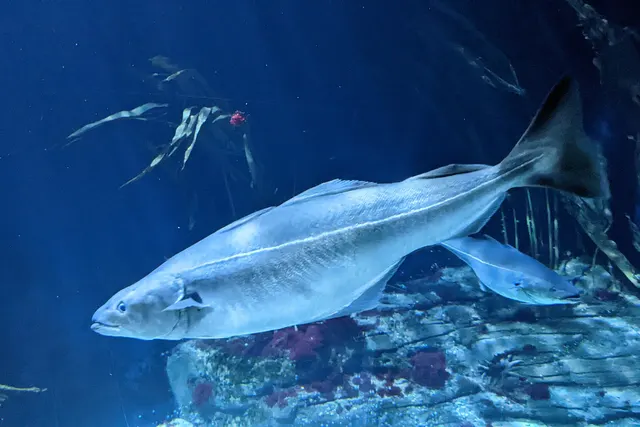
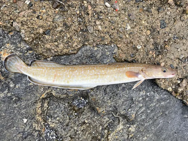
What these strengths mean
- Repeatedly reported
- Several independent public accounts. Enough to say it happens more than once; not enough to call it a fishery.
- Recorded here
- At least one credible public account of this species being caught here. That is all it means.
- How breadth is counted
- A fish documented at six marks is shown as six marks: breadth never raises the strength on its own. A fishery account describes the fishing; a recorded catch reports one specific catch. How evidence is weighed.
How people fish it
Practised here: Sea fishing.
Methods the sources name for this ground. Each one is explained in full on its own page.
- Jigging
Working a weighted lure with a rising-and-falling motion, usually vertically, so it behaves like a wounded or fleeing baitfish.
- Deep-drop fishing
Fishing baits several hundred metres down with heavy weights and, usually, an electric reel — a method defined entirely by what depth does to everything else.
The ground and the water
- The ground
- The deep water off the stacks at the north end of Unst, where the ground falls to around fifty metres within reach of the lighthouse and the Atlantic and Norwegian Sea streams meet over it.
- Exposure
- The most exposed water in the British Isles, with nothing between it and the edge of the shelf, and a sea that gets up faster than a small boat can leave it.
- Depth
- Worked at around a hundred and seventy-five feet, so it is jigging and deep-drop ground rather than anything a shore rod reaches.
Safety
Boat safety — Can cause serious injury or death
The ground is roughly an hour's sail north of the nearest launch into the most exposed water in the British Isles, where two ocean streams meet and conditions deteriorate faster than a small craft can run home.
What reduces it: Treat it as offshore passage-making rather than as a fishing trip, go in a boat and with people equipped for it, and set a turn-round decision on the forecast before leaving.
Cliffs and rock platforms — Can cause serious injury or death
Shore fishing here happens on cliff and rock ledges above deep water on a coast exposed to Atlantic swell with no shelter. Long-period ground swell arrives independently of local wind, and being swept from a ledge into cold deep water below a cliff is the characteristic serious accident.
What reduces it: Read swell height, period and direction rather than wind, watch a full set before committing to a ledge, stand higher than feels necessary, wear a buoyancy aid, never fish exposed cliff alone, and know the exit before you need it.
Worse when:
- With any Atlantic ground swell running, including on a calm day.
- In winter, when daylight is very short and conditions change fast.
- On unfamiliar ground, where which ledges are workable is entirely local knowledge.
Cold water shock — Can cause serious injury or death
Sea temperature at this latitude is cold year-round. Immersion triggers the involuntary gasp and hyperventilation response and swimming ability is lost within the first minute — which below a cliff with deep moving water is the minute that decides the outcome.
What reduces it: Wear a buoyancy aid on cliff and in a boat, and if immersed, float and control breathing before attempting to swim. Do not assume summer water is warm enough to remove this risk.
Rules and access
FishingHQ does not know the current access position here. Sea angling in Scotland is not rod-licensed, but access rights under the Scottish Outdoor Access Code carry responsibilities, and harbour, local authority, marine conservation and fisheries measures all apply and all change. Check the current position with the Marine Directorate, the harbour or local authority and the land manager before going.
Who holds the answer:
- The Scottish Government Marine Directorate, for sea fisheries measures in Scottish waters.
- The harbour authority or land manager, for access to the structure or the ground.
- The local authority, for shellfish harvesting classification.
- The Scottish marine directorate, for sea fisheries, minimum sizes, prohibited species and gear.
- The local body holding the inshore shellfish regulating order, which manages the shellfish fishery within the defined area.
- The local angling association, which administers most of the islands' trout loch fishing.
- The national conservation and fisheries bodies for salmon and sea trout, and for marine protected area management.
- The harbour authority and maritime bodies for port operations and small-craft safety.
Nearby fishing
Other publicly documented places within about 40 km, by distance. Positions are approximate public geography and are never exact marks.
- Burrafirth Beach — 2–5 km · Beach
- The Loch of Cliff — 5–10 km · Loch
- Baltasound — 10–25 km · Bay
- Gloup Voe — 10–25 km · Sea loch
- Bluemull Sound — 10–25 km · Tidal race
- Cullivoe — 10–25 km · Charter departure port
- Uyeasound — 10–25 km · Sound or strait
- Papil Water — 25–40 km · Loch
Sources for this place
- Sea Angler — Bauer Media (Specialist angling publication)Relied on for: Long-running published description of British sea angling practice by region, ground type and named mark.FishingHQ's interpretation of what it saysCitation checked — the work exists and is described correctly
- General angling website restatements of established technique — Various (Credible secondary source)Relied on for: Widely restated public descriptions of which places are conventionally fished and how, recorded as practitioner consensus rather than as scholarship, and not relied on for access, permission or any current rule.Background and mechanism onlyCitation checked — the work exists and is described correctly
- Monster cod and coalfish in Shetland — boat fishing off Unst — Alba Game Fishing (Practitioner report)Relied on for: That the deep ground off the north end of Unst is fished from boats for cod, coalfish and ling, and the depth at which it is worked.FishingHQ's interpretation of what it saysPassage read and verified
How FishingHQ labels evidence is explained in the evidence policy. Last reviewed 2026-08-16.