The Strangford narrows
Tidal race · Salt water · in Strangford Lough and the Ards coast
An eight-kilometre channel a few hundred metres wide connecting Strangford Lough to the Irish Sea, with a rock and boulder bed, deep scoured holes and the Routen Wheel — a permanent whirlpool feature — partway along it.
Safety: moving water and currents — can cause serious injury or death. 2 more points apply here.
FishingHQ describes what this place is, not whether you may fish it. Access, permits and who to ask.
What you can catch here
Documented at this place, grouped by how you would be fishing, with how strongly the sources support each one. This is what has been written down, not a forecast, and being listed is never permission to fish.
From the shore · 6
 Ballan wrasseRegular local target1 placeThe Strangford narrowsOver tidal raceAround May–Oct
 PollackRegular local target1 placeThe Strangford narrowsOver tidal raceAround May–Oct
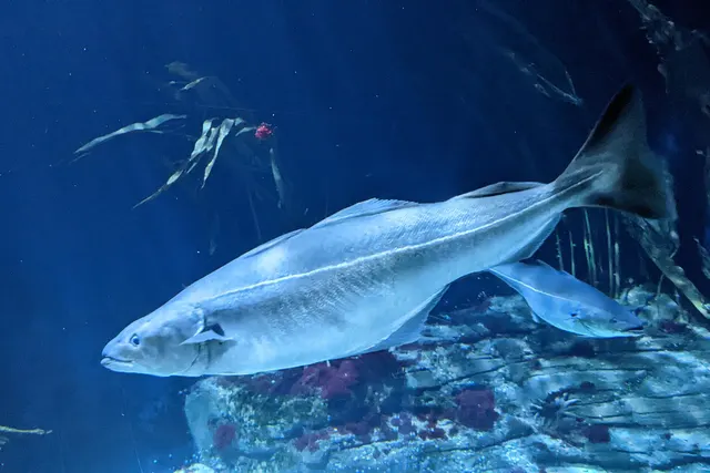 SaitheRegular local target1 placeThe Strangford narrowsOver tidal race
 Atlantic mackerelSeasonal1 placeThe Strangford narrowsOver tidal raceAround Jun–Sept
 Thick-lipped grey mulletSeasonal1 placeThe Strangford narrowsOver tidal raceAround Jun–Sept
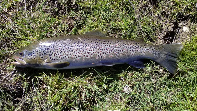 Brown troutRecorded here1 placeThe Strangford narrowsOver tidal race
What these strengths mean
- Regular local target
- Fishing sources describe this as a normal local target here, not merely as caught.
- Seasonal
- Well supported, and concentrated in part of the year rather than spread through it.
- Recorded here
- At least one credible public account of this species being caught here. That is all it means.
- How breadth is counted
- A fish documented at six marks is shown as six marks: breadth never raises the strength on its own. A fishery account describes the fishing; a recorded catch reports one specific catch. How evidence is weighed.
Also associated with this ground
Recorded as present here without a documented method or strength behind them.
How people fish it
Practised here: Sea fishing.
Methods the sources name for this ground. Each one is explained in full on its own page.
- Spinning
Casting an artificial lure and retrieving it so that it moves like something alive — the most direct form of lure fishing.
- Jigging
Working a weighted lure with a rising-and-falling motion, usually vertically, so it behaves like a wounded or fleeing baitfish.
- Float fishing
Suspending a bait at a controlled depth beneath a buoyant indicator — the most visual, most controllable and most widely applicable method in angling.
- Kayak fishing
A platform rather than a technique: quiet, shallow-draught access to water no other craft reaches, bought at the price of exposure, and a discipline where the decision not to launch is part of the skill.
The ground and the water
- The ground
- An eight-kilometre channel a few hundred metres wide connecting Strangford Lough to the Irish Sea, with a rock and boulder bed, deep scoured holes and the Routen Wheel — a permanent whirlpool feature — partway along it.
- Exposure
- Sheltered from swell; the danger here is entirely tidal. The lough behind it is one of the most sheltered large bodies of water in the British Isles.
- Depth
- Very deep and scoured in the narrows — some of the deepest inshore water in Northern Ireland — with the strong flow supporting an exceptional filter-feeding reef community on the rock.
- Tide and flow
- The whole tidal exchange of a 150-square-kilometre sea lough passes through this channel twice a day, producing streams of up to eight knots, whirlpools, boils and overfalls, with a slack window measured in minutes rather than hours.
Getting there
What public sources describe, last checked 2026-08-26. Car parks fill, services change and a path existing is not a path anybody may use — none of this is a guarantee of availability and none of it is permission to be anywhere.
- Getting to it
- The narrows are crossed rather than approached: a government-operated ferry runs between Strangford and Portaferry across the mouth of the lough, and the two villages face each other on either side of the channel the fishing is in. The road route round the lough is the alternative and it is a long one.
- Public transport
- A government-operated ferry runs Strangford to Portaferry every day of the year except Christmas Day, half-hourly both ways for about fifteen hours — from Strangford on the hour and half hour, from Portaferry at quarter past and quarter to. Fares and exact sailings are the department's to change. When this was checked, industrial action had removed the off-schedule weekday morning sailings.
Where this access information comes from
- Strangford ferry timetable — nidirect — Department for Infrastructure, Northern Ireland (Local authority, harbour or protected-area body)Relied on for: The department's own timetable: a daily year-round service except Christmas Day, half-hourly in both directions across the narrows, with disruption alerts and a note of current industrial action.States this directlyPassage read and verified
What is there
Harbour facilities
Slipways at both Strangford and Portaferry serve the ferry. They are working ferry slips rather than angling access, and what may be done on them is the operator's to decide.
Through the year
Pollack, wrasse and mackerel in the warmer months; the practical calendar here is the tidal stream table rather than the month.
The months the sources attach to each species here. Where a species carries no season it is listed underneath rather than assumed to run through the year.
| Species | J | F | M | A | M | J | J | A | S | O | N | D |
|---|---|---|---|---|---|---|---|---|---|---|---|---|
| Ballan wrasse — regular local target, recorded in May, June, July, August, September, October. | ||||||||||||
| Pollack — regular local target, recorded in May, June, July, August, September, October. | ||||||||||||
| Atlantic mackerel — seasonal, recorded in June, July, August, September. | ||||||||||||
| Thick-lipped grey mullet — seasonal, recorded in June, July, August, September. |
Recorded here with no season stated: Saithe, Brown trout.
Safety
Moving water and currents — Can cause serious injury or death
Eight knots through a narrow channel with whirlpools and boils and almost no slack. A craft or a person in the water is carried through the whole channel, and the flow is strong enough to pull a swimmer under at the Routen Wheel.
What reduces it: Plan entirely from tidal stream data for the narrows, transit only at the identified slack, keep clear of the Routen Wheel at all states, and treat the ferry crossing as evidence about the water rather than as a demonstration that it is easy.
Cold water shock — Can cause serious injury or death
UK coastal and inland water is cold enough for most of the year to trigger the involuntary gasp and the loss of swimming ability that decides most immersion deaths, and it does so within the first minute, long before hypothermia is relevant.
What reduces it: Wear a buoyancy aid rather than carry one, carry a means of calling for help on the person rather than in a bag, and plan on the assumption that an unplanned entry into the water is survivable only if somebody knows immediately.
Boat safety — Can cause serious injury or death
The lough is strewn with hundreds of rocky pladdies, many unmarked and many just covered. They show as a slick in flat calm and are invisible in the ripple that makes the fishing, and striking one at speed can hole or capsize a boat.
What reduces it: Keep to known passages, go slowly on unfamiliar water, take local knowledge of the safe routes before travelling at speed, and treat a chop as a reason to slow down rather than to press on.
Rules and access
FishingHQ does not know the current access position here. Sea angling access in Northern Ireland is governed by landowner permission, harbour and council byelaws, and fisheries and conservation measures, all of which change. Check the current position with the Department of Agriculture, Environment and Rural Affairs, the harbour or council, and the landowner before going.
Particular to this water: This ground carries conservation designations that constrain access, vehicles, bait collection and disturbance independently of any fishing rule.
Who holds the answer:
- The Department of Agriculture, Environment and Rural Affairs, for sea fisheries and marine conservation in Northern Ireland.
- The harbour authority or council, for access to the structure or the shore.
- The Northern Ireland department responsible for agriculture, environment and rural affairs, which administers sea fisheries measures and marine conservation here.
- The Loughs Agency or the Northern Ireland licensing body as applicable, for rod licensing and permits on freshwater and migratory fisheries, which differ by area.
- The Northern Ireland Environment Agency and the site management bodies, where a marine designation affects anchoring, access, collection or disturbance.
- The harbour authority at each port, for access to and fishing from harbour structures.
- The local district council and the Food Standards Agency framework, for shellfish harvesting area classification.
- The marine conservation zone and reserve managers, where restrictions on the lough and narrows apply.
Nearby fishing
Other publicly documented places within about 40 km, by distance. Positions are approximate public geography and are never exact marks.
- Ballyhornan and Guns Island — 5–10 km · Beach
- The Quoile — 5–10 km · River reach
- Portavogie — 10–25 km · Harbour wall
- Ardglass — 10–25 km · Harbour wall
- Ballywalter — 10–25 km · Rock mark
- St John's Point — 10–25 km · Rock mark
- Ballyhalbert — 10–25 km · Pier
- Dundrum Bay and Newcastle — 10–25 km · Bay
Sources for this place
- JNCC species and habitat conservation advice — Joint Nature Conservation Committee (Conservation authority)Relied on for: Description, designation and habitat characterisation of the named coastal and marine features of the United Kingdom, and the species characteristically associated with them.States this directlyCitation checked — the work exists and is described correctly
- Cefas science, advice and data on marine and freshwater environments — Centre for Environment, Fisheries and Aquaculture Science (Government fisheries body)Relied on for: Marine environmental science for UK shelf seas: sediment characterisation, estuarine process, shellfish bed distribution, tidal range and the monitoring that describes them.States this directlyCitation checked — the work exists and is described correctly
- Met Office shipping forecast, inshore waters forecast and marine warnings — Met Office, United Kingdom (Government fisheries body)Relied on for: That inshore waters forecasts, sea state and swell are the operative inputs for shore and small-craft decisions in these waters.States this directlyCitation checked — the work exists and is described correctly
- Sea Angler — Bauer Media (Specialist angling publication)Relied on for: Long-running published description of British sea angling practice by region, ground type and named mark.FishingHQ's interpretation of what it saysCitation checked — the work exists and is described correctly
- General angling website restatements of established technique — Various (Credible secondary source)Relied on for: Widely restated public descriptions of which places are conventionally fished and how, recorded as practitioner consensus rather than as scholarship, and not relied on for access, permission or any current rule.Background and mechanism onlyCitation checked — the work exists and is described correctly
- RNLI water safety guidance: cold water shock and Float to Live — Royal National Lifeboat Institution (Water-safety or diver-training authority)Relied on for: Cold water shock and the immersion response, tidal cut-off, and water-safety guidance for shore anglers and small-craft users.States this directlyPassage read and verified
- Strangford ferry timetable — nidirect — Department for Infrastructure, Northern Ireland (Local authority, harbour or protected-area body)Relied on for: The government department that operates the crossing, publishing its own service.States this directlyPassage read and verified
- British Sea Fishing: Northern Ireland shore marks — British Sea Fishing (Credible secondary source)Relied on for: The mark-by-mark Northern Ireland shore guide: species, bait, hook size, method, season and ground at each named mark from the Roe to Carlingford.States this directlyPassage read and verified
How FishingHQ labels evidence is explained in the evidence policy. Last reviewed 2026-08-16.