The Fens and their drains
Fishing regions · Last reviewed 2026-08-15
A drained landscape in eastern England where the rivers run above the fields, every water level is set by a pump, and fishing a straight featureless channel is a skill of its own.
Safety: drowning and immersion — can cause serious injury or death. 5 more points apply here.
Being listed here is not permission to fish. What that meansClose
Access, fishing rights, seasons, licences, local bylaws and permitted methods vary and can change. Check current access, permission, local regulations, closures and restrictions before you travel or fish. FishingHQ describes what the ground is and names who holds the answer; it does not hold the answer itself.
Find the authority for a jurisdiction · What FishingHQ does and does not cover
The Fens are the strangest fishing environment in England and the least explained.
THE LAND IS BELOW THE WATER. Fenland was drained from the seventeenth century onwards, principally by Dutch engineers, by cutting straight artificial channels and running the water out to the Wash. As the drained peat dried it shrank and oxidised, and the fields sank — in places several metres below sea level. The rivers and drains, embanked to carry water across the landscape, now run ABOVE the fields they drain. That is the single fact from which everything else follows.
SO NOTHING HERE IS NATURAL AND EVERYTHING IS PUMPED. Water levels in the drains are set by pumping stations and sluices operated for flood defence and agriculture. Levels rise and fall on a schedule that has nothing to do with rainfall on the day, water is moved between channels, and a drain can be drawn down or filled with no visible weather reason at all.
THE CHANNELS THEMSELVES ARE STRAIGHT, WIDE AND ALMOST FEATURELESS. A fen drain can run for miles in a line, with the same width, the same depth and the same reed margin throughout. There is no bend to read, no gravel run, no obvious structure. Finding fish in one is a genuinely different skill from finding them in a river.
WHICH IS WHY THE FENS PRODUCED THEIR OWN ANGLING CULTURE. Long-distance match fishing, the roach and bream fishing of the mid-twentieth century, and later a pike and zander fishery of national significance grew here, and the techniques — the pole, the feeder, the long trot down an unchanging channel — were refined on this water.
AND THE SYSTEM IS UNDER PRESSURE. The peat continues to shrink, the land continues to sink, the pumping requirement continues to grow, and sea level is rising against the outfalls. The fishing sits inside a landscape whose long-term arrangement is an open question.
What fishing here is like
A large artificially drained lowland in eastern England, most of it at or below sea level and some of it several metres below, drained by a network of straight embanked channels — drains, cuts and levels — whose water levels are managed by pumping stations and sluices rather than by rainfall. The channels are wide, straight, deep-margined and largely featureless, with reed fringes and soft silt beds. Fishing here is fishing managed water in an engineered landscape, and the skills it rewards are those of locating fish in uniform water rather than reading natural structure.
What you can target here
One entry per fish, grouped by how you would be fishing — because the answer is a different one from the rocks and from a boat. Each entry says how strongly the sources support it and how much evidence sits behind it. These are documented catches, not a forecast, and none of it is a statement that you may fish any particular ground.
From the shore · 5
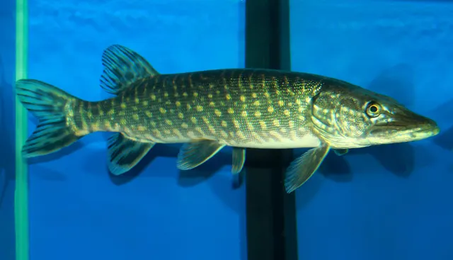 Northern pikeRegular local target9 placesThe Old Bedford River and the Delph, The Great Ouse at Ely, The Nene at Peterborough, The Welland at Spalding and 5 moreOver drain, river reachAround Jan–Feb, Oct–Dec
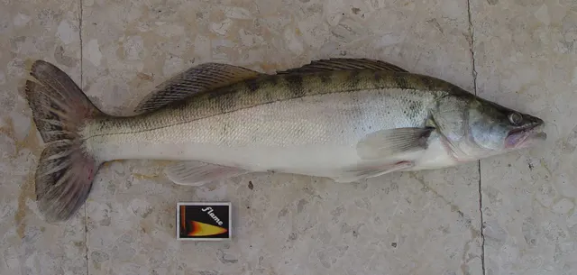 ZanderRegular local target9 placesThe Old Bedford River and the Delph, The Great Ouse at Ely, The Nene at Peterborough, The Welland at Spalding and 5 moreOver drain, river reachAround Jan–Feb, Oct–Dec
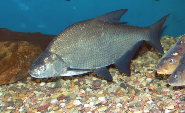 Common breamRegular local target8 placesThe Great Ouse at Ely, The Nene at Peterborough, The Welland at Spalding, The Sixteen Foot Drain and 4 moreOver drain, river reachAround May–Sept
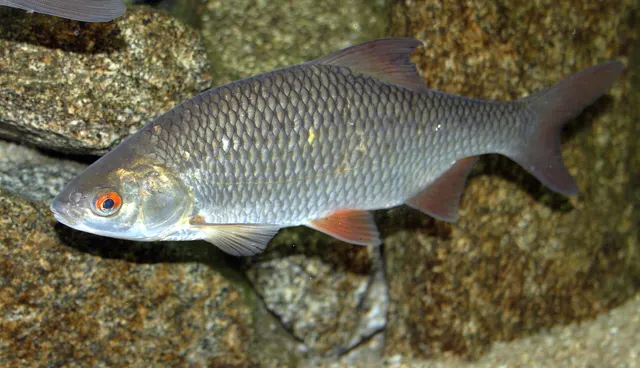 RoachRegular local target8 placesThe Great Ouse at Ely, The Nene at Peterborough, The Welland at Spalding, The Sixteen Foot Drain and 4 moreOver drain, river reach
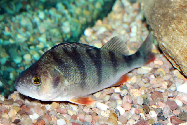 European perchRepeatedly reported9 placesThe Old Bedford River and the Delph, The Great Ouse at Ely, The Nene at Peterborough, The Welland at Spalding and 5 moreOver drain, river reach
What these strengths mean
- Regular local target
- Fishing sources describe this as a normal local target here, not merely as caught.
- Repeatedly reported
- Several independent public accounts. Enough to say it happens more than once; not enough to call it a fishery.
- How breadth is counted
- A fish documented at six marks is shown as six marks: breadth never raises the strength on its own. A fishery account describes the fishing; a recorded catch reports one specific catch. How evidence is weighed.
How people fish here
6 methods are recorded on the places documented here, counted from the records themselves rather than from what is practised in the country. Each opens a full guide to the technique.
Float fishing
Recorded at 9 places here, over drain, river reach.
Suspending a bait at a controlled depth beneath a buoyant indicator — the most visual, most controllable and most widely applicable method in angling.
Documented on the same ground: Common bream, Northern pike, Roach, Zander, European perch.
Deadbaiting
Recorded at 5 places here, over drain.
Presenting a dead fish as bait for predators — a method that works because scavenging is normal predator behaviour, not an exception.
Documented on the same ground: Northern pike, Roach, Zander, Common bream, European perch.
Spinning
Recorded at 5 places here, over drain.
Casting an artificial lure and retrieving it so that it moves like something alive — the most direct form of lure fishing.
Documented on the same ground: Northern pike, Roach, Zander, Common bream, European perch.
Feeder fishing
Recorded at 4 places here, over river reach, drain.
Legering with a weight that also carries bait, so that free offerings arrive in exactly the same place as the hookbait, cast after cast.
Documented on the same ground: Common bream, Northern pike, Roach, Zander, European perch.
Pole fishing
Recorded at 3 places here, over river reach, drain.
Fishing with a long jointed pole and a short fixed line, giving bait placement precision no rod and reel can match.
Documented on the same ground: Common bream, Northern pike, Roach, Zander, European perch.
Ledgering
Recorded at 2 places here, over drain, river reach.
Fishing a bait on the bottom held by a weight, with no float — the simplest way to fish at distance, in depth, or in wind.
Documented on the same ground: Common bream, Northern pike, Roach, Zander, European perch.
These are the methods documented at the places FishingHQ holds here. A species listed beside a method is documented on the same ground, which is not the same as being taken that way — where a source establishes the method a fish was caught on, it is stated on that place’s own page. All fishing methods.
The fishing year here
The months the records under this area actually name, tightest season first. This is “observed in these months” rather than a season: a species whose months nobody recorded is not listed, because a gap in the evidence is not a year-round fishery.
- Northern pikeOctober to February
- ZanderOctober to February
- Common breamMay to September
What dominates
Pole fishing and long-pole work on the drains, which the Fens did much to develop. Feeder and waggler fishing at range across wide channels. Match fishing, which has a long and serious history here. Predator fishing for pike and zander, both from the bank and increasingly from small boats and float tubes, which is the fishery the region is now best known for. Lure fishing for zander in particular. Traditional bream and roach fishing, which built the region's reputation and has declined with the fisheries.
The water available
Straight artificial drains and cuts of uniform width and depth, embanked above the surrounding land; larger navigable rivers running through the same system; washes and flood storage areas that hold water seasonally; pumping stations, sluices and outfalls that control every level; reed-fringed margins over soft silt beds; and, at the seaward end, tidal sluices and the transition to the Wash.
How the rules are structured
Angling in England requires a rod licence from the national fisheries authority. Fishing rights on the drains and rivers are held variously by drainage boards, angling clubs, landowners and consortia, and permission is required from whoever controls the specific water — the pattern is complex and local. National coarse fishing byelaws apply, including the statutory close season on rivers, and whether a given drain counts as a river or a canal for that purpose is a question with a specific answer that is not stated here. Navigation authorities control some of the larger channels. Internal drainage boards operate the pumps and sluices and have statutory functions in water level management, and their operations take precedence over fishing. Non-native species including zander are subject to specific rules on movement and return in some waters. Biosecurity requirements apply. FishingHQ does not state what any current rule is.
Who to ask
- The national fisheries authority for England, for rod licensing, byelaws, close seasons and fisheries enforcement.
- The internal drainage boards, which operate the pumping stations and sluices and manage water levels across the system.
- The navigation authority for the navigable rivers and channels within the system.
- The angling club, consortium or landowner controlling the specific water, for permission to fish it.
- The authorities responsible for invasive and non-native species, for the rules on moving or returning particular fish.
Words you will meet
- Drain
- An artificial channel cut to carry water off the land. In the Fens a drain may be larger than many natural rivers and may be the principal fishery of its district. The word describes its function, not its size.
- Level
- A defined drainage district and, by extension, the system of channels serving it — the Middle Level and the Bedford Levels are the best known. A level is an engineering and administrative unit as much as a geographical one.
- Wash
- Land deliberately allowed to flood to store water at times of high flow, lying between embankments. The Ouse Washes are the classic example. A wash is a flood-storage device that is also, seasonally, a huge shallow water body.
- Pumping station
- The installation that lifts water from a low-lying drain into a higher channel or out to sea. Every water level in the Fens is downstream of one, and their operation determines flow, level and often whether a drain is fishable at all.
- Sluice
- A controllable gate regulating flow between channels or out to tidal water. Sluices produce the only reliable current features in an otherwise still system, and fish gather at them for exactly that reason.
Conditions and hazards
The banks are the principal hazard and they are deceptive. Fenland drains are typically deep with steep, often near-vertical sides, soft margins and no shallow ledge — a person entering the water frequently cannot climb out unaided, and there may be no easy exit for a considerable distance. The water is deep close in and the bank may be slippery clay or crumbling peat. Levels change without weather warning when pumps operate, and flow can start suddenly. The landscape is exposed, flat and windy, with no shelter, and hypothermia in winter is a real risk on a long session. It is also sparsely populated: help may be a long way off and mobile signal is not universal. Fishing alone on a remote drain in winter is the combination that causes serious incidents here.
Straight, deep, pumped, and above the fields
The Fenland environment is an engineered one and the engineering is the environment.
THE FIELDS ARE BELOW THE CHANNELS. Draining the peat caused it to shrink and oxidise, and the land surface fell — in places well below sea level. The drains, embanked to carry water across the sinking landscape, now sit above the fields they drain. Standing on a bank looking down at farmland on one side and water on the other is the ordinary Fenland experience and it is a good deal odder than it first appears.
WHICH MEANS EVERY LEVEL IS PUMPED. Water is lifted from low drains into higher ones and eventually out through tidal sluices to the Wash. Levels in a given channel are set for flood defence and agriculture, not for anything else, and they change on operational schedules rather than with the weather.
THE CHANNELS ARE UNIFORM. Straight, of consistent width and depth, with reed margins and soft silt beds, running for miles without a bend. There is no riffle, no gravel run, no natural pool.
SO THE FEATURES THAT EXIST ARE ARTIFICIAL AND ARE THEREFORE PREDICTABLE. Bridges, sluices, pumping station outfalls, bends where a channel does turn, junctions between drains, moored boats, and changes in reed density. Those are the structure, and fish use them for the same reasons fish use structure anywhere.
THE WASHES ARE THE EXCEPTION. Land deliberately flooded to store water becomes, seasonally, an enormous shallow water body with entirely different ecology from the channels around it.
AND THE SEAWARD END IS TIDAL, with sluices separating fresh from salt and providing the only reliable current in the system.
Backed by research — why, and the sources (2)
Supported by peer-reviewed research or fisheries science. The sources are listed and can be checked.
- Environment Agency fisheries management, byelaws and rod licensing information — Environment Agency (Government fisheries body)Relied on for: Freshwater fisheries management in England, including byelaws, the rod licence framework, and water-level and flood management.States this directlyCitation checked — the work exists and is described correctly
- Freshwater Fishes of the British Isles — HarperCollins (New Naturalist 75), 1992 (Reference work)Relied on for: Distribution, habitat association, spawning requirements and ecology of British and Irish freshwater fishes.States this directlyCitation checked — the work exists and is described correctly
Bream and roach that made the reputation, pike and zander that replaced it
The Fens' species list has changed substantially within living memory and the change is the interesting part.
BREAM AND ROACH BUILT THE REGION'S NAME. Fenland drains supported enormous shoals of bream and roach through the middle of the twentieth century, and the match fishing that developed here was built on them. Catches from that era are part of British angling folklore.
THOSE FISHERIES DECLINED, and the causes are argued about: water quality, changed management, cormorant predation, the arrival of new predators, and habitat simplification all feature in the argument. What is not in doubt is that the drains do not fish as they did.
ZANDER ARRIVED AND CHANGED THE SYSTEM. Introduced to the Great Ouse system in the 1960s and spreading through the connected drains, zander became established across much of the Fens. They are a non-native predator, they are subject to specific rules in some waters, and they are also now the region's best-known sport fishery — which is an uncomfortable combination and is stated as such rather than resolved.
PIKE are native, abundant and the other major predator target, and Fenland pike fishing has a serious following.
PERCH, TENCH, RUDD AND CARP are all present, with carp increasingly significant in the drains as well as in the region's still waters.
EELS were historically enormously important here — the Fens are named in association with them and the town of Ely takes its name from them — and the European eel is now critically endangered.
AND THE DRAINS HOLD SPECIES A READER MIGHT NOT EXPECT: burbot were once present in eastern England and are gone, and the Fens are one of the places their loss is documented.
Backed by research — why, and the sources (4)
Supported by peer-reviewed research or fisheries science. The sources are listed and can be checked.
- Freshwater Fishes of the British Isles — HarperCollins (New Naturalist 75), 1992 (Reference work)Relied on for: Distribution, habitat association, spawning requirements and ecology of British and Irish freshwater fishes.States this directlyCitation checked — the work exists and is described correctly
- FishBase: a global information system on fishes — Froese, R. and D. Pauly, eds. — FishBase Consortium (Scientific institute)Relied on for: Distribution, habitat association and life history recorded for the species concerned.States this directlyPassage read and verified
- Environment Agency fisheries management, byelaws and rod licensing information — Environment Agency (Government fisheries body)Relied on for: Freshwater fisheries management in England, including byelaws, the rod licence framework, and water-level and flood management.States this directlyCitation checked — the work exists and is described correctly
- The IUCN Red List of Threatened Species — International Union for Conservation of Nature (Conservation authority)Relied on for: Global conservation assessment, range and recorded threats for the species.States this directlyCitation checked — the work exists and is described correctly
The pole, the feeder, and finding fish in a channel with no features
Fenland disciplines were shaped by a problem: how do you locate fish in miles of identical water?
THE ANSWER MATCH ANGLERS DEVELOPED WAS TO BRING THE FISH TO YOU. Feeding accurately and consistently at a fixed spot, and holding a shoal there, matters more here than on water where you can read where fish will be. That emphasis is a large part of why Fenland match fishing developed the feeding disciplines it did.
POLE FISHING SUITS THE CHANNELS EXACTLY. A uniform depth at a fixed distance, no current to speak of, and the need for precise repeated bait placement is the situation the pole was designed for, and Fenland anglers did a great deal to develop its use.
FEEDER AND WAGGLER FISHING cover the wider channels at range, and the choice between them is a wind question as often as a fish one — these are exposed, windy waters with no shelter.
PREDATOR FISHING IS THE MODERN SPECIALITY. Lure fishing for zander and pike, deadbaiting, and increasingly small-boat, float-tube and kayak approaches that let anglers cover the miles of bank that walking cannot. Zander in particular are a low-light fish and the fishing is organised around dawn, dusk and coloured water.
MOBILITY BEATS PATIENCE FOR PREDATORS. Where a match angler holds one spot, a predator angler covers ground — working the artificial features, the junctions and the sluices in sequence rather than waiting.
AND EVERYTHING IS AFFECTED BY THE PUMPS. A drain being drawn down or filled fishes differently, and the operational schedule is a variable no angler controls and few outsiders know exists.
What experienced anglers do — why, and the sources (2)
Widely and independently recommended by experienced anglers and specialist sources. This is real angling knowledge, not proof: controlled evidence for it is limited, and FishingHQ records it as convention rather than as a demonstrated effect.
- General angling website restatements of established technique — Various (Credible secondary source)Relied on for: Widely restated descriptions of regional angling practice, recorded as consensus rather than as scholarship.Background and mechanism onlyCitation checked — the work exists and is described correctly
- Environment Agency fisheries management, byelaws and rod licensing information — Environment Agency (Government fisheries body)Relied on for: Freshwater fisheries management in England, including byelaws, the rod licence framework, and water-level and flood management.States this directlyCitation checked — the work exists and is described correctly
A year set by pumps, weed and wind rather than by the calendar
The Fenland fishing year has the usual seasonal drivers plus one nobody else has.
SPRING brings warming water, spawning activity, and the statutory river close season where it applies — and whether it applies to a given drain is a specific legal question worth resolving before fishing rather than after.
SUMMER IS WEED SEASON, and weed growth in nutrient-rich still channels can be dense enough to make some drains close to unfishable. Weed cutting by the drainage authorities is itself a scheduled operation that transforms a water overnight.
AUTUMN IS THE PREDATOR SEASON and is when the Fens are at their best. Water cools, weed dies back, zander and pike feed hard, and the channels become navigable to a bait again.
WINTER IS THE CLASSIC FENLAND FISHING and it is brutal. Flat, exposed country with nothing between the angler and the wind, short days, and often the best predator fishing of the year. It is also when the safety picture is worst: cold water, steep banks, remote drains and few people about.
THE PUMPING SCHEDULE IS A SEASON OF ITS OWN. Levels are managed differently through the year for flood defence and irrigation, and a drain's level, flow and clarity may change for operational reasons that have nothing to do with weather. Anglers who fish these waters regularly learn the patterns; visitors are frequently baffled by them.
AND FLOOD EVENTS FILL THE WASHES, turning flood-storage land into enormous temporary shallow water bodies and moving fish around the system in ways that reshape a fishery for a season.
What experienced anglers do — why, and the sources (2)
Widely and independently recommended by experienced anglers and specialist sources. This is real angling knowledge, not proof: controlled evidence for it is limited, and FishingHQ records it as convention rather than as a demonstrated effect.
- Environment Agency fisheries management, byelaws and rod licensing information — Environment Agency (Government fisheries body)Relied on for: Freshwater fisheries management in England, including byelaws, the rod licence framework, and water-level and flood management.States this directlyCitation checked — the work exists and is described correctly
- General angling website restatements of established technique — Various (Credible secondary source)Relied on for: Widely restated descriptions of regional angling practice, recorded as consensus rather than as scholarship.Background and mechanism onlyCitation checked — the work exists and is described correctly
A rod licence, a drainage board, and a question about close seasons
Permission in the Fens is complicated because the water is owned and managed by more bodies than anywhere comparable.
A ROD LICENCE IS REQUIRED, issued by the national fisheries authority for England. It is a licence to fish, not permission to fish anywhere.
PERMISSION COMES FROM WHOEVER CONTROLS THE WATER, and in the Fens that may be an internal drainage board, an angling club, a consortium of clubs, a navigation authority or a private landowner — and it varies drain by drain and sometimes bank by bank. There is no general answer and the specific answer is worth establishing before travelling.
THE INTERNAL DRAINAGE BOARDS ARE THE BODIES WITH REAL POWER over these waters. They operate the pumps and sluices, they have statutory functions in water level management, and their operations take priority over recreation. A drain is a piece of flood defence infrastructure that happens to hold fish.
THE CLOSE SEASON QUESTION IS A REAL ONE. England retains a statutory close season for coarse fish on rivers, and whether a given Fenland channel is legally a river, a canal or a still water for that purpose determines whether it applies. The answer is specific to the water, it is published by the fisheries authority, and getting it wrong is an offence rather than an embarrassment.
NON-NATIVE SPECIES RULES APPLY TO ZANDER in some waters, and what an angler may or must do with a captured zander differs between waters within the same system.
NAVIGATION AUTHORITIES control the larger channels.
AND FISHINGHQ STATES NONE OF IT. What it states is that five separate bodies may have a say, which is the fact that decides where to ask.
Official guidance — why, and the sources (2)
Stated by a fisheries authority, scientific institute or recognised angling body. Authoritative, but summarising rather than demonstrating.
- Environment Agency fisheries management, byelaws and rod licensing information — Environment Agency (Government fisheries body)Relied on for: Freshwater fisheries management in England, including byelaws, the rod licence framework, and water-level and flood management.States this directlyCitation checked — the work exists and is described correctly
- Good Fish Guide — Marine Conservation Society (Conservation authority)Relied on for: Sustainability ratings and the stock and gear considerations behind them.Background and mechanism onlyCitation checked — the work exists and is described correctly
Drain, level, wash, sluice: the words of an engineered landscape
Fenland vocabulary is drainage-engineering vocabulary that anglers adopted, and it describes real things.
A DRAIN is an artificial channel cut to move water off the land. The word carries no implication of size: some Fenland drains are larger than most English rivers and are the principal fishery of their district. Calling one a river is a category error a local will notice.
A LEVEL is a drainage district and the system of channels serving it. The Middle Level and the Bedford Levels are the best known. It is an administrative and engineering unit, and it is why the region's geography reads as an organisational chart.
A WASH is land between embankments deliberately allowed to flood to store water at times of high flow. The Ouse Washes are the classic example, and seasonally they become one of the largest shallow water bodies in England.
A PUMPING STATION lifts water from a low channel into a higher one. Every water level in the Fens is downstream of one.
A SLUICE is a controllable gate between channels or out to tidal water. Sluices produce the only reliable current in an otherwise still system, and fish gather at them for that reason.
A LODE is an older term for a channel, frequently a very old one — several Fenland lodes are Roman in origin, which is a reminder that people were draining this landscape long before the seventeenth-century engineers.
AND ELY means 'eel island', which is the clearest surviving evidence of what this landscape was and what it produced before it was drained.
What experienced anglers do — why, and the sources (2)
Widely and independently recommended by experienced anglers and specialist sources. This is real angling knowledge, not proof: controlled evidence for it is limited, and FishingHQ records it as convention rather than as a demonstrated effect.
- General angling website restatements of established technique — Various (Credible secondary source)Relied on for: Widely restated descriptions of regional angling practice, recorded as consensus rather than as scholarship.Background and mechanism onlyCitation checked — the work exists and is described correctly
- Environment Agency fisheries management, byelaws and rod licensing information — Environment Agency (Government fisheries body)Relied on for: Freshwater fisheries management in England, including byelaws, the rod licence framework, and water-level and flood management.States this directlyCitation checked — the work exists and is described correctly
Eels, drainage, and a landscape that ate itself
The Fens have the most dramatic history of any English fishing landscape, and it is a history of deliberate destruction followed by consequences.
BEFORE DRAINAGE THIS WAS A WETLAND, and one of the richest in Europe: meres, reedbeds, seasonal flood and an economy built on fish, eels and wildfowl. Eels were currency in the literal sense — rents were paid in them — and Ely's name records it. The people who lived here were called Fen Slodgers and their economy was a wetland economy.
DRAINAGE BEGAN IN EARNEST IN THE SEVENTEENTH CENTURY, driven by landowners and executed largely by Dutch engineers, cutting the straight channels that define the landscape today. It was contested violently at the time by the people whose living it destroyed.
AND IT PRODUCED AN UNINTENDED CONSEQUENCE that is still unfolding. Drained peat shrinks and oxidises. The land fell — and continues to fall — so the drainage that made the land farmable created a permanent and increasing requirement to pump. Windmills gave way to steam, steam to diesel, diesel to electricity, each generation lifting water further than the last.
THE TWENTIETH-CENTURY FISHERY was a coarse-fishing phenomenon: enormous bream and roach shoals, celebrated match catches, and a bank culture that produced techniques still used nationally.
ZANDER ARRIVED IN THE 1960s and reshaped the ecology and the fishing.
AND THE FUTURE IS AN OPEN QUESTION. The peat continues to shrink, the pumping requirement continues to grow, and sea level is rising against the outfalls. Whether this landscape stays as it is, is partly rewetted, or changes some other way is being actively debated, and the fishing sits inside that question rather than beside it.
What experienced anglers do — why, and the sources (2)
Widely and independently recommended by experienced anglers and specialist sources. This is real angling knowledge, not proof: controlled evidence for it is limited, and FishingHQ records it as convention rather than as a demonstrated effect.
- General angling website restatements of established technique — Various (Credible secondary source)Relied on for: Widely restated descriptions of regional angling practice, recorded as consensus rather than as scholarship.Background and mechanism onlyCitation checked — the work exists and is described correctly
- Environment Agency fisheries management, byelaws and rod licensing information — Environment Agency (Government fisheries body)Relied on for: Freshwater fisheries management in England, including byelaws, the rod licence framework, and water-level and flood management.States this directlyCitation checked — the work exists and is described correctly
Match fishing, hard weather, and a fishery that had to be re-learned
Fenland angling culture is one of the more distinct in England and it has had to change.
MATCH FISHING IS THE FOUNDATION. The drains supported open matches and team competitions on a scale and a seriousness that shaped British match angling nationally. The techniques, the feeding disciplines and much of the pole's development came from anglers solving Fenland problems.
IT IS A HARD-WEATHER CULTURE. This is flat, exposed, windy country with no shelter, and Fenland anglers fish it in winter as a matter of course. There is an unsentimental toughness about the local approach that visitors from sheltered rivers notice.
THE DECLINE OF THE BREAM AND ROACH FISHERIES WAS A CULTURAL LOSS as well as an ecological one. A region whose identity rested on enormous silver-fish catches had to find something else, and what it found was predators.
ZANDER SIT AWKWARDLY IN THAT CULTURE and the awkwardness is honest. They are a non-native species implicated in the decline of the fisheries the region was famous for, and they are also the reason anglers now travel here. Local opinion is genuinely divided, the rules differ between waters, and anybody fishing here should establish the position on the specific water rather than assume.
ACCESS IS LOCAL AND CLUB-BASED, and the pattern of who controls which bank is knowledge held by people rather than published.
AND THERE IS A GROWING BOAT AND FLOAT-TUBE CULTURE among predator anglers, which is a practical response to miles of bank and a limited number of access points rather than a fashion.
What experienced anglers do — why, and the sources (2)
Widely and independently recommended by experienced anglers and specialist sources. This is real angling knowledge, not proof: controlled evidence for it is limited, and FishingHQ records it as convention rather than as a demonstrated effect.
- General angling website restatements of established technique — Various (Credible secondary source)Relied on for: Widely restated descriptions of regional angling practice, recorded as consensus rather than as scholarship.Background and mechanism onlyCitation checked — the work exists and is described correctly
- Environment Agency fisheries management, byelaws and rod licensing information — Environment Agency (Government fisheries body)Relied on for: Freshwater fisheries management in England, including byelaws, the rod licence framework, and water-level and flood management.States this directlyCitation checked — the work exists and is described correctly
Some of what lives here
Fish recorded here that FishingHQ holds a reviewed photograph of. It is not a complete list of what The Fens and their drains holds, and it is not a prediction that you will catch any of them — it is a way in to the ones we can show you.
- ZanderA shoaling freshwater predator built for hunting in low light and coloured water, and the fish that made a virtue of the conditions pike find difficult.
eLNuko — Public domain, via Wikimedia Commons
- Northern pikeThe dominant freshwater ambush predator of the northern hemisphere: long, cryptic, and built for one violent acceleration rather than pursuit.
Karelj, Public domain, via Wikimedia Commons
- Common breamA deep-bodied, slow-moving shoal fish that feeds in large groups over soft bottoms and can transform a swim when it arrives.
Karelj, Public domain, via Wikimedia Commons
- RoachThe most numerous and most frequently caught coarse fish across much of Europe, and the prey species that underpins the whole freshwater predator food web.
Karelj, Public domain, via Wikimedia Commons
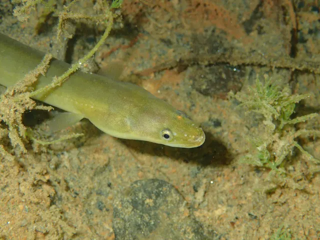 European eelA Critically Endangered fish that breeds in the Sargasso Sea, drifts to Europe as a transparent larva, lives decades in fresh water and returns once to spawn and die.
jujurenoult — CC BY 4.0, via Wikimedia Commons
Places within this area
Publicly documented fishing geography. FishingHQ describes what the ground is; it does not say whether you may fish it, and every one of these sends that question to the body that holds the answer. Browse every place in this part of the world.
Who to ask before fishing any of these
FishingHQ does not know the current access position here. Freshwater rod fishing in England requires a current rod licence AND separate permission from whoever controls the fishing, which is frequently a club, riparian owner or navigation authority rather than a public body. Close seasons, byelaws and local rules apply and change. Check with the Environment Agency and with the controlling club or owner before going.
The Old Bedford River and the Delph
Drain · Fresh water
Two straight seventeenth-century artificial channels running parallel across the Fens with the Ouse Washes flood storage area between them: uniform width, steep clay banks, silt bed, and no natural features at all.
Total. The Fens are the flattest land in Britain and there is nothing at all to break the wind on a drain bank.
Particular to this ground: drowning and immersion, cold water shock, fishing alone.
Particular to this water: This ground carries conservation designations that constrain access, vehicles, bait collection and disturbance independently of any fishing rule.
The Great Ouse at Ely
River reach · Fresh water
A wide, deep, slow, embanked navigation running across the peat fen with almost no natural feature, uniform depth and level controlled by pumping and sluices.
Severe hazards of The Fens and their drains apply here: drowning and immersion.
The Nene at Peterborough
River reach · Fresh water
A wide, deep, slow embanked river running through the city towards the fen, with heavy boat traffic, hard banks and a level held by locks and sluices.
Severe hazards of The Fens and their drains apply here: drowning and immersion.
The Welland at Spalding
River reach · Fresh water
A straight embanked fen river with high banks, uniform depth and a level held by the Coronation Channel and the tidal sluice below the town.
Severe hazards of The Fens and their drains apply here: drowning and immersion.
The Sixteen Foot Drain
Drain · Fresh water
A dead-straight artificial channel across the black peat fen with steep smooth clay banks, uniform shallow depth and a level set entirely by pumping.
Severe hazards of The Fens and their drains apply here: drowning and immersion.
The Forty Foot Drain
Drain · Fresh water
A seventeenth-century drainage channel running straight across the fen, shallow and uniform, with high steep banks and reed fringes where the level allows.
Severe hazards of The Fens and their drains apply here: drowning and immersion.
The Middle Level Main Drain
Drain · Fresh water
The principal artificial artery of the Middle Level system, wide and deep for a drain, running to a tidal outfall at St Germans with a level set by one of the largest pumping stations in Europe.
Severe hazards of The Fens and their drains apply here: drowning and immersion.
The Relief Channel
Drain · Fresh water
A wide, deep, artificial flood channel running beside the Great Ouse to King's Lynn, with steep uniform banks, sluice-controlled level and unusual depth for a fen water.
Severe hazards of The Fens and their drains apply here: drowning and immersion.
1 more place in this area
The Counter Drain
Drain · Fresh water
A narrow shallow drain running beside the South Forty Foot across the south Lincolnshire fen, heavily weeded in summer with a very uniform profile.
Severe hazards of The Fens and their drains apply here: drowning and immersion.
Safety
Drowning and immersion — Can cause serious injury or death
Fenland drains are typically deep with steep or near-vertical sides, soft crumbling margins and no shallow ledge. A person who enters the water frequently cannot climb out unaided and may find no exit for a considerable distance along the bank. The landscape is sparsely populated and help can be far away.
What reduces it: Identify an exit point before fishing a swim. Do not fish alone on remote drains, particularly in winter. Carry a means of calling for help and tell somebody where you are going. Treat a bank of soft peat or clay above deep water as the hazard it is rather than as a nuisance.
Worse when:
- Winter, when cold water shortens self-rescue time dramatically
- Remote drains with no nearby road or building
- Wet or frozen banks
- Fishing alone
Hypothermia — Can cause injury needing treatment
The Fens are flat, treeless and exposed, with nothing between an angler and the wind. Long winter sessions in wind chill, which is when the best predator fishing happens, carry a real risk of hypothermia even without immersion.
What reduces it: Layer properly, carry spare dry clothing, and use a shelter. Recognise that wind chill on an open fen bank is more severe than the air temperature suggests.
Worse when:
- Wind with rain or sleet
- Long static sessions
- Short winter days and dusk
Precautions that always apply here
- Tell somebody where you are going and when you expect to be back.
- Carry a charged phone in a waterproof case, or another means of calling for help.
- Wear a buoyancy aid or lifejacket. Cold water incapacitates strong swimmers within a minute, long before swimming ability matters.
- Never move live fish, live bait or water from one water to another.
Further safety reading
- Cold water shock and immersion — Deep water with steep soft banks and no shallow ledge, in flat exposed country where the best fishing is in winter and help is often far away.
Check the rules before you fish
Fishing laws, bylaws, access rules, seasons, bait restrictions and permitted methods vary by location and can change. Check the current rules from the relevant authority and the water you intend to fish before fishing.
Check with:
- Current national or regional law for where you are fishing
- Current local bylaws
- The relevant fisheries authority
- The landowner, club or fishery whose water it is
- Any restrictions specific to the species or the method you intend to use
Where to go next
What swims here
- Common breamThe species that built the region's twentieth-century reputation, in shoals whose recorded catches are part of British angling folklore, and whose decline reshaped what the Fens are fished for.
- European eelHistorically enormous here — rents were paid in eels and Ely takes its name from them — and now a critically endangered species whose presence is a conservation fact rather than a fishery.
- Northern pikeNative, abundant and the other major predator target, with a serious following on these waters.
- RoachThe other half of the classic Fenland match fishery, and the other half of its decline.
- ZanderIntroduced to the Great Ouse system in the 1960s and now established across much of the Fens. A non-native predator implicated in the decline of the fisheries the region was famous for, and simultaneously the fishery it is now best known for.
Local knowledge
How this compares
- The English canal networkThe two great artificial water systems of England, both dug for a purpose that was not fishing — freight and drainage — and both now major fisheries. The drains are wider, deeper and pumped; the canals are narrow, level and trafficked, and the difference produced two quite different fishing cultures.
- The Norfolk BroadsTwo managed lowland water systems within a few miles of each other in eastern England, managed for opposite reasons: the Broads are flooded medieval peat diggings kept as water, the Fens are wetland deliberately drained and kept dry by pumps.
Sources and evidence
- Freshwater Fishes of the British Isles — HarperCollins (New Naturalist 75), 1992 (Reference work)Relied on for: Distribution, habitat association, spawning requirements and ecology of British and Irish freshwater fishes.States this directlyCitation checked — the work exists and is described correctly
- FishBase: a global information system on fishes — Froese, R. and D. Pauly, eds. — FishBase Consortium (Scientific institute)Relied on for: Distribution, habitat association and life history recorded for the species concerned.States this directlyPassage read and verified
- Environment Agency fisheries management, byelaws and rod licensing information — Environment Agency (Government fisheries body)Relied on for: Freshwater fisheries management in England, including byelaws, the rod licence framework, and water-level and flood management.States this directlyCitation checked — the work exists and is described correctly
- General angling website restatements of established technique — Various (Credible secondary source)Relied on for: Widely restated descriptions of regional angling practice, recorded as consensus rather than as scholarship.Background and mechanism onlyCitation checked — the work exists and is described correctly
- The IUCN Red List of Threatened Species — International Union for Conservation of Nature (Conservation authority)Relied on for: Global conservation assessment, range and recorded threats for the species.States this directlyCitation checked — the work exists and is described correctly
Why the 10 connections on this page are here, and the sources
What swims here
Backed by research — 5 connections
Supported by peer-reviewed research or fisheries science. The sources are listed and can be checked.
Common bream
A distributional claim about where a species occurs, which is a claim about the world and rests on the reference literature rather than on angling report.
- Freshwater Fishes of the British Isles — HarperCollins (New Naturalist 75), 1992 (Reference work)Relied on for: Distribution, habitat association and ecology of the freshwater fishes of the British Isles.States this directlyCitation checked — the work exists and is described correctly
- FishBase: a global information system on fishes — Froese, R. and D. Pauly, eds. — FishBase Consortium (Scientific institute)Relied on for: Distribution, habitat association and life history recorded for the species.States this directlyPassage read and verified
European eel
A distributional claim about where a species occurs, which is a claim about the world and rests on the reference literature rather than on angling report.
- Freshwater Fishes of the British Isles — HarperCollins (New Naturalist 75), 1992 (Reference work)Relied on for: Distribution, habitat association and ecology of the freshwater fishes of the British Isles.States this directlyCitation checked — the work exists and is described correctly
- FishBase: a global information system on fishes — Froese, R. and D. Pauly, eds. — FishBase Consortium (Scientific institute)Relied on for: Distribution, habitat association and life history recorded for the species.States this directlyPassage read and verified
Northern pike
A distributional claim about where a species occurs, which is a claim about the world and rests on the reference literature rather than on angling report.
- Freshwater Fishes of the British Isles — HarperCollins (New Naturalist 75), 1992 (Reference work)Relied on for: Distribution, habitat association and ecology of the freshwater fishes of the British Isles.States this directlyCitation checked — the work exists and is described correctly
- FishBase: a global information system on fishes — Froese, R. and D. Pauly, eds. — FishBase Consortium (Scientific institute)Relied on for: Distribution, habitat association and life history recorded for the species.States this directlyPassage read and verified
Roach
A distributional claim about where a species occurs, which is a claim about the world and rests on the reference literature rather than on angling report.
- Freshwater Fishes of the British Isles — HarperCollins (New Naturalist 75), 1992 (Reference work)Relied on for: Distribution, habitat association and ecology of the freshwater fishes of the British Isles.States this directlyCitation checked — the work exists and is described correctly
- FishBase: a global information system on fishes — Froese, R. and D. Pauly, eds. — FishBase Consortium (Scientific institute)Relied on for: Distribution, habitat association and life history recorded for the species.States this directlyPassage read and verified
Zander
A distributional claim about where a species occurs, which is a claim about the world and rests on the reference literature rather than on angling report.
- Freshwater Fishes of the British Isles — HarperCollins (New Naturalist 75), 1992 (Reference work)Relied on for: Distribution, habitat association and ecology of the freshwater fishes of the British Isles.States this directlyCitation checked — the work exists and is described correctly
- FishBase: a global information system on fishes — Froese, R. and D. Pauly, eds. — FishBase Consortium (Scientific institute)Relied on for: Distribution, habitat association and life history recorded for the species.States this directlyPassage read and verified
How people fish here
What experienced anglers do — 1 connection
Widely and independently recommended by experienced anglers and specialist sources. This is real angling knowledge, not proof: controlled evidence for it is limited, and FishingHQ records it as convention rather than as a demonstrated effect.
Coarse fishing
A statement about which disciplines are actually practised in a place, which is angling convention rather than a fact about the world.
- Angling Times — Bauer Media (Specialist angling publication)Relied on for: Contemporary British angling practice as reported week by week, across coarse, game and sea fishing, including which waters are fished for what.States this directlyCitation checked — the work exists and is described correctly
- General angling website restatements of established technique — Various (Credible secondary source)Relied on for: Widely restated descriptions of regional angling practice, recorded as consensus rather than as scholarship.Background and mechanism onlyCitation checked — the work exists and is described correctly
Local knowledge
Backed by research — 1 connection
Supported by peer-reviewed research or fisheries science. The sources are listed and can be checked.
Urban and canal fishing
A link from a place to the mechanism record that explains why its fishing works the way it does.
- Freshwater Fishes of the British Isles — HarperCollins (New Naturalist 75), 1992 (Reference work)Relied on for: Distribution, habitat association and ecology of the freshwater fishes of the British Isles.States this directlyCitation checked — the work exists and is described correctly
- FishBase: a global information system on fishes — Froese, R. and D. Pauly, eds. — FishBase Consortium (Scientific institute)Relied on for: Distribution, habitat association and life history recorded for the species.States this directlyPassage read and verified
How this compares
What experienced anglers do — 2 connections
Widely and independently recommended by experienced anglers and specialist sources. This is real angling knowledge, not proof: controlled evidence for it is limited, and FishingHQ records it as convention rather than as a demonstrated effect.
The English canal network
A claim that two places are worth reading against one another, because a reader choosing between them or generalising from one to the other needs to know how the underlying process differs.
- General angling website restatements of established technique — Various (Credible secondary source)Relied on for: Widely restated descriptions of which practices are conventionally used in the waters named, recorded as practitioner consensus rather than as scholarship.Background and mechanism onlyCitation checked — the work exists and is described correctly
- Sea Angler — Bauer Media (Specialist angling publication)Relied on for: Long-running published description of British and Irish sea angling practice by region and by ground type.FishingHQ's interpretation of what it saysCitation checked — the work exists and is described correctly
The Norfolk Broads
A navigational claim that two places pose the same problem differently and that a reader on one is likely to want the other.
- Angling Times — Bauer Media (Specialist angling publication)Relied on for: Contemporary British angling practice as reported week by week, across coarse, game and sea fishing, including which waters are fished for what.States this directlyCitation checked — the work exists and is described correctly
- General angling website restatements of established technique — Various (Credible secondary source)Relied on for: Widely restated descriptions of regional angling practice, recorded as consensus rather than as scholarship.Background and mechanism onlyCitation checked — the work exists and is described correctly
Safety reading
Official guidance — 1 connection
Stated by a fisheries authority, scientific institute or recognised angling body. Authoritative, but summarising rather than demonstrating.
Cold water shock and immersion
A link from a place to the safety record covering the hazard its character creates.
- RNLI water safety guidance: cold water shock and Float to Live — Royal National Lifeboat Institution (Water-safety or diver-training authority)Relied on for: Water safety guidance including cold water shock and coastal risk.States this directlyPassage read and verified
How FishingHQ labels evidence is explained in the evidence policy.