Mumbles Head
Rock mark · Salt water · in The Gower and Carmarthen Bay
The rock at the end of the Mumbles causeway beyond the pier, with the two islets and the lighthouse off it and deep water on the seaward face. Broken rock and kelp, fished from ledges that the tide takes back before the causeway does.
Safety: cliffs and rock platforms — can cause serious injury or death. 3 more points apply here.
FishingHQ describes what this place is, not whether you may fish it. Access, permits and who to ask.
What you can catch here
Documented at this place, grouped by how you would be fishing, with how strongly the sources support each one. This is what has been written down, not a forecast, and being listed is never permission to fish.
From the shore · 9
 Ballan wrasseRegular local target1 placeMumbles HeadOver rock mark
 Conger eelRegular local target1 placeMumbles HeadOver rock mark
 PollackRegular local target1 placeMumbles HeadOver rock mark
 Atlantic codSeasonal1 placeMumbles HeadOver rock markAround Jan–Feb, Nov–Dec
 Atlantic mackerelSeasonal1 placeMumbles HeadOver rock markAround Jun–Sept
 European sea bassSeasonal1 placeMumbles HeadOver rock markAround May–Sept
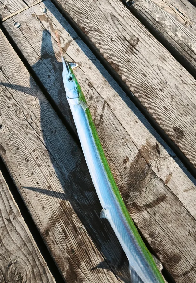 GarfishSeasonal1 placeMumbles HeadOver rock markAround Jun–Sept
 WhitingSeasonal1 placeMumbles HeadOver rock markAround Jan–Feb, Nov–Dec
Also documented from the shore: Starry smooth-hound
What these strengths mean
- Regular local target
- Fishing sources describe this as a normal local target here, not merely as caught.
- Seasonal
- Well supported, and concentrated in part of the year rather than spread through it.
- Recorded here
- At least one credible public account of this species being caught here. That is all it means.
- How breadth is counted
- A fish documented at six marks is shown as six marks: breadth never raises the strength on its own. A fishery account describes the fishing; a recorded catch reports one specific catch. How evidence is weighed.
Fish documented nearby, not here
Nothing below has been documented at Mumbles Head itself. Each one has been documented at a named place on the same ground, and the places are listed with it. Treat this as what the water around here holds rather than as a catch list for this mark.
Also documented at neighbouring places
One or two accounts each, on the ground around here. Enough to know the fish is caught in these waters; not enough to say anything about this place.
From the shore
- European flounder — documented at Llangennith and Burry Holms; Swansea West Pier
- Small-spotted catshark — documented at Swansea West Pier; Mewslade Bay
- Thick-lipped grey mullet — documented at Llangennith and Burry Holms
- Pouting — documented at Swansea West Pier
- Thornback ray — documented at Mewslade Bay
How people fish it
Practised here: Sea fishing.
Methods the sources name for this ground. Each one is explained in full on its own page.
- Float fishing
Suspending a bait at a controlled depth beneath a buoyant indicator — the most visual, most controllable and most widely applicable method in angling.
- Spinning
Casting an artificial lure and retrieving it so that it moves like something alive — the most direct form of lure fishing.
- Ledgering
Fishing a bait on the bottom held by a weight, with no float — the simplest way to fish at distance, in depth, or in wind.
- Surfcasting
Casting heavy baited tackle from a beach into surf — a method defined by distance, by tide, and by reading water that all looks the same.
Baits and lures for these fish
The baits and lures each of the fish above is commonly taken on, from that fish’s own page. This is what works for the fish, not a report of what people use on this particular water — local knowledge and the conditions on the day still decide.
Baits
- Crab and shellfish — for Ballan wrasse, European sea bass, Starry smooth-hound
- Peeler crab — for Atlantic cod, European sea bass, Starry smooth-hound
- Ragworm — for Ballan wrasse, Pollack, European sea bass
- Fish strip and cut bait — for Conger eel, Atlantic cod
- Lugworm — for Atlantic cod, Whiting
- Sand eel — for Pollack, European sea bass
- Squid and cuttlefish — for Conger eel, Atlantic cod
- Prawns and shrimp — for Ballan wrasse
Lures
- Metal jigs — for Pollack, Atlantic cod, Atlantic mackerel, European sea bass
- Soft plastics — for Ballan wrasse, Pollack, Atlantic cod, European sea bass
- Jerkbaits — for European sea bass
- Jigs and jig heads — for Pollack
- Spinners — for Atlantic mackerel
- Streamers — for European sea bass
- Surface lures — for European sea bass
The ground and the water
- The ground
- The rock at the end of the Mumbles causeway beyond the pier, with the two islets and the lighthouse off it and deep water on the seaward face. Broken rock and kelp, fished from ledges that the tide takes back before the causeway does.
- Exposure
- Open south and east; the head itself shelters the pier and the bay behind it.
- Depth
- Deep off the seaward face, shallow and broken over the causeway.
- Tide and flow
- The causeway to the head covers, and the ledges beyond it cover first.
Not to be confused with Mumbles Pier, which is a separate place on different ground.
Getting there
What public sources describe, last checked 2026-08-24. Car parks fill, services change and a path existing is not a path anybody may use — none of this is a guarantee of availability and none of it is permission to be anywhere.
- Getting to it
- The head is reached from the pier along the shore, and the official coast path description states that the tide must be out to do it.
- The walk in
- A rugged beach walk across loose and slippery pebbles, with 18 concrete steps down to it and 113 steps up to the lighthouse. The surrounding coast path carries further flights of 37 wooden and 63 and 60 concrete steps.
- Tidal access
- The route to the head crosses a beach that covers. The coast path authority's own instruction is to retrace your steps to Mumbles Pier before the beach is covered, which makes this a cut-off crossing rather than a walk with a wet section.
- Public transport
- Daily bus services link Mumbles with Swansea. There is no train service.
- Mobility
- Loose pebbles and several long flights of steps, with a tide-dependent crossing in the middle of it. This is not a route that can be recommended to anybody with limited mobility.
Parking
Bracelet Bay
Public car park · Charged
A Swansea Council car park above the bay on Mumbles Head, about two hundred metres from the shore, with rough ground between it and the beach. Accessible toilets are recorded here. No space count is published: the council's own car park pages could not be read.
Where this access information comes from
- Oystermouth and Mumbles Head circular walk — Wales Coast Path (Natural Resources Wales and partners) (Local authority, harbour or protected-area body)Relied on for: That the head is reached across a beach only at low water with an instruction to return before it covers, the step counts on the route, and the bus service to Mumbles.States this directlyPassage read and verified
- Bracelet Bay — Visit Swansea Bay (Credible secondary source)Relied on for: That a Swansea Council car park with accessible toilets serves the headland about two hundred metres from the shore over rough ground, and that reaching the lighthouse depends on the tide.States this directlyPassage read and verified
What is there
Public toilets
Accessible toilets are recorded at Bracelet Bay above the shore. There is nothing at the head itself.
Through the year
Bass in spring and summer, wrasse and pollack over the rock through the warm half, mackerel and garfish on the surface in summer, cod and whiting in winter.
The months the sources attach to each species here. Where a species carries no season it is listed underneath rather than assumed to run through the year.
| Species | J | F | M | A | M | J | J | A | S | O | N | D |
|---|---|---|---|---|---|---|---|---|---|---|---|---|
| Atlantic cod — seasonal, recorded in November, December, January, February. | ||||||||||||
| Atlantic mackerel — seasonal, recorded in June, July, August, September. | ||||||||||||
| European sea bass — seasonal, recorded in May, June, July, August, September. | ||||||||||||
| Garfish — seasonal, recorded in June, July, August, September. | ||||||||||||
| Whiting — seasonal, recorded in November, December, January, February. |
Recorded here with no season stated: Ballan wrasse, Conger eel, Pollack.
Safety
Cliffs and rock platforms — Can cause serious injury or death
Anglers are swept from rock platforms by individual large sets rather than by the average sea, which means the conditions that kill people frequently look survivable for the twenty minutes before they arrive. Wet rock, weed and a swell running onto a sloping platform remove any chance of recovery.
What reduces it: Watch the water for a full set cycle before committing to a position, know the escape route and how long it takes, wear a flotation aid rather than carry one, never fish a platform alone, and treat a rising swell forecast as a reason not to go rather than a reason to be careful.
Tides and being cut off — Can cause serious injury or death
The flood fills the ground behind an angler before it covers the ground in front, so the water arrives between them and the shore while the position they are standing on is still dry.
What reduces it: Read the tide table before going rather than after arriving, set a leaving time from the tide rather than from the fishing, and identify the exit and how long it takes while the ground is still uncovered.
Slips, trips and falls — Can cause serious injury or death
The limestone platform is deeply fissured, holed, undercut and riddled with caves and blowholes. Voids are invisible under water or weed, some sections are structurally unsound, and a fall onto sharp limestone lacerates rather than bruises.
What reduces it: Wear footwear with real grip and ankle support, move deliberately and in daylight where possible, keep off undercut ground and away from blowholes, and treat the walk across the platform as part of the hazard rather than the approach to it.
Cold water shock — Can cause serious injury or death
The water here is cold for most of the year, and an immersion produces an involuntary gasp and loss of breathing control within seconds — which decides the outcome rather than swimming ability afterwards.
What reduces it: Wear a buoyancy aid rather than carry one, do not fish alone on the rock or the flats, and carry a means of calling for help on the person.
Rules and access
FishingHQ does not know the current access position here. Shore angling in Wales is not rod-licensed, but access rights, landowner permission, local authority and harbour byelaws, national and inshore fisheries measures, and site designations all apply and all change. Check the current position with Natural Resources Wales, the harbour or local authority, and the landowner before going.
Who holds the answer:
- Natural Resources Wales, which administers marine and fisheries regulation in Welsh waters.
- The local authority and, where one exists, the harbour authority, for access, byelaws and shellfish classification.
- Natural Resources Wales, which administers rod licensing, freshwater and migratory fisheries, cockle fishery regulation and conservation designations in Wales.
- The Welsh Government, for sea fisheries measures and marine policy in Welsh waters.
- The local authority and the Food Standards Agency framework, for shellfish harvesting area classification and closures.
- The relevant site management bodies, where a coastal or estuarine designation affects access, vehicles or collection.
- The harbour authority at each port, for access to and fishing from harbour structures.
Nearby fishing
Other publicly documented places within about 40 km, by distance. Positions are approximate public geography and are never exact marks.
- Mumbles Pier — under 2 km · Pier
- Caswell and Langland — 2–5 km · Bay
- Swansea Bay — 2–5 km · Bay
- Swansea West Pier — 5–10 km · Pier
- Port Talbot breakwater — 5–10 km · Breakwater
- Aberavon Sands — 10–25 km · Surf beach
- Oxwich Bay — 10–25 km · Bay
- Port Eynon Point — 10–25 km · Headland
Sources for this place
- Sea Angler — Bauer Media (Specialist angling publication)Relied on for: Long-running published description of British sea angling practice by region, ground type and named mark.FishingHQ's interpretation of what it saysCitation checked — the work exists and is described correctly
- General angling website restatements of established technique — Various (Credible secondary source)Relied on for: Widely restated public descriptions of which places are conventionally fished and how, recorded as practitioner consensus rather than as scholarship, and not relied on for access, permission or any current rule.Background and mechanism onlyCitation checked — the work exists and is described correctly
- British Sea Fishing: Welsh shore marks — British Sea Fishing (Credible secondary source)Relied on for: Mark-by-mark Welsh shore angling: which species are fished for at each named mark, in which season, and with which baits and methods.States this directlyPassage read and verified
- Fishing in Wales — sea fishing marks and location guides — Angling Trust (Angling or fisheries organisation)Relied on for: Welsh sea fishing marks: the ground, the species targeted at each, the mode, the state of tide and the weather preconditions, as set out by the national angling body's own Welsh resource.States this directlyPassage read and verified
How FishingHQ labels evidence is explained in the evidence policy. Last reviewed 2026-08-16.