Colwyn Bay
Bay · Salt water · in The Welsh coast and Anglesey
A wide shallow sand bay backed by promenade and railway, with the limestone of Little Orme closing its western end and clean sand throughout.
Safety: moving water and currents — can cause serious injury or death (general advice, not specific to this place). One more point applies here.
FishingHQ describes what this place is, not whether you may fish it. Access, permits and who to ask.
What you can catch here
Documented at this place, grouped by how you would be fishing, with how strongly the sources support each one. This is what has been written down, not a forecast, and being listed is never permission to fish.
From the shore · 9
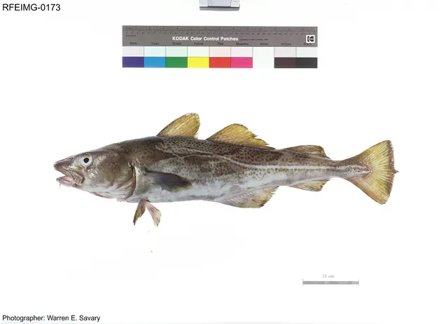 Atlantic codRecorded here1 placeColwyn BayOver bay
Photo: The U.S. Food and Drug Administration, via Wikimedia Commons, public domain; resized and trimmed to fit
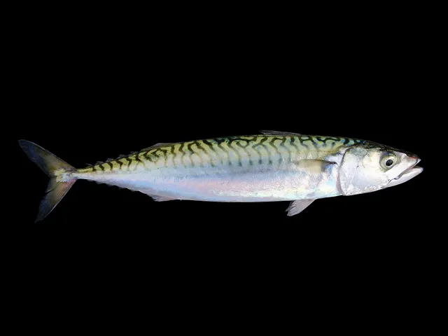 Atlantic mackerelRecorded here1 placeColwyn BayOver bay
Photo: Hans Hillewaert, via Wikimedia Commons, CC BY-SA 4.0; resized; shared under the same licence
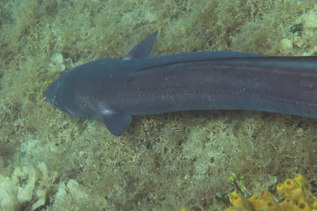 Conger eelRecorded here1 placeColwyn BayOver bay
Photo: Holger Krisp, via Wikimedia Commons, CC BY 3.0; resized and trimmed to fit
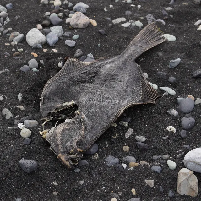 European flounderRecorded here1 placeColwyn BayOver bay
Photo: nbasargin, via iNaturalist, CC BY; resized and trimmed to fit
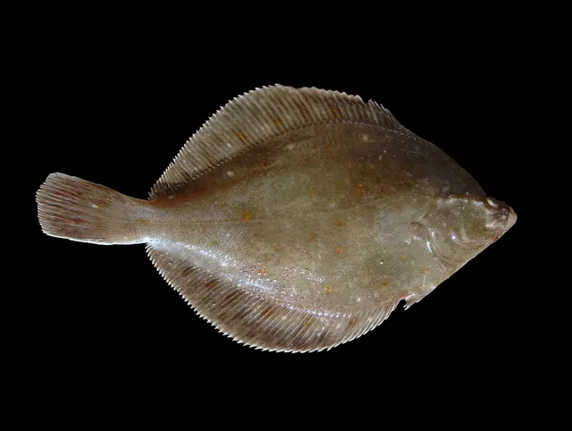 European plaiceRecorded here1 placeColwyn BayOver bay
Photo: Hans Hillewaert, via Wikimedia Commons, CC BY-SA 4.0; resized; shared under the same licence
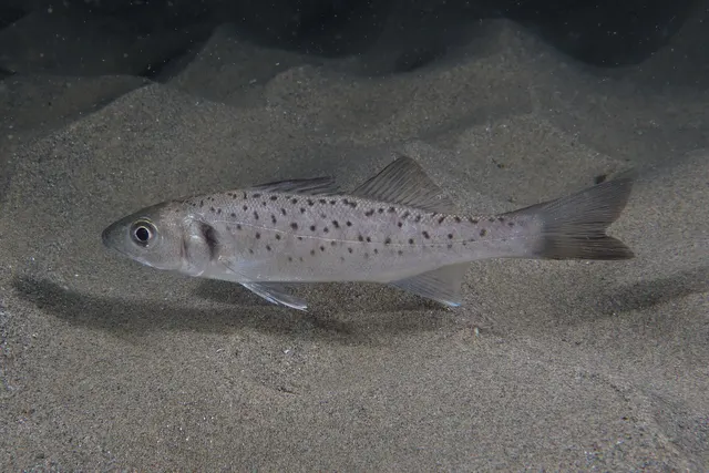 European sea bassRecorded here1 placeColwyn BayOver bay
Photo: Julien Renoult, via Wikimedia Commons, CC BY 4.0; resized and trimmed to fit
- Small-spotted catsharkRecorded here1 placeColwyn BayOver bay
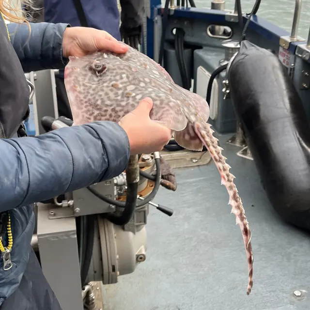 Thornback rayRecorded here1 placeColwyn BayOver bay
Photo: Ella McCausland, via iNaturalist, CC BY; resized and trimmed to fit


Also documented from the shore: Whiting
What these strengths mean
- Recorded here
- At least one credible public account of this species being caught here. That is all it means.
- How breadth is counted
- A fish documented at six marks is shown as six marks: breadth never raises the strength on its own. A fishery account describes the fishing; a recorded catch reports one specific catch. How evidence is weighed.
Also associated with this ground
Recorded as present here without a documented method or strength behind them.
Fish documented nearby, not here
Nothing below has been documented at Colwyn Bay itself. Each one has been documented at a named place on the same ground, and the places are listed with it. Treat this as what the water around here holds rather than as a catch list for this mark.
Widely documented on this ground
Documented at three or more neighbouring places, fished a way this place is also fished. That is a pattern about the ground rather than about any one mark, and it is the closest this site comes to saying you will probably meet a fish somewhere nothing has been written about.
From the shore
- Thick-lipped grey mullet — documented at The Conwy estuary; Caernarfon and the Menai south entrance; The Welsh Dee at Mostyn and Flint
Also documented at neighbouring places
One or two accounts each, on the ground around here. Enough to know the fish is caught in these waters; not enough to say anything about this place.
From the shore
- Dab — documented at The Welsh Dee at Mostyn and Flint
- Pollack — documented at The Great Orme
- Ballan wrasse — documented at The Great Orme
- Black seabream — documented at Caernarfon and the Menai south entrance
- Common sole — documented at The Welsh Dee at Mostyn and Flint
How people fish it
Practised here: Sea fishing.
Methods the sources name for this ground. Each one is explained in full on its own page.
- Ledgering
Fishing a bait on the bottom held by a weight, with no float — the simplest way to fish at distance, in depth, or in wind.
Baits and lures for these fish
The baits and lures each of the fish above is commonly taken on, from that fish’s own page. This is what works for the fish, not a report of what people use on this particular water — local knowledge and the conditions on the day still decide.
Baits
- Fish strip and cut bait — for Atlantic cod, Conger eel, Small-spotted catshark, Thornback ray and 1 more
- Lugworm — for Atlantic cod, European flounder, European plaice, Whiting
- Peeler crab — for Atlantic cod, European flounder, European sea bass, Thornback ray
- Ragworm — for European flounder, European plaice, European sea bass, Small-spotted catshark
- Squid and cuttlefish — for Atlantic cod, Conger eel, Small-spotted catshark
- Sand eel — for European sea bass, Thornback ray
- Sea deadbaits — for Conger eel, Small-spotted catshark
- Crab and shellfish — for European sea bass
Lures
- Metal jigs — for Atlantic cod, Atlantic mackerel, European sea bass
- Soft plastics — for Atlantic cod, European sea bass
- Jerkbaits — for European sea bass
- Spinners — for Atlantic mackerel
- Streamers — for European sea bass
- Surface lures — for European sea bass
How to catch them: Cod fishing · Mackerel fishing · Conger fishing · Flounder fishing · Plaice fishing · Bass fishing · Dogfish (small-spotted catshark) fishing · Thornback ray fishing · Whiting fishing
The ground and the water
- The ground
- A wide shallow sand bay backed by promenade and railway, with the limestone of Little Orme closing its western end and clean sand throughout.
Safety
Moving water and currents — Can cause serious injury or death
General safety for this kind of ground, not a finding about this place.
Tidal races and overfalls form and disperse with the state of the tide, producing standing waves and fast confused water where flat water was an hour earlier. Small craft caught in a race on the wrong state face conditions that paddling or a small engine will not overcome, and a person swept from rock into a running stream is carried away from the entry point immediately.
What reduces it: Plan against tidal stream timing rather than against wind alone; obtain local knowledge of when each piece of water runs and when it is slack; never launch a small craft near a race without that information; and treat the state of the tide as the go or no-go variable it is here.
Worse when:
- Spring tides, when the streams run hardest
- Wind against tide, which stands the water up steeply
- Any small craft, and kayaks in particular, whose speed is a fraction of the stream's
Cliffs and rock platforms — Can cause serious injury or death
General safety for this kind of ground, not a finding about this place.
Rock platforms on the north and west put an angler beside deep, fast-moving water, sometimes with a descent that is much harder to reverse than to make. Immersion here is compounded by the stream, which removes any prospect of climbing out where you went in.
What reduces it: Watch a mark for a long period before committing; wear a buoyancy aid; never fish rock alone; plan the exit for a worse sea than the one you arrived in; and know whether the mark is cut off by the tide.
Rules and access
FishingHQ does not know the current access position here. Shore angling in Wales is not rod-licensed, but access rights, landowner permission, local authority and harbour byelaws, national and inshore fisheries measures, and site designations all apply and all change. Check the current position with Natural Resources Wales, the harbour or local authority, and the landowner before going.
Who holds the answer:
- Natural Resources Wales, which administers marine and fisheries regulation in Welsh waters.
- The local authority and, where one exists, the harbour authority, for access, byelaws and shellfish classification.
- The Welsh environmental and fisheries authority, for licensing, sea fisheries rules and enforcement in Wales
- The relevant local authority, for byelaws and for shellfish harvesting classification and closures
- The body managing any marine protected area on the stretch concerned
- The harbour authority for working harbours and the relevant landowner for access points
- The coastguard, for tidal stream and safety information, and local charter skippers whose knowledge of the races is operative safety information
Nearby fishing
Other publicly documented places within about 40 km, by distance. Positions are approximate public geography and are never exact marks.
- The Conwy estuary — 5–10 km · Estuary
- Llandudno Pier — 5–10 km · Pier
- The Great Orme — 10–25 km · Headland
- Rhyl — 10–25 km · Beach
- The Conwy at Llanrwst — 10–25 km · River reach
- The Clwyd — 10–25 km · River reach
- Penmon Point — 10–25 km · Headland
- Beaumaris Pier — 10–25 km · Pier
Sources for this place
- Sea Angler — Bauer Media (Specialist angling publication)Relied on for: Long-running published description of British sea angling practice by region, ground type and named mark.FishingHQ's interpretation of what it saysCitation checked — the work exists and is described correctly
- General angling website restatements of established technique — Various (Credible secondary source)Relied on for: Widely restated public descriptions of which places are conventionally fished and how, recorded as practitioner consensus rather than as scholarship, and not relied on for access, permission or any current rule.Background and mechanism onlyCitation checked — the work exists and is described correctly
- British Sea Fishing: Welsh shore marks — British Sea Fishing (Credible secondary source)Relied on for: The shore species the guide's own entry for this mark names, with the seasons, baits and methods it gives for them.States this directlyPassage read and verified
How FishingHQ labels evidence is explained in the evidence policy. Last reviewed 2026-08-16.
Something wrong or out of date?
If something on this page has changed, email us from your own account using the link that fits, with a link to where you saw the change if you can. Every report is checked by a person before anything is changed, and a report never appears on the site by itself. Please don’t send exact private marks.
Before you go
- Fish documented here
- 9 at this place itself. See them.
- Getting there
- Not recorded. FishingHQ holds no sourced description of the way in.
- Rules particular to this water
- None recorded, which is not the same as none existing.
- Hazards particular to this place
- None recorded for this place; the hazards of the wider coast or water still apply.
Check before you travel
- Whether you may fish here, and whether a licence or permit is needed — start with Natural Resources Wales.
- The tide times and the forecast for the day you go.
- Anything recorded here was true when it was read; it is not watched for change.