Tenerife
Fishing regions · Last reviewed 2026-08-14
The deepest water closest to shore in the archipelago, a mountain that makes its own weather, and the centre of the Canaries' blue-water fishery.
Being listed here is not permission to fish. What that meansClose
Access, fishing rights, seasons, licences, local bylaws and permitted methods vary and can change. Check current access, permission, local regulations, closures and restrictions before you travel or fish. FishingHQ describes what the ground is and names who holds the answer; it does not hold the answer itself.
Find the authority for a jurisdiction · What FishingHQ does and does not cover
Tenerife earns an island record for the opposite reason to Lanzarote: not because it has shallow ground the archipelago lacks, but because it has the most extreme version of the archipelago's defining feature and a topography that creates two different coasts.
THE DROP-OFF IS THE STEEPEST AND CLOSEST. Tenerife rises from very deep ocean floor to the highest point in Spain, and the underwater slope is correspondingly abrupt. Depths of several hundred metres are available within a short run from the south-western coast, and depths that require a long offshore passage elsewhere in Europe are reached in minutes. That is the whole basis of the island's blue-water fishery.
WHICH MAKES IT THE ARCHIPELAGO'S BIG-GAME CENTRE. Blue marlin, bigeye and yellowfin tuna, wahoo and other blue-water species are reachable on a half-day trip from the southern ports, and the charter fleet concentrated there is the largest in the Canaries. It is a genuine deep-water fishery conducted at what would elsewhere be inshore distances.
THE MOUNTAIN DIVIDES THE ISLAND IN TWO. Teide and the central ridge intercept the north-easterly trades, so the north coast is cloudier, wetter, greener and more exposed, and the south-west is dry, sunny and substantially sheltered. The practical fishing consequence is large: the south-west is workable on most days, the north coast frequently is not, and the two coasts have different swell exposure as well as different weather.
SHORE FISHING IS ROCK FISHING INTO DEEP WATER. With little shelf, the shore fishery is conducted from volcanic rock and harbour walls with depth arriving quickly, which allows species from the rocks that would need a boat elsewhere.
AND THE ISLAND HAS NO RIVERS, like the rest of the archipelago. There is no freshwater fishing to speak of. Nothing here states what any current rule is.
What fishing here is like
The highest and steepest of the Canaries, with the archipelago's most abrupt drop-off and consequently the shortest run to genuinely deep water anywhere in it. The central mountain divides the island into a cloudy exposed north and a dry sheltered south-west, and almost all charter and small-boat activity is concentrated in the south. Big-game and blue-water fishing is the island's distinctive offering; shore fishing from volcanic rock into deep water is the accessible mainstream. There are no rivers and no freshwater fishing.
What you can target here
One entry per fish, grouped by how you would be fishing — because the answer is a different one from the rocks and from a boat. Each entry says how strongly the sources support it and how much evidence sits behind it. These are documented catches, not a forecast, and none of it is a statement that you may fish any particular ground.
From the shore · 12
- White seabreamRegular local target10 places · 4 fishery accounts · 2 independent sourcesPunta de Teno, Tenerife, Garachico, Bajamar, Candelaria and 6 moreOver beach, cliff coast, harbour wall, headland, rock platform, surf beach
- Atlantic horse mackerelRegular local target3 places · 1 fishery account · 1 sourceEl Médano, Tenerife, Punta Rasca, Tenerife, CandelariaOver headland, rock platform, surf beach
- Mediterranean parrotfishRegular local target5 placesGarachico, Bajamar, Candelaria, The El Sauzal coast and 1 moreOver cliff coast, harbour wall, rock platform
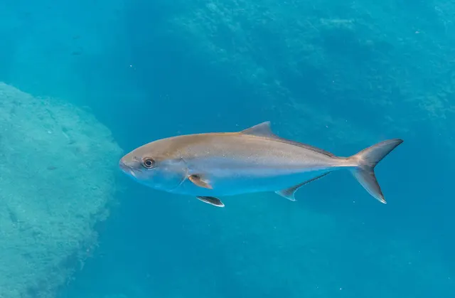 Greater amberjackRegular local target4 placesPunta de Teno, Tenerife, Punta del Hidalgo, Tenerife, Punta Rasca, Tenerife, The El Sauzal coastOver cliff coast, headland, rock platformAround Jan–Feb, Sept–Dec
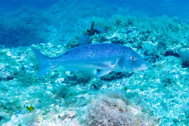 Common dentexRegular local target1 placePunta de Teno, TenerifeOver headland
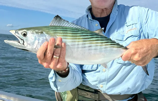 Atlantic bonitoSeasonal1 placePunta de Teno, TenerifeOver headlandAround Jun–Oct
Also documented from the shore: Bogue · Salema porgy · Comber · Common octopus · European squid · Red porgy
What these strengths mean
- Regular local target
- Fishing sources describe this as a normal local target here, not merely as caught.
- Seasonal
- Well supported, and concentrated in part of the year rather than spread through it.
- Recorded here
- At least one credible public account of this species being caught here. That is all it means.
- How breadth is counted
- A fish documented at six marks is shown as six marks: breadth never raises the strength on its own. A fishery account describes the fishing; a recorded catch reports one specific catch. How evidence is weighed.
How people fish here
10 methods are recorded on the places documented here, counted from the records themselves rather than from what is practised in the country. Each opens a full guide to the technique.
Float fishing
Recorded at 13 places here, over rock platform, harbour wall, beach, headland.
Suspending a bait at a controlled depth beneath a buoyant indicator — the most visual, most controllable and most widely applicable method in angling.
Documented on the same ground: Atlantic horse mackerel, Common dentex, Greater amberjack, Mediterranean parrotfish, White seabream, Atlantic bonito.
Spinning
Recorded at 8 places here, over rock platform, headland, cliff coast, harbour wall.
Casting an artificial lure and retrieving it so that it moves like something alive — the most direct form of lure fishing.
Documented on the same ground: Common dentex, Greater amberjack, Mediterranean parrotfish, White seabream, Atlantic bonito, Atlantic horse mackerel.
Ledgering
Recorded at 7 places here, over rock platform, beach, cliff coast, harbour wall.
Fishing a bait on the bottom held by a weight, with no float — the simplest way to fish at distance, in depth, or in wind.
Documented on the same ground: Atlantic horse mackerel, Mediterranean parrotfish, White seabream, Bogue, Comber, Common octopus.
Light rock fishing
Recorded at 6 places here, over harbour wall, rock platform, cliff coast.
Ultralight lure fishing from the shore with tackle rated in single grams — a discipline that catches the fish everybody else steps over, and one FishingHQ held every component of and had never named.
Documented on the same ground: Mediterranean parrotfish, White seabream, Bogue, Comber, Common octopus, European squid.
Jigging
Recorded at 2 places here, over cliff coast, harbour wall.
Working a weighted lure with a rising-and-falling motion, usually vertically, so it behaves like a wounded or fleeing baitfish.
Documented on the same ground: Mediterranean parrotfish, White seabream, Comber, Greater amberjack, Red porgy.
Big-game fishing
Recorded at 1 place here, over harbour wall.
Fishing offshore for the largest fish in the sea with tackle rated by line class — a formalised, rule-bound discipline as much as a technique.
Eging
Recorded at 1 place here, over harbour wall.
Jigging for squid and cuttlefish with a barbed, weighted lure worked in lifts and pauses — a Japanese discipline with its own tackle, vocabulary and competitive scene.
Documented on the same ground: Mediterranean parrotfish, White seabream, Bogue, Common octopus, European squid, Salema porgy.
Shore diving
Recorded at 1 place here, over headland.
Entering and leaving the water from land under your own power — the most accessible spearfishing and the one where the entry and exit are the dangerous part.
Documented on the same ground: Common dentex, Greater amberjack, White seabream, Atlantic bonito.
Surfcasting
Recorded at 1 place here, over beach.
Casting heavy baited tackle from a beach into surf — a method defined by distance, by tide, and by reading water that all looks the same.
1 further method is recorded at one or two places each: Trolling.
These are the methods documented at the places FishingHQ holds here. A species listed beside a method is documented on the same ground, which is not the same as being taken that way — where a source establishes the method a fish was caught on, it is stated on that place’s own page. All fishing methods.
What dominates
Charter big-game and blue-water fishing for marlin, tuna and wahoo from the southern ports, which is the island's best-known fishery. Deep drop and bottom fishing on the steep slopes for deep-water species. Shore fishing from volcanic rock and harbour structure for seabream species, parrotfish, wrasse and moray. Light lure and rock fishing for smaller inshore predators. Spearfishing on breath-hold where permitted and licensed. Some squid and cuttlefish fishing, though the limited shallow ground constrains it by comparison with the eastern islands.
The water available
Steep volcanic rock coastline dropping quickly into deep water; a very narrow shelf, effectively absent along much of the coast; abrupt slopes reaching oceanic depths within a short distance of shore; a cloudier, wetter, more exposed north coast and a dry, sheltered south-west; harbour and marina structure providing accessible fishing ground; black volcanic sand beaches; and no rivers or natural freshwater systems.
How the rules are structured
Recreational sea fishing in the Canary Islands is administered by the autonomous community government rather than by the Spanish state, with licences issued at that level and separate arrangements for shore, boat and spearfishing. Minimum sizes, bag limits and protected species apply, and certain species carry specific protection. Spearfishing is restricted by area, time and equipment and is prohibited in some zones. Marine protected areas exist around parts of the island and in the wider archipelago, with their own restrictions. Big-game charter operations are subject to their own licensing and, for billfish, to international management arrangements and widely adopted release practice. Collection of shellfish and other marine organisms is separately regulated. FishingHQ does not state what any current rule is.
Who to ask
- The Canary Islands autonomous government's fisheries department, which administers recreational sea fishing licensing and rules in Canarian waters.
- The management authority of any marine protected area in which fishing is proposed.
- The Spanish national fisheries administration for offshore waters and for matters reserved to it.
- The harbour authority of the port used, for berthing, launching and charter arrangements.
- International fishery bodies whose measures apply to billfish and large pelagic species taken in Atlantic waters.
Words you will meet
- The drop-off
- The abrupt underwater slope falling from the island's shallow fringe into oceanic depth. On Tenerife it is closer to shore and steeper than anywhere else in the archipelago, and it is what makes the blue-water fishery accessible.
- Vieja
- The parrotfish of Canarian waters, a mainstream shore and spearfishing target and a staple of the local table.
- Cherne
- Wreckfish and related deep-water groupers taken on the steep slopes, a traditional and highly regarded Canarian deep-water target.
- Calima
- A hot, dusty easterly airflow carrying Saharan dust over the islands, which reduces visibility, raises temperatures sharply and changes conditions for several days at a time.
Conditions and hazards
The volcanic shore is sharp, uneven and frequently undercut, and being swept from a low rock platform by a set wave is the characteristic serious accident — long-period Atlantic swell arrives independently of local wind and the north coast in particular receives it heavily through the winter. The north and south coasts have materially different exposure and a forecast for one does not describe the other. Deep water arrives extremely quickly offshore, so a small craft is in oceanic conditions within a very short distance and an offshore wind has the whole Atlantic behind it. Currents around the island and through the channels between islands are strong. Sun exposure at this latitude and altitude is severe and consistently underestimated. Moray eels are common on the rock ground and are a genuine handling hazard. On the mountain, altitude and rapid weather change are a separate consideration entirely for anybody combining fishing with hill walking.
Blue water in half an hour, and what a steep island does to a fishery
Tenerife's fishery is a direct consequence of underwater topography, and the topography is more extreme than almost anywhere else that people fish from a small boat.
THE ISLAND IS THE TOP OF A VERY LARGE MOUNTAIN. Tenerife rises from an ocean floor several kilometres down to the highest point in Spain, and the slope between those two is continuous and steep. There is no shelf worth the name; the island's fringe drops away almost immediately.
SO OCEANIC DEPTH IS AVAILABLE AT INSHORE DISTANCES. A boat leaving a southern port reaches water hundreds of metres deep in a short run, and the deep blue water that elsewhere in Europe requires a long offshore passage is a half-day trip here. That single fact is the basis of the island's charter fleet and its reputation.
WHICH BRINGS BLUE-WATER SPECIES WITHIN REACH OF ORDINARY BOATS. Marlin, tuna and wahoo occupy oceanic water, and oceanic water is close. The fishery is genuinely deep-water fishing conducted at inshore range, which is unusual and is the honest reason the island is worth naming separately from the archipelago.
IT ALSO PRODUCES A DEEP-DROP FISHERY on the slopes themselves, for wreckfish and other deep-water species that live on the steep ground between the shore and the abyss.
AND IT SHAPES THE SHORE FISHERY IN THE SAME DIRECTION. With no shelf, a shore angler on volcanic rock is fishing into water that deepens rapidly, which is why species that would require a boat on a mainland coast are reachable from the rocks — the archipelago's characteristic advantage, at its most pronounced here.
WHAT IS ABSENT IS THE SOFT-GROUND FISHERY. There is very little sand, very little shallow mixed bottom, and correspondingly little of the flatfish, ray and shallow-ground cephalopod fishing that Lanzarote's shared shelf supports. The two islands are close to opposites within one archipelago, which is precisely why both earn a record and the intermediate islands do not.
THE PRACTICAL CONSEQUENCE FOR A VISITOR is that Tenerife rewards a boat and Lanzarote rewards a car, and that is a real distinction rather than a preference.
Backed by research — why, and the sources (2)
Supported by peer-reviewed research or fisheries science. The sources are listed and can be checked.
- FAO Species Identification Guides for Fishery Purposes and the FAO Species Catalogues — Food and Agriculture Organization of the United Nations (Scientific institute)Relied on for: Distribution, habitat and depth accounts for the species of the eastern central Atlantic in the FAO regional identification guides.States this directlyCitation checked — the work exists and is described correctly
- FishBase: a global information system on fishes — Froese, R. and D. Pauly, eds. — FishBase Consortium (Scientific institute)Relied on for: Distribution, habitat association and depth range recorded for the species.States this directlyPassage read and verified
One mountain, two coasts, and why almost everything happens in the south
Tenerife's weather is made by its own topography to an unusual degree, and understanding that explains why the island's fishing is so unevenly distributed.
THE TRADES ARRIVE FROM THE NORTH-EAST AND MEET A WALL. The central ridge and Teide intercept the moisture-laden trade wind flow, which is forced up, cools and condenses. The result is the sea of cloud that sits against the northern slopes for much of the year, and a north coast that is cloudier, wetter, greener and considerably more exposed.
THE SOUTH-WEST SITS IN THE LEE AND IS A DIFFERENT CLIMATE. Descending air warms and dries, so the south is sunny, arid and substantially sheltered from the prevailing wind. That is why the resorts, the marinas and effectively the entire charter fleet are there, and it is a physical explanation rather than a commercial one.
SWELL EXPOSURE FOLLOWS THE SAME DIVISION AND MATTERS MORE. The north coast receives long-period North Atlantic swell, heavily through the winter, and it arrives independently of local wind. That produces the specific hazard the safety context describes: a calm, sunny, windless day with unfishable and genuinely dangerous rock ground on the north coast while the south is benign.
SO A FORECAST FOR THE ISLAND IS NOT A FORECAST FOR A COAST, and anybody planning shore fishing needs the swell direction and period as well as the wind, and needs to know which coast they are on.
BIOLOGICAL SEASONALITY IS MODEST BY TEMPERATE STANDARDS. Water temperature varies over a narrow range, so inshore species are present year-round with changes in abundance and condition rather than presence. The blue-water fishery is more seasonal, tracking water temperature and bait, and the pelagic species that make the island's reputation are more available in some months than others.
AND THE CALIMA IS THE ONE WEATHER EVENT WORTH NAMING SEPARATELY. A hot easterly airflow carrying Saharan dust raises temperatures sharply, drops visibility and persists for days. It is uncomfortable rather than dangerous at sea, and it is a genuine feature of the year rather than a rarity.
WHAT IS PERMITTED, WHERE AND WHEN remains a matter for the Canarian fisheries department and for any protected-area authority, and it is not derivable from anything above.
What experienced anglers do — why, and the sources (2)
Widely and independently recommended by experienced anglers and specialist sources. This is real angling knowledge, not proof: controlled evidence for it is limited, and FishingHQ records it as convention rather than as a demonstrated effect.
- FAO Species Identification Guides for Fishery Purposes and the FAO Species Catalogues — Food and Agriculture Organization of the United Nations (Scientific institute)Relied on for: Distribution, habitat and depth accounts for the species of the eastern central Atlantic in the FAO regional identification guides.States this directlyCitation checked — the work exists and is described correctly
- FishBase: a global information system on fishes — Froese, R. and D. Pauly, eds. — FishBase Consortium (Scientific institute)Relied on for: Distribution, habitat association and depth range recorded for the species.States this directlyPassage read and verified
A charter port, a mountain and two climates
Tenerife's fishing culture is dominated by having the archipelago's deepest water closest to shore and its largest visitor economy.
THE BLUE-WATER CHARTER FISHERY IS THE ISLAND'S SIGNATURE. Very deep water a short distance off the south-western coast supports a big-game fishery with an international reputation, principally for blue marlin, and the charter fleet built around it is the largest in the archipelago.
THE ISLAND IS SPLIT BY ITS MOUNTAIN. A high volcanic peak divides Tenerife into a wet, green, cloud-covered north and a dry, sunny south, and the difference is as pronounced in the sea conditions as on land. The southern coast is sheltered and calm; the northern one is exposed to Atlantic swell.
SHORE FISHING IS PRACTISED WIDELY, from lava rock and harbour into deep water, and it is a local pursuit as much as a visitor one.
THE ARTISANAL FISHERY PERSISTS in the island's smaller harbours, working traps and lines over hard ground close to shore.
CETACEAN WATCHING IS A MAJOR INDUSTRY in the same southern waters as the charter fishery, and it is a resident population rather than a seasonal one, which is unusual and gives the area a strong conservation profile.
THE VISITOR ECONOMY IS VERY LARGE and concentrated in the south, and coastal development, boat traffic and access pressures follow from it.
AND THE NORTHERN COAST HAS A QUIETER, MORE LOCAL FISHING CULTURE, conducted on harder ground in worse conditions, and it is where the island's shore fishing tradition is strongest.
What experienced anglers do — why, and the sources (2)
Widely and independently recommended by experienced anglers and specialist sources. This is real angling knowledge, not proof: controlled evidence for it is limited, and FishingHQ records it as convention rather than as a demonstrated effect.
- General angling website restatements of established technique — Various (Credible secondary source)Relied on for: Widely restated practice associating this discipline or technique with this place, recorded as practitioner consensus rather than as tested fact.Background and mechanism onlyCitation checked — the work exists and is described correctly
- Fishers' Craft and Lettered Art: Tracts on Fishing from the End of the Middle Ages — University of Toronto Press, 1997 (Scientific literature)Relied on for: That fishing traditions develop around the water and fish available to them, and the historical method of reading such traditions from their documentary record.States this directlyCitation checked — the work exists and is described correctly
Marlin off the south coast and parrotfish on the rock
Tenerife's species picture divides cleanly between the blue water offshore and the rock inshore.
ATLANTIC BLUE MARLIN ARE THE ISLAND'S FAMOUS FISH, occurring in the deep water off the south-western coast in the warmer months, and the fishery for them is the archipelago's principal big-game attraction.
TUNA WORK THE SAME WATER — bigeye, skipjack and albacore among them — and support both the charter fishery and the traditional pole-and-line commercial fishery.
WAHOO AND OTHER BLUE-WATER PELAGICS occur along the drop-offs and current lines.
GREATER AMBERJACK HOLD THE DEEPER ROCK AND STRUCTURE and are a mainstay of jigging.
PARROTFISH ARE THE INSHORE FOOD FISH, as across the archipelago, grazing the rocky shallows and central to the local kitchen.
SEABREAMS AND DENTEX-TYPE SPECIES occupy the rock and the drop-off edges and are the principal shore species.
GROUPERS AND WRECKFISH HOLD THE DEEPER STRUCTURE, with the deep-water groupers taken from the steep ground close to shore.
BARRACUDA AND ATLANTIC BONITO work the inshore pelagic zone.
CEPHALOPODS ARE AN ORDINARY CATCH, with squid and cuttlefish taken from harbours and rock after dark.
AND THE FAUNA IS EASTERN CENTRAL ATLANTIC RATHER THAN EUROPEAN. A visitor arriving with a British or Mediterranean species list will find much of it inapplicable, and the parrotfish's prominence is the clearest single marker of that.
Backed by research — why, and the sources (2)
Supported by peer-reviewed research or fisheries science. The sources are listed and can be checked.
- FAO Species Identification Guides for Fishery Purposes and the FAO Species Catalogues — Food and Agriculture Organization of the United Nations (Scientific institute)Relied on for: Distribution, habitat and depth accounts for the species of the eastern central Atlantic in the FAO regional identification guides.States this directlyCitation checked — the work exists and is described correctly
- FishBase: a global information system on fishes — Froese, R. and D. Pauly, eds. — FishBase Consortium (Scientific institute)Relied on for: Distribution, habitat association and depth range recorded for the species.States this directlyPassage read and verified
Veril, calima and the words for a steep island
Tenerife's vocabulary is Canarian with several terms describing the island's defining steepness.
VERIL NAMES THE DROP-OFF — the point where the shallow rock gives way to deep water. On an island with essentially no shelf, the veril is close inshore, it is the principal structural feature of the fishing, and the word is used constantly.
MALPAÍS NAMES THE ROUGH LAVA GROUND that forms much of the coast, sharp and unstable underfoot.
CHARCO NAMES A NATURAL ROCK POOL in the lava, of which the island has many, and they are both habitat and public swimming places.
CALIMA NAMES THE SAHARAN DUST EVENT that periodically hazes the islands on easterly winds, affecting visibility and comfort.
VIEJA NAMES THE PARROTFISH, the emblematic inshore food fish, and its centrality is a good marker of the fauna's African-Atlantic character.
CHERNE NAMES THE WRECKFISH AND DEEP GROUPERS taken from the steep ground close to shore.
AGUAS CALMAS AND THE LEE describe the sheltered water on the southern and western sides in the lee of the mountain, which is where the charter fleet and most of the calm-water activity are concentrated, and knowing that the island has a sheltered half is the first practical fact about fishing here.
AND THE NORTH COAST'S EXPOSURE HAS ITS OWN VOCABULARY of swell and rock condition, because shore fishing there is a swell-reading exercise rather than a wind-reading one.
What experienced anglers do — why, and the sources (2)
Widely and independently recommended by experienced anglers and specialist sources. This is real angling knowledge, not proof: controlled evidence for it is limited, and FishingHQ records it as convention rather than as a demonstrated effect.
- General angling website restatements of established technique — Various (Credible secondary source)Relied on for: Widely restated practice associating this discipline or technique with this place, recorded as practitioner consensus rather than as tested fact.Background and mechanism onlyCitation checked — the work exists and is described correctly
- Fishers' Craft and Lettered Art: Tracts on Fishing from the End of the Middle Ages — University of Toronto Press, 1997 (Scientific literature)Relied on for: That fishing traditions develop around the water and fish available to them, and the historical method of reading such traditions from their documentary record.States this directlyCitation checked — the work exists and is described correctly
Guanche fishers, a banana economy and the arrival of big game
Tenerife's fishing history follows the archipelago's general pattern with a distinctive twentieth-century chapter.
THE PRE-CONQUEST GUANCHE POPULATION USED THE COAST, and the archaeological record includes fish and shellfish remains and evidence of stone tidal traps built on the shore, showing systematic use of the inshore resource before European contact.
THE ISLAND BECAME AN ATLANTIC PROVISIONING POINT after the fifteenth century, and its ports served transatlantic traffic.
AGRICULTURE DOMINATED THE ECONOMY for a long period — sugar, wine and then bananas — which is part of why Tenerife's fishing sector remained comparatively small relative to the drier eastern islands where the land offered less.
THE AFRICAN BANK FISHERY employed Canarian fleets including Tenerife's, and its loss in the later twentieth century affected the whole archipelago's fishing economy.
BIG-GAME FISHING DEVELOPED FROM THE MID-TWENTIETH CENTURY on the strength of deep water close to shore, and the island's blue marlin reputation was built in that period and sustained by a charter industry.
TOURISM TRANSFORMED THE SOUTHERN COAST from the 1960s, with resort development, harbour construction and a very large visitor economy concentrated in the sheltered south-west.
CETACEAN WATCHING EMERGED AS A MAJOR INDUSTRY in the same waters, based on resident populations, and it brought conservation regulation into an area that had been developed for tourism first.
AND MARINE PROTECTION ARRIVED RECENTLY, with designations covering the southern waters recognising both the cetacean populations and the seabed habitats there.
Official guidance — why, and the sources (2)
Stated by a fisheries authority, scientific institute or recognised angling body. Authoritative, but summarising rather than demonstrating.
- Fishers' Craft and Lettered Art: Tracts on Fishing from the End of the Middle Ages — University of Toronto Press, 1997 (Scientific literature)Relied on for: The historical development of fishing practice and its transmission, and the method of reading a fishing tradition from its documentary record.States this directlyCitation checked — the work exists and is described correctly
- Code of Conduct for Responsible Fisheries — Food and Agriculture Organization of the United Nations, Rome, 1995 (Standards body)Relied on for: Principles for fisheries management including the treatment of traditional, small-scale and shared fisheries, against which historical arrangements can be read.Background and mechanism onlyCitation checked — the work exists and is described correctly
Licences by category, cetacean rules and a protected southern strip
Tenerife sits within the Canarian and Spanish frameworks, with cetacean protection adding a layer that matters to anybody operating a boat.
RECREATIONAL FISHING REQUIRES A REGIONAL LICENCE with separate shore, boat and underwater categories, and bag limits, minimum sizes and species restrictions attach to it.
CETACEAN WATCHING AND APPROACH IS REGULATED, with rules on distance, vessel numbers and behaviour around whales and dolphins. Those rules apply to any vessel, including a fishing boat, in waters where resident cetacean populations occur — which is exactly where the charter fishery operates.
MARINE PROTECTED AREA DESIGNATION COVERS SOUTHERN WATERS, recognising both cetacean populations and seabed habitat, and it constrains activity independently of fisheries rules.
UNDERWATER FISHING IS SEPARATELY LICENSED AND CONDITIONED, with equipment restrictions and a prohibition on combining spearfishing with breathing apparatus.
BIG-GAME AND BILLFISH FISHING SITS INSIDE INTERNATIONAL MANAGEMENT for Atlantic billfish and tuna, with the measures implemented through European and Spanish law, and recreational catch counts against managed stocks.
INTERTIDAL GATHERING IS CONSTRAINED as it is across the archipelago, and shellfish for consumption fall under a separate public health regime.
CHARTER OPERATION CARRIES ITS OWN LICENSING AND SAFETY REQUIREMENTS through the maritime authority.
AND FISHINGHQ DOES NOT STATE WHAT ANY OF THIS CURRENTLY PERMITS. The regional fisheries directorate, the protected area authority and the maritime administration are the durable answers.
Official guidance — why, and the sources (2)
Stated by a fisheries authority, scientific institute or recognised angling body. Authoritative, but summarising rather than demonstrating.
- Code of Conduct for Responsible Fisheries — Food and Agriculture Organization of the United Nations, Rome, 1995 (Standards body)Relied on for: Principles for the management of fisheries, including licensing, closed seasons, size limits and the treatment of small-scale and shared stocks.States this directlyCitation checked — the work exists and is described correctly
- Good Fish Guide — Marine Conservation Society (Conservation authority)Relied on for: Assessment of fisheries and the management measures applied to them, including the instruments used and their purpose.Background and mechanism onlyCitation checked — the work exists and is described correctly
Some of what lives here
Fish recorded here that FishingHQ holds a reviewed photograph of. It is not a complete list of what Tenerife holds, and it is not a prediction that you will catch any of them — it is a way in to the ones we can show you.
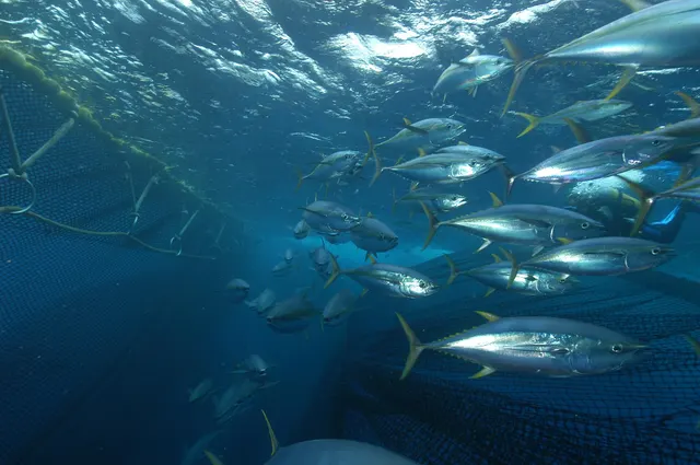 Yellowfin tunaA warm-blooded, high-speed oceanic predator that schools with dolphins and under floating debris, and one of the most commercially important fish in the world.
Marc Taquet — CC BY 4.0, via Wikimedia Commons
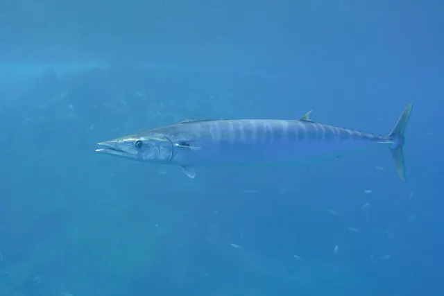 WahooAn extremely fast blue-water mackerel with razor teeth and a long slender body, taken by high-speed trolling and almost always fished on wire.
Bommerer — CC BY 4.0, via Wikimedia Commons
Places within this area
Publicly documented fishing geography. FishingHQ describes what the ground is; it does not say whether you may fish it, and every one of these sends that question to the body that holds the answer. Browse every place in this part of the world.
Who to ask before fishing any of these
FishingHQ does not know the current access position here. The Canary Islands are an autonomous community licensing their own recreational sea, boat and underwater fishing, separately from mainland Spain, and the archipelago carries marine reserves in which fishing and diving are restricted or prohibited on boundaries a visitor cannot see from the shore. Measures change. Check the current position with the Canarian government's fisheries administration before going.
Playa de los Patos and El Bollullo, Tenerife
Beach · Salt water
Two adjacent black-sand beaches on Tenerife's north coast below the Orotava valley, cut into a cliffed coast, with volcanic rock at either end of each and reef running out from the points between them.
Fully open to the northern Atlantic swell with no shelter of any kind, which is the defining fact about this coast and the reason the fishing on it is decided by the sea rather than by the season.
Particular to this ground: cliffs and rock platforms, drowning and immersion, sun, dehydration and fatigue.
The Anaga north coast, Tenerife
Rock platform · Salt water
The north-facing coast of the Anaga massif at the north-eastern tip of Tenerife: steep laurel-forested ridges falling to a coast of black boulder beach, lava platform and rock stacks, with a breakwater at one of the settlements along it.
One of the most exposed pieces of accessible coast in the archipelago. It faces the open north Atlantic directly and the swell that reaches it is unfiltered, which is why the settlements along it are small and the ground below them is scoured.
Particular to this ground: cliffs and rock platforms, drowning and immersion, sun, dehydration and fatigue.
Particular to this water: Underwater fishing is licensed and regulated separately from rod fishing throughout this jurisdiction, with its own age, equipment and distance requirements, and holding a rod licence is not permission to spearfish.
La Dársena Pesquera, Santa Cruz de Tenerife
Harbour wall · Salt water
The fishing dock at the northern end of the port of Santa Cruz, with a long armoured breakwater enclosing it and boulder armour along the outer face of that arm.
Sheltered by the arm itself and by the bulk of the commercial port, which is what makes it fishable when the open coast on either side is not.
Particular to this ground: boat traffic and being seen, sun, dehydration and fatigue.
Severe hazards of Tenerife apply here: cliffs and rock platforms.
Particular to this water: This is an owned and operated structure. Whether angling is allowed on it, when, from where and on what terms is the operator's decision, is frequently seasonal, and changes without notice.
Los Abrigos, Tenerife
Harbour wall · Salt water
A small fishing settlement and harbour on the arid southern coast of Tenerife, with a short mole, low volcanic ledge along the shore either side of it and broken ground running out from the point.
On the sheltered southern coast in the lee of the island, and open to the swell that wraps around the southern tip. Considerably calmer than the north and considerably windier than the west.
Particular to this ground: cliffs and rock platforms, sun, dehydration and fatigue.
Particular to this water: This is an owned and operated structure. Whether angling is allowed on it, when, from where and on what terms is the operator's decision, is frequently seasonal, and changes without notice.
Playa San Juan and Alcalá, Tenerife
Harbour wall · Salt water
Two small harbours a short distance apart on Tenerife's western coast, each with a mole and a pocket of dark sand beside it, on a coast of low volcanic ledge below the arid western slopes.
In the lee of the island from the trade wind, which is why the west coast carries the charter fleet and why these harbours are workable when the north is not.
Particular to this ground: boat traffic and being seen, sun, dehydration and fatigue.
Severe hazards of Tenerife apply here: cliffs and rock platforms.
Particular to this water: This is an owned and operated structure. Whether angling is allowed on it, when, from where and on what terms is the operator's decision, is frequently seasonal, and changes without notice.
Puerto Colón, Adeje, Tenerife
Charter departure port · Salt water
A purpose-built leisure marina on the south-western coast of Tenerife in the municipality of Adeje, with capacity for three hundred and sixty-four moored vessels and two hundred and thirty-seven dry berths, and a stated maximum length overall of twenty-four metres. It carries the largest concentration of charter and excursion boats on the island.
On the lee coast, in the wind shadow the island's central massif throws across its south-west. That shelter is the reason the charter fleet is on this side of Tenerife and not on the north, where the same swell that scours the Anaga coast makes a working marina impractical.
Particular to this ground: boat traffic and being seen, sun, dehydration and fatigue.
Severe hazards of Tenerife apply here: cliffs and rock platforms.
Particular to this water: A departure port, not a fishing mark. What the fleet catches is recorded against the offshore ground rather than against this harbour, and what any individual boat may fish for is a matter for its skipper and the fisheries authority.
Punta de Teno, Tenerife
Headland · Salt water
The north-western corner of Tenerife: a basalt point at the foot of the Teno massif, with boulder and lava ledge at the water's edge, high cliffs behind and deep water immediately offshore.
Exposed to the north-westerly swell and to the acceleration of the trade wind around the corner of the island.
Particular to this ground: cliffs and rock platforms, sun, dehydration and fatigue.
Particular to this water: Underwater fishing is licensed and regulated separately from rod fishing throughout this jurisdiction, with its own age, equipment and distance requirements, and holding a rod licence is not permission to spearfish.
Los Gigantes, Tenerife
Harbour wall · Salt water
A small marina cut into the foot of a wall of basalt cliffs rising several hundred metres straight from the sea on Tenerife's west coast, with very deep water within a short distance of the harbour mouth.
Sheltered from the trade wind in the lee of the island, which is why the west coast carries most of the charter fleet.
Severe hazards of Tenerife apply here: cliffs and rock platforms.
Particular to this water: This is an owned and operated structure. Whether angling is allowed on it, when, from where and on what terms is the operator's decision, is frequently seasonal, and changes without notice.
10 more places in this area
El Médano, Tenerife
Surf beach · Salt water
A long light sand beach on Tenerife's flat southern corner, with low rock at each end and the volcanic cone of Montaña Roja above it.
The windiest coast on the island by a wide margin — the reason it is a sailboarding centre — and the sources treat wind as the condition that defines fishing here rather than an inconvenience.
Particular to this ground: sun, dehydration and fatigue.
Severe hazards of Tenerife apply here: cliffs and rock platforms.
Particular to this water: A Canary recreational fishing licence is required, separately for shore, boat and underwater fishing. FishingHQ does not hold the current requirements — check with the Canary regional fisheries authority before fishing.
Playa de Las Teresitas, Tenerife
Beach · Salt water
An imported golden-sand beach behind a breakwater at San Andrés, north-east of Santa Cruz, with the working mole of San Andrés at one end and the natural dark rock of the Anaga coast beyond.
Artificially sheltered: the breakwater is the reason the beach exists in this form.
Particular to this ground: sun, dehydration and fatigue, boat traffic and being seen.
Severe hazards of Tenerife apply here: cliffs and rock platforms.
Particular to this water: A Canary recreational fishing licence is required, separately for shore, boat and underwater fishing. FishingHQ does not hold the current requirements — check with the Canary regional fisheries authority before fishing. This is an owned and operated structure. Whether angling is allowed on it, when, from where and on what terms is the operator's decision, is frequently seasonal, and changes without notice.
Punta del Hidalgo, Tenerife
Rock platform · Salt water
A broad wave-cut lava platform at the north end of the Anaga massif, running out below the lighthouse into pools, ledges and gullies that cover and uncover with the sea.
Full north-coast exposure. Canary sources recommend the north for variety and warn about it in the same paragraph, and this is the ground they mean.
Particular to this ground: cliffs and rock platforms, drowning and immersion, sun, dehydration and fatigue.
Particular to this water: A Canary recreational fishing licence is required, separately for shore, boat and underwater fishing. FishingHQ does not hold the current requirements — check with the Canary regional fisheries authority before fishing.
Punta Rasca, Tenerife
Headland · Salt water
The low black lava point at Tenerife's southern tip below the lighthouse, a flat platform of broken rock running out into deep water with no beach on either side.
Sits where the two sides of the island meet, so it takes whichever sea is running and the water over the point moves hard.
Particular to this ground: cliffs and rock platforms, drowning and immersion, sun, dehydration and fatigue.
Particular to this water: A Canary recreational fishing licence is required, separately for shore, boat and underwater fishing. FishingHQ does not hold the current requirements — check with the Canary regional fisheries authority before fishing.
Los Cristianos, Tenerife
Charter departure port · Salt water
The main southern port of Tenerife: ferry berths, a fishing quay and the charter fleet that works the deep water off the island's south-west corner.
Sheltered in the island's lee, which is why the offshore fleet is based on this coast rather than the north.
Particular to this ground: boat traffic and being seen.
Severe hazards of Tenerife apply here: cliffs and rock platforms.
Particular to this water: A Canary recreational fishing licence is required, separately for shore, boat and underwater fishing. FishingHQ does not hold the current requirements — check with the Canary regional fisheries authority before fishing. This is a working commercial and ferry port. Fishing from port structures is restricted and the port authority decides where anybody may stand.
Garachico
Rock platform · Salt water
The lava field that buried the old harbour in 1706, now a low black platform of pools, arches and cut channels along the town front, with the sea working through it constantly and deep water immediately outside.
Full north-coast exposure. The Canary sources recommend the north coast for variety and warn about it in the same paragraph, and this is the ground they mean.
Particular to this ground: cliffs and rock platforms.
Bajamar
Rock platform · Salt water
A cut lava platform with tidal pools and the town's sea pools built into it, on the north coast below the Anaga hills, running out into broken rock and gullies that uncover as the sea drops off them.
Open north; the swell that makes this coast dangerous is the swell that makes it productive.
Particular to this ground: cliffs and rock platforms.
Candelaria
Rock platform · Salt water
Black shingle and low lava ledge along the town front below the basilica, on the island's east coast, with the sea breaking directly against the sea wall in anything but calm and mixed rock and sand running out from it.
Open east to the trade wind and the sea it pushes down the channel between the islands.
Particular to this ground: cliffs and rock platforms.
The El Sauzal coast
Cliff coast · Salt water
Steep cliff and boulder on the north coast between Tacoronte and Santa Úrsula, with small lava platforms at sea level reached by paths down through banana terraces, and deep water very close in.
Full north-coast exposure with no shelter, on ground named by Canary sources as among the island's most productive and most complicated.
Particular to this ground: cliffs and rock platforms, cliffs and rock platforms.
Puerto de la Cruz
Harbour wall · Salt water
The small fishing harbour and the lava ledges either side of it on the north coast, with the old mole giving hard standing and the natural rock of the Punta Brava shore running west from the town.
Open north; the harbour mole is the only shelter on this stretch.
Particular to this ground: cliffs and rock platforms.
Safety
Further safety reading
- Boat safety for anglers — Oceanic depth arrives within a very short distance of shore, so a small craft is in oceanic conditions quickly and an offshore wind has the whole Atlantic behind it.
- Rock platform and cliff safety — The north coast receives heavy long-period Atlantic swell through the winter independently of local wind, and the two coasts have materially different exposure.
Check the rules before you fish
Fishing laws, bylaws, access rules, seasons, bait restrictions and permitted methods vary by location and can change. Check the current rules from the relevant authority and the water you intend to fish before fishing.
Check with:
- Current national or regional law for where you are fishing
- Current local bylaws
- The relevant fisheries authority
- The landowner, club or fishery whose water it is
- Any restrictions specific to the species or the method you intend to use
Where to go next
What swims here
- Atlantic blue marlinOccupies the deep blue water off the island's abrupt drop-off, and is the species the Canarian big-game charter fleet is built around.
- WahooFollows warm oceanic water and current edges close to the island, where deep water arrives within a very short distance of shore.
- White seabreamA mainstream shore target over the island's volcanic rock, taken from platforms into water that deepens rapidly.
- Yellowfin tunaOccupies the oceanic water that lies within a short run of the island's south-western ports, which is the basis of the archipelago's blue-water fishery.
Local knowledge
How this compares
- Canary IslandsTenerife carries the group's greatest altitude and its sharpest windward-leeward contrast, which is the clearest demonstration that a Canary island's two coasts are two fisheries.
- LanzaroteThe two are close to opposites within one archipelago: Tenerife has the steepest drop-off and rewards a boat, Lanzarote has the only real shelf and rewards a car. That contrast is why both earn a record and the intermediate islands do not.
Sources and evidence
- FAO Species Identification Guides for Fishery Purposes and the FAO Species Catalogues — Food and Agriculture Organization of the United Nations (Scientific institute)Relied on for: Distribution, habitat and depth accounts for the species of the eastern central Atlantic in the FAO regional identification guides.States this directlyCitation checked — the work exists and is described correctly
- FishBase: a global information system on fishes — Froese, R. and D. Pauly, eds. — FishBase Consortium (Scientific institute)Relied on for: Distribution, habitat association and depth range recorded for the species.States this directlyPassage read and verified
Why the 10 connections on this page are here, and the sources
What swims here
Backed by research — 4 connections
Supported by peer-reviewed research or fisheries science. The sources are listed and can be checked.
Atlantic blue marlin
A distribution association between an animal and a kind of water, rather than a claim about any named mark.
- FishBase: a global information system on fishes — Froese, R. and D. Pauly, eds. — FishBase Consortium (Scientific institute)Relied on for: Distribution, habitat association and depth range recorded for the species, including its occurrence in the water body concerned.States this directlyPassage read and verified
- The IUCN Red List of Threatened Species — International Union for Conservation of Nature (Conservation authority)Relied on for: Assessment and range account for the species, including the systems and coasts it occupies.Background and mechanism onlyCitation checked — the work exists and is described correctly
Wahoo
A distribution association between an animal and a kind of water, rather than a claim about any named mark.
- FishBase: a global information system on fishes — Froese, R. and D. Pauly, eds. — FishBase Consortium (Scientific institute)Relied on for: Distribution, habitat association and depth range recorded for the species, including its occurrence in the water body concerned.States this directlyPassage read and verified
- The IUCN Red List of Threatened Species — International Union for Conservation of Nature (Conservation authority)Relied on for: Assessment and range account for the species, including the systems and coasts it occupies.Background and mechanism onlyCitation checked — the work exists and is described correctly
White seabream
A distribution association between an animal and a kind of water, rather than a claim about any named mark.
- FishBase: a global information system on fishes — Froese, R. and D. Pauly, eds. — FishBase Consortium (Scientific institute)Relied on for: Distribution, habitat association and depth range recorded for the species, including its occurrence in the water body concerned.States this directlyPassage read and verified
- The IUCN Red List of Threatened Species — International Union for Conservation of Nature (Conservation authority)Relied on for: Assessment and range account for the species, including the systems and coasts it occupies.Background and mechanism onlyCitation checked — the work exists and is described correctly
Yellowfin tuna
A distribution association between an animal and a kind of water, rather than a claim about any named mark.
- FishBase: a global information system on fishes — Froese, R. and D. Pauly, eds. — FishBase Consortium (Scientific institute)Relied on for: Distribution, habitat association and depth range recorded for the species, including its occurrence in the water body concerned.States this directlyPassage read and verified
- The IUCN Red List of Threatened Species — International Union for Conservation of Nature (Conservation authority)Relied on for: Assessment and range account for the species, including the systems and coasts it occupies.Background and mechanism onlyCitation checked — the work exists and is described correctly
How people fish here
What experienced anglers do — 1 connection
Widely and independently recommended by experienced anglers and specialist sources. This is real angling knowledge, not proof: controlled evidence for it is limited, and FishingHQ records it as convention rather than as a demonstrated effect.
Sea fishing
A discipline that is characteristic of the place rather than merely possible there, joined so a reader can move between the place and the practice.
- General angling website restatements of established technique — Various (Credible secondary source)Relied on for: Widely restated practice associating this discipline with this place, recorded as practitioner consensus rather than as tested fact.Background and mechanism onlyCitation checked — the work exists and is described correctly
- Fishers' Craft and Lettered Art: Tracts on Fishing from the End of the Middle Ages — University of Toronto Press, 1997 (Scientific literature)Relied on for: That fishing traditions develop around the water and fish available to them, and the historical method of reading such traditions.States this directlyCitation checked — the work exists and is described correctly
Local knowledge
What experienced anglers do — 1 connection
Widely and independently recommended by experienced anglers and specialist sources. This is real angling knowledge, not proof: controlled evidence for it is limited, and FishingHQ records it as convention rather than as a demonstrated effect.
Upwelling, and the coasts it makes
A place joined to the mechanism that explains what is distinctive about fishing there, which is what makes a location page transferable rather than local colour.
- Sea Angler — Bauer Media (Specialist angling publication)Relied on for: Contemporary UK and European sea angling practice as reported by practitioners, including regional ground and species behaviour.States this directlyCitation checked — the work exists and is described correctly
- General angling website restatements of established technique — Various (Credible secondary source)Relied on for: Widely restated descriptions of regional angling practice, recorded as consensus rather than as scholarship.Background and mechanism onlyCitation checked — the work exists and is described correctly
How this compares
What experienced anglers do — 2 connections
Widely and independently recommended by experienced anglers and specialist sources. This is real angling knowledge, not proof: controlled evidence for it is limited, and FishingHQ records it as convention rather than as a demonstrated effect.
Canary Islands
Two places or records a reader will hold together, joined where the comparison teaches something neither states alone.
- Sea Angler — Bauer Media (Specialist angling publication)Relied on for: Contemporary UK and European sea angling practice as reported by practitioners, including regional ground and species behaviour.States this directlyCitation checked — the work exists and is described correctly
- General angling website restatements of established technique — Various (Credible secondary source)Relied on for: Widely restated descriptions of regional angling practice, recorded as consensus rather than as scholarship.Background and mechanism onlyCitation checked — the work exists and is described correctly
Lanzarote
Two places a reader would reasonably weigh against one another, joined where the comparison teaches something about both.
- General angling website restatements of established technique — Various (Credible secondary source)Relied on for: Widely restated practice associating this discipline with this place, recorded as practitioner consensus rather than as tested fact.Background and mechanism onlyCitation checked — the work exists and is described correctly
- Fishers' Craft and Lettered Art: Tracts on Fishing from the End of the Middle Ages — University of Toronto Press, 1997 (Scientific literature)Relied on for: That fishing traditions develop around the water and fish available to them, and the historical method of reading such traditions.States this directlyCitation checked — the work exists and is described correctly
Safety reading
Official guidance — 2 connections
Stated by a fisheries authority, scientific institute or recognised angling body. Authoritative, but summarising rather than demonstrating.
Boat safety for anglers
A place is joined to the safety topic that explains a hazard genuinely characteristic of it, so the mechanism is reachable rather than restated as a weak warning.
- RNLI water safety guidance: cold water shock and Float to Live — Royal National Lifeboat Institution (Water-safety or diver-training authority)Relied on for: Cold water shock and the immersion response, shore angling hazards, small-craft guidance and the circumstances in which water users are most often killed.States this directlyPassage read and verified
- RoSPA water safety information and UK accidental drowning statistics — Royal Society for the Prevention of Accidents (Water-safety or diver-training authority)Relied on for: Accidental drowning statistics and the circumstances in which recreational water users are most often killed.Background and mechanism onlyPassage read and verified
Rock platform and cliff safety
A place is joined to the safety topic that explains a hazard genuinely characteristic of it, so the mechanism is reachable rather than restated as a weak warning.
- United States Lifesaving Association public education on rip currents and the surf zone — United States Lifesaving Association (Water-safety or diver-training authority)Relied on for: Surf zone hazards, wave behaviour, shore-break and the mechanisms by which people are swept from exposed shores.States this directlyCitation checked — the work exists and is described correctly
- RNLI water safety guidance: cold water shock and Float to Live — Royal National Lifeboat Institution (Water-safety or diver-training authority)Relied on for: Shore angling hazards including being swept in, shore-break and cold water shock.States this directlyPassage read and verified
How FishingHQ labels evidence is explained in the evidence policy.