Windermere
Lake · Fresh water · in The Lake District lakes
England's largest natural lake: a ribbon lake gouged by ice into a north–south glacial trough, seventeen kilometres long, with two basins separated by a shallow sill and islands, rocky shores and deep cold water.
Safety: cold water shock — can cause serious injury or death. 2 more points apply here.
FishingHQ describes what this place is, not whether you may fish it. Access, permits and who to ask.
What you can catch here
Documented at this place, grouped by how you would be fishing, with how strongly the sources support each one. This is what has been written down, not a forecast, and being listed is never permission to fish.
From the shore · 3
From a boat · 5
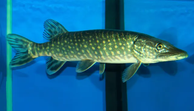 Northern pikeCharacteristic of this water1 placeWindermereOver lakeAround Jan–Mar, Oct–Dec
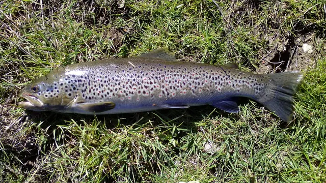 Brown troutRegular local target1 placeWindermereOver lake
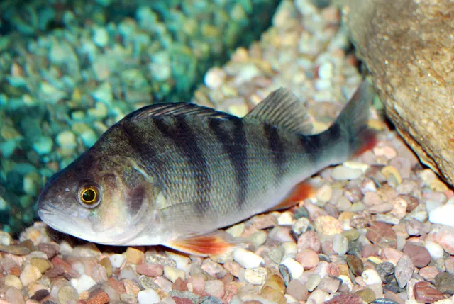 European perchRegular local target1 placeWindermereOver lake
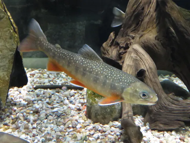 Arctic charSeasonal1 placeWindermereOver lakeAround Apr–Jun
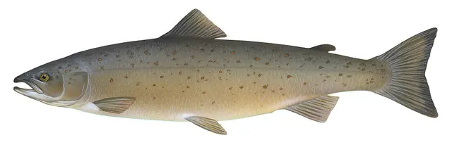 Atlantic salmonRecorded here1 placeWindermereOver lake
Fly fishing · 1
What these strengths mean
- Characteristic of this water
- This water is strongly identified with this species by the sources that cover it.
- Regular local target
- Fishing sources describe this as a normal local target here, not merely as caught.
- Seasonal
- Well supported, and concentrated in part of the year rather than spread through it.
- Recorded here
- At least one credible public account of this species being caught here. That is all it means.
- How breadth is counted
- A fish documented at six marks is shown as six marks: breadth never raises the strength on its own. A fishery account describes the fishing; a recorded catch reports one specific catch. How evidence is weighed.
Recorded here, but not a species to target
These are recorded here, but they are not fish to take. Each is either assessed as Critically Endangered or protected by statute in this jurisdiction, and taking one may be prohibited outright — elsewhere every rod-caught fish must be returned. Read the species page and check the current rules with the authority before fishing.
Fish documented nearby, not here
Nothing below has been documented at Windermere itself. Each one has been documented at a named place on the same ground, and the places are listed with it. Treat this as what the water around here holds rather than as a catch list for this mark.
Also documented at neighbouring places
One or two accounts each, on the ground around here. Enough to know the fish is caught in these waters; not enough to say anything about this place.
From the shore
- Rainbow trout — documented at Esthwaite Water
- Roach — documented at Bassenthwaite Lake; Esthwaite Water
From a boat
- Rainbow trout — documented at Esthwaite Water
Fly fishing
- Rainbow trout — documented at Esthwaite Water
How people fish it
Practised here: Coarse fishing, Fly fishing.
Methods the sources name for this ground. Each one is explained in full on its own page.
- Trolling
Towing lures or baits behind a moving boat to cover large volumes of water and locate scattered fish.
- Deadbaiting
Presenting a dead fish as bait for predators — a method that works because scavenging is normal predator behaviour, not an exception.
- Float fishing
Suspending a bait at a controlled depth beneath a buoyant indicator — the most visual, most controllable and most widely applicable method in angling.
- Stillwater fly fishing
Fly fishing without current, where the angler supplies every movement and the problem becomes finding fish rather than presenting to them.
The ground and the water
- The ground
- England's largest natural lake: a ribbon lake gouged by ice into a north–south glacial trough, seventeen kilometres long, with two basins separated by a shallow sill and islands, rocky shores and deep cold water.
- Exposure
- The valley funnels wind along the lake's axis, so the fetch is the full length and squalls run down it. Sheltered from cross-winds by the fells either side.
- Depth
- Deep — over sixty metres in the north basin — and cold at depth year-round, which is what allows Arctic charr to persist here as a glacial relict.
- Tide and flow
- None. Level varies with rainfall and outflow; the lake stratifies thermally in summer, which divides it into a warm surface layer and a cold deep one with different fish in each.
Through the year
Perch and pike through the year with a cold-season predator peak, trout in the warmer months, and a charr population that is one of the most closely studied glacial relict fisheries in Britain.
The months the sources attach to each species here. Where a species carries no season it is listed underneath rather than assumed to run through the year.
| Species | J | F | M | A | M | J | J | A | S | O | N | D |
|---|---|---|---|---|---|---|---|---|---|---|---|---|
| Northern pike — characteristic of this water, recorded in October, November, December, January, February, March. | ||||||||||||
| Arctic char — seasonal, recorded in April, May, June. |
Recorded here with no season stated: Brown trout, European perch, Atlantic salmon.
Safety
Cold water shock — Can cause serious injury or death
UK coastal and inland water is cold enough for most of the year to trigger the involuntary gasp and the loss of swimming ability that decides most immersion deaths, and it does so within the first minute, long before hypothermia is relevant.
What reduces it: Wear a buoyancy aid rather than carry one, carry a means of calling for help on the person rather than in a bag, and plan on the assumption that an unplanned entry into the water is survivable only if somebody knows immediately.
Boat safety — Can cause serious injury or death
A long, deep, cold lake in a wind-funnelling valley, carrying heavy recreational boat traffic in summer. Squalls run the length of it, the water is cold enough at any time of year to disable a swimmer quickly, and the shores in the middle reaches are steep.
What reduces it: Wear a buoyancy aid afloat, watch up-lake for approaching wind, keep clear of the passenger and speed traffic, and treat the lake's depth and temperature as the reason an immersion here is serious rather than uncomfortable.
Biosecurity and disease transfer — Can cause injury needing treatment
The lake holds populations of national conservation significance alongside documented invasive species, and gear moved wet between waters is the principal vector.
What reduces it: Check, clean and dry everything between waters without exception.
Rules and access
Licence
A rod licence is required for freshwater rod fishing in England, issued by the Environment Agency.
Permission to fish
Separate. Almost all fishing rights are held by a club, association, riparian owner or navigation authority, and the licence does not grant access to any of them.
FishingHQ does not know the current access position here. Freshwater rod fishing in England requires a current rod licence AND separate permission from whoever controls the fishing, which is frequently a club, riparian owner or navigation authority rather than a public body. Close seasons, byelaws and local rules apply and change. Check with the Environment Agency and with the controlling club or owner before going.
Particular to this water: This ground carries conservation designations that constrain access, vehicles, bait collection and disturbance independently of any fishing rule.
Who holds the answer:
- The Environment Agency, for rod licensing, close seasons and fisheries byelaws in England.
- The club, association, riparian owner or navigation authority that controls the fishing.
- The Environment Agency, for rod licences, byelaws, close seasons and fisheries enforcement in England.
- The owner of the fishing rights on a given water — private, National Trust, angling association or other — which is a separate permission from the licence and differs lake by lake.
- Natural England and the site management body, where a conservation designation constrains access, launching or activity.
- The Lake District National Park Authority, for access, launching and vehicle constraints across the park.
- The GB Non-Native Species Secretariat, for biosecurity practice on waters where introduced species are a direct conservation threat.
- The Lake District National Park Authority as navigation authority for the lake.
Nearby fishing
Other publicly documented places within about 40 km, by distance. Positions are approximate public geography and are never exact marks.
- Esthwaite Water — 2–5 km · Lake
- Coniston Water — 5–10 km · Lake
- Ullswater — 10–25 km · Lake
- Derwent Water — 25–40 km · Lake
- Morecambe Stone Jetty — 25–40 km · Jetty
- The Lune at Lancaster — 25–40 km · River reach
- Walney Island — 25–40 km · Island
- Throbshaw Rocks, Heysham — 25–40 km · Rock mark
Sources for this place
- Environment Agency fisheries management, byelaws and rod licensing information — Environment Agency (Government fisheries body)Relied on for: Freshwater and transitional-water fisheries management in England, the structure of rod licensing, close seasons and byelaws, and the monitoring of rivers and stillwaters.States this directlyCitation checked — the work exists and is described correctly
- Freshwater Fishes of the British Isles — HarperCollins (New Naturalist 75), 1992 (Reference work)Relied on for: Distribution, habitat requirements and biology of the freshwater fishes of Britain and Ireland named here.States this directlyCitation checked — the work exists and is described correctly
- Angling Times — Bauer Media (Specialist angling publication)Relied on for: Long-running published description of British coarse and match angling practice by water and by named reach.FishingHQ's interpretation of what it saysCitation checked — the work exists and is described correctly
- General angling website restatements of established technique — Various (Credible secondary source)Relied on for: Widely restated public descriptions of which waters are conventionally fished and how, recorded as practitioner consensus rather than as scholarship, and not relied on for access, permission or any current rule.Background and mechanism onlyCitation checked — the work exists and is described correctly
How FishingHQ labels evidence is explained in the evidence policy. Last reviewed 2026-08-16.