Thurso Bay and Scrabster
Bay · Salt water · in Caithness and the north coast
A north-facing bay on the Pentland Firth's southern shore, with a flagstone rock platform, a deep working harbour at Scrabster and clean sand at the Thurso river mouth.
Safety: moving water and currents — can cause serious injury or death. 2 more points apply here.
FishingHQ describes what this place is, not whether you may fish it. Access, permits and who to ask.
What you can catch here
Documented at this place, grouped by how you would be fishing, with how strongly the sources support each one. This is what has been written down, not a forecast, and being listed is never permission to fish.
From the shore · 3
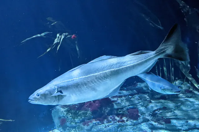 SaitheRegular local target1 placeThurso Bay and ScrabsterOver bay
Photo: Wilhelm Thomas Fiege, via Wikimedia Commons, CC BY-SA 4.0; resized and trimmed to fit
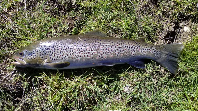 Brown troutRecorded here1 placeThurso Bay and ScrabsterOver bay
Photo: Robermix, via Wikimedia Commons, CC0; resized and trimmed to fit
- Short-spined sea scorpionRecorded here1 placeThurso Bay and ScrabsterOver bay
.jpg)

From a boat · 3
 Atlantic codRegular local target1 placeThurso Bay and ScrabsterOver bay
Photo: The U.S. Food and Drug Administration, via Wikimedia Commons, public domain; resized and trimmed to fit
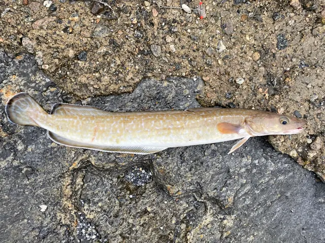 LingRegular local target1 placeThurso Bay and ScrabsterOver bay
- Cuckoo wrasseRecorded here1 placeThurso Bay and ScrabsterOver bay
.jpg)

What these strengths mean
- Regular local target
- Fishing sources describe this as a normal local target here, not merely as caught.
- Recorded here
- At least one credible public account of this species being caught here. That is all it means.
- How breadth is counted
- A fish documented at six marks is shown as six marks: breadth never raises the strength on its own. A fishery account describes the fishing; a recorded catch reports one specific catch. How evidence is weighed.
Also associated with this ground
Recorded as present here without a documented method or strength behind them.
Fish documented nearby, not here
Nothing below has been documented at Thurso Bay and Scrabster itself. Each one has been documented at a named place on the same ground, and the places are listed with it. Treat this as what the water around here holds rather than as a catch list for this mark.
Also documented at neighbouring places
One or two accounts each, on the ground around here. Enough to know the fish is caught in these waters; not enough to say anything about this place.
From the shore
- European flounder — documented at Dunnet Beach; Castletown and Keiss beaches
- European plaice — documented at Dunnet Beach; Castletown and Keiss beaches
- European sea bass — documented at Dunnet Beach; Castletown and Keiss beaches
- Dab — documented at Castletown and Keiss beaches
How people fish it
Practised here: Sea fishing.
Methods the sources name for this ground. Each one is explained in full on its own page.
Kayak fishing is the exception: it is listed for this ground and no kayak source has been read for it. Take it as somewhere a kayak might be used, not as something a source reports.
- Float fishing
Suspending a bait at a controlled depth beneath a buoyant indicator — the most visual, most controllable and most widely applicable method in angling.
- Spinning
Casting an artificial lure and retrieving it so that it moves like something alive — the most direct form of lure fishing.
- Ledgering
Fishing a bait on the bottom held by a weight, with no float — the simplest way to fish at distance, in depth, or in wind.
- Kayak fishing
A platform rather than a technique: quiet, shallow-draught access to water no other craft reaches, bought at the price of exposure, and a discipline where the decision not to launch is part of the skill.
Baits and lures for these fish
The baits and lures each of the fish above is commonly taken on, from that fish’s own page. This is what works for the fish, not a report of what people use on this particular water — local knowledge and the conditions on the day still decide.
Baits
- Crab and shellfish — for Saithe
- Fish strip and cut bait — for Atlantic cod
- Lugworm — for Atlantic cod
- Peeler crab — for Atlantic cod
- Sand eel — for Saithe
- Squid and cuttlefish — for Atlantic cod
Lures
- Metal jigs — for Atlantic cod, Ling, Saithe
- Soft plastics — for Atlantic cod, Saithe
- Dry flies — for Brown trout
- Jigs and jig heads — for Cuckoo wrasse
- Nymphs — for Brown trout
- Streamers — for Brown trout
- Terrestrial fly patterns — for Brown trout
- Wet flies — for Brown trout
How to catch them: Cod fishing · Coalfish fishing · Brown trout fishing
The ground and the water
- The ground
- A north-facing bay on the Pentland Firth's southern shore, with a flagstone rock platform, a deep working harbour at Scrabster and clean sand at the Thurso river mouth.
Safety
Moving water and currents — Can cause serious injury or death
Tidal streams through narrow water run hard enough to overwhelm a small boat and to make a person in the water uncatchable. Overfalls stand up where the stream meets wind or shoaling ground, and the transition from workable to dangerous happens over minutes rather than hours as the tide turns.
What reduces it: Do not take a small boat into a race without knowing the times of slack water for that specific gate. Wear flotation. Fish from the shore where the ground allows it rather than from a boat that has to hold position in the stream.
Worse when:
- Wind against tide, which stands the water up into steep breaking overfalls
- Springs, when the stream runs at its hardest
- An engine failure, where a drift becomes a race transit with no way out of it
Cold water shock — Can cause serious injury or death
Sea temperatures around these coasts stay low enough for most of the year that sudden immersion causes involuntary gasping and rapid loss of useful movement in the hands and arms. Swimming ability makes very little difference to the outcome in the first minute, which is the minute that decides it.
What reduces it: Wear a buoyancy aid on any rock, pier or harbour mark, not only on a boat. If you go in, float on your back and let the gasping pass before trying to do anything. Get out and get warm quickly — the danger continues after the water.
Worse when:
- Spring and early summer, when the air feels warm and the sea has not caught up
- Fishing alone, where nobody raises the alarm
- Heavy clothing and waders, which make self-rescue much harder
Cliffs and rock platforms — Can cause serious injury or death
Low limestone and shale ledges reached by a descent from a cliff top, fished from a platform that is wet, sloping seaward and lower than it looks from above. A sea that was manageable on arrival can put water across the whole platform, and the way back up is a climb rather than a walk.
What reduces it: Look at the state of the sea from the top before committing to the descent, and look at the forecast for the whole session rather than for the hour. Know where the exit is and how long it takes. Do not fish a ledge alone. Wear a buoyancy aid: a person in the water at the foot of a cliff cannot be reached quickly from the land.
Worse when:
- A rising swell during the session, so the descent was safe and the ascent is not
- Wet weed and algae on the platform, which are as slippery as ice on limestone
- A big spring tide, which reaches ledges that a neap leaves dry
Rules and access
FishingHQ does not know the current access position here. Sea angling in Scotland is not rod-licensed, but access rights under the Scottish Outdoor Access Code carry responsibilities, and harbour, local authority, marine conservation and fisheries measures all apply and all change. Check the current position with the Marine Directorate, the harbour or local authority and the land manager before going.
Who holds the answer:
- The Scottish Government Marine Directorate, for sea fisheries measures in Scottish waters.
- The harbour authority or land manager, for access to the structure or the ground.
- The local authority, for shellfish harvesting classification.
- The Scottish marine and fisheries authorities, for sea fisheries rules, minimum sizes, protected areas and species restrictions.
- The relevant district salmon fishery board, for anything concerning migratory salmon and sea trout.
- The local authority environmental health service, for shellfish harvesting classification and closures.
- The harbour authority for any working harbour, which is operational infrastructure rather than public space.
- The body managing any conservation designation on the stretch concerned.
Nearby fishing
Other publicly documented places within about 40 km, by distance. Positions are approximate public geography and are never exact marks.
- Dunnet Beach — 10–25 km · Surf beach
- The Thurso — 10–25 km · River reach
- Castletown and Keiss beaches — 10–25 km · Beach
- Duncansby Head and the Pentland Firth — 25–40 km · Tidal race
- Wick — 25–40 km · Harbour wall
- Longberry Rock — 25–40 km · Rock mark
- Scapa Flow — 25–40 km · Bay
Sources for this place
- JNCC species and habitat conservation advice — Joint Nature Conservation Committee (Conservation authority)Relied on for: Description, designation and habitat characterisation of the named coastal and marine features of the United Kingdom, and the species characteristically associated with them.States this directlyCitation checked — the work exists and is described correctly
- Cefas science, advice and data on marine and freshwater environments — Centre for Environment, Fisheries and Aquaculture Science (Government fisheries body)Relied on for: Marine environmental science for UK shelf seas: sediment characterisation, estuarine process, shellfish bed distribution, tidal range and the monitoring that describes them.States this directlyCitation checked — the work exists and is described correctly
- Sea Angler — Bauer Media (Specialist angling publication)Relied on for: Long-running published description of British sea angling practice by region, ground type and named mark.FishingHQ's interpretation of what it saysCitation checked — the work exists and is described correctly
- General angling website restatements of established technique — Various (Credible secondary source)Relied on for: Widely restated public descriptions of which places are conventionally fished and how, recorded as practitioner consensus rather than as scholarship, and not relied on for access, permission or any current rule.Background and mechanism onlyCitation checked — the work exists and is described correctly
- FISHMAG Scotland east and west coast sea fishing guides — FISHMAG (Credible secondary source)Relied on for: The mark-by-mark north-east Scottish shore guide: which species are fished for at each mark, in which season, and with which baits and methods.States this directlyPassage read and verified
- Sea fishing in Scotland, area by area — Clyde Outboard Services, in collaboration with Glasgow Angling Centre (Credible secondary source)Relied on for: Scottish sea fishing by coastal area and by mode — which species a drift or an anchored boat produces off each stretch of coast, and in which season.States this directlyPassage read and verified
How FishingHQ labels evidence is explained in the evidence policy. Last reviewed 2026-08-16.