Portpatrick
Harbour wall · Salt water · in The Solway Firth
A small harbour blasted into a hard greywacke cliff coast on the western Rhins, facing Ireland across the North Channel, with deep water and heavy reef ground immediately outside.
Safety: tides and being cut off — can cause serious injury or death.
FishingHQ describes what this place is, not whether you may fish it. Access, permits and who to ask.
What you can catch here
Documented at this place, grouped by how you would be fishing, with how strongly the sources support each one. This is what has been written down, not a forecast, and being listed is never permission to fish.
From a kayak · 3
 Atlantic codRepeatedly reported1 place · 1 fishery account · 1 sourcePortpatrickOver harbour wallSources name Kayak fishingAround MayObserved May 2022
 PollackRepeatedly reported1 place · 1 fishery account · 1 sourcePortpatrickOver harbour wallSources name Kayak fishingAround MayObserved May 2022
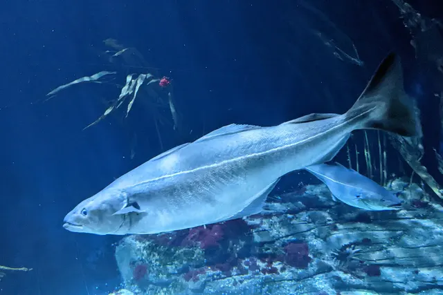 SaitheRepeatedly reported1 place · 1 fishery account · 1 sourcePortpatrickOver harbour wallSources name Kayak fishingAround MayObserved May 2022
What these strengths mean
- Repeatedly reported
- Several independent public accounts. Enough to say it happens more than once; not enough to call it a fishery.
- How breadth is counted
- A fish documented at six marks is shown as six marks: breadth never raises the strength on its own. A fishery account describes the fishing; a recorded catch reports one specific catch. How evidence is weighed.
Also associated with this ground
Recorded as present here without a documented method or strength behind them.
Fish documented nearby, not here
Nothing below has been documented at Portpatrick itself. Each one has been documented at a named place on the same ground, and the places are listed with it. Treat this as what the water around here holds rather than as a catch list for this mark.
Also documented at neighbouring places
One or two accounts each, on the ground around here. Enough to know the fish is caught in these waters; not enough to say anything about this place.
From a kayak
- Cuckoo wrasse — documented at Port Logan
- Haddock — documented at Port Logan
How people fish it
Practised here: Sea fishing, Spearfishing.
Methods the sources name for this ground. Each one is explained in full on its own page.
- Float fishing
Suspending a bait at a controlled depth beneath a buoyant indicator — the most visual, most controllable and most widely applicable method in angling.
- Spinning
Casting an artificial lure and retrieving it so that it moves like something alive — the most direct form of lure fishing.
- Ledgering
Fishing a bait on the bottom held by a weight, with no float — the simplest way to fish at distance, in depth, or in wind.
- Kayak fishing
A platform rather than a technique: quiet, shallow-draught access to water no other craft reaches, bought at the price of exposure, and a discipline where the decision not to launch is part of the skill.
The ground and the water
- The ground
- A small harbour blasted into a hard greywacke cliff coast on the western Rhins, facing Ireland across the North Channel, with deep water and heavy reef ground immediately outside.
Getting there
What public sources describe, last checked 2026-08-26. Car parks fill, services change and a path existing is not a path anybody may use — none of this is a guarantee of availability and none of it is permission to be anywhere.
- Getting to it
- A village built around a small harbour blasted into the cliff on the west side of the Rhins, reached by road from Stranraer. The harbour, the promenade and the village are one place and everything is within a few minutes' walk of everything else.
- The walk in
- Everything is at the harbour. The rough ground the kayak accounts describe is outside the harbour mouth rather than along a walk-in, and the Southern Upland Way begins on the cliff above the village for anybody working the coast on foot.
Where this access information comes from
- Portpatrick Harbour Community Benefit Society: harbour facilities — Portpatrick Harbour Community Benefit Society, 2026 (Local authority, harbour or protected-area body)Relied on for: The community benefit society that runs the harbour, listing its facilities and stating the condition attached to vehicular slipway access.States this directlyPassage read and verified
What is there
Slipway or launch
The harbour has a slipway, and VEHICULAR ACCESS TO IT FOR LAUNCHING AND RECOVERY IS ARRANGED WITH HARBOUR MANAGEMENT IN ADVANCE, with proof of insurance required. It is not a drive-down-and-launch slip and a kayak angler planning on one should ring first.
Public toilets
The harbour society lists toilets and showers; it built the visitor block itself on land obtained from the council.
Drinking water
Fresh water is listed among the harbour's facilities.
Food or shelter
Bars, restaurants, a provisions store and a Post Office in the village, listed by the harbour among its facilities.
Harbour facilities
A harbour run by a community benefit society since it passed out of private ownership, with a harbourmaster, published contact details, visitor berthing and winter onshore storage. Fuel is available by can rather than from a pump.
Through the year
The months the sources attach to each species here. Where a species carries no season it is listed underneath rather than assumed to run through the year.
| Species | J | F | M | A | M | J | J | A | S | O | N | D |
|---|---|---|---|---|---|---|---|---|---|---|---|---|
| Atlantic cod — repeatedly reported, recorded in May. | ||||||||||||
| Pollack — repeatedly reported, recorded in May. | ||||||||||||
| Saithe — repeatedly reported, recorded in May. |
Safety
Tides and being cut off — Can cause serious injury or death
Ledges, skerries and boulder ground below a cliff are reached over rock that the flood covers, and on a coast with a large range that happens quickly. The way back is a scramble rather than a walk, so it becomes unusable while there is still dry rock to stand on, and swell breaking over the covered ground removes it earlier than the tide table suggests.
What reduces it: Work out the way back before going down, and set the time you will leave from the tide rather than from the fishing. Treat the first wave that reaches the return route as the signal to take it, not as a warning that there is time left. Do not go down onto low ground alone on a rising tide, and carry a means of calling for help on the person.
Worse when:
- Spring tides, when the range and the rate of covering are greatest
- Any swell, which breaks over ground the tide has not yet reached
- Onshore wind and low pressure, which put the water above the predicted level
- Wet rock and weed, which make a return route slower on the way back than it was on the way down
Rules and access
FishingHQ does not know the current access position here. Sea angling in Scotland is not rod-licensed, but access rights under the Scottish Outdoor Access Code carry responsibilities, and harbour, local authority, marine conservation and fisheries measures all apply and all change. Check the current position with the Marine Directorate, the harbour or local authority and the land manager before going.
Who holds the answer:
- The Scottish Government Marine Directorate, for sea fisheries measures in Scottish waters.
- The harbour authority or land manager, for access to the structure or the ground.
- The local authority, for shellfish harvesting classification.
- The relevant national fisheries administration for the shore concerned — different bodies apply on the English and Scottish sides of the same firth
- The relevant salmon fishery board or migratory fisheries authority, for anything concerning salmon and sea trout
- The local authority environmental health service, for shellfish harvesting classification and public health closures
- The coastguard, for tidal and safety information, and as the service that will be called if somebody is cut off
- Local clubs and long-established practitioners, whose knowledge of channel positions is operative safety information rather than a courtesy
Nearby fishing
Other publicly documented places within about 40 km, by distance. Positions are approximate public geography and are never exact marks.
- Loch Ryan and Stranraer — 10–25 km · Sea loch
- Luce Bay and Sandhead — 10–25 km · Bay
- Port Logan — 10–25 km · Harbour wall
- The Mull of Galloway — 25–40 km · Headland
- Donaghadee pier — 25–40 km · Pier
- Orlock Point — 25–40 km · Headland
- Groomsport — 25–40 km · Harbour wall
- Islandmagee and the Gobbins — 25–40 km · Rock mark
Sources for this place
- Sea Angler — Bauer Media (Specialist angling publication)Relied on for: Long-running published description of British sea angling practice by region, ground type and named mark.FishingHQ's interpretation of what it saysCitation checked — the work exists and is described correctly
- General angling website restatements of established technique — Various (Credible secondary source)Relied on for: Widely restated public descriptions of which places are conventionally fished and how, recorded as practitioner consensus rather than as scholarship, and not relied on for access, permission or any current rule.Background and mechanism onlyCitation checked — the work exists and is described correctly
- Portpatrick Harbour Community Benefit Society: harbour facilities — Portpatrick Harbour Community Benefit Society, 2026 (Local authority, harbour or protected-area body)Relied on for: The harbour operator's own facilities list, and its statement that vehicular slipway access is by prior arrangement with proof of insurance.States this directlyPassage read and verified
- Public fishing video with an explicitly stated location — Various public video platforms (Practitioner report)Relied on for: A dated public video whose uploader names this ground and shows it being fished from a kayak, without naming a species.States this directlyCitation checked — the work exists and is described correctly
How FishingHQ labels evidence is explained in the evidence policy. Last reviewed 2026-08-16.