Lyme Regis Cobb
Harbour wall · Salt water · in Lyme Bay
A curving medieval harbour wall of Portland stone enclosing a small drying harbour, standing on the Jurassic clay coast where the ledges are dark blue lias and the ground is soft and slipping.
Safety: cliffs and rock platforms — can cause serious injury or death. One more point applies here.
FishingHQ describes what this place is, not whether you may fish it. Access, permits and who to ask.
What you can catch here
Documented at this place, grouped by how you would be fishing, with how strongly the sources support each one. This is what has been written down, not a forecast, and being listed is never permission to fish.
From the shore · 6
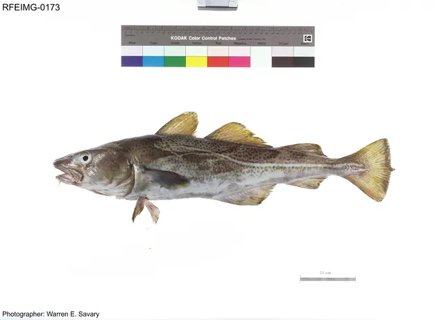 Atlantic codRecorded here1 placeLyme Regis CobbOver harbour wall
Photo: The U.S. Food and Drug Administration, via Wikimedia Commons, public domain; resized and trimmed to fit
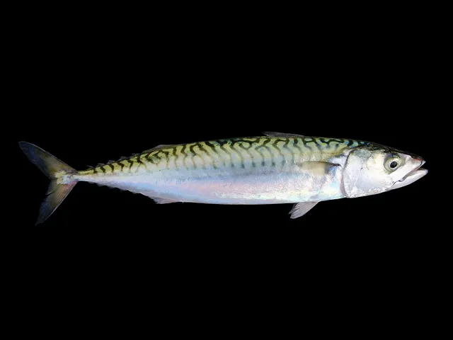 Atlantic mackerelRecorded here1 placeLyme Regis CobbOver harbour wall
Photo: Hans Hillewaert, via Wikimedia Commons, CC BY-SA 4.0; resized
- Bull hussRecorded here1 placeLyme Regis CobbOver harbour wall
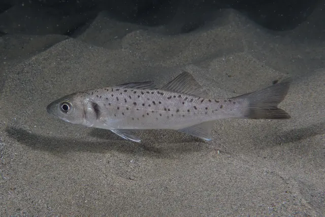 European sea bassRecorded here1 placeLyme Regis CobbOver harbour wall
Photo: Julien Renoult, via Wikimedia Commons, CC BY 4.0; resized and trimmed to fit
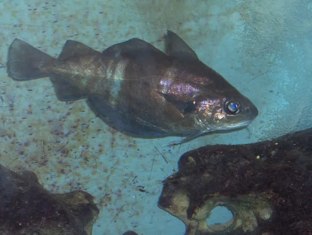 PoutingRecorded here1 placeLyme Regis CobbOver harbour wall
Photo: Georges Jansoone JoJan, via Wikimedia Commons, CC BY-SA 3.0; resized
- Small-spotted catsharkRecorded here1 placeLyme Regis CobbOver harbour wall


What these strengths mean
- Recorded here
- At least one credible public account of this species being caught here. That is all it means.
- How breadth is counted
- A fish documented at six marks is shown as six marks: breadth never raises the strength on its own. A fishery account describes the fishing; a recorded catch reports one specific catch. How evidence is weighed.
Also associated with this ground
Recorded as present here without a documented method or strength behind them.
Fish documented nearby, not here
Nothing below has been documented at Lyme Regis Cobb itself. Each one has been documented at a named place on the same ground, and the places are listed with it. Treat this as what the water around here holds rather than as a catch list for this mark.
Also documented at neighbouring places
One or two accounts each, on the ground around here. Enough to know the fish is caught in these waters; not enough to say anything about this place.
From the shore
- Atlantic horse mackerel — documented at Seatown
- European flounder — documented at West Bay and Bridport harbour
- Garfish — documented at Seatown
- Small-eyed ray — documented at Seatown
- Thin-lipped grey mullet — documented at West Bay and Bridport harbour
- Whiting — documented at West Bay and Bridport harbour
How people fish it
Practised here: Sea fishing.
Methods the sources name for this ground. Each one is explained in full on its own page.
- Ledgering
Fishing a bait on the bottom held by a weight, with no float — the simplest way to fish at distance, in depth, or in wind.
- Float fishing
Suspending a bait at a controlled depth beneath a buoyant indicator — the most visual, most controllable and most widely applicable method in angling.
Baits and lures for these fish
The baits and lures each of the fish above is commonly taken on, from that fish’s own page. This is what works for the fish, not a report of what people use on this particular water — local knowledge and the conditions on the day still decide.
Baits
- Fish strip and cut bait — for Atlantic cod, Bull huss, Small-spotted catshark
- Squid and cuttlefish — for Atlantic cod, Bull huss, Small-spotted catshark
- Peeler crab — for Atlantic cod, European sea bass
- Ragworm — for European sea bass, Small-spotted catshark
- Sea deadbaits — for Bull huss, Small-spotted catshark
- Crab and shellfish — for European sea bass
- Lugworm — for Atlantic cod
- Sand eel — for European sea bass
Lures
- Metal jigs — for Atlantic cod, Atlantic mackerel, European sea bass
- Soft plastics — for Atlantic cod, European sea bass
- Jerkbaits — for European sea bass
- Spinners — for Atlantic mackerel
- Streamers — for European sea bass
- Surface lures — for European sea bass
How to catch them: Cod fishing · Mackerel fishing · Bass fishing
What guides and anglers say
These are statements other people have published about fishing here, summarised and attributed. Where one is a catch, it is that angler’s own report of one day; a recommendation is not a catch, and neither is a forecast.
A safety remark
A Dorset guide written by local anglers calls the Cobb good for beginners in summer and dangerous in stormy weather, when it says waves can reach the top wall. It says the stone wall is the easier part to fish but needs good footing.
A published angling guide: Fishmag.
A safety remark
The same guide warns that the cliffs between Lyme Regis and Charmouth are unstable, especially after rain, and that tide and wind can cut an angler off beneath them.
A published angling guide: Fishmag.
Getting there, as described
The same guide says the ground off the outer wall is rough, and that float fishing or a single spinner loses less tackle there than a bait on the bottom. It places wrasse and small species round the inner section and the boulders, for light lure tackle, and names Monmouth Beach to the west as rough, broken ground where weed can be a problem.
A published angling guide: Fishmag.
The ground and the water
- The ground
- A curving medieval harbour wall of Portland stone enclosing a small drying harbour, standing on the Jurassic clay coast where the ledges are dark blue lias and the ground is soft and slipping.
Safety
Cliffs and rock platforms — Can cause serious injury or death
The soft Jurassic cliffs along this shore fail regularly and without warning, and rockfall and mudslide reach the beach beneath them. The coast's own managing bodies advise against walking close under the cliffs at all, and the failures are not confined to wet weather.
What reduces it: Do not walk or fish close beneath the cliffs. Keep to the seaward side of the beach where there is one. Take the managing body's current advice seriously — it is issued because the ground moves, not as a formality.
Worse when:
- After prolonged rain, which is when the largest failures happen
- On a narrow beach at high water, where there is nowhere to be except under the cliff
- Where a previous slip has left an unstable face that looks like solid ground
Cold water shock — Can cause serious injury or death
Sea temperatures around these coasts stay low enough for most of the year that sudden immersion causes involuntary gasping and rapid loss of useful movement in the hands and arms. Swimming ability makes very little difference to the outcome in the first minute, which is the minute that decides it.
What reduces it: Wear a buoyancy aid on any rock, pier or harbour mark, not only on a boat. If you go in, float on your back and let the gasping pass before trying to do anything. Get out and get warm quickly — the danger continues after the water.
Worse when:
- Spring and early summer, when the air feels warm and the sea has not caught up
- Fishing alone, where nobody raises the alarm
- Heavy clothing and waders, which make self-rescue much harder
Rules and access
FishingHQ does not know the current access position here. Shore angling in England is not rod-licensed, but access rights, landowner permission, local authority and harbour byelaws, national and inshore fisheries measures, and site designations all apply and all change. Check the current position with the relevant inshore fisheries and conservation authority, the harbour or local authority, and the landowner before going.
Who holds the answer:
- The Inshore Fisheries and Conservation Authority for the district, which makes and enforces inshore byelaws.
- The Marine Management Organisation, for national recreational sea fishing measures in English waters.
- The local authority and, where one exists, the harbour authority, for access, byelaws and shellfish classification.
- The relevant Inshore Fisheries and Conservation Authority for the district, which makes and enforces inshore byelaws including those on bait collection.
- The harbour authority or commissioners, for fishing from piers, breakwaters and harbour structures, where permission is a local matter and changes.
- Natural England and the relevant protected site body, where a designation affects access or collection.
- The Maritime and Coastguard Agency and the RNLI, for safety guidance on this coast.
Nearby fishing
Other publicly documented places within about 40 km, by distance. Positions are approximate public geography and are never exact marks.
- Seatown — 5–10 km · Shingle bank
- Seaton beach and the Axe mouth — 5–10 km · Beach
- West Bay and Bridport harbour — 10–25 km · Harbour wall
- Hive Beach, Burton Bradstock — 10–25 km · Beach section
- Cogden Beach — 10–25 km · Beach section
- West Bexington — 10–25 km · Beach section
- Sidmouth — 10–25 km · Beach
- Abbotsbury beach — 10–25 km · Beach section
Sources for this place
- Sea Angler — Bauer Media (Specialist angling publication)Relied on for: Long-running published description of British sea angling practice by region, ground type and named mark.FishingHQ's interpretation of what it saysCitation checked — the work exists and is described correctly
- General angling website restatements of established technique — Various (Credible secondary source)Relied on for: Widely restated public descriptions of which places are conventionally fished and how, recorded as practitioner consensus rather than as scholarship, and not relied on for access, permission or any current rule.Background and mechanism onlyCitation checked — the work exists and is described correctly
- Fishmag: sea fishing in Dorset, the locals' guide — Fishmag (Specialist angling publication)Relied on for: The species the guide names for each part of the mark, and the methods it gives for them.States this directlyPassage read and verified
How FishingHQ labels evidence is explained in the evidence policy. Last reviewed 2026-08-16.