The Trent at Collingham
River reach · Fresh water · in The River Trent
A wide, powerful, gravel-and-sand-bedded reach of the lower non-tidal Trent between Newark and Cromwell weir, with hard gravel runs, deeper slacks against the far bank and a heavily engineered flood channel.
Safety: drowning and immersion — can cause serious injury or death. 2 more points apply here.
FishingHQ describes what this place is, not whether you may fish it. Access, permits and who to ask.
What you can catch here
Documented at this place, grouped by how you would be fishing, with how strongly the sources support each one. This is what has been written down, not a forecast, and being listed is never permission to fish.
From the shore · 6
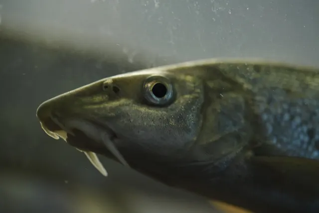 BarbelCharacteristic of this water1 placeThe Trent at CollinghamOver river reachAround Jun–Oct
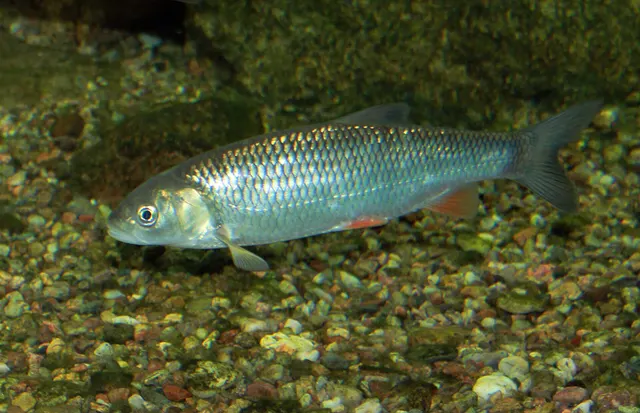 ChubRegular local target1 placeThe Trent at CollinghamOver river reach
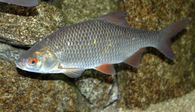 RoachRegular local target1 placeThe Trent at CollinghamOver river reach
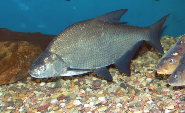 Common breamSeasonal1 placeThe Trent at CollinghamOver river reachAround May–Sept
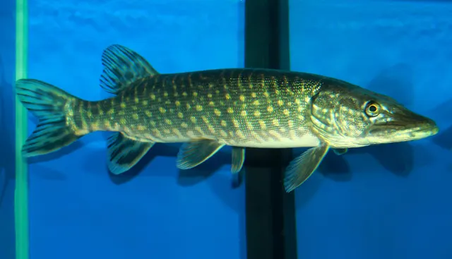 Northern pikeSeasonal1 placeThe Trent at CollinghamOver river reachAround Jan–Feb, Oct–Dec
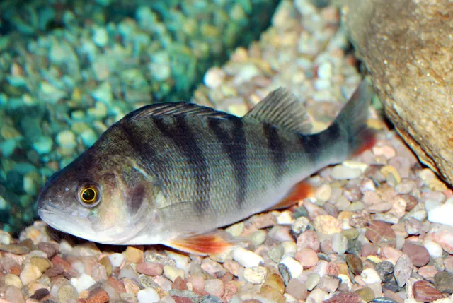 European perchRepeatedly reported1 placeThe Trent at CollinghamOver river reach
What these strengths mean
- Characteristic of this water
- This water is strongly identified with this species by the sources that cover it.
- Regular local target
- Fishing sources describe this as a normal local target here, not merely as caught.
- Seasonal
- Well supported, and concentrated in part of the year rather than spread through it.
- Repeatedly reported
- Several independent public accounts. Enough to say it happens more than once; not enough to call it a fishery.
- How breadth is counted
- A fish documented at six marks is shown as six marks: breadth never raises the strength on its own. A fishery account describes the fishing; a recorded catch reports one specific catch. How evidence is weighed.
How people fish it
Practised here: Coarse fishing.
Methods the sources name for this ground. Each one is explained in full on its own page.
- Feeder fishing
Legering with a weight that also carries bait, so that free offerings arrive in exactly the same place as the hookbait, cast after cast.
- Ledgering
Fishing a bait on the bottom held by a weight, with no float — the simplest way to fish at distance, in depth, or in wind.
- Float fishing
Suspending a bait at a controlled depth beneath a buoyant indicator — the most visual, most controllable and most widely applicable method in angling.
- Spinning
Casting an artificial lure and retrieving it so that it moves like something alive — the most direct form of lure fishing.
The ground and the water
- The ground
- A wide, powerful, gravel-and-sand-bedded reach of the lower non-tidal Trent between Newark and Cromwell weir, with hard gravel runs, deeper slacks against the far bank and a heavily engineered flood channel.
- Exposure
- Open agricultural floodplain with little bankside cover, so the reach is fully exposed to wind, which matters more here than on a sheltered river because the flow is already strong.
- Depth
- Consistently deep for a coarse river, with a strong main flow and defined creases.
- Tide and flow
- Non-tidal above Cromwell weir and tidal below it, which is the single most important navigational and biological division on the river. Flow here is dominated by upstream rainfall and by releases rather than by tide.
Through the year
A summer and autumn barbel fishery of national standing, chub through the year, and a documented recovery of predator fishing on the river since water quality improved.
The months the sources attach to each species here. Where a species carries no season it is listed underneath rather than assumed to run through the year.
| Species | J | F | M | A | M | J | J | A | S | O | N | D |
|---|---|---|---|---|---|---|---|---|---|---|---|---|
| Barbel — characteristic of this water, recorded in June, July, August, September, October. | ||||||||||||
| Common bream — seasonal, recorded in May, June, July, August, September. | ||||||||||||
| Northern pike — seasonal, recorded in October, November, December, January, February. |
Recorded here with no season stated: Chub, Roach, European perch.
Safety
Drowning and immersion — Can cause serious injury or death
A soft, undercut or steep bank gives way, or a wader steps off a shelf, and an angler enters water that is deeper and colder than the surface suggests, in clothing and boots that fill.
What reduces it: Test the bank before committing weight, wade only where you can see or have felt the bottom, wear a buoyancy aid on any water you would not want to swim in clothes, and do not fish alone at night on a steep or undercut bank.
Moving water and currents — Can cause serious injury or death
A river in spate rises faster than a wading angler can cross back, carries debris, and turns a familiar crossing into one that cannot be made. Rain falling on high ground miles upstream produces the rise here hours later under a clear sky.
What reduces it: Check the upstream rainfall and river-level data rather than the sky overhead, identify the exit before wading, use a wading staff, and get out on the first sign of rising or colouring water rather than the second.
Cold water shock — Can cause serious injury or death
UK coastal and inland water is cold enough for most of the year to trigger the involuntary gasp and the loss of swimming ability that decides most immersion deaths, and it does so within the first minute, long before hypothermia is relevant.
What reduces it: Wear a buoyancy aid rather than carry one, carry a means of calling for help on the person rather than in a bag, and plan on the assumption that an unplanned entry into the water is survivable only if somebody knows immediately.
Rules and access
Licence
A rod licence is required for freshwater rod fishing in England, issued by the Environment Agency.
Permission to fish
Separate. Almost all fishing rights are held by a club, association, riparian owner or navigation authority, and the licence does not grant access to any of them.
FishingHQ does not know the current access position here. Freshwater rod fishing in England requires a current rod licence AND separate permission from whoever controls the fishing, which is frequently a club, riparian owner or navigation authority rather than a public body. Close seasons, byelaws and local rules apply and change. Check with the Environment Agency and with the controlling club or owner before going.
Who holds the answer:
- The Environment Agency, for rod licensing, close seasons and fisheries byelaws in England.
- The club, association, riparian owner or navigation authority that controls the fishing.
- The Environment Agency, for rod licences, byelaws, the statutory close season and fisheries enforcement in England.
- The club, syndicate, landowner or day-ticket fishery that holds the fishing rights on a given stretch, which is a separate permission from the licence.
- The Canal & River Trust, where fishing is on connected navigations and canals.
- The GB Non-Native Species Secretariat, for biosecurity guidance on moving between waters in a catchment holding invasive species.
Nearby fishing
Other publicly documented places within about 40 km, by distance. Positions are approximate public geography and are never exact marks.
- The Trent at Newark Dyke — 5–10 km · River reach
- The tidal Trent at Dunham — 10–25 km · River reach
- The Witham at Lincoln — 10–25 km · River reach
- Gunthorpe weir pool, River Trent — 10–25 km · Weir pool
- The Trent at Burton Joyce — 10–25 km · River reach
Sources for this place
- Angling Times — Bauer Media (Specialist angling publication)Relied on for: Long-running published description of British coarse and match angling practice by water and by named reach.FishingHQ's interpretation of what it saysCitation checked — the work exists and is described correctly
- General angling website restatements of established technique — Various (Credible secondary source)Relied on for: Widely restated public descriptions of which waters are conventionally fished and how, recorded as practitioner consensus rather than as scholarship, and not relied on for access, permission or any current rule.Background and mechanism onlyCitation checked — the work exists and is described correctly
- Environment Agency fisheries management, byelaws and rod licensing information — Environment Agency (Government fisheries body)Relied on for: Freshwater and transitional-water fisheries management in England, the structure of rod licensing, close seasons and byelaws, and the monitoring of rivers and stillwaters.States this directlyCitation checked — the work exists and is described correctly
- Freshwater Fishes of the British Isles — HarperCollins (New Naturalist 75), 1992 (Reference work)Relied on for: Distribution, habitat requirements and biology of the freshwater fishes of Britain and Ireland named here.States this directlyCitation checked — the work exists and is described correctly
How FishingHQ labels evidence is explained in the evidence policy. Last reviewed 2026-08-16.