Port Erin and Raglan Pier
Pier · Salt water · in The Isle of Man
A stone pier inside a deep west-facing bay, with the breakwater stump beyond it, clean sand in the bay's middle and broken rock round both headlands. Depth off the pier end and rough ground within a short walk of it.
Safety: cliffs and rock platforms — can cause serious injury or death.
FishingHQ describes what this place is, not whether you may fish it. Access, permits and who to ask.
What you can catch here
Documented at this place, grouped by how you would be fishing, with how strongly the sources support each one. This is what has been written down, not a forecast, and being listed is never permission to fish.
From the shore · 8
 Ballan wrasseRegular local target1 placePort Erin and Raglan PierOver pier
 Conger eelRegular local target1 placePort Erin and Raglan PierOver pier
 European flounderRegular local target1 placePort Erin and Raglan PierOver pier
 European sea bassRegular local target1 placePort Erin and Raglan PierOver pier
 PollackRegular local target1 placePort Erin and Raglan PierOver pier
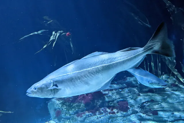 SaitheRegular local target1 placePort Erin and Raglan PierOver pier
- Small-spotted catsharkRegular local target1 placePort Erin and Raglan PierOver pier
 Atlantic mackerelSeasonal1 placePort Erin and Raglan PierOver pierAround Jun–Sept
What these strengths mean
- Regular local target
- Fishing sources describe this as a normal local target here, not merely as caught.
- Seasonal
- Well supported, and concentrated in part of the year rather than spread through it.
- How breadth is counted
- A fish documented at six marks is shown as six marks: breadth never raises the strength on its own. A fishery account describes the fishing; a recorded catch reports one specific catch. How evidence is weighed.
How people fish it
Practised here: Sea fishing.
Methods the sources name for this ground. Each one is explained in full on its own page.
- Float fishing
Suspending a bait at a controlled depth beneath a buoyant indicator — the most visual, most controllable and most widely applicable method in angling.
- Feathering and multi-lure traces
A string of small lures on droppers, worked in the water column — how most people in Britain and Ireland catch their first sea fish, and the method most likely to catch far more than anybody intended.
- Ledgering
Fishing a bait on the bottom held by a weight, with no float — the simplest way to fish at distance, in depth, or in wind.
- Spinning
Casting an artificial lure and retrieving it so that it moves like something alive — the most direct form of lure fishing.
The ground and the water
- The ground
- A stone pier inside a deep west-facing bay, with the breakwater stump beyond it, clean sand in the bay's middle and broken rock round both headlands. Depth off the pier end and rough ground within a short walk of it.
- Exposure
- Open west; the bay's headlands give it more shelter than the coast either side.
Through the year
Mackerel through the summer; wrasse, pollack and coalfish over the rock through the year.
Safety
Cliffs and rock platforms — Can cause serious injury or death
Much of the island's characteristic fishing is from cliff and rock platforms with deep water immediately below. A person entering the water from such a mark has no shallow ground to reach and frequently no route back up. Swell arriving from the open Irish Sea can produce a set considerably larger than the prevailing sea.
What reduces it: Wear a buoyancy aid on any rock platform. Watch a mark through a full set before committing. Identify the exit before starting. Do not fish deep-water rock marks alone, and treat swell in the forecast as a separate consideration from wind.
Worse when:
- Swell from a distant system in otherwise calm local conditions
- Night fishing on unfamiliar ground
- Wet or weed-covered rock
Rules and access
FishingHQ does not know the current access position here. The Isle of Man is a Crown dependency with its own fisheries legislation and its own licensing, separate from the United Kingdom's. Access, permits, seasons and measures apply and change. Check the current position with the Manx government's fisheries directorate and with the landowner or harbour authority before going.
Particular to this water: This is an owned and operated structure. Whether angling is allowed on it, when, from where and on what terms is the operator's decision, is frequently seasonal, and changes without notice.
Who holds the answer:
- The Isle of Man Government's fisheries directorate, which administers sea fisheries in Manx waters.
- The harbour authority or landowner, for access.
- The Manx government department responsible for fisheries, which sets and enforces sea fisheries measures within Manx territorial waters.
- Tynwald, the island's parliament, which makes the fisheries legislation those measures rest on.
- The Manx authority responsible for freshwater fishing licences and inland waters.
- The harbour authority, for launching, mooring and access at the island's harbours.
- The Manx food safety and public health authorities, for shellfish classification and closures.
- The landowner or angling club, for permission to fish inland waters.
Nearby fishing
Other publicly documented places within about 40 km, by distance. Positions are approximate public geography and are never exact marks.
- Port St Mary and Alfred Pier — under 2 km · Pier
- Calf Sound — 2–5 km · Tidal race
- Langness Point — 5–10 km · Headland
- Peel breakwater — 10–25 km · Breakwater
- Douglas Head — 10–25 km · Headland
- Laxey breakwater — 25–40 km · Breakwater
Sources for this place
- Sea Angler — Bauer Media (Specialist angling publication)Relied on for: Long-running published description of British sea angling practice by region, ground type and named mark.FishingHQ's interpretation of what it saysCitation checked — the work exists and is described correctly
- General angling website restatements of established technique — Various (Credible secondary source)Relied on for: Widely restated public descriptions of which places are conventionally fished and how, recorded as practitioner consensus rather than as scholarship, and not relied on for access, permission or any current rule.Background and mechanism onlyCitation checked — the work exists and is described correctly
- British Sea Fishing: Isle of Man shore marks — British Sea Fishing (Credible secondary source)Relied on for: Which species are fished for at each named Manx shore mark, at which state of tide, and in which season.States this directlyPassage read and verified
How FishingHQ labels evidence is explained in the evidence policy. Last reviewed 2026-08-16.