The Montgomery Canal
Canal section · Fresh water · in The English canal network
A partially restored rural canal on the Welsh border, much of it isolated from the main network, with exceptionally clear water and nationally protected aquatic plant communities.
Safety: overhead power lines — can cause serious injury or death. One more point applies here.
FishingHQ describes what this place is, not whether you may fish it. Access, permits and who to ask.
What you can catch here
Documented at this place, grouped by how you would be fishing, with how strongly the sources support each one. This is what has been written down, not a forecast, and being listed is never permission to fish.
From the shore · 5
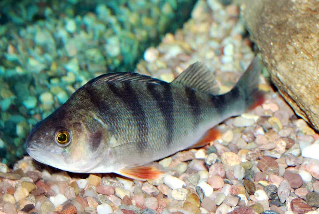 European perchRegular local target1 placeThe Montgomery CanalOver canal section
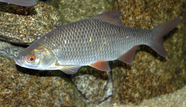 RoachRegular local target1 placeThe Montgomery CanalOver canal section
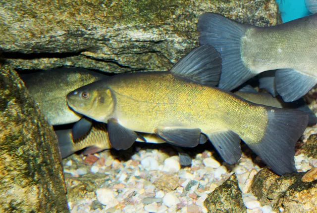 TenchSeasonal1 placeThe Montgomery CanalOver canal sectionAround May–Sept
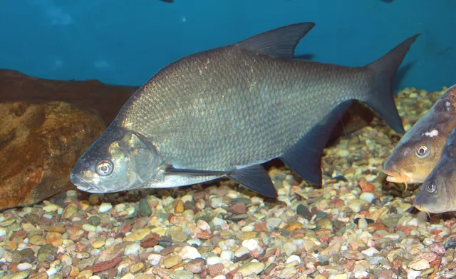 Common breamRecorded here1 placeThe Montgomery CanalOver canal section
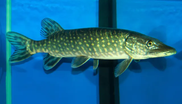 Northern pikeRecorded here1 placeThe Montgomery CanalOver canal section
What these strengths mean
- Regular local target
- Fishing sources describe this as a normal local target here, not merely as caught.
- Seasonal
- Well supported, and concentrated in part of the year rather than spread through it.
- Recorded here
- At least one credible public account of this species being caught here. That is all it means.
- How breadth is counted
- A fish documented at six marks is shown as six marks: breadth never raises the strength on its own. A fishery account describes the fishing; a recorded catch reports one specific catch. How evidence is weighed.
Fish documented nearby, not here
Nothing below has been documented at The Montgomery Canal itself. Each one has been documented at a named place on the same ground, and the places are listed with it. Treat this as what the water around here holds rather than as a catch list for this mark.
Also documented at neighbouring places
One or two accounts each, on the ground around here. Enough to know the fish is caught in these waters; not enough to say anything about this place.
From the shore
- Zander — documented at The Shropshire Union Canal
- Common carp — documented at The Shropshire Union Canal
- Gudgeon — documented at The Llangollen Canal
How people fish it
Practised here: Coarse fishing.
Methods the sources name for this ground. Each one is explained in full on its own page.
- Pole fishing
Fishing with a long jointed pole and a short fixed line, giving bait placement precision no rod and reel can match.
- Float fishing
Suspending a bait at a controlled depth beneath a buoyant indicator — the most visual, most controllable and most widely applicable method in angling.
- Feeder fishing
Legering with a weight that also carries bait, so that free offerings arrive in exactly the same place as the hookbait, cast after cast.
The ground and the water
- The ground
- A partially restored rural canal on the Welsh border, much of it isolated from the main network, with exceptionally clear water and nationally protected aquatic plant communities.
Safety
Overhead power lines — Can cause serious injury or death
Overhead electricity lines cross canals and towpaths in many places. Carbon poles and rods conduct, and electricity arcs across a gap without contact, so raising or shipping back a long pole beneath a line kills instantly. It is a recurring cause of angler deaths in Britain.
What reduces it: Look up before setting up, at the peg and along the whole stretch you will ship back over. Do not fish a peg with a line over or near it — there is always another peg. Treat this as an absolute rule rather than a judgement.
Worse when:
- With long poles, which are shipped back over a considerable distance behind the angler.
- In poor light or in a hurry, when nobody looks up.
Drowning and immersion — Can cause serious injury or death
Canal margins are frequently vertical stone or steel piling with no shallow shelf. A person who goes in cannot wade out and cannot climb a smooth vertical face, and cold water shock removes the ability to try within seconds for most of the year — in water they could otherwise stand up in.
What reduces it: Note the nearest exit points in both directions when setting up, do not fish alone at night on piled stretches, keep the bank clear of tackle you can trip on, and carry a means of calling for help on the person.
Rules and access
Licence
A rod licence is required for freshwater rod fishing in England, issued by the Environment Agency.
Permission to fish
Separate. Almost all fishing rights are held by a club, association, riparian owner or navigation authority, and the licence does not grant access to any of them.
FishingHQ does not know the current access position here. Freshwater rod fishing in England requires a current rod licence AND separate permission from whoever controls the fishing, which is frequently a club, riparian owner or navigation authority rather than a public body. Close seasons, byelaws and local rules apply and change. Check with the Environment Agency and with the controlling club or owner before going.
Particular to this water: This canal crosses the England–Wales border, and the rod licence and fisheries regulator differ between the two lengths — the Environment Agency in England, Natural Resources Wales in Wales. Establish which side of the border a length sits on before buying a licence for it. The canal also carries national conservation designations for its aquatic plant communities, which constrain access and bankside activity independently of any fishing rule.
Who holds the answer:
- The Environment Agency, for rod licensing, close seasons and fisheries byelaws in England.
- The club, association, riparian owner or navigation authority that controls the fishing.
- The Environment Agency, for rod licensing in England, close season provisions and fisheries enforcement.
- The navigation authority for the waterway — most commonly the Canal and River Trust — for towpath access, mooring and waterway rules.
- The angling club or association holding the fishing rights on the stretch, which is normally where the right to fish it actually comes from.
- Natural England, where a canal or its margins carry a conservation designation.
- The local authority, for towpath byelaws and access in urban areas.
Nearby fishing
Other publicly documented places within about 40 km, by distance. Positions are approximate public geography and are never exact marks.
- The Severn at Shrewsbury — 25–40 km · River reach
- The Llangollen Canal — 25–40 km · Canal section
- The Dee at Llangollen — 25–40 km · River reach
- Llyn Clywedog — 25–40 km · Reservoir
- Llyn Tegid — 25–40 km · Lake
Sources for this place
- Environment Agency fisheries management, byelaws and rod licensing information — Environment Agency (Government fisheries body)Relied on for: Freshwater and transitional-water fisheries management in England, the structure of rod licensing, close seasons and byelaws, and the monitoring of rivers and stillwaters.States this directlyCitation checked — the work exists and is described correctly
- Angling Times — Bauer Media (Specialist angling publication)Relied on for: Long-running published description of British coarse and match angling practice by water and by named reach.FishingHQ's interpretation of what it saysCitation checked — the work exists and is described correctly
- General angling website restatements of established technique — Various (Credible secondary source)Relied on for: Widely restated public descriptions of which waters are conventionally fished and how, recorded as practitioner consensus rather than as scholarship, and not relied on for access, permission or any current rule.Background and mechanism onlyCitation checked — the work exists and is described correctly
How FishingHQ labels evidence is explained in the evidence policy. Last reviewed 2026-08-16.