The Bay of Mont-Saint-Michel
Bay · Brackish water · in France
An enormous shallow bay at the base of the Cotentin peninsula, uncovering several hundred square kilometres of sand and mud at low water, cut by shifting channels carrying three rivers, with mussel and oyster ground across the flats and quicksand in places.
Safety: tides and being cut off — can cause serious injury or death. 2 more points apply here.
FishingHQ describes what this place is, not whether you may fish it. Access, permits and who to ask.
What you can catch here
Documented at this place, grouped by how you would be fishing, with how strongly the sources support each one. This is what has been written down, not a forecast, and being listed is never permission to fish.
From the shore · 5
 European flounderRegular local target1 placeThe Bay of Mont-Saint-MichelOver bay
 European sea bassRegular local target1 placeThe Bay of Mont-Saint-MichelOver bayAround May–Oct
 Thick-lipped grey mulletRegular local target1 placeThe Bay of Mont-Saint-MichelOver bay
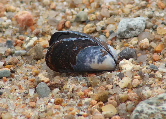 Blue musselRecorded here1 placeThe Bay of Mont-Saint-MichelOver bay
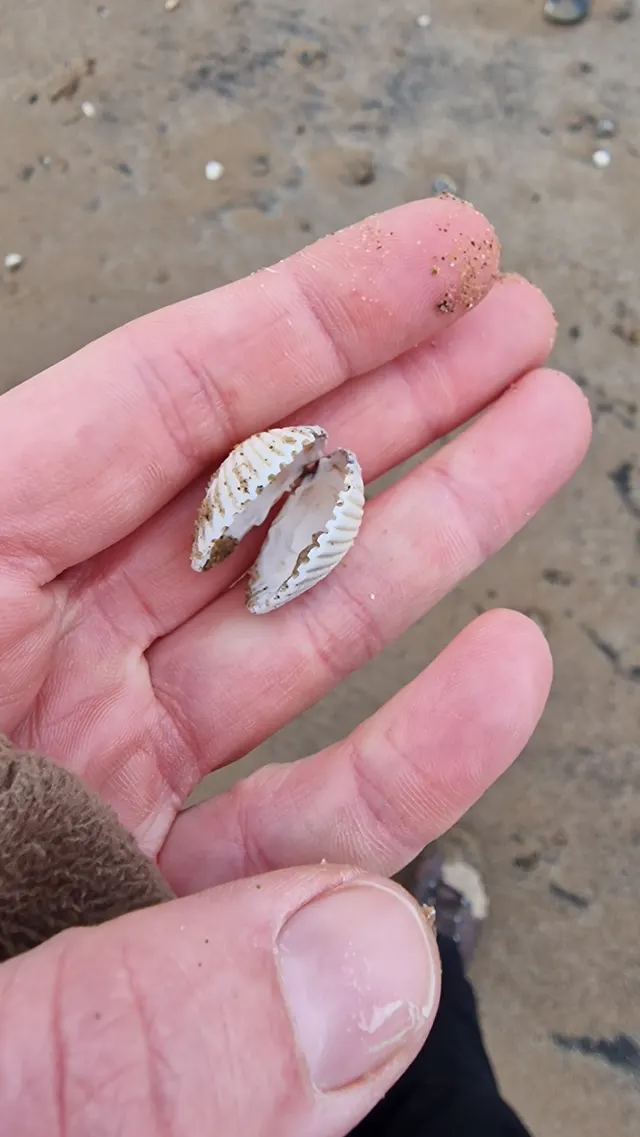 Common cockleRecorded here1 placeThe Bay of Mont-Saint-MichelOver bay
What these strengths mean
- Regular local target
- Fishing sources describe this as a normal local target here, not merely as caught.
- Recorded here
- At least one credible public account of this species being caught here. That is all it means.
- How breadth is counted
- A fish documented at six marks is shown as six marks: breadth never raises the strength on its own. A fishery account describes the fishing; a recorded catch reports one specific catch. How evidence is weighed.
How people fish it
Practised here: Sea fishing.
Methods the sources name for this ground. Each one is explained in full on its own page.
- Spinning
Casting an artificial lure and retrieving it so that it moves like something alive — the most direct form of lure fishing.
- Ledgering
Fishing a bait on the bottom held by a weight, with no float — the simplest way to fish at distance, in depth, or in wind.
- Surfcasting
Casting heavy baited tackle from a beach into surf — a method defined by distance, by tide, and by reading water that all looks the same.
The ground and the water
- The ground
- An enormous shallow bay at the base of the Cotentin peninsula, uncovering several hundred square kilometres of sand and mud at low water, cut by shifting channels carrying three rivers, with mussel and oyster ground across the flats and quicksand in places.
- Exposure
- Sheltered from ocean swell by the shape of the coast, so every hazard here is tidal, and the tidal hazard is among the largest in Europe.
- Depth
- Very shallow throughout, with the deeper water confined to migrating river channels across the flats.
- Tide and flow
- One of the greatest tidal ranges on earth — the water can move more than a dozen metres vertically on a large spring — and across ground this flat that becomes a horizontal advance faster than a person can walk over soft going. The channels shift between tides.
Through the year
The shore fishery works through the warmer half for bass and mullet on the flooding tide, and the shellfish and bait grounds are worked on the ebb throughout the year.
Safety
Tides and being cut off — Can cause serious injury or death
Across several hundred square kilometres of near-level sand, a tidal range among the largest on earth becomes a horizontal advance faster than a person can walk over soft ground. The water fills the channels first and spreads outward, so it arrives between somebody and the shore while the sand under them is dry, and the channels move between tides so a route used last week may not exist.
What reduces it: Do not go out onto the flats unaccompanied — guided crossing exists here as a regulated activity precisely because local judgement is that it cannot be done safely alone. Set a leaving time from the tide, and treat water appearing behind you as the signal to go immediately.
Worse when:
- On the largest spring tides, when the advance is fastest and reaches furthest.
- In fog, which removes the only navigation a featureless flat offers.
Drowning and immersion — Can cause serious injury or death
Saturated sand in the bay behaves as quicksand in places, and ground that carried weight on the way out may not on the way back. Somebody stuck on a flat with a rising tide of this size cannot free themselves.
What reduces it: Go with somebody who knows that specific ground and that specific tide, tell somebody ashore the plan and the return time, and carry a means of calling for help on the person.
Moving water and currents — Can cause serious injury or death
On the Atlantic sand coast, water pushed over an offshore bar returns seaward through gaps in it as concentrated rip currents — the baïnes — which carry waders and swimmers offshore from water that looks calm. Long-period Atlantic swell arrives independently of local wind and breaks heavily on shoaling ground and on Breton rock platforms.
What reduces it: Read a swell forecast rather than only a wind forecast. Recognise a baïne channel by its darker, calmer, seaward-moving water between areas of breaking waves, and stay out of it. Watch a full set before committing to a low rock platform.
Rules and access
FishingHQ does not know the current access position here. Recreational sea fishing in France is not generally licensed for shore angling, but national and European measures on species, sizes, quantities and gear apply, some species carry a declaration or marking requirement, and access to structures, beaches and shellfish grounds is governed locally. All of it changes. Check the current position with the maritime prefecture or the departmental directorate for the sea, and with the commune, before going. This water is tidal and transitional, so the freshwater regime may also apply above the tidal limit: FishingHQ does not know the current access position here. Inland fishing in France runs through membership: an angler joins an approved local fishing association, which is affiliated to a departmental federation, and pays the national levy alongside it — so the permission and the licence arrive together and are bought from the association rather than from a state counter. Waters, seasons, methods and reciprocity arrangements differ by department and change. Check with the departmental fishing federation and the local association before going.
Particular to this water: Shellfish harvesting areas are classified for food safety and are opened and closed on monitoring results a gatherer cannot see. Neither cooking nor appearance removes a biotoxin. Check the current classification with the responsible authority before taking anything. This ground lies in or beside a marine protected area whose zoning constrains fishing, diving, anchoring and collection independently of any licence, with rules that differ between zones and boundaries that are not visible from the water.
Who holds the answer:
- The maritime prefecture and the departmental directorate for the territories and the sea, for recreational sea fishing measures in French waters.
- The commune and, where one exists, the port authority, for access to beaches, structures and shellfish grounds.
- The departmental fishing and aquatic-environment federation, which sets the waters, seasons and reciprocity for its department.
- The approved local fishing association that holds the rights on the water.
- The national biodiversity agency, for fisheries policing and for the national levy.
- The local AAPPMA and the départemental federation, for inland fishing rights, seasons and membership.
- The Office français de la biodiversité, for freshwater fisheries policy and enforcement.
- The direction interrégionale de la mer and the relevant préfecture maritime, for recreational sea fishing and underwater fishing.
- The départemental authority publishing pêche à pied rules and shellfish ground classifications.
- The regional health and environment service, whose biotoxin monitoring determines whether a shellfish ground may be worked.
- The managing body of any marine protected area or nature reserve on the stretch of coast concerned.
Sources for this place
- EMODnet — the European Marine Observation and Data Network — The European Commission, assembled from the national hydrographic offices, geological surveys and marine institutes of the member states (Scientific institute)Relied on for: Charted bathymetry, seabed substrate and seabed habitat for European sea areas, assembled from the national hydrographic and geological surveys, at the resolution the product publishes.States this directlyCitation checked — the work exists and is described correctly
- The European Environment Agency's assessments of Europe's waters, seas and coasts — European Environment Agency, Copenhagen (Conservation authority)Relied on for: Assessment of Europe's coasts and regional seas, including the condition of coastal water bodies, the pressures recorded on them and the coverage of designated sites.Background and mechanism onlyCitation checked — the work exists and is described correctly
- ICES Advice on fishing opportunities, catch and effort — International Council for the Exploration of the Sea (Scientific institute)Relied on for: Ecoregion description, stock distribution, nursery function and the hydrography of the north-east Atlantic and Baltic sea areas assessed.States this directlyCitation checked — the work exists and is described correctly
- FishBase: a global information system on fishes — Froese, R. and D. Pauly, eds. — FishBase Consortium (Scientific institute)Relied on for: Recorded distribution, depth range and habitat association of the species named for this ground.States this directlyPassage read and verified
- RNLI water safety guidance: cold water shock and Float to Live — Royal National Lifeboat Institution (Water-safety or diver-training authority)Relied on for: Cold water shock and the immersion response, tidal cut-off, and water-safety guidance for shore anglers and small-craft users. Cited for the mechanism, which does not vary by coast.States this directlyPassage read and verified
How FishingHQ labels evidence is explained in the evidence policy. Last reviewed 2026-08-18.