The Alvor estuary
Estuary · Salt water · in Portugal
A shallow tidal lagoon and channel system behind a dune spit west of Portimão, with sandflats that dry over most of their area and a scoured channel running out through the training walls.
Safety: cliffs and rock platforms — can cause serious injury or death. 2 more points apply here.
FishingHQ describes what this place is, not whether you may fish it. Access, permits and who to ask.
What you can catch here
Documented at this place, grouped by how you would be fishing, with how strongly the sources support each one. This is what has been written down, not a forecast, and being listed is never permission to fish.
From the shore · 4
 European sea bassRepeatedly reported1 place · 1 fishery account · 1 sourceThe Alvor estuaryOver estuary
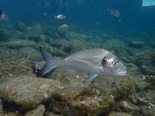 Gilthead breamRepeatedly reported1 place · 1 fishery account · 1 sourceThe Alvor estuaryOver estuary
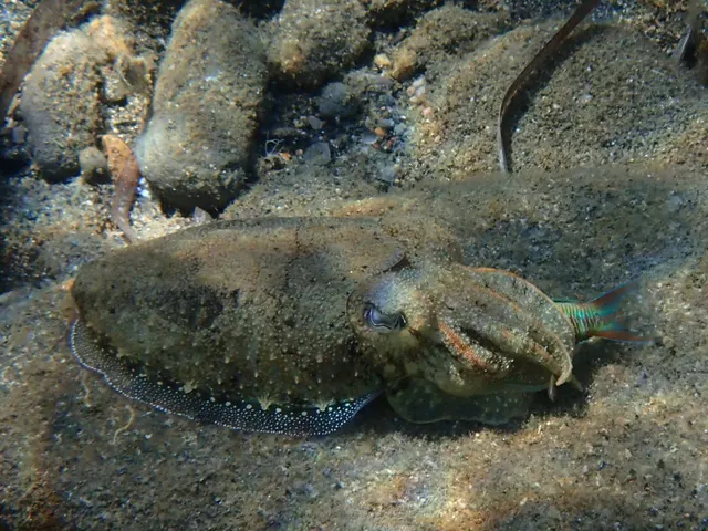 Common cuttlefishRecorded here1 placeThe Alvor estuaryOver estuary
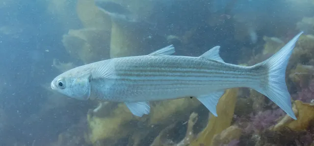 Flathead grey mulletRecorded here1 placeThe Alvor estuaryOver estuary
What these strengths mean
- Repeatedly reported
- Several independent public accounts. Enough to say it happens more than once; not enough to call it a fishery.
- Recorded here
- At least one credible public account of this species being caught here. That is all it means.
- How breadth is counted
- A fish documented at six marks is shown as six marks: breadth never raises the strength on its own. A fishery account describes the fishing; a recorded catch reports one specific catch. How evidence is weighed.
Also associated with this ground
Recorded as present here without a documented method or strength behind them.
Fish documented nearby, not here
Nothing below has been documented at The Alvor estuary itself. Each one has been documented at a named place on the same ground, and the places are listed with it. Treat this as what the water around here holds rather than as a catch list for this mark.
Widely documented on this ground
Documented at three or more neighbouring places, fished a way this place is also fished. That is a pattern about the ground rather than about any one mark, and it is the closest this site comes to saying you will probably meet a fish somewhere nothing has been written about.
From the shore
- White seabream — documented at Sagres and Cabo de São Vicente; Praia da Rocha, Portimão; Praia de Quarteira (+3 more)
Also documented at neighbouring places
One or two accounts each, on the ground around here. Enough to know the fish is caught in these waters; not enough to say anything about this place.
From the shore
- European squid — documented at The Vilamoura moles
- Common octopus — documented at Sagres and Cabo de São Vicente; The Albufeira cliffs and coves
- Common dentex — documented at Sagres and Cabo de São Vicente
How people fish it
Practised here: Sea fishing.
Methods the sources name for this ground. Each one is explained in full on its own page.
- Ledgering
Fishing a bait on the bottom held by a weight, with no float — the simplest way to fish at distance, in depth, or in wind.
- Float fishing
Suspending a bait at a controlled depth beneath a buoyant indicator — the most visual, most controllable and most widely applicable method in angling.
- Spinning
Casting an artificial lure and retrieving it so that it moves like something alive — the most direct form of lure fishing.
The ground and the water
- The ground
- A shallow tidal lagoon and channel system behind a dune spit west of Portimão, with sandflats that dry over most of their area and a scoured channel running out through the training walls.
- Exposure
- Sheltered. Fishable in weather that closes the open beaches.
- Tide and flow
- Strong flow through the narrow channel; most of the lagoon dries.
Safety
Cliffs and rock platforms — Can cause serious injury or death
Long-period Atlantic swell breaks in irregular sets onto the low rock platforms used for shore fishing along the exposed west coast. Anglers are swept off by a wave substantially larger than those preceding it, frequently after an hour of ordinary conditions, and the water is deep and moving immediately below.
What reduces it: Read a swell forecast — height, period and direction — rather than a wind forecast, and treat a long period as the warning. Watch a full set before committing to a platform, never fish exposed rock alone, wear a buoyancy aid, and treat a windless sunny day with swell running as a hazardous day rather than a safe one.
Worse when:
- Long-period ground swell from a distant Atlantic depression, which gives no local warning at all.
- Rising tide, which brings the break progressively further up the platform.
- Unfamiliar ground, where which platforms are workable at which swell is entirely local knowledge.
Moving water and currents — Can cause serious injury or death
The long surf beaches generate strong, persistent rip currents, and river bars break heavily in swell. Percebes gathering in the surge zone of exposed rock is conducted in breaking water and has a serious fatality record.
What reduces it: Stay out of rip channels, recognisable as darker calmer water moving seaward between areas of breaking waves. Do not attempt goose barnacle gathering — it is licensed professional work. Treat river bar crossings as requiring local knowledge and the right state of tide.
Sun, dehydration and fatigue — Can cause injury needing treatment
Long summer sessions on shadeless rock produce dehydration and heat exhaustion, and both degrade judgement and coordination well before they produce collapse, on ground where both are what keep somebody safe.
What reduces it: Carry substantially more water than the session appears to need, fish the ends of the day rather than the middle of it in high summer, and treat shade and a stopping time as part of the plan.
Rules and access
FishingHQ does not know the current access position here. Recreational sea fishing in mainland Portugal is licensed by the state, with separate categories for shore, boat and underwater fishing and separate arrangements again for shellfish gathering, and with quantity, size and species measures alongside. Licences, measures and closures change. Check the current position with the national fisheries directorate and with the local maritime authority before going.
Particular to this water: Portugal requires a recreational sea fishing licence, and separate conditions apply to spearfishing and to shellfish gathering. Minimum sizes, bag limits and closed seasons are set nationally and change. Check the current requirements with the Portuguese fisheries authority before fishing.
Who holds the answer:
- The Directorate-General for Natural Resources, Safety and Maritime Services, which licenses recreational sea fishing in Portuguese waters.
- The local maritime authority, for access to structures and for local measures.
- The Direção-Geral de Recursos Naturais, Segurança e Serviços Marítimos, for recreational sea fishing and underwater fishing licensing.
- The Instituto da Conservação da Natureza e das Florestas, for inland fishing licences, seasons and protected freshwater species.
- The Instituto Português do Mar e da Atmosfera, for shellfish ground classification and biotoxin monitoring.
- The managing body of the relevant marine protected area or natural park, including the Ria Formosa and the south-west coast.
- The regional government of Madeira or the Azores for fishing in those autonomous regions, which is administered separately.
Nearby fishing
Other publicly documented places within about 40 km, by distance. Positions are approximate public geography and are never exact marks.
- Praia da Rocha, Portimão — 5–10 km · Beach
- Portimão — 5–10 km · Charter departure port
- Armação de Pêra — 10–25 km · Beach
- The Albufeira cliffs and coves — 25–40 km · Cliff coast
- Sagres and Cabo de São Vicente — 25–40 km · Headland
Sources for this place
- Sea Angler — Bauer Media (Specialist angling publication)Relied on for: Long-running published description of British sea angling practice by region, ground type and named mark.FishingHQ's interpretation of what it saysCitation checked — the work exists and is described correctly
- General angling website restatements of established technique — Various (Credible secondary source)Relied on for: Widely restated public descriptions of which places are conventionally fished and how, recorded as practitioner consensus rather than as scholarship, and not relied on for access, permission or any current rule.Background and mechanism onlyCitation checked — the work exists and is described correctly
How FishingHQ labels evidence is explained in the evidence policy. Last reviewed 2026-08-16.