Sørøya
Island · Salt water · in Norway and the Nordic coast
A large bare island in western Finnmark, well inside the Arctic, with rock and boulder shores, kelp forest, and a shelf edge and deep fjord channels within a short distance of the coast.
Safety: cold water shock — can cause serious injury or death. One more point applies here.
FishingHQ describes what this place is, not whether you may fish it. Access, permits and who to ask.
What you can catch here
Documented at this place, grouped by how you would be fishing, with how strongly the sources support each one. This is what has been written down, not a forecast, and being listed is never permission to fish.
From the shore · 2
From a boat · 5
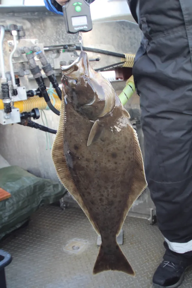 Atlantic halibutSeasonal1 place · 2 fishery accounts · 2 independent sourcesSørøyaOver islandAround Jun–Aug
 Atlantic codSeasonal1 place · 1 fishery account · 1 sourceSørøyaOver islandAround Mar–Apr
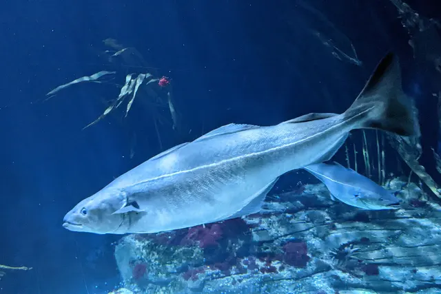 SaitheRepeatedly reported1 placeSørøyaOver island
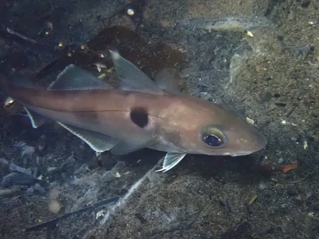 HaddockRecorded here1 placeSørøyaOver island
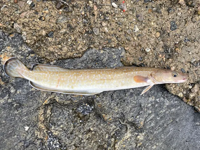 LingRecorded here1 placeSørøyaOver island
On a charter · 4
What these strengths mean
- Seasonal
- Well supported, and concentrated in part of the year rather than spread through it.
- Repeatedly reported
- Several independent public accounts. Enough to say it happens more than once; not enough to call it a fishery.
- Recorded here
- At least one credible public account of this species being caught here. That is all it means.
- How breadth is counted
- A fish documented at six marks is shown as six marks: breadth never raises the strength on its own. A fishery account describes the fishing; a recorded catch reports one specific catch. How evidence is weighed.
How people fish it
Practised here: Sea fishing.
Methods the sources name for this ground. Each one is explained in full on its own page.
- Jigging
Working a weighted lure with a rising-and-falling motion, usually vertically, so it behaves like a wounded or fleeing baitfish.
- Deep-drop fishing
Fishing baits several hundred metres down with heavy weights and, usually, an electric reel — a method defined entirely by what depth does to everything else.
- Drift fishing
Letting the boat move with tide and wind while fishing, so the tackle searches ground instead of waiting on it — and the decision that determines whether a boat session works at all.
The ground and the water
- The ground
- A large bare island in western Finnmark, well inside the Arctic, with rock and boulder shores, kelp forest, and a shelf edge and deep fjord channels within a short distance of the coast.
- Exposure
- Open to the Barents Sea on its northern and western sides with no shelter at all.
- Depth
- Very deep water close inshore, which is the reason this island has a disproportionate reputation for large halibut and coalfish.
Through the year
The months the sources attach to each species here. Where a species carries no season it is listed underneath rather than assumed to run through the year.
| Species | J | F | M | A | M | J | J | A | S | O | N | D |
|---|---|---|---|---|---|---|---|---|---|---|---|---|
| Atlantic cod — seasonal, recorded in March, April. | ||||||||||||
| Atlantic halibut — seasonal, recorded in June, July, August. |
Recorded here with no season stated: Saithe, Haddock, Ling.
Safety
Cold water shock — Can cause serious injury or death
Northern European water is cold enough for most of the year to trigger the involuntary gasp and the loss of swimming ability that decides most immersion deaths, and it does so within the first minute, long before hypothermia is relevant.
What reduces it: Wear a buoyancy aid rather than carry one, carry a means of calling for help on the person rather than in a bag, and plan on the assumption that an unplanned entry into the water is survivable only if somebody knows immediately.
Boat safety — Can cause serious injury or death
Small-boat fishing in cold deep water, frequently in unfamiliar waters, with weather that changes quickly and winds that come off high ground with little warning. Help can be a long way away and mobile coverage is not continuous.
What reduces it: Flotation suits rather than lifejackets in cold water — they buy time that a lifejacket alone does not. Check the forecast for the whole window. File a plan ashore. Carry communications that work beyond phone coverage. Do not go further than the weather and the boat justify.
Rules and access
FishingHQ does not know the current access position here. Norway permits recreational sea angling broadly, but rules on gear, quantity, export, minimum sizes, protected species and boat registration apply and change, and they differ for residents and visitors. Check the current position with the Norwegian Directorate of Fisheries before going.
Who holds the answer:
- The Norwegian Directorate of Fisheries, for recreational sea fishing measures.
- The harbour authority or landowner, for access.
- The national directorate responsible for fisheries, for sea fishing rules including species, size and quantity limits and export restrictions
- The national environment agency, for freshwater and anadromous species and the associated fee
- The landowner, association or river management body holding the fishing rights for any given fresh water
- County and municipal authorities, for local rules and for protected areas
- Border and customs authorities, for the rules on taking caught fish out of the country, which catch visitors out regularly
Nearby fishing
Other publicly documented places within about 40 km, by distance. Positions are approximate public geography and are never exact marks.
- The Sørøya banks — 25–40 km · Offshore bank
Sources for this place
- EMODnet — the European Marine Observation and Data Network — The European Commission, assembled from the national hydrographic offices, geological surveys and marine institutes of the member states (Scientific institute)Relied on for: Charted bathymetry, seabed substrate and seabed habitat for European sea areas, assembled from the national hydrographic and geological surveys, at the resolution the product publishes.States this directlyCitation checked — the work exists and is described correctly
- The European Environment Agency's assessments of Europe's waters, seas and coasts — European Environment Agency, Copenhagen (Conservation authority)Relied on for: Assessment of Europe's coasts and regional seas, including the condition of coastal water bodies, the pressures recorded on them and the coverage of designated sites.Background and mechanism onlyCitation checked — the work exists and is described correctly
- Sea Angler — Bauer Media (Specialist angling publication)Relied on for: Long-running published description of European sea angling practice by region, ground type and destination, including the continental marks British anglers travel to.FishingHQ's interpretation of what it saysCitation checked — the work exists and is described correctly
- General angling website restatements of established technique — Various (Credible secondary source)Relied on for: Widely restated public descriptions of which continental European places are conventionally fished and how, recorded as practitioner consensus rather than as scholarship, and not relied on for access, permission or any current rule.Background and mechanism onlyCitation checked — the work exists and is described correctly
- RNLI water safety guidance: cold water shock and Float to Live — Royal National Lifeboat Institution (Water-safety or diver-training authority)Relied on for: Cold water shock and the immersion response, tidal cut-off, and water-safety guidance for shore anglers and small-craft users. Cited for the mechanism, which does not vary by coast.States this directlyPassage read and verified
How FishingHQ labels evidence is explained in the evidence policy. Last reviewed 2026-08-18.