The Islamorada flats
Shallow flat · Salt water · in Florida
Shin-to-knee-deep water over hard sand and turtle grass on the ocean side of the Upper Keys, fished by sight from a poled skiff or on foot, with channels and potholes breaking the grass.
Safety: boat traffic and being seen — can cause serious injury or death. 2 more points apply here.
FishingHQ describes what this place is, not whether you may fish it. Access, permits and who to ask.
What you can catch here
Documented at this place, grouped by how you would be fishing, with how strongly the sources support each one. This is what has been written down, not a forecast, and being listed is never permission to fish.
From the shore · 1
From a boat · 4
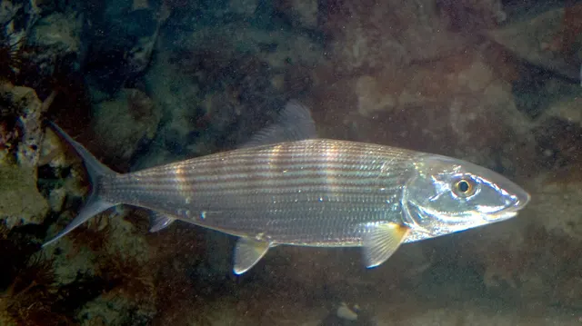 BonefishRepeatedly reported1 place · 2 fishery accounts · 2 independent sourcesThe Islamorada flatsOver shallow flat
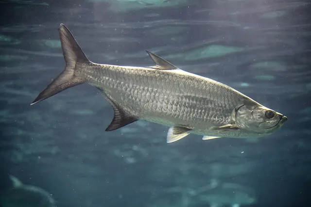 Atlantic tarponRepeatedly reported1 place · 1 fishery account · 1 sourceThe Islamorada flatsOver shallow flat
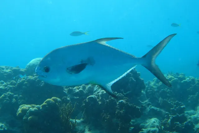 PermitRepeatedly reported1 place · 1 fishery account · 1 sourceThe Islamorada flatsOver shallow flat
- Great barracudaRecorded here1 placeThe Islamorada flatsOver shallow flat
Fly fishing · 4
- BonefishRepeatedly reported1 place · 2 fishery accounts · 2 independent sourcesThe Islamorada flatsOver shallow flat
- Atlantic tarponRepeatedly reported1 place · 1 fishery account · 1 sourceThe Islamorada flatsOver shallow flat
- PermitRepeatedly reported1 place · 1 fishery account · 1 sourceThe Islamorada flatsOver shallow flat
- Great barracudaRecorded here1 placeThe Islamorada flatsOver shallow flat
What these strengths mean
- Repeatedly reported
- Several independent public accounts. Enough to say it happens more than once; not enough to call it a fishery.
- Recorded here
- At least one credible public account of this species being caught here. That is all it means.
- How breadth is counted
- A fish documented at six marks is shown as six marks: breadth never raises the strength on its own. A fishery account describes the fishing; a recorded catch reports one specific catch. How evidence is weighed.
Also associated with this ground
Recorded as present here without a documented method or strength behind them.
Fish documented nearby, not here
Nothing below has been documented at The Islamorada flats itself. Each one has been documented at a named place on the same ground, and the places are listed with it. Treat this as what the water around here holds rather than as a catch list for this mark.
Also documented at neighbouring places
One or two accounts each, on the ground around here. Enough to know the fish is caught in these waters; not enough to say anything about this place.
From a boat
- Common snook — documented at Seven Mile Bridge; The Florida Bay backcountry
- Yellowtail snapper — documented at The Upper Keys reef line; Seven Mile Bridge
- Red drum — documented at The Florida Bay backcountry
- Cobia — documented at The Florida Bay backcountry; The Upper Keys reef line
- King mackerel — documented at The Upper Keys reef line
From the shore
- Common snook — documented at Seven Mile Bridge
- Yellowtail snapper — documented at Seven Mile Bridge
Fly fishing
- Common snook — documented at The Florida Bay backcountry
- Red drum — documented at The Florida Bay backcountry
How people fish it
Practised here: Sea fishing, Fly fishing.
Methods the sources name for this ground. Each one is explained in full on its own page.
- Saltwater fly fishing
Fly fishing adapted to the sea: heavier lines, corrosion-proof tackle, fish that run rather than fight, and wind as the permanent constraint.
- Spinning
Casting an artificial lure and retrieving it so that it moves like something alive — the most direct form of lure fishing.
- Livebaiting at sea
Presenting a living fish where a predator will find it — the most effective method for many species and the one with the clearest welfare questions attached.
The ground and the water
- The ground
- Shin-to-knee-deep water over hard sand and turtle grass on the ocean side of the Upper Keys, fished by sight from a poled skiff or on foot, with channels and potholes breaking the grass.
- Exposure
- Shallow and wind-exposed: a flat that is unfishable in a strong breeze is not a matter of swell but of visibility.
- Depth
- Ankle to knee deep over most of its area, which is what makes it a sight fishery rather than a bait one.
Safety
Boat traffic and being seen — Can cause serious injury or death
Summer small-craft traffic on this coast is heavy and fast, and a swimmer, breath-hold diver or small float is nearly invisible from a planing hull until it is too close to alter course.
What reduces it: Carry a surface marker buoy with a dive flag and keep it directly above the diver, work inside marked zones where they exist, and leave water where traffic is heavy rather than trying to be seen in it.
Weather and lightning — Can cause serious injury or death
Florida records more lightning strikes than anywhere else in the United States, and afternoon thunderstorms build rapidly in the warm months. An angler on an open flat or a boat is the highest point over water. Hurricanes affect the state seasonally and are a life-threatening event rather than a weather inconvenience.
What reduces it: Watch the sky and the radar rather than waiting for thunder, get off the water at the first sign of building storms, and never continue fishing a flat with a cell approaching. Treat hurricane warnings as absolute and evacuate rather than assess.
Worse when:
- Summer afternoons, when convective storms build almost daily.
- On an open flat or in a small boat, with no shelter and nothing higher nearby.
- During the hurricane season, when a distant storm can produce dangerous conditions locally.
Sun, dehydration and fatigue — Can cause injury needing treatment
Long summer sessions on shadeless rock produce dehydration and heat exhaustion, and both degrade judgement and coordination well before they produce collapse, on ground where both are what keep somebody safe.
What reduces it: Carry substantially more water than the session appears to need, fish the ends of the day rather than the middle of it in high summer, and treat shade and a stopping time as part of the plan.
Rules and access
FishingHQ does not know the current access position here. Florida requires a saltwater fishing licence to fish from shore, a pier, a bridge or a jetty as well as from a boat, with exemptions that depend on age, residency and whether the trip is on a licensed charter. Several species are catch-and-release only, some carry separate permits or stamps, and fishing for sharks from shore requires its own permit and an educational course. Much of the Keys sits inside a National Marine Sanctuary whose zones restrict where and how fishing is permitted, on boundaries that are invisible from the water, and federal rules apply to some species beyond state waters. Measures change. Check the current position with the state wildlife authority and with the sanctuary before going.
Particular to this water: Most of this water lies inside the Florida Keys National Marine Sanctuary, which carries a network of zones with their own rules on where and how fishing is permitted. Zone boundaries and conditions are set by the sanctuary, not by the state licence, and being listed here is not permission to fish any particular spot. Bonefish and tarpon are catch-and-release species here. A large tarpon must remain in the water throughout the release. These are the rules that define this fishery, and they change; confirm the current position with the authority.
Who holds the answer:
- The Florida state wildlife authority, which licenses recreational saltwater fishing and sets state species rules, seasons and size limits.
- The federal fisheries authority, for species and waters beyond state jurisdiction.
- The Florida Keys National Marine Sanctuary, whose zones carry their own restrictions on where and how fishing is permitted.
- The national park authority, where the water lies inside a park boundary.
- The state fish and wildlife conservation commission, for state waters, inshore species, licensing and the freshwater fishery.
- The regional fishery management council and the federal fisheries service, for reef fish and pelagic species in federal waters.
- The national marine sanctuary authority for the Keys, whose zoning governs what may happen where along the reef.
- The national park authority where fishing takes place inside Everglades, Biscayne or Dry Tortugas waters.
- The state health authority, for shellfish harvesting area classification and closures.
Nearby fishing
Other publicly documented places within about 40 km, by distance. Positions are approximate public geography and are never exact marks.
- Islamorada — under 2 km · Charter departure port
- The Upper Keys reef line — 10–25 km · Reef
- The Florida Bay backcountry — 25–40 km · Mangrove shore
Sources for this place
- Sea Angler — Bauer Media (Specialist angling publication)Relied on for: Long-running published description of British sea angling practice by region, ground type and named mark.FishingHQ's interpretation of what it saysCitation checked — the work exists and is described correctly
- General angling website restatements of established technique — Various (Credible secondary source)Relied on for: Widely restated public descriptions of which places are conventionally fished and how, recorded as practitioner consensus rather than as scholarship, and not relied on for access, permission or any current rule.Background and mechanism onlyCitation checked — the work exists and is described correctly
How FishingHQ labels evidence is explained in the evidence policy. Last reviewed 2026-08-16.