Inverbervie beach
Beach · Salt water · in The Fife, Angus and Mearns coast
A steep storm beach of rounded cobble and shingle at the Bervie Water mouth, dropping quickly into deep water with no shallow margin. Deep water within a short cast, which is why it is a cod beach.
Safety: cliffs and rock platforms — can cause serious injury or death. 2 more points apply here.
FishingHQ describes what this place is, not whether you may fish it. Access, permits and who to ask.
What you can catch here
Documented at this place, grouped by how you would be fishing, with how strongly the sources support each one. This is what has been written down, not a forecast, and being listed is never permission to fish.
From the shore · 4
 Atlantic codRegular local target1 placeInverbervie beachOver beachAround Jan–Feb, Sept–Dec
Photo: The U.S. Food and Drug Administration, via Wikimedia Commons, public domain; resized and trimmed to fit
 European flounderRecorded here1 placeInverbervie beachOver beach
Photo: nbasargin, via iNaturalist, CC BY; resized and trimmed to fit
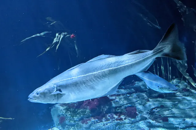 SaitheRecorded here1 placeInverbervie beachOver beach
Photo: Wilhelm Thomas Fiege, via Wikimedia Commons, CC BY-SA 4.0; resized and trimmed to fit
- Small-spotted catsharkRecorded here1 placeInverbervie beachOver beach
.jpg)
.jpg)
What these strengths mean
- Regular local target
- Fishing sources describe this as a normal local target here, not merely as caught.
- Recorded here
- At least one credible public account of this species being caught here. That is all it means.
- How breadth is counted
- A fish documented at six marks is shown as six marks: breadth never raises the strength on its own. A fishery account describes the fishing; a recorded catch reports one specific catch. How evidence is weighed.
Fish documented nearby, not here
Nothing below has been documented at Inverbervie beach itself. Each one has been documented at a named place on the same ground, and the places are listed with it. Treat this as what the water around here holds rather than as a catch list for this mark.
Widely documented on this ground
Documented at three or more neighbouring places, fished a way this place is also fished. That is a pattern about the ground rather than about any one mark, and it is the closest this site comes to saying you will probably meet a fish somewhere nothing has been written about.
From the shore
- Pollack — documented at Arbroath; Crawton; Rumness Rocks
Also documented at neighbouring places
One or two accounts each, on the ground around here. Enough to know the fish is caught in these waters; not enough to say anything about this place.
From the shore
- Atlantic mackerel — documented at Crawton
- European sea bass — documented at Crawton
- Turbot — documented at Arbroath
- Whiting — documented at The Don mouth
How people fish it
Practised here: Sea fishing.
Methods the sources name for this ground. Each one is explained in full on its own page.
- Surfcasting
Casting heavy baited tackle from a beach into surf — a method defined by distance, by tide, and by reading water that all looks the same.
- Ledgering
Fishing a bait on the bottom held by a weight, with no float — the simplest way to fish at distance, in depth, or in wind.
Baits and lures for these fish
The baits and lures each of the fish above is commonly taken on, from that fish’s own page. This is what works for the fish, not a report of what people use on this particular water — local knowledge and the conditions on the day still decide.
Baits
- Fish strip and cut bait — for Atlantic cod, Small-spotted catshark
- Peeler crab — for Atlantic cod, European flounder
- Ragworm — for European flounder, Small-spotted catshark
- Squid and cuttlefish — for Atlantic cod, Small-spotted catshark
- Crab and shellfish — for Saithe
- Lugworm — for Atlantic cod
- Sand eel — for Saithe
- Sea deadbaits — for Small-spotted catshark
Lures
- Metal jigs — for Atlantic cod, Saithe
- Soft plastics — for Atlantic cod, Saithe
How to catch them: Cod fishing · Flounder fishing · Coalfish fishing
The ground and the water
- The ground
- A steep storm beach of rounded cobble and shingle at the Bervie Water mouth, dropping quickly into deep water with no shallow margin. Deep water within a short cast, which is why it is a cod beach.
- Exposure
- Open east into the North Sea.
- Depth
- Steep-to: the shingle drops away and there is depth close in.
Through the year
Cod in autumn and winter, and the guide states this beach fishes best after dark.
Safety
Cliffs and rock platforms — Can cause serious injury or death
Low limestone and shale ledges reached by a descent from a cliff top, fished from a platform that is wet, sloping seaward and lower than it looks from above. A sea that was manageable on arrival can put water across the whole platform, and the way back up is a climb rather than a walk.
What reduces it: Look at the state of the sea from the top before committing to the descent, and look at the forecast for the whole session rather than for the hour. Know where the exit is and how long it takes. Do not fish a ledge alone. Wear a buoyancy aid: a person in the water at the foot of a cliff cannot be reached quickly from the land.
Worse when:
- A rising swell during the session, so the descent was safe and the ascent is not
- Wet weed and algae on the platform, which are as slippery as ice on limestone
- A big spring tide, which reaches ledges that a neap leaves dry
Tides and being cut off — Can cause serious injury or death
Ledges, sandbanks and beach sections reached at low water and cut off by a flooding tide that comes in behind rather than towards. The route back disappears before the standing ground does, which is why people are caught out on ground that is still dry.
What reduces it: Work out the time of the tide before going, not after arriving. Identify the point at which the way back closes and set an alarm for it. Never rely on being able to wade a channel that was walkable an hour earlier.
Worse when:
- Big spring tides, which flood faster and reach further
- Onshore wind and low pressure, which raise the water above the predicted height
- Fog or darkness, which remove the visual cues people navigate back by
Cold water shock — Can cause serious injury or death
General safety for this kind of ground, not a finding about this place.
UK coastal and inland water is cold enough for most of the year to trigger the involuntary gasp and the loss of swimming ability that decides most immersion deaths, and it does so within the first minute, long before hypothermia is relevant.
What reduces it: Wear a buoyancy aid rather than carry one, carry a means of calling for help on the person rather than in a bag, and plan on the assumption that an unplanned entry into the water is survivable only if somebody knows immediately.
Rules and access
FishingHQ does not know the current access position here. Sea angling in Scotland is not rod-licensed, but access rights under the Scottish Outdoor Access Code carry responsibilities, and harbour, local authority, marine conservation and fisheries measures all apply and all change. Check the current position with the Marine Directorate, the harbour or local authority and the land manager before going.
Who holds the answer:
- The Scottish Government Marine Directorate, for sea fisheries measures in Scottish waters.
- The harbour authority or land manager, for access to the structure or the ground.
- The local authority, for shellfish harvesting classification.
- The Scottish marine and fisheries authorities, for sea fisheries rules, minimum sizes, protected areas and species restrictions.
- The relevant district salmon fishery board, for anything concerning migratory salmon and sea trout.
- The local authority environmental health service, for shellfish harvesting classification and closures.
- The harbour authority for any working harbour, which is operational infrastructure rather than public space.
- The body managing any conservation designation on the stretch concerned.
Nearby fishing
Other publicly documented places within about 40 km, by distance. Positions are approximate public geography and are never exact marks.
- Gourdon harbour — 2–5 km · Harbour wall
- Crawton — 10–25 km · Rock mark
- Stonehaven — 10–25 km · Harbour wall
- Montrose and the South Esk — 10–25 km · Estuary
- The River Dee at Banchory — 25–40 km · River reach
- Girdle Ness and Cove Bay — 25–40 km · Rock mark
- Rumness Rocks — 25–40 km · Rock mark
- The Don mouth — 25–40 km · Estuary mark
Sources for this place
- Sea Angler — Bauer Media (Specialist angling publication)Relied on for: Long-running published description of British sea angling practice by region, ground type and named mark.FishingHQ's interpretation of what it saysCitation checked — the work exists and is described correctly
- General angling website restatements of established technique — Various (Credible secondary source)Relied on for: Widely restated public descriptions of which places are conventionally fished and how, recorded as practitioner consensus rather than as scholarship, and not relied on for access, permission or any current rule.Background and mechanism onlyCitation checked — the work exists and is described correctly
- British Sea Fishing: Scottish shore marks — British Sea Fishing (Credible secondary source)Relied on for: Which species are fished for at each named Scottish shore mark and how the fishing divides between the winter and the summer half of the year.States this directlyPassage read and verified
How FishingHQ labels evidence is explained in the evidence policy. Last reviewed 2026-08-16.