Eoropie beach
Surf beach · Salt water · in Outer Hebrides
White shell sand at the very top of Lewis, backed by machair and open to the whole North Atlantic, with reef at both ends of the strand. Clean ground where the surf is almost never absent.
Safety: cold water shock — can cause serious injury or death. 2 more points apply here.
FishingHQ describes what this place is, not whether you may fish it. Access, permits and who to ask.
What you can catch here
Documented at this place, grouped by how you would be fishing, with how strongly the sources support each one. This is what has been written down, not a forecast, and being listed is never permission to fish.
From the shore · 5
 European flounderRegular local target1 placeEoropie beachOver surf beach
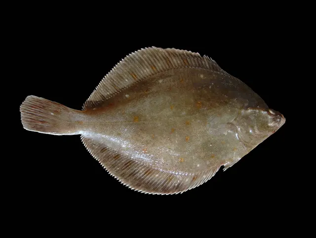 European plaiceRegular local target1 placeEoropie beachOver surf beach
 PollackRegular local target1 placeEoropie beachOver surf beach
 Atlantic mackerelSeasonal1 placeEoropie beachOver surf beachAround Jun–Sept
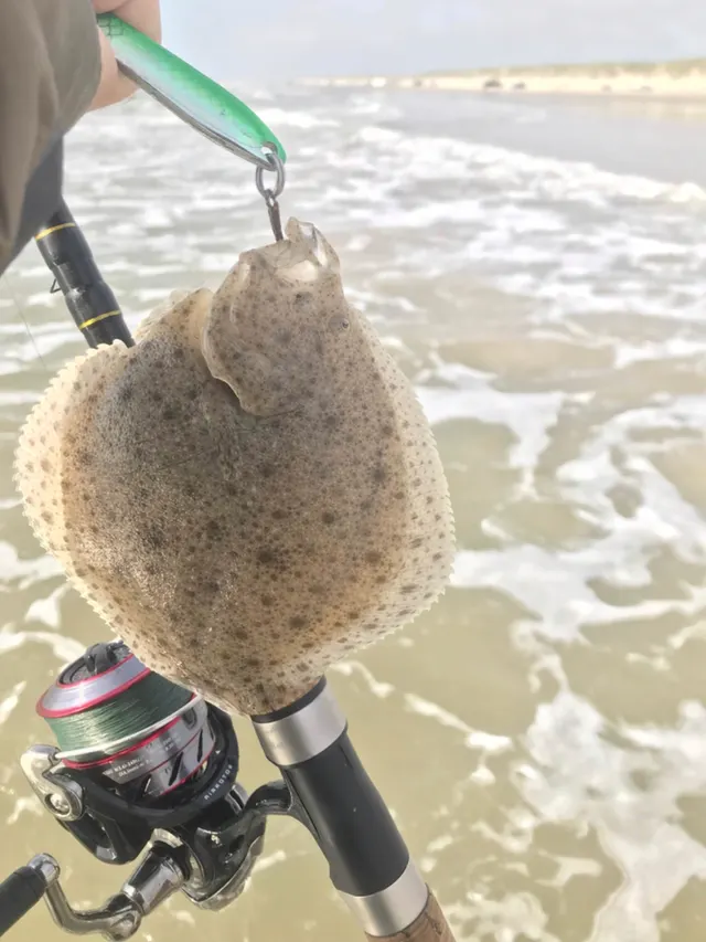 TurbotRecorded here1 placeEoropie beachOver surf beach
What these strengths mean
- Regular local target
- Fishing sources describe this as a normal local target here, not merely as caught.
- Seasonal
- Well supported, and concentrated in part of the year rather than spread through it.
- Recorded here
- At least one credible public account of this species being caught here. That is all it means.
- How breadth is counted
- A fish documented at six marks is shown as six marks: breadth never raises the strength on its own. A fishery account describes the fishing; a recorded catch reports one specific catch. How evidence is weighed.
How people fish it
Practised here: Sea fishing.
Methods the sources name for this ground. Each one is explained in full on its own page.
- Surfcasting
Casting heavy baited tackle from a beach into surf — a method defined by distance, by tide, and by reading water that all looks the same.
- Ledgering
Fishing a bait on the bottom held by a weight, with no float — the simplest way to fish at distance, in depth, or in wind.
- Spinning
Casting an artificial lure and retrieving it so that it moves like something alive — the most direct form of lure fishing.
The ground and the water
- The ground
- White shell sand at the very top of Lewis, backed by machair and open to the whole North Atlantic, with reef at both ends of the strand. Clean ground where the surf is almost never absent.
- Exposure
- As exposed as anywhere in Britain: open north and west into the Atlantic with no land before Iceland.
Through the year
Fished through the year, with the mackerel a summer fish.
Safety
Cold water shock — Can cause serious injury or death
UK coastal and inland water is cold enough for most of the year to trigger the involuntary gasp and the loss of swimming ability that decides most immersion deaths, and it does so within the first minute, long before hypothermia is relevant.
What reduces it: Wear a buoyancy aid rather than carry one, carry a means of calling for help on the person rather than in a bag, and plan on the assumption that an unplanned entry into the water is survivable only if somebody knows immediately.
Cliffs and rock platforms — Can cause serious injury or death
The Atlantic-facing coast takes unobstructed ocean swell. Rock platforms and exposed headlands are reached by waves generated by weather thousands of miles away and invisible locally.
What reduces it: Check swell rather than wind. Observe an exposed mark for a sustained period before committing. Fish the sheltered eastern side when the west is running — the choice of coast is the local skill.
Fishing alone — Can cause serious injury or death
Sparse population, long distances between settlements, unreliable mobile coverage on much of the coast and interior, and a great deal of fishing done alone a long way from a road.
What reduces it: Tell somebody your plan and expected return. Do not assume mobile coverage; carry an alternative means of calling for help where it matters. Allow for the fact that help is not close.
Rules and access
FishingHQ does not know the current access position here. Sea angling in Scotland is not rod-licensed, but access rights under the Scottish Outdoor Access Code carry responsibilities, and harbour, local authority, marine conservation and fisheries measures all apply and all change. Check the current position with the Marine Directorate, the harbour or local authority and the land manager before going.
Who holds the answer:
- The Scottish Government Marine Directorate, for sea fisheries measures in Scottish waters.
- The harbour authority or land manager, for access to the structure or the ground.
- The local authority, for shellfish harvesting classification.
- The Scottish fisheries and marine authorities, for sea fisheries rules, sizes and protected areas
- The relevant estate, angling club or community body, for freshwater permits — which are required and are obtained locally
- The local authority environmental health service, for shellfish harvesting classification and closures
- Local clubs and tackle shops, which in a sparsely populated island chain are the practical route to current access information
Nearby fishing
Other publicly documented places within about 40 km, by distance. Positions are approximate public geography and are never exact marks.
- Stornoway harbour — 25–40 km · Harbour wall
Sources for this place
- Sea Angler — Bauer Media (Specialist angling publication)Relied on for: Long-running published description of British sea angling practice by region, ground type and named mark.FishingHQ's interpretation of what it saysCitation checked — the work exists and is described correctly
- General angling website restatements of established technique — Various (Credible secondary source)Relied on for: Widely restated public descriptions of which places are conventionally fished and how, recorded as practitioner consensus rather than as scholarship, and not relied on for access, permission or any current rule.Background and mechanism onlyCitation checked — the work exists and is described correctly
- British Sea Fishing: Scottish shore marks — British Sea Fishing (Credible secondary source)Relied on for: Which species are fished for at each named Scottish shore mark and how the fishing divides between the winter and the summer half of the year.States this directlyPassage read and verified
How FishingHQ labels evidence is explained in the evidence policy. Last reviewed 2026-08-16.