The Spey at Aberlour
River reach · Fresh water · in The River Spey
A fast, clean, gravel-and-boulder reach of the middle Spey through Strathspey, with long streamy glides, defined necks and tails, unstable shifting gravel bars and very little slack water anywhere.
Safety: moving water and currents — can cause serious injury or death. 2 more points apply here.
FishingHQ describes what this place is, not whether you may fish it. Access, permits and who to ask.
What you can catch here
Documented at this place, grouped by how you would be fishing, with how strongly the sources support each one. This is what has been written down, not a forecast, and being listed is never permission to fish.
Fly fishing · 3
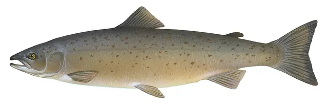
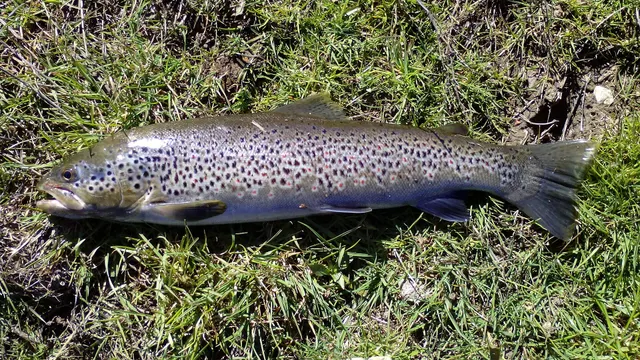
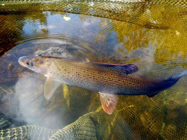
What these strengths mean
- Characteristic of this water
- This water is strongly identified with this species by the sources that cover it.
- Regular local target
- Fishing sources describe this as a normal local target here, not merely as caught.
- Recorded here
- At least one credible public account of this species being caught here. That is all it means.
- How breadth is counted
- A fish documented at six marks is shown as six marks: breadth never raises the strength on its own. A fishery account describes the fishing; a recorded catch reports one specific catch. How evidence is weighed.
How people fish it
Practised here: Fly fishing.
Methods the sources name for this ground. Each one is explained in full on its own page.
- Dry fly fishing
Presenting a floating artificial to a fish feeding at the surface, so that it drifts exactly as a natural insect would.
The ground and the water
- The ground
- A fast, clean, gravel-and-boulder reach of the middle Spey through Strathspey, with long streamy glides, defined necks and tails, unstable shifting gravel bars and very little slack water anywhere.
- Exposure
- Open strath, with wind frequently running up or down the valley — a real factor in a river where casting technique is the point.
- Depth
- Moderate over gravel with a very strong push, which is exactly the water that produced Spey casting as a technique — a river too fast and too tree-lined for an overhead back cast.
- Tide and flow
- Non-tidal. The Spey is one of the fastest-flowing large rivers in Britain and its gravel bed is genuinely mobile, so the streams change shape between seasons.
Through the year
A salmon and sea trout river with runs from spring through autumn, and a summer sea trout fishery at night that is among the best documented in Scotland.
Safety
Moving water and currents — Can cause serious injury or death
The Spey rises very fast on Cairngorm rainfall and snowmelt and pushes hard, and its gravel bars shift, so a crossing that was safe last season may not exist. Night sea-trout fishing puts anglers in that water in the dark.
What reduces it: Check the upstream rainfall and river-level data rather than the sky overhead, identify the exit before wading, use a wading staff, and get out on the first sign of rising or colouring water rather than the second.
Moving water and currents — Can cause serious injury or death
A fast, cold, strong-pushing river with unstable gravel, waded routinely and at night. Losing footing here means being taken downstream immediately.
What reduces it: Wear a wading belt and buoyancy aid, use a staff, wade with the current rather than against it, and reduce night wading to water you have walked in daylight that same day.
Cold water shock — Can cause serious injury or death
UK coastal and inland water is cold enough for most of the year to trigger the involuntary gasp and the loss of swimming ability that decides most immersion deaths, and it does so within the first minute, long before hypothermia is relevant.
What reduces it: Wear a buoyancy aid rather than carry one, carry a means of calling for help on the person rather than in a bag, and plan on the assumption that an unplanned entry into the water is survivable only if somebody knows immediately.
Rules and access
Licence
Scotland has no general rod licence for freshwater fishing. That is the opposite of the position in England and Wales, and it is not a relaxation.
Permission to fish
The whole question. Fishing rights on almost every river and loch belong to a proprietor, estate, angling association or district salmon fishery board, and permission must come from them.
FishingHQ does not know the current access position here. Scotland has no general rod licence, and the fishing rights on almost every river and loch belong to somebody: a proprietor, an estate, an angling association or a district salmon fishery board. Permission is a separate question from access, and both change. Check with the relevant fishery board or association before going.
Particular to this water: This ground carries conservation designations that constrain access, vehicles, bait collection and disturbance independently of any fishing rule.
Who holds the answer:
- The district salmon fishery board for the catchment, where the water holds migratory fish.
- The proprietor, estate or angling association that holds the fishing rights.
- The Scottish Government, for freshwater fisheries policy and protection orders.
- The district salmon fishery board for the river, which has statutory functions in the protection and management of salmon and sea trout.
- The Scottish national authorities responsible for salmon conservation regulation, river assessment and the annual retention rules that follow from it.
- The proprietor of the fishing rights or their letting agent, whose permission is required to fish any beat.
- The river trust or foundation working on catchment habitat, juvenile monitoring and restoration.
- The national park authority and the nature conservation body, for the designations covering much of the catchment.
- The biosecurity authorities, for the equipment cleaning requirements that apply to anglers moving between waters.
Nearby fishing
Other publicly documented places within about 40 km, by distance. Positions are approximate public geography and are never exact marks.
- The Findhorn at Forres — 25–40 km · River reach
- The Spey at Grantown — 25–40 km · River reach
- Buckie — 25–40 km · Harbour wall
- Lossiemouth — 25–40 km · Beach
- Findhorn Bay — 25–40 km · Bay
Sources for this place
- Trout & Salmon — Bauer Media (Specialist angling publication)Relied on for: Long-running published description of British and Irish game angling practice by river, beat and season.FishingHQ's interpretation of what it saysCitation checked — the work exists and is described correctly
- General angling website restatements of established technique — Various (Credible secondary source)Relied on for: Widely restated public descriptions of which waters are conventionally fished and how, recorded as practitioner consensus rather than as scholarship, and not relied on for access, permission or any current rule.Background and mechanism onlyCitation checked — the work exists and is described correctly
- Freshwater Fishes of the British Isles — HarperCollins (New Naturalist 75), 1992 (Reference work)Relied on for: Distribution, habitat requirements and biology of the freshwater fishes of Britain and Ireland named here.States this directlyCitation checked — the work exists and is described correctly
- RNLI water safety guidance: cold water shock and Float to Live — Royal National Lifeboat Institution (Water-safety or diver-training authority)Relied on for: Cold water shock and the immersion response, tidal cut-off, and water-safety guidance for shore anglers and small-craft users.States this directlyPassage read and verified
How FishingHQ labels evidence is explained in the evidence policy. Last reviewed 2026-08-16.