The Slovenian coast at Piran
Headland · Salt water · in The Soča and Slovenia's Adriatic rivers
A short flysch and sandstone coast at the head of the Adriatic, with a walled headland at Piran, shallow shelving rock and mud offshore, and salt pans and a protected cliff coast either side of it.
Safety: moving water and currents — can cause serious injury or death.
FishingHQ describes what this place is, not whether you may fish it. Access, permits and who to ask.
What you can catch here
Documented at this place, grouped by how you would be fishing, with how strongly the sources support each one. This is what has been written down, not a forecast, and being listed is never permission to fish.
From the shore · 4
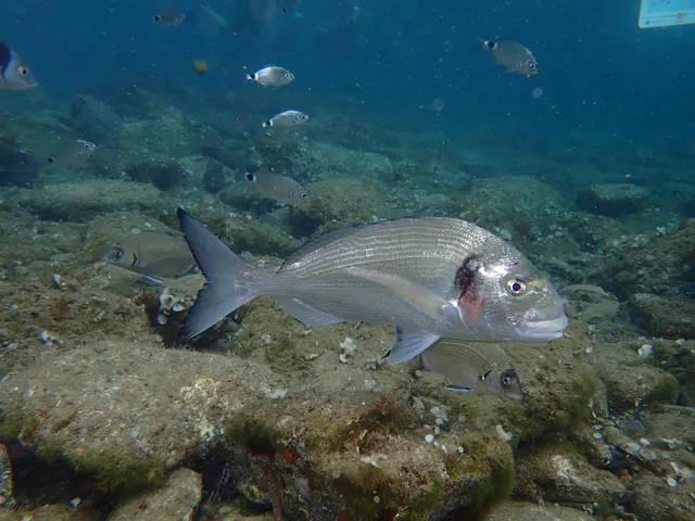 Gilthead breamCharacteristic of this water1 placeThe Slovenian coast at PiranOver headland
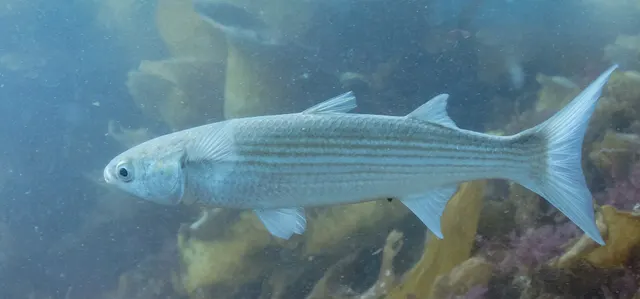 Flathead grey mulletRegular local target1 placeThe Slovenian coast at PiranOver headland
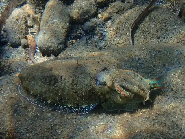 Common cuttlefishSeasonal1 placeThe Slovenian coast at PiranOver headlandAround Mar–May, Oct–Nov
 European sea bassSeasonal1 placeThe Slovenian coast at PiranOver headlandAround Jan–Mar, Nov–Dec
What these strengths mean
- Characteristic of this water
- This water is strongly identified with this species by the sources that cover it.
- Regular local target
- Fishing sources describe this as a normal local target here, not merely as caught.
- Seasonal
- Well supported, and concentrated in part of the year rather than spread through it.
- How breadth is counted
- A fish documented at six marks is shown as six marks: breadth never raises the strength on its own. A fishery account describes the fishing; a recorded catch reports one specific catch. How evidence is weighed.
How people fish it
Practised here: Sea fishing.
Methods the sources name for this ground. Each one is explained in full on its own page.
- Float fishing
Suspending a bait at a controlled depth beneath a buoyant indicator — the most visual, most controllable and most widely applicable method in angling.
- Eging
Jigging for squid and cuttlefish with a barbed, weighted lure worked in lifts and pauses — a Japanese discipline with its own tackle, vocabulary and competitive scene.
- Ledgering
Fishing a bait on the bottom held by a weight, with no float — the simplest way to fish at distance, in depth, or in wind.
The ground and the water
- The ground
- A short flysch and sandstone coast at the head of the Adriatic, with a walled headland at Piran, shallow shelving rock and mud offshore, and salt pans and a protected cliff coast either side of it.
- Exposure
- At the very head of a long shallow gulf, so the water is shallow, warm in summer, cold in winter and turbid by Adriatic standards.
- Depth
- Shallow for a considerable distance offshore — the northern Adriatic is the shallowest large area of the Mediterranean — which makes this coast unlike the karst coast a short distance south.
Through the year
The months the sources attach to each species here. Where a species carries no season it is listed underneath rather than assumed to run through the year.
| Species | J | F | M | A | M | J | J | A | S | O | N | D |
|---|---|---|---|---|---|---|---|---|---|---|---|---|
| Common cuttlefish — seasonal, recorded in March, April, May, October, November. | ||||||||||||
| European sea bass — seasonal, recorded in November, December, January, February, March. |
Recorded here with no season stated: Gilthead bream, Flathead grey mullet.
Safety
Moving water and currents — Can cause serious injury or death
The rivers are steep and fast over smooth limestone bedrock, which is among the most slippery substrate a river can have. Gorges and deep pools frequently have no easy exit. Levels respond within hours to rain and to snowmelt in the alpine catchment, and a river can rise dangerously from rainfall a long way upstream in weather that is fine locally.
What reduces it: Wade with studded soles and a staff on bedrock. Know the exit from any gorge section before descending into it. Check the weather over the whole upper catchment rather than locally, and leave the water when it starts to rise or colour.
Worse when:
- Spring snowmelt
- Thunderstorms in the mountains during otherwise settled weather
- Gorge sections with steep sides and no bank
Rules and access
FishingHQ does not know the current access position here. Slovenia's coast is short and its recreational sea fishing is licensed by the state, with species and gear measures and with a protected landscape covering part of it. Check the current position with the ministry responsible for agriculture, forestry and food before going.
Particular to this water: This ground lies in or beside a marine protected area whose zoning constrains fishing, diving, anchoring and collection independently of any licence, with rules that differ between zones and boundaries that are not visible from the water. This is an owned and operated structure. Whether angling is allowed on it, when, from where and on what terms is the operator's decision, is frequently seasonal, and changes without notice.
Who holds the answer:
- The Slovenian ministry responsible for agriculture, forestry and food, for recreational sea fishing.
- The protected landscape administration, where the water is inside one.
- The Slovenian fishing family or club managing the specific district, which issues permits and sets the rules for its water.
- The national Slovenian fisheries authority and the fisheries research institute, for legislation, stock management and the marble trout recovery programme.
- The national park and nature conservation authorities, for the protected areas covering much of the upper catchment.
- The national angling association, which coordinates the club system.
Sources for this place
- EMODnet — the European Marine Observation and Data Network — The European Commission, assembled from the national hydrographic offices, geological surveys and marine institutes of the member states (Scientific institute)Relied on for: Charted bathymetry, seabed substrate and seabed habitat for European sea areas, assembled from the national hydrographic and geological surveys, at the resolution the product publishes.States this directlyCitation checked — the work exists and is described correctly
- The European Environment Agency's assessments of Europe's waters, seas and coasts — European Environment Agency, Copenhagen (Conservation authority)Relied on for: Assessment of Europe's coasts and regional seas, including the condition of coastal water bodies, the pressures recorded on them and the coverage of designated sites.Background and mechanism onlyCitation checked — the work exists and is described correctly
- FAO Species Identification Guides for Fishery Purposes and the FAO Species Catalogues — Food and Agriculture Organization of the United Nations (Scientific institute)Relied on for: Identification, distribution and habitat association of the fishes and invertebrates of the Mediterranean and Black Sea.States this directlyCitation checked — the work exists and is described correctly
- FishBase: a global information system on fishes — Froese, R. and D. Pauly, eds. — FishBase Consortium (Scientific institute)Relied on for: Recorded distribution, depth range and habitat association of the species named for this ground.States this directlyPassage read and verified
How FishingHQ labels evidence is explained in the evidence policy. Last reviewed 2026-08-18.