Deception Pass
Sound or strait · Salt water · in The Pacific Northwest coast
The narrow pass between Whidbey and Fidalgo islands, fished from North Beach in Deception Pass State Park, east of West Point. Pink and coho salmon passing here are mostly returning to the Skagit River.
Safety: moving water and currents — can cause serious injury or death (general advice, not specific to this place). One more point applies here.
FishingHQ describes what this place is, not whether you may fish it. Access, permits and who to ask.
What you can catch here
Documented at this place, grouped by how you would be fishing, with how strongly the sources support each one. This is what has been written down, not a forecast, and being listed is never permission to fish.
From the shore · 4
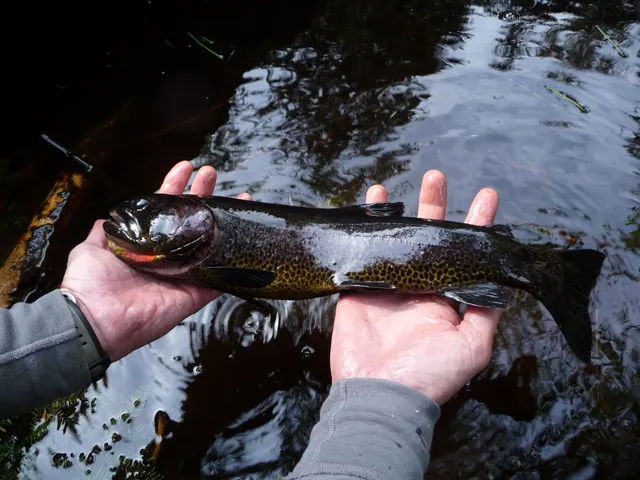 Cutthroat troutRegular local target1 placeDeception PassOver sound or strait
Photo: Bruce Deagle, via iNaturalist, CC BY; resized
- Coho salmonSeasonal1 placeDeception PassOver sound or straitAround Aug–Sept
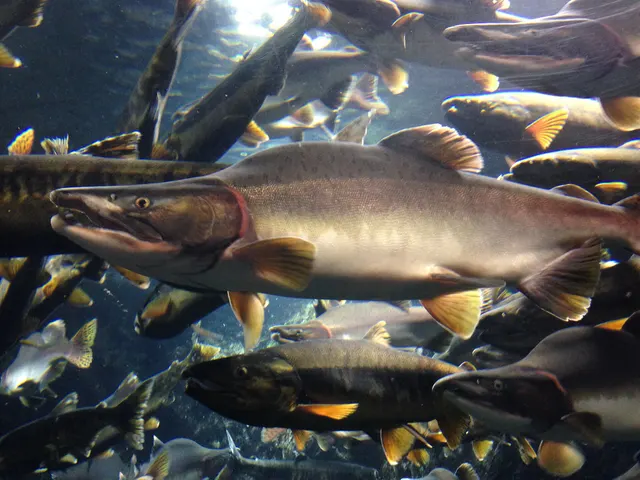 Pink salmonSeasonal1 placeDeception PassOver sound or straitAround Aug–Sept
Photo: Totti, via Wikimedia Commons, CC BY-SA 4.0; resized; shared under the same licence
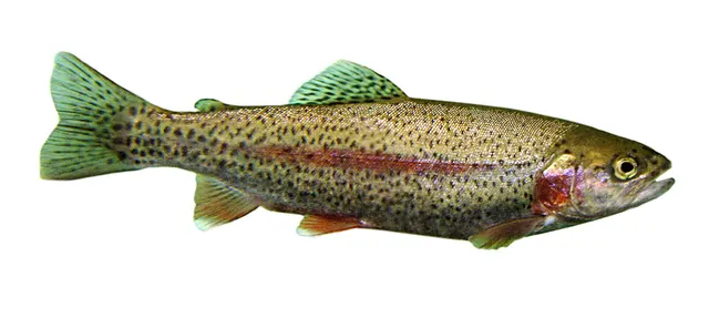 Rainbow troutSeasonal1 placeDeception PassOver sound or straitAround Jan–Feb, Dec
Photo: Jonathunder, via Wikimedia Commons, CC BY-SA 3.0; resized and trimmed to fit; shared under the same licence


What these strengths mean
- Regular local target
- Fishing sources describe this as a normal local target here, not merely as caught.
- Seasonal
- Well supported, and concentrated in part of the year rather than spread through it.
- How breadth is counted
- A fish documented at six marks is shown as six marks: breadth never raises the strength on its own. A fishery account describes the fishing; a recorded catch reports one specific catch. How evidence is weighed.
How people fish it
Practised here: Sea fishing.
Methods the sources name for this ground. Each one is explained in full on its own page.
Baits and lures for these fish
The baits and lures each of the fish above is commonly taken on, from that fish’s own page. This is what works for the fish, not a report of what people use on this particular water — local knowledge and the conditions on the day still decide.
The ground and the water
- The ground
- The narrow pass between Whidbey and Fidalgo islands, fished from North Beach in Deception Pass State Park, east of West Point. Pink and coho salmon passing here are mostly returning to the Skagit River.
- Exposure
- A tidal pass; the department's advice is tied to the change of tide.
- Tide and flow
- The department suggests fishing within a couple of hours of the tide change for winter steelhead.
Getting there
What public sources describe, last checked 2026-10-10. Car parks fill, services change and a path existing is not a path anybody may use — none of this is a guarantee of availability and none of it is permission to be anywhere.
- Getting to it
- The department's directions are to enter Deception Pass State Park, park at the day-use area at North Beach and walk north to the beach.
Where this access information comes from
- Washington Department of Fish and Wildlife: marine area fishing pages — Washington Department of Fish and Wildlife (Government fisheries body)Relied on for: The Washington Department of Fish and Wildlife's page for the marine area this site is in: the site as it names it, the fish it gives for it, the methods and timing, and the access it describes.States this directlyPassage read and verified
Through the year
Migratory coho and pink salmon peak from August through September, with pinks close to shore in odd-numbered years. Returning hatchery steelhead are fished in winter.
The months the sources attach to each species here. Where a species carries no season it is listed underneath rather than assumed to run through the year.
| Species | J | F | M | A | M | J | J | A | S | O | N | D |
|---|---|---|---|---|---|---|---|---|---|---|---|---|
| Coho salmon — seasonal, recorded in August, September. | ||||||||||||
| Pink salmon — seasonal, recorded in August, September. | ||||||||||||
| Rainbow trout — seasonal, recorded in December, January, February. |
Recorded here with no season stated: Cutthroat trout.
Safety
Moving water and currents — Can cause serious injury or death
General safety for this kind of ground, not a finding about this place.
River bar crossings at the mouths of the Columbia and other Pacific Northwest rivers produce steep breaking seas when ebbing river flow meets incoming ocean swell over shallow ground, and they are among the most dangerous small-craft situations anywhere. On the surf beaches, sneaker waves — a wave substantially larger than those preceding it — arrive without warning and are a recurring cause of death, particularly among razor clam diggers who are facing away from the sea.
What reduces it: Treat bar crossings as requiring local knowledge, current bar conditions and the right state of tide, and do not attempt them on the strength of a general forecast. On surf beaches, face the sea periodically, never turn your back on it for extended periods, keep well up the beach, and treat any long-period swell as a reason to stay clear of the water's edge.
Worse when:
- Ebb tide against incoming swell at a river mouth, which is when a bar is at its worst.
- Long-period Pacific ground swell arriving with no local wind.
- Low tide razor clam digging, which puts people far out on an open beach with their backs to the sea.
Cold water shock — Can cause serious injury or death
General safety for this kind of ground, not a finding about this place.
Water temperature on this coast is low year-round, including through summer, and immersion produces an involuntary gasp and hyperventilation that incapacitates competent swimmers within the first minute. This applies equally in the sheltered inside waters, where the calm surface conceals the same temperature.
What reduces it: Wear a lifejacket or buoyancy aid on any small craft, dress for the water rather than the air, and treat sheltered water as no warmer than exposed water because it is not.
Rules and access
Particular to this water: Seasons, limits and closures for this water are set by the Washington Department of Fish and Wildlife by marine area and are changed at short notice by emergency rule. Nothing here states that it is open. Check the current regulations and emergency rule changes with the department before fishing. The department states that a state parks pass is required and asks anglers not to trespass on private property.
Beyond what is stated above, FishingHQ does not know the current access position here. Washington manages its marine sport fisheries by numbered marine area: salmon, halibut, lingcod and other fisheries open and close area by area, some are closed altogether in a given year, and any of it can be changed at short notice by emergency rule. Some shore sites are inside state parks that need a pass, and much of the shoreline and tideland beside them is private. Shellfish beaches are also subject to health closures. Check the current position with the Washington Department of Fish and Wildlife before going.
Who holds the answer:
- The Washington Department of Fish and Wildlife, which publishes the sport fishing regulations and emergency rule changes for each marine area.
- The Washington State Department of Health, for whether a shellfish beach is open to harvest.
- The park or land manager, where the shore is reached through a state or county park.
- The state fish and wildlife agency — Washington, Oregon, California or Alaska — for recreational fishing in US state waters.
- Fisheries and Oceans Canada, for recreational fishing in British Columbia.
- NOAA Fisheries, for listed species, offshore waters and federal management in the United States.
- The relevant treaty tribe or First Nation natural resources authority, whose fisheries are separately administered and legally distinct.
- The state health department's shellfish programme, whose biotoxin testing determines whether razor clam and other shellfish harvest may take place at all.
- The Pacific Fishery Management Council, for federal fishery management planning on the US west coast.
- Washington Department of Fish and Wildlife: publishes the sport fishing regulations and emergency rule changes for this marine area.
Nearby fishing
Other publicly documented places within about 40 km, by distance. Positions are approximate public geography and are never exact marks.
- Bellingham Bay — 25–40 km · Bay
Sources for this place
- Washington Department of Fish and Wildlife: marine area fishing pages — Washington Department of Fish and Wildlife (Government fisheries body)Relied on for: The Washington Department of Fish and Wildlife's page for the marine area this site is in: the site as it names it, the fish it gives for it, the methods and timing, and the access it describes.States this directlyPassage read and verified
How FishingHQ labels evidence is explained in the evidence policy. Last reviewed 2026-10-10.
Something wrong or out of date?
If something on this page has changed, email us from your own account using the link that fits, with a link to where you saw the change if you can. Every report is checked by a person before anything is changed, and a report never appears on the site by itself. Please don’t send exact private marks.
Before you go
- Fish documented here
- 4 at this place itself. See them.
- Getting there
- Described from public sources, last checked 2026-10-10. Getting there.
- Rules particular to this water
- Seasons, limits and closures for this water are set by the Washington Department of Fish and Wildlife by marine area and are changed at short notice by emergency rule. Source not tied: no recorded source has been matched to this statement.
- Nothing here states that it is open. Source not tied: no recorded source has been matched to this statement.
- Check the current regulations and emergency rule changes with the department before fishing. Source not tied: no recorded source has been matched to this statement.
- The department states that a state parks pass is required and asks anglers not to trespass on private property. Source not tied: no recorded source has been matched to this statement.
Nothing here is watched for change. Sources and who to ask.
- Hazards particular to this place
- None recorded for this place; the hazards of the wider coast or water still apply.
Check before you travel
- Whether you may fish here, and whether a licence or permit is needed — start with the Washington Department of Fish and Wildlife.
- The tide times and the forecast for the day you go.
- Anything recorded here was true when it was read; it is not watched for change.