Delimara Point
Headland · Salt water · in Malta and Gozo
A low limestone peninsula on the south-eastern corner of Malta, with wave-cut ledges at the water's edge, deep water immediately off the point and the traditional fishing harbour of Marsaxlokk in the bay behind it.
Safety: drowning and immersion — can cause serious injury or death. 4 more points apply here.
FishingHQ describes what this place is, not whether you may fish it. Access, permits and who to ask.
What you can catch here
Documented at this place, grouped by how you would be fishing, with how strongly the sources support each one. This is what has been written down, not a forecast, and being listed is never permission to fish.
From the shore · 4
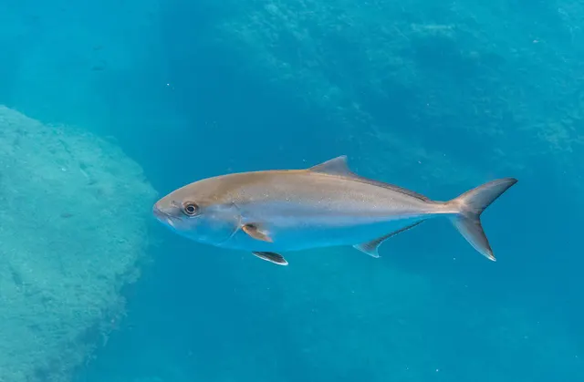
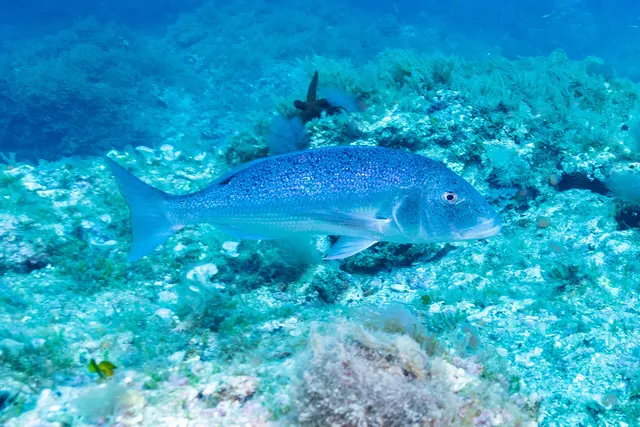
From a boat · 2
What these strengths mean
- Regular local target
- Fishing sources describe this as a normal local target here, not merely as caught.
- Seasonal
- Well supported, and concentrated in part of the year rather than spread through it.
- Repeatedly reported
- Several independent public accounts. Enough to say it happens more than once; not enough to call it a fishery.
- How breadth is counted
- A fish documented at six marks is shown as six marks: breadth never raises the strength on its own. A fishery account describes the fishing; a recorded catch reports one specific catch. How evidence is weighed.
How people fish it
Practised here: Sea fishing, Spearfishing.
Methods the sources name for this ground. Each one is explained in full on its own page.
- Float fishing
Suspending a bait at a controlled depth beneath a buoyant indicator — the most visual, most controllable and most widely applicable method in angling.
- Spinning
Casting an artificial lure and retrieving it so that it moves like something alive — the most direct form of lure fishing.
- Shore diving
Entering and leaving the water from land under your own power — the most accessible spearfishing and the one where the entry and exit are the dangerous part.
The ground and the water
- The ground
- A low limestone peninsula on the south-eastern corner of Malta, with wave-cut ledges at the water's edge, deep water immediately off the point and the traditional fishing harbour of Marsaxlokk in the bay behind it.
- Exposure
- Exposed from east through south, and sheltered from the prevailing north-westerly by the island itself.
Safety
Drowning and immersion — Can cause serious injury or death
Mediterranean rock shores drop into deep water within a body length of the edge, so a slip puts somebody into water they cannot stand up in, frequently with no beach within reach and nobody in sight.
What reduces it: Wear a flotation aid rather than carry one, fish rock ground with somebody else, carry a means of calling for help on the person, and treat wet or weeded rock at the water's edge as unusable rather than as careful ground.
Cliffs and rock platforms — Can cause serious injury or death
Maltese shore fishing is done from limestone ledges at the waterline, frequently below cliffs and frequently with deep water immediately in front. Swell arrives in sets and the largest wave is several times the height of the preceding ones; wet algae-covered limestone is extremely slippery; access often involves a scramble; and a person in the water at the base of a cliff has no exit.
What reduces it: Watch a mark for a full set cycle — at least twenty minutes — before committing. Wear a buoyancy aid and footwear with grip. Know the exit before you start, and know that on many of these marks there is not one. Do not fish a ledge alone, and treat any forecast swell as a decision already made.
Worse when:
- Any ground swell, regardless of what the local wind is doing
- After dark, when a set is invisible
- Marks reached by a climb, where retreat is slow
Boat traffic and being seen — Can cause serious injury or death
This is a small, busy, intensively used sea area with heavy recreational and commercial traffic, and a snorkeller or freediver at the surface is close to invisible from a boat.
What reduces it: A marked surface float on every dive, without exception. Stay clear of channels and harbour approaches. Assume no vessel has seen you and that none is going to alter course.
Worse when:
- Summer, at the height of the season
- Near harbours, bays and popular anchorages
Shallow water blackout and breath-hold loss of consciousness — Can cause serious injury or death
Exceptional visibility makes depth look and feel considerably less than it is, which is a known and specific trap: divers go deeper than planned because the bottom appears close, and blackout concentrates in the final metres of the ascent.
What reduces it: Recognised freediving training. A competent buddy watching every dive, one up and one down. Never dive alone. Set a depth and time before entering the water and hold to them regardless of how shallow it looks. Aborting a dive is always a valid answer.
Worse when:
- Exceptionally clear water, which is most of the season here
- Diving after a long drive or a flight, tired
- Any hyperventilation before a dive
Sun, dehydration and fatigue — Can cause injury needing treatment
Long summer sessions on shadeless rock produce dehydration and heat exhaustion, and both degrade judgement and coordination well before they produce collapse, on ground where both are what keep somebody safe.
What reduces it: Carry substantially more water than the session appears to need, fish the ends of the day rather than the middle of it in high summer, and treat shade and a stopping time as part of the plan.
Rules and access
FishingHQ does not know the current access position here. Malta licenses recreational boat fishing and underwater fishing separately, underwater fishing carries its own age, equipment and area rules, and the islands' marine protected areas and bunkering zones constrain where anything may happen. Species measures — bluefin tuna above all — are managed internationally and change every season. Check the current position with the department responsible for fisheries and aquaculture before going.
Particular to this water: Underwater fishing is licensed and regulated separately from rod fishing throughout this jurisdiction, with its own age, equipment and distance requirements, and holding a rod licence is not permission to spearfish.
Who holds the answer:
- The Maltese department responsible for fisheries and aquaculture, which licenses recreational and underwater fishing.
- The environment and resources authority, for marine protected areas.
- The ports and yachting directorate, for access to structures and for restricted zones.
- The Maltese Department of Fisheries and Aquaculture, for the recreational fishing framework, licensing and species rules
- The Environment and Resources Authority, for marine protected areas, Natura 2000 sites and protected habitat including Posidonia
- Transport Malta, for anything involving a vessel, and for the maritime rules that apply to a hired boat
- A local dive centre or spearfishing club, which is the fastest practical route to the current position on spearfishing and to what is expected of a visitor
- The tackle shops, which in Malta are a genuine source of local practice and current rules and are used as such by residents
Sources for this place
- EMODnet — the European Marine Observation and Data Network — The European Commission, assembled from the national hydrographic offices, geological surveys and marine institutes of the member states (Scientific institute)Relied on for: Charted bathymetry, seabed substrate and seabed habitat for European sea areas, assembled from the national hydrographic and geological surveys, at the resolution the product publishes.States this directlyCitation checked — the work exists and is described correctly
- The European Environment Agency's assessments of Europe's waters, seas and coasts — European Environment Agency, Copenhagen (Conservation authority)Relied on for: Assessment of Europe's coasts and regional seas, including the condition of coastal water bodies, the pressures recorded on them and the coverage of designated sites.Background and mechanism onlyCitation checked — the work exists and is described correctly
- Sea Angler — Bauer Media (Specialist angling publication)Relied on for: Long-running published description of European sea angling practice by region, ground type and destination, including the continental marks British anglers travel to.FishingHQ's interpretation of what it saysCitation checked — the work exists and is described correctly
- General angling website restatements of established technique — Various (Credible secondary source)Relied on for: Widely restated public descriptions of which continental European places are conventionally fished and how, recorded as practitioner consensus rather than as scholarship, and not relied on for access, permission or any current rule.Background and mechanism onlyCitation checked — the work exists and is described correctly
How FishingHQ labels evidence is explained in the evidence policy. Last reviewed 2026-08-18.